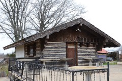
Block
From the record
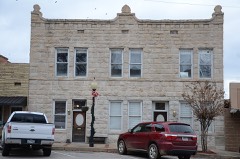
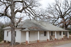
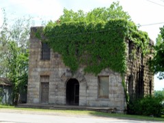
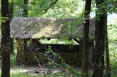
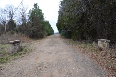
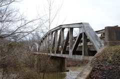
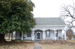
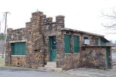
22 National Register listings published here.
Sources: the National Register database, National Park Service
115 topographic sheets cover 50 settlements here, and 22 properties are on the National Register of Historic Places.
22 National Register listings published here.
Sources: the National Register database, National Park Service
Every property in this county listed on the National Register of Historic Places, with the year it was listed and the federal nomination document.
Every wildfire the federal occurrence database records inside this county: 475 of them, burning about 7,363 acres. 33 started naturally and 144 were recorded as arson. Each settlement page carries the fires within five miles of it.
| Reported cause | Fires |
|---|---|
| Arson/incendiarism | 144 |
| Debris and open burning | 124 |
| Missing data/not specified/undetermined | 116 |
| Natural | 33 |
| Equipment and vehicle use | 29 |
| Misuse of fire by a minor | 9 |
| Recreation and ceremony | 9 |
| Smoking | 5 |
| Power generation/transmission/distribution | 4 |
| Railroad operations and maintenance | 1 |
| Fireworks | 1 |
The five largest, by the area the report gives. One of them was set deliberately.
| Date | Cause | Size | Reported by | Name on the report |
|---|---|---|---|---|
| 17 November 2016 | Debris and open burning | 1,001 acres | Arkansas Forestry Commission | not named |
| 5 November 2016 | Natural | 441 acres | Ozark-St. Francis National Forests | MOUNTAIN CREEK |
| 11 March 2007 | Missing data/not specified/undetermined | 300 acres | Ozark-St. Francis National Forests | THE LOCKE FIRE |
| 4 March 2016 | Debris and open burning | 283 acres | Arkansas Forestry Commission | not named |
| 8 January 2020 | Missing data/not specified/undetermined | 215 acres | Arkansas Forestry Commission | not named |
| 29 June 2012 | Arson/incendiarism | 142 acres | Arkansas Forestry Commission | WHITE VALLEY ROAD |
| 25 January 2018 | Missing data/not specified/undetermined | 117 acres | Arkansas Forestry Commission | not named |
| 11 January 2017 | Missing data/not specified/undetermined | 113 acres | Arkansas Forestry Commission | not named |
Every settlement page carries the fires within five miles of it - see the settlement index below.
The NOAA Storm Events Database holds 704 reports for this county, causing 3 deaths, 28 injuries and about $12,547,000 in recorded property damage. Each settlement page carries the reports that name it.
| Kind of event | Reports |
|---|---|
| Thunderstorm Wind | 333 |
| Hail | 239 |
| Flash Flood | 69 |
| Tornado | 38 |
| Flood | 15 |
| Lightning | 8 |
| Funnel Cloud | 2 |
The most serious of them, by death, then injury, then recorded damage. The accounts are quoted exactly as the forecast office filed them.
| When | Event | Place named | Harm | What the report says |
|---|---|---|---|---|
| May 2011 | Tornado (EF3) | Denning | 2 killed, 10 hurt, $2,000,000 | This is the fifth of six segments of this tornado. The tornado crossed the Arkansas River, moving back into Franklin County from Logan County. The tornado crossed Carbon Plant Road and W Creek Road, destroying a mobile home and killing another person. It continued northeast across the town of Denning where it destroyed numerous permanent homes and mobile homes. At least 10 injuries occurred in Denning as the mile-wide tornado moved through the town. Several of these injuries were serious or critical and one of the victims died from her injuries on June 14th. She was in one of the many mobile homes that were destroyed in town. Ten 100-foot metal power poles were bent over at the ground by the tornado and many other power poles were snapped throughout the Denning area. Many large trees were also snapped or uprooted. Maximum estimated wind speed in this segment of the tornado based on this damage was about 145 mph.||The tornado moved northeast from Denning and crossed Highway 64, severely damaging the roof of a permanent home and snapping or uprooting numerous trees. The tornado continued into Johnson County, Arkansas. |
| May 2011 | Tornado (EF4) | Peter Pender | 1 killed, 6 hurt, $1,500,000 | This is the third of six segments of this tornado. The tornado snapped or uprooted a number of large trees as it moved back into Franklin County from Logan County. The damage path widened considerably to about 3/4 of a mile as the tornado moved north of Highway 398 and approached Etna. In and near Etna, the tornado destroyed a number of permanent homes, destroyed mobile homes, destroyed a metal building, destroyed a number of outbuildings, snapped numerous power poles, and snapped or uprooted many large trees. One of the three tornado-related fatalities in Franklin County occurred when a double-wide mobile home was destroyed in Etna. At least six serious injuries occurred in this area and several of those were critical.||Several well-built, wood-framed permanent homes were destroyed in Etna with only a small amount of debris remaining on the foundation. Trees were debarked in this area and the ground was scoured by debris. A well-built, two-story, steel-framed home northeast of Etna on Highway 309 was also destroyed with only a few interior walls remaining on the first floor. Two people survived in the kitchen pantry as the home was destroyed around them. Maximum estimated wind speed in this segment of the tornado based on this damage was about 170 mph.||The tornado continued into Logan County, Arkansas, at 1.25 miles wide. |
| March 1961 | Tornado (F2) | not stated | 4 hurt, $250,000 | no account filed |
| April 1996 | Tornado (F2) | Fern | 2 hurt, $500,000 | no account filed |
| April 1964 | Tornado (F1) | not stated | 2 hurt, $250,000 | no account filed |
| April 2011 | Tornado (EF1) | Charleston | 2 hurt, $30,000 | A tornado rolled a trailer, damaged the roofs of two permanent homes, damaged two chicken houses, and snapped or uprooted a number of trees. Two people were injured in the trailer that was damaged. Maximum estimated wind in the tornado based on this damage was about 105 mph. |
| June 2008 | Thunderstorm Wind | Branch | 1 hurt, $25,000 | Thunderstorm winds estimated at 70 miles an hour rolled over a mobile home. The occupant was injured. |
| August 2006 | Lightning | Altus | 1 hurt | A 59 year old man was struck by lightning in the yard of his home. |
| November 2001 | Tornado (F1) | Altus | $2,000,000 | An F1 tornado touched down 1 mile west of Altus and crossed the Johnson County border 6 miles northeast of Altus. The tornado first began doing damage just southwest of Highway 64. The strongest intensity began just south of Interstate 40, just east of Wiederkerh Village and continued across Interstate 40 into Philpott Valley where most of the property damage occurred. The tornado resulted in F1 damage to several houses. Several mobile homes, numerous barns, outbuildings, and other weaker structures were destroyed, including two long turkey houses. |
| March 1999 | Hail | Ozark | $600,000 | Just south of Ozark, golfball to baseball-sized hail fell, while quarter to golfball-sized hail fell and covered the ground just north of Ozark.There were widespread reports of damage to vehicles and to roofs on homes and other structures. |
| June 2023 | Thunderstorm Wind | Branch | $250,000 | Strong thunderstorm wind destroyed four poultry barns, uprooted numerous large trees, and blew down power poles. |
| July 2021 | Flash Flood | Charleston | $250,000 | Flood water caused minor damage to twenty homes in Ozark, and damaged portions of several roads in southwestern Franklin County. |
| April 2004 | Flash Flood | Countywide | $250,000 | Thunderstorms with heavy rain moved repeatedly over Franklin county during the April 20s. This caused several rounds of flash flooding. Numerous county roads were flooded at one time or another. Some more notable highways that were closed were Highway 23 2 miles south of Cass and Highway 219 7 miles north of Ozark. Damage to roads was estimated to be in excess of $100,000. In addition to the flooded roads as many as 12 to 15 homes received damage from the flood waters. On April 25th, the governor of Arkansas declared the county a disaster area. |
| October 2000 | Hail | Ozark | $250,000 | no account filed |
| April 2014 | Tornado (EF1) | Vesta | $200,000 | This tornado damaged the roofs of a number of homes, destroyed numerous barns and outbuildings, and snapped or uprooted numerous trees. Based on this damage, maximum estimated wind in the tornado was 95 to 105 mph. |
| November 2001 | Tornado (F1) | Denning | $200,000 | An F1 tornado touched down 8 miles southwest of Denning and lifted just southwest of Denning. Along its path it damaged several barns and one house. The house was near Etna and it suffered roof damage and structural damage. The tornado briefly exited Franklin County as it crossed a corner of Logan County (see NWS Little Rock's report) and then returned into Franklin County after crossing the Arkansas River. |
| March 2000 | Hail | Charleston | $200,000 | no account filed |
| April 2022 | Hail | Charleston | $150,000 | Hail larger than baseball size damaged homes, businesses, and vehicles. |
| June 2000 | Flash Flood | Countywide | $150,000 | Heavy rains caused the washout of many roads across Franklin county. The water flooded a few homes west of Ozark a few businesses in Ozark. |
| April 2022 | Hail | Branch | $125,000 | Baseball size hail damaged homes, businesses, and vehicles. |
| October 2009 | Flash Flood | Ozark | $125,000 | Thunderstorms moving repeatedly over extreme southern and eastern Franklin County produced 2 to 4 inches of rain, which resulted in flooding of rural roads. Portions of some roads were washed out. Water rescues were conducted as motorists became stranded in flood water. |
| April 2007 | Tornado (EF1) | Webb City | $125,000 | A tornado tore portions of the roofs off of two houses, damaged several other homes, destroyed several outbuildings, and snapped or uprooted a number of trees. |
| April 2022 | Hail | Charleston | $100,000 | Hail larger than hen egg size damaged homes, businesses, and vehicles. |
| July 2022 | Thunderstorm Wind | Meg | $100,000 | Strong thunderstorm wind damaged several chicken houses, and snapped large tree limbs. |
| April 2016 | Tornado (EF0) | Toney | $100,000 | This tornado damaged chicken houses, damaged several homes, destroyed an outbuilding, and snapped numerous large tree limbs. Based on this damage, maximum estimated wind in the tornado was 75 to 85 mph. |
| December 2015 | Flood | Charleston | $100,000 | A bridge northwest of Charleston was washed out at the intersection of Jetton and Kiene roads. |
| June 2000 | Flash Flood | Countywide | $100,000 | Heavy thunderstorm rains caused flooding of many rural roads across Franklin county. The roads and bridges received some damage. Flood waters also entered a motel in Ozark. |
| April 2022 | Hail | Branch | $75,000 | Golf ball size hail damaged homes and vehicles. |
| November 2022 | Tornado (EF1) | Peter Pender | $75,000 | This tornado moved east-northeast from Shaw Loop to Highway 23. It uprooted trees, damaged a couple homes, and destroyed several outbuildings. Based on this damage, maximum estimated wind in the tornado was 90 to 100 mph. |
| August 2017 | Flash Flood | Branch | $75,000 | Portions of Highway 41 were flooded and closed, and a couple bridges were washed out. |
| May 2015 | Flash Flood | Webb City | $75,000 | A road was washed out by flood water. |
| May 2015 | Flash Flood | Ozark | $75,000 | Significant street flooding off of Highway 64. Flood water entered several businesses. |
| April 2009 | Tornado (EF0) | Sutherland Xrds | $75,000 | A tornado damaged six homes, destroyed a barn, and damaged numerous trees. |
| March 2008 | Tornado (EF1) | Peter Pender | $75,000 | A tornado destroyed several large barns, damaged several homes, and blew down trees and power poles. |
| September 2025 | Flash Flood | Charleston | $50,000 | Portions of several roads were flooded in and around Charleston, with flood water entering some residences. |
| November 2024 | Flood | Sutherland Xrds | $50,000 | A bridge was washed out by flood water on Chickadee Lane in the Mountain Grove community. Flooding resulted in at least four residences landlocked in the Watalula area. Portions of Highway 23 were flooded and closed north of the Mulberry River Bridge near Turners Bend. |
| April 2022 | Hail | Charleston | $50,000 | Golf ball size hail damaged homes, businesses, and vehicles. |
| July 2022 | Thunderstorm Wind | Altus | $50,000 | Strong thunderstorm wind damaged several outbuildings, damaged the roof of a home, damaged the roof of a school, and blew down trees. |
| May 2018 | Tornado (EF1) | Charleston | $50,000 | This tornado developed south of Highway 60 near Grand Prairie Road where large tree limbs were snapped. It moved east-northeast uprooting trees and snapping large limbs. The tornado moved northeast from N Bradbury Street to near the Highway 41 and Highway 60 intersection, where trees were uprooted and large limbs were snapped. East of Highway 41, the tornado moved east-northeast along and across Highway 288 and Compressor Road, where outbuildings were destroyed, chicken houses were damaged, and trees were uprooted. The tornado dissipated before reaching Highway 23. Based on this damage, maximum estimated wind in the tornado was 85 to 95 mph. |
| June 2009 | Lightning | Watalula | $50,000 | Lightning struck a house causing a fire that resulted in considerable damage. |
| June 2009 | Thunderstorm Wind | Watalula | $50,000 | Thunderstorm winds damaged chicken houses. Report relayed by NSSL through the SHAVE project. |
| April 2002 | Flash Flood | Countywide | $50,000 | Heavy rain fell on and off across Franklin county from the evening of April 7th to the early morning hours of April 8th. 5.50 inches of rain fell near Ozark. This excessive rainfall resulted in the flooding of numerous county roads. One bridge was washed out near Cass and Highway 23 was flooded 5 miles south of Cass. |
| December 2001 | Flash Flood | Southeast Portion | $50,000 | Heavy thunderstorm rains caused several county roads to be washed out south of Altus. |
| April 1994 | Thunderstorm Wind | Ozark | $50,000 | Thunderstorm winds damaged several turkey and chicken houses. |
| July 1994 | Thunderstorm Wind | Cass | $50,000 | Thunderstorm winds downed numerous trees. |
| October 1993 | Thunderstorm Wind | Charleston | $50,000 | Thunderstorm winds uprooted some trees and damaged several roofs on houses. |
| August 2017 | Flash Flood | White Oak | $40,000 | Flood water inundated several homes along Highway 23 north of Ozark. |
| July 2014 | Thunderstorm Wind | Charleston | $40,000 | Strong thunderstorm wind heavily damage a metal building and caused minor damage to several other buildings. |
| January 2020 | Tornado (EF1) | Poping | $35,000 | This tornado developed along the leading edge of a line of thunderstorms, south of Highway 96. It moved east-northeast, damaging the roof of a home, destroying several outbuildings, snapping or uprooting numerous trees, and blowing down power poles. Based on this damage, maximum estimated wind in the tornado was 95 to 105 mph. |
| May 2024 | Tornado (EF1) | Fern | $30,000 | This tornado developed over Fern Mountain, and moved east-northeast uprooting and snapping numerous trees, and damaging outbuildings. A tornadic debris signature was detected by the KSRX WSR-88D with this tornado. Based on this damage, maximum estimated wind in the tornado was 95 to 105 mph. |
| June 2009 | Thunderstorm Wind | Ozark | $30,000 | Thunderstorm winds estimated at 80 miles an hour did structural damage to a house. |
| June 2008 | Thunderstorm Wind | Ozark | $30,000 | Widespread wind damage occurred across the southern part of Franklin County. One barn was destroyed and a tree fell into a house. Several trees were blown down. |
| April 2025 | Hail | Meg | $25,000 | Hail larger than golf ball size damaged homes and vehicles. |
| June 2023 | Thunderstorm Wind | Branch | $25,000 | Strong thunderstorm wind blew down a tree onto a home. |
| April 2022 | Tornado (EF1) | Charleston | $25,000 | This tornado damaged a home, damaged several outbuildings, and uprooted or snapped trees. Based on this damage, maximum estimated wind in the tornado was 90 to 100 mph. |
| November 2022 | Tornado (EF0) | Peter Pender | $25,000 | This tornado moved east-northeast from just east of Highway 54 to north of Compressor Road, and damaged outbuildings and snapped large tree limbs. Based on this damage, maximum estimated wind in the tornado was 75 to 80 mph. |
| April 2021 | Flash Flood | Charleston | $25,000 | Portions of Highway 22 were flooded. A home in Charleston was flooded, requiring the resident to be rescued. |
| April 2021 | Hail | Altus | $25,000 | Golf ball size hail damaged vehicles and homes in Denning. |
| April 2020 | Thunderstorm Wind | Watalula | $25,000 | Strong thunderstorm wind blew down several large trees, and heavily damaged a barn. |
| May 2019 | Tornado (EF1) | Charleston | $25,000 | This is the second segment of a two-segment tornado. Shortly after crossing into Franklin County, this tornado uprooted trees on Robertson Road. It continued northeast uprooting trees, damaging the roofs of homes, and damaging chicken houses on Jetton Road and Highway 217. The tornado dissipated east of N Rattlesnake Road. Based on this damage, maximum estimated wind in this segment of the tornado was 95 to 105 mph. |
The Survey's mineral resources record lists 33 workings inside this county. 3 still produce and 30 are closed or unrecorded. Each settlement page carries the workings within five miles of it.
| Commodity | Workings |
|---|---|
| Sand and Gravel, Construction | 18 |
| Stone | 13 |
| Flagstone | 2 |
The least common of them first, because a county's hundredth gravel pit says nothing its first ten did not.
| Where | Site | Commodity | Status | Recorded |
|---|---|---|---|---|
| Chrisman Rock Quarry | Flagstone | Past Producer | ||
| Dixie Stone Co | Flagstone | Past Producer | ||
| Arnold Stone Co | Stone | Past Producer | Thin-bedded sandstone | |
| Unk | Stone | Past Producer | ||
| Unk | Stone | Past Producer | ||
| Unk | Stone | Past Producer | ||
| Unk | Stone | Past Producer | ||
| Unk | Stone | Past Producer | ||
| Unk | Stone | Past Producer | ||
| Unk | Stone | Past Producer | ||
| Unk | Stone | Past Producer | ||
| Unk Quarries 2 | Stone | Past Producer | ||
| Unk Quarries 2 | Stone | Past Producer | ||
| Unk Quarries 2 | Stone | Past Producer | ||
| Unk Quarries 3 | Stone | Past Producer | ||
| Gutrie Island | Sand and Gravel, Construction | Producer | ||
| Unk | Sand and Gravel, Construction | Past Producer | ||
| Unk | Sand and Gravel, Construction | Past Producer | ||
| Unk | Sand and Gravel, Construction | Past Producer | ||
| Unk | Sand and Gravel, Construction | Past Producer | ||
| Unk | Sand and Gravel, Construction | Past Producer | ||
| Unk | Sand and Gravel, Construction | Past Producer | ||
| Unk | Sand and Gravel, Construction | Producer | ||
| Unk | Sand and Gravel, Construction | Past Producer | ||
| Unk | Sand and Gravel, Construction | Past Producer | ||
| Unk | Sand and Gravel, Construction | Past Producer | ||
| Unk | Sand and Gravel, Construction | Unknown | ||
| Unk | Sand and Gravel, Construction | Past Producer | ||
| Unk | Sand and Gravel, Construction | Past Producer | ||
| Unk Gravel Pits 2 | Sand and Gravel, Construction | Past Producer | ||
| Unk Quarries 2 | Sand and Gravel, Construction | Past Producer | ||
| Unk Quarries 2 | Sand and Gravel, Construction | Past Producer | ||
| White Oak Creek Pit & Plant | Sand and Gravel, Construction | Producer |
Named settlements recorded in the Geographic Names Information System, each with the topographic sheets covering it. Villages, hamlets and abandoned places alike. Each is shown with the nearest named watercourse or landform and the survey quadrangle it falls on.
Mill Creek township · 72933 · Mulberry quadrangle
25 sheets, 1890 to 1987
No longer a settlement
Cravens township · 72949 · On Possum Trot Creek · Cravens quadrangle
14 sheets, 1879 to 1992
Hurricane township · 72933 · Branch quadrangle
19 sheets, 1887 to 1993
No longer a settlement
Six Mile township · 72928 · On Prairie Creek · Branch quadrangle
19 sheets, 1887 to 1993
No longer a settlement
White Oak township · 72949 · On Duncan Branch · Watalula quadrangle
14 sheets, 1879 to 1992
Morgan township · 72721 · Near McKay Ridge · Saint Paul quadrangle
18 sheets, 1943 to 1992
No longer a settlement
Boston township · 72949 · Near Browder Hollow · Cass quadrangle
15 sheets, 1879 to 1992
No longer a settlement
Prairie township · 72933 · Near Pine Hill · Barber quadrangle
23 sheets, 1890 to 1997
No longer a settlement
Mulberry township · 72947 · Near Boyd Mountain · Cravens quadrangle
14 sheets, 1879 to 1992
Mountain township · 72949 · Near Brushy Mountain · Yale quadrangle
10 sheets, 1906 to 1992
Morgan township · 72727 · Near Fortner Hollow · Delaney quadrangle
16 sheets, 1943 to 1992
Mountain township · 72949 · Near Brushy Mountain · Hunt quadrangle
10 sheets, 1906 to 1992
White Oak township · 72949 · On East Fork Gar Creek · Ozark quadrangle
19 sheets, 1887 to 1993
Hurricane township · 72933 · On Lowes Creek · Branch quadrangle
19 sheets, 1887 to 1993
Mountain township · 72949 · Near Brushy Mountain · Yale quadrangle
10 sheets, 1906 to 1992
Hurricane township · 72930 · Near Pine Hollow · Cecil quadrangle
19 sheets, 1887 to 1993
No longer a settlement
Prairie township · 72933 · Charleston quadrangle
22 sheets, 1890 to 1987
No longer a settlement
White Oak township · 72949 · On Duncan Branch · Watalula quadrangle
14 sheets, 1879 to 1992
The vanished settlements of Franklin County: the places named above that are no longer on the map.