 Block
From the record
11 National Register listings published here.
Sources: the National Register database, National Park Service
48 topographic sheets cover 38 settlements here, and 11 properties are on the National Register of Historic Places.
11 National Register listings published here.
Sources: the National Register database, National Park Service
Every property in this county listed on the National Register of Historic Places, with the year it was listed and the federal nomination document.
| Photograph | Property | Type | Listed | Reference |
|---|---|---|---|---|
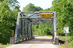 | AR 289 Bridge Over English Creek | structure | 2009 | 08001338 |
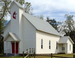 | Camp Methodist Church | building | 1997 | 97000402 |
| Castleberry Building | building | 2021 | 100006023 | |
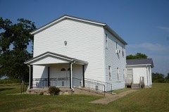 | County Line School and Lodge | building | 1975 | 75000386 |
| Green Valley Homestead | district | 2018 | 100001994 | |
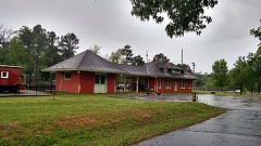 | Kansas City, Fort Scott and Memphis Railroad Depot | building | 1992 | 92000617 |
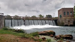 | Mammoth Spring Dam and Lake | structure | 2009 | 09000512 |
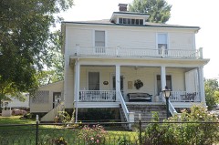 | T. H. Morris House | building | 1990 | 90001462 |
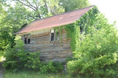 | Saddle Store | building | 2000 | 00001366 |
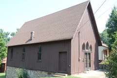 | Saint Andrew's Episcopal Church | building | 1986 | 86002944 |
 | Spring River Bridge | structure | 2014 | 13001104 |
Every wildfire the federal occurrence database records inside this county: 877 of them, burning about 15,064 acres. 8 started naturally and 207 were recorded as arson. Each settlement page carries the fires within five miles of it.
| Reported cause | Fires |
|---|---|
| Debris and open burning | 419 |
| Arson/incendiarism | 207 |
| Missing data/not specified/undetermined | 181 |
| Equipment and vehicle use | 51 |
| Natural | 8 |
| Smoking | 4 |
| Recreation and ceremony | 4 |
| Railroad operations and maintenance | 2 |
| Misuse of fire by a minor | 1 |
The five largest, by the area the report gives. None of them was recorded as arson.
| Date | Cause | Size | Reported by | Name on the report |
|---|---|---|---|---|
| 22 March 2018 | Missing data/not specified/undetermined | 472 acres | Arkansas Forestry Commission | not named |
| 12 April 2018 | Missing data/not specified/undetermined | 357 acres | Arkansas Forestry Commission | not named |
| 24 March 2003 | Debris and open burning | 336 acres | Arkansas Forestry Commission | not named |
| 6 March 2012 | Debris and open burning | 285 acres | Arkansas Forestry Commission | BROWN'S CHAPEL |
| 22 January 2003 | Debris and open burning | 170 acres | Arkansas Forestry Commission | not named |
| 8 March 2020 | Missing data/not specified/undetermined | 155 acres | Arkansas Forestry Commission | not named |
| 3 April 2019 | Missing data/not specified/undetermined | 150 acres | Arkansas Forestry Commission | not named |
| 3 March 2017 | Missing data/not specified/undetermined | 120 acres | Arkansas Forestry Commission | not named |
Every settlement page carries the fires within five miles of it - see the settlement index below.
The NOAA Storm Events Database holds 309 reports for this county, causing 5 deaths, 32 injuries and about $11,016,600 in recorded property damage. Each settlement page carries the reports that name it.
| Kind of event | Reports |
|---|---|
| Thunderstorm Wind | 146 |
| Hail | 88 |
| Flash Flood | 33 |
| Tornado | 22 |
| Heavy Rain | 8 |
| Flood | 7 |
| Funnel Cloud | 3 |
| Lightning | 2 |
The most serious of them, by death, then injury, then recorded damage. The accounts are quoted exactly as the forecast office filed them.
| When | Event | Place named | Harm | What the report says |
|---|---|---|---|---|
| April 1982 | Tornado (F3) | not stated | 2 killed, 2 hurt, $250,000 | no account filed |
| March 1959 | Tornado (F2) | not stated | 1 killed, 15 hurt, $25,000 | no account filed |
| February 2001 | Tornado (F2) | Union | 1 killed, 3 hurt | A strong tornado was spawned in southern Fulton County about 3 miles west of Union. The tornado moved quickly northeast, and caused considerable damage. Roofs were damaged at several homes, with a dairly barn heavily damaged. Three mobile homes were destroyed. In one of the mobile homes about 5.5 miles southwest of Salem, four people were injured. An 18 month old boy died from his injuries the next day after being transported to a hospital in Little Rock. There was extensive tree damage, with many cedar trees twisted or downed. The tornado travelled about 8 miles before dissipating 3.8 miles southwest of Salem. |
| March 2012 | Flood | French | 1 killed, $20,000 | Heavy rain caused flooding along the South Fork of the Spring River. On the 24th at the Kia Kima Scout Reservation, a 4 year-old boy was helping clean up the area. According to news reports, a group of older boys left the clean-up site to return to the camping area. Sometime thereafter, the younger boy asked if he could catch up with the other boys. At some point, the boy ended up drowning in the river, which was described as high and rolling. His body was recovered on the 28th. |
| December 1982 | Tornado (F4) | not stated | 5 hurt, $250,000 | no account filed |
| August 1986 | Thunderstorm Wind | not stated | 4 hurt | no account filed |
| April 1999 | Tornado (F1) | Mammoth Spg | 2 hurt | no account filed |
| November 2005 | Tornado (F1) | Moko | 1 hurt | A weak tornado touched down briefly in Fulton County, about 3 miles east of Moko. Estimated winds with the tornado were about 110 mph. A house had shingles off, a broken window and the porch was shifted.One person in the house sustained minor injuries from flying debris. Another house had broken windows and several outbuildings were destroyed. Farm machinery was overturned and several vehicles sustained damage. Numerous trees were downed or snapped off along the path of the tornado. The tornado was on the ground almost five and a half miles before dissipating. |
| May 2011 | Flood | Vidette | $3,000,000 | no account filed |
| March 2008 | Flash Flood | Ott | $2,000,000 | Arkansas Highway 395 north of Salem was closed due to high water. On Arkansas Highway 223 south of Viola, a 22-foot bridge collapsed due to flooding. Two people were rescued at Sadler Falls due to flooding. The South Fork River overflowed its banks in Salem and flooded a construction site for a new baseball complex. Water flooded 120 homes in the county. |
| April 2008 | Flood | Mammoth Spg | $1,500,000 | Excessive rainfall in Missouri and north Arkansas caused another sharp rise on the Warm Fork of the Spring River and the Spring River, flooding portions of Mammoth Spring and areas downstream. The river rose to 20.8 feet, within two feet of the March crest at the Hardy gage. Over bank flooding begins at 10 feet. The flood wave from the Warm Fork of the Spring River, which comes from West Plains, MO, and into Thayer, MO, was significantly higher than the March flooding. Damage to the Arkansas Game and Fish Commission trout hatchery was severe, with loss of equipment and all trout in the holding tanks. |
| April 2011 | Flood | Vidette | $1,400,000 | Widespread areal flooding occurred. |
| May 2016 | Thunderstorm Wind | Salem | $500,000 | Airplanes were severely damaged along with structural damage to some airport buildings. Winds estimated at 80 to 100 mph. |
| January 2007 | Flash Flood | Salem | $310,000 | Heavy rains produced widespread flash flooding across Fulton County. Numerous secondary and county roads were flooded and impassible. |
| December 2012 | Thunderstorm Wind | Gepp | $250,000 | One duplex lost its entire roof, several mobile homes were damaged, several outbuildings were damaged or destroyed, and highway signs were blown down. The area affected was so small that only about 100 electric customers lost service. |
| March 1991 | Tornado (F1) | not stated | $250,000 | no account filed |
| October 2009 | Flash Flood | Ott | $130,000 | Numerous county roads were damaged by flooding. |
| April 2014 | Flash Flood | Viola | $100,000 | County roads suffered considerable damage. |
| August 2012 | Thunderstorm Wind | Flint Springs | $100,000 | In the Mt. Calm area, trees and power lines were blown down, two homes and two barns were damaged, and a tractor-trailer and a horse trailer were blown over. |
| August 2012 | Thunderstorm Wind | Salem | $100,000 | Tin roofing was removed from several structures, especially on the west side of Salem. Numerous trees and power lines were blown down. |
| May 2011 | Thunderstorm Wind | Agnos | $60,000 | Barns, outbuildings, and mobile homes were damaged in the Agnos area. Several trees were blown down and there were power outages. |
| August 2012 | Thunderstorm Wind | Viola | $50,000 | Tin roofing was removed from several houses. Trees and power lines were blown down. Some power poles were snapped. |
| December 2010 | Thunderstorm Wind | Mammoth Spg | $50,000 | Damage occurred in the vicinity of the Jim Hinkle Fish Hatchery on the Spring River. A roof was blown off a storage building, there was roof damage to a house, an 80-foot section of a fence was damaged, a feed bin was overturned, and some trees were blown down. |
| May 2009 | Flash Flood | Ott | $50,000 | Flooding occurred on county roads in the western half of the county. One residence was surrounded by water west of Arkansas Highway 223. Water entered the Viola City Hall. |
| June 1994 | Thunderstorm Wind | Mammoth Spring | $50,000 | Thunderstorm winds knocked down trees and power lines. |
| April 1993 | Hail | Mammoth Spring | $50,000 | Hail up to 1.00 inch in diameter, broke windows and damaged roofs and cars in Mammoth Spring. |
| March 1997 | Thunderstorm Wind | Elizabeth | $50,000 | no account filed |
| April 2022 | Thunderstorm Wind | Gepp | $40,000 | A shop building was reported destroyed. |
| July 2015 | Thunderstorm Wind | Mammoth Spg | $30,000 | A tree fell across three cars in the Mammoth Spring State Park area. |
| October 2009 | Flash Flood | Salem | $30,000 | Water rescues were carried out north of Salem on Arkansas Highway 395 along Pine Hill Creek. |
| October 2009 | Flash Flood | Viola | $30,000 | Water rescues were carried out south of Viola. |
| October 2009 | Flash Flood | Shady Grove | $30,000 | Water rescues were carried out south of Salem. |
| June 2001 | Thunderstorm Wind | Viola | $30,000 | Thunderstorm winds removed at least half of a metal roof at a school building in Viola. Several trees were also blown down. |
| May 2011 | Thunderstorm Wind | Wheeling | $25,000 | Trees were blown down, shingles were torn off roofs, the roof was blown off a barn, and a pole barn was damaged. |
| April 1979 | Tornado (F1) | not stated | $25,000 | no account filed |
| December 2015 | Thunderstorm Wind | Viola | $20,000 | A roof was blown off a barn. |
| December 2015 | Thunderstorm Wind | Salem | $20,000 | Several power lines were blown down across the county. A roof was blown off a barn in Viola, and a tree fell onto a car in Mammoth Springs. |
| June 2014 | Thunderstorm Wind | Sturkie | $20,000 | Trees and power lines were blown down. One of the falling trees caused minor damage to a house. |
| April 2008 | Flash Flood | Camp | $20,000 | A minivan was swept away while trying to cross a low water crossing on Pleasant Valley Road in Camp. |
| May 2011 | Thunderstorm Wind | Bexar | $15,000 | Trees were blown down, with one of the trees damaging the roof of a house. A tree that was uprooted pulled a shed off the ground. |
| May 2011 | Thunderstorm Wind | Viola | $12,000 | Trees were blown down, with one of the trees falling on a garage. A carport was blown away. Shingles were torn off roofs. |
| April 2022 | Hail | Gepp | $10,000 | Four inch hail was estimated and windshields were broken. |
| January 2020 | Thunderstorm Wind | Elizabeth | $10,000 | Trees were blown down and damaged a mobile home. |
| April 2017 | Thunderstorm Wind | Pickren Hall | $10,000 | Tree...power line...and some roof damage was reported. |
| March 2017 | Thunderstorm Wind | Cherokee Vlg | $10,000 | OEM Director reported windows damaged, yawnings and tree limbs down throughout the area. Personal weather instrument recorded 64 mph wind gust. |
| July 2010 | Flash Flood | Ott | $10,000 | Water was over some roads in Fulton County and several low water crossings were flooded. |
| May 2009 | Thunderstorm Wind | Gepp | $10,000 | Power lines were blown down in the area. |
| May 2016 | Thunderstorm Wind | Salem | $5,000 | Trees were downed on houses...with some building damage reported. Straight-line winds were estimated at 60 to 80 mph. |
| April 2013 | Thunderstorm Wind | Viola | $5,000 | Trees were blown down around Viola. |
| April 2013 | Thunderstorm Wind | Salem | $5,000 | Tree limbs were blown down, causing minor power outages. |
| May 2011 | Thunderstorm Wind | Glencoe | $5,000 | Some trees were blown down. |
| May 2011 | Thunderstorm Wind | Agnos | $5,000 | Some trees were blown down. |
| May 2011 | Thunderstorm Wind | Saddle | $5,000 | Large trees were uprooted around Saddle. |
| December 2010 | Thunderstorm Wind | Kittle | $5,000 | Several trees were blown down between Kittle and Lake Omaha. |
| July 2010 | Thunderstorm Wind | Viola | $5,000 | A few trees were blown down. |
| June 1984 | Tornado (F0) | not stated | $2,500 | no account filed |
| May 1968 | Tornado (F1) | not stated | $2,500 | no account filed |
| June 1968 | Tornado (F2) | not stated | $2,500 | no account filed |
| July 2015 | Thunderstorm Wind | Salem | $2,000 | Power lines were blown down in Salem. |
| July 2011 | Thunderstorm Wind | Fryatt | $2,000 | A large tree was blown down on Arkansas 9. |
The Survey's mineral resources record lists 20 workings inside this county. 7 still produce and 13 are closed or unrecorded. Each settlement page carries the workings within five miles of it.
| Commodity | Workings |
|---|---|
| Sand and Gravel, Construction | 10 |
| Stone, Crushed/Broken | 4 |
| Iron | 2 |
| Copper | 1 |
| Clay | 1 |
| Manganese | 1 |
| Stone | 1 |
| Magnesium Compounds | 1 |
The least common of them first, because a county's hundredth gravel pit says nothing its first ten did not.
| Where | Site | Commodity | Status | Recorded |
|---|---|---|---|---|
| Baker | Copper | Occurrence | ||
| Lowrance | Manganese, Iron | Occurrence | ||
| Rice Farm | Magnesium Compounds | Unknown | ||
| Unk | Clay | Occurrence | ||
| Unk | Stone | Unknown | ||
| Leshem Property | Iron | Occurrence | ||
| Crusher No. 1 | Stone, Crushed/Broken | Producer | ||
| Hardy Crusher & Mill | Stone, Crushed/Broken | Producer | ||
| Highway 87 Pit & Mill | Stone, Crushed/Broken | Producer | ||
| Joyce Brothers Quarry & Plant | Stone, Crushed/Broken | Producer | ||
| Humphrie | Sand and Gravel, Construction | Producer | ||
| Lafevers Sand & Gravel Co. | Sand and Gravel, Construction | Prospect | ||
| Pierce Pit & Plant | Sand and Gravel, Construction | Producer | ||
| Salem Quarry | Sand and Gravel, Construction | Producer | ||
| Sturkie Pit | Sand and Gravel, Construction | Past Producer | ||
| Unk | Sand and Gravel, Construction | Unknown | ||
| Unk | Sand and Gravel, Construction | Unknown | ||
| Unk | Sand and Gravel, Construction | Unknown | ||
| Unk | Sand and Gravel, Construction | Unknown | ||
| Unk | Sand and Gravel, Construction | Unknown |
Named settlements recorded in the Geographic Names Information System, each with the topographic sheets covering it. Villages, hamlets and abandoned places alike. Each is shown with the nearest named watercourse or landform and the survey quadrangle it falls on.
Afton township · 72554 · On Wolf Creek · Mammoth Spring quadrangle
7 sheets, 1957 to 1983
South Fork township · 72520 · On Cherry Hollow Branch · Agnos quadrangle
9 sheets, 1957 to 1983
Afton township · 72554 · On Brush Creek · Mammoth Spring quadrangle
7 sheets, 1957 to 1983
No longer a settlement
Mammoth Spring township · 72554 · On Warm Fork Spring River · Mammoth Spring quadrangle
7 sheets, 1957 to 1983
Afton township · 72554 · On Little Gut Creek · Mammoth Spring quadrangle
7 sheets, 1957 to 1983
Cleveland township · 72583 · On Hutchinson Creek · Elizabeth quadrangle
16 sheets, 1890 to 1985
Washington township · 72576 · On Newcomb Branch · Salem Knob quadrangle
11 sheets, 1950 to 1984
Mammoth Spring township · 72554 · Near Long Run Hollow · Mammoth Spring quadrangle
7 sheets, 1957 to 1983
No longer a settlement
Afton township · 72542 · Near Rock Quarry Hill · Wirth quadrangle
8 sheets, 1957 to 1983
The vanished settlements of Fulton County: the places named above that are no longer on the map.