 Block
From the record
10 National Register listings published here.
Sources: the National Register database, National Park Service
64 topographic sheets cover 41 settlements here, and 10 properties are on the National Register of Historic Places.
10 National Register listings published here.
Sources: the National Register database, National Park Service
Every property in this county listed on the National Register of Historic Places, with the year it was listed and the federal nomination document.
| Photograph | Property | Type | Listed | Reference |
|---|---|---|---|---|
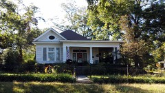 | Dr. John L. Butler House | building | 1986 | 86002848 |
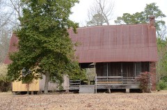 | Samuel D. Byrd Sr. Homestead | building | 2005 | 04001494 |
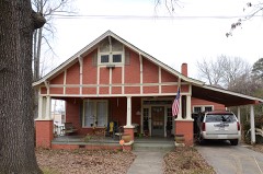 | Glaser-Kelly House | building | 1992 | 91000583 |
| Jenkins' Ferry Battleground | site | 1970 | 70000120 | |
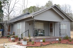 | Koon House #1 | building | 1999 | 99001249 |
| Koon House #2 | building | 1999 | 99001248 | |
| Koon House #3 | building | 1999 | 99001247 | |
| Koon House #4 | building | 1999 | 99001246 | |
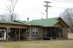 | Koon House #6 | building | 1999 | 99001245 |
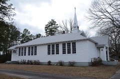 | Oak Grove School | building | 1991 | 91000693 |
Every wildfire the federal occurrence database records inside this county: 1,295 of them, burning about 8,543 acres. 58 started naturally and 345 were recorded as arson. Each settlement page carries the fires within five miles of it.
| Reported cause | Fires |
|---|---|
| Debris and open burning | 517 |
| Arson/incendiarism | 345 |
| Missing data/not specified/undetermined | 260 |
| Equipment and vehicle use | 65 |
| Natural | 58 |
| Smoking | 20 |
| Misuse of fire by a minor | 19 |
| Recreation and ceremony | 10 |
| Railroad operations and maintenance | 1 |
The five largest, by the area the report gives. Three of them were set deliberately.
| Date | Cause | Size | Reported by | Name on the report |
|---|---|---|---|---|
| 8 January 2006 | Debris and open burning | 336 acres | Arkansas Forestry Commission | not named |
| 8 March 2020 | Missing data/not specified/undetermined | 226 acres | Arkansas Forestry Commission | not named |
| 23 October 2010 | Debris and open burning | 221 acres | Arkansas Forestry Commission | STAGECOACH |
| 23 March 2003 | Arson/incendiarism | 150 acres | Arkansas Forestry Commission | not named |
| 7 August 2005 | Natural | 138 acres | Arkansas Forestry Commission | PRAGUE |
| 3 February 2010 | Arson/incendiarism | 136 acres | Arkansas Forestry Commission | JAMESTOWN |
| 5 January 2006 | Arson/incendiarism | 130 acres | Arkansas Forestry Commission | not named |
| 24 September 2010 | Debris and open burning | 114 acres | Arkansas Forestry Commission | SOUTH CROSSROADS |
Every settlement page carries the fires within five miles of it - see the settlement index below.
The NOAA Storm Events Database holds 381 reports for this county, causing 1 death, 4 injuries and about $10,554,000 in recorded property damage. Each settlement page carries the reports that name it.
| Kind of event | Reports |
|---|---|
| Thunderstorm Wind | 190 |
| Hail | 106 |
| Flash Flood | 37 |
| Tornado | 27 |
| Heavy Rain | 10 |
| Flood | 7 |
| Lightning | 3 |
| Funnel Cloud | 1 |
The most serious of them, by death, then injury, then recorded damage. The accounts are quoted exactly as the forecast office filed them.
| When | Event | Place named | Harm | What the report says |
|---|---|---|---|---|
| May 2013 | Tornado (EF1) | Tull | 1 killed, $25,000 | A brief EF1 tornado caused damage, mainly to trees. However, one of these trees killed a 33 year-old man when it fell on his car. He was driving on Main St./Arkansas 291 in Tull on his way to work. This was the first tornado fatality in Grant County in more than 60 years. A few houses had minor roof damage. |
| April 1966 | Tornado (F3) | not stated | 2 hurt, $250,000 | no account filed |
| December 2012 | Tornado (EF1) | Sheridan | 1 hurt, $175,000 | A double-wide mobile home was destroyed; the owner suffered minor injuries. The roof of a house was badly damaged. A couple of additional houses had minor roof damage, and one had a couple of windows blown out. Several shop buildings were damaged or destroyed. A camper was overturned. Trees and power lines were blown down. One of the trees fell on a carport, crushing a pickup truck and a car. |
| May 1987 | Thunderstorm Wind | not stated | 1 hurt | no account filed |
| May 2008 | Tornado (EF2) | Leola | $3,500,000 | This tornado exited Dallas County, north-northeast of Carthage, and moved into Grant County, south-southeast of Leola. About 10 residences (houses and mobile homes) were destroyed, nine had major damage, and approximately 35 had minor damage. Several barns and outbuildings were destroyed. One church also suffered damage. The majority of the damage was in the area around the Crossroads community. There was extensive timber damage. One major power transmission line was knocked down, as were a number of other power lines and poles. |
| May 2008 | Tornado (EF1) | Belfast | $1,500,000 | The tornado destroyed three mobile homes and caused major damage to a house. There was extensive damage to timber, both hardwoods and softwoods. Two large, steel, electrical transmission towers were knocked down. The tornado exited Grant County, northeast of Ico, and entered Saline County, south-southeast of East End. |
| May 2009 | Flash Flood | Tull | $600,000 | A number of county roads and state highways across the area were flooded. Several businesses in Sheridan and a skating rink outside of town suffered flood damage. |
| December 2009 | Flood | Tull | $500,000 | Flash flooding, which developed early on the morning of the 24th, became widespread areal flooding later in the morning on the 24th and continued into Christmas morning. Arkansas Highway 229 was closed south of Poyen. |
| December 2009 | Flash Flood | Tull | $500,000 | Heavy rain resulted in the development of flash flooding early on the morning of the 24th. |
| October 2014 | Thunderstorm Wind | Turin | $400,000 | Winds up to 85 mph blew through the Sheridan area. Numerous trees and power lines were blown down. Approximately 30 structures were damaged, three of which had major damage. Much of the structural damage was due to falling trees. An automated weather station, belonging to the Arkansas Forestry Commission, recorded a wind gust of 76 mph at the Sheridan airport. Numerous trees were blown down in other sections of Grant County. |
| October 2009 | Flash Flood | Tull | $400,000 | Numerous streets in Sheridan were flooded, and the Sheridan Fire Department sustained flood damage. In the county, flooded roads included Grant 58, 16, 9, 14, 31, and 313, along with Keg Mill Rd., Fairview Rd., and Arkansas Highway 46 in the Hurricane Creek area. Several homes and businesses suffered flood damage. Two water rescues occurred. The Sheridan schools were closed on the 30th due to flooding on at least 25 of the 44 bus routes. |
| September 2008 | Flash Flood | Ico | $300,000 | Flooding occurred across the county. Arkansas Highway 291 between Tull and Prattsville was closed due to flooding. Arkansas Highway 46 West at 2A was closed due to high water. |
| September 2008 | Flood | Slabtown | $300,000 | Water was over the roads. |
| May 2011 | Flood | Ico | $250,000 | no account filed |
| December 1982 | Tornado (F2) | not stated | $250,000 | no account filed |
| March 1961 | Tornado (F1) | not stated | $250,000 | no account filed |
| October 2009 | Thunderstorm Wind | Junet | $200,000 | Many trees were knocked down, with several of the trees falling on houses. Power lines were also felled. |
| December 2012 | Thunderstorm Wind | Sheridan | $150,000 | In Sheridan, part of the roof was blown off at a consignment shop, the metal roof was blown off the Masonic Lodge, the roof was blown off an oil company, a carport and a garage collapsed, shingles were blown off many roofs, and trees and power lines were blown down. East of Sheridan, trees were blown down at a number of locations along U.S. 270. |
| October 2009 | Tornado (EF1) | Junet | $150,000 | The tornado blew down or snapped off thousands of trees on private timber lands. |
| December 2016 | Tornado (EF1) | Cedar Branch | $100,000 | A supercell dropped a tornado on the northeast side of Grapevine, Arkansas. This tornado tracked for approximately half a mile and was 100 yards wide. Major damage was sustained to a house (double wide trailer). Several hardwood trees snapped, along with minor damage to a few other structures. |
| April 2011 | Flood | Ico | $100,000 | Widespread areal flooding occurred. |
| October 2009 | Tornado (EF1) | Turin | $50,000 | The tornado tore shingles and siding off a house, destroyed a shed, uprooted iron clothesline poles anchored in concrete, blew down an 80-foot tall amateur radio antenna, damaged the roof of a mobile home, took the roof off a shed, and blew down trees and power lines. |
| April 1994 | Thunderstorm Wind | Sheridan | $50,000 | Thunderstorm winds downed some trees and power lines. |
| June 1994 | Thunderstorm Wind | Sheridan | $50,000 | Thunderstorm winds downed trees and power lines along Highway 167. |
| April 2010 | Tornado (EF1) | Belfast | $40,000 | An EF1 tornado caused roof damage to a house and a church. Half of a barn roof was blown off and trees were blown down. This was the first of five tornadoes spawned by the same supercell thunderstorm. |
| May 2022 | Thunderstorm Wind | Poyen | $30,000 | The local EM relayed that a business in Poyen sustained roof damage. |
| November 2015 | Thunderstorm Wind | Sheridan | $30,000 | An auto body shop had its roof torn off, and a house behind it was heavily damaged. Numerous trees were blown down. |
| April 2011 | Thunderstorm Wind | Leola | $30,000 | Numerous trees and power lines were blown down. Siding and awnings on buildings were torn off. |
| September 2012 | Flash Flood | Poyen | $25,000 | Ditches overflowed, causing roads to flood. |
| April 2011 | Thunderstorm Wind | Orion | $25,000 | Two large trees blew down, knocking down power lines. Siding and underpinning on mobile homes were damaged. |
| April 2011 | Thunderstorm Wind | Sheridan | $25,000 | A few trees and some power lines were blown down. |
| October 2009 | Thunderstorm Wind | Sheridan | $25,000 | Several large trees were blown down. Shingles were torn off the roof of some homes. |
| April 2008 | Flash Flood | Tull | $25,000 | Portions of several roads were under water. At least one motorist had to be rescued via boat by the Cane Creek Fire Department near Ico. A family in the Delta Circle area was also evacuated by boat. An area of Hickory Street in Tull was flooded. |
| April 1982 | Tornado (F1) | not stated | $25,000 | no account filed |
| January 2020 | Thunderstorm Wind | Center Grove | $20,000 | A spotter located along Hwy 270 between Sheridan and White Hall reported strong winds threw an anchored carport against their home. |
| April 2008 | Tornado (EF1) | Prattsville | $20,000 | A tornado destroyed a barn, a shed, a cattle shed, and a covered pavilion at a cemetery. Four cows and a donkey were killed. Dozens of trees were snapped off or blown down. The tornado exited Grant County, north of Ico, and moved into Saline County, south of East End. |
| April 2014 | Thunderstorm Wind | Grapevine | $15,000 | Trees and power lines were blown down. |
| June 2012 | Thunderstorm Wind | Millerville | $15,000 | Multiple large trees were blown over and snapped with several trees blocking Grant 7. Some minor damage was noted to an outbuilding as large limbs from a tree fell on it. |
| June 2009 | Thunderstorm Wind | Grapevine | $15,000 | Trees were down across the area. |
| May 2025 | Lightning | Slabtown | $10,000 | The South Sheridan Water Association Treatment Plant was struck by lightning. A fire developed and led to significant damage to the structure and equipment housed inside. This led to a temporary loss of water service to area residents. |
| April 2020 | Thunderstorm Wind | Sheridan | $10,000 | Several trees were blown down and there was some damage noted to small outbuildings. |
| July 2012 | Thunderstorm Wind | Ico | $10,000 | A house was damaged. |
| February 2012 | Thunderstorm Wind | Leola | $10,000 | Several trees were blown down along Arkansas 46 south. |
| April 2010 | Tornado (EF1) | Ico | $10,000 | This tornado exited Saline County south of Sardis and moved through a tiny portion of Grant County before re-entering Saline County south of Sardis. In Grant County, a few trees were blown down. |
| June 2009 | Thunderstorm Wind | Sheridan | $10,000 | Trees and large limbs were down around Sheridan. |
| June 2009 | Thunderstorm Wind | Prattsville | $10,000 | A tree fell on a boat. |
| August 2024 | Thunderstorm Wind | Sheridan | $5,000 | This report was from mPING. One inch tree limbs were broken and shingles were blown off. |
| April 2014 | Thunderstorm Wind | Grapevine | $5,000 | Trees were blown down. |
| January 2013 | Thunderstorm Wind | Walnut Ridge | $5,000 | Power lines were blown down. |
| June 2012 | Thunderstorm Wind | Grapevine | $5,000 | Trees were reported down along Grant 16. |
| August 2012 | Thunderstorm Wind | Grapevine | $5,000 | Power lines were blown down. |
| April 2011 | Thunderstorm Wind | Sheridan | $5,000 | A large tree was blown down, knocking down power lines. |
| August 2011 | Thunderstorm Wind | Poyen | $5,000 | Trees were blown down onto U.S. 270. |
| August 2011 | Thunderstorm Wind | Prattsville | $5,000 | Trees were blown down in Prattsville. |
| June 2009 | Thunderstorm Wind | Sheridan | $5,000 | Trees were down on the north end of the high school football field. |
| October 2009 | Thunderstorm Wind | Cross Roads | $5,000 | Large trees were knocked down. |
| April 2001 | Thunderstorm Wind | Sheridan | $5,000 | Severe thunderstorm winds damaged the roofs of several buildings 8 miles northeast of Sheridan. |
| April 2011 | Thunderstorm Wind | Leola | $3,000 | Trees were blown down. |
| January 1978 | Tornado (F1) | not stated | $2,500 | no account filed |
| February 1950 | Tornado (F2) | not stated | $2,500 | no account filed |
The Survey's mineral resources record lists 119 workings inside this county. 3 still produce and 116 are closed or unrecorded. Each settlement page carries the workings within five miles of it.
| Commodity | Workings |
|---|---|
| Sand and Gravel, Construction | 119 |
The least common of them first, because a county's hundredth gravel pit says nothing its first ten did not.
| Where | Site | Commodity | Status | Recorded |
|---|---|---|---|---|
| Dw Phillip | Sand and Gravel, Construction | Past Producer | ||
| Grant County Pit | Sand and Gravel, Construction | Producer | ||
| H Jordan | Sand and Gravel, Construction | Past Producer | ||
| Hyman Pit & Plant | Sand and Gravel, Construction | Producer | ||
| J Carpente | Sand and Gravel, Construction | Past Producer | ||
| Skorza Pit | Sand and Gravel, Construction | Producer | ||
| Unk | Sand and Gravel, Construction | Unknown | ||
| Unk | Sand and Gravel, Construction | Unknown | ||
| Unk | Sand and Gravel, Construction | Unknown | ||
| Unk | Sand and Gravel, Construction | Unknown | ||
| Unk | Sand and Gravel, Construction | Unknown | ||
| Unk | Sand and Gravel, Construction | Unknown | ||
| Unk | Sand and Gravel, Construction | Unknown | ||
| Unk | Sand and Gravel, Construction | Unknown | ||
| Unk | Sand and Gravel, Construction | Unknown | ||
| Unk | Sand and Gravel, Construction | Unknown | ||
| Unk | Sand and Gravel, Construction | Unknown | ||
| Unk | Sand and Gravel, Construction | Unknown | ||
| Unk | Sand and Gravel, Construction | Unknown | ||
| Unk | Sand and Gravel, Construction | Unknown | ||
| Unk | Sand and Gravel, Construction | Unknown | ||
| Unk | Sand and Gravel, Construction | Unknown | ||
| Unk | Sand and Gravel, Construction | Unknown | ||
| Unk | Sand and Gravel, Construction | Unknown | ||
| Unk | Sand and Gravel, Construction | Unknown | ||
| Unk | Sand and Gravel, Construction | Unknown | ||
| Unk | Sand and Gravel, Construction | Unknown | ||
| Unk | Sand and Gravel, Construction | Unknown | ||
| Unk | Sand and Gravel, Construction | Unknown | ||
| Unk | Sand and Gravel, Construction | Unknown | ||
| Unk | Sand and Gravel, Construction | Unknown | ||
| Unk | Sand and Gravel, Construction | Unknown | ||
| Unk | Sand and Gravel, Construction | Unknown | ||
| Unk | Sand and Gravel, Construction | Unknown | ||
| Unk | Sand and Gravel, Construction | Unknown | ||
| Unk | Sand and Gravel, Construction | Unknown | ||
| Unk | Sand and Gravel, Construction | Unknown | ||
| Unk | Sand and Gravel, Construction | Unknown | ||
| Unk | Sand and Gravel, Construction | Unknown | ||
| Unk | Sand and Gravel, Construction | Unknown | ||
| Unk | Sand and Gravel, Construction | Unknown | ||
| Unk | Sand and Gravel, Construction | Unknown | ||
| Unk | Sand and Gravel, Construction | Unknown | ||
| Unk | Sand and Gravel, Construction | Unknown | ||
| Unk | Sand and Gravel, Construction | Unknown | ||
| Unk | Sand and Gravel, Construction | Unknown | ||
| Unk | Sand and Gravel, Construction | Unknown | ||
| Unk | Sand and Gravel, Construction | Unknown | ||
| Unk | Sand and Gravel, Construction | Unknown | ||
| Unk | Sand and Gravel, Construction | Unknown | ||
| Unk | Sand and Gravel, Construction | Unknown | ||
| Unk | Sand and Gravel, Construction | Unknown | ||
| Unk | Sand and Gravel, Construction | Unknown | ||
| Unk | Sand and Gravel, Construction | Unknown | ||
| Unk | Sand and Gravel, Construction | Unknown | ||
| Unk | Sand and Gravel, Construction | Unknown | ||
| Unk | Sand and Gravel, Construction | Unknown | ||
| Unk | Sand and Gravel, Construction | Unknown | ||
| Unk | Sand and Gravel, Construction | Unknown | ||
| Unk | Sand and Gravel, Construction | Unknown | ||
| Unk | Sand and Gravel, Construction | Unknown | ||
| Unk | Sand and Gravel, Construction | Unknown | ||
| Unk | Sand and Gravel, Construction | Unknown | ||
| Unk | Sand and Gravel, Construction | Unknown | ||
| Unk | Sand and Gravel, Construction | Unknown | ||
| Unk | Sand and Gravel, Construction | Unknown | ||
| Unk | Sand and Gravel, Construction | Unknown | ||
| Unk | Sand and Gravel, Construction | Unknown | ||
| Unk | Sand and Gravel, Construction | Unknown | ||
| Unk | Sand and Gravel, Construction | Unknown | ||
| Unk | Sand and Gravel, Construction | Unknown | ||
| Unk | Sand and Gravel, Construction | Unknown | ||
| Unk | Sand and Gravel, Construction | Unknown | ||
| Unk | Sand and Gravel, Construction | Unknown | ||
| Unk | Sand and Gravel, Construction | Unknown | ||
| Unk | Sand and Gravel, Construction | Unknown | ||
| Unk | Sand and Gravel, Construction | Unknown | ||
| Unk | Sand and Gravel, Construction | Unknown | ||
| Unk | Sand and Gravel, Construction | Unknown | ||
| Unk | Sand and Gravel, Construction | Unknown | ||
| Unk | Sand and Gravel, Construction | Unknown | ||
| Unk | Sand and Gravel, Construction | Unknown | ||
| Unk | Sand and Gravel, Construction | Unknown | ||
| Unk | Sand and Gravel, Construction | Unknown | ||
| Unk | Sand and Gravel, Construction | Unknown | ||
| Unk | Sand and Gravel, Construction | Unknown | ||
| Unk | Sand and Gravel, Construction | Unknown | ||
| Unk | Sand and Gravel, Construction | Unknown | ||
| Unk | Sand and Gravel, Construction | Unknown | ||
| Unk | Sand and Gravel, Construction | Unknown | ||
| Unk | Sand and Gravel, Construction | Unknown | ||
| Unk | Sand and Gravel, Construction | Unknown | ||
| Unk | Sand and Gravel, Construction | Unknown | ||
| Unk | Sand and Gravel, Construction | Unknown | ||
| Unk | Sand and Gravel, Construction | Unknown | ||
| Unk | Sand and Gravel, Construction | Unknown | ||
| Unk | Sand and Gravel, Construction | Unknown | ||
| Unk | Sand and Gravel, Construction | Unknown | ||
| Unk | Sand and Gravel, Construction | Unknown | ||
| Unk | Sand and Gravel, Construction | Unknown | ||
| Unk | Sand and Gravel, Construction | Unknown | ||
| Unk | Sand and Gravel, Construction | Unknown | ||
| Unk | Sand and Gravel, Construction | Unknown | ||
| Unk | Sand and Gravel, Construction | Unknown | ||
| Unk | Sand and Gravel, Construction | Unknown | ||
| Unk | Sand and Gravel, Construction | Unknown | ||
| Unk | Sand and Gravel, Construction | Unknown | ||
| Unk | Sand and Gravel, Construction | Unknown | ||
| Unk | Sand and Gravel, Construction | Unknown | ||
| Unk | Sand and Gravel, Construction | Unknown | ||
| Unk | Sand and Gravel, Construction | Unknown | ||
| Unk | Sand and Gravel, Construction | Unknown | ||
| Unk | Sand and Gravel, Construction | Unknown | ||
| Unk | Sand and Gravel, Construction | Unknown | ||
| Unk | Sand and Gravel, Construction | Unknown | ||
| Unk | Sand and Gravel, Construction | Unknown | ||
| Unk | Sand and Gravel, Construction | Unknown | ||
| Unk | Sand and Gravel, Construction | Unknown | ||
| Unk | Sand and Gravel, Construction | Unknown |
Named settlements recorded in the Geographic Names Information System, each with the topographic sheets covering it. Villages, hamlets and abandoned places alike. Each is shown with the nearest named watercourse or landform and the survey quadrangle it falls on.
Washington township · 72150 · On Red Fork · Redfield quadrangle
12 sheets, 1932 to 1985
No longer a settlement
Tennessee township · 72084 · Prattsville quadrangle
8 sheets, 1955 to 1985
No longer a settlement
Simpson township · 72150 · On Logan Creek · Cane Creek quadrangle
10 sheets, 1955 to 1985
Calvert township · 72150 · Sheridan quadrangle
9 sheets, 1955 to 1985
No longer a settlement
Darysaw township · 71602 · On Little Derrieusseaux Creek · Pine Bluff NW quadrangle
10 sheets, 1955 to 1985
No longer a settlement
Simpson township · 72150 · On Caple Creek · Cane Creek quadrangle
10 sheets, 1955 to 1985
No longer a settlement
Simpson township · 72150 · Cane Creek quadrangle
10 sheets, 1955 to 1985
No longer a settlement
Calvert township · 72150 · On Gamble Creek · Bunn quadrangle
9 sheets, 1955 to 1985
No longer a settlement
Merry Green township · 72150 · On West Fork Big Creek · Sheridan quadrangle
9 sheets, 1955 to 1985
Madison township · 72057 · On Big Branch · Grapevine quadrangle
9 sheets, 1955 to 1985
No longer a settlement
Simpson township · 72079 · On Horn Branch · Redfield quadrangle
12 sheets, 1932 to 1985
The vanished settlements of Grant County: the places named above that are no longer on the map.