Block
From the record
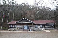
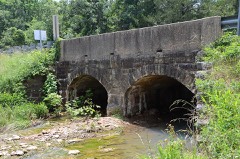
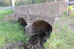
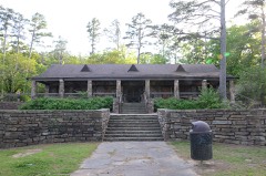
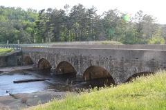
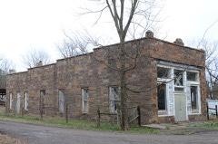
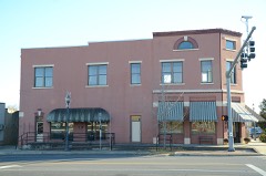
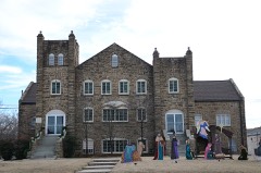
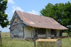
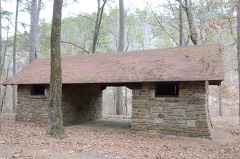
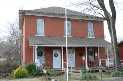
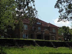
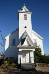
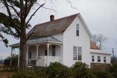
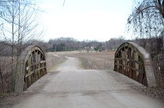
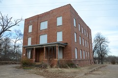
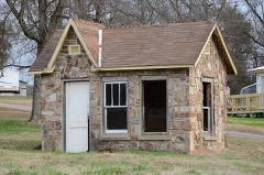
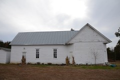
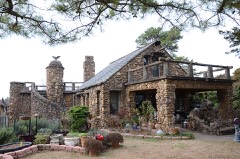
44 National Register listings published here.
Sources: the National Register database, National Park Service
107 topographic sheets cover 53 settlements here, and 44 properties are on the National Register of Historic Places.
44 National Register listings published here.
Sources: the National Register database, National Park Service
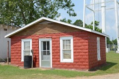
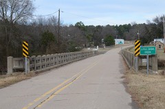
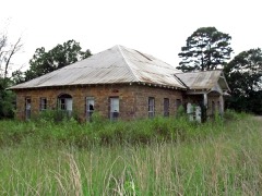
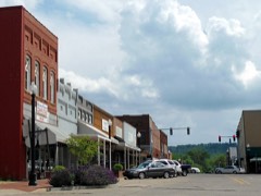
Every property in this county listed on the National Register of Historic Places, with the year it was listed and the federal nomination document.
Every wildfire the federal occurrence database records inside this county: 602 of them, burning about 6,899 acres. 52 started naturally and 96 were recorded as arson. Each settlement page carries the fires within five miles of it.
| Reported cause | Fires |
|---|---|
| Debris and open burning | 197 |
| Missing data/not specified/undetermined | 163 |
| Arson/incendiarism | 96 |
| Equipment and vehicle use | 65 |
| Natural | 52 |
| Recreation and ceremony | 11 |
| Power generation/transmission/distribution | 8 |
| Misuse of fire by a minor | 4 |
| Smoking | 4 |
| Other causes | 2 |
The five largest, by the area the report gives. Two of them were set deliberately.
| Date | Cause | Size | Reported by | Name on the report |
|---|---|---|---|---|
| 8 January 2006 | Debris and open burning | 651 acres | Arkansas Forestry Commission | not named |
| 20 September 2000 | Missing data/not specified/undetermined | 500 acres | Arkansas Forestry Commission | not named |
| 1 July 2012 | Arson/incendiarism | 300 acres | Arkansas Forestry Commission | HOG THEIF |
| 6 October 2004 | Debris and open burning | 292 acres | Arkansas Forestry Commission | not named |
| 1 September 2000 | Natural | 262 acres | Ozark-St. Francis National Forests | BROCK CREEK |
| 14 April 2010 | Debris and open burning | 260 acres | Ouachita National Forest | ROAD 39 |
| 3 August 2011 | Missing data/not specified/undetermined | 217 acres | Arkansas Forestry Commission | not named |
| 17 January 2014 | Arson/incendiarism | 188 acres | Ozark-St. Francis National Forests | EAST END |
Every settlement page carries the fires within five miles of it - see the settlement index below.
The NOAA Storm Events Database holds 417 reports for this county, causing 1 death, 21 injuries and about $24,715,950 in recorded property damage. Each settlement page carries the reports that name it.
| Kind of event | Reports |
|---|---|
| Thunderstorm Wind | 223 |
| Hail | 119 |
| Flash Flood | 32 |
| Tornado | 30 |
| Heavy Rain | 5 |
| Flood | 3 |
| Lightning | 2 |
| Funnel Cloud | 2 |
| Dust Devil | 1 |
The most serious of them, by death, then injury, then recorded damage. The accounts are quoted exactly as the forecast office filed them.
| When | Event | Place named | Harm | What the report says |
|---|---|---|---|---|
| February 1997 | Tornado (F1) | Booneville | 1 killed, 3 hurt, $250,000 | no account filed |
| August 1988 | Thunderstorm Wind | not stated | 6 hurt | no account filed |
| March 1967 | Tornado (F2) | not stated | 5 hurt | no account filed |
| April 1973 | Tornado (F2) | not stated | 2 hurt, $25,000 | no account filed |
| November 1985 | Thunderstorm Wind | not stated | 2 hurt | no account filed |
| April 1980 | Tornado (F2) | not stated | 1 hurt, $250,000 | no account filed |
| February 1977 | Tornado (F1) | not stated | 1 hurt, $250,000 | no account filed |
| March 2009 | Lightning | Booneville | 1 hurt | A man was struck by lightning while on a drilling rig off of Ferguson Valley Road. |
| March 2008 | Flash Flood | Ione | $15,000,000 | Several roads were impassible across the county. Damage was caused to at least 50 percent of the county's roads. At least three of the county's bridges were damaged. A low spot on Arkansas Highway 109 north of Magazine had water running over it. Arkansas Highway 217 South flooded with water up to the tops of fences around the Petit Jean River. Damage to bridges and roads across the county was estimated at $15 Million. |
| June 2008 | Thunderstorm Wind | Paris | $2,700,000 | Six houses suffered major damage, 20 had moderate damage, and 27 had minor damage. Four businesses had major damage, including a car dealership, two shop buildings, and a lumber company. At the car dealership, 37 cars were damaged, primarily due to flying debris and the collapse of three concrete block walls of an adjacent building. Three other businesses suffered moderate damage, and six had minor damage. Many trees were blown down, some of which fell on houses. Arkansas' second-oldest cherry tree was toppled. Many power lines were blown down and about 40 utility poles had to be replaced. |
| March 2008 | Thunderstorm Wind | Booneville Muni Arpt | $2,000,000 | It was reported that 12 to 14 houses and mobile homes were destroyed or rendered unlivable. An outbuilding was blown away on Lowder Road. A home at the intersection of Lowder and Calahan was moved off of its foundation. Most of its roof was removed and the porch was leveled with a portion blown into the road. Trees were blown over at two residences on Arkansas Highway 10. Six hangars, the fuel dispenser, the terminal building and two airplanes at the Booneville Airport were damaged. A roof was blown off a house and a camper trailer was blown into a vehicle. An uninhabited mobile home in a trailer park on Turkey Ridge was also blown over and damaged. |
| January 2020 | Tornado (EF2) | Corley | $500,000 | The tornado touched down east of Cove Lake off of Mt. Salem Road where a barn was destroyed. It continued northeast damaging a mobile home along St. Louis Valley Road. After crossing Arkansas Hwy. 109 just west of Midway, the tornado destroyed a mobile home off of Old Military Rd. As it crossed Hwy. 109 again south of Prairie View, chicken houses were destroyed. Homes lost large sections of their roofs along Parks Rd. southeast of Prairie View, but most of their walls remained. Additional outbuildings and chicken houses were damaged or destroyed east of Scranton. Several trees and power lines were blown down along the path. The tornado lifted just north of the Tokalon community. |
| October 2009 | Flash Flood | Carbon City | $450,000 | Arkansas Highway 10 was flooded between Booneville and the Magazine Bridge. Damage to bridges occurred at Marcelle Phillips Park and Veterans Park in Booneville. An aluminum bridge on Earl Prairie Rd. was washed out. Part of Brewer Rd. washed away and a pipe washed out on Goff Rd. Water rose to a depth of more than 3 feet at a feed store in Booneville, causing merchandise to float around in the store. A hardware store also suffered flood damage. Numerous county roads were flooded, especially in the southern half of the county. |
| March 2019 | Thunderstorm Wind | Paris Muni Arpt | $300,000 | The storm survey revealed a large swath of straight-line wind damage, with winds of 80 to 90 mph estimated. These winds caused damage to several farm or outbuildings, with the most damage around the Scranton area. Several soft and hardwood trees were either uprooted or snapped. |
| June 2009 | Thunderstorm Wind | Booneville | $300,000 | The roof of a building was damaged and a window was blown out of a store. Trees, power lines, and power poles were knocked down. Trees fell on several residences and a barn. |
| March 2008 | Thunderstorm Wind | Caulksville | $250,000 | Homes were damaged across the area. Trees and power lines were blown down. |
| May 2011 | Flood | Paris | $250,000 | no account filed |
| December 1982 | Tornado (F2) | not stated | $250,000 | no account filed |
| December 1982 | Tornado (F2) | not stated | $250,000 | no account filed |
| March 1953 | Tornado (F3) | not stated | $250,000 | no account filed |
| April 2014 | Thunderstorm Wind | Booneville | $150,000 | A metal roof was blown off a building housing the Arkansas Revenue Office and a medical clinic. Part of the brick facade of the building fell into the street. The bricks damaged some other businesses and vehicles. |
| April 2011 | Flood | Paris | $100,000 | Widespread areal flooding occurred. |
| April 2022 | Tornado (EF1) | Scranton | $85,000 | This tornado started east of Scranton, just southwest of the intersection of AR Hwy. 197 and Stoney Point Rd. Significant damage was observed to a metal barn building (worst damage here), along with roof damage to a mobile home. Several trees were snapped or uprooted in this area and just northeast. More tree damage was noted as the tornado moved northeast through some forest, snapping or uprooting many trees, crossing Cane Creek Recreation Rd. A small outbuilding was destroyed as the tornado crossed Tokalon Rd. The rest of the track was mainly tree damage until the tornado lifted just north of Dublin Rd. west of the Jones Rd. intersection. |
| July 2012 | Dust Devil | Delaware | $75,000 | A very well-developed dust devil damaged four chicken houses near Delaware. Tin was torn off the roof and sides of the chicken houses. The debris was pulled so high into the air that it flew over trees and ridges. Cattle and horses were frightened and ran. |
| June 2009 | Thunderstorm Wind | Paris | $75,000 | Trees and power lines were knocked down. Part of the roof was blown off a house. |
| October 2009 | Tornado (EF1) | Joyland | $75,000 | This tornado moved out of Scott County about 7 1/2 miles north-northwest of Olio and entered Logan County about 2 1/4 miles south-southeast of Joyland. Hundreds of trees were blown down. Several barns and sheds were destroyed in the Jacks Creek area. |
| June 2019 | Thunderstorm Wind | Subiaco | $50,000 | A tree was blown down onto a house along Hwy. 309 near Paris. |
| May 2019 | Thunderstorm Wind | Scranton | $50,000 | Trees were down on roads and some homes. Chicken houses and outbuildings were also damaged. |
| July 2014 | Thunderstorm Wind | Booneville | $50,000 | A metal building was damaged. |
| May 2011 | Thunderstorm Wind | Booneville | $50,000 | Numerous trees and power lines were blown down. |
| March 2008 | Thunderstorm Wind | Caulksville | $50,000 | Part of a metal roof was blown off a barn and trees were blown down. |
| January 1998 | Flash Flood | Countywide | $45,000 | Heavy rains caused flash flooding across parts of Logan County. Several county roads and low water bridges were washed out as a result of the heavy rainfall. |
| April 2014 | Thunderstorm Wind | Paris | $40,000 | Several trees were blown down. One of the trees collapsed a wooden carport that was attached to a house, crushing a car beneath the carport. |
| November 2018 | Tornado (EF0) | Driggs | $25,000 | The tornado blew down trees, and removed some roofing material from several homes. Some barns and outbuildings were damaged. |
| April 2011 | Thunderstorm Wind | Blue Mtn | $25,000 | The roof was blown off City Hall and the fire department. |
| May 2011 | Tornado (EF2) | Roseville | $25,000 | This is the fourth segment of a six-segment tornado. (The first, third, and fifth segments occurred in Franklin County in the Tulsa County Warning Area.) The tornado moved out of Franklin County west of Denning and entered Logan County 2.05 miles northwest of Roseville. The tornado clipped a small piece of Logan County, snapping and uprooting trees. The tornado then exited Logan County 2.06 miles north-northwest of Roseville and moved back into Franklin County north-northeast of Denning. |
| May 2011 | Tornado (EF1) | Ratcliff | $25,000 | This is the second segment of a six-segment tornado. (The first, third, and fifth segments occurred in Franklin County in the Tulsa County Warning Area.) The tornado moved out of Franklin County east-northeast of Branch and entered Logan County 2.17 miles west-northwest of Ratcliff. The tornado clipped a small corner of Logan County, snapping and uprooting trees. The tornado then exited Logan County 1.86 miles northwest of Ratcliff and moved back into Franklin County south-southeast of Peter Pender. |
| March 2008 | Flash Flood | Hamilton Mine | $25,000 | Arkansas Highway 109 was flooded south of Paris. Short Mountain Road and North Carbon City Road were closed due to flooding. |
| March 1959 | Tornado (F3) | not stated | $25,000 | no account filed |
| March 1955 | Tornado (F2) | not stated | $25,000 | no account filed |
| January 2020 | Thunderstorm Wind | Midway | $20,000 | A photo from social media showed a tree down on a mobile home. |
| October 2019 | Thunderstorm Wind | Subiaco | $20,000 | A roof was blown off of a building. |
| September 2013 | Thunderstorm Wind | Paris | $20,000 | A house had much of its metal roof torn off. Power lines and numerous large tree limbs were blown down. |
| October 2012 | Tornado (EF1) | Lucas | $20,000 | A barn was destroyed and trees were damaged. |
| May 2010 | Thunderstorm Wind | Mixon | $20,000 | A cooperative observer reported that a tree fell on a building and some power lines. |
| February 2009 | Thunderstorm Wind | Booneville | $20,000 | Trees were blown down across Arkansas Highway 10 in and around Booneville. |
| May 2009 | Flash Flood | Joyland | $20,000 | Flooding occurred in the Grayson area. Jack Creek Road and Golden City Road were flooded. Two houses were evacuated. |
| June 2019 | Tornado (EF0) | Subiaco | $15,000 | Trees were uprooted along this short path. Damage was noted to a mobile home roof and porch. |
| August 2014 | Thunderstorm Wind | Paris | $15,000 | Trees and power lines were blown down in the city of Paris, and just east of town. |
| August 2010 | Flash Flood | Glendale | $15,000 | Widespread flooding occurred in Booneville and Glendale. |
| July 2010 | Thunderstorm Wind | Booneville | $15,000 | Trees and power lines were blown down south of Booneville. |
| September 2008 | Flash Flood | Wilkins | $15,000 | Flooding occurred on the streets of Paris and Subiaco. Cherry Street at the intersection of Maple and a one block section of South Fifth Street between Maple and Wahl Street were closed due to flooding. In Subiaco, North Leo Street was closed. Cove Lake flooded the Cove Lake Campground. |
| January 2007 | Flash Flood | Booneville | $11,000 | A number of secondary roads throughout the county were flooded. |
| August 2013 | Thunderstorm Wind | Roseville | $10,000 | Large trees were blown down on Arkansas 309. |
| September 2012 | Thunderstorm Wind | Booneville | $10,000 | Trees were blown down. |
| August 2009 | Flash Flood | Scranton | $10,000 | Water was over the roads from Charleston to Paris to Scranton. Water was also covering Arkansas Highway 22. |
| August 2009 | Thunderstorm Wind | Roseville | $10,000 | A large tree was down across a gas line on Tanyard Mountain Road north of Carbon City. |
| March 2008 | Flash Flood | Carolan | $10,000 | There was minor flooding with low water crossings covered. |
| March 1997 | Thunderstorm Wind | Scranton | $8,000 | no account filed |
| October 2019 | Thunderstorm Wind | New Blaine | $5,000 | A tree was blown down and damaged the metal roofing on two buildings. |
The Survey's mineral resources record lists 55 workings inside this county. 10 still produce and 45 are closed or unrecorded. Each settlement page carries the workings within five miles of it.
| Commodity | Workings |
|---|---|
| Stone | 28 |
| Sand and Gravel, Construction | 11 |
| Stone, Crushed/Broken | 8 |
| Stone, Dimension | 4 |
| Clay | 2 |
| Manganese | 1 |
| Stone, Crushed/Broken, Flagstone | 1 |
The least common of them first, because a county's hundredth gravel pit says nothing its first ten did not.
| Where | Site | Commodity | Status | Recorded |
|---|---|---|---|---|
| B.F.Hodges Property | Manganese | Past Producer | ||
| Logan County Building Stone Co | Stone, Crushed/Broken, Flagstone | Past Producer | ||
| Unk | Clay | Past Producer | ||
| Unk Shale Pits 2 | Clay | Past Producer | ||
| Arkansas Cherry Blend Stone Co | Stone, Dimension | Past Producer | ||
| Arkansas Ledge Stone Co | Stone, Dimension | Past Producer | ||
| Arkansas Wild Rose Stone Co | Stone, Dimension | Past Producer | ||
| Texas Ledgestone | Stone, Dimension | Past Producer | ||
| Arkansas Rainbow Stone Quarry &Mill | Stone, Crushed/Broken | Producer | ||
| Magazine | Stone, Crushed/Broken | Past Producer | ||
| Midway Quarry & Plant | Stone, Crushed/Broken | Producer | ||
| Needham Pit & Plant | Stone, Crushed/Broken | Producer | ||
| Patterson | Stone, Crushed/Broken | Past Producer | ||
| River Mountain Quarry & Mill | Stone, Crushed/Broken | Producer | ||
| Rv Mtn | Stone, Crushed/Broken | Past Producer | ||
| S & W Rk Qy | Stone, Crushed/Broken | Producer | ||
| B & G Pit & Plant | Sand and Gravel, Construction | Producer | ||
| Duffield Quarry | Sand and Gravel, Construction | Producer | ||
| Garland Cotton Sand & Gravel Co | Sand and Gravel, Construction | Past Producer | ||
| Gilbert Pit & Plant | Sand and Gravel, Construction | Producer | ||
| Logan County New Blaine | Sand and Gravel, Construction | Producer | ||
| Meyers Qy | Sand and Gravel, Construction | Past Producer | ||
| Shoal Creek Pit & Plant | Sand and Gravel, Construction | Producer | ||
| Unk | Sand and Gravel, Construction | Past Producer | ||
| Unk | Sand and Gravel, Construction | Past Producer | ||
| Unk Gravel Quarries 2 | Sand and Gravel, Construction | Past Producer | ||
| Var Contr | Sand and Gravel, Construction | Past Producer | ||
| Unk | Stone | Past Producer | ||
| Unk | Stone | Past Producer | ||
| Unk | Stone | Past Producer | ||
| Unk | Stone | Past Producer | ||
| Unk | Stone | Past Producer | ||
| Unk | Stone | Past Producer | ||
| Unk | Stone | Past Producer | ||
| Unk | Stone | Past Producer | ||
| Unk | Stone | Past Producer | ||
| Unk | Stone | Past Producer | ||
| Unk | Stone | Past Producer | ||
| Unk | Stone | Past Producer | ||
| Unk | Stone | Past Producer | ||
| Unk Quarries 2 | Stone | Past Producer | ||
| Unk Quarries 2 | Stone | Past Producer | ||
| Unk Quarries 2 | Stone | Past Producer | ||
| Unk Quarries 2 | Stone | Past Producer | ||
| Unk Quarries 3 | Stone | Past Producer | ||
| Unk Quarries 3 | Stone | Prospect | ||
| Unk Quarries 3 | Stone | Past Producer | ||
| Unk Quarries 3 | Stone | Past Producer | ||
| Unk Quarries 4 | Stone | Past Producer | ||
| Unk Quarries 4 | Stone | Past Producer | ||
| Unk Quarries 5 | Stone | Past Producer | ||
| Unk Quarries 5 | Stone | Past Producer | ||
| Unk Quarries 5 | Stone | Past Producer | ||
| Unk Quarries 5 | Stone | Past Producer | ||
| Unk Quarries 6 | Stone | Past Producer |
Named settlements recorded in the Geographic Names Information System, each with the topographic sheets covering it. Villages, hamlets and abandoned places alike. Each is shown with the nearest named watercourse or landform and the survey quadrangle it falls on.
Barber township · 72927 · On Little Washburn Creek · Barber quadrangle
23 sheets, 1890 to 1997
Blue Mountain township · 72826 · Near Donathan Ridge · Blue Mountain quadrangle
19 sheets, 1879 to 1992
Washburn township · 72927 · Near Ferguson Valley · Booneville quadrangle
22 sheets, 1887 to 1992
Short Mountain township · 72855 · On Gack Creek · Caulksville quadrangle
19 sheets, 1887 to 1993
Cauthron township · 72927 · On Brushy Creek · Golden City quadrangle
22 sheets, 1887 to 1992
Six Mile township · 72951 · On Little Creek · Caulksville quadrangle
19 sheets, 1887 to 1993
Washburn township · 72943 · Near Fox Valley · Booneville quadrangle
22 sheets, 1887 to 1992
Mountain township · 72855 · Near Flattop Mountain · Blue Mountain quadrangle
19 sheets, 1879 to 1992
Delaware township · 72835 · Near Charlie Rollans Mountain · Delaware quadrangle
19 sheets, 1888 to 1993
Ellsworth township · 72855 · Near Sand Ridge · Scranton quadrangle
20 sheets, 1887 to 1993
No longer a settlement
Cane Creek township · 72863 · New Blaine quadrangle
20 sheets, 1888 to 1993
No longer a settlement
Short Mountain township · 72855 · On Short Mountain Creek · Paris quadrangle
20 sheets, 1887 to 1993
Sugar Creek township · 72927 · On Long Branch · Sugar Grove quadrangle
22 sheets, 1887 to 1992
Cane Creek township · 72863 · On Pigeon Roost Creek · New Blaine quadrangle
20 sheets, 1888 to 1993
Delaware township · 72835 · On West Fork Mill Creek · Delaware quadrangle
19 sheets, 1888 to 1993
Reveilee township · 72943 · On Prairie Branch · Magazine quadrangle
22 sheets, 1887 to 1992
Ellsworth township · 72865 · On South Fork Pee Dee Creek · Scranton quadrangle
20 sheets, 1887 to 1993
Petit Jean township · 72927 · Near Logan Eddy · Sugar Grove quadrangle
22 sheets, 1887 to 1992
Shoal Creek township · 72851 · On Mill Creek · New Blaine quadrangle
20 sheets, 1888 to 1993
Ellsworth township · 72865 · On East Fork Cane Creek · Scranton quadrangle
20 sheets, 1887 to 1993
Clark township · 72863 · On East Fork Cane Creek · Scranton quadrangle
20 sheets, 1887 to 1993
Clark township · 72863 · On East Fork Cane Creek · Scranton quadrangle
20 sheets, 1887 to 1993
Logan township · 72863 · On Prairie View Mountain · Scranton quadrangle
20 sheets, 1887 to 1993
Shoal Creek township · 72851 · On Pee Dee Creek · New Blaine quadrangle
20 sheets, 1888 to 1993
Shoal Creek township · 72851 · On Earles Branch · Chickalah Mountain West quadrangle
18 sheets, 1888 to 1992
Shoal Creek township · 72851 · Near Tater Hill · New Blaine quadrangle
20 sheets, 1888 to 1993
Cane Creek township · 72863 · On Thompson Branch · New Blaine quadrangle
20 sheets, 1888 to 1993
No longer a settlement
Clark township · 72865 · On West Fork Cane Creek · Paris quadrangle
20 sheets, 1887 to 1993
No longer a settlement
Petit Jean township · 72927 · On Smiths Branch · Sugar Grove quadrangle
22 sheets, 1887 to 1992
Cauthron township · 72927 · Near Boney Mountain · Golden City quadrangle
22 sheets, 1887 to 1992
Clark township · 72863 · On East Fork Cane Creek · Scranton quadrangle
20 sheets, 1887 to 1993
The vanished settlements of Logan County: the places named above that are no longer on the map.