Block
From the record
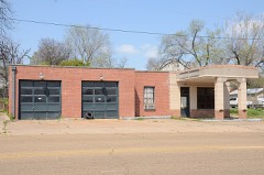
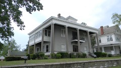
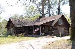
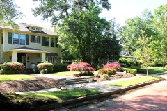
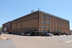
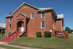
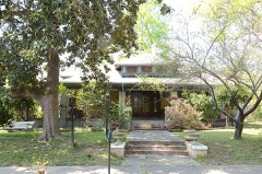
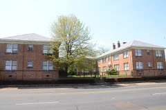
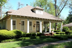
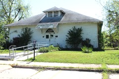
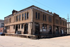
35 National Register listings published here.
Sources: the National Register database, National Park Service
108 topographic sheets cover 42 settlements here, and 35 properties are on the National Register of Historic Places.
35 National Register listings published here.
Sources: the National Register database, National Park Service
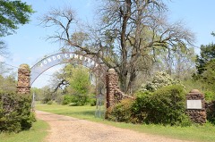
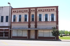
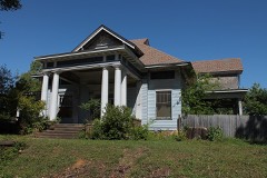
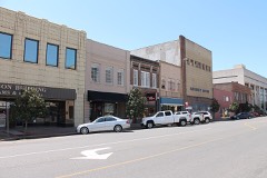
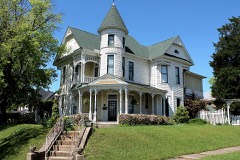
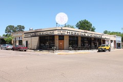
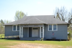
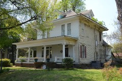
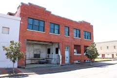
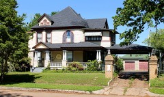
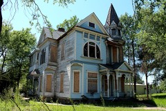
Every property in this county listed on the National Register of Historic Places, with the year it was listed and the federal nomination document.
Every wildfire the federal occurrence database records inside this county: 1,144 of them, burning about 12,455 acres. 42 started naturally and 363 were recorded as arson. Each settlement page carries the fires within five miles of it.
| Reported cause | Fires |
|---|---|
| Arson/incendiarism | 363 |
| Debris and open burning | 330 |
| Missing data/not specified/undetermined | 282 |
| Equipment and vehicle use | 77 |
| Natural | 42 |
| Misuse of fire by a minor | 17 |
| Railroad operations and maintenance | 16 |
| Smoking | 11 |
| Recreation and ceremony | 6 |
The five largest, by the area the report gives. Four of them were set deliberately.
| Date | Cause | Size | Reported by | Name on the report |
|---|---|---|---|---|
| 21 March 2004 | Arson/incendiarism | 1,299 acres | Arkansas Forestry Commission | FOUKE |
| 23 June 2012 | Arson/incendiarism | 537 acres | Arkansas Forestry Commission | TEXARKANA |
| 5 September 2011 | Equipment and vehicle use | 277 acres | Arkansas Forestry Commission | MILLER-LA |
| 8 October 2011 | Railroad operations and maintenance | 198 acres | Arkansas Forestry Commission | GENOA |
| 23 September 2005 | Arson/incendiarism | 195 acres | Arkansas Forestry Commission | not named |
| 1 February 2003 | Debris and open burning | 158 acres | Arkansas Forestry Commission | not named |
| 1 February 2003 | Debris and open burning | 157 acres | Arkansas Forestry Commission | not named |
| 4 September 2000 | Arson/incendiarism | 155 acres | Arkansas Forestry Commission | not named |
Every settlement page carries the fires within five miles of it - see the settlement index below.
The NOAA Storm Events Database holds 581 reports for this county, causing 1 death, 15 injuries and about $101,309,900 in recorded property damage. Each settlement page carries the reports that name it.
| Kind of event | Reports |
|---|---|
| Thunderstorm Wind | 287 |
| Hail | 200 |
| Flash Flood | 47 |
| Tornado | 31 |
| Lightning | 8 |
| Flood | 4 |
| Funnel Cloud | 3 |
| Heavy Rain | 1 |
The most serious of them, by death, then injury, then recorded damage. The accounts are quoted exactly as the forecast office filed them.
| When | Event | Place named | Harm | What the report says |
|---|---|---|---|---|
| May 2000 | Thunderstorm Wind | Texarkana | 1 killed, 2 hurt, $40,000 | Numerous trees down across the area. One tree fell across a mobile home killing a young girl inside. The 2 year old was killed instantly when a tree fell across the home crushing the infant in her bed. Both parents were injured but not seriously. |
| October 1980 | Tornado (F2) | not stated | 3 hurt, $250,000 | no account filed |
| April 1973 | Tornado (F2) | not stated | 3 hurt, $250,000 | no account filed |
| May 2009 | Tornado (EF1) | Pleasant Hill | 3 hurt, $50,000 | Numerous trees and powerlines were snapped along Blackman Ferry Road and along CR 10. A porch and its contents were blown off the back of the home and strewn downstream one half mile. Damage also extended west to State Line Road. Injuries occurred along Blackman Ferry Road where a powerpole fell on a car injuring the driver and two passengers. |
| October 2005 | Thunderstorm Wind | Texarkana | 1 hurt, $30,000 | One injury was reported at Loop 245 and I-30 when a billboard sign was blown over onto a man. A roof was also taken off a concrete building next to a truck stop in town. |
| May 2007 | Thunderstorm Wind | Texarkana | 1 hurt, $15,000 | A few trees were blown over including one on top of a car. The driver of the car received a cut on his forehead but he was treated at the scene. No other injuries were reported. |
| July 1997 | Lightning | Texarkana | 1 hurt | A Texarkana woman was struck by lightning while inside an outbuilding at her home. She was leaning against an aluminum window frame when the frame was hit. She was held overnight at a local hospital then released. |
| March 1987 | Thunderstorm Wind | not stated | 1 hurt | no account filed |
| March 2008 | Hail | (Txk)Texarkana Arpt | $85,000,000 | Very large hail fell across the entire city of Texarkana, Arkansas resulting in widespread damage to automobiles, home roofs and windows. The estimated monetary damage amount at the time of this publication was nearly 65 million dollars and according to local emergency management officials...this amount would likely be adjusted upward.|The hail damage was particularily bad in downtown Texarkana, Arkansas. The City Hall's spanish tile roof...some of the hardest material known as far as roofing material was concerned was damaged to destroyed. Many car dealerships inventory was deemed a total loss from the hail. Hail stones not only broke out car windows but went completely through the roofs of some dealerships and then busted out car windows inside the facilities. |
| December 1982 | Tornado (F2) | not stated | $2,500,000 | no account filed |
| December 1982 | Tornado (F2) | not stated | $2,500,000 | no account filed |
| December 1982 | Tornado (F2) | not stated | $2,500,000 | no account filed |
| May 2008 | Thunderstorm Wind | Texarkana | $2,000,000 | Two severe thunderstorms came together over the south side of the city. One severe storm was moving northeastward from southern Bowie County while the other was moving northwestward through Miller County. Both storms collided in an area just south of downtown Texarkana. As a result of the collision, the storm cores collapsed in an area just east of State Line Avenue over a several block area between 16th and 20th Streets. Numerous large trees were snapped or uprooted onto homes and cars in the Glendale Subdivision. As the survey expanded outward to the north near 24th Street and the Woodlawn Cemetery, trees were noted to have fallen in a north or northeastward direction typical of a microburst. Damage was found as far northeast as the Calvary Cemetery area with trees downed in a north to northeast direction. Trees were also uprooted and snapped on the Texas side of State Line Avenue with a heavier concentration along Magnolia Street between 24th Street and 30th Streets. It was noted that the trees fell in a northwesterly direction which would be expected if a microburst had occurred to the south and east of those locations. Numerous homes were damaged on the Texas side of State Line Avenue as a result. Powerlines were also downed throughout the area as a result of either poles snapping or trees falling on the lines. The area impacted by the microburst is approximately 3.5 miles long to the northeast of the origin and 4 miles in width from one end of the damage swath to the other. City and County officials estimate that 44 homes sustained major damage with an unknown number of vehicles damaged. At least 100 damage reports have been collected thus far. Only one minor injury occurred when a tree fell on a home injuring an elderly woman inside. All of Miller County was considered a disaster area after the damage that resulted from the microburst across the northern portion of the county. |
| May 1998 | Flash Flood | Texarkana | $1,100,000 | Excessive rain caused numerous flooding throughout the city. U.S. highway 82 at Arkansas 2378 was washed out. A private dam broke which led to the closure of County Road 290. Numerous homes were flooded. The County Judge declared a local disaster and the Red Cross set up emergency shelters. A total of 10.48 inches of rain fell from the storm which was a record for the date. Records began in 1930. |
| April 2009 | Tornado (EF3) | Ravanna | $1,000,000 | This tornado initially touched down in southwestern Miller County, Arkansas along CR 80...snapping several pine trees about 2 miles south of Ravana. The tornado then moved toward the intersection of CR 31 and CR 32. Here, at its widest and strongest, the tornado uprooted and snapped numerous pine and oak trees, some 2 to 3 feet in diameter. The storm completely destroyed an outbuilding and mobile home, placing roofing material in a tree approximately a half mile away. Mostly EF1 damage was noted elsewhere as the tornado continued moving east-northeast across southern Miller County. Numerous pine and oak trees were either snapped or uprooted, with pieces of roofing material ripped from well-constructed homes. The tornado passed near the intersection of US-71 and AR-549, near the community of Doddridge, before lifting approximately 2.5 miles north-northeast of Kiblah AR. |
| May 1994 | Thunderstorm Wind | Texarkana | $500,000 | Numerous trees were blown down. Two houses and a mobile home were severely damaged by fallen trees. |
| April 2008 | Flash Flood | Texarkana | $250,000 | Emergency manager reported many roads and underpasses covered with water across the city. A few buildings ware being evacuated due to flood waters. In all...23 roads were closed due to flash flooding across the county. |
| October 2009 | Flash Flood | Kiblah | $200,000 | High water near two feet was reportedly across Hwy. 71 just north of Ida inside the Miller County Arkansas line but south of the Hwy 549/71 interchange south of Doddgridge. Hwy. 71 south of Hwy. 549 and north of Ida has been closed. Up to 30 additional County Roads were damaged from flood waters. |
| June 2015 | Flood | Smithville | $191,000 | Excessive heavy rainfall during the month of May resulted in very high water on the Red River bordering Little River, Hempstead, Miller and Lafayette Counties in Southwest Arkansas as well as Bowie County in Northeast Texas during the entire month of June. Rainfall amounts during the month of May across the Upper and Middle Red River basins of Southern Oklahoma and Northern Texas totaled over 20 inches of rain. The Oklahoma state climatologist reported that May of 2015 was the all time wettest month of any month in state history. Lake Texhoma, a flood control reservoir to the Red River upstream of Arthur City, Texas rose to its highest pool stage on record early on June 1st at 645.66 feet with peak releases of around 140,000 CFS. The Muddy Boggy Creek tributary to the Red River rose to near its flood of record cresting near 55 feet earlier on May 29th with inflows upwards of 70,000 CFS into the Red River. Muddy Boggy Creek crested just shy of the 1990 flood of record with 55.27 feet near Unger, Oklahoma. Other tributaries of the Red River also crested at very high levels during the final week of May and early in June, 2015 below Lake Texhoma including Bois D'Arc and Bokchito Creeks. Finally the Kiamichi River at Hugo Reservoir crested just below a new pool stage record after May 25th and contributed peak releases of near 60,000 CFS as well to the Red River. This excessive heavy rainfall and inflow into the Red River resulted in river levels that eclipsed the flood of May of 1990 at Pecan Point and was just shy of the Red River flood of May of 1908 at Pecan Point. The Red River at Pecan Point north of Dekalb, Texas went above the 24 foot flood stage on May 10th, 2015 and remained above that flood stage through the entire month of June and did not fall below flood stage until until July, 2015. The Red River at Pecan Point north of Dekalb, Texas went above the 30 foot major flood stage on May 24th, 2015 and crested at a stage of 35.0 feet on June 2nd, 2015. This is the 3rd highest crest in recorded history at the gauging location, eclipsed only by the flood of record of 36.0 feet in 1938 and 35.5 feet in 1908. The river fell below the 30 foot major flood stage on June 10th. A secondary rise on the Red River developed because of excessive heavy rainfall once again in the middle Red River Basin from the remnants of Tropical Storm Bill. As a result, the Red River at Pecan Point north of Dekalb, Texas went back above the 30 foot major flood stage on June 22nd and crested at a stage of 32.5 feet on June 24th. The Red River then fell below the 30 foot major flood stage on June 28th. Below Pecan Point north of Dekalb, Texas, the Red River at Index, Arkansas crested at 31.4 feet on June 3rd. This was the 3rd highest flood at Index, Arkansas in recorded history at the gauging location, eclipsed only by the flood of record of 34.4 feet in 1938 and 32.3 feet in 1990. The river fell below the 28 foot major flood stage on June 8th. A secondary rise on the Red River developed because of excessive heavy rainfall once again in the middle Red River Basin from the remnants of Tropical Storm Bill. As a result, the Red River at Index, Arkansas crested again at 26.6 feet on June 27th and fell below the 25 foot flood stage on June 29th. Below Index, Arkansas, the Red River at Fulton, Arkansas crested at 32.12 feet on June 5th. This was the 11th highest flood at Fulton, Arkansas in recorded history at the gauging location with the record crest of 37.40 having occurred in 1945. The river fell below the 27 foot flood stage on June 10th. A secondary rise on the Red River developed because of excessive heavy rainfall once again in the middle Red River Basin from the remnants of Tropical Storm Bill. As a result, the Red River at Fulton, Arkansas crested again at 25.1 feet on June 27th which was nearly two feet short of the 27 foot flood stage at Fulton, Arkansas. Bank erosion was extreme on the Miller County side of the Red River with thousands of acres of farmland and pastureland inundated. Monetary damage from the agricultural land inundated was $840,000. Hundreds of head of cattle had to be relocated. There were 26 homes damaged by the flooding totaling $191,000 in damages. The United States Highway 259 bridge, Hwy 8 bridge and the Hwy. 71 bridge going over the Red River were closed. Mandatory, emergency evacuations were ordered by the Miller County Emergency Management officials for the small community of Garland City, Arkansas. Backwater flooding was excessive in the community and the Army Corps of Engineers found a weak spot in the city's levee leading to the mandatory, emergency evacuation of the town. The river runs close to the small town of about 240 residents. A Federal Disaster Declaration was issued for Little River and Miller Counties in Southwest Arkansas for the Red River flooding event of 2015. |
| January 1999 | Flash Flood | Texarkana | $166,000 | Reports of flooding throughout the city. Two to three feet of water was reported across Hwy 71. Water made its way into numerous homes. Area declared a disaster area by FEMA. Vehicles were reported stalled and flooded along numerous secondary roads. |
| December 2009 | Flash Flood | Capps City | $145,000 | County Road 5 was underwater and closed. Several other roads were closed and underwater across the county. The damage to infrastructure resulted in Miller County receiving Federal assistance. |
| April 1999 | Tornado (F1) | Texarkana Arpt | $125,000 | Long north to south line of moderate to severe thunderstorms moving eastward at 40 to 45 mph. Numerous homes with minor to moderate roof damage. Numerous small to a few large trees uprooted or snapped off. A few homes and buildings with trees down on them. |
| December 2012 | Thunderstorm Wind | Texarkana | $100,000 | Roof or structural damage was reported to several homes in the Texarkana area. |
| April 2011 | Tornado (EF1) | Ft Lynn | $100,000 | The National Weather Service conducted a storm survey in Miller County Arkansas and concluded that storm damage was the result of an EF1 tornado. The tornado touched down at around 8:50 AM, south of Fouke AR along county road 7 snapping a few trees. The tornado continued east crossing old HWY 71 snapping more trees and a home sustained minor damage. The tornado crossed 549 and intensified snapping more trees into a clear convergent path west of county road 9 in a pasture. Trees also fell on a home puncturing the roof3 people were home at the time but sustained no injuries. A large storage building behind the home was destroyed. More trees were snapped and uprooted northeastward crossing CR 9. Maximum winds are estimated at 100-110 mph. |
| June 2007 | Lightning | Garland | $100,000 | A lightning strike hit a home in Garland city burning the home to the ground. There were no residents home at the time. |
| December 2002 | Thunderstorm Wind | Fouke | $78,000 | Severe damage to two home roofs. |
| October 2009 | Flash Flood | Fouke | $75,000 | A school bus with 2 children aboard was flooded in high water on CR 10 near Fouke. The driver and children escaped the flood waters on their own. Also, Miller County Road 207 was completely flooded. Arkansas High School closed early when flood waters began entering the doorways. Portions of the library at the school were flooded. Miller County was one of 20 counties across the state that were declared disaster areas from rainfall up to the 13th, 14th and 15th of October. |
| January 2013 | Thunderstorm Wind | Black Diamond | $70,000 | A large barn was destroyed and numerous trees were downed across the area. A trailer was overturned as well near CR. 413 off of CR. 6. |
| April 2008 | Thunderstorm Wind | Pleasant Hill | $60,000 | Several trees were downed along County Road 28. Trees fell across two vehicles and one home. No injuries were reported. |
| May 2020 | Tornado (EF1) | Dooley | $50,000 | An EF-1 tornado with estimated maximum winds near 100 mph touched down along Miller County 21 and Miller County 116 where it uprooted trees and snapped the wooden pole of a electrical transmission line. It continued moving northwest and crossed Highway 296, downing large limbs. Before the tornado lifted just north of Highway 296, it ripped off the shingles and destroyed the carport of a single family home. |
| March 2013 | Thunderstorm Wind | Garland | $50,000 | Thunderstorm winds resulted in reports of damage to an airplane hanger and roof damage to a few homes in the Garland community. A few trees were also downed and the top of a grain silo was blown down. |
| February 1998 | Thunderstorm Wind | Doddridge | $50,000 | Trees and powerlines were blown over. A church steeple was blown off a church while several chicken houses were either damaged or destroyed. |
| November 1994 | Thunderstorm Wind | Doddridge | $50,000 | Numerous trees were blown down. |
| November 1994 | Thunderstorm Wind | Fouke | $50,000 | Thunderstorm winds knocked down numerous trees and damaged a barn. |
| April 1994 | Thunderstorm Wind | Clarksville | $50,000 | Thunderstorm winds blew a tree down onto a mobile home. |
| April 1994 | Thunderstorm Wind | Doddridge | $50,000 | Thunderstorm winds blew down several trees. |
| May 1994 | Thunderstorm Wind | Dooley | $50,000 | Thunderstorm winds knocked down numerous trees and damaged several roofs. |
| June 1994 | Thunderstorm Wind | Fouke | $50,000 | Thunderstorm winds downed some trees and power lines. |
| June 1994 | Thunderstorm Wind | Genoa | $50,000 | Thunderstorm winds downed numerous trees and damaged two chicken houses. |
| June 1994 | Thunderstorm Wind | Fouke | $50,000 | Thunderstorm winds blew down numerous trees. |
| June 1994 | Thunderstorm Wind | Texarkana | $50,000 | Thunderstorm winds blew the roof off a house. |
| June 1994 | Thunderstorm Wind | Texarkana | $50,000 | Thunderstorm winds downed numerous trees and power lines. |
| July 1994 | Thunderstorm Wind | Dooley | $50,000 | Thunderstorm winds downed several trees and damaged the roof of a chicken barn. |
| May 1994 | Thunderstorm Wind | Garland | $50,000 | Numerous trees were blown down and several roofs were damaged. |
| May 1993 | Thunderstorm Wind | Homan | $50,000 | Thunderstorm winds downed numerous trees. |
| August 1993 | Thunderstorm Wind | Texarkana | $50,000 | Numerous trees were blown down. |
| October 1993 | Thunderstorm Wind | Fouke | $50,000 | Thunderstorm winds downed numerous trees. |
| April 1993 | Thunderstorm Wind | Brightstar | $50,000 | Numerous trees were blown down, blocking several county roads. |
| February 1993 | Thunderstorm Wind | Brightstar | $50,000 | Thunderstorm winds blew down several trees and damaged two automobiles. |
| November 1993 | Thunderstorm Wind | Genoa | $50,000 | Thunderstorm winds downed numerous trees. |
| October 2001 | Thunderstorm Wind | Doddridge | $42,000 | Roof blown off a home on the outskirts of town. |
| August 2010 | Lightning | Texarkana | $40,000 | Two apartment complexes caught fire due to a lightning strike. These included the Quall Creek and Beacon Point apartments. |
| June 2004 | Thunderstorm Wind | Fouke | $40,000 | Numerous trees downed throughout the county. A tree fell across a home and a truck. No injuries were reported. |
| March 2002 | Thunderstorm Wind | Doddridge | $40,000 | Numerous trees down over county roads. Roof blown off a home and a porch blown down. |
| August 2001 | Thunderstorm Wind | Fouke | $40,000 | Large tree fell across a home producing heavy damage to the roof and frame structure. |
| August 2001 | Thunderstorm Wind | Fouke | $35,000 | Large oak tree fell and crushed a new car. |
| July 2011 | Lightning | Texarkana | $30,000 | Lightning hit a backyard tree, then moved onto a powerline which set the roof of a local residence on fire. There were no report of injuries. |
| October 2009 | Flash Flood | Boggy | $30,000 | Several bridges were washed out in the Fouke, Arkansas community. |
| August 2005 | Thunderstorm Wind | Texarkana | $30,000 | Trees were downed on a house along Hwy 71. Powerlines were also downed. |
| March 2023 | Tornado (EF1) | Boggy | $25,000 | An EF-1 tornado with estimated maximum winds near 107 mph affected locations in central Miller County near the Sulphur River Wildlife Management Area and a handful of miles west/southwest of Fouke. The tornado began at the eastern end of Miller County Road 36 very weakly, but soon produced a lot of tree and structural damage along the southeastern terminus of Miller County Road 152. Here the tornado was its strongest and widest, reaching a peak width of around a quarter of a mile. There were several outbuildings damaged or mostly destroyed by the wind alone with some homes and other structures also damaged, but mainly due to impact from large limbs and trees falling on top of them. The tornado continued north for another half a mile before ending roughly as it crossed Miller County Road 151. Fortunately, there were no injuries or fatalities associated with the tornado. |
The Survey's mineral resources record lists 76 workings inside this county. 6 still produce and 70 are closed or unrecorded. Each settlement page carries the workings within five miles of it.
| Commodity | Workings |
|---|---|
| Sand and Gravel, Construction | 66 |
| Clay | 9 |
| Gemstone | 1 |
The least common of them first, because a county's hundredth gravel pit says nothing its first ten did not.
| Where | Site | Commodity | Status | Recorded |
|---|---|---|---|---|
| Unk | Gemstone | Past Producer | ||
| Gallagher | Clay | Past Producer | ||
| Hutchinson Pit | Clay | Producer | ||
| Hutchinson Pit | Clay | Producer | ||
| Unk | Clay | Past Producer | ||
| Unk | Clay | Past Producer | ||
| Unk | Clay | Past Producer | ||
| Unk | Clay | Past Producer | ||
| Unk | Clay | Past Producer | ||
| Unk | Clay | Past Producer | ||
| F.P.Post Property | Sand and Gravel, Construction | Past Producer | ||
| Fouke Pit & Plant | Sand and Gravel, Construction | Producer | ||
| Hoot Pit & Plant | Sand and Gravel, Construction | Producer | ||
| Hoot Plant | Sand and Gravel, Construction | Producer | ||
| Jb Cooper | Sand and Gravel, Construction | Past Producer | ||
| Kennedy Sand & Gravel Co. | Sand and Gravel, Construction | Past Producer | ||
| Putch Pit & Plant | Sand and Gravel, Construction | Producer | ||
| Unk | Sand and Gravel, Construction | Past Producer | ||
| Unk | Sand and Gravel, Construction | Past Producer | ||
| Unk | Sand and Gravel, Construction | Past Producer | ||
| Unk | Sand and Gravel, Construction | Past Producer | ||
| Unk | Sand and Gravel, Construction | Past Producer | ||
| Unk | Sand and Gravel, Construction | Past Producer | ||
| Unk | Sand and Gravel, Construction | Past Producer | ||
| Unk | Sand and Gravel, Construction | Past Producer | ||
| Unk | Sand and Gravel, Construction | Past Producer | ||
| Unk | Sand and Gravel, Construction | Past Producer | ||
| Unk | Sand and Gravel, Construction | Past Producer | ||
| Unk | Sand and Gravel, Construction | Past Producer | ||
| Unk | Sand and Gravel, Construction | Past Producer | ||
| Unk | Sand and Gravel, Construction | Past Producer | ||
| Unk | Sand and Gravel, Construction | Past Producer | ||
| Unk | Sand and Gravel, Construction | Past Producer | ||
| Unk | Sand and Gravel, Construction | Past Producer | ||
| Unk | Sand and Gravel, Construction | Past Producer | ||
| Unk | Sand and Gravel, Construction | Past Producer | ||
| Unk | Sand and Gravel, Construction | Past Producer | ||
| Unk | Sand and Gravel, Construction | Past Producer | ||
| Unk | Sand and Gravel, Construction | Past Producer | ||
| Unk | Sand and Gravel, Construction | Past Producer | ||
| Unk | Sand and Gravel, Construction | Past Producer | ||
| Unk | Sand and Gravel, Construction | Past Producer | ||
| Unk | Sand and Gravel, Construction | Past Producer | ||
| Unk | Sand and Gravel, Construction | Past Producer | ||
| Unk | Sand and Gravel, Construction | Past Producer | ||
| Unk | Sand and Gravel, Construction | Past Producer | ||
| Unk | Sand and Gravel, Construction | Past Producer | ||
| Unk | Sand and Gravel, Construction | Past Producer | ||
| Unk | Sand and Gravel, Construction | Past Producer | ||
| Unk | Sand and Gravel, Construction | Past Producer | ||
| Unk | Sand and Gravel, Construction | Past Producer | ||
| Unk | Sand and Gravel, Construction | Past Producer | ||
| Unk | Sand and Gravel, Construction | Past Producer | ||
| Unk | Sand and Gravel, Construction | Past Producer | ||
| Unk | Sand and Gravel, Construction | Past Producer | ||
| Unk | Sand and Gravel, Construction | Past Producer | ||
| Unk | Sand and Gravel, Construction | Past Producer | ||
| Unk | Sand and Gravel, Construction | Past Producer | ||
| Unk | Sand and Gravel, Construction | Past Producer | ||
| Unk | Sand and Gravel, Construction | Past Producer | ||
| Unk | Sand and Gravel, Construction | Past Producer | ||
| Unk | Sand and Gravel, Construction | Past Producer | ||
| Unk | Sand and Gravel, Construction | Past Producer | ||
| Unk | Sand and Gravel, Construction | Past Producer | ||
| Unk | Sand and Gravel, Construction | Past Producer | ||
| Unk | Sand and Gravel, Construction | Past Producer | ||
| Unk | Sand and Gravel, Construction | Past Producer | ||
| Unk | Sand and Gravel, Construction | Past Producer | ||
| Unk | Sand and Gravel, Construction | Past Producer | ||
| Unk | Sand and Gravel, Construction | Past Producer | ||
| Unk | Sand and Gravel, Construction | Past Producer | ||
| Unk | Sand and Gravel, Construction | Past Producer | ||
| Unk | Sand and Gravel, Construction | Past Producer | ||
| Unk | Sand and Gravel, Construction | Past Producer | ||
| Unk | Sand and Gravel, Construction | Past Producer | ||
| Unk | Sand and Gravel, Construction | Past Producer |
Named settlements recorded in the Geographic Names Information System, each with the topographic sheets covering it. Villages, hamlets and abandoned places alike. Each is shown with the nearest named watercourse or landform and the survey quadrangle it falls on.
Beech township · 71837 · Doddridge NW quadrangle
15 sheets, 1952 to 1989
No longer a settlement
Homan township · 71854 · On Cedar Creek · Homan quadrangle
17 sheets, 1951 to 1989
Cleveland township · 71854 · On Tennessee Branch · Mandeville quadrangle
15 sheets, 1952 to 1989
Days Creek township · 71854 · On Hooker Branch · Domino quadrangle
19 sheets, 1909 to 1992
Sulphur township · 71834 · On Sulphur River · Doddridge SE quadrangle
15 sheets, 1952 to 1989
No longer a settlement
Garland township · 71854 · Near Wilburn Hill · Texarkana quadrangle
21 sheets, 1909 to 2001
Garland township · 71854 · Mandeville quadrangle
15 sheets, 1952 to 1989
No longer a settlement
The vanished settlements of Miller County: the places named above that are no longer on the map.