 Block
Texarkana, Arkansas
21 topographic sheets cover this place, the earliest surveyed in 1909 and the latest in 2001. It stands in Garland Township. It lies in ZIP code area 71854. It lies near Wilburn Hill. The Survey maps it on the Texarkana quadrangle. 29,387 people lived here at the 2020 count. It stands 361 feet above sea level.
Research this city
On record in Texarkana
Buildings and businesses the archive holds for this place. Each opens its own page, with the source record it came from.
On the National Register 12 of 27 shown
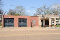 Wallace Adams Service Stationlisted 2008
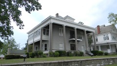 Patrick J. Ahern Houselisted 2005
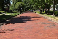 Beech Street Brick Streetlisted 2007
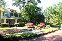 Beech Street Historic Districtlisted 2010
 Bottoms Houselisted 1982
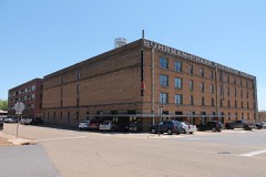 Buhrman-Pharr Hardware Company Historic Districtlisted 2004
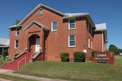 Canaan Baptist Churchlisted 1990
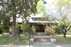 John Clifton Houselisted 2000
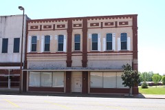 Cotton Belt Railroad Office Buildinglisted 2008
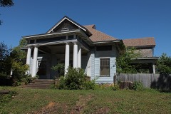 Dean Houselisted 1976
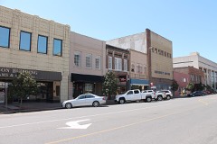 East Broad Street Historic Districtlisted 2008
 Claude Foulke Houselisted 1982
Population over time
2 figuresTexarkana fell from 29,919 to 29,387 between 2010 and 2020. These are the recorded population figures Wikidata holds for this place, reached through the Geographic Names Information System number this page is keyed on rather than by name, so they belong to this place and not to another of the same name. Most are census counts, but not all are: an early figure may be a founding or settlement estimate, and an estimate published within five years of a census is left out. The change column is computed, and is left blank where more than 20 years separate a figure from the one before it, because a gap that long is not a change between two counts.
| Year | People | Change |
|---|---|---|
| 2010 | 29,919 | |
| 2020 | 29,387 | -532 (-2%) |
Topographic sheets covering this place
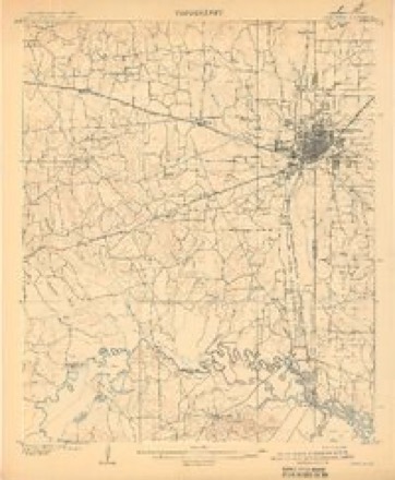
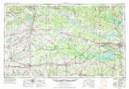
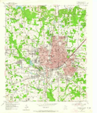
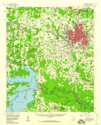
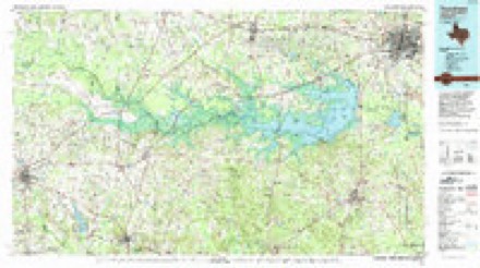
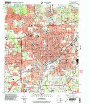
8 surveys from 21 printed sheetsMatched by testing this settlement's coordinate against the published boundary of every sheet in the United States Geological Survey's historical collection. Each opens the scanned sheet at the Survey.
- 1909 USGS Texarkana quadrangle1:62500, 5 printings
- 1953 USGS Texarkana quadrangle1:250000, 4 printings
- 1954 USGS Texarkana quadrangle1:24000, 6 printings
- 1954 USGS Texarkana quadrangle1:62500, 2 printings
- 1956 USGS Texarkana quadrangle1:250000
- 1986 USGS Texarkana quadrangle1:100000
- 1992 USGS Texarkana quadrangle1:100000
- 2001 USGS Texarkana quadrangle1:24000
Fires near this place
217 since 1993Regional context, not property-specific evidence. The federal wildfire occurrence database lists 217 fires within 5 miles of Texarkana between 1993 and 2020, burning about 463 acres in total. 2 started naturally. 16 were recorded as arson. Distance is straight-line from the map coordinates, so a fire counted here may appear on a neighbouring settlement's page as well.
| Reported cause | Fires |
|---|---|
| Missing data/not specified/undetermined | 90 |
| Debris and open burning | 81 |
| Arson/incendiarism | 16 |
| Misuse of fire by a minor | 7 |
| Power generation/transmission/distribution | 6 |
| Smoking | 5 |
| Equipment and vehicle use | 5 |
| Railroad operations and maintenance | 3 |
| Natural | 2 |
| Recreation and ceremony | 2 |
The most recent of them, most recent first, with the day each was reported and the service that recorded it.
| Date | Cause | Size | Reported by | Name on the report |
|---|---|---|---|---|
| 8 September 2013 | Debris and open burning | 1.0 acres | Texas A & M Forest Service | 3406 GIN RD |
| 8 September 2013 | Equipment and vehicle use | 5.0 acres | Texas A & M Forest Service | 6296 |
| 7 September 2013 | Debris and open burning | 1.0 acres | Texas A & M Forest Service | RAY/GILLAM |
| 7 September 2002 | Missing data/not specified/undetermined | under an acre | Arkansas Forestry Commission | not named |
| 6 September 2011 | Smoking | 1.0 acres | Arkansas Forestry Commission | not named |
| 6 September 2006 | Debris and open burning | 2.0 acres | Texas A & M Forest Service | LINDEN - 634 |
| 5 September 2015 | Debris and open burning | 1.5 acres | Texas A & M Forest Service | BRUSH FIRE |
| 4 September 2013 | Debris and open burning | 1.0 acres | Texas A & M Forest Service | 1 COUNTY ROAD 1329 ST |
Settlements close enough to share some of these fires:
Mines and quarries near this place
10 of 19 shownRegional context, not property-specific evidence. The federal mineral resources record lists 19 workings within 5 miles of Texarkana: 12 past producers, 6 producers, 1 unknown. 6 still produce. What was taken out: Clay, Sand and Gravel, Construction, Iron. Distance is straight-line from the map coordinates, so a quarry counted here may appear on a neighbouring settlement's page as well.
| Where | Site | Commodity | Status | Recorded |
|---|---|---|---|---|
| S. W. A. Pits | Iron | Producer | ||
| Hoot Plant | Sand and Gravel, Construction | Producer | ||
| Kennedy Sand & Gravel Co. | Sand and Gravel, Construction | Past Producer | ||
| Putch Pit & Plant | Sand and Gravel, Construction | Producer | ||
| Unknown | Sand and Gravel, Construction | Past Producer | ||
| Unknown | Sand and Gravel, Construction | Past Producer | ||
| Unknown | Sand and Gravel, Construction | Past Producer | ||
| Unknown | Sand and Gravel, Construction | Past Producer | ||
| Dickey | Clay | Unknown | ||
| Gallagher | Clay | Past Producer |
Storms near this place
60 of 141 shownRegional context, not property-specific evidence. The National Weather Service names Texarkana in 141 storm reports between 1993 and 2025: 60 thunderstorm wind, 45 hail, 27 flash flood, 5 lightning. The reports record 1 death and 5 injuries. Each account below is quoted exactly as the forecast office filed it, from the NOAA Storm Events Database, and each date opens the federal record of that event.
| When | Event | Place named | Harm | What the report says |
|---|---|---|---|---|
| May 2000 | Thunderstorm Wind | Texarkana | 1 killed, 2 hurt, $40,000 | Numerous trees down across the area. One tree fell across a mobile home killing a young girl inside. The 2 year old was killed instantly when a tree fell across the home crushing the infant in her bed. Both parents were injured but not seriously. |
| October 2005 | Thunderstorm Wind | Texarkana | 1 hurt, $30,000 | One injury was reported at Loop 245 and I-30 when a billboard sign was blown over onto a man. A roof was also taken off a concrete building next to a truck stop in town. |
| May 2007 | Thunderstorm Wind | Texarkana | 1 hurt, $15,000 | A few trees were blown over including one on top of a car. The driver of the car received a cut on his forehead but he was treated at the scene. No other injuries were reported. |
| July 1997 | Lightning | Texarkana | 1 hurt | A Texarkana woman was struck by lightning while inside an outbuilding at her home. She was leaning against an aluminum window frame when the frame was hit. She was held overnight at a local hospital then released. |
| May 2008 | Thunderstorm Wind | Texarkana | $2,000,000 | Two severe thunderstorms came together over the south side of the city. One severe storm was moving northeastward from southern Bowie County while the other was moving northwestward through Miller County. Both storms collided in an area just south of downtown Texarkana. As a result of the collision, the storm cores collapsed in an area just east of State Line Avenue over a several block area between 16th and 20th Streets. Numerous large trees were snapped or uprooted onto homes and cars in the Glendale Subdivision. As the survey expanded outward to the north near 24th Street and the Woodlawn Cemetery, trees were noted to have fallen in a north or northeastward direction typical of a microburst. Damage was found as far northeast as the Calvary Cemetery area with trees downed in a north to northeast direction. Trees were also uprooted and snapped on the Texas side of State Line Avenue with a heavier concentration along Magnolia Street between 24th Street and 30th Streets. It was noted that the trees fell in a northwesterly direction which would be expected if a microburst had occurred to the south and east of those locations. Numerous homes were damaged on the Texas side of State Line Avenue as a result. Powerlines were also downed throughout the area as a result of either poles snapping or trees falling on the lines. The area impacted by the microburst is approximately 3.5 miles long to the northeast of the origin and 4 miles in width from one end of the damage swath to the other. City and County officials estimate that 44 homes sustained major damage with an unknown number of vehicles damaged. At least 100 damage reports have been collected thus far. Only one minor injury occurred when a tree fell on a home injuring an elderly woman inside. All of Miller County was considered a disaster area after the damage that resulted from the microburst across the northern portion of the county. |
| May 1998 | Flash Flood | Texarkana | $1,100,000 | Excessive rain caused numerous flooding throughout the city. U.S. highway 82 at Arkansas 2378 was washed out. A private dam broke which led to the closure of County Road 290. Numerous homes were flooded. The County Judge declared a local disaster and the Red Cross set up emergency shelters. A total of 10.48 inches of rain fell from the storm which was a record for the date. Records began in 1930. |
| May 1994 | Thunderstorm Wind | Texarkana | $500,000 | Numerous trees were blown down. Two houses and a mobile home were severely damaged by fallen trees. |
| April 2008 | Flash Flood | Texarkana | $250,000 | Emergency manager reported many roads and underpasses covered with water across the city. A few buildings ware being evacuated due to flood waters. In all...23 roads were closed due to flash flooding across the county. |
| January 1999 | Flash Flood | Texarkana | $166,000 | Reports of flooding throughout the city. Two to three feet of water was reported across Hwy 71. Water made its way into numerous homes. Area declared a disaster area by FEMA. Vehicles were reported stalled and flooded along numerous secondary roads. |
| December 2012 | Thunderstorm Wind | Texarkana | $100,000 | Roof or structural damage was reported to several homes in the Texarkana area. |
| June 1994 | Thunderstorm Wind | Texarkana | $50,000 | Thunderstorm winds blew the roof off a house. |
| June 1994 | Thunderstorm Wind | Texarkana | $50,000 | Thunderstorm winds downed numerous trees and power lines. |
| August 1993 | Thunderstorm Wind | Texarkana | $50,000 | Numerous trees were blown down. |
| August 2010 | Lightning | Texarkana | $40,000 | Two apartment complexes caught fire due to a lightning strike. These included the Quall Creek and Beacon Point apartments. |
| July 2011 | Lightning | Texarkana | $30,000 | Lightning hit a backyard tree, then moved onto a powerline which set the roof of a local residence on fire. There were no report of injuries. |
| August 2005 | Thunderstorm Wind | Texarkana | $30,000 | Trees were downed on a house along Hwy 71. Powerlines were also downed. |
| September 2009 | Flash Flood | Texarkana | $20,000 | Excessive heavy rainfall led to flooding of the Seventh Street overpass which was barricaded and closed. Barricades were also placed at 40th Street and Potomac Avenue. A motorist was flooded in the Beacon Point Apartments parking lot on Arkansas Boulevard. Sanderson lane was also temporary closed from the flooding. |
| October 2009 | Flash Flood | Texarkana | $20,000 | Several Miller County roads were closed or washed out including CR 19...43 and 215. |
| May 2008 | Flash Flood | Texarkana | $15,000 | Excessive heavy rainfall resulted in stranded motorists at 8th Street and Stateline Road. |
| July 2013 | Lightning | Texarkana | $10,000 | Lightning struck a home in Texarkana resulting in a small fire. There were no report of injuries. |
| April 2012 | Thunderstorm Wind | Texarkana | $10,000 | Multiple trees were downed across the county including one on a home. There were no report of injuries. |
| July 2011 | Thunderstorm Wind | Texarkana | $10,000 | Winds damaged the front of the Deliverance Temple Church of God in Christ. Bricks were reported to have come through the ceiling of the church. There were no report of injuries. |
| November 2009 | Flash Flood | Texarkana | $10,000 | A mother and her infant were trapped by flood waters at State Line Road and 40th Street. The were rescued with no injuries reported. |
| October 2012 | Thunderstorm Wind | Texarkana | $5,000 | A tree snapped and fell through the Texarkana Country Club pool house. |
| May 2009 | Lightning | Texarkana | $5,000 | Lightning struck a home on the east side of town doing minor damage. No injuries were reported. |
| June 1994 | Thunderstorm Wind | Texarkana | $5,000 | Thunderstorm winds damaged trees on the east side of the Texarkana Airport. |
| May 2009 | Flash Flood | Texarkana | $3,000 | East 9th Street and Broad on the Arkansas side of Texarkana was flooded. A car was stranded in the underpass. |
| November 1996 | Thunderstorm Wind | Texarkana | $2,000 | no account filed |
| October 1993 | Thunderstorm Wind | Texarkana | $500 | Thunderstorm winds knocked down a large tree. |
| April 2025 | Flash Flood | Texarkana | - | Numerous vehicles were stranded in high water, with multiple water rescues needed. |
| April 2024 | Hail | Texarkana | - | Quarter size hail reported near Texarkana. |
| May 2024 | Thunderstorm Wind | Texarkana | - | Tree downed at Dudley Street and East Street. |
| June 2022 | Thunderstorm Wind | Texarkana | - | Trees and power lines were blown down across both the Arkansas and Texas sides of Texarkana. |
| September 2022 | Hail | Texarkana | - | Social media picture of nickel-sized hail in Texarkana, AR. |
| April 2021 | Thunderstorm Wind | Texarkana | - | Numerous utility poles were downed throughout Texarkana, resulting in widespread power outages across the city. SWEPCO reported that over 8,000 customers were without power. Several trees were blown down and some roofing damage was reported. Report from TXK Today Facebook post. |
| July 2020 | Flash Flood | Texarkana | - | Flash flooding was reported across several roads throughout the city of Texarkana. Several vehicles were stranded in high water. |
| July 2020 | Flash Flood | Texarkana | - | Flash flooding was reported at 9th Street and Broad Street near Nix Creek. |
| August 2020 | Flash Flood | Texarkana | - | Nearly 60 units from the Sterling Crest Apartments were flooded with water nearly 3 feet deep. Nearly 20 residents had to be rescued from their apartments. |
| August 2020 | Flash Flood | Texarkana | - | Grand Avenue and 24th Street was flooded and closed. Timberwood Lane was also flooded and closed. |
| February 2018 | Flash Flood | Texarkana | - | High water across South State Line Road in Texarkana. |
| April 2016 | Thunderstorm Wind | Texarkana | - | Numerous large limbs greater than 2 inches in diameter were snapped off across the city of Texarkana. |
| April 2016 | Hail | Texarkana | - | Nickel size hail fell in the city of Texarkana. |
| March 2016 | Hail | Texarkana | - | Penny size hail fell at the intersection of Jefferson Ave. and Arkansas Blvd. |
| March 2016 | Hail | Texarkana | - | Quarter size hail fell in Texarkana, Arkansas. |
| August 2016 | Thunderstorm Wind | Texarkana | - | Several trees and powerlines were downed in Texarkana, Arkansas. |
| August 2016 | Flash Flood | Texarkana | - | Several vehicles were stranded in high water on East Street under the railroad overpass, with high water rescues needed to rescue the stranded motorists. |
| April 2015 | Hail | Texarkana | - | Hail fell along Hwy. 196 and County Road 70. |
| May 2015 | Flash Flood | Texarkana | - | Numerous roads were closed from excessive heavy rainfall on the Arkansas side of Texarkana. |
| October 2014 | Thunderstorm Wind | Texarkana | - | Trees were downed across Hwy. 237 in Texarkana, Arkansas. |
| October 2014 | Thunderstorm Wind | Texarkana | - | Trees and powerlines were downed near the intersection of 10 and 17. |
| March 2014 | Thunderstorm Wind | Texarkana | - | Trees and powerlines downed in Texarkana. |
| July 2014 | Thunderstorm Wind | Texarkana | - | Trees and powerlines were downed across all of Miller County including across the Genoa, Fouke, Texarkana and Dodridge communities. |
| July 2013 | Thunderstorm Wind | Texarkana | - | Trees were downed in and around town. |
| April 2012 | Thunderstorm Wind | Texarkana | - | Several trees and powerlines downed across the entire county. |
| December 2012 | Thunderstorm Wind | Texarkana | - | A measured 59 mph gust was recorded at the KTXK ASOS on the airport. |
| June 2012 | Hail | Texarkana | - | Hail was reported in the southeast portion of Texarkana, Arkansas. |
| June 2012 | Thunderstorm Wind | Texarkana | - | Numerous trees were downed across the entire county. Trees were downed across County Road 18, Hwy. 237, South State Line Road and Hwy. 71. |
| June 2011 | Thunderstorm Wind | Texarkana | - | Measured gust at the Texarkana Airport in Miller County, Arkansas. |
| April 2011 | Thunderstorm Wind | Texarkana | - | A local spotter estimated the wind gust in Texarkana. |
| August 2010 | Thunderstorm Wind | Texarkana | - | Measured wind gust from the Texarkana airport. |
Nearest settlements
The eight closest, with where each one stands in the county. Distances are straight-line, computed from the Geographic Names Information System coordinates.
| Map | Place | Distance | Sheets |
|---|---|---|---|
| Rondo | 3.2 miles | 15 | |
| Gertrude | 3.9 miles | 15 | |
| Lakewood Estates | 4.5 miles | 15 | |
| Mandeville | 4.8 miles | 15 | |
| Mount Pleasant | 5.4 miles | 15 | |
| Wona (historical) | 5.4 miles | 15 | |
| Paup | 6.5 miles | 17 | |
| Index | 7.3 miles | 13 |
Elsewhere
Matched on this settlement's Geographic Names Information System number rather than its name, so it cannot be a different place of the same name in another state.
| Wikipedia article on Texarkana | An encyclopaedic summary. Its text is share-alike, so it is linked here rather than copied. |
| Wikidata item Q79438 | The structured record the population and elevation above come from. Public domain (CC0). |
Provenance
This settlement is recorded in the Geographic Names Information System as feature 78542. The sheet list is computed by point-in-boundary test against the United States Geological Survey's historical topographic inventory. Both are works of the United States government and carry no copyright under 17 U.S.C. 105.
Wildfire. Short, Karen C. 2022. Spatial wildfire occurrence data for the United States, 1992-2020 [FPA_FOD_20221014]. 6th Edition. Fort Collins, CO: Forest Service Research Data Archive. https://doi.org/10.2737/RDS-2013-0009.6 Collected with United States Government funding and usable without additional permissions or fees.
Mines and quarries. USGS Mineral Resources Data System (MRDS) https://mrdata.usgs.gov/mrds/ A work of the United States government, no copyright under 17 U.S.C. 105.
Storms. NOAA National Centers for Environmental Information, Storm Events Database https://www.ncei.noaa.gov/stormevents/ A work of the United States government, no copyright under 17 U.S.C. 105. Narratives are quoted verbatim from the National Weather Service report and are not edited or summarised.