 Block
From the record
16 National Register listings published here.
Sources: the National Register database, National Park Service
93 topographic sheets cover 59 settlements here, and 16 properties are on the National Register of Historic Places.
16 National Register listings published here.
Sources: the National Register database, National Park Service
Every property in this county listed on the National Register of Historic Places, with the year it was listed and the federal nomination document.
| Photograph | Property | Type | Listed | Reference |
|---|---|---|---|---|
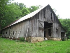 | Big Buffalo Valley Historic District | district | 1987 | 87000110 |
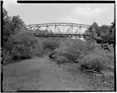 | Buffalo River Bridge | structure | 1990 | 90000509 |
| Dr. Hudson Sanitarium Agricultural Building Historic District | building | 1992 | 92001345 | |
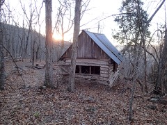 | Flowers Cabin | building | 2021 | 100005991 |
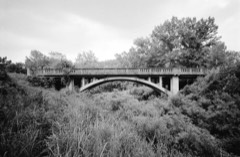 | Harp Creek Bridge | structure | 1990 | 90000519 |
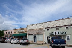 | Jasper Commercial Historic District | district | 2010 | 09001255 |
| Gould Jones Reservoir | structure | 1998 | 98000956 | |
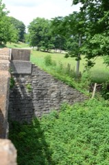 | Little Buffalo River Bridge | structure | 1995 | 95000647 |
| May Farmstead | building | 1999 | 99001470 | |
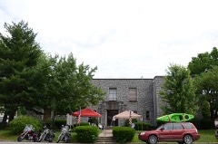 | Newton County Courthouse | building | 1994 | 94001412 |
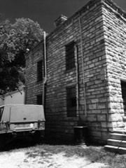 | Newton County Jail | building | 1994 | 94001414 |
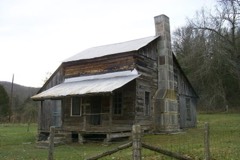 | Parker-Hickman Farm Historic District | district | 1987 | 87001029 |
| Valley Y Ranch | district | 2023 | 100009410 | |
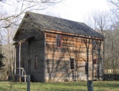 | Villines Mill | building | 1974 | 74000482 |
Every wildfire the federal occurrence database records inside this county: 623 of them, burning about 17,289 acres. 28 started naturally and 189 were recorded as arson. Each settlement page carries the fires within five miles of it.
| Reported cause | Fires |
|---|---|
| Arson/incendiarism | 189 |
| Missing data/not specified/undetermined | 176 |
| Debris and open burning | 165 |
| Natural | 28 |
| Recreation and ceremony | 28 |
| Equipment and vehicle use | 14 |
| Power generation/transmission/distribution | 8 |
| Smoking | 6 |
| Misuse of fire by a minor | 4 |
| Railroad operations and maintenance | 2 |
| Fireworks | 2 |
| Other causes | 1 |
The five largest, by the area the report gives. Two of them were set deliberately.
| Date | Cause | Size | Reported by | Name on the report |
|---|---|---|---|---|
| 24 March 2014 | Missing data/not specified/undetermined | 1,000 acres | Buffalo National River | SEED TICK |
| 8 April 1995 | Arson/incendiarism | 990 acres | Buffalo National River | STRINGTOWN |
| 12 April 2011 | Missing data/not specified/undetermined | 750 acres | Buffalo National River | CENTERPOINT |
| 23 November 2017 | Missing data/not specified/undetermined | 643 acres | Buffalo National River | STRINGTOWN |
| 14 March 2014 | Missing data/not specified/undetermined | 568 acres | Arkansas Forestry Commission | NEW1183034 |
| 4 April 2016 | Arson/incendiarism | 550 acres | Buffalo National River | DRY CREEK WF |
| 25 November 2017 | Missing data/not specified/undetermined | 478 acres | Arkansas Forestry Commission | not named |
| 29 March 2006 | Missing data/not specified/undetermined | 457 acres | Arkansas Forestry Commission | LOW GAP |
Every settlement page carries the fires within five miles of it - see the settlement index below.
The NOAA Storm Events Database holds 359 reports for this county, causing 2 deaths, 4 injuries and about $11,527,900 in recorded property damage. Each settlement page carries the reports that name it.
| Kind of event | Reports |
|---|---|
| Thunderstorm Wind | 152 |
| Hail | 142 |
| Flash Flood | 34 |
| Tornado | 16 |
| Heavy Rain | 9 |
| Flood | 5 |
| Lightning | 1 |
The most serious of them, by death, then injury, then recorded damage. The accounts are quoted exactly as the forecast office filed them.
| When | Event | Place named | Harm | What the report says |
|---|---|---|---|---|
| February 2002 | Lightning | Ben Hur | 1 killed, 1 hurt | Two men were unloading wood from a truck at a campsite when lightning struck. One man was killed by the lightning strike and the other suffered burns. |
| May 2011 | Flood | George | 1 killed | Heavy rain produced flooding along the Buffalo National River. A 21 year-old man swimming in the river at Blue Hole (between Hasty and Piercetown) drowned on the evening of the 24th. He had swum across the river and was swimming back across when the current carried him away. His body was recovered five days later. |
| March 1962 | Tornado (F2) | not stated | 2 hurt, $25,000 | no account filed |
| March 2017 | Tornado (EF2) | Mossville | 1 hurt, $200,000 | An EF-2 tornado cut a 36.7 mile path across Newton and Searcy counties. The damage included trees being uprooted and snapped. Several residences were damaged. The post office at Parthenon was destroyed. Maximum winds with this tornado were 120 mph. This tornado touched down north of Mossville in Newton County, and lifted east northeast of Saint Joe in Searcy County. At Parthenon, several homes were damaged. Outbuildings were damaged or destroyed. The post office was destroyed. A residence was destroyed north of Vendor. North of Saint Joe, a family of five (two adults and 3 small children) heard the tornado warning, went into a storm shelter before the tornado hit. Their manufactured home was completely destroyed. The damage was likely not survivable. Also, north of Saint Joe, trees and power lines were blown down. Outbuildings were damaged. A residence had significant damage. There was one minor injury. |
| May 2011 | Flood | Compton | $5,000,000 | Parts of the Buffalo National River were closed due to flooding, flood damage, and debris piles. |
| April 2011 | Flood | Compton | $1,500,000 | Widespread areal flooding occurred. |
| March 2008 | Flash Flood | George | $1,000,000 | Several roads were flooded throughout the county. Arkansas Highways 43 and 74 were blocked near Boxley Valley. Parts of Arkansas Highway 7 were affected by washouts and landslides. |
| October 2009 | Flash Flood | Compton | $700,000 | Arkansas Highway 327 between Parthenon and Jasper had logs and debris on the road from heavy rain, and part of the road was flooded as well. A mudslide occurred 2 miles north of Wayton and the road was impassable. A landslide occurred on Boat Mountain, taking out the road leading to the top of the mountain. According to the county judge, areas around Walnut and Limestone were particularly hard hit by flooding, which washed out most bridges and roads. In addition, numerous low water slabs and culverts were washed out. |
| August 2013 | Flash Flood | Compton | $550,000 | Numerous county roads and bridges were damaged. |
| April 2011 | Tornado (EF1) | Arbaugh | $500,000 | This tornado exited Madison County south of Red Star and entered Newton County north of Arbaugh. In Newton County, hundreds of trees were blown down, with several of the trees falling on houses and vehicles. A number of outbuildings were damaged. A chicken house and a barn were destroyed. The greatest amount of structural damage occurred just south of Wayton. Many power poles and power lines were blown down. |
| June 1994 | Thunderstorm Wind | Dogpatch | $500,000 | Thunderstorm winds downed numerous trees and power poles and destroyed several mobile homes. |
| December 2006 | Flood | Jasper | $277,000 | Heavy rain caused flooding in many sections of Newton County. A couple of low water crossings were washed out, as were a number of county roads. Some of the areas affected included Jasper, Cave Creek, Vendor, Mt. Judea, and Deer. |
| February 2023 | Tornado (EF1) | Fallsville | $200,000 | This tornado touched down approximately one mile north of the community of Fallsville, AR along the ridgeline north of town where it began to track northeastward. Damage consisted of many trees that were snapped or uprooted along with several outbuildings/barns that were damaged or completely destroyed along its path. A few homes had minor structural damage. The tornado lifted just west of Arkansas State Highway 21 after tracking 3.4 miles. |
| March 2017 | Thunderstorm Wind | Parthenon | $110,000 | Several homes have suffered damage...and the post office has been destroyed. The roof was blown off of a church and several roadways are blocked. |
| August 2011 | Thunderstorm Wind | Fallsville | $80,000 | Numerous trees were blown down along Arkansas 21. Three parked vehicles were crushed by falling trees. |
| May 2008 | Thunderstorm Wind | Jasper | $75,000 | A tree was downed on Arkansas Highway 7 in Jasper. Power lines were down across the county. One home had a tree on part of its roof and the porch collapsed at one end of the house. There was also damage to the garage. |
| June 2015 | Flash Flood | Ponca | $50,000 | Heavy rainfall caused rapid rises on the Buffalo River near Ponca. The river rose over 14 ft in a short period. Cars near the river in campgrounds were flooded. |
| June 1994 | Thunderstorm Wind | Vendor | $50,000 | Thunderstorm winds destroyed two barns. |
| April 1994 | Thunderstorm Wind | Ben Hur | $50,000 | Thunderstorm winds blew down some trees and tore roofs off some houses. |
| April 1994 | Thunderstorm Wind | Deer | $50,000 | Thunderstorm winds blew roofs off some houses and knocked down some trees. |
| April 1994 | Thunderstorm Wind | Mossville | $50,000 | Thunderstorm winds downed trees and damaged some roofs. |
| April 1994 | Tornado (F0) | Low Gap | $50,000 | A short-lived F0 tornado touched down near Low Gap. The tornado knocked down a few trees and tore part of the roof off a house. |
| January 2007 | Flash Flood | Jasper | $31,900 | Heavy rains produced flash flooding across much of Newton County. A number of county roads were flooded. |
| March 2017 | Thunderstorm Wind | Parthenon | $30,000 | A roof was blown off of a church. |
| March 2008 | Flash Flood | Pruitt | $30,000 | Flooding occurred at all low water bridges. On Arkansas Highway 123, there was one spot that was impassible. There was one person stranded at their home due to the flooding. |
| October 2014 | Thunderstorm Wind | Crossroad | $25,000 | Several trees were blown down in the area, including one that fell on a house. |
| September 2014 | Tornado (EF0) | Mt Hersey | $25,000 | Trees were uprooted or snapped off. |
| August 2012 | Thunderstorm Wind | Vendor | $25,000 | Barns were damaged. |
| September 2012 | Thunderstorm Wind | Jasper | $25,000 | Numerous trees and power lines were blown down in Jasper and along Arkansas 7 north of Jasper. |
| June 2009 | Thunderstorm Wind | Jasper | $25,000 | Trees were down across the city. |
| October 2009 | Flash Flood | Jasper | $25,000 | A rock slide occurred on Arkansas Highway 74 about a mile east of Jasper. |
| March 1991 | Tornado (F1) | not stated | $25,000 | no account filed |
| March 2017 | Thunderstorm Wind | Jasper | $20,000 | Some roofs had shingles blown off of them. Trees were blown down and snapped. |
| January 2012 | Flash Flood | Vendor | $20,000 | Flash flooding occurred in the area around Vendor. A swift-water rescue occurred on Handmaiden Rd. when a vehicle was swept off into a creek. The motorist and her 2 year-old child were rescued without incident. A farm tractor pulled the vehicle out of the creek. |
| June 2009 | Thunderstorm Wind | Ponca | $20,000 | A tree was down on a car on Arkansas Highway 43 south of Ponca. |
| August 2012 | Thunderstorm Wind | Parthenon | $15,000 | Trees were blown down, with one of the trees falling on a house. |
| August 2020 | Flash Flood | Jasper | $10,000 | The first floor of Valley View Apartments on Mountain Street in Jasper was reported as flooded. Heavy rain continued to fall. |
| June 2020 | Thunderstorm Wind | Parthenon | $10,000 | A tree fell onto a home in Parthenon. |
| April 2017 | Thunderstorm Wind | Diamond Cave | $10,000 | A barge had part of its roof blown off. |
| July 2015 | Flash Flood | Marble Falls | $10,000 | Water was waist deep on Highway 7 at Mill Creek near Dogpatch. At least one vehicle was swept off the highway. |
| August 2011 | Thunderstorm Wind | Deer | $10,000 | Trees were blown down. |
| May 2009 | Tornado (EF0) | Walnut | $10,000 | Trees were knocked down and a small shed was destroyed. |
| June 2009 | Thunderstorm Wind | Jasper | $10,000 | Trees were down at the sheriff's office in Newton County. |
| October 2009 | Flash Flood | Marble Falls | $10,000 | Gravel washed over Arkansas Highway 7 due to heavy rain and flash flooding. |
| May 2022 | Thunderstorm Wind | Western Grove | $5,000 | Pictures were on social media of downed tree limbs and a small shed that was knocked over in Western Grove. Time is based on radar data. |
| April 2017 | Thunderstorm Wind | Deer | $5,000 | This is a delayed report. Newton County emergency management reported a porch was damaged by thunderstorm winds near Deer. |
| April 2017 | Thunderstorm Wind | Deer | $5,000 | A roof was removed from a porch at a home in Deer by thunderstorm winds. |
| September 2014 | Thunderstorm Wind | Piercetown | $5,000 | Trees were blown down, blocking Arkansas 123. |
| September 2014 | Thunderstorm Wind | Bass Natl Wildlife A | $5,000 | Some trees were blown down. |
| August 2012 | Thunderstorm Wind | Wayton | $5,000 | Trees were pushed over. |
| September 2009 | Flash Flood | Mt Sherman | $5,000 | Minor flooding occurred on county roads. |
| May 1994 | Thunderstorm Wind | Ponca | $5,000 | Thunderstorm winds downed several trees. |
| June 1994 | Thunderstorm Wind | Pruitt | $5,000 | Thunderstorm winds blew down some trees. |
| June 1994 | Tornado (F1) | Mt. Judea- | $5,000 | An F1 tornado touched down in a very isolated area. The only damage that occurrred was that several trees were blown down. |
| June 1994 | Thunderstorm Wind | Ben Hur | $5,000 | Thunderstorm winds downed several trees. |
| November 1994 | Thunderstorm Wind | Jasper | $5,000 | Thunderstorm winds blew the roof off a small building at the fairgrounds. |
| November 1994 | Thunderstorm Wind | Lurton | $5,000 | Several highway signs and antennas were blown down. |
| August 1993 | Thunderstorm Wind | Vendor | $5,000 | Thunderstorm winds knocked down several trees. |
| September 2014 | Thunderstorm Wind | Carver | $3,000 | A few trees were blown down. |
| September 2014 | Thunderstorm Wind | Yardelle | $3,000 | A few trees were blown down. |
The Survey's mineral resources record lists 52 workings inside this county. 2 still produce and 50 are closed or unrecorded. Each settlement page carries the workings within five miles of it.
| Commodity | Workings |
|---|---|
| Zinc | 21 |
| Lead | 12 |
| Lead, Zinc | 10 |
| Sand and Gravel, Construction | 9 |
| Stone | 4 |
| Manganese | 3 |
| Iron | 1 |
| Dolomite | 1 |
| Stone, Crushed/Broken | 1 |
| Kaolin | 1 |
| Zinc, Lead | 1 |
The least common of them first, because a county's hundredth gravel pit says nothing its first ten did not.
| Where | Site | Commodity | Status | Recorded |
|---|---|---|---|---|
| Ben Heuer Property | Kaolin | Past Producer | ||
| Davidson Prospect | Iron, Manganese | Prospect | ||
| Old Granby Mine | Lead, Zinc, Dolomite | Past Producer | ||
| Ozark Rock Co. | Stone, Crushed/Broken | Producer | ||
| Ragged Breeches | Zinc, Lead | Past Producer | ||
| Cross Prospect | Manganese | Past Producer | ||
| Sam Davidson | Manganese | Occurrence | ||
| Unk | Stone | Past Producer | ||
| Unk | Stone | Past Producer | ||
| Unk | Stone | Past Producer | ||
| Unk | Stone | Past Producer | ||
| J A Lowry | Sand and Gravel, Construction | Past Producer | ||
| Mmcelhaney | Sand and Gravel, Construction | Past Producer | ||
| Newton County Pit | Sand and Gravel, Construction | Producer | ||
| Pruitt Pit | Sand and Gravel, Construction | Past Producer | ||
| Unk | Sand and Gravel, Construction | Past Producer | ||
| Unk | Sand and Gravel, Construction | Past Producer | ||
| Unk | Sand and Gravel, Construction | Past Producer | ||
| Unk | Sand and Gravel, Construction | Past Producer | ||
| Z Hudson | Sand and Gravel, Construction | Past Producer | ||
| Belle of Wichita Mine | Lead, Zinc | Past Producer | ||
| Blue Bluff | Lead, Zinc | Past Producer | ||
| Bonanza Mine | Lead, Zinc | Past Producer | ||
| Chimney Rock Mine | Lead, Zinc | Past Producer | ||
| Hudson Property | Lead, Zinc | Past Producer | ||
| Kilgore | Lead, Zinc | Past Producer | ||
| Lost Mountain Mine | Lead, Zinc | Past Producer | ||
| Ponca | Lead, Zinc | Past Producer | ||
| Upper Cave Creek | Lead, Zinc | Past Producer | ||
| A-Prospect | Lead, Zinc | Past Producer | ||
| Bennett | Zinc, Lead | Past Producer | ||
| Bierbaum | Lead | Past Producer | ||
| Boulder Prospect | Lead | Past Producer | ||
| Brewer | Zinc, Lead | Past Producer | ||
| Canton Mine | Lead, Zinc | Past Producer | ||
| Confederate | Lead, Zinc | Past Producer | ||
| Jackpot | Lead, Zinc | Past Producer | ||
| Keys Gap | Zinc, Lead | Past Producer | ||
| Lee Roy Mine | Lead, Zinc | Unknown | ||
| Peck Mine | Zinc, Lead | Past Producer | ||
| Turkey Fat Mine | Zinc, Lead | Past Producer | ||
| Bald Hill | Zinc | Past Producer | ||
| Beechwood | Zinc | Past Producer | ||
| Brewer No 2 | Zinc | Past Producer | ||
| Lamar Mine | Zinc | Past Producer | ||
| Little Buffalo River | Zinc | Past Producer | ||
| Markham | Zinc | Occurrence | ||
| Panther Creek | Zinc | Past Producer | ||
| Ponca City Mine | Zinc | Past Producer | ||
| Spier Mine | Zinc | Past Producer | ||
| Tom Hill Property | Zinc | Occurrence | ||
| Yount | Zinc | Past Producer |
Named settlements recorded in the Geographic Names Information System, each with the topographic sheets covering it. Villages, hamlets and abandoned places alike. Each is shown with the nearest named watercourse or landform and the survey quadrangle it falls on.
Osage township · 72638 · Near McCullough Hollow · Osage SW quadrangle
15 sheets, 1904 to 1985
No longer a settlement
Pleasant Hill township · 72628 · Near Meadows Park · Parthenon quadrangle
13 sheets, 1933 to 1992
Jackson township · 72641 · On Panther Creek · Parthenon quadrangle
13 sheets, 1933 to 1992
Osage township · 72740 · Near Hamstring Hollow · Osage SW quadrangle
15 sheets, 1904 to 1985
Marble Falls township · 72601 · By Spring Bluff · Jasper quadrangle
13 sheets, 1904 to 1985
Jefferson township · 72628 · Near Lost Mountain · Swain quadrangle
9 sheets, 1956 to 1992
Jackson township · 72641 · Near Little Bear Cave Hollow · Jasper quadrangle
13 sheets, 1904 to 1985
White township · 72641 · By Rocklick Point · Parthenon quadrangle
13 sheets, 1933 to 1992
Big Creek township · 72655 · On Campbell Creek · Lurton quadrangle
15 sheets, 1933 to 1992
No longer a settlement
Jackson township · 72648 · Near Stringtown Hollow · Jasper quadrangle
13 sheets, 1904 to 1985
No longer a settlement
Grove township · 72685 · On Mill Branch · Western Grove quadrangle
16 sheets, 1893 to 1985
Big Creek township · 72655 · Near Kent Mountain · Mount Judea quadrangle
14 sheets, 1933 to 1992
Jackson township · 72641 · Near Sherman Mountain · Ponca quadrangle
14 sheets, 1904 to 1985
White township · 72640 · Near Jim Brown Hollow · Mount Judea quadrangle
14 sheets, 1933 to 1992
Plumlee township · 72641 · On Bear Creek · Ponca quadrangle
14 sheets, 1904 to 1985
No longer a settlement
Richland township · 72856 · Near Tarlton Flats · Lurton quadrangle
15 sheets, 1933 to 1992
Marble Falls township · 72601 · Near Sulphur Mountain · Hasty quadrangle
13 sheets, 1904 to 1985
No longer a settlement
Marble Falls township · 72648 · Near Grapevine Ridge · Jasper quadrangle
13 sheets, 1904 to 1985
Hasty township · 72640 · On Bat House Branch · Hasty quadrangle
13 sheets, 1904 to 1985
No longer a settlement
The vanished settlements of Newton County: the places named above that are no longer on the map.