Block
From the record
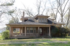
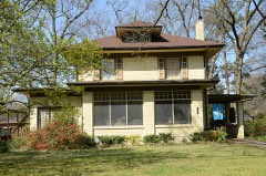
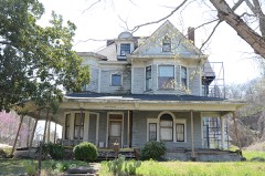
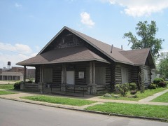
60 National Register listings published here, 2 of them National Historic Landmarks.
Sources: the National Register database, National Park Service
65 topographic sheets cover 67 settlements here, and 60 properties are on the National Register of Historic Places.
60 National Register listings published here, 2 of them National Historic Landmarks.
Sources: the National Register database, National Park Service
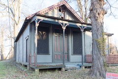
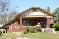
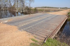
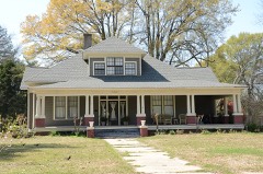
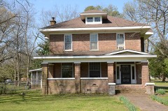
Every property in this county listed on the National Register of Historic Places, with the year it was listed and the federal nomination document.
Every wildfire the federal occurrence database records inside this county: 52 of them, burning about 865 acres. None started naturally and 22 were recorded as arson. Each settlement page carries the fires within five miles of it.
| Reported cause | Fires |
|---|---|
| Arson/incendiarism | 22 |
| Missing data/not specified/undetermined | 12 |
| Debris and open burning | 11 |
| Recreation and ceremony | 3 |
| Equipment and vehicle use | 2 |
| Smoking | 2 |
The five largest, by the area the report gives. 6 of them were set deliberately.
| Date | Cause | Size | Reported by | Name on the report |
|---|---|---|---|---|
| 1 November 2000 | Arson/incendiarism | 90 acres | Arkansas Forestry Commission | not named |
| 21 August 1997 | Missing data/not specified/undetermined | 83 acres | Dale Bumpers White River National Wildlife Refuge | LEVEE97 |
| 7 March 2013 | Recreation and ceremony | 82 acres | Dale Bumpers White River National Wildlife Refuge | LEVEE |
| 28 August 1998 | Arson/incendiarism | 71 acres | Arkansas Forestry Commission | not named |
| 24 June 1998 | Arson/incendiarism | 69 acres | Dale Bumpers White River National Wildlife Refuge | TAYLOR E |
| 21 August 2000 | Arson/incendiarism | 60 acres | Dale Bumpers White River National Wildlife Refuge | TUPELO |
| 17 September 2000 | Arson/incendiarism | 60 acres | Arkansas Forestry Commission | not named |
| 28 June 1998 | Arson/incendiarism | 52 acres | Dale Bumpers White River National Wildlife Refuge | TAYLOR W |
Every settlement page carries the fires within five miles of it - see the settlement index below.
The NOAA Storm Events Database holds 178 reports for this county, causing no deaths, 9 injuries and about $9,352,850 in recorded property damage. Each settlement page carries the reports that name it.
| Kind of event | Reports |
|---|---|
| Thunderstorm Wind | 98 |
| Hail | 35 |
| Tornado | 28 |
| Flash Flood | 12 |
| Flood | 5 |
The most serious of them, by death, then injury, then recorded damage. The accounts are quoted exactly as the forecast office filed them.
| When | Event | Place named | Harm | What the report says |
|---|---|---|---|---|
| January 1996 | Tornado (F1) | Marvell | 3 hurt, $30,000 | no account filed |
| February 2001 | Tornado (F2) | Mosby Spur | 2 hurt, $50,000 | The tornado moved into the southeast corner of Phillips county from northern Desha county. The tornado struck several mobile homes just southwest of Mosby. Two mobile homes and a farm shop were destroyed. Two people from one of the mobile homes were injured. |
| June 1977 | Tornado (F1) | not stated | 2 hurt, $25,000 | no account filed |
| May 1989 | Thunderstorm Wind | not stated | 2 hurt | no account filed |
| December 1978 | Tornado (F2) | not stated | $2,500,000 | no account filed |
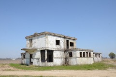
| July 2009 | Tornado (EF2) | Crumrod | $1,500,000 | A tornado touched down in Arkansas County roughly 5 miles south of Tichnor. The tornado moved northeast crossing into Phillips County. The tornado knocked down around one thousand trees in the White River National Wildlife Refuge. From there, the tornado traveled northeast on a continuous path producing damage near Lundell. The Phillips County Airport sustained damage to several buildings. One brick building had major roof damage while another building was completely destroyed. An airport hangar was damaged as well. Several airplanes received damage. Another building sustained minor damage. Several trees were snapped off and many power lines were knocked down in the area. The tornado continued northeast crossing into Coahoma County, Mississippi near Jackson Point. |
| May 2009 | Flash Flood | Helena - West Helena | $500,000 | Heavy rain produced flash flooding across portions of Phillips County including Helena-West Helena, Elaine, Marvell, Barton and Lake View. Numerous roads were closed and several homes were inundated with water. The police department in Marvell had three to four feet of water inside. |
| May 2009 | Flash Flood | Elaine | $500,000 | Heavy rain produced flash flooding over Eastern Phillips County. At least 60 homes sustained some water damage. Several roads were flooded in Elaine, Lexa, and Helena-West Helena and some sustained damage. At least 1 foot of water covered Highway 242 near Lick Creek. |
| May 2008 | Thunderstorm Wind | Turner | $500,000 | Straight line winds created a thirty mile damage path across Phillips County beginning near County Road 146 northwest of Noy eventually ending in Coahoma County, Mississippi. Near Noy, several trees were blown down and uprooted. A mobile home was also destroyed in this area and several homes sustained damaged. The damage path continued to near Cypert, where several sheds and barns were either heavily destroyed or damaged. Dozens of large trees and power lines were downed or snapped. The damage path then continued east affecting the Gobell, Trenton, and Oneida areas. Rail cars were overturned and crops were damaged in the area. Three miles east of Lakeview, an airport hangar was heavily damaged and dozens of power poles were downed along Highway 44. Dozens of power lines were downed on Highway 20, 8 miles east of Lakeview. The damaging winds then crossed the Mississippi River. |
| May 1993 | Thunderstorm Wind | Elaine | $500,000 | Thunderstorm winds blew down several television antennas in Postelle and Elaine. |
| May 1993 | Thunderstorm Wind | Postelle | $500,000 | Thunderstorm winds blew down several television antennas in Postelle and Elaine. |
| November 1995 | Tornado (F1) | Lakeview | $300,000 | A tornado touched down along a road in Lakeview. Three homes, two of which were brick, were heavily damaged. One mobile home was destroyed. Another mobile home was moved off its foundation. Three to four other homes received minor damage. Numerous trees had twisted and broken limbs with pieces of tin roofing and other debris hanging from the trees and power lines. Two large trees were uprooted and moved 25 feet. One of the trees had a field disker entangled in it. |
| March 2002 | Thunderstorm Wind | West Helena | $250,000 | Four businesses were damaged. Four homes were also damaged. Some trees and power lines were knocked down. |
| January 1982 | Tornado (F1) | not stated | $250,000 | no account filed |
| August 1978 | Tornado (F1) | not stated | $250,000 | no account filed |
| February 1965 | Tornado (F2) | not stated | $250,000 | no account filed |
| April 1956 | Tornado (F3) | not stated | $250,000 | no account filed |
| May 2011 | Flood | Lundell | $200,000 | The Mississippi River at Helena-West Helena rose to near record levels during the beginning and middle part of May. Helena-West Helena escaped the flood waters by reinforcing the flood wall with sandbags. A residential area off of Highway 44 and Lithium Road was evacuated as a precaution. A few roads were flooded and/or damaged. Several thousand acres of fields were flooded. The river remained above flood stage through the end of the month. |
| January 2012 | Thunderstorm Wind | Helena - West Helena | $100,000 | Several mobile homes were destroyed on the west side of West Helena. One mobile home was flipped on the southwest side of a neighborhood on the outskirts of town. The bottom frame of the home struck a tree behind the home 15 feet in the air. The mobile home landed on its roof and was completely destroyed. Cars were damaged by flying debris and trees were also blown down. Another neighborhood southwest of town was damaged as well. In this neighborhood, two mobile homes were flipped. One was blown into another mobile home and a wood house. Power lines and irrigation systems were blown down in the fields between the two neighborhoods. In West Helena, only minor damage was noted to the Junior High School roof and the roof and siding of a few motels. A few storage sheds were blown over but had not been secured to the ground. |
| June 2004 | Flash Flood | West Helena | $100,000 | Numerous businesses, homes and roads were flooded. |
| January 2020 | Thunderstorm Wind | Elaine | $50,000 | Straight-line winds damaged several homes and barns in Elaine. |
| June 2020 | Flash Flood | Helena - West Helena | $50,000 | Vehicles were stranded in floodwaters. Water rescues were necessary. |
| January 2012 | Thunderstorm Wind | Marvell | $50,000 | Thunderstorm winds caused significant damage to some metal buildings, a house, and some very large trees. The hardwood trees were approximately 3 feet wide. One metal building had a portion of the roof peeled up as well as 2 garage doors blown in. The grain bins behind the metal building sustained dents near the top due to the winds. The house was damaged by one of the large trees falling on top of it. Two mobile homes were damaged as well with their roofs blown off. Additional smaller trees were snapped in the vicinity. |
| May 2009 | Tornado (EF1) | Marvell | $40,000 | A tornado touched down briefly just west-northwest of Marvell. Several trees and power lines were knocked down. A supply feed store was damaged as the tornado crossed Highway 49. |
| March 2016 | Tornado (EF0) | Edgewood | $35,000 | The tornado caused intermittent damage in far Northern Phillips County, northwest of the town of Lexa. The tornado damaged outbuildings and lightweight structures along Highways 316 and 201. The tornado caused roof damage to a barn and downed wooden power poles along Highway 1 north of Lexa. Peak estimated wind 85 mph. |
| January 1999 | Thunderstorm Wind | West Helena | $35,000 | Thirty mobile homes were damaged. An outbuilding was also damaged and a fence was wrapped around a tree. A house under construction had the outer frame blown off. A parked 18-wheeler was blown over. |
| March 2023 | Thunderstorm Wind | Lexa | $30,000 | Straight-line winds damaged an outbuilding on Highway 242. A mobile home was pushed off block piers and two homes suffered roof damage along Highway 242. |
| March 2022 | Thunderstorm Wind | Black Foot | $25,000 | Three power poles were knocked down on Highway 316 one mile north of Highway 49. One tree was also knocked down along with tree limbs. |
| March 2022 | Thunderstorm Wind | Helena - West Helena | $25,000 | Powerlines and trees down on Waverly Wood Drive, Springdale Road, and Oakland Avenue, along with other various locations in Helena-West Helena. Storage buildings also suffered damage on Highway 49 near Helena Regional Hospital. |
| March 2016 | Tornado (EF0) | Marvell | $25,000 | The tornado caused intermittent damage from west-southwest of Marvell into the town of Marvell. The tornado downed power poles and damaged a small outbuilding along Highway 1 southwest of Marvell. In town, the tornado bent street lights and a power pole. Tree limbs were broken and a baseball field scoreboard was knocked down. Peak estimated wind was 80 mph. |
| January 2012 | Tornado (EF1) | Postelle | $25,000 | The tornado moved into Phillips County from Monroe County and continued to move northeast. A large storage shed was tossed over a farm building. A few trees were knocked down and minor tree damage was noted. A couple of irrigation pivots were overturned. Some grain bins were also dented towards the top. |
| September 2002 | Thunderstorm Wind | Barton | $25,000 | Several mobile homes were damaged. Some trees were knocked down. |
| June 1998 | Thunderstorm Wind | Marvell | $25,000 | The roof of the Boys, Girls, Adult Community Development Center was blown off. Several trees were blown down. |
| April 1976 | Tornado (F1) | not stated | $25,000 | no account filed |
| May 2025 | Thunderstorm Wind | Barton | $20,000 | Two power poles downed and several trees downed. |
| February 2008 | Thunderstorm Wind | West Helena | $20,000 | Straight line winds knocked down trees and caused some minor roof damage in the West Helena and Helena area. A storage shed roof was blown off and another shed was picked up over a four foot fence and thrown into the side of a house. |
| February 1996 | Thunderstorm Wind | West Helena | $20,000 | no account filed |
| May 2025 | Thunderstorm Wind | Midway | $15,000 | A few power poles were downed along Hwy 243. |
| August 2017 | Tornado (EF0) | Preston Place | $15,000 | A weak tornado touched down south of Helena-West Helena and caused some minor damage to a house. Peak winds were estimated at 75 mph. |
| February 1999 | Thunderstorm Wind | Helena | $15,000 | A couple of buildings in downtown Helena were damaged. Several trees and power lines were also knocked down. |
| June 2025 | Thunderstorm Wind | Helena - West Helena | $10,000 | Trees were knocked down, and a tree landed on a home at the 300 block of Waverly Road in Helena, AR. |
| June 2023 | Hail | Crumrod | $10,000 | Golfball size hail damaged windows and some vehicles. |
| May 2022 | Thunderstorm Wind | Brookings | $10,000 | Part of a roof blown off a building. Trees and powerlines down in Marvell. |
| March 2021 | Thunderstorm Wind | Morning Star | $10,000 | Metal roofs were peeled from outbuildings along Highway 20 west of Elaine. |
| March 2019 | Thunderstorm Wind | Helena - West Helena | $10,000 | Large tree down on building, snapped at the base of the tree. |
| April 2011 | Tornado (EF0) | Morning Star | $10,000 | A weak tornado touched down one mile north of Elaine on Highway 44 and traveled east-northeast. Trees and power lines were knocked down. A few road signs were also blown over. The tornado continued east-northeast and crossed into Coahoma County, Mississippi. |
| July 2009 | Tornado (EF2) | Ratio | $10,000 | A tornado crossed into Phillips County from Coahoma County, Mississippi. The tornado moved northeast through a wooded area crossing the Mississippi River back into Coahoma County, Mississippi. Several trees were knocked down. |
| February 2008 | Thunderstorm Wind | Hln Thmpsn Robbins A | $10,000 | Straight line winds destroyed a woodworking shop off of County Road 223 outside of Lexa. |
| November 1995 | Thunderstorm Wind | Turner | $10,000 | A mobile home was blown down. |
| April 2006 | Hail | Marvell | $10,000 | no account filed |
| July 2008 | Thunderstorm Wind | Morning Star | $8,000 | Straight line winds blew several trees down in Elaine. In addition, a few small sheds were blown over and some roof damage occurred. |
| February 2007 | Thunderstorm Wind | Mellwood | $5,500 | Straight line winds produced some damage between Mellwood and Elaine. In Mellwood, roof shingles were blown off a house and a tv antenna was also blown over. In Elaine, pieces of a tin roof were blown off a barn. A large tree was also blown down. |
| April 2025 | Thunderstorm Wind | Helena - West Helena | $5,000 | Downed trees and powerlines in between Highland St and Arkansas St in Helena-West Helena. |
| April 2022 | Thunderstorm Wind | Southland | $5,000 | Trees uprooted on Springdale Road and 9th Street. |
| April 2011 | Tornado (EF0) | Ferguson | $5,000 | A weak tornado touched down near Ferguson on Highway 44 and traveled northeast toward the Mississippi River. Some trees were knocked down. The tornado continued northeast crossing into Coahoma County, Mississippi. |
| May 2004 | Thunderstorm Wind | West Helena | $5,000 | A few trees were uprooted. |
| August 2002 | Thunderstorm Wind | Marvell | $5,000 | Some trees were knocked down. |
| April 2001 | Thunderstorm Wind | Elaine | $5,000 | More than a dozen power lines were blown down. |
| May 2000 | Thunderstorm Wind | West Helena | $5,000 | Several trees were knocked down. |
| April 1999 | Thunderstorm Wind | Helena | $5,000 | Several trees were knocked down. |
The Survey's mineral resources record lists 5 workings inside this county. None of them still produces: all are closed or unrecorded. Each settlement page carries the workings within five miles of it.
| Commodity | Workings |
|---|---|
| Sand and Gravel, Construction | 4 |
| Clay | 1 |
The least common of them first, because a county's hundredth gravel pit says nothing its first ten did not.
| Where | Site | Commodity | Status | Recorded |
|---|---|---|---|---|
| Unk | Clay | Past Producer | ||
| Helena Revetment | Sand and Gravel, Construction | Past Producer | ||
| Miss River Plant | Sand and Gravel, Construction | Past Producer | ||
| Phillips Cnty Hiwy Dept | Sand and Gravel, Construction | Past Producer | ||
| Thompson | Sand and Gravel, Construction | Past Producer |
Named settlements recorded in the Geographic Names Information System, each with the topographic sheets covering it. Villages, hamlets and abandoned places alike. Each is shown with the nearest named watercourse or landform and the survey quadrangle it falls on.
Hornor township · 72390 · On Caney Creek · West Helena quadrangle
16 sheets, 1939 to 1990
No longer a settlement
Mooney township · 72328 · Near Island Number 68 · Mellwood quadrangle
16 sheets, 1930 to 1990
Mooney township · 72328 · Near Island Number 68 · Mellwood quadrangle
16 sheets, 1930 to 1990
Mooney township · 72328 · Near Island Number 68 · Mellwood quadrangle
16 sheets, 1930 to 1990
Spring Creek township · 72355 · Lexa quadrangle
13 sheets, 1940 to 1990
No longer a settlement
St. Francis township · 72342 · On Porter Bayou · Helena quadrangle
16 sheets, 1939 to 1990
Spring Creek township · 72355 · On Crooked Creek · West Helena quadrangle
16 sheets, 1939 to 1990
Tappan township · 72333 · On Yellow Bank Bayou · Lambrook quadrangle
16 sheets, 1939 to 1990
Mooney township · 72328 · Mellwood quadrangle
16 sheets, 1930 to 1990
No longer a settlement
Spring Creek township · 72355 · Lexa quadrangle
13 sheets, 1940 to 1990
No longer a settlement
Lake township · 72342 · By Kangaroo Point · Friars Point NW quadrangle
15 sheets, 1939 to 1990
The vanished settlements of Phillips County: the places named above that are no longer on the map.