Block
From the record
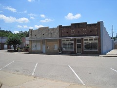
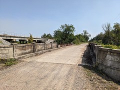
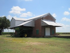
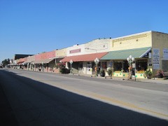
23 National Register listings published here.
Sources: the National Register database, National Park Service
57 topographic sheets cover 66 settlements here, and 23 properties are on the National Register of Historic Places.
23 National Register listings published here.
Sources: the National Register database, National Park Service
Every property in this county listed on the National Register of Historic Places, with the year it was listed and the federal nomination document.
Every wildfire the federal occurrence database records inside this county: 37 of them, burning about 1,270 acres. None started naturally and 12 were recorded as arson. Each settlement page carries the fires within five miles of it.
| Reported cause | Fires |
|---|---|
| Debris and open burning | 20 |
| Arson/incendiarism | 12 |
| Smoking | 2 |
| Missing data/not specified/undetermined | 2 |
| Recreation and ceremony | 1 |
The five largest, by the area the report gives. Two of them were set deliberately.
| Date | Cause | Size | Reported by | Name on the report |
|---|---|---|---|---|
| 23 November 2005 | Debris and open burning | 450 acres | Arkansas Forestry Commission | BRADFORD |
| 13 February 2015 | Debris and open burning | 95 acres | Arkansas Forestry Commission | not named |
| 13 March 1998 | Debris and open burning | 80 acres | Arkansas Forestry Commission | not named |
| 8 January 2006 | Arson/incendiarism | 66 acres | Arkansas Forestry Commission | not named |
| 13 February 2015 | Debris and open burning | 50 acres | Arkansas Forestry Commission | not named |
| 15 April 2003 | Arson/incendiarism | 40 acres | Arkansas Forestry Commission | not named |
| 10 November 2005 | Missing data/not specified/undetermined | 40 acres | Arkansas Forestry Commission | not named |
| 8 January 2006 | Debris and open burning | 35 acres | Arkansas Forestry Commission | not named |
Every settlement page carries the fires within five miles of it - see the settlement index below.
The NOAA Storm Events Database holds 399 reports for this county, causing 8 deaths, 106 injuries and about $67,347,650 in recorded property damage. Each settlement page carries the reports that name it.
| Kind of event | Reports |
|---|---|
| Thunderstorm Wind | 176 |
| Hail | 131 |
| Tornado | 48 |
| Flash Flood | 36 |
| Heavy Rain | 3 |
| Lightning | 2 |
| Flood | 2 |
| Dust Storm | 1 |
The most serious of them, by death, then injury, then recorded damage. The accounts are quoted exactly as the forecast office filed them.
| When | Event | Place named | Harm | What the report says |
|---|---|---|---|---|
| March 1984 | Tornado (F4) | not stated | 5 killed, 12 hurt, $25,000,000 | no account filed |
| March 1952 | Tornado (F3) | not stated | 2 killed, 39 hurt, $250,000 | no account filed |
| March 1952 | Tornado (F3) | not stated | 1 killed, 5 hurt, $250,000 | no account filed |
| May 1973 | Tornado (F4) | not stated | 25 hurt, $25,000 | no account filed |
| September 1959 | Tornado (F3) | not stated | 10 hurt, $250,000 | no account filed |
| October 2019 | Tornado (EF1) | Tyronza | 3 hurt, $350,000 | This was a short track tornado that touched down in the southwest part of Tyronza and tracked northeast. There was straight line wind damage surrounding the tornado. Primarily damage to a convenience store and elementary school. Several outbuildings were destroyed and numerous trees down. |
| November 1983 | Tornado (F1) | not stated | 3 hurt, $250,000 | no account filed |
| April 2020 | Tornado (EF2) | Mc Daniel | 2 hurt, $250,000 | The tornado tracked predominately through farm fields. A trailer home was destroyed in the Claypool area and homes were damaged and destroyed on the north side of Harrisburg. |
| May 1973 | Tornado (F2) | not stated | 2 hurt, $25,000 | no account filed |
| June 1988 | Thunderstorm Wind | not stated | 2 hurt | no account filed |
| November 1983 | Tornado (F1) | not stated | 1 hurt, $250,000 | no account filed |
| December 1971 | Tornado (F2) | not stated | 1 hurt, $250,000 | no account filed |
| March 1989 | Thunderstorm Wind | not stated | 1 hurt | no account filed |
| March 1984 | Tornado (F4) | not stated | $25,000,000 | no account filed |
| December 2021 | Tornado (EF2) | Trumann | $6,300,000 | Tornado developed just southwest of Trumann and destroyed about 70 homes and damaged another 100 homes. Several businesses were damaged or destroyed. There was also widespread tree damage. The fire station was also heavily damaged. The worst damage was in the northeast part of Trumann with businesses and homes destroyed. Tornado path ended near the St. Francis River. Peak winds were estimated at 130 mph. |
| April 2002 | Hail | Lepanto | $3,000,000 | One hundred were damaged at a Ford dealership in Trumann. Over 2,000 cars in the area were damaged by the hail. Many homes were also damaged. The Trumann schools had at least 100 windows broken. |
| June 2023 | Thunderstorm Wind | Marked Tree | $500,000 | Straight-line winds caused widespread damage in Marked Tree. Many trees were uprooted or snapped. Some trees fell on homes. Fences and utility poles were knocked down and some structures sustained damage. |
| April 2002 | Thunderstorm Wind | Trumann | $500,000 | The local high school and elementary school had windows broken. Fifteen police cars were severely damaged. Several trees were blown down. |
| May 2013 | Flash Flood | Trumann | $424,000 | Approximately five inches of rain fell across northern and western Poinsett County resulting in flash flooding. A few homes and several county roads were flooded. Many of the roads that were flooded were badly damaged and had to be repaired. |
| May 2009 | Flash Flood | Trumann | $250,000 | Heavy rain produced flash flooding in Trumann. Twenty four homes were flooded along Mulberry Drive. |
| November 1989 | Tornado (F0) | not stated | $250,000 | no account filed |
| December 1982 | Tornado (F1) | not stated | $250,000 | no account filed |
| December 1982 | Tornado (F1) | not stated | $250,000 | no account filed |
| April 1970 | Tornado (F2) | not stated | $250,000 | no account filed |
| March 1961 | Tornado (F1) | not stated | $250,000 | no account filed |
| May 2011 | Flood | Trumann | $200,000 | Heavy rain during late April into early May caused the St. Francis River to rise to near record levels. The river remained above flood stage through the end of May. Several homes sustained minor damage from the flooding. The city of Payneway had to be evacuated as a result of the flooding. Several roads were closed and/or damaged. Several hundred acres of cropland was flooded. |
| May 2010 | Flash Flood | Fisher | $150,000 | Heavy rain produced flash flooding across Poinsett County. A bridge on Old Military Road was washed out. In addition, U.S. Highway 214 near Fisher was underwater. Several homes were flooded in Lepanto as well. |
| April 2025 | Tornado (EF1) | Deckerville | $125,000 | A shortlived tornado touched down just to the west of Interstate 555. As it crossed the highway, it knocked multiple train box cars off their bases along the Burlington Northern Railroad that runs parallel to the highway. The box car bases remained on the tracks. The tornado continued northeast, with multiple power poles damaged along Jett Road. Additional powerline damage was noted along Howard Road. The tornado lifted shortly after crossing the intersection of Cavitt Lane and Howard Road. Estimated peak winds were 90 mph. |
| October 2009 | Flash Flood | Greenfield | $122,000 | Crane Farm Road was flooded when water was flowing over the Big Creek bridge. |
| June 2018 | Thunderstorm Wind | Waldenburg | $100,000 | Lots of trees and power-lines down around the area. A shed completely destroyed. Shingles peeled off roof and a metal farm shop roof was removed. |
| July 2009 | Tornado (EF0) | Hydrick | $100,000 | A tornado touched down along Highway 214 snapping a telephone pole in half. The tornado tracked northeastward across W.D. Thomas Road damaging two grain bins and three farm buildings. The tornado continued northeast knocking down one tree and damaging air conditioning units at a home. A truck window was shattered and a mobile home window was broken as well. A shed on the property was picked up and moved into a power pole a couple of feet away. Further northeast, an old barn was toppled. The tornado traveled further northeast lifting along Highway 1 after damaging a barn and a few sheds. |
| December 2009 | Flash Flood | Trumann | $91,000 | Heavy rain produced flash flooding around Poinsett County. Numerous roads around the county were closed due to high water including Highways 1, 14, and 69. |
| April 2018 | Hail | Merced | $75,000 | Hail ranged from pea to golf-ball size across town. |
| June 2018 | Thunderstorm Wind | Fisher | $75,000 | Sixteen power-poles in a row snapped and a metal barn blown down. |
| June 2018 | Thunderstorm Wind | Fisher | $75,000 | Two large grain bins were completely destroyed near County Road 100. One grain bin was tossed 75 feet across the road into a bunch of trees. |
| May 2017 | Thunderstorm Wind | Lepanto | $75,000 | Trees down on roads and houses in Lepanto. |
| May 2010 | Tornado (EF1) | Weona Jct | $75,000 | A tornado touched down southwest of Weona near Hogg Road. The tornado moved a tractor disc and then moved northeast across open farm land damaging several transmission lines near Highway 373. Four power poles were also snapped. The tornado continued northeast destroying an office trailer at a crop duster hangar off Highway 14 in Weona. The crop duster hangar was also damaged. The tornado then tracked across open farm land damaging trees and power poles. The tornado crossed Henderson Lane and damaged one home. A barn was also destroyed. The tornado then tracked across more open farm land snapping three more transmission lines as it crossed Maple Grove Lane. The tornado damaged more trees between farm fields before lifting near County Road 204. |
| February 2001 | Tornado (F2) | Uno | $75,000 | The tornado moved into Poinsett county from Jackson county and continued to move northeast.One mobile home was demolished. Four other mobile homes were overturned. A few houses were damaged. One shed was blown over. A few trees were knocked down. |
| February 2018 | Thunderstorm Wind | Trumann | $60,000 | Estimated gust. Light poles and trees down in the Trumann area. |
| April 2025 | Tornado (EF1) | Middlebrook | $50,000 | A tornado touched down near Ziegenhorn Lane, damaging a few utility poles. Damage was initially sporadic as the tornado moved northeast, with tree damage noted on Wendy Lane. Trees were snapped along Longview Lane and Prairie City Lane with the tornado widening and intensifying as it approached Highway 214 E. Numerous trees and several utility poles were snapped on Highway 214 and Bornhoft Lane. Damage was more sporadic farther northeast with the tornado lifting near the intersection of Roberts Lane and Kink Road. Peak winds were estimated at 110 mph. |
| June 2023 | Thunderstorm Wind | Marked Tree | $50,000 | Trees and powerlines were knocked down in Marked Tree. Several trees were down in the cemetery. A church suffered damage. |
| September 2019 | Thunderstorm Wind | Trumann | $50,000 | Video scoreboard at RMC Stadium in Trumann was knocked down by straight line winds. |
| June 2018 | Thunderstorm Wind | Fisher | $50,000 | Wind damage to a power sub station. |
| January 2008 | Tornado (EF1) | Deckerville | $50,000 | A tornado touched down in Deckerville on Lucas Road just south of Highway 63. The tornado was 25 yards wide and 250 yards long. Two homes sustained roof damage and an utility and parking shed were completely destroyed. Numerous trees were knocked down in the area with debris scattered across a nearby field. |
| May 2003 | Tornado (F1) | Harrisburg | $50,000 | The tornado touched down in Harrisburg and traveled east. The Harrisburg High School was damaged while commencement exercises were going on. Several houses in Harrisburg were damaged. A large barn was displaced off its foundation. Many trees were knocked down. |
| July 2002 | Lightning | Trumann | $50,000 | The Providence Baptist Church in Trumann was destroyed by a fire started by lightning. |
| June 1994 | Thunderstorm Wind | Marked Tree | $50,000 | Thunderstorm winds blew down some large trees and destroyed a greenhouse. |
| January 1996 | Tornado (F0) | Lepanto | $50,000 | no account filed |
| June 2013 | Thunderstorm Wind | Waldenburg | $40,000 | Straight line winds snapped power poles northwest and southeast of Waldenburg. In the town of Waldenburg, one power line plus several billboard and business signs were knocked down. The roof off of several buildings (warehouse style) at the Farmer's Supply fertilizer plant were ripped off. |
| December 2013 | Flash Flood | Buffalo Lick | $40,000 | Over seven inches of rain produced flash flooding across Poinsett County. Water entered four homes in Trumann. Several streets in Trumann were flooded including Primrose Lane. Highway 69 at Highway 163 in Northern Poinsett County and MB Lane off Highway 118 near Marked Tree were closed due to wash outs. Ditches throughout the county were filled to capacity. |
| April 2021 | Thunderstorm Wind | Tyronza | $30,000 | A few power lines were knocked down just south of Tyronza between Interstate 555 and Highway 322. One house south of town lost some siding and had some windows knocked out by a picnic table. Two center pivots irrigation systems were damaged. |
| September 2009 | Flash Flood | Greenfield | $30,000 | Heavy rain produced flash flooding near the Craighead/Poinsett County Line. Several homes had six inches of standing water inside them. |
| April 2025 | Thunderstorm Wind | Fisher | $25,000 | Broken wood cross member on an electrical transmission line. |
| December 2021 | Tornado (EF0) | Weiner | $25,000 | A brief tornado damaged trees southwest of Weiner. A tree fell against a house in Weiner. Peak winds were estimated at 65 mph. |
| December 2021 | Tornado (EF0) | Middlebrook | $25,000 | Several outbuildings damaged and some damage to home and trees. Tornado started and ended in open fields. Peak winds were estimated at 80 mph. |
| May 2010 | Thunderstorm Wind | Trumann | $25,000 | Straight line winds knocked down five power poles in Trumann. A pivot irrigation unit and buildings at a farm store storage compound near the Craighead County border were damaged from the wind. In addtion, a house was hit with a tree in Lepanto. |
| July 2005 | Thunderstorm Wind | Tyronza | $25,000 | Two mobile homes were damaged. Many trees and power lines were blown down. |
| May 2003 | Thunderstorm Wind | Waldenburg | $25,000 | A grain silo was damaged near Waldenburg. A house trailer was destroyed. Numerous trees were blown down with some of the trees falling on houses. |
| May 2003 | Thunderstorm Wind | Trumann | $25,000 | A house had part of its second floor ripped off. Some trees were knocked down. |
| October 1996 | Thunderstorm Wind | Payneway | $25,000 | no account filed |
The Survey's mineral resources record lists 23 workings inside this county. 5 still produce and 18 are closed or unrecorded. Each settlement page carries the workings within five miles of it.
| Commodity | Workings |
|---|---|
| Sand and Gravel, Construction | 23 |
The least common of them first, because a county's hundredth gravel pit says nothing its first ten did not.
| Where | Site | Commodity | Status | Recorded |
|---|---|---|---|---|
| Bartholamu Pit | Sand and Gravel, Construction | Producer | ||
| Easton Pit | Sand and Gravel, Construction | Producer | ||
| G Cantrell | Sand and Gravel, Construction | Past Producer | ||
| Holly Springs Pit and Plant | Sand and Gravel, Construction | Producer | ||
| Laff Wesss | Sand and Gravel, Construction | Producer | ||
| Long John D & Son Gravel Co Pit | Sand and Gravel, Construction | Past Producer | ||
| Unk | Sand and Gravel, Construction | Unknown | ||
| Unk | Sand and Gravel, Construction | Unknown | ||
| Unk | Sand and Gravel, Construction | Unknown | ||
| Unk | Sand and Gravel, Construction | Unknown | ||
| Unk | Sand and Gravel, Construction | Unknown | ||
| Unk | Sand and Gravel, Construction | Unknown | ||
| Unk | Sand and Gravel, Construction | Unknown | ||
| Unk | Sand and Gravel, Construction | Unknown | ||
| Unk | Sand and Gravel, Construction | Unknown | ||
| Unk | Sand and Gravel, Construction | Unknown | ||
| Unk | Sand and Gravel, Construction | Unknown | ||
| Unk | Sand and Gravel, Construction | Unknown | ||
| Unk | Sand and Gravel, Construction | Unknown | ||
| Unk | Sand and Gravel, Construction | Unknown | ||
| Unk | Sand and Gravel, Construction | Unknown | ||
| Unk | Sand and Gravel, Construction | Unknown | ||
| Whitehall Pit | Sand and Gravel, Construction | Producer |
Named settlements recorded in the Geographic Names Information System, each with the topographic sheets covering it. Villages, hamlets and abandoned places alike. Each is shown with the nearest named watercourse or landform and the survey quadrangle it falls on.
Little River township · 72472 · Monterey quadrangle
13 sheets, 1940 to 1986
No longer a settlement
Scott township · 72432 · On Otter Creek · Cherry Valley East quadrangle
13 sheets, 1940 to 1986
Little River township · 72365 · Near Cow Island · Monterey quadrangle
13 sheets, 1940 to 1986
West Prairie township · 72479 · Otwell quadrangle
12 sheets, 1939 to 1986
No longer a settlement
Owen township · 72429 · On Bale Brown Branch · Hickory Ridge quadrangle
12 sheets, 1939 to 1992
Greenfield township · 72432 · Greenfield quadrangle
9 sheets, 1940 to 1986
No longer a settlement
Greenwood township · 72365 · On Iron Mines Creek · Marked Tree quadrangle
11 sheets, 1941 to 1986
No longer a settlement
Lunsford township · 72472 · McCormick quadrangle
9 sheets, 1940 to 1986
No longer a settlement
Little River township · 72365 · On Left Hand Chute of Little River · Marked Tree quadrangle
11 sheets, 1941 to 1986
Dobson township · 72421 · On Old Channel Cache River · Grubbs quadrangle
10 sheets, 1935 to 1986
Little River township · 72365 · Near Miller Mound (historical) · Marked Tree quadrangle
11 sheets, 1941 to 1986
Dobson township · 72421 · On Old Channel Cache River · Grubbs quadrangle
10 sheets, 1935 to 1986
Little River township · 72365 · On Left Hand Chute of Little River · Marked Tree quadrangle
11 sheets, 1941 to 1986
Scott township · 72432 · On Kaylo Creek · Cherry Valley East quadrangle
13 sheets, 1940 to 1986
The vanished settlements of Poinsett County: the places named above that are no longer on the map.