Block
From the record
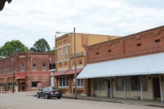
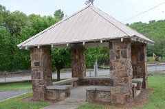
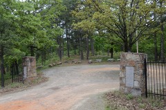
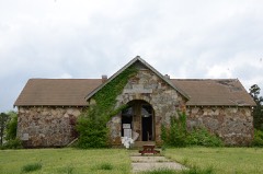
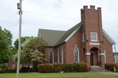
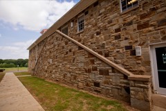
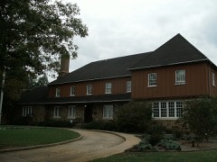
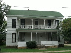
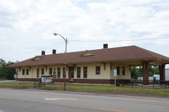
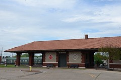
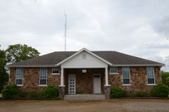
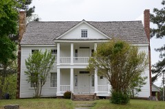
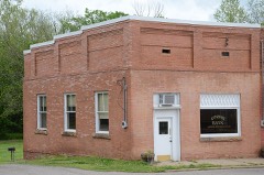
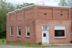
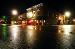
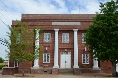
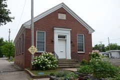
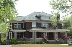
38 National Register listings published here.
Sources: the county history on the Internet Archive · the National Register database, National Park Service
112 topographic sheets cover 70 settlements here, and 38 properties are on the National Register of Historic Places.
38 National Register listings published here.
Sources: the county history on the Internet Archive · the National Register database, National Park Service
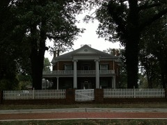
Every property in this county listed on the National Register of Historic Places, with the year it was listed and the federal nomination document.
Every wildfire the federal occurrence database records inside this county: 586 of them, burning about 6,619 acres. 39 started naturally and 172 were recorded as arson. Each settlement page carries the fires within five miles of it.
| Reported cause | Fires |
|---|---|
| Arson/incendiarism | 172 |
| Debris and open burning | 169 |
| Missing data/not specified/undetermined | 104 |
| Equipment and vehicle use | 54 |
| Natural | 39 |
| Smoking | 14 |
| Misuse of fire by a minor | 11 |
| Power generation/transmission/distribution | 10 |
| Recreation and ceremony | 7 |
| Fireworks | 4 |
| Railroad operations and maintenance | 1 |
| Other causes | 1 |
The five largest, by the area the report gives. Three of them were set deliberately.
| Date | Cause | Size | Reported by | Name on the report |
|---|---|---|---|---|
| 14 April 2006 | Arson/incendiarism | 850 acres | Ozark-St. Francis National Forests | SULPHUR CREEK #2 |
| 18 November 1999 | Fireworks | 505 acres | Ozark-St. Francis National Forests | NARROWS |
| 3 July 2012 | Arson/incendiarism | 471 acres | Arkansas Forestry Commission | PEA RIDGE |
| 3 April 1996 | Equipment and vehicle use | 253 acres | Ozark-St. Francis National Forests | SOLO |
| 29 January 2018 | Arson/incendiarism | 176 acres | Ozark-St. Francis National Forests | FORK |
| 10 September 2005 | Debris and open burning | 130 acres | Arkansas Forestry Commission | not named |
| 8 March 2017 | Debris and open burning | 130 acres | Ozark-St. Francis National Forests | EASTFORK II |
| 7 April 2006 | Natural | 130 acres | Ozark-St. Francis National Forests | SULPHUR CREEK |
Every settlement page carries the fires within five miles of it - see the settlement index below.
The NOAA Storm Events Database holds 601 reports for this county, causing 9 deaths, 46 injuries and about $30,880,400 in recorded property damage. Each settlement page carries the reports that name it.
| Kind of event | Reports |
|---|---|
| Thunderstorm Wind | 315 |
| Hail | 190 |
| Flash Flood | 37 |
| Tornado | 29 |
| Flood | 14 |
| Lightning | 6 |
| Heavy Rain | 6 |
| Funnel Cloud | 4 |
The most serious of them, by death, then injury, then recorded damage. The accounts are quoted exactly as the forecast office filed them.
| When | Event | Place named | Harm | What the report says |
|---|---|---|---|---|
| February 2008 | Tornado (EF3) | Galla Rock | 5 killed, 15 hurt, $11,500,000 | The tornado moved out of the Carden Bottoms area of Yell County, crossing the Arkansas River, and re-entering Pope County southwest of Atkins. The intensity and width of the tornado increased quickly within just a couple of miles after it moved across the Arkansas River. According to a survey by the Red Cross, damage included 46 houses destroyed, 19 houses with major damage, 37 houses with minor damage, and 2 other houses affected. In addition, 6 mobile homes were destroyed, 1 mobile home had major damage, and 4 others suffered minor damage. Several businesses were damaged as well. Numerous trees, power lines, and power poles were blown down. Several vehicles were blown off Interstate 40 as the tornado crossed the highway. One fatality occurred in the Lucky Landing area when a woman was thrown from her mobile home. Three fatalities, all members of a single family, occurred at a house on the east side of Atkins. Another fatality occurred in the Happy Bend community when a man left his mobile home and took shelter in a large, metal, intermodal shipping container. The container was blown hundreds of yards into the woods. The tornado then moved into Conway County, in the area west of Hattieville. |
| May 1961 | Tornado (F2) | not stated | 1 killed, 4 hurt, $25,000 | no account filed |
| January 2008 | Tornado (EF2) | Moreland | 1 killed, 1 hurt, $3,500,000 | A tornado touched down in central Pope County and tracked to the northeast. The Pope County Office of Emergency Management reported that 42 residential structures were affected. Of these, seven were destroyed, six had minor damage, and the rest had moderate to heavy damage. In addition, six chicken houses, two barns, and a number of outbuildings were destroyed, a travel trailer and motor home were overturned, and hundreds of trees were blown down. A 61 year-old man was killed and his wife was injured when their double-wide mobile home was destroyed on Simba Road, about 1.4 miles south-southeast of Appleton. Arkansas Governor Mike Beebe declared Pope County a state disaster area. The tornado continued into Conway County. |
| December 2015 | Thunderstorm Wind | Economy | 1 killed, $40,000 | Straight line winds blew over several trees, one of which fell onto a double-wide mobile home, killing 1 person. |
| July 2018 | Lightning | Oakland Hgts | 1 killed | A 67 year old male was killed by a lightning strike. The man was outside working on his yard at the time of the strike. The time is estimated based on radar data, but there were storms near Russellville from 1 pm through 2 pm CDT. |
| March 1953 | Tornado (F3) | not stated | 7 hurt, $2,500 | no account filed |
| September 1970 | Tornado (F2) | not stated | 5 hurt, $250,000 | no account filed |
| February 1975 | Tornado (F2) | not stated | 4 hurt, $250,000 | no account filed |
| February 1956 | Tornado (F3) | not stated | 2 hurt, $250,000 | no account filed |
| May 2022 | Thunderstorm Wind | Russellville | 2 hurt | A tree fell on a vehicle near East 4th Street in Russellville. Two people were extricated from the vehicle and taken to the local hospital. |
| April 1999 | Tornado (F2) | Russellville | 2 hurt | no account filed |
| November 1988 | Thunderstorm Wind | not stated | 2 hurt | no account filed |
| March 1997 | Tornado (F1) | Oak Grove | 1 hurt, $5,000,000 | no account filed |
| May 2019 | Thunderstorm Wind | Economy | 1 hurt | NWS survey crews determined thunderstorm wind damage was caused by a microburst near Atkins, AR. One serious injury was reported. Wind gusts were estimated to be between 80 and 90 mph. |
| June 2009 | Thunderstorm Wind | Atkins | $1,500,000 | Widespread tree damaged occurred, and about 30 homes were damaged by the falling trees. A wall of a food plant was blown down, and a rail station at another business was damaged. Several other businesses suffered damage, as well. Many power lines were blown down. A pavilion at a church collapsed. Two chicken houses were badly damaged. |
| March 2008 | Flash Flood | London | $1,500,000 | Minor flooding was reported along side streets in Russellville. Two individuals were rescued from their home in Scottsville before the house floated down the Illinois Bayou. A portion of West Parkway Drive in Russellville was closed due to flooding. North Elizabeth Road, Peaceful Valley Road and Humphrey Road in Dover were closed. Lee Mountain Road was washed out one mile north of Rushing Road. Parts of Arkansas Highway 7 in the Ozark National Forest were affected by washouts and landslides. |
| June 2019 | Flood | Odita | $1,000,000 | Heavy rain and upstream reservoir releases led to flooding on the Arkansas River at Dardanelle. The record crest was 45.91 feet on 5/31/19. |
| May 2019 | Flood | Humphrey | $1,000,000 | River flooding began on the Arkansas River at Dardanelle May 24 and continued through the end of the month. The river crested there at 45.91 feet on May 31 and this was a record stage. |
| November 2011 | Flash Flood | London | $1,000,000 | Parts of U.S. 64 and Arkansas 7, 25, 27, and 124 were closed due to flooding. Numerous major intersections in Russellville were flooded, some with more than 2 feet of water. Many vehicles stalled in the high water. A shopping center on Arkansas Ave. in Russellville flooded. Several residences in the Russellville and Dover areas had to be evacuated. Altogether, the county 911 dispatch center received about 150 calls for assistance during the flooding. |
| May 2014 | Tornado (EF1) | Taral | $250,000 | An EF1 tornado destroyed a chicken house, which had no chickens in it. Two other chicken houses had minor damage. A mobile home was overturned. Trees and power lines were blown down. |
| June 2008 | Flash Flood | Augsburg | $250,000 | The central portion of the county was flooded, causing damage to 18 roads. Roads and culverts were washed out. Some roads were closed due to flooding. Some houses were damaged. Flooding occurred at Pine Hill Bridge. Elizabeth Street bridge was impassable and a culvert and 40 feet of road were washed out at the city raw water pumps. A car was under water at Morgan Road and Market Street. |
| May 2011 | Flood | Pelsor | $250,000 | no account filed |
| March 1976 | Tornado (F1) | not stated | $250,000 | no account filed |
| January 2013 | Flash Flood | Moreland | $200,000 | Water flowed over multiple bridges on county roads. Parts of Arkansas Ave./Arkansas 7 were closed. Water entered some houses and apartments. |
| April 2011 | Flood | Pelsor | $200,000 | Widespread areal flooding occurred. |
| May 2009 | Flash Flood | Simpson | $185,000 | A number of county roads were damaged by flooding, especially around Treat and Crow Mountain. Mount Zion Road was closed due to flooding. |
| July 2014 | Flash Flood | Odita | $125,000 | Flash flooding occurred in Russellville. One photo on social media showed water halfway up the doors of cars. |
| September 2009 | Thunderstorm Wind | Pottsville | $125,000 | Thunderstorm winds destroyed two poultry houses. |
| July 2012 | Thunderstorm Wind | London | $100,000 | Numerous trees and some power lines were blown down. One tree fell on a car, and two others landed on a house. Thousands of people in the area from Russellville to west of Dover lost power. |
| June 2009 | Thunderstorm Wind | Augsburg | $100,000 | Many trees and power lines were blown down. Tin roofs were damaged on farm buildings. A hay barn was blown down. Power poles were snapped, carports were destroyed, and business signs were blown out. |
| January 2007 | Flash Flood | Russellville | $90,000 | Heavy rains fell across Pope County and flooded a number of county and other secondary roads. |
| July 2018 | Thunderstorm Wind | Oakland Hgts | $60,000 | Several trees were uprooted. Several buildings had signs blown in, windows blown in, and roofs with shingle damage. Winds blew in the glass doors of Fred's Pharmacy. All damage is consistent with straight-line winds of 75-85 mph. |
| August 2010 | Thunderstorm Wind | Scottsville | $60,000 | Trees, power poles, and power lines were blown down. One of the trees fell on a house. Arkansas Highway 27 was blocked for several hours. |
| March 2022 | Tornado (EF1) | Augsburg | $50,000 | This tornado started in west central Pope county, just northeast of Augsburg and tracked northeast for approximately 16 miles, before dissipating in central Pope county. Mostly tree damage was noted. There was some structural damage, with the worst damage to a home 1.1 miles west-northwest of Pleasant Valley with extensive roof damage. The sliding doors, three of them, on a volunteer fire department were also blown in about 0.8 mile north of Pleasant Valley along Highway 7. |
| May 2021 | Thunderstorm Wind | Atkins | $50,000 | Multiple trees and power lines were down across the county. A tree fell on a house in Atkins. |
| May 2021 | Thunderstorm Wind | Oakland Hgts | $50,000 | Numerous trees and powerlines were down across the county. A tree fell on a home in Russellville. |
| April 2020 | Thunderstorm Wind | Oakland Hgts | $50,000 | A tree fell on a home. |
| May 2019 | Thunderstorm Wind | Atkins | $50,000 | Trees were down at Atkins. A home was heavily damaged by a fallen tree. |
| February 2019 | Thunderstorm Wind | Oak Grove | $50,000 | A chicken house and 3 barns were damaged between Hector and Atkins. |
| May 2017 | Thunderstorm Wind | Pottsville | $50,000 | Metal roofing was removed from a row of businesses. Numerous trees were down or snapped. |
| March 2015 | Thunderstorm Wind | Oakland Hgts | $50,000 | Some windows and a portion of a wall was blown out of the top floor of the two story Moor Building. Other businesses had roof damage, and many lost power due to the high winds. |
| April 2014 | Thunderstorm Wind | Russellville | $50,000 | Thunderstorm winds blew down trees and power lines. |
| June 2009 | Thunderstorm Wind | Economy | $50,000 | Tin was blown off a chicken house and several dozen trees were blown down. |
| February 2008 | Tornado (EF1) | Holla Bend | $50,000 | The tornado from Yell County tracked into the Holla Bend National Wildlife Refuge in Pope County. Damage was limited to trees being blown down on the southeast side of the refuge. The tornado then tracked back into Yell County, in the Carden Bottoms area. |
| April 2008 | Flood | Odita | $50,000 | Moderate flooding at the Dardanelle stream gage on the Arkansas River occurred for two and a half days. The Arkansas River rose to 36.3 feet, the highest level since May, 1990, and primarily impacted the low land within the levee system. Damages were primarily to agricultural lands and some county roads. |
| June 1994 | Thunderstorm Wind | Russellville | $50,000 | Thunderstorm winds downed trees and power lines. |
| April 1994 | Thunderstorm Wind | Pottsville | $50,000 | Thunderstorm winds blew the roof off of a house. |
| April 1994 | Thunderstorm Wind | Long Pool | $50,000 | Thunderstorm winds knocked down several large trees. |
| November 1993 | Thunderstorm Wind | Scottsville | $50,000 | Thunderstorm winds blew down some trees and tore the roof off a building. Several homes in the area also sustained some minor damage. |
| February 2022 | Thunderstorm Wind | Hector | $40,000 | A roof was torn off of a barn in Hector. Roof debris blocked Pine Street. |
| June 2009 | Thunderstorm Wind | Oakland Hgts | $40,000 | Trees and power lines were blown down in the Russellville area. |
| June 2014 | Thunderstorm Wind | Atkins | $30,000 | Numerous trees and power lines were blown down. |
| September 2012 | Thunderstorm Wind | Dover | $30,000 | Trees and power lines were blown down around Dover. |
| April 2011 | Thunderstorm Wind | Pottsville | $30,000 | Numerous trees were blown down. |
| June 2009 | Thunderstorm Wind | London | $30,000 | A tree was blown down onto a house. |
| February 2009 | Thunderstorm Wind | Russellville | $30,000 | Numerous power lines were down across Pope County. |
| February 2009 | Thunderstorm Wind | London | $30,000 | A boat dock from Lake Dardanelle was thrown onto the shore. |
| August 2014 | Thunderstorm Wind | Oakland Hgts | $25,000 | A tree was blown down in Russellville, and there were reports of trees and power lines down across the county. |
| June 2012 | Thunderstorm Wind | Appleton | $25,000 | Numerous trees were blown down and two barns had damage to their doors and roofs. |
| August 2011 | Thunderstorm Wind | Pottsville | $25,000 | Trees, power lines, and street signs were blown down. |
The Survey's mineral resources record lists 96 workings inside this county. 11 still produce and 85 are closed or unrecorded. Each settlement page carries the workings within five miles of it.
| Commodity | Workings |
|---|---|
| Stone, Crushed/Broken | 42 |
| Sand and Gravel, Construction | 36 |
| Stone | 10 |
| Clay | 6 |
| Titanium | 1 |
| Iron | 1 |
The least common of them first, because a county's hundredth gravel pit says nothing its first ten did not.
| Where | Site | Commodity | Status | Recorded |
|---|---|---|---|---|
| Black-Sands Deposit | Titanium | Occurrence | ||
| Jacimore Ocher Cave | Iron | Unknown | ||
| Bernice | Clay | Past Producer | ||
| R. L. Bewley Tract | Clay | Prospect | ||
| Shale Pit | Clay | Unknown | ||
| Shale Pit | Clay | Unknown | ||
| Shale Pit | Clay | Unknown | ||
| Shale Pit | Clay | Unknown | ||
| Bernice Quarry | Stone | Past Producer | ||
| Unknown | Stone | Unknown | ||
| Unknown | Stone | Unknown | ||
| Unknown | Stone | Unknown | ||
| Unknown | Stone | Unknown | ||
| Unknown | Stone | Unknown | ||
| Unknown | Stone | Unknown | ||
| Unknown | Stone | Unknown | ||
| Unknown | Stone | Unknown | ||
| Unknown | Stone | Unknown | ||
| Dardanelle Dredge | Sand and Gravel, Construction | Producer | ||
| Gravel Pit | Sand and Gravel, Construction | Unknown | ||
| Gravel Pit | Sand and Gravel, Construction | Unknown | ||
| Gravel Pit | Sand and Gravel, Construction | Unknown | ||
| Gravel Pit | Sand and Gravel, Construction | Unknown | ||
| Gravel Pit | Sand and Gravel, Construction | Unknown | ||
| Gravel Pit | Sand and Gravel, Construction | Unknown | ||
| Gravel Pit | Sand and Gravel, Construction | Unknown | ||
| Gravel Pit | Sand and Gravel, Construction | Unknown | ||
| Gravel Pit | Sand and Gravel, Construction | Unknown | ||
| Gravel Pit | Sand and Gravel, Construction | Unknown | ||
| Gravel Pit | Sand and Gravel, Construction | Unknown | ||
| Gravel Pit | Sand and Gravel, Construction | Unknown | ||
| Gravel Pit | Sand and Gravel, Construction | Unknown | ||
| Gravel Pit | Sand and Gravel, Construction | Unknown | ||
| Gravel Pit | Sand and Gravel, Construction | Unknown | ||
| Gravel Pit | Sand and Gravel, Construction | Unknown | ||
| Gravel Pit | Sand and Gravel, Construction | Unknown | ||
| Gravel Pit | Sand and Gravel, Construction | Unknown | ||
| Gravel Pit | Sand and Gravel, Construction | Unknown | ||
| Gravel Pit | Sand and Gravel, Construction | Unknown | ||
| Gravel Pit | Sand and Gravel, Construction | Unknown | ||
| Gravel Pit | Sand and Gravel, Construction | Unknown | ||
| Gravel Pit | Sand and Gravel, Construction | Unknown | ||
| Gravel Pit | Sand and Gravel, Construction | Unknown | ||
| Gravel Pit | Sand and Gravel, Construction | Unknown | ||
| Gravel Pit | Sand and Gravel, Construction | Unknown | ||
| Gravel Pit | Sand and Gravel, Construction | Unknown | ||
| Gravel Pit | Sand and Gravel, Construction | Unknown | ||
| Gravel Pit | Sand and Gravel, Construction | Unknown | ||
| Jack Duvall Quarry & Plant | Sand and Gravel, Construction | Producer | ||
| Mobley Construction Co. Pit | Sand and Gravel, Construction | Unknown | ||
| New Hope Pit | Sand and Gravel, Construction | Producer | ||
| Pope County Pit | Sand and Gravel, Construction | Unknown | ||
| Pope County Pit | Sand and Gravel, Construction | Producer | ||
| Pope County Pit | Sand and Gravel, Construction | Producer | ||
| Barton Qy | Stone, Crushed/Broken | Producer | ||
| Cabot Sandstone Operations | Stone, Crushed/Broken | Unknown | ||
| Corps of Engineers - Dardanelle Quarry | Stone, Crushed/Broken | Past Producer | ||
| Ferguson Quarry & Plant | Stone, Crushed/Broken | Past Producer | ||
| New Hope Quarry | Stone, Crushed/Broken | Producer | ||
| Pelsor Quarry | Stone, Crushed/Broken | Producer | ||
| Pensacola Construction Co. Quarry | Stone, Crushed/Broken | Unknown | ||
| Pitts Quarry | Stone, Crushed/Broken | Past Producer | ||
| Pope County Mill | Stone, Crushed/Broken | Producer | ||
| Pope County Quarry | Stone, Crushed/Broken | Unknown | ||
| Pope County Quarry | Stone, Crushed/Broken | Producer | ||
| Riverside Rock Quarry & Plant | Stone, Crushed/Broken | Producer | ||
| Scott Materials Co Quarry | Stone, Crushed/Broken | Unknown | ||
| Unknown | Stone, Crushed/Broken | Unknown | ||
| Unknown | Stone, Crushed/Broken | Unknown | ||
| Unknown | Stone, Crushed/Broken | Unknown | ||
| Unknown | Stone, Crushed/Broken | Unknown | ||
| Unknown | Stone, Crushed/Broken | Unknown | ||
| Unknown | Stone, Crushed/Broken | Unknown | ||
| Unknown | Stone, Crushed/Broken | Unknown | ||
| Unknown | Stone, Crushed/Broken | Unknown | ||
| Unknown | Stone, Crushed/Broken | Unknown | ||
| Unknown | Stone, Crushed/Broken | Unknown | ||
| Unknown | Stone, Crushed/Broken | Unknown | ||
| Unknown | Stone, Crushed/Broken | Unknown | ||
| Unknown | Stone, Crushed/Broken | Unknown | ||
| Unknown | Stone, Crushed/Broken | Unknown | ||
| Unknown | Stone, Crushed/Broken | Unknown | ||
| Unknown | Stone, Crushed/Broken | Unknown | ||
| Unknown | Stone, Crushed/Broken | Unknown | ||
| Unknown | Stone, Crushed/Broken | Unknown | ||
| Unknown | Stone, Crushed/Broken | Unknown | ||
| Unknown | Stone, Crushed/Broken | Unknown | ||
| Unknown | Stone, Crushed/Broken | Unknown | ||
| Unknown | Stone, Crushed/Broken | Unknown | ||
| Unknown | Stone, Crushed/Broken | Unknown | ||
| Unknown | Stone, Crushed/Broken | Unknown | ||
| Unknown | Stone, Crushed/Broken | Unknown | ||
| Unknown | Stone, Crushed/Broken | Unknown | ||
| Unknown | Stone, Crushed/Broken | Unknown | ||
| Unknown | Stone, Crushed/Broken | Unknown | ||
| Us Army Quarry | Stone, Crushed/Broken | Unknown |
One book written about this county, cut here where the book itself is cut, at its printed chapters: 1 chapter in all. Every chapter is public domain, machine-read from the scan and reproduced complete. A chapter already given under one of the county's towns is not repeated in this list.
| Chapter | Length |
|---|---|
| The whole text | 16,253 words in 2 parts |
Named settlements recorded in the Geographic Names Information System, each with the topographic sheets covering it. Villages, hamlets and abandoned places alike. Each is shown with the nearest named watercourse or landform and the survey quadrangle it falls on.
District 6 · 72847 · On Augsburg Mountain · Lee Mountain quadrangle
19 sheets, 1888 to 1993
District 7 · 72802 · On Bakers Creek · Russellville West quadrangle
19 sheets, 1888 to 1993
No longer a settlement
District 4 · 72843 · On Dare Creek · Hector quadrangle
16 sheets, 1892 to 1992
No longer a settlement
District 5 · 72837 · Near Shinn Mountain · Lee Mountain quadrangle
19 sheets, 1888 to 1993
No longer a settlement
District 6 · 72846 · On Wilson Creek · Lee Mountain quadrangle
19 sheets, 1888 to 1993
No longer a settlement
District 6 · 72837 · Near Augsburg Mountain · Lee Mountain quadrangle
19 sheets, 1888 to 1993
No longer a settlement
District 4 · 72837 · Near Burgiss Knob · Sand Gap quadrangle
15 sheets, 1889 to 1992
District 4 · 72837 · Near Burgiss Knob · Sand Gap quadrangle
15 sheets, 1889 to 1992
District 4 · 72843 · On Meyer Branch · Solo quadrangle
21 sheets, 1879 to 1992
No longer a settlement
District 4 · 72837 · On Bob Bates Fork · Simpson quadrangle
15 sheets, 1889 to 1992
No longer a settlement
District 6 · 72802 · On Mill Creek · Russellville West quadrangle
19 sheets, 1888 to 1993
District 9 · 72802 · On Norristown Mountain · Russellville West quadrangle
19 sheets, 1888 to 1993
District 12 · 72802 · On Whig Creek · Dardanelle quadrangle
21 sheets, 1888 to 1993
District 4 · 72843 · Near Bear Hollow · Lost Corner quadrangle
21 sheets, 1879 to 1992
No longer a settlement
District 9 · 72802 · On Prairie Creek · Russellville West quadrangle
19 sheets, 1888 to 1993
District 5 · 72837 · Near Lee Mountain · Lee Mountain quadrangle
19 sheets, 1888 to 1993
District 4 · 72837 · On West Fork North Fork Illinois Bayou · Simpson quadrangle
15 sheets, 1889 to 1992
District 5 · 72837 · Near Linker Mountain · Russellville East quadrangle
20 sheets, 1888 to 1993
District 6 · 72846 · On Wilson Creek · Lee Mountain quadrangle
19 sheets, 1888 to 1993
No longer a settlement
The vanished settlements of Pope County: the places named above that are no longer on the map.