Block
From the record
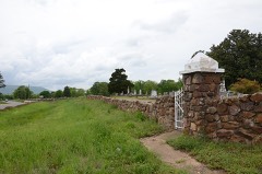
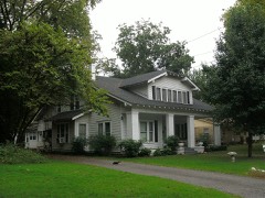
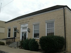
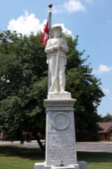
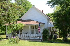
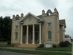
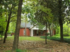
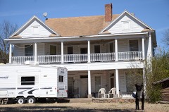
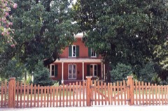
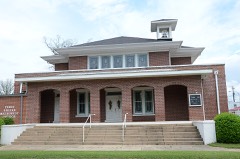
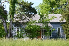
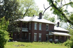
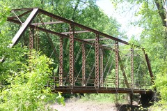
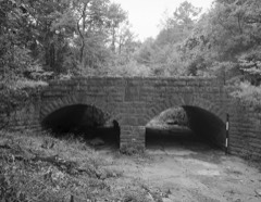
33 National Register listings published here.
Sources: the National Register database, National Park Service
94 topographic sheets cover 65 settlements here, and 33 properties are on the National Register of Historic Places.
33 National Register listings published here.
Sources: the National Register database, National Park Service
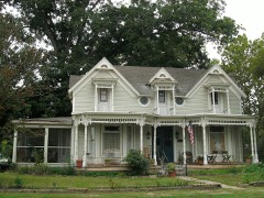
Every property in this county listed on the National Register of Historic Places, with the year it was listed and the federal nomination document.
Every wildfire the federal occurrence database records inside this county: 537 of them, burning about 12,411 acres. 80 started naturally and 142 were recorded as arson. Each settlement page carries the fires within five miles of it.
| Reported cause | Fires |
|---|---|
| Arson/incendiarism | 142 |
| Debris and open burning | 114 |
| Missing data/not specified/undetermined | 113 |
| Natural | 80 |
| Equipment and vehicle use | 47 |
| Smoking | 17 |
| Recreation and ceremony | 10 |
| Power generation/transmission/distribution | 7 |
| Misuse of fire by a minor | 5 |
| Fireworks | 1 |
| Railroad operations and maintenance | 1 |
The five largest, by the area the report gives. One of them was set deliberately.
| Date | Cause | Size | Reported by | Name on the report |
|---|---|---|---|---|
| 11 April 2007 | Natural | 4,000 acres | Ouachita National Forest | POTATO HILL |
| 25 July 2012 | Equipment and vehicle use | 1,014 acres | Arkansas Forestry Commission | OLA |
| 22 March 2018 | Arson/incendiarism | 816 acres | Ouachita National Forest | BOGUS RIDGE |
| 26 August 2000 | Natural | 489 acres | Arkansas Forestry Commission | not named |
| 22 July 2016 | Natural | 315 acres | Ouachita National Forest | SWEETWATER |
| 19 March 1994 | Smoking | 220 acres | Ouachita National Forest | BUCK RIDGE |
| 3 April 2019 | Recreation and ceremony | 185 acres | Ouachita National Forest | POTATO HILL |
| 15 October 2015 | Equipment and vehicle use | 144 acres | Arkansas Forestry Commission | not named |
Every settlement page carries the fires within five miles of it - see the settlement index below.
The NOAA Storm Events Database holds 599 reports for this county, causing 3 deaths, 14 injuries and about $11,809,200 in recorded property damage. Each settlement page carries the reports that name it.
| Kind of event | Reports |
|---|---|
| Thunderstorm Wind | 257 |
| Hail | 156 |
| Flood | 85 |
| Flash Flood | 47 |
| Tornado | 33 |
| Heavy Rain | 13 |
| Lightning | 4 |
| Funnel Cloud | 3 |
| Dust Devil | 1 |
The most serious of them, by death, then injury, then recorded damage. The accounts are quoted exactly as the forecast office filed them.
| When | Event | Place named | Harm | What the report says |
|---|---|---|---|---|
| April 2008 | Flood | Plainview | 2 killed, $10,000 | According to police reports, the driver of a small pick-up truck drove around barricades into a flooded portion of Arkansas Highway 28. The motorist continued through about 1/8 mile of flooded roadway until the water got so deep that the truck floated off the highway. The two occupants drowned. Water was reported to be so deep on the highway that only the tops of the guardrails were visible. The highway had been closed and barricaded for more than 24 hours when the fatalities occurred. |
| October 2014 | Lightning | Gilkey | 1 killed | A 33-year-old man was killed by lightning in a forested area. The man was sitting under a tree, when lightning traveled down the tree, striking the man. |
| March 1976 | Tornado (F3) | not stated | 4 hurt, $2,500,000 | no account filed |
| October 1951 | Tornado (F2) | not stated | 4 hurt | no account filed |
| July 2001 | Lightning | Dardanelle | 3 hurt | no account filed |
| May 2015 | Flash Flood | Sills | 2 hurt, $10,000 | A water rescue was completed of 4 people who were in a car that went off into a creek off on Southpoint Lane west of Dardanelle. Two individuals had minor injuries. |
| February 1998 | Lightning | Danville | 1 hurt | A man was outside finishing up some yard work when he was struck by lightning. The lightning bolt went into his right arm and went out his left hip. He was treated at a local hospital for his injuries and later released. |
| March 2008 | Flood | Waveland | $1,500,000 | Heavy rain caused the Petit Jean River at Danville to go above flood stage. Upstream, Blue Mountain Lake rose to record levels and several feet of water was flowing through the emergency spillway. Numerous county roads were flooded and Arkansas Highways 27 and 10 were affected. Pastures along the river and the Petit Jean Wildlife Management Area were inundated. |
| March 2008 | Flash Flood | Waveland | $1,000,000 | Arkansas Highway 307 north of Belleville was closed due to flooding. Damaged areas included Plainview and Rover, including Arkansas Highway 28. |
| March 2008 | Flood | Rover | $600,000 | Heavy rain caused the Fourche LaFave River at Gravelly to go above major flood level. Parts of Arkansas Highway 28 in multiple locations had to be closed because of high water. At least one person drove off into the floodwaters and lost the vehicle but not their life. Downstream, Lake Nimrod rose to its highest level ever with water more than 4.5 feet deep flowing through the emergency spillway. Some homes were isolated by floodwaters and livestock and infrastructure losses were also noted. |
| March 2008 | Flood | Sills | $600,000 | Heavy rain in eastern Oklahoma and western Arkansas caused the Arkansas River at Dardenelle to go above minor flood level. This was the fifth highest crest since completion of the McClellan-Kerr Arkansas River Navigation System. Damages were primarily losses to winter wheat and county roads. |
| May 2011 | Flood | Waveland | $500,000 | Some campsites at Waveland Park on Blue Mountain Lake were closed due to flooding. |
| May 2015 | Tornado (EF1) | Birta | $300,000 | Some trees and power lines were blown down, along with some damage to a home and out-buildings. Some chicken houses were damaged, one of which was destroyed. |
| June 2009 | Thunderstorm Wind | Sulphur Spgs | $250,000 | Trees and power lines were down across the area. About 15 houses were damaged by falling trees. |
| April 2008 | Thunderstorm Wind | Dardanelle | $250,000 | A barn was destroyed on Salem Road and Forrest Lane. Poultry houses were destroyed. |
| April 1980 | Tornado (F2) | not stated | $250,000 | no account filed |
| April 1980 | Tornado (F2) | not stated | $250,000 | no account filed |
| April 2017 | Tornado (EF0) | Chickalah | $200,000 | A supercell produced an EF0 tornado, which was on the ground for approximately 0.5 miles. Most resultant damage occurred in the form of downed trees. There were also 2 high voltage electric transmission towers that were heavily damaged by the tornado. |
| July 2014 | Thunderstorm Wind | Danville | $150,000 | Trees were blown down in Danville and numerous other locations in Yell County. One of the trees fell on a house in Danville. |
| July 2014 | Thunderstorm Wind | Ola | $150,000 | Trees were blown down in Ola. One tree caused minor damage to a house while another destroyed a mobile home. No one was injured. Elsewhere in Yell County, fallen trees blocked many county roads and knocked down power lines. |
| August 2011 | Thunderstorm Wind | Dardanelle | $150,000 | The roof was blown off the National Guard Armory. Water poured inside, collecting two inches deep on the floor. Numerous trees were blown down in Dardanelle. |
| November 2011 | Flash Flood | Stafford | $150,000 | Parts of Arkansas 27, 28, 80, 307, and 309 were flooded, as were numerous county roads. A National Weather Service storm survey indicated that virtually every creek had overflowed from Dardanelle through Danville to Rover and west to Gravelly. Many low-water crossing were flooded with at least 2 to 4 feet of water, as indicated by debris left in trees, brush, and fences. Young Gravelly Rd., just off Arkansas 28, had 6 to 7 feet of water across it at a low-water crossing. Arkansas 28 had some pavement washed away near Gravelly when the Fourche LaFave River overflowed onto the highway. |
| April 2008 | Flood | Whitehall | $150,000 | Moderate flooding at the Dardanelle stream gage on the Arkansas River occurred for two and a half days. The Arkansas River rose to 36.3 feet, the highest level since May, 1990, and primarily impacted the low land within the levee system. Damages were primarily to agricultural lands and some county roads. Most of the Holla Bend National Wildlife Refuge was also flooded with interior roads damaged. |
| June 2008 | Thunderstorm Wind | Havana | $150,000 | Numerous trees and some power lines were blown down. At least one tree fell on a house. |
| June 2008 | Thunderstorm Wind | Danville | $150,000 | Numerous trees and some power lines were blown down from the Danville area east to Mount George, and then on to Dale Bend and north of New Hope. The damage then continued farther east to Pullen Pond and on to near the intersection of the Yell County line with the Perry and Conway County lines. |
| April 2011 | Flood | Waveland | $125,000 | Widespread areal flooding occurred. |
| January 1998 | Flash Flood | Countywide | $108,000 | Heavy rains caused flash flooding in several parts of Yell County. Numerous low water bridges and roads sustained damage as a result of the heavy rains. |
| April 2011 | Thunderstorm Wind | Belleville | $100,000 | A mobile home was blown over and destroyed. Trees and power lines were blown down. Some houses were damaged. |
| June 2011 | Thunderstorm Wind | Danville | $100,000 | A very isolated storm became severe, causing damage in Danville. Trees and power lines were blown down at a number of locations in town. Six residences and one car were damaged, primarily due to falling trees. |
| April 2008 | Flash Flood | Ola | $100,000 | Several residents near Ola were evacuated due to rising waters from a nearby creek. Flood waters reached the interior of one residence and a church in Ola. Arkansas Highway 28 between Rover and Plainview was closed due to rising waters from Porter Creek. Arkansas Highway 28 was closed between Rover and Briggsville due to a culvert being washed out. County roads and secondary roads in Danville were flooded. |
| May 2013 | Flood | Gravelly | $75,000 | Very heavy rainfall on the evening of the 30th into the morning hours of the 31st caused the Fourche LaFave River near Gravelly to rise rapidly above flood stage during the morning hours on the 31st, reaching a record level of 32.6 feet about midday. This river remained above flood stage into the early morning hours on June 1st. |
| September 2013 | Thunderstorm Wind | Danville | $75,000 | Multiple trees were blown down between Danville and Belleville, one of which fell on Arkansas 10. In the Danville area, one home had roof damage and another had windows blown out, half the roof was blown off a shop, and a pavilion and shed lost their roofs. In Belleville, one home had roof damage. On Belleville Ridge Rd., an older barn and a cattle corral were blown down. |
| April 2011 | Tornado (EF1) | Chickalah | $75,000 | A tornado destroyed a mobile home and blew down numerous trees. |
| June 2009 | Thunderstorm Wind | Bluffton | $75,000 | Trees and power lines were down across the area. Two houses were damaged by falling trees. |
| April 2014 | Thunderstorm Wind | Marvinville | $70,000 | A shop building was badly damaged, a carport was destroyed, a mobile home and shed were blown off their foundations, two boats and their trailers were overturned, roofs were damaged, and trees, power lines, and a power pole were blown down just west of Havana. |
| May 2011 | Thunderstorm Wind | Belleville | $70,000 | Numerous trees and power lines were blown down. One of the trees fell on a car, trapping the occupant. |
| April 2020 | Thunderstorm Wind | Ranger | $50,000 | The Emergency Manager reported a roof was blown off of a poultry farm on Highway 154 north of Danville. |
| June 2013 | Flood | Birta | $50,000 | Heavy rain fell over the Fourche LaFave River and its tributaries on May 30th through June 1st, setting off a rapid rise on Nimrod Lake. By June 5th, the lake had risen 21 feet, flooding roads and campgrounds near the lake. Some of the campgrounds that were flooded included Sunlight Bay, Carter Cove, and County Line. After the 5th, the lake began a slow fall and it returned to its normal level on June 26th. |
| August 2011 | Thunderstorm Wind | Dardanelle | $50,000 | Many trees were blown down in Dardanelle. |
| April 2009 | Thunderstorm Wind | Danville | $50,000 | Trees were down across the area. |
| May 2009 | Thunderstorm Wind | Danville | $50,000 | Trees were blown down. |
| September 2009 | Thunderstorm Wind | Dardanelle | $50,000 | Trees were down in the city limits. Power outages occurred across the county. |
| April 2008 | Flood | Waveland | $50,000 | Record levels on Blue Mountain Lake with excessive spillway releases, when combined with heavy rainfall in the first week of April, produced moderate flooding on the Petit Jean River at Danville. County road flooding was the principal damage during the event. |
| September 2008 | Flash Flood | Dardanelle | $50,000 | One-half mile of Arkansas Highway 80 had approximately a foot of water over it. Arkansas Highway 28 was closed due to water over the road. |
| July 2007 | Thunderstorm Wind | Belleville | $50,000 | The local emergency manager reported telephone and power lines down from near Belleville to near Danville. Numerous trees were blown down, including one that blocked Arkansas Highway 307 North. Some barns and chicken houses had tin blown off their roofs. Shingles were removed from a roof near Danville. Damage was reported to an outbuilding. |
| June 1994 | Thunderstorm Wind | Waveland | $50,000 | Thunderstorm winds downed trees and power lines. |
| June 1994 | Thunderstorm Wind | Plainview | $50,000 | Some trees and power lines were blown down. |
| June 1994 | Thunderstorm Wind | Dardanelle | $50,000 | Thunderstorm winds knocked down some trees and power lines. |
| January 2013 | Flash Flood | Belleville | $40,000 | Arkansas 27 had many places under water. In the eastern part of Danville, five people had to be evacuated from a house and a motorist stranded in high water had to be rescued. |
| April 2014 | Thunderstorm Wind | Plainview | $30,000 | An old barn was destroyed, several houses had roof damage, a fence was blown down, and trees and power lines were blown down. |
| June 2012 | Thunderstorm Wind | Dardanelle | $30,000 | The metal roof of a restaurant was peeled off, with some of the metal ending up in power lines. Some trees were blown down in the area. |
| April 2014 | Thunderstorm Wind | Blue Mtn Lake | $25,000 | Trees and power lines were blown down and roofs were damaged. |
| July 2014 | Thunderstorm Wind | Ola | $25,000 | The roof of a chicken house was badly damaged near Ola. |
| July 2013 | Thunderstorm Wind | Ola | $25,000 | Part of a roof was torn off, and trees and power lines were blown down. |
| September 2012 | Thunderstorm Wind | Danville | $25,000 | Trees were blown down across the area. |
| November 2011 | Flood | Gravelly | $25,000 | Heavy rainfall caused the Fourche LaFave River near Gravelly to rise above flood stage during the early morning hours on the 22nd. This river reached over 29 feet before receding below flood stage during the evening hours on the same day. The crest of 29.38 feet reached during the afternoon of the 22nd was the 5th highest crest on record. |
| November 2011 | Flood | Danville | $25,000 | Heavy rainfall caused the Petit Jean River near Danville to rise above flood stage during the evening hours on the 21st. This river reached over 26 feet before receding below flood stage during the evening hours on the 24th. The crest of 26.66 feet reached during the evening hours of the 22nd was the 7th highest crest on record. |
| April 2011 | Tornado (EF1) | Gilkey | $25,000 | The tornado destroyed a barn and damaged two pieces of farming equipment. A number of trees were blown down. The damage path was entirely on private property, well away from any public roads. |
| June 2009 | Thunderstorm Wind | Plainview | $25,000 | Trees and power lines were blown down. |
| December 2009 | Flood | Mickles | $25,000 | Heavy rainfall on the 23rd and 24th caused the Petit Jean River near Danville to rise above flood stage on the afternoon on the 24th. The river remained above flood stage through midnight on the 27th. |
The Survey's mineral resources record lists 34 workings inside this county. 3 still produce and 31 are closed or unrecorded. Each settlement page carries the workings within five miles of it.
| Commodity | Workings |
|---|---|
| Sand and Gravel, Construction | 21 |
| Clay | 7 |
| Stone | 5 |
| Titanium | 1 |
The least common of them first, because a county's hundredth gravel pit says nothing its first ten did not.
| Where | Site | Commodity | Status | Recorded |
|---|---|---|---|---|
| Black Sands | Titanium | Past Producer | ||
| Unk | Stone | Past Producer | ||
| Unk | Stone | Past Producer | ||
| Unk | Stone | Past Producer | ||
| Unk | Stone | Past Producer | ||
| Unk Quarry | Stone | Past Producer | ||
| Unk | Clay | Past Producer | ||
| Unk | Clay | Past Producer | ||
| Unk | Clay | Past Producer | ||
| Unk | Clay | Past Producer | ||
| Unk | Clay | Past Producer | ||
| Unk | Clay | Past Producer | ||
| Unk | Clay | Past Producer | ||
| Buford Compton Gravel Pits | Sand and Gravel, Construction | Past Producer | ||
| Hunt Gravel Pit | Sand and Gravel, Construction | Producer | ||
| Roberson Const Co | Sand and Gravel, Construction | Past Producer | ||
| Russelville Concrete Pit & Plant | Sand and Gravel, Construction | Producer | ||
| Unk | Sand and Gravel, Construction | Past Producer | ||
| Unk | Sand and Gravel, Construction | Past Producer | ||
| Unk | Sand and Gravel, Construction | Past Producer | ||
| Unk | Sand and Gravel, Construction | Past Producer | ||
| Unk | Sand and Gravel, Construction | Past Producer | ||
| Unk | Sand and Gravel, Construction | Past Producer | ||
| Unk | Sand and Gravel, Construction | Past Producer | ||
| Unk | Sand and Gravel, Construction | Past Producer | ||
| Unk | Sand and Gravel, Construction | Past Producer | ||
| Unk | Sand and Gravel, Construction | Past Producer | ||
| Unk | Sand and Gravel, Construction | Past Producer | ||
| Unk | Sand and Gravel, Construction | Past Producer | ||
| Unk | Sand and Gravel, Construction | Past Producer | ||
| Unk Gravel Pits 2 | Sand and Gravel, Construction | Past Producer | ||
| Unk Gravel Pits 2 | Sand and Gravel, Construction | Past Producer | ||
| Unk Gravel Pits 2 | Sand and Gravel, Construction | Past Producer | ||
| Warren Brothers Sand & Gravel | Sand and Gravel, Construction | Producer |
Named settlements recorded in the Geographic Names Information System, each with the topographic sheets covering it. Villages, hamlets and abandoned places alike. Each is shown with the nearest named watercourse or landform and the survey quadrangle it falls on.
Magazine township · 72833 · On Jake Creek · Danville Mountain quadrangle
17 sheets, 1888 to 1992
Briggsville township · 72828 · On McClain Branch · Rover quadrangle
13 sheets, 1890 to 1982
Galla Rock township · 72834 · Near Carden Bottom · Holla Bend quadrangle
19 sheets, 1888 to 1993
Dutch Creek township · 72833 · On Kitchen Branch · Bluffton quadrangle
16 sheets, 1890 to 1985
Magazine township · 72833 · On Little Chickalah Creek · Chickalah Mountain East quadrangle
18 sheets, 1888 to 1992
Ions Creek township · 72857 · On Glover Creek · Chula Mountain quadrangle
16 sheets, 1890 to 1986
Dardanelle township · 72834 · On Bryant Branch · Dardanelle quadrangle
21 sheets, 1888 to 1993
Herring township · 72833 · On Moss Creek · Havana quadrangle
18 sheets, 1879 to 1992
No longer a settlement
Dardanelle township · 72834 · On Harris Creek · Dardanelle quadrangle
21 sheets, 1888 to 1993
Briggsville township · 72828 · On Gault Branch · Bluffton quadrangle
16 sheets, 1890 to 1985
Galla Rock township · 72834 · Near Carden Bottom · Holla Bend quadrangle
19 sheets, 1888 to 1993
Gravelly Hill township · 72838 · On Jennings Creek · Gravelly quadrangle
16 sheets, 1890 to 1985
Mountain township · 72824 · Near Chickalah Mountain · Chickalah Mountain West quadrangle
18 sheets, 1888 to 1992
Mountain township · 72824 · Near Jim White Ridge · Chickalah Mountain West quadrangle
18 sheets, 1888 to 1992
Prairie township · 72833 · On Cape Slough · Danville Mountain quadrangle
17 sheets, 1888 to 1992
Danville township · 72833 · On Chickalah Creek · Danville Mountain quadrangle
17 sheets, 1888 to 1992
Ferguson township · 72824 · On Dry Branch · Danville quadrangle
17 sheets, 1888 to 1992
No longer a settlement
Magazine township · 72834 · Near Mc Cray Ridge · Chickalah Mountain East quadrangle
18 sheets, 1888 to 1992
Magazine township · 72833 · On Choate George Branch · Ola quadrangle
18 sheets, 1888 to 1992
Dardanelle township · 72834 · On Mount Nebo · Chickalah Mountain East quadrangle
18 sheets, 1888 to 1992
Dardanelle township · 72834 · Near Jones Mountain · Dardanelle quadrangle
21 sheets, 1888 to 1993
Briggsville township · 72827 · On Poda Branch · Bluffton quadrangle
16 sheets, 1890 to 1985
Dardanelle township · 72834 · On Pole Pin Creek · Dardanelle quadrangle
21 sheets, 1888 to 1993
Waveland township · 72943 · Near Potts Ridge · Blue Mountain Dam quadrangle
20 sheets, 1879 to 1992
Ferguson township · 72833 · On Riley Creek · Danville quadrangle
17 sheets, 1888 to 1992
No longer a settlement
Dardanelle township · 72834 · Near Wildcat Hollow · Delaware quadrangle
19 sheets, 1888 to 1993
Richland township · 72842 · Blue Mountain Dam quadrangle
20 sheets, 1879 to 1992
No longer a settlement
Mountain township · 72824 · On White Creek · Chickalah Mountain West quadrangle
18 sheets, 1888 to 1992
Sulphur Springs township · 72834 · Near Harkey Valley · Chickalah Mountain East quadrangle
18 sheets, 1888 to 1992
Dutch Creek township · 72833 · On Mitchell Branch · Bluffton quadrangle
16 sheets, 1890 to 1985
Waveland township · 72842 · On Smallwood Creek · Blue Mountain Dam quadrangle
20 sheets, 1879 to 1992
Galla Rock township · 72834 · Near Carden Bottom · Atkins quadrangle
18 sheets, 1889 to 1992
Gravelly Hill township · 72838 · On Cudd Creek · Gravelly quadrangle
16 sheets, 1890 to 1985
The vanished settlements of Yell County: the places named above that are no longer on the map.