 Block
Bingen, Arkansas
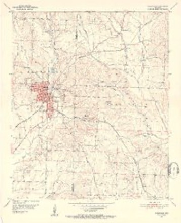
14 topographic sheets cover this place, the earliest surveyed in 1951 and the latest in 1989. It stands in Mine Creek Township. It lies in ZIP code area 71852. It stands on Cary Creek. The Survey maps it on the Nashville quadrangle.
Topographic sheets covering this place
7 surveys from 14 printed sheetsMatched by testing this settlement's coordinate against the published boundary of every sheet in the United States Geological Survey's historical collection. Each opens the scanned sheet at the Survey.
- 1951 USGS Nashville quadrangle1:24000, 3 printings
- 1953 USGS El Dorado quadrangle1:250000, 3 printings
- 1957 USGS El Dorado quadrangle1:250000
- 1958 USGS El Dorado quadrangle1:250000, 3 printings
- 1960 USGS El Dorado quadrangle1:250000
- 1986 USGS Hope quadrangle1:100000, 2 printings
- 1989 USGS El Dorado quadrangle1:250000
Fires near this place
41 since 1997Regional context, not property-specific evidence. The federal wildfire occurrence database lists 41 fires within 5 miles of Bingen between 1997 and 2020, burning about 752 acres in total. 8 started naturally. 11 were recorded as arson. Distance is straight-line from the map coordinates, so a fire counted here may appear on a neighbouring settlement's page as well.
| Reported cause | Fires |
|---|---|
| Arson/incendiarism | 11 |
| Missing data/not specified/undetermined | 9 |
| Debris and open burning | 9 |
| Natural | 8 |
| Equipment and vehicle use | 3 |
| Smoking | 1 |
The most recent of them, most recent first, with the day each was reported and the service that recorded it.
| Date | Cause | Size | Reported by | Name on the report |
|---|---|---|---|---|
| 22 September 2000 | Equipment and vehicle use | 50 acres | Arkansas Forestry Commission | not named |
| 20 September 2000 | Smoking | 20 acres | Arkansas Forestry Commission | not named |
| 20 September 2000 | Equipment and vehicle use | 1.0 acres | Arkansas Forestry Commission | not named |
| 19 September 2011 | Natural | 1.0 acres | Arkansas Forestry Commission | not named |
| 3 August 2020 | Missing data/not specified/undetermined | 2.0 acres | Arkansas Forestry Commission | not named |
| 25 August 1999 | Natural | 1.0 acres | Arkansas Forestry Commission | not named |
| 23 August 1999 | Arson/incendiarism | 80 acres | Arkansas Forestry Commission | not named |
| 22 August 2002 | Debris and open burning | 6.0 acres | Arkansas Forestry Commission | not named |
Settlements close enough to share some of these fires:
Mines and quarries near this place
10 of 21 shownRegional context, not property-specific evidence. The federal mineral resources record lists 21 workings within 5 miles of Bingen: 12 unknowns, 7 past producers, 2 producers. 2 still produce. What was taken out: Sand and Gravel, Construction, Gypsum-Anhydrite, Iron, Clay. Distance is straight-line from the map coordinates, so a quarry counted here may appear on a neighbouring settlement's page as well.
| Where | Site | Commodity | Status | Recorded |
|---|---|---|---|---|
| No Name | Clay | Past Producer | ||
| Roy Leslie Farm | Iron | Past Producer | ||
| Arkansas Gypsum Company | Gypsum-Anhydrite | Producer | ||
| F S Neely Co Mine | Gypsum-Anhydrite | Unknown | ||
| Highland Mine | Gypsum-Anhydrite | Unknown | ||
| Unknown Mine | Gypsum-Anhydrite | Unknown | ||
| Bingen | Sand and Gravel, Construction | Past Producer | ||
| Bobby Smith Sand & Gravel | Sand and Gravel, Construction | Unknown | ||
| Gravel Pit | Sand and Gravel, Construction | Unknown | ||
| Gravel Pit | Sand and Gravel, Construction | Unknown |
Storms near this place
14 since 2006Regional context, not property-specific evidence. The National Weather Service names Bingen in 14 storm reports between 2006 and 2023: 6 thunderstorm wind, 4 hail, 3 flash flood, 1 tornado. No death or injury is recorded in these reports. Each account below is quoted exactly as the forecast office filed it, from the NOAA Storm Events Database, and each date opens the federal record of that event.
| When | Event | Place named | Harm | What the report says |
|---|---|---|---|---|
| July 2009 | Thunderstorm Wind | Bingen | $40,000 | Numerous trees were snapped in a forested area south of US 371 with trees facing northeast closer to the intersection of US 371 and Hempstead 290. Trees were snapped along Hempstead 347 near US 371 and facing northwest. A large oak tree fell on a home along Hempstead 347 punching a large hole in the southwest corner of the home. Further northwest, several pieces of tin were peeled from a chicken house |along Hempstead 348. South of US 371 and west of the downburst centerpoint,|an old pickup truck was picked up and thrown approximately 75 yards due west over a fence. Maximum envelope of wind damage was 1.25 miles. |
| May 2010 | Thunderstorm Wind | Bingen | $10,000 | Numerous trees were downed along CR 27N and along 352 north of Bingen, Arkansas. A roof was also blown off a chicken coop near Bingen. |
| April 2011 | Thunderstorm Wind | Bingen | $5,000 | The National Weather Service conducted a storm survey in the northern part of Hempstead County and determined that the damage was consistent with severe thunderstorm wind gusts near 80 mph. Damage was very sporadic and a tornado track could not be found. Damage consisted of several scattered trees uprooted and/or snapped near the community of Bingen. There were also several trees downed across the northern third of the county associated with a large bow echo and straight line wind gusts. |
| May 2010 | Thunderstorm Wind | Bingen | $5,000 | Trees were downed and some structural damage was reported along CR 352 north northeast of Nashville, Arkansas. |
| July 2009 | Tornado (EF0) | Bingen | $5,000 | Several trees were snapped along a fence line east of Hempstead 27 near some chicken houses. A nearby wellhouse was partially knocked over and the walls of a metal shop were thurst outward at the northeast corner. Numerous trees were uprooted and snapped approximately 0.75 miles east along Hempstead 348 and further east in a heavily wooded area. |
| March 2023 | Thunderstorm Wind | Bingen | - | Trees downed near the intersection of Highway 27 South and County Road 351. |
| April 2020 | Thunderstorm Wind | Bingen | - | Numerous trees were uprooted onto several homes and vehicles along Hempstead 34 Road just north of Highway 27 along the Howard/Hempstead County line. |
| July 2019 | Flash Flood | Bingen | - | Significant flooding was reported by the Arkansas State Police all along Highway 371 between Nashville and Prescott. |
| July 2019 | Flash Flood | Bingen | - | Numerous county roads throughout Northern Hempstead County were underwater and closed. |
| September 2017 | Hail | Bingen | - | Quarter size hail fell in the Bingen community. |
| July 2015 | Flash Flood | Bingen | - | Numerous roads were flooded, closed and/or washed out across the northern half of Hempstead County from excessive heavy rainfall. Nearly a foot of rain fell across the northern half of Hempstead County affecting the following highways: 2, 8, 16, 18, 23, 24, 30, 38, 39, 45, 47, 51, 254, 256, 258, 280, 332 and 333. |
| May 2010 | Hail | Bingen | - | Hail was reported in the town of Bingen, Arkansas. Large tree limbs were also downed. |
| November 2010 | Hail | Bingen | - | no account filed |
| June 2006 | Hail | Bingen | - | no account filed |
Nearest settlements
The eight closest, with where each one stands in the county. Distances are straight-line, computed from the Geographic Names Information System coordinates.
| Map | Place | Distance | Sheets |
|---|---|---|---|
| North Bingen | 0.9 miles | 14 | |
| Doyle | 2.2 miles | 14 | |
| Tokio | 2.6 miles | 12 | |
| Compton (historical) | 3.5 miles | 14 | |
| Belton (historical) | 4.9 miles | 14 | |
| Bellair | 5.2 miles | 14 | |
| Clow | 6.0 miles | 14 | |
| Westbrook (historical) | 8.0 miles | 14 |
Provenance
This settlement is recorded in the Geographic Names Information System as feature 57380. The sheet list is computed by point-in-boundary test against the United States Geological Survey's historical topographic inventory. Both are works of the United States government and carry no copyright under 17 U.S.C. 105.
Wildfire. Short, Karen C. 2022. Spatial wildfire occurrence data for the United States, 1992-2020 [FPA_FOD_20221014]. 6th Edition. Fort Collins, CO: Forest Service Research Data Archive. https://doi.org/10.2737/RDS-2013-0009.6 Collected with United States Government funding and usable without additional permissions or fees.
Mines and quarries. USGS Mineral Resources Data System (MRDS) https://mrdata.usgs.gov/mrds/ A work of the United States government, no copyright under 17 U.S.C. 105.
Storms. NOAA National Centers for Environmental Information, Storm Events Database https://www.ncei.noaa.gov/stormevents/ A work of the United States government, no copyright under 17 U.S.C. 105. Narratives are quoted verbatim from the National Weather Service report and are not edited or summarised.