Block
From the record
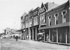
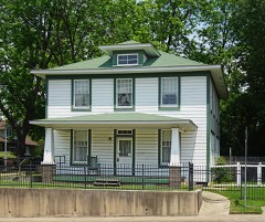
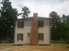
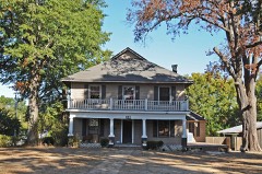
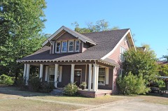
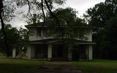
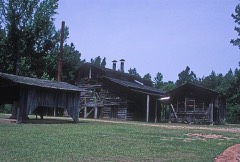
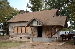
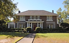
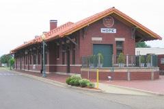
29 National Register listings published here, 1 of them a National Historic Landmark.
Sources: the National Register database, National Park Service
80 topographic sheets cover 68 settlements here, and 29 properties are on the National Register of Historic Places.
29 National Register listings published here, 1 of them a National Historic Landmark.
Sources: the National Register database, National Park Service
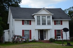
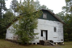
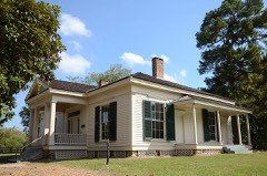
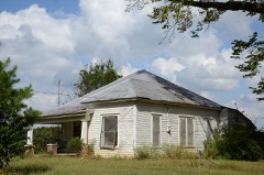
Every property in this county listed on the National Register of Historic Places, with the year it was listed and the federal nomination document.
Every wildfire the federal occurrence database records inside this county: 541 of them, burning about 5,622 acres. 40 started naturally and 186 were recorded as arson. Each settlement page carries the fires within five miles of it.
| Reported cause | Fires |
|---|---|
| Arson/incendiarism | 186 |
| Debris and open burning | 125 |
| Missing data/not specified/undetermined | 124 |
| Natural | 40 |
| Equipment and vehicle use | 31 |
| Railroad operations and maintenance | 24 |
| Misuse of fire by a minor | 6 |
| Smoking | 5 |
The five largest, by the area the report gives. Four of them were set deliberately.
| Date | Cause | Size | Reported by | Name on the report |
|---|---|---|---|---|
| 3 August 2011 | Arson/incendiarism | 176 acres | Arkansas Forestry Commission | PATMOS |
| 26 July 2008 | Natural | 155 acres | Arkansas Forestry Commission | MCCASKILL |
| 18 July 1998 | Arson/incendiarism | 110 acres | Arkansas Forestry Commission | not named |
| 20 July 1998 | Missing data/not specified/undetermined | 86 acres | Arkansas Forestry Commission | not named |
| 31 July 2010 | Natural | 85 acres | Arkansas Forestry Commission | not named |
| 5 October 2002 | Arson/incendiarism | 80 acres | Arkansas Forestry Commission | not named |
| 23 August 1999 | Arson/incendiarism | 80 acres | Arkansas Forestry Commission | not named |
| 9 September 1998 | Debris and open burning | 79 acres | Arkansas Forestry Commission | not named |
Every settlement page carries the fires within five miles of it - see the settlement index below.
The NOAA Storm Events Database holds 556 reports for this county, causing 6 deaths, 22 injuries and about $18,179,750 in recorded property damage. Each settlement page carries the reports that name it.
| Kind of event | Reports |
|---|---|
| Thunderstorm Wind | 246 |
| Hail | 198 |
| Flash Flood | 67 |
| Tornado | 36 |
| Lightning | 4 |
| Funnel Cloud | 2 |
| Flood | 2 |
| Heavy Rain | 1 |
The most serious of them, by death, then injury, then recorded damage. The accounts are quoted exactly as the forecast office filed them.
| When | Event | Place named | Harm | What the report says |
|---|---|---|---|---|
| April 1982 | Tornado (F3) | not stated | 5 killed, 4 hurt, $2,500,000 | no account filed |
| June 1987 | Thunderstorm Wind | not stated | 1 killed | no account filed |
| May 1971 | Tornado (F3) | not stated | 3 hurt, $250,000 | no account filed |
| March 2025 | Tornado (EF1) | Center Pt | 2 hurt, $500,000 | An EF1 tornado with estimated maximum winds near 100 mph touched down late in the evening on March 14th, 2025, along County Road 5 near the intersection of County Road 160 and County Road 161 West. Large branches on trees were snapped, along with a few uprooted trees in this area. The tornado then moved slightly northeast, passing just north of County Road 161 West before then crossing Highway 29 South where the tornado continued to produce tree damage along with structural damage to several residences, mainly damage to roofing. As the tornado continued east, it damaged more structures, with a home experiencing roof damage, along with a camper and cattle trailer thrown approximately 100 yards from their original positions. Extensive tree damage was visible to the east from the backyard of the residence, indicating that the tornado continued in this direction, heading toward County Road 150. Off of County Road 150, a mobile home was completely destroyed, injuring the two residents inside. The roof and walls of the mobile home were separated from the undercarriage and moved from the original position. The tornado continued its path to the east northeast, crossing Little Bodcaw Creek before damaging the roof of another residence off of County Road 57. The tornado would persist for another several miles, mainly uprooting trees and snapping branches as it passed near the intersection of County Road 8 and County Road 3, then County Road 134 and County Road 52. The tornado then finally lifted as it approached Highway 32. |
| April 2011 | Tornado (EF2) | Dunlap | 2 hurt, $500,000 | The National Weather Service conducted a storm survey in northern Hempstead County Arkansas and concluded that storm damage was the result of an EF2 tornado. The tornado touched down at around 8:40 AM east of the town of Blevins near a chicken farm. Four large chicken houses were completely destroyed and hundreds of chickens killed. A small trailer on the south side of the chicken houses used as an office for the farm was picked up and thrown 20 yards north into one of the chicken houses. The occupant inside the trailer sustained minor injuries. Another worker on the farm also sustained minor injuries. Metal debris was found up to 3 miles east from the farm. The tornado continued east crossing CR 45. Numerous trees were snapped along a treeline south of hwy 371 as the tornado paralleled the hwy. The tornado lifted near CR 17 in Nevada County Maximum winds are estimated at 115-120 mph. |
| June 2004 | Thunderstorm Wind | Hope | 2 hurt, $300,000 | Trees downed all around the community of Perrytown, Arkansas. Many trees on homes in the community. One tree fell across a car injuring two people. |
| June 2004 | Thunderstorm Wind | Hope | 2 hurt, $60,000 | Three 18-wheeler trucks turned over on I-30 due to the high winds. 2 minor injuries reported. |
| May 1978 | Tornado (F1) | not stated | 2 hurt, $25,000 | no account filed |
| December 1982 | Tornado (F1) | not stated | 1 hurt, $250,000 | no account filed |
| July 1994 | Thunderstorm Wind | Hope | 1 hurt, $50,000 | Thunderstorm winds blew a tree onto a house. A person inside the house where the tree fell, received minor injuries. |
| July 2011 | Thunderstorm Wind | Hope | 1 hurt, $15,000 | Trees and powerlines were downed on North Pine Street and a large tree was down at the intersection of Edgewood and Third Streets. One of the trees was blown onto a pickup truck. The tree crushed the cab, injuring a passenger. |
| April 1979 | Tornado (F1) | not stated | 1 hurt, $2,500 | no account filed |
| May 1986 | Thunderstorm Wind | not stated | 1 hurt | no account filed |
| April 1982 | Tornado (F3) | not stated | $2,500,000 | no account filed |
| April 1982 | Tornado (F4) | not stated | $2,500,000 | no account filed |
| April 1982 | Tornado (F3) | not stated | $2,500,000 | no account filed |
| March 1997 | Tornado (F2) | Hope | $1,000,000 | no account filed |
| June 2015 | Flood | Fulton | $770,000 | Excessive heavy rainfall during the month of May resulted in very high water on the Red River bordering Little River, Hempstead, Miller and Lafayette Counties in Southwest Arkansas as well as Bowie County in Northeast Texas during the entire month of June. Rainfall amounts during the month of May across the Upper and Middle Red River basins of Southern Oklahoma and Northern Texas totaled over 20 inches of rain. The Oklahoma state climatologist reported that May of 2015 was the all time wettest month of any month in state history. Lake Texhoma, a flood control reservoir to the Red River upstream of Arthur City, Texas rose to its highest pool stage on record early on June 1st at 645.66 feet with peak releases of around 140,000 CFS. The Muddy Boggy Creek tributary to the Red River rose to near its flood of record cresting near 55 feet earlier on May 29th with inflows upwards of 70,000 CFS into the Red River. Muddy Boggy Creek crested just shy of the 1990 flood of record with 55.27 feet near Unger, Oklahoma. Other tributaries of the Red River also crested at very high levels during the final week of May and early in June, 2015 below Lake Texhoma including Bois D'Arc and Bokchito Creeks. Finally the Kiamichi River at Hugo Reservoir crested just below a new pool stage record after May 25th and contributed peak releases of near 60,000 CFS as well to the Red River. This excessive heavy rainfall and inflow into the Red River resulted in river levels that eclipsed the flood of May of 1990 at Pecan Point and was just shy of the Red River flood of May of 1908 at Pecan Point. The Red River at Pecan Point north of Dekalb, Texas went above the 24 foot flood stage on May 10th, 2015 and remained above that flood stage through the entire month of June and did not fall below flood stage until until July, 2015. The Red River at Pecan Point north of Dekalb, Texas went above the 30 foot major flood stage on May 24th, 2015 and crested at a stage of 35.0 feet on June 2nd, 2015. This is the 3rd highest crest in recorded history at the gauging location, eclipsed only by the flood of record of 36.0 feet in 1938 and 35.5 feet in 1908. The river fell below the 30 foot major flood stage on June 10th. A secondary rise on the Red River developed because of excessive heavy rainfall once again in the middle Red River Basin from the remnants of Tropical Storm Bill. As a result, the Red River at Pecan Point north of Dekalb, Texas went back above the 30 foot major flood stage on June 22nd and crested at a stage of 32.5 feet on June 24th. The Red River then fell below the 30 foot major flood stage on June 28th. Below Pecan Point north of Dekalb, Texas, the Red River at Index, Arkansas crested at 31.4 feet on June 3rd. This was the 3rd highest flood at Index, Arkansas in recorded history at the gauging location, eclipsed only by the flood of record of 34.4 feet in 1938 and 32.3 feet in 1990. The river fell below the 28 foot major flood stage on June 8th. A secondary rise on the Red River developed because of excessive heavy rainfall once again in the middle Red River Basin from the remnants of Tropical Storm Bill. As a result, the Red River at Index, Arkansas crested again at 26.6 feet on June 27th and fell below the 25 foot flood stage on June 29th. Below Index, Arkansas, the Red River at Fulton, Arkansas crested at 32.12 feet on June 5th. This was the 11th highest flood at Fulton, Arkansas in recorded history at the gauging location with the record crest of 37.40 having occurred in 1945. The river fell below the 27 foot flood stage on June 10th. A secondary rise on the Red River developed because of excessive heavy rainfall once again in the middle Red River Basin from the remnants of Tropical Storm Bill. As a result, the Red River at Fulton, Arkansas crested again at 25.1 feet on June 27th which was nearly two feet short of the 27 foot flood stage at Fulton, Arkansas. Bank erosion was extreme on the Hempstead County side of the Red River with hundreds of acres of farmland and pastureland inundated. Cattle had to be relocated. Only one home suffered flood damage but Hempstead County loses mainly from roads, levees and pumps totaled $770,000. The United States Highway 259 bridge, Hwy 8 bridge and the Hwy. 71 bridge going over the Red River were closed. |
| June 1994 | Thunderstorm Wind | Blevins | $500,000 | Thunderstorm winds downed numerous trees and turned over a mobile home. |
| April 2025 | Tornado (EF2) | Sprudel | $400,000 | An EF-2 tornado with estimated maximum winds near 115 mph touched down just north of Interstate 30 along Hempstead 2, and remained on the ground tracking east-northeast just north of I-30 to near Hope. The tornado was strongest on Hempstead 2 where widespread major tree damage yielded a peak wind speed of 115 mph. Tree damage remained significant through the Highway 15 and Hempstead 2 intersection and the maximum width was estimated to have been achieved near this latter intersection. After this intersection, the tornado began gradually weakening and decreasing in size, with the last trace of contact with the ground being minor tree damage on North Hazel Street on the north side of Hope. Along the tornado's path, the majority of the damage was to hardwood and softwood trees, although some structures were damaged. Most of the structure damage was to outbuildings and carports, including the Hope Volunteer Fire Department. There was at least one recreational vehicle rolled with a mobile home pushed off of its foundation. Fortunately, no injuries or fatalities were reported from this tornado. |
| December 2018 | Tornado (EF1) | Spring Hill | $300,000 | An EF-1 tornado with maximum estimated winds near 107 mph touched down along County Road 1041 about one mile northwest of the Spring Hill community. Tree limbs were downed and a trunk was snapped off of a tree. More concentrated damage was found on County Road 174, where a barn's tin metal roof was completely removed, windows were blown out of two homes, shingles removed from roofs, trees fallen onto several homes, a shed was shifted off of its foundation, and a carport was destroyed. In addition, approximately 15 trees were either uprooted or snapped at their trunk. As the tornado continued northeast across Highway 29, it ripped the tin metal roof off of a heavy machinery shelter and led to the column anchorage failure of the structure. The metal roof was thrown and twisted into a tree behind it. The tornado continued to uproot and snap trees as it crossed Country Club Drive, East 28th Street, and Highway 32 before lifting along Highway 278 just southeast of Hope. |
| April 2011 | Tornado (EF1) | Hope | $300,000 | The National Weather Service conducted a storm survey in Hempstead County Arkansas and found evidence of an EF1 tornado north of Hope. The tornado first touched down along CR 248 where 9 out of 10 chicken houses lost their roofsseveral trees were snapped and an tractor trailer was flipped over. The tornado continued north east crossing CR 211 where several trees were snapped or uprooted and metal roofing was peeled from a barn. Maximum winds are estimated at 85-95 mph. |
| October 2009 | Flash Flood | Ozan | $250,000 | Numerous county roads were underwater and closed, including County Roads 2, 3, 5, 8, 9, 54, 333, 57, 198, 118 west, 50, 56, 189, 205, 254, 246, 243 and at Allen's Ferry Landing. Many of these roads were washed out. |
| May 1998 | Flash Flood | Hope | $250,000 | A family was trapped in their trailer off Hwy 27 when flood waters overturned their trailer. Several highways were closed and/or washed out including Hwy 4, Hwy 29, and Interstate 30. High water over 355 overturned an 18-wheeler. |
| December 1967 | Tornado (F2) | not stated | $250,000 | no account filed |
| April 1954 | Tornado (F3) | not stated | $250,000 | no account filed |
| May 2015 | Thunderstorm Wind | Camp Spg | $200,000 | An NWS Storm Survey determined that damage was consistent with that of straight line wind gusts. Damage consisted with numerous trees snapped and/or uprooted from near Millwood Lake to near the community of Saratoga. Some structures also suffered damage mostly from fallen trees. |
| May 1996 | Thunderstorm Wind | Columbus | $200,000 | no account filed |
| December 2009 | Flash Flood | De Ann | $135,000 | Flooding was reported at the intersection of County Road 332 and County Road 209. Flash flooding also resulted in road closures on 32 from Hope to Bodcaw and on 195 from Fulton to Liberty, Arkansas. Highway 73 west of Gurnsey was also closed due to high water on the roadway. Flooding was also widespread across the county with infrastructure damage resulting in Hempstead County receiving Federal assistance. |
| April 2014 | Thunderstorm Wind | Rocky Mound | $125,000 | Six homes were damaged with multiple trees downed in Perrytown. Additional trees were downed across the entire county. |
| June 2004 | Thunderstorm Wind | Hope | $100,000 | Numerous trees downed all throughout the county. Some trees on homes in town and several chicken houses destroyed. |
| July 1997 | Thunderstorm Wind | Hope | $100,000 | Numerous trees were uprooted and snapped across the southeast portions of town. Four vehicles were crushed and several homes were damaged in the Plainview and Gunter subdivisions. Trees were also uprooted on CR50, 116, 117, 132 and Hwy 4. A moving truck was also struck by a fallen tree but no injuries resulted. |
| November 1997 | Tornado (F1) | Ozan | $70,000 | OES chased a funnel cloud from just southeast of Alpine, southeastward across extreme eastern Howard County into Hempstead County. The funnel lowered throughout the chase until it touched down and was classified as a tornado 5.5 miles south of Nashville, AR. Damage initially consisted of broken and felled trees. The tornado then moved over cleared pastureland and intensified on CR318 between Hwy 4 and CR 44; totally destroying several chicken coups...leaving the chickens untouched...felling a tree onto a car, and slightly damaging a house. The tornado then began to weaken and rapidly dissipated. Skywarn spotters living in the area, the Hempstead County Judge and OES were eyewitnesses to the event. |
| March 2007 | Tornado (EF0) | Patmos | $60,000 | This was a continuation of the tornado which first touched down in northern Lafayette County. Damage consisted of several trees uprooted and damage to a chicken house. Damage occurred on Hwy 355 about 1 mile east of Hwy 29. A porch was torn off one brick home and one home suffered shingle damage. An 18-wheeler and a cattle trailer was overturned as well. The tornado was rated an EF0 on the Enhanced Fujita Scale. Damage Indicator (DI): Small barns and outbuildings. Degree of Damage (DOD): Loss of wood or metal roofs. |
| May 2024 | Lightning | Deaneyville | $50,000 | Nineteen head of cattle were killed when lightning struck a nearby tree just off of Highway 371 several miles east of Blevins near the Nevada County line. |
| July 1994 | Thunderstorm Wind | Mt. Zion | $50,000 | Numerous trees were blown down. |
| June 1994 | Thunderstorm Wind | Sheppard | $50,000 | Thunderstorm winds damaged several chicken houses. |
| April 1994 | Thunderstorm Wind | Clow | $50,000 | Thunderstorm winds damaged a barn and blew down several trees. |
| June 1994 | Thunderstorm Wind | Hope | $50,000 | Thunderstorm winds damaged several chicken houses. |
| June 1994 | Thunderstorm Wind | Hope | $50,000 | Several trees and power lines were blown down. |
| June 1994 | Thunderstorm Wind | Silver Springs | $50,000 | Thunderstorm winds downed some trees and power lines. |
| June 1994 | Thunderstorm Wind | Hope | $50,000 | Thunderstorm winds damaged several barn roofs. |
| October 1993 | Thunderstorm Wind | Hope | $50,000 | A chicken barn was damaged by thunderstorm winds. |
| January 1993 | Thunderstorm Wind | Blevins | $50,000 | Thunderstorm winds blew down numerous trees. |
| May 1993 | Thunderstorm Wind | Spring Hill | $50,000 | Numerous trees were blown down. |
| July 2009 | Thunderstorm Wind | Bingen | $40,000 | Numerous trees were snapped in a forested area south of US 371 with trees facing northeast closer to the intersection of US 371 and Hempstead 290. Trees were snapped along Hempstead 347 near US 371 and facing northwest. A large oak tree fell on a home along Hempstead 347 punching a large hole in the southwest corner of the home. Further northwest, several pieces of tin were peeled from a chicken house |along Hempstead 348. South of US 371 and west of the downburst centerpoint,|an old pickup truck was picked up and thrown approximately 75 yards due west over a fence. Maximum envelope of wind damage was 1.25 miles. |
| May 2010 | Thunderstorm Wind | Blevins | $30,000 | A large tree fell on a home and penetrated the roof in downtown Blevins, Arkansas. Multiple windows were broked and the front glass door was ripped off the hinges. |
| January 1999 | Tornado (F2) | Washington | $30,000 | Large trees uprooted and pushed over. Several large trees fell on homes and residences in Washington. Some structural and roof damage occurred to several homes and businesses. Otherwise this tornado traversed mostly unpopulated wooded regions. |
| May 2015 | Thunderstorm Wind | Fulton | $25,000 | A tree fell on a home near Hwy. 67 in west Fulton, Arkansas. There were no report of injuries. |
| April 2011 | Thunderstorm Wind | Rocky Mound | $25,000 | A downburst occurred northeast of where the tornado track ended along cr 53. Numerous trees were snapped and uprooted blocking the road. A small pen was damaged east of cr 53. All of the trees in this area were pointing outward away from where the downburst occurred approximately 200 yards west of cr 53. Maximum winds are estimated at 95-105 mph. |
| April 2000 | Tornado (F0) | De Ann | $22,000 | Mainly trees down. Two homes damaged from fallen trees. One "open air" barn lost some siding and roofing material. |
| January 2012 | Thunderstorm Wind | Ozan | $20,000 | Report of two damaged chicken houses on CR 1310 between Ozan and Nashville, Arkansas. |
| August 2012 | Thunderstorm Wind | Anthony | $20,000 | A large oak tree fell on the front side of a home south of Hope, Arkansas. There were no reports of injuries. |
| July 2010 | Lightning | Ozan | $20,000 | A strong thunderstorm developed over a pasture and lightning struck a tree with a herd of cattle standing underneath the tree. Approximately a dozen cows were killed. |
| March 2006 | Thunderstorm Wind | Mc Caskill | $20,000 | Storage buildings and car ports damaged. |
| April 1999 | Thunderstorm Wind | De Ann | $20,000 | Several large trees and powerlines toppled. One tree fell on a home while another tree fell across an automobile. |
| December 2003 | Thunderstorm Wind | Hope | $20,000 | no account filed |
| December 2015 | Tornado (EF1) | New Hope | $15,000 | An NWS Storm Survey team concluded that damage near the Patmos community was consistent with that of EF-1 tornado damage. This tornado partially lifted the roof off a mobile home along AR 355. The tornado continued north and snapped several trees before lifting along Hempstead County Road 9. |
| May 1999 | Tornado (F1) | Patmos | $15,000 | Damage consisted of numerous snapped and fallen small trees. One barn was severely damaged and two chicken barns were destroyed. |
| June 2019 | Lightning | Hope | $10,000 | Lightning struck several hay bales along Highway 278 just west of Hope, which caused them to catch fire. |
The Survey's mineral resources record lists 37 workings inside this county. 4 still produce and 33 are closed or unrecorded. Each settlement page carries the workings within five miles of it.
| Commodity | Workings |
|---|---|
| Sand and Gravel, Construction | 23 |
| Clay | 10 |
| Iron | 3 |
| Limestone, Dimension | 1 |
The least common of them first, because a county's hundredth gravel pit says nothing its first ten did not.
| Where | Site | Commodity | Status | Recorded |
|---|---|---|---|---|
| Saratoga Chalk Mine & Mill | Limestone, Dimension | Producer | ||
| Ray Mcdowell Property | Iron | Past Producer | ||
| Roy Leslie Farm | Iron | Past Producer | ||
| Unk | Iron | Past Producer | ||
| Hope Pit | Clay | Producer | ||
| No Name | Clay | Past Producer | ||
| No Name | Clay | Past Producer | ||
| No Name | Clay | Past Producer | ||
| No Name | Clay | Past Producer | ||
| Sample Site | Clay | Past Producer | ||
| Unk | Clay | Past Producer | ||
| Unk | Clay | Past Producer | ||
| Unk | Clay | Past Producer | ||
| Unk | Clay | Past Producer | ||
| Al Ross | Sand and Gravel, Construction | Past Producer | ||
| Bingen | Sand and Gravel, Construction | Past Producer | ||
| Hempstead County | Sand and Gravel, Construction | Past Producer | ||
| Lavender Pit | Sand and Gravel, Construction | Past Producer | ||
| Unk | Sand and Gravel, Construction | Past Producer | ||
| Unk | Sand and Gravel, Construction | Past Producer | ||
| Unk | Sand and Gravel, Construction | Past Producer | ||
| Unk | Sand and Gravel, Construction | Past Producer | ||
| Unk | Sand and Gravel, Construction | Past Producer | ||
| Unk | Sand and Gravel, Construction | Past Producer | ||
| Unk | Sand and Gravel, Construction | Past Producer | ||
| Unk | Sand and Gravel, Construction | Producer | ||
| Unk | Sand and Gravel, Construction | Past Producer | ||
| Unk | Sand and Gravel, Construction | Past Producer | ||
| Unk | Sand and Gravel, Construction | Past Producer | ||
| Unk | Sand and Gravel, Construction | Past Producer | ||
| Unk | Sand and Gravel, Construction | Past Producer | ||
| Unk | Sand and Gravel, Construction | Past Producer | ||
| Unk | Sand and Gravel, Construction | Past Producer | ||
| Unk | Sand and Gravel, Construction | Past Producer | ||
| Unk | Sand and Gravel, Construction | Past Producer | ||
| Unk | Sand and Gravel, Construction | Past Producer | ||
| Unk | Sand and Gravel, Construction | Producer |
Named settlements recorded in the Geographic Names Information System, each with the topographic sheets covering it. Villages, hamlets and abandoned places alike. Each is shown with the nearest named watercourse or landform and the survey quadrangle it falls on.
Ozan township · 71862 · Washington quadrangle
13 sheets, 1951 to 1989
No longer a settlement
Springhill township · 71801 · On Goss Creek · Spring Hill quadrangle
14 sheets, 1951 to 1989
Redland township · 71852 · McCaskill quadrangle
14 sheets, 1951 to 1989
No longer a settlement
Mine Creek township · 71855 · Nashville quadrangle
14 sheets, 1951 to 1989
No longer a settlement
Redland township · 71847 · Pisgah quadrangle
14 sheets, 1951 to 1989
No longer a settlement
Wallaceburg township · 71857 · Blevins quadrangle
15 sheets, 1951 to 1989
No longer a settlement
Water Creek township · 71801 · On Black Branch · Sheppard quadrangle
15 sheets, 1951 to 1989
Bodcaw township · 71801 · Old Town quadrangle
14 sheets, 1952 to 1989
No longer a settlement
Ozan township · 71801 · Washington quadrangle
13 sheets, 1951 to 1989
No longer a settlement
Redland township · 71847 · On Blue Branch · Pisgah quadrangle
14 sheets, 1951 to 1989
No longer a settlement
Bois d'Arc township · 71838 · On Little Bridge Creek · McNab quadrangle
14 sheets, 1951 to 1989
Mine Creek township · 71852 · On Bryant Branch · Nashville quadrangle
14 sheets, 1951 to 1989
De Roan township · 71801 · On Rocky Mound Hill · Hope quadrangle
15 sheets, 1951 to 1989
Water Creek township · 71838 · On Peavine Creek · Sheppard quadrangle
15 sheets, 1951 to 1989
Bois d'Arc township · 71838 · On Little Bridge Creek · McNab quadrangle
14 sheets, 1951 to 1989
No longer a settlement
Water Creek township · 71801 · On Water Creek · Sheppard quadrangle
15 sheets, 1951 to 1989
Redland township · 71847 · McCaskill quadrangle
14 sheets, 1951 to 1989
No longer a settlement
The vanished settlements of Hempstead County: the places named above that are no longer on the map.