 Block
Camden, Arkansas
17 topographic sheets cover this place, the earliest surveyed in 1903 and the latest in 1989. It stands in Ecore Fabre Township. It lies in ZIP code area 71701. It stands on Palmer Bayou. The Survey maps it on the Camden quadrangle. 10,612 people lived here at the 2020 count. It stands 203 feet above sea level.
Research this city
On record in Camden
Buildings and businesses the archive holds for this place. Each opens its own page, with the source record it came from.
On the National Register 12 of 34 shown
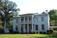 Bragg Houselisted 1974
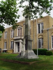 Camden Confederate Monumentlisted 1996
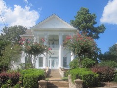 Clifton and Greening Street Historic District (Boundary Increase II)listed 2007
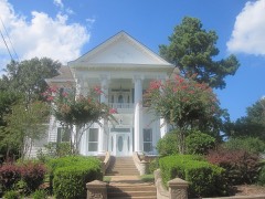 Clifton and Greening Street Historic District (Boundary Increase)listed 2001
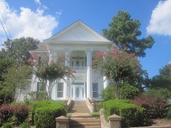 Clifton and Greening Streets Historic Districtlisted 1998
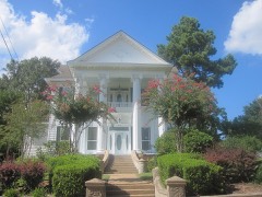 Clifton and Greening Streets Historic District (Boundary Increase III)listed 2011
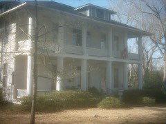 Elliott-Meek Houselisted 1974
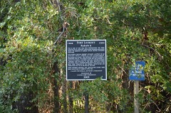 Fort Lookoutlisted 1994
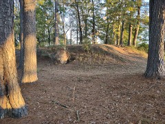 Fort Southerlandlisted 1994
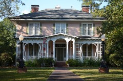 Graham-Gaughan-Betts Houselisted 1974
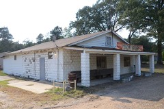 Harvey's Grocery and Texaco Stationlisted 2001
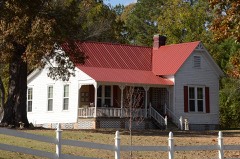 Hickman Houselisted 2006
Population over time
2 figuresCamden fell from 12,183 to 10,612 between 2010 and 2020. These are the recorded population figures Wikidata holds for this place, reached through the Geographic Names Information System number this page is keyed on rather than by name, so they belong to this place and not to another of the same name. Most are census counts, but not all are: an early figure may be a founding or settlement estimate, and an estimate published within five years of a census is left out. The change column is computed, and is left blank where more than 20 years separate a figure from the one before it, because a gap that long is not a change between two counts.
| Year | People | Change |
|---|---|---|
| 2010 | 12,183 | |
| 2020 | 10,612 | -1,571 (-13%) |
Topographic sheets covering this place
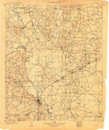
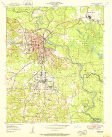
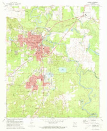
9 surveys from 17 printed sheetsMatched by testing this settlement's coordinate against the published boundary of every sheet in the United States Geological Survey's historical collection. Each opens the scanned sheet at the Survey.
- 1903 USGS Camden quadrangle1:125000, 3 printings
- 1951 USGS Camden quadrangle1:24000, 2 printings
- 1953 USGS El Dorado quadrangle1:250000, 3 printings
- 1957 USGS El Dorado quadrangle1:250000
- 1958 USGS El Dorado quadrangle1:250000, 3 printings
- 1960 USGS El Dorado quadrangle1:250000
- 1971 USGS Camden quadrangle1:24000, 2 printings
- 1986 USGS Camden quadrangle1:100000
- 1989 USGS El Dorado quadrangle1:250000
Fires near this place
146 since 1997Regional context, not property-specific evidence. The federal wildfire occurrence database lists 146 fires within 5 miles of Camden between 1997 and 2020, burning about 478 acres in total. 2 started naturally. 34 were recorded as arson. Distance is straight-line from the map coordinates, so a fire counted here may appear on a neighbouring settlement's page as well.
| Reported cause | Fires |
|---|---|
| Debris and open burning | 50 |
| Missing data/not specified/undetermined | 37 |
| Arson/incendiarism | 34 |
| Equipment and vehicle use | 13 |
| Recreation and ceremony | 4 |
| Misuse of fire by a minor | 3 |
| Natural | 2 |
| Smoking | 2 |
| Railroad operations and maintenance | 1 |
The most recent of them, most recent first, with the day each was reported and the service that recorded it.
| Date | Cause | Size | Reported by | Name on the report |
|---|---|---|---|---|
| 6 September 2015 | Debris and open burning | 5.0 acres | Arkansas Forestry Commission | not named |
| 6 September 2011 | Arson/incendiarism | 2.0 acres | Arkansas Forestry Commission | not named |
| 6 September 2010 | Debris and open burning | 10 acres | Arkansas Forestry Commission | not named |
| 5 September 2011 | Debris and open burning | 2.0 acres | Arkansas Forestry Commission | not named |
| 4 September 2013 | Missing data/not specified/undetermined | 20 acres | Arkansas Forestry Commission | not named |
| 24 September 2010 | Arson/incendiarism | 1.0 acres | Arkansas Forestry Commission | not named |
| 22 September 2005 | Missing data/not specified/undetermined | 3.0 acres | Arkansas Forestry Commission | not named |
| 20 September 2010 | Arson/incendiarism | 1.0 acres | Arkansas Forestry Commission | not named |
Settlements close enough to share some of these fires:
Mines and quarries near this place
7 within 5 milesRegional context, not property-specific evidence. The federal mineral resources record lists 7 workings within 5 miles of Camden: 4 past producers, 2 producers, 1 unknown. 2 still produce. What was taken out: Sand and Gravel, Construction, Iron, Quartz, Sulfur, Phosphorus-Phosphates. Distance is straight-line from the map coordinates, so a quarry counted here may appear on a neighbouring settlement's page as well.
| Where | Site | Commodity | Status | Recorded |
|---|---|---|---|---|
| Unk | Quartz, Iron, Sulfur, Phosphorus-Phosphates | Unknown | ||
| Aggie Mccree Property | Iron | Past Producer | ||
| T.I.Brown Property | Iron | Past Producer | ||
| Camden | Sand and Gravel, Construction | Past Producer | ||
| Garner | Sand and Gravel, Construction | Past Producer | ||
| Ouchita County Pit | Sand and Gravel, Construction | Producer | ||
| Standard Gravel Pit and Plant | Sand and Gravel, Construction | Producer | bedded |
Storms near this place
60 of 171 shownRegional context, not property-specific evidence. The National Weather Service names Camden in 171 storm reports between 1993 and 2026: 67 flood, 54 thunderstorm wind, 34 hail, 10 flash flood. No death or injury is recorded in these reports. Each account below is quoted exactly as the forecast office filed it, from the NOAA Storm Events Database, and each date opens the federal record of that event.
| When | Event | Place named | Harm | What the report says |
|---|---|---|---|---|
| April 2016 | Thunderstorm Wind | Camden | $1,000,000 | Trees were uprooted and snapped, with some trees falling and causing damage to homes. This was on the northwest side of town. |
| March 2008 | Flood | Camden | $600,000 | Heavy rain caused the Ouachita River at Camden to go above moderate flood level. Numerous county roads were flooded and Arkansas Highway 7 was closed. Many residences were cut off by flooded access roads at points along the river both upstream and downstream of Camden. Access was by boat only. Agricultural damages were primarily to lost pastures due to prolonged inundation. |
| July 2011 | Thunderstorm Wind | Camden | $250,000 | Near the junction of U.S. 79/287 and Arkansas 7, much of the roof of an old motel was blown off, as was part of the back wall of the building. Although the motel was unoccupied, many of the rooms were being used to store furnishings. The roofing material from the motel was blown behind the building, covering Dunning St. with debris, and knocking down power poles and transformers. Some of the debris blew across the street, damaging a vacant house. An occupied motel had some shingles removed from its roof. A number of trees were blown down in the area, including Carnes Park. Trees landed on residences on Mt. Holly Rd., Cherry St., and Cuba Cir. At the sheriff's office, a two-car carport was picked up and thrown, damaging an antique patrol car and some fences. At Camden Fairview High School, the roof was rolled up on an outbuilding. |
| October 2009 | Thunderstorm Wind | Camden | $150,000 | Trees were down along Arkansas Highway 7 south of Camden. Five homes sustained damage. |
| June 2021 | Thunderstorm Wind | East Camden | $40,000 | A tree was blown down onto a house in East Camden. The damage was confirmed via a photo on social media and relayed by KATV. |
| October 2009 | Thunderstorm Wind | East Camden | $35,000 | The new roof was torn off the fire station in East Camden and some trees and power lines were blown down. |
| March 2012 | Thunderstorm Wind | Camden | $25,000 | Trees and power lines were blown down. |
| June 2011 | Thunderstorm Wind | Camden | $25,000 | A mobile home was overturned by thunderstorm winds. |
| June 2011 | Thunderstorm Wind | Camden | $25,000 | Trees were blown down in Camden. One of the trees fell on the porch of a house. |
| June 2009 | Thunderstorm Wind | Camden | $25,000 | Numerous power lines were down in and around Camden. |
| June 2011 | Thunderstorm Wind | East Camden | $20,000 | Trees were blown down and shingles were blown off roofs. A large trampoline was wrapped around a utility pole. |
| April 2014 | Thunderstorm Wind | East Camden | $15,000 | Numerous trees were blown down. |
| March 2012 | Flood | Camden | $15,000 | Heavy rain in the second half of March pushed the Ouachita River at Camden above flood stage through the end of March. Arkansas 7 flooded between Camden and Harmony Grove. |
| June 2013 | Flood | Camden | $10,000 | Heavy rainfall from late May into early June caused the Ouachita River at Camden to rise above flood stage during the evening hours on the 3rd. The river remained above flood stage for several days, before falling below flood stage during the morning hours on the 12th. |
| May 2011 | Flood | Camden | $10,000 | no account filed |
| May 2013 | Thunderstorm Wind | East Camden | $5,000 | The roof was blown off a mobile home. |
| April 2012 | Thunderstorm Wind | East Camden | $5,000 | Several trees were blown down on Arkansas 274. |
| January 2007 | Flash Flood | Camden | $2,000 | Heavy rains flooded several secondary roads across Ouachita County. |
| February 2014 | Flood | Camden | $1,000 | Heavy rainfall caused the Ouachita River at Camden to rise above flood stage during the evening hours of the 7th. The river then fell back below flood stage during the morning hours of the next day. |
| August 2010 | Thunderstorm Wind | Camden | $1,000 | A tree was blown down in Camden. |
| May 2009 | Thunderstorm Wind | Camden | $1,000 | A tree was down near the intersection of U.S. Highway 278 and Arkansas Highway 376. |
| April 1993 | Thunderstorm Wind | Camden | $500 | Thunderstorm winds knocked down a few trees. |
| April 2026 | Thunderstorm Wind | Camden | - | The metal roofing material of a business was almost entirely removed. |
| April 2026 | Thunderstorm Wind | Camden | - | A tree was blown down onto a house. |
| April 2026 | Hail | Camden | - | Quarter-sized hail fell in the community of Camden. |
| April 2025 | Flood | Camden | - | Major river flooding was observed at Camden along the Ouachita River. |
| January 2025 | Flood | Camden | - | The Ouachita River at Camden began the month of January in minor flood stage. The river at this site would experience a crest on 1/1/2025 at 1430 LST of 28.36 feet. The river at this site would fall below minor flood stage a few days later. |
| May 2025 | Flood | Camden | - | Minor river flooding was observed at Camden along the Ouachita River. |
| May 2025 | Flood | Camden | - | Minor river flooding was observed at Camden along the Ouachita River. |
| February 2025 | Flood | Camden | - | Minor flooding was observed along the Ouachita River at Camden. |
| February 2025 | Flood | Camden | - | Minor flooding was observed at Camden along the Ouachita River. |
| April 2025 | Thunderstorm Wind | Camden | - | A tree fell onto a house along Columbia Avenue in the town of Camden. |
| April 2025 | Flash Flood | Camden | - | Water flooded several low-lying roadways in the town of Camden. |
| June 2025 | Flood | Camden | - | Minor river flooding was observed at Camden along the Ouachita River. |
| May 2024 | Flood | Camden | - | Minor river flooding was observed along the Ouachita River at Camden. |
| April 2024 | Flood | Camden | - | Heavy rain brought flooding to the Ouachita River at Camden in mid April. |
| April 2024 | Thunderstorm Wind | Camden | - | Powerlines were blown down along Fort Lookout Acre on the northern side of Camden. |
| August 2024 | Thunderstorm Wind | East Camden | - | Multiple trees were blown down and a few buildings experienced roof damage in the town of East Camden. |
| December 2024 | Flood | Camden | - | River flooding occurred on the Ouachita River at Camden in late December and remained in minor flood stage into early January with the crest of the river occurring in minor flood stage in early January. |
| July 2024 | Thunderstorm Wind | East Camden | - | Power lines and power poles were blown down across the town of Camden. |
| January 2023 | Flood | Camden | - | Heavy rain brought river flooding to the Ouachita River at Camden in early January. |
| January 2023 | Flood | Camden | - | Heavy rain brought river flooding to the Ouachita River at Camden in late January. |
| February 2023 | Flood | Camden | - | Heavy rain brought flooding to the Ouachita River at Camden in January that continued into February. |
| May 2023 | Flood | Camden | - | Heavy rainfall brought minor flooding to the Ouachita River at Camden through mid-May. |
| March 2023 | Flood | Camden | - | Heavy rain brought flooding to the Ouachita River at Camden in early March. |
| May 2022 | Flood | Camden | - | Heavy rain brought flooding to the Ouachita River at Camden in early May. |
| March 2022 | Flood | Camden | - | Heavy rain brought minor river flooding to the Ouachita River at Camden. |
| April 2021 | Thunderstorm Wind | Camden | - | Another tree was blown down on a house in East Camden. |
| April 2021 | Flood | East Camden | - | Heavy rain brought flooding to the Ouachita River at Camden in early April. |
| February 2021 | Flood | Camden | - | Heavy rain brought flooding to the Ouachita River at Camden from 2/27 through the end of the month. |
| June 2021 | Thunderstorm Wind | Camden | - | The Ouachita County sheriff's office reported scattered trees and power lines down throughout Ouachita County. |
| January 2021 | Flood | Camden | - | Heavy rain caused flooding on the Ouachita River at Camden through the first half of January. |
| April 2021 | Thunderstorm Wind | Camden | - | The AWOS station in Camden measured a 58 MPH wind gust. |
| April 2021 | Thunderstorm Wind | Camden | - | Trees were downed on several homes, an apartment building, and a vehicle from Camden to East Camden. |
| April 2021 | Thunderstorm Wind | East Camden | - | A large tree was blown down onto a home. |
| April 2021 | Thunderstorm Wind | Camden | - | A large tree was blown down. |
| April 2021 | Flood | Camden | - | Heavy rain brought flooding to the Ouachita River at Camden in late April. |
| May 2021 | Hail | Camden | - | Half dollar size hail was reported in Camden. |
| May 2021 | Flood | Camden | - | Heavy rain brought flooding to the Ouachita River at Camden on May 20, 2021. |
| March 2021 | Flood | Camden | - | Heavy rains late in February brought flooding to the Ouachita River at Camden through the 9th. |
Nearest settlements
The eight closest, with where each one stands in the county. Distances are straight-line, computed from the Geographic Names Information System coordinates.
| Map | Place | Distance | Sheets |
|---|---|---|---|
| Herbert | 2.3 miles | 17 | |
| Kent | 3.0 miles | 15 | |
| Cullendale | 3.2 miles | 17 | |
| Fairview | 3.3 miles | 17 | |
| Warner | 4.2 miles | 15 | |
| Camark | 4.9 miles | 15 | |
| Lakeside | 5.1 miles | 16 | |
| Rendezvous | 5.1 miles | 17 |
Elsewhere
Matched on this settlement's Geographic Names Information System number rather than its name, so it cannot be a different place of the same name in another state.
| Wikipedia article on Camden | An encyclopaedic summary. Its text is share-alike, so it is linked here rather than copied. |
| Wikidata item Q79446 | The structured record the population and elevation above come from. Public domain (CC0). |
Provenance
This settlement is recorded in the Geographic Names Information System as feature 76505. The sheet list is computed by point-in-boundary test against the United States Geological Survey's historical topographic inventory. Both are works of the United States government and carry no copyright under 17 U.S.C. 105.
Wildfire. Short, Karen C. 2022. Spatial wildfire occurrence data for the United States, 1992-2020 [FPA_FOD_20221014]. 6th Edition. Fort Collins, CO: Forest Service Research Data Archive. https://doi.org/10.2737/RDS-2013-0009.6 Collected with United States Government funding and usable without additional permissions or fees.
Mines and quarries. USGS Mineral Resources Data System (MRDS) https://mrdata.usgs.gov/mrds/ A work of the United States government, no copyright under 17 U.S.C. 105.
Storms. NOAA National Centers for Environmental Information, Storm Events Database https://www.ncei.noaa.gov/stormevents/ A work of the United States government, no copyright under 17 U.S.C. 105. Narratives are quoted verbatim from the National Weather Service report and are not edited or summarised.