Block
From the record
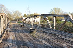
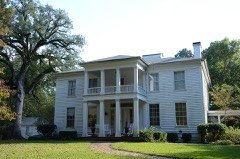
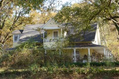
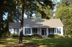
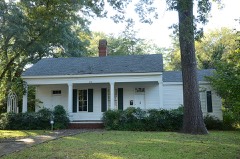
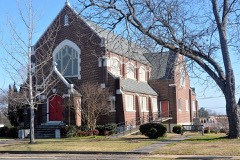
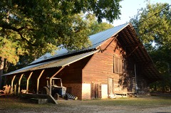
42 National Register listings published here.
Sources: the National Register database, National Park Service
68 topographic sheets cover 54 settlements here, and 42 properties are on the National Register of Historic Places.
42 National Register listings published here.
Sources: the National Register database, National Park Service
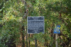
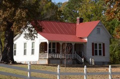
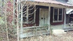
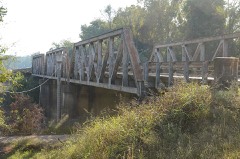
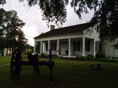
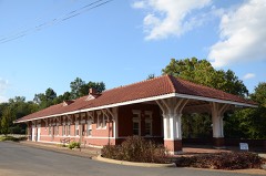
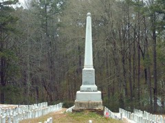
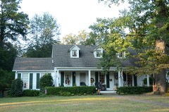
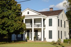
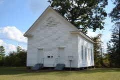
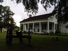
Every property in this county listed on the National Register of Historic Places, with the year it was listed and the federal nomination document.
Every wildfire the federal occurrence database records inside this county: 1,249 of them, burning about 7,051 acres. 75 started naturally and 362 were recorded as arson. Each settlement page carries the fires within five miles of it.
| Reported cause | Fires |
|---|---|
| Missing data/not specified/undetermined | 365 |
| Arson/incendiarism | 362 |
| Debris and open burning | 271 |
| Equipment and vehicle use | 95 |
| Natural | 75 |
| Misuse of fire by a minor | 22 |
| Railroad operations and maintenance | 21 |
| Smoking | 20 |
| Recreation and ceremony | 18 |
The five largest, by the area the report gives. One of them was set deliberately.
| Date | Cause | Size | Reported by | Name on the report |
|---|---|---|---|---|
| 23 September 2010 | Missing data/not specified/undetermined | 486 acres | Arkansas Forestry Commission | EAST CAMDEN |
| 5 September 2010 | Missing data/not specified/undetermined | 194 acres | Arkansas Forestry Commission | CHAPEL CREEK |
| 23 August 2020 | Missing data/not specified/undetermined | 109 acres | Arkansas Forestry Commission | not named |
| 17 July 2006 | Natural | 90 acres | Arkansas Forestry Commission | not named |
| 3 April 2015 | Debris and open burning | 86 acres | Arkansas Forestry Commission | not named |
| 7 October 2011 | Equipment and vehicle use | 84 acres | Arkansas Forestry Commission | not named |
| 25 March 2014 | Arson/incendiarism | 80 acres | Arkansas Forestry Commission | OUA9414838 |
| 1 September 2000 | Natural | 80 acres | Arkansas Forestry Commission | not named |
Every settlement page carries the fires within five miles of it - see the settlement index below.
The NOAA Storm Events Database holds 497 reports for this county, causing 1 death, 24 injuries and about $17,712,600 in recorded property damage. Each settlement page carries the reports that name it.
| Kind of event | Reports |
|---|---|
| Thunderstorm Wind | 200 |
| Hail | 127 |
| Flood | 105 |
| Flash Flood | 32 |
| Tornado | 23 |
| Heavy Rain | 6 |
| Lightning | 3 |
| Funnel Cloud | 1 |
The most serious of them, by death, then injury, then recorded damage. The accounts are quoted exactly as the forecast office filed them.
| When | Event | Place named | Harm | What the report says |
|---|---|---|---|---|
| October 2008 | Flood | Amy | 1 killed, $20,000 | An elderly man drowned when he drove his small SUV into floodwaters on Arkansas Highway 7 south of Amy. The vehicle was washed off the highway and overturned. Doppler weather radar estimated that at least 6 to 8 inches of rain had fallen in the area on the night of the 6th and the morning of the 7th. The rain caused creeks to begin rising, and the highway eventually flooded. The Arkansas Highway and Transportation Department indicated that the highway was closed and barricaded on the afternoon of the 7th. The man drove around the barricades and into the water around 5:30 AM CDT on the 8th. According to a report from the Arkansas State Police, the water on the highway was 4 feet deep at the time of the accident. Furthermore, the Ouachita County Sheriff's Office indicated that the water was still rising quickly at the time. |
| April 1979 | Tornado (F3) | not stated | 17 hurt, $2,500,000 | no account filed |
| December 1982 | Tornado (F3) | not stated | 7 hurt, $2,500,000 | no account filed |
| May 2009 | Flood | Tates Bluff | $3,000,000 | Heavy to record rainfall produced river flooding along the Ouachita River that had not been experienced since 1990. Numerous parks, county and state roads, and private residences were flooded. |
| April 2014 | Thunderstorm Wind | Buena Vista | $2,500,000 | The Camden-Fairview High School had damage at the baseball field, where the bleachers were overturned and the dugouts were destroyed, at the football stadium and weight room, at the band building, and at one of the classroom buildings. Hundreds of trees were blown down. Nine homes were destroyed, nine had major damage, 13 had minor damage, and seven were affected. Many power lines were blown down, including a major transmission line, leaving the entire city without power. |
| April 2016 | Thunderstorm Wind | Camden | $1,000,000 | Trees were uprooted and snapped, with some trees falling and causing damage to homes. This was on the northwest side of town. |
| March 2008 | Flood | Camden | $600,000 | Heavy rain caused the Ouachita River at Camden to go above moderate flood level. Numerous county roads were flooded and Arkansas Highway 7 was closed. Many residences were cut off by flooded access roads at points along the river both upstream and downstream of Camden. Access was by boat only. Agricultural damages were primarily to lost pastures due to prolonged inundation. |
| October 2009 | Flash Flood | Sayre | $500,000 | U.S. Highway 79 southwest of Camden was closed due to water over the road. A high water rescue was necessary on the highway at Ogemaw. Other highways closed included Arkansas 57 from U.S. Highway 278 to Arkansas Highway 76, and Arkansas Highway 376 from U.S. Highway 79 to U.S. Highway 278. The basement of the county courthouse in Camden was flooded. County roads closed included Ouachita 1, 2, 6, 25, 32, 45, 88, 96, 210, 232, and the intersection of 427 and 97. Many county roads were washed out. |
| October 2009 | Tornado (EF1) | Lakeside | $350,000 | This tornado moved out of Calhoun County about 4 1/3 miles west of Locust Bayou and re-entered Ouachita County about 2 1/4 miles south-southwest of Lakeside. In Ouachita County, the tornado tore part of the roof off a house, damaged a church roof, and caused trees to fall on four houses. The tornado then moved through a trailer park, where falling trees destroyed nine of the homes and caused major damage to three others. Otherwise, hundreds of trees were blown down, as were a number of power lines. The tornado then exited Ouachita County in East Camden and moved into the Calhoun County portion of the same town. |
| October 2009 | Flood | Sayre | $300,000 | Flash flooding which began on the 29th became widespread areal flooding on the 30th. Several businesses were flooded and four families were evacuated in the southwest part of Camden. Water was up to the door handles of minivans. |
| October 2009 | Tornado (EF1) | Salem | $300,000 | After badly damaging the Arkansas Fire Training Academy, this tornado moved from the Calhoun County portion of the Highland Industrial Park into the Ouachita County portion. Thirty-one empty railroad tank cars, which had been stored on a little-used track, were blown over. After the tornado left the industrial park, it caused several houses to suffer roof damage, snapped power poles, and blew down power lines. Along the tornado's path, hundreds of trees were toppled. |
| July 2011 | Thunderstorm Wind | Camden | $250,000 | Near the junction of U.S. 79/287 and Arkansas 7, much of the roof of an old motel was blown off, as was part of the back wall of the building. Although the motel was unoccupied, many of the rooms were being used to store furnishings. The roofing material from the motel was blown behind the building, covering Dunning St. with debris, and knocking down power poles and transformers. Some of the debris blew across the street, damaging a vacant house. An occupied motel had some shingles removed from its roof. A number of trees were blown down in the area, including Carnes Park. Trees landed on residences on Mt. Holly Rd., Cherry St., and Cuba Cir. At the sheriff's office, a two-car carport was picked up and thrown, damaging an antique patrol car and some fences. At Camden Fairview High School, the roof was rolled up on an outbuilding. |
| May 2011 | Flood | Reader | $250,000 | Part of Arkansas Highway 7 was closed due to flooding. |
| December 2009 | Flood | Sayre | $250,000 | Flash flooding, which developed early on the morning of the 24th, became widespread areal flooding later in the morning on the 24th and continued into Christmas morning. Arkansas Highway 7 was flooded north of Camden. Road cave-ins occurred on Adams Ave., Roseman Rd., and Ouachita 143 off Old Wire Rd. Roads closed due to flooding included Ouachita 44, 45, 32, and 232. |
| December 2009 | Flash Flood | Sayre | $250,000 | Widespread heavy rain led to the development of flash flooding early on the morning of the 24th. |
| October 2009 | Flash Flood | Red Hill | $250,000 | Streets were flooded and creeks overflowed in Camden. More than 20 county roads were flooded. |
| December 1978 | Tornado (F2) | not stated | $250,000 | no account filed |
| January 1978 | Tornado (F1) | not stated | $250,000 | no account filed |
| October 2009 | Thunderstorm Wind | Bearden | $200,000 | Numerous trees and power lines were blown down. Some of the trees fell on houses. |
| October 2009 | Tornado (EF2) | Lester | $200,000 | The tornado caused a massive tree blowdown soon after touching down. It then passed west of Velie and near Amy. One house had part of one wall and a portion of its roof torn off, part of the roof was torn off a mobile home, another mobile home was blown off its foundation, and several outbuildings were damaged. The tornado exited Ouachita County about 3 1/3 miles east-northeast of Smead and continued into Dallas County about 3 2/3 miles west-southwest of Holly Springs. |
| October 2009 | Thunderstorm Wind | Buena Vista | $150,000 | Trees and power lines were blown down. Several roofs were damaged by the falling trees. |
| October 2009 | Thunderstorm Wind | Camden | $150,000 | Trees were down along Arkansas Highway 7 south of Camden. Five homes sustained damage. |
| October 2009 | Tornado (EF1) | Louann | $150,000 | A tornado moved out of Union County and into Ouachita County just east-southeast of Louann. Roof damage occurred to a number of residences and the roof was torn off a mobile home. Hundreds of trees were blown down or snapped off, and power lines were blown down. The tornado exited Ouachita County northeast of Frenchport and continued into Calhoun County about 6 2/3 miles southwest of Locust Bayou. |
| April 2008 | Flood | Lunet | $150,000 | The upstream flood wave on the Ouachita River progressed downstream to the Camden vicinity by the middle of the month. The stage at the Camden stream gage crested at moderate flood level. Arkansas Highway 7 and numerous county and city roads were flooded. |
| April 2011 | Flood | Reader | $100,000 | Widespread areal flooding occurred. Part of Arkansas Highway 7 was closed from the morning of the 28th through the end of the month. |
| September 2009 | Flood | Lunet | $100,000 | Heavy rainfall during the middle of September pushed the Ouachita River at Camden above flood stage. Some county roads and private roads were flooded. |
| April 2008 | Thunderstorm Wind | Buena Vista | $100,000 | A tree fell across a house and trapped a resident. The person was rescued and was uninjured. The house and vehicles were destroyed. |
| September 2009 | Flash Flood | Chidester | $75,000 | Arkansas Highway 57 west of Stephens was closed due to high water. Numerous county roads were closed across Ouachita County due to high water. |
| March 2014 | Thunderstorm Wind | Harmony Grove | $70,000 | A tree fell into a mobile home, destroying it. Another mobile home had one side and part of the roof blown off. Trees were blown down on Arkansas 7. |
| December 2015 | Tornado (EF1) | Millville | $50,000 | This tornado continued from Calhoun County. Several trees were uprooted, along with several limbs snapped off. Within the town of Beardon, some windows were blown out and roof damage was observed at a few downtown businesses. Some metal was blown off a church. One large tree was blown over onto a home. |
| April 2014 | Thunderstorm Wind | Harmony Grove | $50,000 | Many trees were blown down and several houses were damaged. |
| August 2014 | Flash Flood | Lester | $50,000 | Street flooding occurred in Camden. At times between 8 and 9 AM CDT, heavy rain reduced the visibility at the Camden airport to less than 1/4 mile. |
| November 1994 | Thunderstorm Wind | Elliott | $50,000 | Thunderstorm winds downed some trees and an antenna tower. |
| November 1994 | Thunderstorm Wind | Harmony Grove | $50,000 | Thunderstorm winds downed trees and power lines. Several homes were also damaged by fallen trees. |
| June 2021 | Thunderstorm Wind | East Camden | $40,000 | A tree was blown down onto a house in East Camden. The damage was confirmed via a photo on social media and relayed by KATV. |
| May 2009 | Flash Flood | Lester | $40,000 | Portions of Arkansas Highway 7 north of Camden were barricaded for a period of time due to high water. Also, county roads 88, 223, 234, 96, and 11 were flooded. |
| October 2009 | Thunderstorm Wind | East Camden | $35,000 | The new roof was torn off the fire station in East Camden and some trees and power lines were blown down. |
| June 2009 | Thunderstorm Wind | Elliott | $30,000 | Several power poles and power lines were down across the area. |
| March 2012 | Thunderstorm Wind | Camden | $25,000 | Trees and power lines were blown down. |
| June 2011 | Thunderstorm Wind | Camden | $25,000 | A mobile home was overturned by thunderstorm winds. |
| June 2011 | Thunderstorm Wind | Camden | $25,000 | Trees were blown down in Camden. One of the trees fell on the porch of a house. |
| July 2010 | Thunderstorm Wind | Bearden | $25,000 | A high-voltage power line was blown down. Two homes were evacuated and a two-block area was closed as a precaution. |
| December 2009 | Flood | Lakeside | $25,000 | Heavy rainfall on December 23rd and 24th allowed the Ouachita River at Camden to rapidly rise above flood stage on Christmas Eve. The river remained above flood stage through early January. Some crops suffered damage. |
| May 2009 | Flash Flood | Good Hope | $25,000 | Arkansas Highway 7 and Ouachita roads 11, 76, 99 and 389 were closed due to flooding. |
| June 2009 | Thunderstorm Wind | Camden | $25,000 | Numerous power lines were down in and around Camden. |
| October 2008 | Flash Flood | Kent | $25,000 | Flash flooding occurred on several county roads in Bearden and Harmony Grove. County roads 31 and 34 near Harmony Grove were closed. Also, Ouachita 86, Ouachita 92 and Ouachita 95 were closed. |
| November 1984 | Tornado (F3) | not stated | $25,000 | no account filed |
| December 1957 | Tornado (F4) | not stated | $25,000 | no account filed |
| February 2014 | Thunderstorm Wind | Stephens | $20,000 | The brick storefront on an old, unoccupied store collapsed. Chert St. was closed due to bricks in the road. |
| June 2011 | Thunderstorm Wind | East Camden | $20,000 | Trees were blown down and shingles were blown off roofs. A large trampoline was wrapped around a utility pole. |
| May 2009 | Flash Flood | Lester | $20,000 | Flooding occurred on many county roads. |
| October 2014 | Thunderstorm Wind | Chidester | $15,000 | Trees were blown down onto Arkansas 24 and 57. |
| April 2014 | Thunderstorm Wind | East Camden | $15,000 | Numerous trees were blown down. |
| March 2012 | Flood | Camden | $15,000 | Heavy rain in the second half of March pushed the Ouachita River at Camden above flood stage through the end of March. Arkansas 7 flooded between Camden and Harmony Grove. |
| June 2010 | Thunderstorm Wind | Bearden | $15,000 | Eight power poles were blown down and there was some tree damage off U.S. Highway 79 southwest of Bearden. |
| February 2010 | Flood | Kent | $15,000 | Heavy rainfall on the 7th and 8th caused the Ouachita River at Camden to rise above flood stage the afternoon of the 7th. The river remained above flood stage until the afternoon of the 20th, cresting at nearly 34 feet on the afternoon of the 13th. |
| February 2020 | Thunderstorm Wind | Amy | $10,000 | Damage was reported to carports and outbuildings. Winds were estimated at 50-55 mph. |
| June 2013 | Flood | Camden | $10,000 | Heavy rainfall from late May into early June caused the Ouachita River at Camden to rise above flood stage during the evening hours on the 3rd. The river remained above flood stage for several days, before falling below flood stage during the morning hours on the 12th. |
| March 2010 | Thunderstorm Wind | Frenchport | $10,000 | Some trees were blown down in the Frenchport area. |
| February 2008 | Thunderstorm Wind | Louann | $10,000 | There were trees down on an abandoned mobile home. Reports of pea size hail were received across county. |
The Survey's mineral resources record lists 78 workings inside this county. 12 still produce and 66 are closed or unrecorded. Each settlement page carries the workings within five miles of it.
| Commodity | Workings |
|---|---|
| Sand and Gravel, Construction | 67 |
| Clay | 6 |
| Iron | 3 |
| Clay, Sand and Gravel, Construction | 1 |
| Stone, Crushed/Broken | 1 |
| Quartz | 1 |
| Sulfur, Phosphorus-Phosphates | 1 |
The least common of them first, because a county's hundredth gravel pit says nothing its first ten did not.
| Where | Site | Commodity | Status | Recorded |
|---|---|---|---|---|
| Hope Brick Co Pit | Clay, Sand and Gravel, Construction | Past Producer | ||
| No Name | Stone, Crushed/Broken | Past Producer | ||
| Unk | Quartz, Iron, Sulfur, Phosphorus-Phosphates | Unknown | ||
| Aggie Mccree Property | Iron | Past Producer | ||
| T.I.Brown Property | Iron | Past Producer | ||
| Chidester | Clay | Past Producer | ||
| No Name | Clay | Past Producer | ||
| No Name | Clay | Past Producer | ||
| No Name | Clay | Past Producer | ||
| Unk | Clay | Past Producer | ||
| Bearden-Holly Springs Mine | Sand and Gravel, Construction | Producer | ||
| Camden | Sand and Gravel, Construction | Past Producer | ||
| Cram Plant | Sand and Gravel, Construction | Producer | ||
| Eagle Mill | Sand and Gravel, Construction | Past Producer | ||
| Eagle Mills Pit & Plant | Sand and Gravel, Construction | Producer | ||
| Fairchild Pit | Sand and Gravel, Construction | Producer | ||
| Garner | Sand and Gravel, Construction | Past Producer | ||
| Garner Pit | Sand and Gravel, Construction | Producer | ||
| Jackson Pit | Sand and Gravel, Construction | Past Producer | ||
| Millville Pit & Plant | Sand and Gravel, Construction | Producer | ||
| Ouchita County Pit | Sand and Gravel, Construction | Producer | ||
| Pine Bluff Sand & Gravel Co Pit | Sand and Gravel, Construction | Past Producer | ||
| Pit & Plant #3 | Sand and Gravel, Construction | Producer | ||
| Pit & Plant No 3 | Sand and Gravel, Construction | Producer | ||
| Standard Gravel Pit and Plant | Sand and Gravel, Construction | Producer | bedded | |
| Triangle Gravel Pit & Plant | Sand and Gravel, Construction | Producer | ||
| Unk | Sand and Gravel, Construction | Past Producer | ||
| Unk | Sand and Gravel, Construction | Past Producer | ||
| Unk | Sand and Gravel, Construction | Past Producer | ||
| Unk | Sand and Gravel, Construction | Past Producer | ||
| Unk | Sand and Gravel, Construction | Past Producer | ||
| Unk | Sand and Gravel, Construction | Past Producer | ||
| Unk | Sand and Gravel, Construction | Past Producer | ||
| Unk | Sand and Gravel, Construction | Past Producer | ||
| Unk | Sand and Gravel, Construction | Past Producer | ||
| Unk | Sand and Gravel, Construction | Past Producer | ||
| Unk | Sand and Gravel, Construction | Past Producer | ||
| Unk | Sand and Gravel, Construction | Past Producer | ||
| Unk | Sand and Gravel, Construction | Past Producer | ||
| Unk | Sand and Gravel, Construction | Past Producer | ||
| Unk | Sand and Gravel, Construction | Past Producer | ||
| Unk | Sand and Gravel, Construction | Past Producer | ||
| Unk | Sand and Gravel, Construction | Past Producer | ||
| Unk | Sand and Gravel, Construction | Past Producer | ||
| Unk | Sand and Gravel, Construction | Past Producer | ||
| Unk | Sand and Gravel, Construction | Past Producer | ||
| Unk | Sand and Gravel, Construction | Past Producer | ||
| Unk | Sand and Gravel, Construction | Past Producer | ||
| Unk | Sand and Gravel, Construction | Past Producer | ||
| Unk | Sand and Gravel, Construction | Past Producer | ||
| Unk | Sand and Gravel, Construction | Past Producer | ||
| Unk | Sand and Gravel, Construction | Past Producer | ||
| Unk | Sand and Gravel, Construction | Past Producer | ||
| Unk | Sand and Gravel, Construction | Past Producer | ||
| Unk | Sand and Gravel, Construction | Past Producer | ||
| Unk | Sand and Gravel, Construction | Past Producer | ||
| Unk | Sand and Gravel, Construction | Past Producer | ||
| Unk | Sand and Gravel, Construction | Past Producer | ||
| Unk | Sand and Gravel, Construction | Past Producer | ||
| Unk | Sand and Gravel, Construction | Producer | ||
| Unk | Sand and Gravel, Construction | Past Producer | ||
| Unk | Sand and Gravel, Construction | Past Producer | ||
| Unk | Sand and Gravel, Construction | Past Producer | ||
| Unk | Sand and Gravel, Construction | Past Producer | ||
| Unk | Sand and Gravel, Construction | Past Producer | ||
| Unk | Sand and Gravel, Construction | Past Producer | ||
| Unk | Sand and Gravel, Construction | Past Producer | ||
| Unk | Sand and Gravel, Construction | Past Producer | ||
| Unk | Sand and Gravel, Construction | Past Producer | ||
| Unk | Sand and Gravel, Construction | Past Producer | ||
| Unk | Sand and Gravel, Construction | Past Producer | ||
| Unk | Sand and Gravel, Construction | Past Producer | ||
| Unk | Sand and Gravel, Construction | Past Producer | ||
| Unk | Sand and Gravel, Construction | Past Producer | ||
| Unk | Sand and Gravel, Construction | Past Producer | ||
| Unk | Sand and Gravel, Construction | Past Producer | ||
| Unk | Sand and Gravel, Construction | Past Producer | ||
| unnamed | Clay | Past Producer |
Named settlements recorded in the Geographic Names Information System, each with the topographic sheets covering it. Villages, hamlets and abandoned places alike. Each is shown with the nearest named watercourse or landform and the survey quadrangle it falls on.
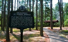
Behestian township · 71726 · On Poison Springs Branch · Bragg City quadrangle
15 sheets, 1903 to 1989
Carroll township · 71701 · Harmony Grove quadrangle
15 sheets, 1903 to 1989
No longer a settlement
Bridge Creek township · 71751 · On Pine Log Creek · Louann quadrangle
16 sheets, 1953 to 1989
Bridge Creek township · 71751 · On Pine Log Creek · Louann quadrangle
16 sheets, 1953 to 1989
Valley township · 71701 · On Brushy Creek · Eagle Mills quadrangle
16 sheets, 1903 to 1989
No longer a settlement
Marion township · 71764 · On Hale Creek · Camden SW quadrangle
15 sheets, 1903 to 1989
No longer a settlement
Valley township · 71701 · On Brushy Creek · Eagle Mills quadrangle
16 sheets, 1903 to 1989
No longer a settlement
Bridge Creek township · 71751 · On Mill Creek · Buena Vista quadrangle
15 sheets, 1953 to 1989
Cleveland township · 71720 · On Little Two Bayou · Eagle Mills quadrangle
16 sheets, 1903 to 1989
Behestian township · 71726 · By Tates Bluff · Tates Bluff quadrangle
15 sheets, 1903 to 1989
Behestian township · 71726 · Bragg City quadrangle
15 sheets, 1903 to 1989
No longer a settlement
Carroll township · 71701 · On Dixon Lake Slough · Harmony Grove quadrangle
15 sheets, 1903 to 1989
River township · 71726 · On Bragg Mill Creek · Bragg City quadrangle
15 sheets, 1903 to 1989
No longer a settlement
Behestian township · 71726 · On Hamilton Creek · Bragg City quadrangle
15 sheets, 1903 to 1989
No longer a settlement
The vanished settlements of Ouachita County: the places named above that are no longer on the map.