 Block
Cosgrove, Arkansas
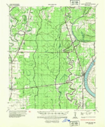
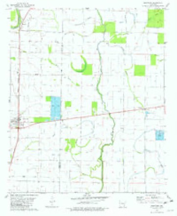
13 topographic sheets cover this place, the earliest surveyed in 1936 and the latest in 1986. It stands in District 7. It lies in ZIP code area 71653. The Survey maps it on the Montrose quadrangle. It stands 118 feet above sea level.
Topographic sheets covering this place
6 surveys from 13 printed sheetsMatched by testing this settlement's coordinate against the published boundary of every sheet in the United States Geological Survey's historical collection. Each opens the scanned sheet at the Survey.
- 1936 USGS Lake Village quadrangle1:62500, 2 printings
- 1953 USGS Greenwood quadrangle1:250000, 5 printings
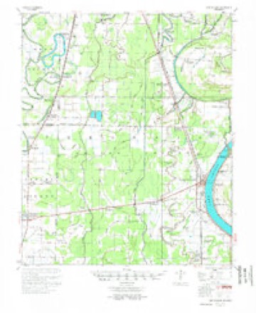
- 1955 USGS Lake Village quadrangle1:62500, 2 printings
- 1956 USGS Greenwood quadrangle1:250000
- 1981 USGS Montrose quadrangle1:24000
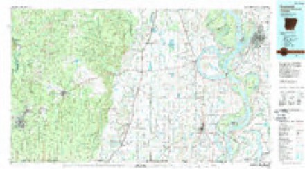
- 1986 USGS Crossett quadrangle1:100000, 2 printings
Fires near this place
1 since 2006Regional context, not property-specific evidence. The federal wildfire occurrence database lists 1 fire within 5 miles of Cosgrove in 2006, burning about 140 acres in total. 1 started naturally. None was recorded as arson. Distance is straight-line from the map coordinates, so a fire counted here may appear on a neighbouring settlement's page as well.
| Reported cause | Fires |
|---|---|
| Natural | 1 |
The most recent of them, most recent first, with the day each was reported and the service that recorded it.
| Date | Cause | Size | Reported by | Name on the report |
|---|---|---|---|---|
| 5 August 2006 | Natural | 140 acres | Arkansas Forestry Commission | CHICOT 210 |
Settlements close enough to share some of these fires:
Storms near this place
19 since 2000Regional context, not property-specific evidence. The National Weather Service names Cosgrove in 19 storm reports between 2000 and 2025: 8 hail, 6 tornado, 4 thunderstorm wind, 1 flash flood. No death or injury is recorded in these reports. Each account below is quoted exactly as the forecast office filed it, from the NOAA Storm Events Database, and each date opens the federal record of that event.
| When | Event | Place named | Harm | What the report says |
|---|---|---|---|---|
| January 2023 | Tornado (EF2) | Cosgrove | $200,000 | This tornado began near the intersection of Ashley 270 Road and Ashley 25 Road west of the Overflow National Wildlife Refuge in southern Ashley County. As it moved northeast, the tornado uprooted, snapped, or damaged trees along its path. It crossed over several highways, county roads, and low-lying areas through the county until it reached Montrose near the intersection of US Highway 82 and 165. There the tornado intensified to its maximum intensity of EF-2 with estimated peak winds of 120 mph. Along US 82 near 9th Street, a small guest home on concrete blocks was pushed off its foundation and destroyed. A nearby mobile home was rolled across three parked cars which were also destroyed. Several sheds and outbuildings were destroyed in the immediate vicinity as well. Widespread damage was common in the western part of town where many homes suffered minor to moderate roof damage. Several trees were uprooted or snapped along with continued minor to moderate residential damage as the tornado moved northeast and across northern Montrose. It crossed US 165 north of Montrose where an outbuilding was destroyed. As the tornado moved into farmland northeast of town, a center pivot irrigation system was destroyed. It continued northeast into Chicot County and across the intersection of Arkansas Highways 144 and 293 where a home and several buildings lost roofing and paneling, and some power poles were blown down. The tornado crossed US Highway 65 and Cedar Road near the Bellaire community in northern Chicot County, blew down a few power poles and damaged a few trees, and then dissipated shortly after crossing into Desha County. |
| January 2020 | Tornado (EF1) | Cosgrove | $200,000 | This tornado started just northeast of Hamburg along Ashley 70 Road and tracked roughly 20 miles to just east of Montrose in Chicot County. Thousands of trees were uprooted and snapped along the path along with numerous power lines and poles downed. Some of the heaviest damage was to a mobile home just off Ashley 129 Road. The home was thrown 15 to 20 feet and destroyed. Another mobile home was destroyed along Ashley 128 Road. The tornado then crossed Highway 82 near Ashley 301 Road. Power poles were broken here and a tractor shed was heavily damaged. From this point, the tornado mostly paralleled Highway 82 or tracked along it. Many power lines were down along with poles. Just east of Ashley 912 Road, one wooden high tension segment had the top broken out. In the Snyder community, some homes sustained roof damage and had trees down on them. North of Highway 82, near Horseshoe Lake, a lot of hardwood trees were heavily damaged and there were three segments of the wooden high tension poles and lines taken out. The tornado continued roughly along Highway 82 toward Montrose. The strongest core of the tornado remained north of the highway and downed two more wooden high tension segments before Montrose and two more just north of town to the west of Highway 165. In the town of Montrose, numerous trees were damaged along with many homes having some degree of roof damage or a handful more with a tree on the home. Just east of Montrose, near the Chicot County line and north of Highway 82, a metal high tension pole segment was taken down which supported the highest wind estimate of 130 mph. The tornado dissipated near County Road 293 on the north side of Highway 82. Maximum width was 1000 yards in Ashley County. Total path length was 20.51 miles. Maximum estimated winds in Chicot County were 88 mph, but 130 mph winds were estimated in Ashley County. |
| April 2003 | Tornado (F0) | Cosgrove | $200,000 | A large tin barn had its roof caved in along with several trees having branches snapped. A mobile home had a portion of its roof pealed back. Another large tin shed was twisted down with some of the tin roof thrown into a pond. |
| April 2018 | Thunderstorm Wind | Cosgrove | $170,000 | Power poles were blown down along Bill Young Road southwest of Lake Village. Stoplights, trees and powerlines were blown down in Lake Village. A powerpole was snapped along Highway 65 north-northwest of Lake Village. Approximately 30 powerpoles and multiple trees were blown down and snapped from Lake Village to the Greenville bridge over the Mississippi River. |
| April 2018 | Tornado (EF1) | Cosgrove | $100,000 | The tornado began along US 165 between Portland and Montrose, where a few older utility poles were damaged and moved northwest across open fields, damaging additional utility poles along Ashley County Roadd 54. The tornado crossed US 82 near the Ashley/Chicot County line. At this location, the top of a silo was removed and the structure was bent, two homes sustained exterior damage with one losing a large amount of roofing material, a travel trailer was destroyed, and a couple of businesses sustained relatively minor structural damage. The tornado reached its peak intensity near this location, where two sets of wooden transmission poles were snapped. There was also considerable tree damage in the area. The tornado continued across Shelton Turner Road, where a home and mobile home sustained damage. The tornado crossed AR Highway 293, Slaughter Road, Beavers Road, and Lingo Road before lifting in west central Chicot County. Maximum estimated wind speed was 115 mph in Ashley County. Total path length of the tornado was just under nine miles and the max width was 700 yards. |
| March 2016 | Flash Flood | Cosgrove | $100,000 | The vast majority of county roads were impassible. Approximately ten families were displaced due to floodwaters around Dermott. Another two families were displaced around Eudora. Highway 65 was under 3.5 feet of water near Eudora. |
| May 2011 | Hail | Cosgrove | $100,000 | A swath of large hail fell across Chicot County near Lake Village. Hail up to the size of golf balls fell across this area. |
| March 2018 | Hail | Cosgrove | $50,000 | A swath of large hail fell across Chicot County as a severe thunderstorm tracked southeast. The largest hailstone was golfball sized which fell across Lake Village and east of Montrose, where it damaged a vehicle. Quarter sized hail also covered the ground east of Montrose. |
| October 2009 | Thunderstorm Wind | Cosgrove | $33,000 | Numerous trees and power lines were blown down. |
| March 2012 | Hail | Cosgrove | $25,000 | A swath of golf ball size hail fell from near Montrose to Lake Village. |
| November 2015 | Thunderstorm Wind | Cosgrove | $15,000 | A utility pole was broken along Highway 82. |
| August 2008 | Thunderstorm Wind | Cosgrove | $12,000 | A few trees were blown down on a few power lines. |
| May 2009 | Hail | Cosgrove | $4,000 | A swath of quarter to golf ball sized hail fell across portions of central Chicot County. Golf ball hail fell in Lake Village. |
| May 2001 | Tornado (F0) | Cosgrove | $1,000 | The tornado was seen by law enforcement officials and other eyewitnesses as it skipped across the ground. This weak tornado occassionally appeared to lift for a brief moment, but it mainly stayed on the ground. Little damage occurred since the tornado was small and was mainly moving through open fields. |
| April 2003 | Hail | Cosgrove | $1,000 | no account filed |
| May 2025 | Tornado (EF1) | Cosgrove | - | An EF-1 tornado tracked along Arkansas Highway 160, beginning near the County Road 252 intersection, and it continued through Chicot Junction and lifted east of US Highway 65. Along the path, several utility poles were snapped along Arkansas 160, and several trees were snapped or uprooted. Two metal farm buildings along the Boeuf River were damaged, with one having concrete anchors pulled from the ground aided by the open air layout of the building. The tornado lifted within a fielded area east of Bayou Macon. The maximum estimated wind speeds were 110 mph. |
| April 2012 | Hail | Cosgrove | - | The hail fell on a sod farm west of Chicot Junction. |
| April 2009 | Hail | Cosgrove | - | A swath of penny to quarter sized hail fell across central Chicot County and through the south side of Lake Village. |
| May 2000 | Hail | Cosgrove | - | no account filed |
Nearest settlements
The eight closest, with where each one stands in the county. Distances are straight-line, computed from the Geographic Names Information System coordinates.
| Map | Place | Distance | Sheets |
|---|---|---|---|
| Reeves (historical) | 2.1 miles | 13 | |
| Ashton | 3.2 miles | 13 | |
| Bayou Macon (historical) | 4.1 miles | 13 | |
| Chanticleer | 6.4 miles | 13 | |
| Lake Village | 6.4 miles | 13 | |
| Myrtle Grove | 6.8 miles | 13 | |
| Jennie | 6.9 miles | 13 | |
| Lakehall | 7.0 miles | 13 |
Elsewhere
Matched on this settlement's Geographic Names Information System number rather than its name, so it cannot be a different place of the same name in another state.
| Wikipedia article on Cosgrove | An encyclopaedic summary. Its text is share-alike, so it is linked here rather than copied. |
| Wikidata item Q19601541 | The structured record the population and elevation above come from. Public domain (CC0). |
Provenance
This settlement is recorded in the Geographic Names Information System as feature 57585. The sheet list is computed by point-in-boundary test against the United States Geological Survey's historical topographic inventory. Both are works of the United States government and carry no copyright under 17 U.S.C. 105.
Wildfire. Short, Karen C. 2022. Spatial wildfire occurrence data for the United States, 1992-2020 [FPA_FOD_20221014]. 6th Edition. Fort Collins, CO: Forest Service Research Data Archive. https://doi.org/10.2737/RDS-2013-0009.6 Collected with United States Government funding and usable without additional permissions or fees.
Storms. NOAA National Centers for Environmental Information, Storm Events Database https://www.ncei.noaa.gov/stormevents/ A work of the United States government, no copyright under 17 U.S.C. 105. Narratives are quoted verbatim from the National Weather Service report and are not edited or summarised.