Block
From the record
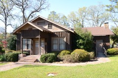
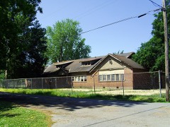
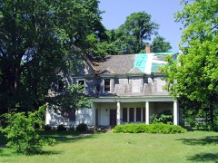
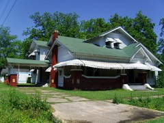
23 National Register listings published here.
Sources: the National Register database, National Park Service
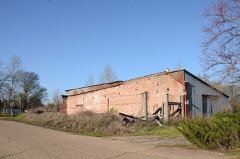
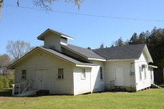
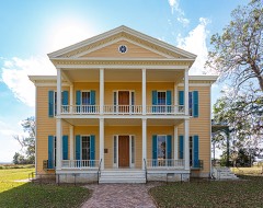
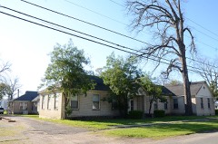
50 topographic sheets cover 54 settlements here, and 23 properties are on the National Register of Historic Places.
23 National Register listings published here.
Sources: the National Register database, National Park Service
Every property in this county listed on the National Register of Historic Places, with the year it was listed and the federal nomination document.
Every wildfire the federal occurrence database records inside this county: 41 of them, burning about 1,208 acres. 1 started naturally and 13 were recorded as arson. Each settlement page carries the fires within five miles of it.
| Reported cause | Fires |
|---|---|
| Arson/incendiarism | 13 |
| Missing data/not specified/undetermined | 11 |
| Debris and open burning | 8 |
| Equipment and vehicle use | 5 |
| Smoking | 2 |
| Railroad operations and maintenance | 1 |
| Natural | 1 |
The five largest, by the area the report gives. Two of them were set deliberately.
| Date | Cause | Size | Reported by | Name on the report |
|---|---|---|---|---|
| 15 March 2006 | Debris and open burning | 178 acres | Arkansas Forestry Commission | not named |
| 5 August 2006 | Natural | 140 acres | Arkansas Forestry Commission | CHICOT 210 |
| 7 September 2010 | Arson/incendiarism | 136 acres | Arkansas Forestry Commission | CARROLL HILL |
| 4 July 2005 | Debris and open burning | 115 acres | Arkansas Forestry Commission | not named |
| 7 September 2006 | Equipment and vehicle use | 80 acres | Arkansas Forestry Commission | not named |
| 21 January 2006 | Arson/incendiarism | 70 acres | Arkansas Forestry Commission | not named |
| 30 September 2004 | Smoking | 60 acres | Arkansas Forestry Commission | not named |
| 28 October 2010 | Smoking | 50 acres | Arkansas Forestry Commission | not named |
Every settlement page carries the fires within five miles of it - see the settlement index below.
The NOAA Storm Events Database holds 499 reports for this county, causing 2 deaths, 49 injuries and about $28,234,000 in recorded property damage. Each settlement page carries the reports that name it.
| Kind of event | Reports |
|---|---|
| Thunderstorm Wind | 221 |
| Hail | 136 |
| Flash Flood | 81 |
| Tornado | 45 |
| Flood | 12 |
| Funnel Cloud | 3 |
| Lightning | 1 |
The most serious of them, by death, then injury, then recorded damage. The accounts are quoted exactly as the forecast office filed them.
| When | Event | Place named | Harm | What the report says |
|---|---|---|---|---|
| October 1979 | Tornado (F1) | not stated | 1 killed, 2 hurt, $25,000 | no account filed |
| April 2007 | Thunderstorm Wind | Lake Vlg | 1 killed | One fatality occurred on Lake Chicot as 60 MPH winds capsized a boat. |
| February 1976 | Tornado (F2) | not stated | 36 hurt, $250,000 | no account filed |
| December 2013 | Tornado (EF1) | Bellaire | 2 hurt, $100,000 | A long track tornado touched down along Highway 65 in Chicot County, Arkansas, where numerous power poles were snapped and two eighteen wheelers flipped over causing 2 minor injuries. Damage occurred to several homes and farm buildings and heavy roof damage occurred to the Yellow Bend Port facility. This tornado was initially in Chicot County, moved into Desha County, and then moved back into Chicot County. The tornado then crossed the Mississippi River into Bolivar County, Mississippi. The tornado was rated EF-1 in Chicot County and was given an overall rating of EF-2 due to damage in Mississippi.||In Bolivar County, Mississippi, numerous power poles were snapped. A well built tractor shed was destroyed and several farm buildings were damaged. Maximum wind speeds were estimated at 115 mph, with a total path length of 41 miles through Chicot, Desha, and Bolivar counties. |
| November 1995 | Tornado (F1) | Eudora | 2 hurt, $30,000 | Two mobile home trailers were totally destroyed in the small community of Empire. Two people were injured. One of the injuries was to a man that had been thrown 40 yard away from his mobile home and was critically injured. Several automobiles were damaged and several trees were blown down. |
| November 1988 | Thunderstorm Wind | not stated | 2 hurt | no account filed |
| March 2016 | Tornado (EF1) | Dermott | 1 hurt, $2,500,000 | This tornado started on the southwest side of Dermott just west of Buckner Lane. Here several trees were snapped. As it crossed Buckner, six power poles were taken down. It then crossed Trotter Street, where more trees were snapped with others uprooted. A fence was laid down as well. A few homes here had minor roof damage where shingles were blown off. The tornado then tracked across US Highway 165 where it moved through open field. It tracked into the South Delta Regional Correctional Facility. Quite a bit of damage was done to the facility as it took a direct hit. Several large sections of the outer fence were torn down. Five buildings on the south side of the complex sustained roof damage where shingles and sheet paper were removed. The gym building, a metal structure, was heavily damaged where a large section of wall was removed. The main building of the complex suffered roof damage where roughly half of the roof was lifted or had parts removed. The roof is not a typical roof; it has several layers. Large portions of the foam insulation were pulled out along with several sections of a thin roof covering. A couple of the guard watch towers had the windows blown out and some minor damage. One employee was injured trying to exit a tower and broke a leg. The tornado then moved into a wooded area, where trees were snapped and a metal carport was thrown and destroyed. As the tornado crossed Highway 35, many more trees were damaged. One home sustained minor roof damage on the south side of the highway. The tornado crossed US Highway 65 and snapped more trees. It then continued through a large wooded area and farmland and it moved into Desha County. It then crossed Highway 159 where many more trees were snapped and uprooted. Where it crossed Highway 159, a home sustained some minor roof damage and had the wood framed shed destroyed. A few power lines were down here as well. The tornado continued northeast into a wooded area where more trees were damaged. Though the tornado likely dissipated a bit farther east, no access was available to that area due to flooding. The total path length was 9.2 miles, with 2.6 miles of that in Desha County. The maximum estimated winds were 105 mph. |
| January 2020 | Tornado (EF1) | Lake Vlg | 1 hurt, $1,000,000 | This tornado began on the southeast side of the Lake Village Municipal Airport on Airport Road where it rolled and almost destroyed a manufactured home. It is at Airport Road where one injury was reported due to a tree falling on a home. It then moved east-northeast to US Highway 278, breaking 8 to 10 wooden electrical poles. It moved to the northeast of the Lake Village community where it continued to knock down wooden electrical poles and began to uproot and snap large branches from softwood trees along North Lakeshore Drive and along the shore of Lake Chicot. The Lake Village Country Club along North Lakeshore Drive took damage to its roof on the backside. In addition, on the backside of the Country Club, a nearby forested area had multiple snapped large hardwood tree limbs in addition to the tin roof of a metal storage building peeled completely off. Also along North Lakeshore Drive, multiple trees were uprooted and snapped at a trailer park, where one trailer was blown across the street to near the bottom of Lake Chicot. As the tornado continued to track northeast, it moved along AR Highway 144, uprooting trees and snapping large hardwood limbs. Five electrical power poles were downed along Highway 144, as well as another trailer getting rolled to near the bottom of Lake Chicot. The tornado continued to snap large limbs and uproot hardwood trees as it moved across Pecan Ridge Drive. The tornado continued to just north of Levee Road where it lifted, but not before a few uprooting hardwood trees and snapping small to medium sized limbs. It is important to note that a large swath of severe wind speeds resulted in widespread downed trees on Lakehall Road, Sunnyside Road, Stuart Island Road and at the Lake Chicot State Park. Several of these trees fell on power lines causing outages to a large portion of the Lake Village community. This tornado then continued east-northeast across the MS River to across Lake Ferguson in Washington County, where the second floor was blown off of a lake house on South Ferguson Road. In addition, a high concentration of snapped and uprooted hardwood trees was noted on the backside of the lakehouse on South Ferguson Road, thus resulting in the upgraded EF-2 rating. It continued to move east to Highway 1 North where it snapped small to large hardwood tree limbs before dissipating. Estimated peak wind with this tornado was 127 mph. Max width was 850 yards. Total path length was 17.81 miles. |
| March 2016 | Tornado (EF1) | Dermott | 1 hurt, $110,000 | The entire path of this tornado was within a mile of the path of the tornado which occurred on the evening of March 13th. The tornado began on the west side of Dermott just south of W Gaines St, where much of the roof was removed from a home and the carport was blown away. An outbuilding was damaged at this location as well and a pontoon boat was blown several yards. The tornado continued through the center of Dermott intermittently snapping and uprooting trees and breaking a couple utility poles along the path. Minor roof damage occurred at a senior care facility, an abandoned trailer was damaged, and a fence was blown down. On the east side of down, a light pole was blown over at a baseball field and a small billboard was blown over. As the tornado crossed the intersection of AR Highway 35 and US Highway 165, several construction cones were blown away. The tornado reached its strongest point in a field north of Highway 35, where a farm equipment shed was demolished. Heavy foundation blocks and farm trailers were moved. Debris was scattered at least a half mile to the north through fields and across US Highway 165. The tornado lifted shortly thereafter. The maximum estimated winds were 110mph. |
| March 1977 | Tornado (F1) | not stated | 1 hurt, $25,000 | no account filed |
| April 2026 | Thunderstorm Wind | Dermott | 1 hurt | A tree fell on a home in Dermott, resulting in minor injuries to one resident. |
| September 2008 | Flash Flood | Vaucluse | $3,000,000 | Persistent heavy rains occurred from weakening Hurricane Gustav and dumped 8 to 12 inches of rain across the county. This heavy rainfall caused many roads to flood along with several homes taking in water.||Agriculture was especially hard hit as all of the farmland was flooded. In some cases, entire crops were lost or were substantially damaged where yields were very low. |
| May 2011 | Flood | Norcross | $2,000,000 | Flooding along the Mississippi River caused extensive flooding of low lying farmland along the river. All of the flood waters were within the mainline levee. Three homes were destroyed and 4 businesses were damaged by the flood waters. |
| May 2008 | Tornado (EF2) | Ashton | $1,500,000 | This tornado touched down near Highway 293 and tracked northeast for 10 miles where is dissipated shortly after crossing Highway 65. Along the path, hundreds of hardwood and softwood trees were snapped and uprooted. A mobile home was flipped over and destroyed. Several sheds, barns, outbuildings and unattached carports were damaged and destroyed along with several fences damaged. A 50 foot antenna was knocked down. A single family home had minor shingle damage, damage to siding, and window damage while 2 boats were damaged. The roll-up door for a tractor shed was damaged and a trampoline was blown around 75 yards and damaged. Lastly, 15 wooden power poles were also snapped near Highway 65. Maximum winds were around 115 mph. |
| September 2008 | Flash Flood | Harwood | $1,000,000 | During the late afternoon on the 3rd, a heavy band of storms developed and dumped a quick 2 to 4 inches across the eastern side of Chicot County. This rainfall fell on already soaked ground some flooding still occurring in some locations. Additional flooding occurred from this rainfall and dozens of additional roads were under water. |
| September 2009 | Flash Flood | Eudora | $700,000 | Water was reported inside 30 homes in Eudora as well as 6 homes south of Eudora near the Indian Point Community. Sandbags were utilized. All major highways in the area had over two feet of water on the roads. Widespread flooding was observed in Eudora. Several businesses in Eudora were damaged by flooding. A service station at Highway 65 and 159 received water damage and was monitored for gasoline leaks. |
| August 2008 | Flash Flood | Arkla | $600,000 | Heavy rainfall, between 4 and 7 inches, caused many roads across the southern half of Chicot County to be inundated with water. A few homes were flooded in the west central portion of the county along with a few around Chicot Junction. Many crops were damaged by the wet conditions and standing water. |
| February 2008 | Hail | Halley Jct | $600,000 | A significant hail storm occurred across the northern portion of Chicot county as a large supercell thunderstorm tracked north-northeast. The hail moved into Chicot County from southeast Drew County between Jerome and Dermott and tracked to the Halley Community. Golf ball sized hail covered the ground along the path with baseball to softball sized hail stones being the largest. Several homes sustained damaged along with dozens of vehicles sustaining substantial hail damage from dents or broken windshields. |
| May 2009 | Flood | Empire | $500,000 | Some 80 roads across the county had flooded. Persistent rains over the past week have produced four to six inches and the water has no place to drain. |
| November 2001 | Tornado (F1) | Lake Vlg | $500,000 | A supercell thunderstorm moved out of Ashley County into Chicot County and produced a short track weak tornado five miles south-southwest of Lake Village. The tornado travelled one mile and damaged four houses and one mobile home, before lifting four miles south-southwest of Lake Village. The tornado also blew down several trees and power lines along its short path. This tornado resulted in a total of $500K in damage. |
| November 1993 | Thunderstorm Wind | Eudora | $500,000 | Thunderstorm winds damaged a couple of barns, a mobile home and an office building. A farm tractor was also overturned. |
| October 2009 | Flash Flood | Dermott | $400,000 | More heavy rainfall fell across Chicot County on the 13th and caused additional flooding. Many more roads were flooded and closed due to high water. Several homes and businesses were flooded in Dermott and Lake Village. Crops were also heavily damaged by the heavy rain and flooding. |
| March 2023 | Hail | Lake Vlg | $300,000 | Golf ball sized hail reported by the sheriffs office. |
| May 2019 | Flash Flood | Eudora | $300,000 | Several homes in Eudora as well as many roads in and near the town were flooded. |
| June 2019 | Thunderstorm Wind | Dermott | $300,000 | A swath of 70-80 mph winds impacted far north Chicot County, which included the city of Dermott and areas along Highways 35 and 65, and into Halley. Much of this was uprooted, snapped, or damaged trees. There were also trees blown down on some homes and power lines. There was quite a bit of minor roof damage to structures from the wind. Pockets of corn stalks were also bent or laid down. Power poles were snapped. |
| March 2016 | Flash Flood | Dermott | $300,000 | Highway 165 was closed in both directions. A portion of the railroad track was also washed out. |
| June 2016 | Thunderstorm Wind | Ross Van Ness | $300,000 | Trees were blown down across the Eudora area, which included on Highway 8 between Pickle Shed Road and Marigold Road, on South Mabry Street, and across Peebles Street. A tree and power lines were blown down along Highway 65 in Eudora. Twenty one homes received minor damage. Three vehicles had trees on them. A bass boat had sunk and a pontoon boat was turned over. Numerous trees and power lines were down along Grand Lake Road between Eudora and Grand Lake. |
| June 2011 | Thunderstorm Wind | Myrtle Grove | $300,000 | Numerous large trees were blown down around Lake Village. Power poles were snapped, trees were down on houses and a couple roofs were blown off houses on Bill Young and Ginny Roads. Fifteen high tension power poles were snapped along Highway 82. Seventy five percent of Lake Village was left without power. |
| September 2005 | Tornado (F1) | Eudora | $300,000 | This tornado briefly touched down just west of Chicot Junction. The brief path of the tornado was across open farm land. However, it did manage to hit an electrical sub station. The tornado caused substantial damage to the sub station. Actually, the winds from the tornado threw grass and other debris into the station causing it to shut down. |
| April 2003 | Tornado (F0) | Eudora | $300,000 | This tornado touched down on the N side of Eudora and moved E for 2.5 miles. This tornado mainly snapped trees and uprooted a few trees that fell onto houses. Four homes sustained major roof damage, due to fallen trees, with 11 other homes sustaining minor damage. |
| December 2024 | Hail | Dermott | $250,000 | Large hail fell in town to at least baseball size, some possibly larger. |
| June 2011 | Thunderstorm Wind | Dermott | $250,000 | Trees and power lines were blown down in the city. There was roof damage to a building on 101 North Shepard Street. Winds were estimated to be 60 to 65 mph. There were power outages in Dermott until 10 pm. |
| September 2011 | Thunderstorm Wind | Halley Jct | $250,000 | A severe thunderstorm produced a damaging downburst near the intersection of US Highways 65 and 165. A carport was ripped off a home, causing structural damage to the rear of the home, and numerous shingles were blown off the west side of the house. A large radio antenna was also blown over. At the same location, a large part of a roof of a commercial building was blown off. In the nearby vicinity, a billboard sign was snapped and blown over, a small carport was flipped and blown across a road, and a fence and three empty eighteen wheeler trailers were pushed over. Additionally, a number of trees were snapped and uprooted. All of the damage was laid out from northwest to southeast and appeared straight line in nature. Maximum winds were estimated at 90 mph. |
| May 2008 | Flash Flood | Dermott | $250,000 | A good portion of the Dermott Business District was flooded by nearly two feet of water. Multiple thunderstorms moved across northwest Chicot County producing several inches of rain. The repetitive nature of the storms produced locally heavy rain which caused flooding around the city. |
| September 2005 | Thunderstorm Wind | Lake Vlg | $250,000 | Numerous trees and power lines down across town and along a swath to the north-northeast around the north shore of the lake. A few structures sustained roof damage just north of Lake Chicot. |
| March 1990 | Tornado (F1) | not stated | $250,000 | no account filed |
| October 1980 | Tornado (F2) | not stated | $250,000 | no account filed |
| April 1979 | Tornado (F1) | not stated | $250,000 | no account filed |
| January 2023 | Tornado (EF2) | Cosgrove | $200,000 | This tornado began near the intersection of Ashley 270 Road and Ashley 25 Road west of the Overflow National Wildlife Refuge in southern Ashley County. As it moved northeast, the tornado uprooted, snapped, or damaged trees along its path. It crossed over several highways, county roads, and low-lying areas through the county until it reached Montrose near the intersection of US Highway 82 and 165. There the tornado intensified to its maximum intensity of EF-2 with estimated peak winds of 120 mph. Along US 82 near 9th Street, a small guest home on concrete blocks was pushed off its foundation and destroyed. A nearby mobile home was rolled across three parked cars which were also destroyed. Several sheds and outbuildings were destroyed in the immediate vicinity as well. Widespread damage was common in the western part of town where many homes suffered minor to moderate roof damage. Several trees were uprooted or snapped along with continued minor to moderate residential damage as the tornado moved northeast and across northern Montrose. It crossed US 165 north of Montrose where an outbuilding was destroyed. As the tornado moved into farmland northeast of town, a center pivot irrigation system was destroyed. It continued northeast into Chicot County and across the intersection of Arkansas Highways 144 and 293 where a home and several buildings lost roofing and paneling, and some power poles were blown down. The tornado crossed US Highway 65 and Cedar Road near the Bellaire community in northern Chicot County, blew down a few power poles and damaged a few trees, and then dissipated shortly after crossing into Desha County. |
| April 2021 | Tornado (EF1) | Indian | $200,000 | An EF1 tornado developed on the evening of April 7, near the intersection of Costello Road and Coffey Road in West Carroll Parish, LA. The tornado tracked northeast, crossed Hwy 585 near Creech Road, where a metal building system structure was significantly damaged, including the roof being removed and thrown. A home sustained some roof damage as well with several shingles missing. The tornado continued to the northeast, damaged more homes and destroyed a central pivot irrigation system southwest of Kilbourne. The tornado then continued northeast, crossed Hwy 159 north of Kilbourne and moved just north of due east along E Arkla Road. Several structures here were damaged including an outbuilding that was completely destroyed. Finally, the tornado crossed over the roadway and into farmland in Chicot County, AR where it flipped over an additional central pivot irrigation system and damaged more trees before lifting northeast of Kilbourne, south of Albright Road. The max wind speed was 95 mph. The total path length was 9.21 miles. |
| January 2020 | Tornado (EF1) | Cosgrove | $200,000 | This tornado started just northeast of Hamburg along Ashley 70 Road and tracked roughly 20 miles to just east of Montrose in Chicot County. Thousands of trees were uprooted and snapped along the path along with numerous power lines and poles downed. Some of the heaviest damage was to a mobile home just off Ashley 129 Road. The home was thrown 15 to 20 feet and destroyed. Another mobile home was destroyed along Ashley 128 Road. The tornado then crossed Highway 82 near Ashley 301 Road. Power poles were broken here and a tractor shed was heavily damaged. From this point, the tornado mostly paralleled Highway 82 or tracked along it. Many power lines were down along with poles. Just east of Ashley 912 Road, one wooden high tension segment had the top broken out. In the Snyder community, some homes sustained roof damage and had trees down on them. North of Highway 82, near Horseshoe Lake, a lot of hardwood trees were heavily damaged and there were three segments of the wooden high tension poles and lines taken out. The tornado continued roughly along Highway 82 toward Montrose. The strongest core of the tornado remained north of the highway and downed two more wooden high tension segments before Montrose and two more just north of town to the west of Highway 165. In the town of Montrose, numerous trees were damaged along with many homes having some degree of roof damage or a handful more with a tree on the home. Just east of Montrose, near the Chicot County line and north of Highway 82, a metal high tension pole segment was taken down which supported the highest wind estimate of 130 mph. The tornado dissipated near County Road 293 on the north side of Highway 82. Maximum width was 1000 yards in Ashley County. Total path length was 20.51 miles. Maximum estimated winds in Chicot County were 88 mph, but 130 mph winds were estimated in Ashley County. |
| March 2016 | Flash Flood | Halley Jct | $200,000 | Highway 35 at Highway 165 remained closed due to flooding. Other secondary roads in the county remained closed as well. |
| March 2016 | Flood | Eudora | $200,000 | Numerous roadways across the county had flooding issues. |
| May 2009 | Flash Flood | Gaines | $200,000 | Numerous roads were flooded with some roads damaged around Lake Village. County roads 808 and 815 had the worst damage due to flooding. |
| April 2003 | Tornado (F0) | Cosgrove | $200,000 | A large tin barn had its roof caved in along with several trees having branches snapped. A mobile home had a portion of its roof pealed back. Another large tin shed was twisted down with some of the tin roof thrown into a pond. |
| April 2018 | Thunderstorm Wind | Cosgrove | $170,000 | Power poles were blown down along Bill Young Road southwest of Lake Village. Stoplights, trees and powerlines were blown down in Lake Village. A powerpole was snapped along Highway 65 north-northwest of Lake Village. Approximately 30 powerpoles and multiple trees were blown down and snapped from Lake Village to the Greenville bridge over the Mississippi River. |
| June 2021 | Flash Flood | Dermott | $150,000 | About 15 streets and roads in Dermott, as well as several in Lake Village, were closed due to flooding. Some businesses in Dermott were flooded, and residents resorted to using sandbags to keep out floodwaters from homes and businesses. |
| May 2019 | Flash Flood | Dermott | $150,000 | Widespread flash flooding occurred around Dermott, including along Freeman Street where a family was rescued from a flooded home. |
| March 2016 | Tornado (EF1) | Hudspeth | $150,000 | This tornado began just east of US Highway 165 and north of Gibson Rd where a 120 ft tall radio antenna was blown over. The tornado continued north paralleling Highway 165. The tornado reached its strongest point just south of Bullock Rd, where a diesel tank was moved several yards through a sod farm and an irrigation pivot was overturned. The tornado lifted about a half mile north of Bullock Rd damaging a few power poles and snapping a tree along a driveway. The maximum estimated winds were 100 mph. |
| September 2005 | Tornado (F1) | Lake Vlg | $150,000 | This tornado was spotted between Lake Village and Montrose moving across farm land. This tornado was on the ground for nearly 2 miles and damaged numerous trees and power lines. |
| March 2006 | Thunderstorm Wind | Lake Vlg | $150,000 | no account filed |
| March 2008 | Hail | Eudora | $130,000 | A swath of quarter to golf ball sized hail fell across the southern portion of Chicot County. Areas just to the west of Eudora and around Eudora received the large hail as the storm moved in a general east direction. The storm continued to produce hail as it crossed the Mississippi River, but did dissipate shortly after crossing the river. |
| April 2024 | Flash Flood | Eudora | $125,000 | Streets in town were flooded, and floodwaters approached or entered several of the businesses along US Highway 65. |
| January 2020 | Tornado (EF1) | Myrtle Grove | $110,000 | A brief tornado developed near US Highway 65/US Highway 278 near Arkansas Highway 159. It collapsed the center of a metal building where only one side and the front of the building were left standing. On the backside, a shed was completely destroyed. The tornado then moved east across the highway to the Delta Spindle Building, a metal warehouse building. Here, some windows were blown out and portions of the tin roof were peeled off and blew into the tree line on the backside of the business. In addition, the tornado broke a wooden power pole in the parking lot of the Delta Spindle Building before lifting. Maximum peak winds were estimated at 99 mph. |
| January 2020 | Thunderstorm Wind | Macon Lake | $100,000 | Multiple utility poles were snapped along US 65, including two concrete towers. |
| February 2018 | Flash Flood | Dermott Muni Arpt | $100,000 | Several city streets were flooded and closed. Evacuations of residents occurred during the night and into the morning. |
| April 2018 | Tornado (EF1) | Cosgrove | $100,000 | The tornado began along US 165 between Portland and Montrose, where a few older utility poles were damaged and moved northwest across open fields, damaging additional utility poles along Ashley County Roadd 54. The tornado crossed US 82 near the Ashley/Chicot County line. At this location, the top of a silo was removed and the structure was bent, two homes sustained exterior damage with one losing a large amount of roofing material, a travel trailer was destroyed, and a couple of businesses sustained relatively minor structural damage. The tornado reached its peak intensity near this location, where two sets of wooden transmission poles were snapped. There was also considerable tree damage in the area. The tornado continued across Shelton Turner Road, where a home and mobile home sustained damage. The tornado crossed AR Highway 293, Slaughter Road, Beavers Road, and Lingo Road before lifting in west central Chicot County. Maximum estimated wind speed was 115 mph in Ashley County. Total path length of the tornado was just under nine miles and the max width was 700 yards. |
| March 2016 | Flash Flood | Cosgrove | $100,000 | The vast majority of county roads were impassible. Approximately ten families were displaced due to floodwaters around Dermott. Another two families were displaced around Eudora. Highway 65 was under 3.5 feet of water near Eudora. |
| March 2014 | Thunderstorm Wind | Eudora | $100,000 | A swath of straight-line wind damage began near Highway 65 just south of Eudora where eight wooden power poles were snapped off to the northeast. Damage also occurred along Grand Lake Loop east southeast of Eudora where a large tree was snapped, a carport was thrown over a home landing on an outbuilding, and shingle damage occurred to a house. The tree, carport and power poles were all blown to the northeast. Multiple trees and large limbs were also blown down to the east and northeast in the city limits of Eudora. |
| January 2013 | Flash Flood | Dermott | $100,000 | A few roads were being blocked off in Dermott due to flooding. Nearly twenty percent of the roads were flooded in Eudora, and eighty percent of the county roads were flooded. Some water approached a number of homes throughout the county. |
The Survey's mineral resources record lists 3 workings inside this county. 1 still produces and 2 are closed or unrecorded. Each settlement page carries the workings within five miles of it.
| Commodity | Workings |
|---|---|
| Sand and Gravel, Construction | 2 |
| Stone, Crushed/Broken, Clay, Sand and Gravel, Construction | 1 |
The least common of them first, because a county's hundredth gravel pit says nothing its first ten did not.
| Where | Site | Commodity | Status | Recorded |
|---|---|---|---|---|
| Unk | Stone, Crushed/Broken, Clay, Sand and Gravel, Construction | Past Producer | ||
| Lee Mccort Dredge | Sand and Gravel, Construction | Unknown | ||
| Sand Pit | Sand and Gravel, Construction | Producer |
Named settlements recorded in the Geographic Names Information System, each with the topographic sheets covering it. Villages, hamlets and abandoned places alike. Each is shown with the nearest named watercourse or landform and the survey quadrangle it falls on.
District 7 · 71653 · Lake Village quadrangle
13 sheets, 1936 to 1986
No longer a settlement
District 1 · 71638 · McGehee South quadrangle
13 sheets, 1936 to 1986
No longer a settlement
District 7 · 71653 · On Old Boeuf River · Lake Village quadrangle
13 sheets, 1936 to 1986
No longer a settlement
District 9 · 71640 · Near Worthington Towhead · Eminence quadrangle
14 sheets, 1939 to 1986
No longer a settlement
The vanished settlements of Chicot County: the places named above that are no longer on the map.