 Block
Palarm, Arkansas
19 topographic sheets cover this place, the earliest surveyed in 1891 and the latest in 1994. It stands in Danley Township. It lies in ZIP code area 72106. The Survey maps it on the Mayflower quadrangle.
Topographic sheets covering this place
11 surveys from 19 printed sheetsMatched by testing this settlement's coordinate against the published boundary of every sheet in the United States Geological Survey's historical collection. Each opens the scanned sheet at the Survey.
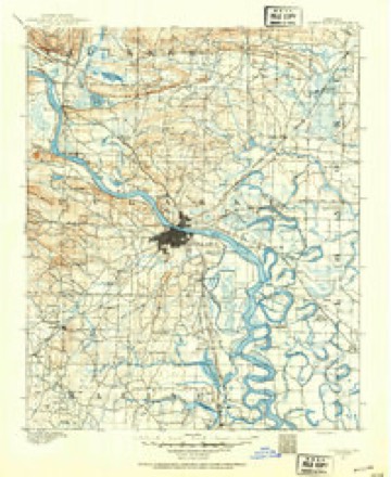
- 1891 USGS Little Rock quadrangle1:125000
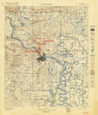
- 1893 USGS Camp Pike quadrangle1:125000
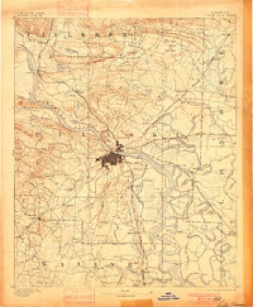
- 1893 USGS Little Rock quadrangle1:125000, 4 printings
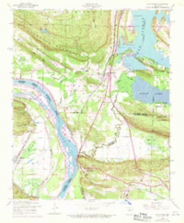
- 1953 USGS Mayflower quadrangle1:24000, 5 printings
- 1955 USGS Little Rock quadrangle1:250000
- 1956 USGS Little Rock quadrangle1:250000
- 1960 USGS Little Rock quadrangle1:250000
- 1964 USGS Little Rock quadrangle1:250000
- 1985 USGS Little Rock quadrangle1:100000
- 1987 USGS Mayflower quadrangle1:24000, 2 printings
- 1994 USGS Mayflower quadrangle1:24000
Fires near this place
63 since 1997Regional context, not property-specific evidence. The federal wildfire occurrence database lists 63 fires within 5 miles of Palarm between 1997 and 2020, burning about 876 acres in total. 1 started naturally. 14 were recorded as arson. Distance is straight-line from the map coordinates, so a fire counted here may appear on a neighbouring settlement's page as well.
| Reported cause | Fires |
|---|---|
| Missing data/not specified/undetermined | 20 |
| Debris and open burning | 18 |
| Arson/incendiarism | 14 |
| Misuse of fire by a minor | 4 |
| Smoking | 2 |
| Equipment and vehicle use | 2 |
| Railroad operations and maintenance | 1 |
| Recreation and ceremony | 1 |
| Natural | 1 |
The most recent of them, most recent first, with the day each was reported and the service that recorded it.
| Date | Cause | Size | Reported by | Name on the report |
|---|---|---|---|---|
| 9 September 2004 | Equipment and vehicle use | 1.0 acres | Arkansas Forestry Commission | not named |
| 9 September 1998 | Missing data/not specified/undetermined | 10 acres | Arkansas Forestry Commission | not named |
| 9 September 1998 | Arson/incendiarism | 25 acres | Arkansas Forestry Commission | not named |
| 5 September 1999 | Smoking | 3.0 acres | Arkansas Forestry Commission | not named |
| 30 September 2001 | Missing data/not specified/undetermined | under an acre | Arkansas Forestry Commission | not named |
| 27 September 2006 | Missing data/not specified/undetermined | 3.0 acres | Arkansas Forestry Commission | not named |
| 2 September 1999 | Debris and open burning | 4.0 acres | Arkansas Forestry Commission | not named |
| 17 September 2000 | Debris and open burning | 5.0 acres | Arkansas Forestry Commission | not named |
Settlements close enough to share some of these fires:
Mines and quarries near this place
7 within 5 milesRegional context, not property-specific evidence. The federal mineral resources record lists 7 workings within 5 miles of Palarm: 6 unknowns, 1 past producer. None of them still produces. What was taken out: Stone, Sand and Gravel, Construction, Aluminum. Distance is straight-line from the map coordinates, so a quarry counted here may appear on a neighbouring settlement's page as well.
Storms near this place
3 since 1998Regional context, not property-specific evidence. The National Weather Service names Palarm in 3 storm reports between 1998 and 2014: 2 tornado, 1 thunderstorm wind. The reports record 12 deaths and 167 injuries. Each account below is quoted exactly as the forecast office filed it, from the NOAA Storm Events Database, and each date opens the federal record of that event.
| When | Event | Place named | Harm | What the report says |
|---|---|---|---|---|
| April 2014 | Tornado (EF4) | Palarm | 12 killed, 167 hurt, $210,000,000 | This tornado exited Pulaski County 1.6 miles northeast of Roland, while crossing the Arkansas River, and entered Faulkner County 0.6 mile southwest of Palarm. The tornado reached its maximum intensity of EF4 in Faulkner County. It tracked through the River Plantation subdivision and White City, then struck Mayflower, where residences and businesses were destroyed. The tornado then moved across Interstate 40 at Mayflower, throwing cars, trucks, and road construction equipment off the freeway. Traffic along the interstate was backed up for weeks following the tornado as motorists slowed to view the damage. Next, the tornado crossed a part of Lake Conway and moved across part of Camp Robinson, a National Guard facility, where the Arkansas Game and Fish Commission lost a clubhouse, shop, horse barn, residence, metal carports, shower house, and dog kennels. The tornado then continued on through Saltillo and then caused devastation to homes and businesses in Vilonia. About 400 people had taken shelter in a safe room at the Vilonia high school. ||According to the American Red Cross, in Faulkner County, the tornado destroyed 261 houses and 121 mobile homes; caused major damage to 77 houses, 29 mobile homes, and 5 apartments; caused minor damage to 96 houses, 14 mobile homes, and 4 apartments; and affected 257 houses, 32 mobile homes, and 4 apartments. Hundreds of cars and pickup trucks were mangled along the path of the tornado. ||In Mayflower, a home improvement store was badly damaged, and a vehicle repair shop, millwork company, construction company, electric substation, and church were destroyed. A recreational vehicle dealership and dozens of RVs were also destroyed. The Arkansas Game and Fish Commission eventually removed 627 tons of tornado debris from Lake Conway. In Vilonia, the new intermediate school under construction was destroyed, as were nearly two dozen businesses along Main St. (U.S. 64B), including a dollar store, a strip mall, two auto repair shops, the old city hall, a gas station, a real estate office, an investment firm, an auto parts store, and a fried chicken restaurant. ||There were 12 fatalities in Faulkner County. In the Mayflower area, a 72-year-old woman was killed in a house on Plantation Dr., a 51-year-old man was killed in a house on Fortner Dr., and an 82-year-old man was killed in a house on Dam Rd. The other 9 fatalities were all in the Vilonia area. These included: brothers 7- and 9-years-old in a house on Cody Ln., a 50-year-old woman in a vehicle on U.S. 64, a 52-year-old man and a 53-year-old woman in a house on Cemetery Rd., a 57-year-old man in a house on North St., a 31-year-old man in a house on Aspen Creek Dr., and a 22-year-old man in a house on Clover Ridge Dr. In addition, a woman who was injured in a mobile home on Ponderosa Dr. gave birth to a baby which died immediately. More than 150 people were treated at hospitals. ||The tornado hit Vilonia three years and two days after a tornado had destroyed some of the same structures. The tornado exited Faulkner County 4.6 miles southeast of Naylor and entered White County 2.2 miles west-northwest of El Paso. |
| April 2011 | Tornado (EF1) | Palarm | $5,000 | This tornado exited Pulaski County 1.31 miles northeast of Natural Steps and moved into Faulkner County 2.42 miles south of Palarm. It crossed a tiny, peninsula-shaped area of Faulkner County adjacent to the Arkansas River. This section of Faulkner County is uninhabited, so damage was limited to some trees being blown down. The tornado then exited Faulkner County 2.06 miles south of Palarm and entered another section of Pulaski County 1.93 miles northeast of Natural Steps. |
| July 1998 | Thunderstorm Wind | Palarm | - | no account filed |
Nearest settlements
The eight closest, with where each one stands in the county. Distances are straight-line, computed from the Geographic Names Information System coordinates.
| Map | Place | Distance | Sheets |
|---|---|---|---|
| Mayflower | 3.7 miles | 19 | |
| Providence (historical) | 6.3 miles | 16 | |
| Chadwick (historical) | 7.3 miles | 17 | |
| Gold Creek | 7.6 miles | 13 | |
| Round Mountain | 8.3 miles | 13 | |
| Preston | 8.4 miles | 13 | |
| Gold Lake Estates | 8.7 miles | 13 | |
| Gentry Corner | 9.1 miles | 17 |
Elsewhere
Matched on this settlement's Geographic Names Information System number rather than its name, so it cannot be a different place of the same name in another state.
| Wikidata item Q122591301 | The structured record the population and elevation above come from. Public domain (CC0). |
Provenance
This settlement is recorded in the Geographic Names Information System as feature 58318. The sheet list is computed by point-in-boundary test against the United States Geological Survey's historical topographic inventory. Both are works of the United States government and carry no copyright under 17 U.S.C. 105.
Wildfire. Short, Karen C. 2022. Spatial wildfire occurrence data for the United States, 1992-2020 [FPA_FOD_20221014]. 6th Edition. Fort Collins, CO: Forest Service Research Data Archive. https://doi.org/10.2737/RDS-2013-0009.6 Collected with United States Government funding and usable without additional permissions or fees.
Mines and quarries. USGS Mineral Resources Data System (MRDS) https://mrdata.usgs.gov/mrds/ A work of the United States government, no copyright under 17 U.S.C. 105.
Storms. NOAA National Centers for Environmental Information, Storm Events Database https://www.ncei.noaa.gov/stormevents/ A work of the United States government, no copyright under 17 U.S.C. 105. Narratives are quoted verbatim from the National Weather Service report and are not edited or summarised.