Block
From the record
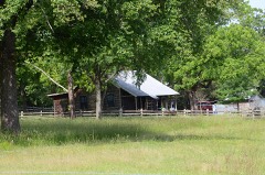
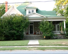
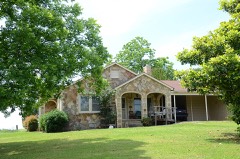
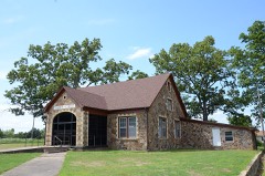
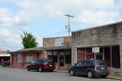
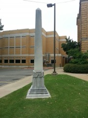
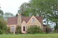
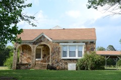
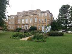
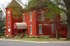
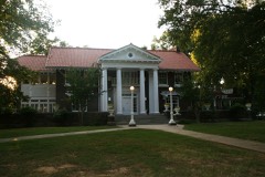
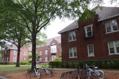
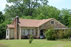
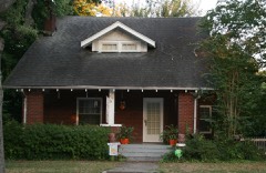
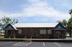
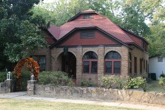
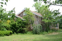
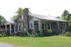
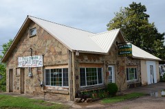
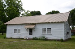
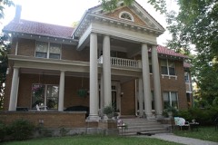
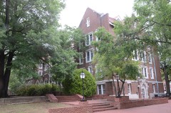
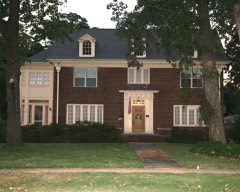
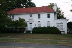
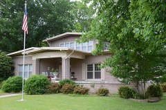
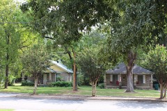
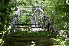
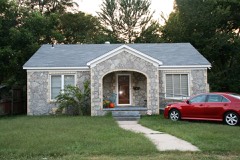
64 National Register listings published here.
Sources: the National Register database, National Park Service
92 topographic sheets cover 61 settlements here, and 64 properties are on the National Register of Historic Places.
64 National Register listings published here.
Sources: the National Register database, National Park Service
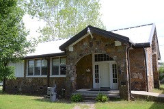
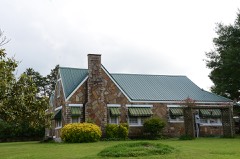
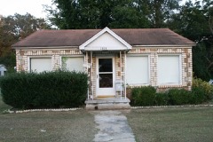
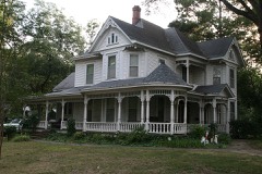
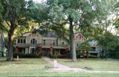
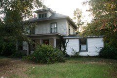
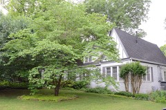
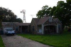
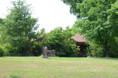
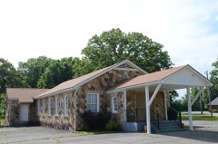
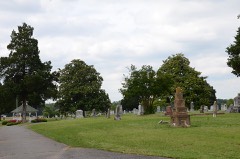
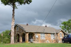
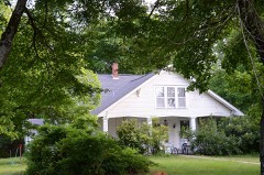
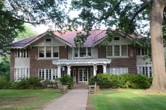
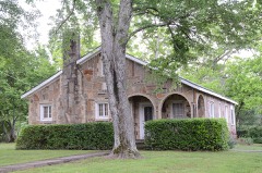
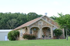
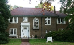
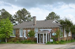
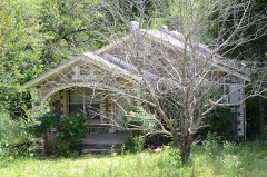
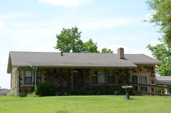
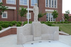
Every property in this county listed on the National Register of Historic Places, with the year it was listed and the federal nomination document.
Every wildfire the federal occurrence database records inside this county: 589 of them, burning about 8,062 acres. 14 started naturally and 108 were recorded as arson. Each settlement page carries the fires within five miles of it.
| Reported cause | Fires |
|---|---|
| Debris and open burning | 247 |
| Missing data/not specified/undetermined | 151 |
| Arson/incendiarism | 108 |
| Equipment and vehicle use | 39 |
| Smoking | 14 |
| Natural | 14 |
| Recreation and ceremony | 8 |
| Misuse of fire by a minor | 7 |
| Railroad operations and maintenance | 1 |
The five largest, by the area the report gives. Two of them were set deliberately.
| Date | Cause | Size | Reported by | Name on the report |
|---|---|---|---|---|
| 6 March 2020 | Missing data/not specified/undetermined | 636 acres | Arkansas Forestry Commission | not named |
| 28 January 2018 | Missing data/not specified/undetermined | 185 acres | Arkansas Forestry Commission | not named |
| 2 February 2018 | Missing data/not specified/undetermined | 161 acres | Arkansas Forestry Commission | not named |
| 15 April 2017 | Recreation and ceremony | 154 acres | Ozark-St. Francis National Forests | CATARACT FALLS |
| 4 April 2018 | Missing data/not specified/undetermined | 125 acres | Arkansas Forestry Commission | not named |
| 3 July 2012 | Arson/incendiarism | 109 acres | Arkansas Forestry Commission | MT. VERNON |
| 15 February 2014 | Debris and open burning | 103 acres | Arkansas Forestry Commission | FAU4274608 |
| 19 March 2004 | Arson/incendiarism | 100 acres | Arkansas Forestry Commission | not named |
Every settlement page carries the fires within five miles of it - see the settlement index below.
The NOAA Storm Events Database holds 827 reports for this county, causing 30 deaths, 538 injuries and about $316,234,500 in recorded property damage. Each settlement page carries the reports that name it.
| Kind of event | Reports |
|---|---|
| Thunderstorm Wind | 360 |
| Hail | 266 |
| Flash Flood | 84 |
| Tornado | 62 |
| Flood | 20 |
| Heavy Rain | 15 |
| Lightning | 13 |
| Funnel Cloud | 7 |
The most serious of them, by death, then injury, then recorded damage. The accounts are quoted exactly as the forecast office filed them.
| When | Event | Place named | Harm | What the report says |
|---|---|---|---|---|
| April 2014 | Tornado (EF4) | Palarm | 12 killed, 167 hurt, $210,000,000 | This tornado exited Pulaski County 1.6 miles northeast of Roland, while crossing the Arkansas River, and entered Faulkner County 0.6 mile southwest of Palarm. The tornado reached its maximum intensity of EF4 in Faulkner County. It tracked through the River Plantation subdivision and White City, then struck Mayflower, where residences and businesses were destroyed. The tornado then moved across Interstate 40 at Mayflower, throwing cars, trucks, and road construction equipment off the freeway. Traffic along the interstate was backed up for weeks following the tornado as motorists slowed to view the damage. Next, the tornado crossed a part of Lake Conway and moved across part of Camp Robinson, a National Guard facility, where the Arkansas Game and Fish Commission lost a clubhouse, shop, horse barn, residence, metal carports, shower house, and dog kennels. The tornado then continued on through Saltillo and then caused devastation to homes and businesses in Vilonia. About 400 people had taken shelter in a safe room at the Vilonia high school. ||According to the American Red Cross, in Faulkner County, the tornado destroyed 261 houses and 121 mobile homes; caused major damage to 77 houses, 29 mobile homes, and 5 apartments; caused minor damage to 96 houses, 14 mobile homes, and 4 apartments; and affected 257 houses, 32 mobile homes, and 4 apartments. Hundreds of cars and pickup trucks were mangled along the path of the tornado. ||In Mayflower, a home improvement store was badly damaged, and a vehicle repair shop, millwork company, construction company, electric substation, and church were destroyed. A recreational vehicle dealership and dozens of RVs were also destroyed. The Arkansas Game and Fish Commission eventually removed 627 tons of tornado debris from Lake Conway. In Vilonia, the new intermediate school under construction was destroyed, as were nearly two dozen businesses along Main St. (U.S. 64B), including a dollar store, a strip mall, two auto repair shops, the old city hall, a gas station, a real estate office, an investment firm, an auto parts store, and a fried chicken restaurant. ||There were 12 fatalities in Faulkner County. In the Mayflower area, a 72-year-old woman was killed in a house on Plantation Dr., a 51-year-old man was killed in a house on Fortner Dr., and an 82-year-old man was killed in a house on Dam Rd. The other 9 fatalities were all in the Vilonia area. These included: brothers 7- and 9-years-old in a house on Cody Ln., a 50-year-old woman in a vehicle on U.S. 64, a 52-year-old man and a 53-year-old woman in a house on Cemetery Rd., a 57-year-old man in a house on North St., a 31-year-old man in a house on Aspen Creek Dr., and a 22-year-old man in a house on Clover Ridge Dr. In addition, a woman who was injured in a mobile home on Ponderosa Dr. gave birth to a baby which died immediately. More than 150 people were treated at hospitals. ||The tornado hit Vilonia three years and two days after a tornado had destroyed some of the same structures. The tornado exited Faulkner County 4.6 miles southeast of Naylor and entered White County 2.2 miles west-northwest of El Paso. |
| April 1965 | Tornado (F4) | not stated | 6 killed, 200 hurt, $25,000,000 | no account filed |
| April 2011 | Tornado (EF2) | Mayflower | 4 killed, 15 hurt, $52,000,000 | This tornado exited Pulaski County north-northwest of Morgan and re-entered Faulkner County east-southeast of Mayflower. In Faulkner County, it first moved through the northwest part of Camp Joseph T. Robinson, a National Guard facility. Thousands of trees were blown down in the area of Arkansas Highway 89 and Clinton Rd. In addition, numerous power lines were blown down and some homes and outbuildings were damaged. Similar damage occurred as the tornado continued moving to the northeast. At the Black Oak Ranch Estates mobile home park, numerous mobile homes were destroyed and four people were killed. Two of the victims, a 63 year-old man and a 55 year-old man, were in separate mobile homes. The other two victims, a man and his wife, both 45 years-old, had left their mobile home and taken shelter in a large, metal, intermodal shipping container. The tornado carried the container approximately 150 yards, depositing it on the bank of a pond. The tornado next moved through Vilonia, causing damage to residences over a large part of the town. Businesses along U.S. Highway 64 were also damaged. Also on the highway, two tractor-trailers overturned, with one of them spilling its load of food products. After leaving Vilonia, the tornado continued on to the northeast. Additional trees were blown down, and houses and outbuildings were damaged or destroyed. The Red Cross indicated that approximately 34 houses and 62 mobile homes were destroyed, 91 houses and 41 mobile homes suffered major damage, 145 houses and 43 mobile homes had minor damage, and 53 houses and 38 mobile homes were affected. The tornado then exited Faulkner County south of Mount Vernon and moved into White County west of Hammonsville. |
| April 1982 | Tornado (F3) | not stated | 2 killed, 37 hurt, $2,500,000 | no account filed |
| May 1957 | Tornado (F3) | not stated | 1 killed, 18 hurt, $250,000 | no account filed |
| December 2002 | Tornado (F3) | Hamlet | 1 killed, 13 hurt | A strong tornado was spawned over Faulkner County about 1 mile north of Hamlet. The tornado moved to the northeast for approximately 9.8 miles before lifting 0.8 mile east-southeast of Enola. A number of homes, both permanent and mobile, were either damaged or destroyed along the path of the tornado. An 84 year-old woman was killed when her mobile home was destroyed. 13 others sustained injuries. Numerous trees and power lines were blown down. A power substation was also damaged. |
| December 1982 | Tornado (F3) | not stated | 1 killed, 7 hurt, $250,000 | no account filed |
| May 2011 | Flash Flood | Gold Creek | 1 killed, $250,000 | At 1:08 AM CDT, water was approaching the doorstep of houses in Mayflower. Around 1:20 AM CDT, an SUV went into flood waters on North Main St. in Mayflower and ended up in a ditch. The water was rising so rapidly that the vehicle was completely submerged by the time rescuers arrived. The 57 year-old driver of the SUV drowned. At 12:08 AM CDT, Numerous roads flooded around Vilonia; swift-water rescues became necessary by 1:00 AM CDT. A total of 29 people had to be evacuated from the Vilonia and Mayflower areas. |
| June 2014 | Thunderstorm Wind | Pickles Gap | 1 killed | A 59-year old man, who was fishing from a 14-foot boat on Beaverfork Lake, drowned when a severe thunderstorm capsized the boat. The investigative report from the Arkansas Game and Fish Commission indicated the primary cause of the accident was Weather - Failure to recognize unsafe conditions for the vessel type and a secondary cause of Hazardous Water. The report also indicated that winds were 60 to 70 mph, waves were over 2 feet, and the boater was not wearing a personal flotation device. |
| April 2004 | Lightning | Conway | 1 killed | no account filed |
| April 1980 | Tornado (F2) | not stated | 15 hurt, $2,500,000 | no account filed |
| March 1961 | Tornado (F2) | not stated | 12 hurt, $250,000 | no account filed |
| January 1956 | Tornado (F3) | not stated | 12 hurt, $25,000 | no account filed |
| January 1999 | Tornado (F2) | Naylor | 7 hurt | no account filed |
| May 1960 | Tornado (F3) | not stated | 6 hurt, $2,500,000 | no account filed |
| March 1952 | Tornado (F2) | not stated | 6 hurt, $25,000 | no account filed |
| April 2014 | Lightning | Enders | 6 hurt | Six workers were injured by lightning at a gas well drilling site near Fairview Rd. and Herring Rd. They were all taken to the hospital, but the injuries were not believed to be life-threatening. Radar and lightning data indicated that one storm had moved through the area and had moved away, then a second storm moved into the area and produced the lightning that injured the workers. Both of the storms produced only a small number of cloud-to-ground lightning strikes. |
| May 1961 | Tornado (F1) | not stated | 3 hurt, $25,000 | no account filed |
| January 1996 | Thunderstorm Wind | Conway | 3 hurt | no account filed |
| December 1982 | Tornado (F2) | not stated | 2 hurt, $250,000 | no account filed |
| July 1999 | Thunderstorm Wind | Conway | 2 hurt | no account filed |
| December 1982 | Tornado (F3) | not stated | 1 hurt, $250,000 | no account filed |
| October 1969 | Tornado (F2) | not stated | 1 hurt, $2,500 | no account filed |
| July 2017 | Lightning | Funston | 1 hurt | A 38 year old male was struck by lightning when he ran out to grab a hammock. |
| September 2006 | Lightning | Twin Groves | 1 hurt | One person was struck by lightning. The person sustained minor injuries and was airlifted to a nearby hospital for treatment. |
| June 1989 | Thunderstorm Wind | not stated | 1 hurt | no account filed |
| May 1985 | Thunderstorm Wind | not stated | 1 hurt | no account filed |
| July 1985 | Thunderstorm Wind | not stated | 1 hurt | no account filed |
| May 2011 | Flood | Twin Groves | $4,000,000 | Many roads around Lake Conway were closed due to flooding, including a portion of Arkansas Highway 89. |
| November 1988 | Tornado (F3) | not stated | $2,500,000 | no account filed |
| December 1982 | Tornado (F3) | not stated | $2,500,000 | no account filed |
| June 2009 | Thunderstorm Wind | Skunk Hollow | $1,500,000 | A couple of structures had portions of their roofs blown off, shingles were blown off several dozen residences, hundreds of large trees were blown down, tin roofs were blown off barns and outbuildings, and a couple of old farm buildings were blown down. Several houses were damaged by falling trees. The trailer of a parked tractor-trailer was overturned. Power lines were blown down. |
| December 2009 | Flood | Twin Groves | $1,250,000 | Flash flooding which developed early on the morning of the 24th became widespread areal flooding later in the morning and continued into the morning of the 25th. Arkansas Highway 85 was closed by flooding. Palarm Creek washed away part of Saltillo Rd. Roads that were under water included Wilson Bottoms Rd., Springfield Rd., Mallet Town Rd., Shaw Bridge Rd., Ridge Dr., Bayou Rd., Beryl Rd., and Otto Rd. The driver of a tank truck had to be rescued from high water on Wilson Bottoms Rd. In Conway, Trey Lane and Centennial Soccer Park flooded, causing the cancellation of the Holiday Festival of Lights. |
| June 2019 | Flood | Portland | $1,000,000 | Heavy rain and upstream reservoir releases led to flooding on the Arkansas River at Toad Suck. The record crest was 285.40 feet on 6/04/19. |
| May 2019 | Flood | Gleason | $1,000,000 | Flooding began on the Arkansas River at Toad Suck on May 25 and continued into June. The river reached a record stage in June. |
| April 2011 | Flood | Twin Groves | $1,000,000 | Widespread areal flooding occurred. |
| December 2009 | Flash Flood | Twin Groves | $750,000 | Widespread heavy rain resulted in the development of flash flooding early on the 24th. |
| March 2008 | Flood | Salem | $500,000 | Heavy rain in eastern Oklahoma and western Arkansas caused the Arkansas River at Toad Suck Lock and Dam to go above moderate flood level. For several days, the flow rate in the river was high enough that the dam functioned in open river operations. During periods such as this, the gates are totally out of the water and the difference in the upper and lower water levels is minimal. Some homes along the river were flooded and access to other homes was flooded for several days. Campers in the camping area had to be evacuated. This was the fifth highest crest since completion of the McClellan-Kerr Arkansas River Navigation System in the early 1970's. Some winter wheat was also lost. |
| April 1979 | Tornado (F2) | not stated | $250,000 | no account filed |
| April 1968 | Tornado (F2) | not stated | $250,000 | no account filed |
| March 1959 | Tornado (F3) | not stated | $250,000 | no account filed |
| August 2010 | Flash Flood | Conway | $150,000 | Several streets flooded in downtown Conway. Cars stalled in the high water, and water entered a few businesses. |
| June 2009 | Thunderstorm Wind | Gleason | $150,000 | A few trees were blown down, one of which fell on a house. A highway sign was blown down on Interstate 40. The ceiling of the drive-though section of a car dealership was badly damaged. |
| March 2008 | Flash Flood | Caney | $150,000 | New Home Road in Guy was flooded. Many roads were flooded in Greenbrier. A man was rescued in Conway after his truck was pinned against a tree in floodwaters on Ridge Road. Ruts were made in Springfield Road and Mallet Town Road by floodwaters. Estimates of $80,000 worth of transportation infrastructure damage were made. |
| March 2023 | Thunderstorm Wind | Enola | $100,000 | A recreational vehicle was crushed by a fallen tree. |
| May 2022 | Thunderstorm Wind | Conway | $100,000 | Trees fell on homes and across roads, windows were damaged and there were power outages. |
| March 2019 | Thunderstorm Wind | Conway | $100,000 | Three cars were crushed by a tree in Conway. |
| January 2018 | Tornado (EF1) | Linder | $100,000 | The most extensive damage occurred to the Needs Creek Church and adjacent neighborhood. The church suffered extensive roof damage, as did a few homes in the neighborhood. Other damage includes the destruction of outbuildings and minor roof damage to other buildings along the path. Winds in the Needs Creek area were estimated to have been near 100 mph (EF1), the highest estimated for this tornado. Trees and power lines were reported down in the area as well. |
| October 2014 | Thunderstorm Wind | Guy | $100,000 | Several barns and outbuildings were damaged or destroyed. A house had damage to its roof, chimney, and siding. Numerous large trees were blown down. Several vehicles were damaged by falling limbs or trees. |
| March 2012 | Flash Flood | Martinville | $100,000 | Numerous county roads were flooded. Four homes in the Liberty community and one home in Greenbrier were evacuated due to rising creeks. |
| April 2011 | Tornado (EF1) | Wooster | $100,000 | This tornado knocked down or snapped numerous trees and a few power lines. Several houses had roof damage from falling trees. One house had a gutter ripped off and one of the eaves damaged by a falling tree. |
| February 2009 | Thunderstorm Wind | Guy | $100,000 | Thunderstorm winds damaged roofs on several barns and a couple homes. Numerous trees were down. |
| February 2008 | Tornado (EF1) | Funston | $100,000 | Trees and power lines were blown down, a barn was destroyed, and part of an old chicken house collapsed. The tornado continued into White County, in the area southwest of El Paso. |
| May 2010 | Thunderstorm Wind | Funston | $75,000 | Trees were blown down, with one of the trees falling on a house. Shingles were blown off another house. A barn roof was blown off. |
| September 2008 | Flash Flood | Bono | $75,000 | Numerous roads were flooded in Conway and throughout Faulkner County. A pickup truck was washed off Springfield Road, west of Bono, and ended up 50 yards out in a field with water up to its windows. Four occupants of the truck were rescued, uninjured, by a swift water rescue team. |
| April 2022 | Thunderstorm Wind | Lake Conway | $50,000 | Homes were damaged near Hwy. 89 and I-40 near Mayflower. |
| September 2020 | Thunderstorm Wind | Greenbrier | $50,000 | Multiple trees were down and roofs were off of mobile homes from East Republican Rd. to Hwy. 25 between Greenbrier and Guy. |
| September 2020 | Thunderstorm Wind | Greenbrier | $50,000 | Multiple trees were down and roofs were off of mobile homes from East Republican Rd. to Hwy. 25 between Greenbrier and Guy. |
| January 2018 | Thunderstorm Wind | Linder | $50,000 | There was a 2 mile swath of damage that started at Arkla Valley and Highway 287. Multiple structures were destroyed, roofs were tore off, and trees and power lines were down. |
| January 2018 | Thunderstorm Wind | Linder | $50,000 | The roof was blown off Needs Creek Baptist Church east of Springhill. Trees and power lines were reported down in the area as well. |
The Survey's mineral resources record lists 43 workings inside this county. 3 still produce and 40 are closed or unrecorded. Each settlement page carries the workings within five miles of it.
| Commodity | Workings |
|---|---|
| Clay | 18 |
| Stone | 11 |
| Sand and Gravel, Construction | 10 |
| Lead | 1 |
| Stone, Crushed/Broken | 1 |
| Silica | 1 |
| Sandstone, Dimension | 1 |
The least common of them first, because a county's hundredth gravel pit says nothing its first ten did not.
| Where | Site | Commodity | Status | Recorded |
|---|---|---|---|---|
| Beryl Pit & Plant | Silica | Past Producer | ||
| Morris Farm | Lead | Unknown | ||
| Mrs. Arthur Palmer Farm | Sandstone, Dimension | Unknown | ||
| Reynolds Quarry and Mill | Stone, Crushed/Broken | Producer | ||
| Mc Ray Quarry | Sand and Gravel, Construction | Past Producer | ||
| Plnt No 3 | Sand and Gravel, Construction | Producer | ||
| Unk | Sand and Gravel, Construction | Past Producer | ||
| Unk | Sand and Gravel, Construction | Unknown | ||
| Unk | Sand and Gravel, Construction | Unknown | ||
| Unk | Sand and Gravel, Construction | Past Producer | ||
| Unk | Sand and Gravel, Construction | Unknown | ||
| Unk | Sand and Gravel, Construction | Producer | ||
| Unk | Sand and Gravel, Construction | Past Producer | ||
| Unk | Sand and Gravel, Construction | Unknown | ||
| Unk | Stone | Past Producer | ||
| Unk | Stone | Unknown | ||
| Unk | Stone | Unknown | ||
| Unk | Stone | Unknown | ||
| Unk | Stone | Past Producer | ||
| Unk | Stone | Past Producer | ||
| Unk | Stone | Unknown | ||
| Unk | Stone | Past Producer | ||
| Unk | Stone | Past Producer | ||
| Unk | Stone | Past Producer | ||
| Unk | Stone | Past Producer | ||
| Unk | Clay | Past Producer | ||
| Unk | Clay | Past Producer | ||
| Unk | Clay | Past Producer | ||
| Unk | Clay | Past Producer | ||
| Unk | Clay | Past Producer | ||
| Unk | Clay | Past Producer | ||
| Unk | Clay | Past Producer | ||
| Unk | Clay | Past Producer | ||
| Unk | Clay | Past Producer | ||
| Unk | Clay | Past Producer | ||
| Unk | Clay | Past Producer | ||
| Unk | Clay | Past Producer | ||
| Unk | Clay | Past Producer | ||
| Unk | Clay | Past Producer | ||
| Unk | Clay | Past Producer | ||
| Unk | Clay | Past Producer | ||
| Unk Shale Pits 2 | Clay | Past Producer | ||
| Unk Shale Pits 3 | Clay | Past Producer |
Named settlements recorded in the Geographic Names Information System, each with the topographic sheets covering it. Villages, hamlets and abandoned places alike. Each is shown with the nearest named watercourse or landform and the survey quadrangle it falls on.
Harve township · 72032 · Near Dun Hill · Holland quadrangle
11 sheets, 1956 to 1994
No longer a settlement
Benedict township · 72106 · Gleason quadrangle
17 sheets, 1892 to 1992
No longer a settlement
Bristol township · 72111 · On Hall Branch · Enola quadrangle
10 sheets, 1956 to 1994
No longer a settlement
Cadron township · 72034 · On Cadron Creek · Gleason quadrangle
17 sheets, 1892 to 1992
No longer a settlement
Danley township · 72032 · On Chadwick Creek · Cato quadrangle
17 sheets, 1891 to 1994
No longer a settlement
Cypress township · 72173 · On Middle Fork Cypress Bayou · Vilonia quadrangle
11 sheets, 1956 to 1994
No longer a settlement
Cypress township · 72173 · On Middle Fork Cypress Bayou · Vilonia quadrangle
11 sheets, 1956 to 1994
Mount Vernon township · 72047 · Near Garland Mountain · Enola quadrangle
10 sheets, 1956 to 1994
Pine Mountain township · 72034 · On Gold Creek · Conway quadrangle
13 sheets, 1956 to 1994
Cadron township · 72032 · On Gold Creek · Conway quadrangle
13 sheets, 1956 to 1994
Bristol township · 72111 · On Hall Branch · Enola quadrangle
10 sheets, 1956 to 1994
No longer a settlement
Cadron township · 72032 · On Pickle Gap Creek · Greenbrier quadrangle
11 sheets, 1956 to 1994
Walker township · 72039 · On Shilling Branch · Damascus quadrangle
13 sheets, 1956 to 1994
Matthews township · 72058 · On Tarkington Creek · Holland quadrangle
11 sheets, 1956 to 1994
Mount Vernon township · 72111 · On Trobough Branch · Mount Vernon quadrangle
11 sheets, 1956 to 1994
East Fork township · 72058 · Near Kaney Ridge · Greenbrier quadrangle
11 sheets, 1956 to 1994
No longer a settlement
Cadron township · 72032 · On Pickle Gap Creek · Greenbrier quadrangle
11 sheets, 1956 to 1994
No longer a settlement
Walker township · 72039 · On Hatcher Branch · Damascus quadrangle
13 sheets, 1956 to 1994
No longer a settlement
Clifton township · 72058 · Near North Cadron Ridge · Greenbrier quadrangle
11 sheets, 1956 to 1994
Benedict township · 72106 · Fourche quadrangle
16 sheets, 1890 to 1985
No longer a settlement
Cadron township · 72032 · On Pickle Gap Creek · Conway quadrangle
13 sheets, 1956 to 1994
Cadron township · 72034 · On Gay Branch · Gleason quadrangle
17 sheets, 1892 to 1992
No longer a settlement
Union township · 72058 · On Clifton Branch · Greenbrier quadrangle
11 sheets, 1956 to 1994
East Fork township · 72058 · Near Tater Hill · Greenbrier quadrangle
11 sheets, 1956 to 1994
Cadron township · 72032 · On Warren Creek · Hamlet quadrangle
12 sheets, 1956 to 1994
No longer a settlement
Cypress township · 72173 · On North Fork Cypress Bayou · Vilonia quadrangle
11 sheets, 1956 to 1994
Clifton township · 72058 · On Little Greenbrier Creek · Greenbrier quadrangle
11 sheets, 1956 to 1994
The vanished settlements of Faulkner County: the places named above that are no longer on the map.