 Block
Pendleton, Arkansas
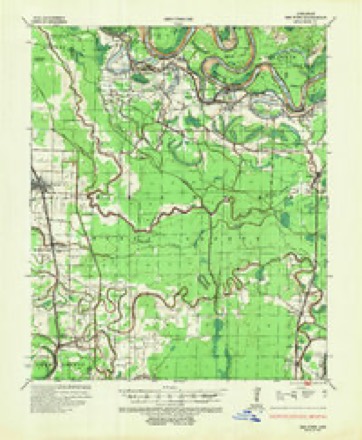
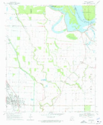
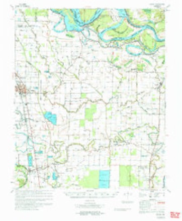
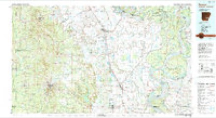
14 topographic sheets cover this place, the earliest surveyed in 1935 and the latest in 1986. It stands in Red Fork Township. It lies in ZIP code area 71639. The Survey maps it on the Dumas quadrangle.
Topographic sheets covering this place
6 surveys from 14 printed sheetsMatched by testing this settlement's coordinate against the published boundary of every sheet in the United States Geological Survey's historical collection. Each opens the scanned sheet at the Survey.
- 1935 USGS Red Fork quadrangle1:62500, 3 printings
- 1953 USGS Greenwood quadrangle1:250000, 5 printings
- 1956 USGS Greenwood quadrangle1:250000
- 1969 USGS Dumas quadrangle1:24000, 2 printings
- 1971 USGS Dumas quadrangle1:62500
- 1986 USGS Dumas quadrangle1:100000, 2 printings
Mines and quarries near this place
1 within 5 milesRegional context, not property-specific evidence. The federal mineral resources record lists 1 working within 5 miles of Pendleton: 1 past producer. None of them still produces. What was taken out: Stone, Crushed/Broken, Clay, Sand and Gravel, Construction. Distance is straight-line from the map coordinates, so a quarry counted here may appear on a neighbouring settlement's page as well.
| Where | Site | Commodity | Status | Recorded |
|---|---|---|---|---|
| Unk | Stone, Crushed/Broken, Clay, Sand and Gravel, Construction | Past Producer |
Storms near this place
19 since 2002Regional context, not property-specific evidence. The National Weather Service names Pendleton in 19 storm reports between 2002 and 2026: 8 thunderstorm wind, 7 flood, 3 hail, 1 tornado. No death or injury is recorded in these reports. Each account below is quoted exactly as the forecast office filed it, from the NOAA Storm Events Database, and each date opens the federal record of that event.
| When | Event | Place named | Harm | What the report says |
|---|---|---|---|---|
| April 2008 | Flood | Pendleton | $1,500,000 | Moderate flooding at the Pendleton stream gage on the Arkansas River occurred for over 3 days. The crest in April was higher than the March crest, primarily due to the high Mississippi River stages. There were damages to agricultural, county roads, and a few houses near the U.S. highway 165 bridge in Pendleton. There were about 6 to 8 homes flooded. Other property within the levee system, such as hunting and fishing camps, were also flooded. The lower Arkansas River floodplain contains some exclusive hunting camps and all were flooded by either the Arkansas or Mississippi River flooding the vast expanse of floodplain. The crest at Pendleton was the highest since May 1990 and the 4th highest of record. |
| April 2008 | Flood | Pendleton | $1,500,000 | Moderate flooding at the Pendleton stream gage on the Arkansas River occurred for over three days. The crest in April was higher than the March crest, primarily due to the high Mississippi River stages. There were damages to agricultural, county roads, and a few houses near the U.S. Highway 165 bridge in Pendleton. There were about six to eight homes flooded. Other property within the levee system, such as hunting and fishing camps, was also flooded. The lower Arkansas River floodplain contains some exclusive hunting camps and all were flooded by either the Arkansas or Mississippi River flooding the vast expanse of floodplain. The crest at Pendleton was the highest since May, 1990, and the fourth highest of record. |
| May 2019 | Flood | Pendleton | $1,000,000 | Flooding began on the Arkansas River at Pendleton on May 28 and continued into June. The river reached a record stage in June of 37.63 feet. |
| March 2008 | Flood | Pendleton | $1,000,000 | The Arkansas River rose to flood stage at Pendleton and caused some damage to roads in the community and a couple of homes. Agricultural losses were noted to the winter wheat crop. The Corps of Engineer park facilities were also damaged. |
| February 2007 | Tornado (EF1) | Pendleton | $25,000 | A weak tornado touched down in Desha County, about 2.5 miles northeast of Pendleton. There was damage to a grain storage facility near the Arkansas River. Then, the tornado tracked along the Arkansas River channel, so the only additional damage noted was several trees that were twisted or snapped off. The tornado continue moving northeastward into Arkansas County. |
| March 2015 | Thunderstorm Wind | Pendleton | $5,000 | A small barn or outbuilding was damage. |
| August 2012 | Thunderstorm Wind | Pendleton | $5,000 | Trees were blown down. |
| March 2026 | Thunderstorm Wind | Pendleton | - | The Mesonet station ARDO7 at Arkansas Highway 165 in Pendleton measured a thunderstorm wind gust of 66 mph. |
| March 2026 | Thunderstorm Wind | Pendleton | - | Corrects previous non-severe thunderstorm wind gust from this site as mesonet from Pendleton record measured wind gust of 66 mph. |
| June 2023 | Hail | Pendleton | - | Hail was estimated to be golf ball sized near Pendleton. |
| March 2021 | Thunderstorm Wind | Pendleton | - | A storage building was damaged on Old Hunter Road in Pendleton. |
| January 2016 | Flood | Pendleton | - | The Arkansas River at Pendleton remained above flood stage from December, and fell below flood stage during the morning hours on the 6th. |
| March 2015 | Thunderstorm Wind | Pendleton | - | A trained spotter reported 70 mph winds at this location. |
| May 2015 | Flood | Pendleton | - | The Arkansas River at Pendleton rose above flood stage during the morning hours of the 30th, remaining above flood stage into June. |
| December 2015 | Flood | Pendleton | - | The Arkansas River at Pendleton rose above flood stage during the afternoon hours of the 30th, remaining above flood stage into January. |
| July 2005 | Thunderstorm Wind | Pendleton | - | Thunderstorm winds downed a tree and caused some damage to a home, a carport and a shed near Pendleton. |
| December 2002 | Thunderstorm Wind | Pendleton | - | Thunderstorm winds knocked a few trailers off their foundations. |
| November 2007 | Hail | Pendleton | - | no account filed |
| April 2006 | Hail | Pendleton | - | no account filed |
Nearest settlements
The eight closest, with where each one stands in the county. Distances are straight-line, computed from the Geographic Names Information System coordinates.
| Map | Place | Distance | Sheets |
|---|---|---|---|
| Medford (historical) | 2.7 miles | 13 | |
| Choctaw Village (historical) | 3.1 miles | 13 | |
| Back Gate | 3.1 miles | 14 | |
| Pea Ridge | 4.6 miles | 13 | |
| Oaklawn | 5.2 miles | 14 | |
| Red Fork | 6.6 miles | 13 | |
| Reedville | 7.9 miles | 13 | |
| Mitchellville | 7.9 miles | 14 |
Provenance
This settlement is recorded in the Geographic Names Information System as feature 58342. The sheet list is computed by point-in-boundary test against the United States Geological Survey's historical topographic inventory. Both are works of the United States government and carry no copyright under 17 U.S.C. 105.
Mines and quarries. USGS Mineral Resources Data System (MRDS) https://mrdata.usgs.gov/mrds/ A work of the United States government, no copyright under 17 U.S.C. 105.
Storms. NOAA National Centers for Environmental Information, Storm Events Database https://www.ncei.noaa.gov/stormevents/ A work of the United States government, no copyright under 17 U.S.C. 105. Narratives are quoted verbatim from the National Weather Service report and are not edited or summarised.