Block
From the record
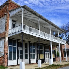
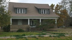
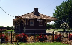
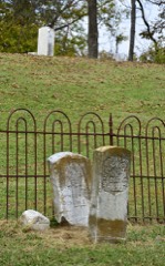
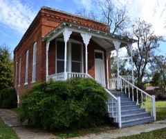
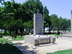
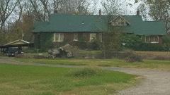
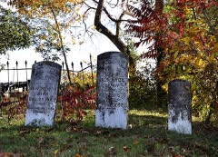
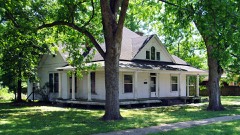
26 National Register listings published here, 1 of them a National Historic Landmark.
Sources: the National Register database, National Park Service
75 topographic sheets cover 46 settlements here, and 26 properties are on the National Register of Historic Places.
26 National Register listings published here, 1 of them a National Historic Landmark.
Sources: the National Register database, National Park Service
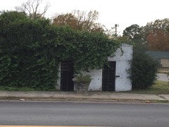
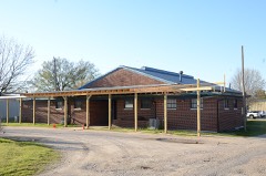
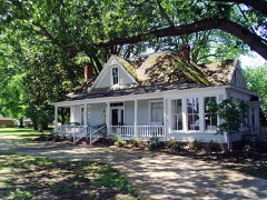
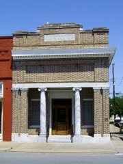
Every property in this county listed on the National Register of Historic Places, with the year it was listed and the federal nomination document.
Every wildfire the federal occurrence database records inside this county: 67 of them, burning about 2,000 acres. 4 started naturally and 24 were recorded as arson. Each settlement page carries the fires within five miles of it.
| Reported cause | Fires |
|---|---|
| Debris and open burning | 27 |
| Arson/incendiarism | 24 |
| Missing data/not specified/undetermined | 7 |
| Natural | 4 |
| Equipment and vehicle use | 3 |
| Recreation and ceremony | 2 |
The five largest, by the area the report gives. Two of them were set deliberately.
| Date | Cause | Size | Reported by | Name on the report |
|---|---|---|---|---|
| 18 November 2016 | Missing data/not specified/undetermined | 468 acres | Felsenthal National Wildlife Refuge | ARFSR-FY17-WF-OAKWOOD 1 |
| 3 April 2011 | Debris and open burning | 188 acres | Arkansas Forestry Commission | HUMPHREY |
| 22 October 2010 | Debris and open burning | 158 acres | Arkansas Forestry Commission | not named |
| 4 October 2010 | Debris and open burning | 130 acres | Arkansas Forestry Commission | DESHA |
| 11 November 2011 | Arson/incendiarism | 120 acres | Arkansas Forestry Commission | not named |
| 9 July 1998 | Natural | 100 acres | Felsenthal National Wildlife Refuge | OAKWOOD3 |
| 29 July 2012 | Debris and open burning | 80 acres | Arkansas Forestry Commission | not named |
| 1 April 2011 | Arson/incendiarism | 59 acres | Arkansas Forestry Commission | not named |
Every settlement page carries the fires within five miles of it - see the settlement index below.
The NOAA Storm Events Database holds 271 reports for this county, causing no deaths, 34 injuries and about $53,779,530 in recorded property damage. Each settlement page carries the reports that name it.
| Kind of event | Reports |
|---|---|
| Thunderstorm Wind | 124 |
| Hail | 59 |
| Flash Flood | 37 |
| Tornado | 26 |
| Flood | 12 |
| Heavy Rain | 11 |
| Lightning | 2 |
The most serious of them, by death, then injury, then recorded damage. The accounts are quoted exactly as the forecast office filed them.
| When | Event | Place named | Harm | What the report says |
|---|---|---|---|---|
| February 2007 | Tornado (EF3) | Dumas | 28 hurt, $45,000,000 | The tornado moved out of Lincoln County and into Desha County about 6 miles southwest of Dumas. The tornado continued to track northeastward and moved across the southeast portion of the city of Dumas and produced significant damage. In Dumas, 25 businesses were destroyed, along with 19 homes. More than 65 additional homes sustained minor to moderate damage. Six mobile homes were destroyed, along with an athletic park. A community building sustained major damage, as well as a 20-unit assisted living center. An electrical substation was destroyed, leaving the area without power for several days. Numerous trees and power lines were also blown down. Farther to the northeast, in the community of Back Gate, 11 mobile homes were destroyed and 12 sustained minor damage. One house was destroyed, along with three that were damaged. The tornado eventually dissipated 4 miles northeast of Pendleton. Altogether, 28 people in the county were injured. |
| January 1974 | Tornado (F1) | not stated | 2 hurt, $25,000 | no account filed |
| April 1973 | Tornado (F1) | not stated | 2 hurt, $25,000 | no account filed |
| October 1955 | Tornado (F3) | not stated | 1 hurt, $25,000 | no account filed |
| April 1991 | Thunderstorm Wind | not stated | 1 hurt | no account filed |
| April 2008 | Flood | Pendleton | $1,500,000 | Moderate flooding at the Pendleton stream gage on the Arkansas River occurred for over 3 days. The crest in April was higher than the March crest, primarily due to the high Mississippi River stages. There were damages to agricultural, county roads, and a few houses near the U.S. highway 165 bridge in Pendleton. There were about 6 to 8 homes flooded. Other property within the levee system, such as hunting and fishing camps, were also flooded. The lower Arkansas River floodplain contains some exclusive hunting camps and all were flooded by either the Arkansas or Mississippi River flooding the vast expanse of floodplain. The crest at Pendleton was the highest since May 1990 and the 4th highest of record. |
| April 2008 | Flood | Pendleton | $1,500,000 | Moderate flooding at the Pendleton stream gage on the Arkansas River occurred for over three days. The crest in April was higher than the March crest, primarily due to the high Mississippi River stages. There were damages to agricultural, county roads, and a few houses near the U.S. Highway 165 bridge in Pendleton. There were about six to eight homes flooded. Other property within the levee system, such as hunting and fishing camps, was also flooded. The lower Arkansas River floodplain contains some exclusive hunting camps and all were flooded by either the Arkansas or Mississippi River flooding the vast expanse of floodplain. The crest at Pendleton was the highest since May, 1990, and the fourth highest of record. |
| May 2019 | Flood | Pendleton | $1,000,000 | Flooding began on the Arkansas River at Pendleton on May 28 and continued into June. The river reached a record stage in June of 37.63 feet. |
| March 2008 | Flood | Pendleton | $1,000,000 | The Arkansas River rose to flood stage at Pendleton and caused some damage to roads in the community and a couple of homes. Agricultural losses were noted to the winter wheat crop. The Corps of Engineer park facilities were also damaged. |
| May 2011 | Flood | Mitchellville | $500,000 | The Freddie Black Choctaw Island Wildlife Management Area was closed due to flooding. Flooding in Desha County continued into June along the Mississippi River. |
| October 2010 | Hail | Mc Gehee | $250,000 | Hail up to golf ball size fell in the McGehee area. The hail nearly covered the ground in some places. Vehicles were dented and had their windshields cracked. Awnings had holes punched in them. |
| October 2009 | Thunderstorm Wind | Mc Gehee | $250,000 | Much of the roof was removed from one house, and several other houses were damaged. A farm shop was destroyed, as was a metal building. Trees and power lines were blown down, a carport fell on a pickup truck, and a fence was blown down. |
| October 2009 | Flash Flood | Back Gate | $250,000 | Streets and houses were flooded in McGehee. County roads were flooded as well. |
| April 1979 | Tornado (F2) | not stated | $250,000 | no account filed |
| December 1978 | Tornado (F2) | not stated | $250,000 | no account filed |
| March 1972 | Tornado (F2) | not stated | $250,000 | no account filed |
| July 1953 | Tornado (F1) | not stated | $250,000 | no account filed |
| March 2016 | Flash Flood | Dumas Mayer Avn Arpt | $200,000 | Emergency manager reported several roads throughout the county are blocked by flash flooding and that approximately 20 houses have been damaged by the flood waters. |
| April 2011 | Thunderstorm Wind | Watson | $200,000 | One house was destroyed, and a house and business sustained major damage. Trees and power lines were blown down. Power was knocked out to the entire town. |
| June 2021 | Flash Flood | Dumas | $100,000 | Widespread flash flooding across the city was reported with water in several homes and numerous street flooded. |
| June 2021 | Flash Flood | Dumas | $100,000 | The Dumas police chief reported all streets in Dumas have standing water on them. Some buildings are still inundated. People keep driving around barricaded roads and getting stuck. |
| December 2013 | Tornado (EF1) | Halley | $100,000 | This tornado moved out of Chicot County into Desha County. One mobile home was knocked off its foundation, had its porch torn off, and had a large metal intermodal shipping container in the back yard overturn and crash into the rear wall of the mobile home, smashing in the kitchen wall. A house had its porch torn off, roof damage, a hole punched in a wall, and broken windows. Another house had a considerable amount of roofing material torn off. At another house, the attached carport was torn off, with much of it landing on the roof of the house. Several sheds were destroyed, large trees were blown down, and several power poles were snapped off. The tornado then exited Desha County 5.1 miles east-northeast of Halley and re-entered Chicot County near the Yellow Bend Port. |
| October 2009 | Thunderstorm Wind | Mc Gehee | $100,000 | Two plate glass windows were blown out of an automobile showroom. Dozens of trees were blown down. One house had a tree limb through its roof. |
| June 2021 | Flash Flood | Pickens | $50,000 | Track ballast was completely washed away beneath railroad tracks in several locations near U.S. Hwy. 65. |
| April 2020 | Thunderstorm Wind | Rohwer | $50,000 | Roofs were peeled back or blown off of several outbuildings and several trees were snapped. |
| April 2014 | Thunderstorm Wind | Arkansas City | $50,000 | A metal storage building was damaged. Trees and power lines were blown down around Arkansas City and elsewhere in Desha County. |
| June 1994 | Thunderstorm Wind | Dumas | $50,000 | Thunderstorm winds damaged some roofs and knocked down several trees. |
| November 1994 | Thunderstorm Wind | McGehee | $50,000 | Several homes received roof damage. A garage door was also blown off a house. |
| August 1993 | Thunderstorm Wind | Watson | $50,000 | Thunderstorm winds downed trees, power lines and power poles. |
| August 1993 | Thunderstorm Wind | Back Gate | $50,000 | Thunderstorm winds downed some trees and damaged several roofs. |
| June 2011 | Thunderstorm Wind | Arkansas City | $25,000 | Trees were blown down, with some of the trees falling on houses. |
| February 2007 | Tornado (EF1) | Pendleton | $25,000 | A weak tornado touched down in Desha County, about 2.5 miles northeast of Pendleton. There was damage to a grain storage facility near the Arkansas River. Then, the tornado tracked along the Arkansas River channel, so the only additional damage noted was several trees that were twisted or snapped off. The tornado continue moving northeastward into Arkansas County. |
| May 2007 | Lightning | Kelso | $25,000 | Lightning set a barn on fire. |
| May 1981 | Tornado (F2) | not stated | $25,000 | no account filed |
| April 1973 | Tornado (F2) | not stated | $25,000 | no account filed |
| June 2009 | Thunderstorm Wind | Dumas | $20,000 | Trees and power lines were blown down, and the steeple was blown off a church. |
| October 2010 | Lightning | Dumas | $15,000 | Lightning knocked out 28 phones at the Delta Memorial Hospital in Dumas. |
| April 2009 | Thunderstorm Wind | Watson | $15,000 | A large shed shifted on its foundation. A metal roof on a house sustained damage. |
| March 2016 | Thunderstorm Wind | Mc Gehee | $10,000 | The wind blew a roof off of a church. |
| April 2011 | Thunderstorm Wind | Yancopin | $10,000 | Several trees fell onto roads. |
| September 2011 | Thunderstorm Wind | Halley | $10,000 | Part of a barn was blown down, as were some trees. |
| April 2011 | Thunderstorm Wind | Arkansas City | $10,000 | Trees were blown down and there was minor damage to a gas station. |
| October 2010 | Thunderstorm Wind | Masonville | $10,000 | Power lines were blown down. |
| July 2009 | Thunderstorm Wind | Mc Gehee | $10,000 | Trees were down in the area. |
| May 2011 | Flood | Medford | $10,000 | no account filed |
| August 2016 | Thunderstorm Wind | Arkansas City | $7,000 | A few large trees were downed with damage to a home and a car. |
| January 2023 | Tornado (EF0) | Halley | $5,000 | This tornado crossed the Chicot/Desha County line around 744 PM CST, and did sparse damage along Arkansas Highway 35, knocking over a few telephone poles along the road, More conclusive evidence was noted in the cotton fields alongside the road, where swaths of convergent flow and damaged cotton were observed for around a half mile, between the county line and the town of Halley, with the tornado dissipating just before reaching Halley. This track is a continuation of a tornado that was ongoing, originating in Ashley County and moving through Chicot County. Peak wind speed was 80 mph. |
| March 2016 | Tornado (EF1) | Halley | $5,000 | This is a continuation of a tornado from Chicot County AR. As the tornado crossed into Desha County, some trees were snapped and uprooted, along with some power lines blown down. |
| March 2015 | Thunderstorm Wind | Pendleton | $5,000 | A small barn or outbuilding was damage. |
| August 2012 | Thunderstorm Wind | Pendleton | $5,000 | Trees were blown down. |
| February 2011 | Thunderstorm Wind | Mc Gehee | $5,000 | Road signs were blown down. |
| July 2011 | Thunderstorm Wind | Dumas | $5,000 | Some large tree limbs were blown down. |
| June 2011 | Flood | Laconia | $5,000 | Areal flooding in Desha County diminished after levels on the Mississippi and White Rivers receded. |
| August 1993 | Thunderstorm Wind | Watson | $5,000 | Several trees were blown down. |
| June 2012 | Thunderstorm Wind | Pea Ridge | $3,000 | Trees were blown down, blocking Arkansas 1. |
| March 1972 | Tornado (F1) | not stated | $2,500 | no account filed |
| May 1956 | Tornado (F1) | not stated | $2,500 | no account filed |
| February 2012 | Thunderstorm Wind | Watson | $2,000 | A few trees were downed along Arkansas 1 in Watson. |
| August 2010 | Flash Flood | Watson | $1,000 | Street flooding occurred in Watson. |
| July 2010 | Thunderstorm Wind | Yukon | $1,000 | A tree and large limbs were blown down. |
The Survey's mineral resources record lists 1 working inside this county. It is closed or unrecorded. Each settlement page carries the workings within five miles of it.
| Commodity | Workings |
|---|---|
| Sand and Gravel, Construction | 1 |
The least common of them first, because a county's hundredth gravel pit says nothing its first ten did not.
| Where | Site | Commodity | Status | Recorded |
|---|---|---|---|---|
| Greenville Gravel Company | Sand and Gravel, Construction | Unknown | 1909 |
Named settlements recorded in the Geographic Names Information System, each with the topographic sheets covering it. Villages, hamlets and abandoned places alike. Each is shown with the nearest named watercourse or landform and the survey quadrangle it falls on.
Franklin township · 38769 · Near Beulah Island Number 74 · Rosedale quadrangle
12 sheets, 1939 to 1986
Clayton township · 71654 · McArthur quadrangle
13 sheets, 1936 to 1986
No longer a settlement
Mississippi township · 72379 · Snow Lake quadrangle
15 sheets, 1939 to 1986
No longer a settlement
Walnut Lake township · 71662 · Winchester quadrangle
14 sheets, 1935 to 1986
No longer a settlement
Franklin township · 71674 · Near Caulk Island · Benoit quadrangle
16 sheets, 1933 to 1986
Franklin township · 71674 · On Cypress Creek · Catfish Point quadrangle
15 sheets, 1933 to 1986
Red Fork township · 71674 · Watson quadrangle
13 sheets, 1935 to 1986
No longer a settlement
Mississippi township · 72379 · Near Snow Lakebed · Snow Lake quadrangle
15 sheets, 1939 to 1986
Franklin township · 71674 · On Old White River · Montgomery Island quadrangle
12 sheets, 1939 to 1986
The vanished settlements of Desha County: the places named above that are no longer on the map.