 Block
Riverside, Arkansas
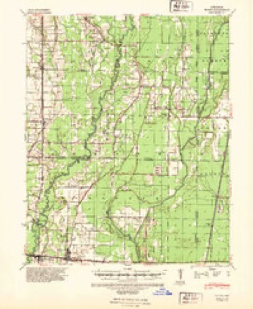
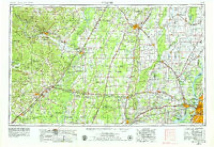
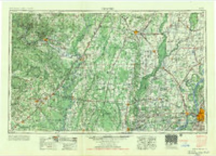
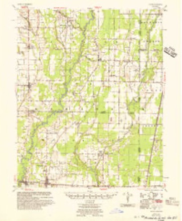
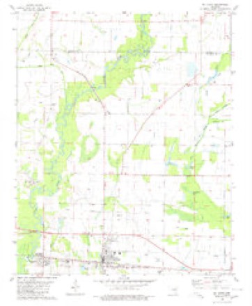
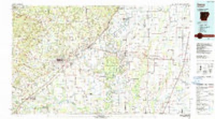
10 topographic sheets cover this place, the earliest surveyed in 1940 and the latest in 1986. It stands in Cotton Plant Township. It lies in ZIP code area 72101. The Survey maps it on the McCrory quadrangle.
Topographic sheets covering this place
6 surveys from 10 printed sheetsMatched by testing this settlement's coordinate against the published boundary of every sheet in the United States Geological Survey's historical collection. Each opens the scanned sheet at the Survey.
- 1940 USGS Tilton quadrangle1:62500, 2 printings
- 1953 USGS Memphis quadrangle1:250000, 3 printings
- 1956 USGS Memphis quadrangle1:250000
- 1956 USGS Tilton quadrangle1:62500
- 1980 USGS Mc Crory quadrangle1:24000
- 1986 USGS Searcy quadrangle1:100000, 2 printings
Fires near this place
20 since 1992Regional context, not property-specific evidence. The federal wildfire occurrence database lists 20 fires within 5 miles of Riverside between 1992 and 2017, burning about 192 acres in total. None started naturally. 7 were recorded as arson. Distance is straight-line from the map coordinates, so a fire counted here may appear on a neighbouring settlement's page as well.
| Reported cause | Fires |
|---|---|
| Smoking | 7 |
| Arson/incendiarism | 7 |
| Debris and open burning | 5 |
| Recreation and ceremony | 1 |
The most recent of them, most recent first, with the day each was reported and the service that recorded it.
| Date | Cause | Size | Reported by | Name on the report |
|---|---|---|---|---|
| 7 September 1999 | Smoking | 29 acres | Central Arkansas Refuges Complex | COLE |
| 1 July 2010 | Debris and open burning | 5.0 acres | Arkansas Forestry Commission | not named |
| 8 June 1998 | Debris and open burning | 2.0 acres | Arkansas Forestry Commission | not named |
| 11 June 2004 | Debris and open burning | 16 acres | Arkansas Forestry Commission | not named |
| 5 March 2012 | Debris and open burning | 5.0 acres | Arkansas Forestry Commission | not named |
| 23 March 1992 | Debris and open burning | under an acre | Central Arkansas Refuges Complex | HWY260#1 |
| 21 March 1992 | Recreation and ceremony | 4.3 acres | Central Arkansas Refuges Complex | HWY260#2 |
| 20 March 2001 | Smoking | 4.0 acres | Central Arkansas Refuges Complex | TRACT 191A |
Settlements close enough to share some of these fires:
Storms near this place
60 of 150 shownRegional context, not property-specific evidence. The National Weather Service names Riverside in 150 storm reports between 2010 and 2026: 150 flood. No death or injury is recorded in these reports. Each account below is quoted exactly as the forecast office filed it, from the NOAA Storm Events Database, and each date opens the federal record of that event.
| When | Event | Place named | Harm | What the report says |
|---|---|---|---|---|
| May 2014 | Flood | Riverside | $10,000 | The Cache River at Patterson remained above flood stage from heavy rainfall back in April. This river remained above flood stage for much of May before finally dropping back below flood stage during the morning hours of the 27th. |
| November 2011 | Flood | Riverside | $10,000 | Heavy rainfall caused the Cache River near Patterson to rise above flood stage during the late evening hours on the 13th. This river reached over 11 feet during the month of November and moderate flooding continued through the end of the month. |
| April 2014 | Flood | Riverside | $5,000 | Heavy spring rains caused the Cache River at Patterson to rise above flood stage during the morning hours on the 7th. The river then remained above flood stage until the evening hours on the 26th. |
| May 2012 | Flood | Riverside | $5,000 | Heavy Rainfall on the 7th and 8th caused minor flooding along the Cache River at Patterson. The river crested at 9.36 feet on the 13th. |
| January 2012 | Flood | Riverside | $5,000 | Heavy rain fell through November and December, causing the Cache River at Patterson to rise above flood stage from mid November through early January. |
| February 2012 | Flood | Riverside | $5,000 | The Cache River at Patterson crested just over 10 feet as a series of heavy rain events during the winter months caused minor flooding through most of February. |
| March 2012 | Flood | Riverside | $5,000 | Heavy rain caused the Cache River at Patterson to rise above flood stage through most of March. |
| September 2012 | Flood | Riverside | $5,000 | Tropical Depression Isaac produced heavy rainfall on the 1st and 2nd of October. This lead to minor flooding on the Cache River at Patterson. Several other rainfall events through early September kept the river at minor flood stage through the 18th of September. |
| January 2012 | Flood | Riverside | $5,000 | A series of heavy rain events in late January pushed the Cache River at Patterson above flood stage in late January. |
| April 2010 | Flood | Riverside | $5,000 | Heavy rainfall caused the Cache River at Patterson to remain above flood stage through the first half of April. |
| May 2010 | Flood | Riverside | $5,000 | Additional rainfall during May caused the Cache River near Patterson to remain above flood stage from April through all of May, and then into the month of June. |
| February 2014 | Flood | Riverside | $2,000 | Heavy rainfall and melting from wintry precipitation caused the Cache River at Patterson to rise above flood stage at midday on the 3rd. This river fell below flood stage during the afternoon hours on the 10th. However, this river would once again rise above flood stage later in the month. |
| February 2014 | Flood | Riverside | $2,000 | Heavy rainfall and some melting of wintry precipitation caused the Cache River at Patterson to rise above flood stage during the afternoon hours of the 19th. The river then fell back below flood stage during the morning hours of the 27th. |
| January 2013 | Flood | Riverside | $2,000 | Heavy rain events in the months of December, 2012, and January, 2013, caused minor flooding along the Cache River at Patterson. The highest crest during this period was 10.6 feet on January 19th. |
| February 2013 | Flood | Riverside | $2,000 | Minor flooding continued along the Cache River at Patterson from a series of heavy rainfall events dating back to December, 2012. The river temporarily dropped below flood stage on February 21st at 4 AM but then rose above flood stage at 1 PM on the 21st. The river crested at 10.73 feet on February 27th. |
| March 2013 | Flood | Riverside | $1,000 | Heavy rainfall in late February caused the Cache River at Patterson to stay above flood stage through March 12th. |
| March 2013 | Flood | Riverside | $1,000 | Heavy rain during the first half of the month fell on an already high Cache River. The Cache River at Patterson remained elevated from a wet first two months of the year. The additional rainfall in March pushed the Cache River at Patterson above flood stage for a few days in the middle of March. |
| December 2012 | Flood | Riverside | $1,000 | Heavy rainfall in early December caused the Cache River at Patterson to crest at 8.35 feet on December 16th. |
| December 2012 | Flood | Riverside | $1,000 | Multiple heavy rain events throughout the month of December dropped 5 to 6 inches of rain. In addition, a heavy snowstorm on Christmas Day dropped 6 inches of snowfall locally, with between 8 and 12 inches of snow upstream. |
| March 2026 | Flood | Riverside | - | The Cache River experienced minor river flooding in mid-March with the Patterson gage cresting at 9.02 feet on March 15, 2026 at 5:45 PM CST. |
| February 2026 | Flood | Riverside | - | The Cache River went into Minor flood stage in mid February and crested (in minor flood stage) at 10.18 feet on February 20, 2026 at 1200 CST. |
| April 2025 | Flood | Riverside | - | Major river flooding was observed at Patterson along the Cache River. |
| May 2025 | Flood | Riverside | - | Minor river flooding was observed at Patterson on the Cache River. |
| May 2025 | Flood | Riverside | - | Major river flooding was observed at Patterson along the Cache River. |
| May 2025 | Flood | Riverside | - | Minor river flooding was observed at Patterson along the Cache River. |
| February 2025 | Flood | Riverside | - | Moderate flooding was observed over the entire month of February at Patterson along the Cache River. |
| January 2025 | Flood | Riverside | - | The Cache River at Patterson began the month of January in minor flood stage and remained in minor flood stage over this period into mid-January and did not encounter a crest within this period. |
| November 2025 | Flood | Riverside | - | Heavy rain led the Cache River at the Patterson gage to enter minor flood stage with the minor flood stage maxima taking place on November 4, 2025 at 1615 CST or LST at a height of 9.34 feet. |
| June 2025 | Flood | Riverside | - | Minor river flooding was observed at Patterson along the Cache River. |
| June 2025 | Flood | Riverside | - | Minor river flooding was observed at Patterson along the Cache River. |
| January 2024 | Flood | Riverside | - | Heavy rain brought flooding to the Cache River at Patterson January 13, 2024 through the end of the month. |
| August 2024 | Flood | Riverside | - | Heavy rain brought flooding to the Cache River at Patterson from 8/22/24 to 8/25/24. |
| February 2024 | Flood | Riverside | - | Heavy rain in January brought continued flooding into early February 2024 on the Cache River at Patterson. |
| May 2024 | Flood | Riverside | - | Minor river flooding was observed along the Cache River at Patterson. |
| June 2024 | Flood | Riverside | - | Heavy rain led to minor river flooding on the Cache River at Patterson between June 1 and Jun 3, the river crested at the Patterson gage on June 1 at 1745 at 9.75 feet. |
| October 2024 | Flood | Riverside | - | Heavy rain brought river flooding to the Cache River at Patterson in early October; the crest of the Cache River at Patterson was 10.24 feet on October 4, 2024 at 9:45 AM CST. |
| December 2024 | Flood | Riverside | - | The Cache River at Patterson flooded during late December with the river site continuing to flood into mid-January. The crest of the Cache River at Patterson would occur in moderate flood stage at 11.02 feet on December 31st at 2230. |
| September 2024 | Flood | Riverside | - | Heavy rain brought river flooding to the Cache River at Patterson lasting from mid into late September; the crest of the Cache River at Patterson was 10.38 feet on September 22, 2024 at 7:15 AM CST. |
| March 2023 | Flood | Riverside | - | Flooding continued into early March at the Cache River at Patterson in early March. |
| March 2023 | Flood | Riverside | - | Heavy rain brought flooding to the Cache River at Patterson in early March that continued through the end of the month. |
| January 2023 | Flood | Riverside | - | Heavy rain brought river flooding to the Cache River at Patterson in early January. |
| February 2023 | Flood | Riverside | - | Heavy rain brought flooding to the Cache River at Patterson in January that continued into February. |
| April 2023 | Flood | Riverside | - | Flooding continued from March into early April on the Cache River at Patterson. |
| April 2023 | Flood | Riverside | - | Heavy rain brought flooding to the Cache River at Patterson. |
| August 2023 | Flood | Riverside | - | Heavy rain brought flooding to the Cache River at Patterson August 11-21, 2023. |
| November 2023 | Flood | Riverside | - | Heavy rain at the end of October brought flooding to the Cache River at Patterson November 3-11. |
| January 2022 | Flood | Riverside | - | Heavy rainfall brought flooding to the Cache River at Patterson January 3-26, 2022. |
| February 2022 | Flood | Riverside | - | Heavy rain brought flooding to the Cache River at Patterson in mid February. |
| April 2022 | Flood | Riverside | - | Heavy rain in March brought flooding to the Cache River at Patterson that continued through April. |
| May 2022 | Flood | Riverside | - | Heavy rain brought flooding to the Cache River at Patterson in early May. |
| May 2022 | Flood | Riverside | - | Heavy rain brought flooding to the Cache River at Patterson again in early May. |
| May 2022 | Flood | Riverside | - | Heavy rain brought flooding to the Cache River at Patterson in late May. |
| May 2022 | Flood | Riverside | - | Heavy rain brought flooding to the Cache River at Patterson in early to mid May. |
| March 2022 | Flood | Riverside | - | Heavy rain in February brought flooding to the Cache River at Patterson that continued through March 7. |
| March 2022 | Flood | Riverside | - | Heavy rain in mid March brought flooding to the Cache River at Patterson for just a little over 24 hours. |
| March 2022 | Flood | Riverside | - | Heavy rain brought minor river flooding to the Cache River at Patterson. This point remained above flood stage through March. |
| August 2022 | Flood | Riverside | - | Heavy rain brought flooding to the Cache River at Patterson in early August. |
| December 2022 | Flood | Riverside | - | Heavy rain in mid December brought flooding to the Cache River at Patterson. |
| June 2022 | Flood | Riverside | - | Flooding continued from May on the White River at Patterson. |
| March 2021 | Flood | Riverside | - | Heavy rains brought flooding to the Cache River at Patterson mid March through the end of the month. |
Nearest settlements
The eight closest, with where each one stands in the county. Distances are straight-line, computed from the Geographic Names Information System coordinates.
Provenance
This settlement is recorded in the Geographic Names Information System as feature 58498. The sheet list is computed by point-in-boundary test against the United States Geological Survey's historical topographic inventory. Both are works of the United States government and carry no copyright under 17 U.S.C. 105.
Wildfire. Short, Karen C. 2022. Spatial wildfire occurrence data for the United States, 1992-2020 [FPA_FOD_20221014]. 6th Edition. Fort Collins, CO: Forest Service Research Data Archive. https://doi.org/10.2737/RDS-2013-0009.6 Collected with United States Government funding and usable without additional permissions or fees.
Storms. NOAA National Centers for Environmental Information, Storm Events Database https://www.ncei.noaa.gov/stormevents/ A work of the United States government, no copyright under 17 U.S.C. 105. Narratives are quoted verbatim from the National Weather Service report and are not edited or summarised.