 Block
White, Arkansas
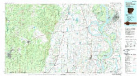
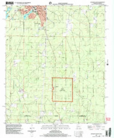
11 topographic sheets cover this place, the earliest surveyed in 1953 and the latest in 2002. It stands in Marais Saline Township. It lies in ZIP code area 71635. It stands on Williamson Creek. The Survey maps it on the Crossett South quadrangle.
Topographic sheets covering this place
6 surveys from 11 printed sheetsMatched by testing this settlement's coordinate against the published boundary of every sheet in the United States Geological Survey's historical collection. Each opens the scanned sheet at the Survey.
- 1953 USGS Greenwood quadrangle1:250000, 5 printings
- 1956 USGS Greenwood quadrangle1:250000
- 1973 USGS Crossett South quadrangle1:24000
- 1978 USGS Hamburg quadrangle1:62500
- 1986 USGS Crossett quadrangle1:100000, 2 printings
- 2002 USGS Crossett South quadrangle1:24000
Fires near this place
114 since 1999Regional context, not property-specific evidence. The federal wildfire occurrence database lists 114 fires within 5 miles of White between 1999 and 2019, burning about 1,710 acres in total. 8 started naturally. 38 were recorded as arson. Distance is straight-line from the map coordinates, so a fire counted here may appear on a neighbouring settlement's page as well.
| Reported cause | Fires |
|---|---|
| Arson/incendiarism | 38 |
| Missing data/not specified/undetermined | 32 |
| Debris and open burning | 17 |
| Natural | 8 |
| Equipment and vehicle use | 5 |
| Smoking | 4 |
| Misuse of fire by a minor | 4 |
| Recreation and ceremony | 3 |
| Railroad operations and maintenance | 2 |
| Power generation/transmission/distribution | 1 |
The most recent of them, most recent first, with the day each was reported and the service that recorded it.
| Date | Cause | Size | Reported by | Name on the report |
|---|---|---|---|---|
| 9 September 2019 | Missing data/not specified/undetermined | 1.0 acres | Arkansas Forestry Commission | not named |
| 7 September 2016 | Arson/incendiarism | 1.0 acres | Arkansas Forestry Commission | not named |
| 7 September 2002 | Missing data/not specified/undetermined | under an acre | Arkansas Forestry Commission | not named |
| 3 September 2019 | Power generation/transmission/distribution | under an acre | Louisiana Office of Forestry | not named |
| 3 September 2019 | Missing data/not specified/undetermined | 1.0 acres | Arkansas Forestry Commission | not named |
| 29 September 2004 | Misuse of fire by a minor | 1.0 acres | Arkansas Forestry Commission | not named |
| 28 September 2003 | Equipment and vehicle use | 1.0 acres | Arkansas Forestry Commission | not named |
| 26 September 2011 | Natural | 9.0 acres | Arkansas Forestry Commission | not named |
Settlements close enough to share some of these fires:
Storms near this place
9 since 2008Regional context, not property-specific evidence. The National Weather Service names White in 9 storm reports between 2008 and 2022: 3 thunderstorm wind, 3 hail, 3 tornado. No death or injury is recorded in these reports. Each account below is quoted exactly as the forecast office filed it, from the NOAA Storm Events Database, and each date opens the federal record of that event.
| When | Event | Place named | Harm | What the report says |
|---|---|---|---|---|
| February 2008 | Hail | White | $1,000,000 | Significant hail storm occurred across a large portion of Ashley County as a large supercell thunderstorm tracked from just south of Crossett to just south of Hamburg and then to around Jerome. Golf ball sized hail was common and covered the ground all along the path. A few locations, mainly just south of Hamburg, the hail was as large as baseballs. This very large hail caused a great deal of damage to dozens of vehicle and roofs. The supercell continued to produce damaging hail as it moved past Jerome and across northern Chicot County. |
| April 2009 | Tornado (EF2) | White | $600,000 | The tornado tracked across rural southern Ashley County and snapped and uprooted hundreds of large hardwood and softwood trees. Forty two homes were damaged with approximately 15 homes that were heavily damaged or destroyed. The most intense damage was along Meridian Church Road in southwest Ashley County. Here, intense tree damage resulted in several cross roads being blocked by dozens of trees, and several mobile homes and houses were destroyed by the winds and fallen trees. This was the area rated EF2 with 130 mph winds. Over the last several miles of the track, the tornado was narrower and damage was primarily in the EF1 category. |
| April 2019 | Tornado (EF1) | White | $500,000 | This tornado began at the marshy backwaters southeast of the Upper Ouachita National Wildlife Refuge. It shifted northeast to the intersection of Martin Trail and North Lake Road where it snapped several large softwood tree limbs and uprooted several softwood trees. It continued northeast to the intersection of Indian Mound Road and Tram Road where it continued to snap softwood trees and begun to uprooted hardwood trees. It moved east northeast to White Arkansas Road, persistently snapping and uprooting large softwood and hardwood trees. As it progressed northeast to Oscar Lum Road, the tornado mowed down a large area of hardwood and softwood trees, where it likely blocked off a nearby bridge. It then propagated northeast to the intersection of Middlebrooks Road and Oscar Lum Road snapping large softwood limbs and uprooting several softwood and hardwood trees. The uprooting and snapping of both hardwood and softwood trees continued when it moved across US Highway 143 to across the Arkansas State line where the aforementioned highway becomes US Highway 133. It also snapped and uprooted hardwood and softwood trees within an Arkansas rural residential area consisting of the Roads of Ashley 203, Ashley 201, Ashley 2, Ashley 228 and Ashley 714. It crossed the intersection of Ashley 4 Road and the railroad tracks west of Highway 425, continuing its snapping and uprooting of softwood and hardwood trees. It then went north northeast snapping and uprooting softwood and hardwood trees along Highway 425, and lifted at the intersection of Highway 425 and Highway 82, but not before uprooting and snapping a few hardwood and softwood trees. Maximum winds were 112 mph. Total path length was 16.24 miles. |
| April 2018 | Tornado (EF1) | White | $110,000 | This tornado originated in a flooded lowland over the Casey Jones Wildlife Management Area. The beginning point is estimated due to a lack of road access. The tornado tracked eastward across Ashley County roads 211, 703, 205, 3, 201, 202, and 2. Along its path, the tornado produced prolific tree damage, with many large uprooted and some snapped trees. A few homes were damaged by fallen trees, some significantly, and a few also sustained shingle damage. The tornado ended in a wooded area north of Ashley County Road 2 and south of Ashley County Road 229. Maximum estimated wind speed was 100 mph. |
| April 2017 | Thunderstorm Wind | White | $8,000 | Trees were blown down along Ashley Road 2 near the Arkansas/Louisiana state line and Highway 133. |
| April 2022 | Thunderstorm Wind | White | $5,000 | Several trees were blown down in the southern part of the county. |
| April 2009 | Hail | White | $1,000 | A swath of quarter to half dollar sized hail was observed across a large portion of central Ashley County. The swath of hail was from just southwest of Crossett to northeast of Hamburg. The hail damaged some windshields near Crossett. |
| March 2008 | Thunderstorm Wind | White | - | A couple trees were blown down near the state line off Highway 133. |
| March 2016 | Hail | White | - | no account filed |
Nearest settlements
The eight closest, with where each one stands in the county. Distances are straight-line, computed from the Geographic Names Information System coordinates.
| Map | Place | Distance | Sheets |
|---|---|---|---|
| Meridian | 1.7 miles | 11 | |
| Venice | 2.3 miles | 18 | |
| Sulphur Springs | 4.4 miles | 18 | |
| South Crossett | 6.7 miles | 11 | |
| Oakhurst Addition | 7.4 miles | 11 | |
| Rawls | 7.5 miles | 11 | |
| Gulledge | 7.7 miles | 11 | |
| Forest Park Addition | 7.7 miles | 11 |
Provenance
This settlement is recorded in the Geographic Names Information System as feature 82844. The sheet list is computed by point-in-boundary test against the United States Geological Survey's historical topographic inventory. Both are works of the United States government and carry no copyright under 17 U.S.C. 105.
Wildfire. Short, Karen C. 2022. Spatial wildfire occurrence data for the United States, 1992-2020 [FPA_FOD_20221014]. 6th Edition. Fort Collins, CO: Forest Service Research Data Archive. https://doi.org/10.2737/RDS-2013-0009.6 Collected with United States Government funding and usable without additional permissions or fees.
Storms. NOAA National Centers for Environmental Information, Storm Events Database https://www.ncei.noaa.gov/stormevents/ A work of the United States government, no copyright under 17 U.S.C. 105. Narratives are quoted verbatim from the National Weather Service report and are not edited or summarised.