Block
From the record
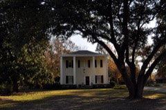
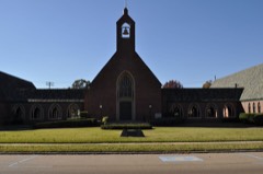
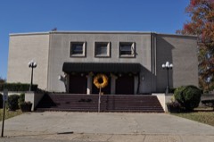
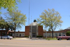
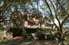
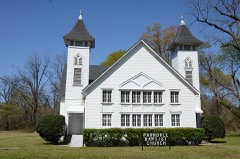
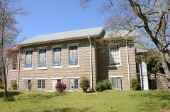
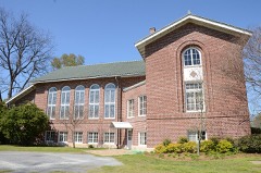
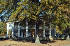
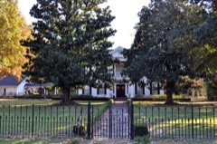
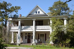
28 National Register listings published here.
Sources: the National Register database, National Park Service
77 topographic sheets cover 56 settlements here, and 28 properties are on the National Register of Historic Places.
28 National Register listings published here.
Sources: the National Register database, National Park Service
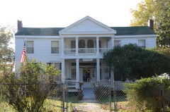
Every property in this county listed on the National Register of Historic Places, with the year it was listed and the federal nomination document.
Every wildfire the federal occurrence database records inside this county: 592 of them, burning about 10,167 acres. 37 started naturally and 149 were recorded as arson. Each settlement page carries the fires within five miles of it.
| Reported cause | Fires |
|---|---|
| Missing data/not specified/undetermined | 189 |
| Arson/incendiarism | 149 |
| Debris and open burning | 123 |
| Equipment and vehicle use | 62 |
| Natural | 37 |
| Railroad operations and maintenance | 12 |
| Misuse of fire by a minor | 10 |
| Recreation and ceremony | 5 |
| Smoking | 5 |
The five largest, by the area the report gives. Four of them were set deliberately.
| Date | Cause | Size | Reported by | Name on the report |
|---|---|---|---|---|
| 8 January 2006 | Arson/incendiarism | 3,669 acres | Arkansas Forestry Commission | not named |
| 14 September 2013 | Missing data/not specified/undetermined | 755 acres | Arkansas Forestry Commission | FOUNTAIN HILL |
| 9 February 2016 | Arson/incendiarism | 300 acres | Arkansas Forestry Commission | not named |
| 8 January 2006 | Arson/incendiarism | 295 acres | Arkansas Forestry Commission | not named |
| 31 January 2017 | Missing data/not specified/undetermined | 251 acres | Arkansas Forestry Commission | not named |
| 13 April 2003 | Arson/incendiarism | 214 acres | Arkansas Forestry Commission | not named |
| 3 August 2012 | Natural | 179 acres | Arkansas Forestry Commission | FOUNTAIN HILL |
| 29 January 2017 | Missing data/not specified/undetermined | 168 acres | Arkansas Forestry Commission | not named |
Every settlement page carries the fires within five miles of it - see the settlement index below.
The NOAA Storm Events Database holds 491 reports for this county, causing 6 deaths, 55 injuries and about $61,031,300 in recorded property damage. Each settlement page carries the reports that name it.
| Kind of event | Reports |
|---|---|
| Thunderstorm Wind | 243 |
| Hail | 132 |
| Flash Flood | 57 |
| Tornado | 45 |
| Flood | 9 |
| Funnel Cloud | 5 |
The most serious of them, by death, then injury, then recorded damage. The accounts are quoted exactly as the forecast office filed them.
| When | Event | Place named | Harm | What the report says |
|---|---|---|---|---|
| November 2001 | Tornado (F3) | Wilmot | 3 killed, 11 hurt, $2,000,000 | A supercell thunderstorm produced a tornado that moved out of Morehouse Parish, Louisiana into Ashley County, Arkansas, 6 miles southwest of Wilmot. The tornado then moved to the south end of Lake Enterprise, just west of Wilmot. The tornado strengthened and widened as it approached the Wilmot area and was rated as an F3 with a maximum width of one half mile. The tornado destroyed 14 mobile homes and houses and caused extensive damage to five other homes in the vicinity of Wilmot. A church on the north side of Wilmot was completely destroyed. Additionally, a tractor shed housing farm equipment was destroyed, and the equipment inside was also destroyed. As the tornado tracked northeast toward Parkdale, it damaged or destroyed several cotton pickers, trailers, and tractors. The tornado lifted 2.5 miles east-northeast of Parkdale. The total estimated damage of the tornado was $2.0 million. The tornado caused the deaths of three people in the vicinity of Wilmot. Additionally, a total of eleven people sustained injuries. |
| February 1976 | Tornado (F2) | not stated | 3 killed, 10 hurt, $250,000 | no account filed |
| April 1979 | Tornado (F3) | not stated | 13 hurt, $25,000,000 | no account filed |
| January 1988 | Tornado (F2) | not stated | 13 hurt, $2,500,000 | no account filed |
| May 1989 | Thunderstorm Wind | not stated | 4 hurt | no account filed |
| April 1978 | Tornado (F2) | not stated | 3 hurt, $250,000 | no account filed |
| April 2012 | Thunderstorm Wind | Crossett | 1 hurt, $75,000 | Numerous trees were blown down around Crossett. One tree was blown down onto a mobile home injuring one occupant inside. A few power lines were also blown down around town. |
| September 2008 | Flash Flood | Fountain Hill | $5,000,000 | Persistent heavy rains occurred from weakening Hurricane Gustav and dumped 8 to 12 inches of rain across the county. This heavy rainfall caused many roads to flood along with several homes taking in water.||Agriculture was especially hard hit as all of the farmland was flooded. In some cases, entire crops were lost or were substantially damaged where yields were very low. |
| January 2020 | Tornado (EF2) | Mist | $2,800,000 | This tornado started just northeast of Hamburg along Ashley 70 Road and tracked roughly 20 miles to just east of Montrose in Chicot County. Thousands of trees were uprooted and snapped along the path along with numerous power lines and poles downed. Some of the heaviest damage was to a mobile home just off Ashley 129 Road. The home was thrown 15 to 20 feet and destroyed. Another mobile home was destroyed along Ashley 128 Road. The tornado then crossed Highway 82 near Ashley 301 Road. Power poles were broken here and a tractor shed was heavily damaged. From this point, the tornado mostly paralleled Highway 82 or tracked along it. Many power lines were down along with poles. Just east of Ashley 912 Road, one wooden high tension segment had the top broken out. In the Snyder community, some homes sustained roof damage and had trees down on them. North of Highway 82, near Horseshoe Lake, a lot of hardwood trees were heavily damaged and there were three segments of the wooden high tension poles and lines taken out. The tornado continued roughly along Highway 82 toward Montrose. The strongest core of the tornado remained north of the highway and downed two more wooden high tension segments before Montrose and two more just north of town to the west of Highway 165. In the town of Montrose, numerous trees were damaged along with many homes having some degree of roof damage or a handful more with a tree on the home. Just east of Montrose, near the Chicot County line and north of Highway 82, a metal high tension pole segment was taken down which supported the highest wind estimate of 130 mph. The tornado dissipated near County Road 293 on the north side of Highway 82. Maximum width was 1000 yards. Total path length was 20.51 miles. Max winds were 130 mph. |
| April 1982 | Tornado (F1) | not stated | $2,500,000 | no account filed |
| April 1979 | Tornado (F2) | not stated | $2,500,000 | no account filed |
| April 1967 | Tornado (F2) | not stated | $2,500,000 | no account filed |
| June 2023 | Thunderstorm Wind | Bovine | $1,500,000 | A destructive thunderstorm complex produced widespread damaging winds across Ashley County. While much of the county experienced severe wind gusts at or above 60 mph, a corridor of higher gusts in the 70 to 100 mph range occurred along a swath from near Crossett and Hamburg to the southeast. Most trees sustained some degree of damage, and many were uprooted or snapped. Approximately 20 to 30 homes were damaged or destroyed by fallen trees, and some residences and businesses lost some shingles and roof covering. Treefall also resulted in numerous power line and power pole failures. A tree also fell onto a substation in Hamburg. Between Crossett and Hamburg, tubular steel power transmission towers were collapsed. This area is where the winds likely reached maximum intensity, estimated to be near 100 mph. The damaging wind complex carried east and southeast toward Wilmot where winds weakened below 70 mph. Wind damage continued farther east into Chicot county, but was this was not as intense as that in central Ashley County. |
| February 2008 | Hail | White | $1,000,000 | Significant hail storm occurred across a large portion of Ashley County as a large supercell thunderstorm tracked from just south of Crossett to just south of Hamburg and then to around Jerome. Golf ball sized hail was common and covered the ground all along the path. A few locations, mainly just south of Hamburg, the hail was as large as baseballs. This very large hail caused a great deal of damage to dozens of vehicle and roofs. The supercell continued to produce damaging hail as it moved past Jerome and across northern Chicot County. |
| January 2020 | Tornado (EF1) | Pugh | $800,000 | This tornado started just west of Highway 133 near Ashley 181 Road and traveled roughly eastward to just east of Highway 425 where it dissipated north of Hamburg. At the start, scattered trees were damaged. As the tornado approached Highway 133, intensity increased and more were snapped and uprooted. A few power lines were down as well. Along Highway 133, two areas of focused damage were noted. One area had a few dozen trees uprooted and one large tree was on a mobile home. The other area was at the Trinity Church, where some roof damage occurred to the main building and the covered walkway was blown away. Numerous trees were uprooted and snapped along Ashley 497 Road and the Egypt Church building sustained damage. The large front covering was destroyed and the roof has some damage. Along Ashley 470 Road, heavy tree damage was noted along with several power lines down. Some homes had minor roof damage here as well as along Ashley 471 Road. Uprooted and snapped trees continued along the path. As the the tornado crossed Highway 189, a strong surge was noted on the north side of the path where a focused corridor of trees were damaged. Here a couple of trees were blown down on a mobile home. On the southern side of the path, at the intersection of Ashley 492 Road, several homes sustained roof damage with tin and insulation thrown. Trees were down here as well. The tornado continued across a wooded area where it crossed Ashley 491 Road, then Highway 425 before dissipating just east of Highway 425. There was one indirect injury which occurred during clean up after the tornado. Maximum peak winds were estimated at 105 mph. |
| March 2006 | Thunderstorm Wind | Crossett | $700,000 | A potent squall line of thunderstorms moved across Ashley county and caused widespread damage, especially across southern and eastern sections of the county. As the squall line moved through, a small segment of the line pushed out ahead of the line. This "bow segment" caused extensive damage along a swath from just south of Crossett to near Portland. The most significant damaged occurred just south and southeast of Crossett. Along the damage swath, numerous trees and power lines were blown down. Several structures sustained damage along with a few outbuildings blown away. |
| January 2020 | Tornado (EF1) | Lake Georgia Pacific | $600,000 | This tornado started in the swamp area on the eastern side of Felsenthal National Wildlife Refuge and tracked roughly due east and dissipated just after crossing Hancock Road. At the start, a few trees were damaged and that continued as the tornado tracked along Ashley 299 Road. Some trees were uprooted along this part of the path. The tornado intensified as it neared Ashley 14 Road and widened. Numerous trees were uprooted and snapped. Several outbuildings were damaged along with other minor damage to some homes with shingles off. Along a portion of Ashley 14 Road, heavy tree damage was noted along with several homes having trees on them. Numerous power lines were down as well. The tornado then weakened some with mostly minor type tree damage. Intensity increased again as it crossed Hancock Road. Here Beulahland Church sustained moderate roof damage along with two other homes having roof damage. Several power lines and poles were down as well. The tornado quickly dissipated just east of Hancock Road. Maximum peak winds were estimated at 108 mph. |
| April 2009 | Tornado (EF2) | White | $600,000 | The tornado tracked across rural southern Ashley County and snapped and uprooted hundreds of large hardwood and softwood trees. Forty two homes were damaged with approximately 15 homes that were heavily damaged or destroyed. The most intense damage was along Meridian Church Road in southwest Ashley County. Here, intense tree damage resulted in several cross roads being blocked by dozens of trees, and several mobile homes and houses were destroyed by the winds and fallen trees. This was the area rated EF2 with 130 mph winds. Over the last several miles of the track, the tornado was narrower and damage was primarily in the EF1 category. |
| January 2023 | Tornado (EF2) | Berlin | $500,000 | This tornado began near the intersection of Ashley 270 Road and Ashley 25 Road west of the Overflow National Wildlife Refuge in southern Ashley County. As it moved northeast, the tornado uprooted, snapped, or damaged trees along its path. It crossed over several highways, county roads, and low-lying areas through the county until it reached Montrose near the intersection of US Highway 82 and 165. There the tornado intensified to its maximum intensity of EF-2 with estimated peak winds of 120 mph. Along US 82 near 9th Street, a small guest home on concrete blocks was pushed off its foundation and destroyed. A nearby mobile home was rolled across three parked cars which were also destroyed. Several sheds and outbuildings were destroyed in the immediate vicinity as well. Widespread damage was common in the western part of town where many homes suffered minor to moderate roof damage. Several trees were uprooted or snapped along with continued minor to moderate residential damage as the tornado moved northeast and across northern Montrose. It crossed US 165 north of Montrose where an outbuilding was destroyed. As the tornado moved into farmland northeast of town, a center pivot irrigation system was destroyed. It continued northeast into Chicot County and across the intersection of Arkansas Highways 144 and 293 where a home and several buildings lost roofing and paneling, and some power poles were blown down. The tornado crossed US Highway 65 and Cedar Road near the Bellaire community in northern Chicot County, blew down a few power poles and damaged a few trees, and then dissipated shortly after crossing into Desha County. |
| April 2019 | Tornado (EF1) | White | $500,000 | This tornado began at the marshy backwaters southeast of the Upper Ouachita National Wildlife Refuge. It shifted northeast to the intersection of Martin Trail and North Lake Road where it snapped several large softwood tree limbs and uprooted several softwood trees. It continued northeast to the intersection of Indian Mound Road and Tram Road where it continued to snap softwood trees and begun to uprooted hardwood trees. It moved east northeast to White Arkansas Road, persistently snapping and uprooting large softwood and hardwood trees. As it progressed northeast to Oscar Lum Road, the tornado mowed down a large area of hardwood and softwood trees, where it likely blocked off a nearby bridge. It then propagated northeast to the intersection of Middlebrooks Road and Oscar Lum Road snapping large softwood limbs and uprooting several softwood and hardwood trees. The uprooting and snapping of both hardwood and softwood trees continued when it moved across US Highway 143 to across the Arkansas State line where the aforementioned highway becomes US Highway 133. It also snapped and uprooted hardwood and softwood trees within an Arkansas rural residential area consisting of the Roads of Ashley 203, Ashley 201, Ashley 2, Ashley 228 and Ashley 714. It crossed the intersection of Ashley 4 Road and the railroad tracks west of Highway 425, continuing its snapping and uprooting of softwood and hardwood trees. It then went north northeast snapping and uprooting softwood and hardwood trees along Highway 425, and lifted at the intersection of Highway 425 and Highway 82, but not before uprooting and snapping a few hardwood and softwood trees. Maximum winds were 112 mph. Total path length was 16.24 miles. |
| April 2018 | Tornado (EF2) | Montrose | $500,000 | The tornado began along US 165 between Portland and Montrose, where a few older utility poles were damaged and moved northwest across open fields, damaging additional utility poles along Ashley County Road 54. The tornado crossed US 82 near the Ashley/Chicot County line. At this location, the top of a silo was removed and the structure was bent, two homes sustained exterior damage with one losing a large amount of roofing material, a travel trailer was destroyed, and a couple of businesses sustained relatively minor structural damage. The tornado reached its peak intensity near this location, where two sets of wooden transmission poles were snapped as well as around 15 power poles. There was also considerable tree damage in the area. The tornado continued across Shelton Turner Road, where a home and mobile home sustained damage. The tornado crossed AR Highway 293, Slaughter Road, Beavers Road, and Lingo Road before lifting in west central Chicot County. Maximum estimated wind speed was 115 mph. Total path length was just under nine miles. |
| October 2009 | Flood | Sulphur Spgs | $500,000 | Area flooding had continued across the county from heavy rains from the previous night with additional rainfall from the 30th. Many roads had water across them and 5 to 7 of them remained closed. |
| May 2007 | Tornado (EF1) | Fountain Hill | $500,000 | This tornado touched down just southeast of Fountain Hill and was on the ground for 5 miles. Numerous trees, some very large, were uprooted and snapped along the path. A church had a part of its roof blown off and a couple of outbuildings were destroyed. |
| January 2020 | Tornado (EF1) | North Crossett | $400,000 | This tornado started just off Highway 133 and continued just east of north where it dissipated just before reaching Highway 8, southeast of Hamburg. At the start, just a few trees were uprooted, some of which took a power line down along Highway 133. The tornado increased in intensity and width as it crossed Binnis Loop Rd. More trees were uprooted or snapped and a couple of homes sustained some roof damage. One large shed was destroyed with fragments of the roof thrown across the road. The tornado traveled along Highway 52 for quite a while. Along this part of the path, numerous trees were uprooted and snapped. Some power lines and poles were down as well. Quite a bit of uprooted trees were noted on the south side of the country club. The tornado moved over the airport where one large hangar had roof damage and the back wall had panels blown out. As the tornado neared Highway 425, the center was to the north side of Highway 52 and continued to snap and uproot trees. As it crossed Highway 425, numerous trees were snapped and uprooted. Moving east-northeast, the tornado began to weaken and dissipated just after crossing Ashley 312 Road. Maximum peak winds were estimated at 100 mph. |
| August 2018 | Thunderstorm Wind | Crossett | $300,000 | Widespread trees, large limbs, and power lines were down throughout the city, with the heaviest damage between Main and Cedar streets. There was minor roof damage to a few homes and other buildings, both due to wind and blown down trees. Scattered blown down trees, due to lessening winds, continued to a few miles east of Crossett along Highway 82 and a little south of the highway. |
| July 2011 | Thunderstorm Wind | Crossett | $300,000 | Multiple trees and power lines were blown down in the city of Crossett. A few of the trees and power lines were blown down near the Crossett Police Department. TV cable lines were blown down. A power line fell on a vehicle in town. A transformer and light pole were blown down on 10th Avenue. |
| March 2008 | Hail | Sulphur Spgs | $300,000 | A large supercell thunderstorm produced a swath of quarter to golf ball sized hail across a large portion of Ashley County. The storm moved into the county at Lake Jack Lee and tracked northeast for an hour. Quarter to golf ball sized hail fell across West Crossett, Crossett and North Crossett. The storm continued to the northeast across Hamburg, where more golf ball sized hail occurred, and then toward the Drew County line were it dissipated. |
| December 1990 | Tornado (F2) | not stated | $250,000 | no account filed |
| December 1953 | Tornado (F2) | not stated | $250,000 | no account filed |
| September 2011 | Thunderstorm Wind | South Crossett | $200,000 | A large shed and a chicken house were heavily damaged along Highway 133 south of Crossett. |
| October 2009 | Flash Flood | Sulphur Spgs | $200,000 | Numerous roads were flooded across the county with some being closed, including County roads 12 and 17 to the west of Hamburg. Also, part of Highway 160 was under water between Fountain Hill and Longview. |
| October 2009 | Flash Flood | West Crossett | $200,000 | More heavy rainfall on the 13th caused significant flooding across a large portion of Ashley County. Numerous roads were under water and closed. Crops across the region were damaged as well from all of the rain and saturated conditions. |
| August 2008 | Flash Flood | Hamburg | $200,000 | Heavy rain fell across nearly all of Ashley County and caused several roads around Hamburg to flood as well as several more across the central and southeast portion of the county. One home in Portland was flooded as 4 to 6 inches of rain fell across the area. |
| April 2008 | Hail | Mist | $200,000 | Large hail, up to golf balls, fell in the Mist Community. Some damage occurred to cars and roofs. |
| April 2003 | Tornado (F1) | Hamburg | $200,000 | This tornado destroyed 1 large barn and 2 small sheds. Six houses sustained minor roof damage. A few hundred trees were snapped or uprooted. |
| December 2013 | Thunderstorm Wind | Crossett | $175,000 | A swath of wind damage occurred across the county as a squall line passed. Trees were blown down all across the county. A few of the trees were snapped due to the strong winds. Several power lines were also blown down, and a large tree was blown onto a house along Highway 165 in the Boydell community. A tree was also blown onto a house in downtown Crossett. |
| February 2018 | Flash Flood | Old Milo | $150,000 | Numerous roads were flooded across the county, along with water over some bridges. Arkansas Highway 8 was closed due to flooding between Hamburg and Parkdale. Highway 133 north of Crossett was closed due to flooding. |
| April 2018 | Thunderstorm Wind | Wilmot | $130,000 | A swath of damaging winds occurred across eastern Ashley County near Ashley County Road 38. Power poles were snapped, roof damage occurred to a church, the steeple of the church was toppled. There was also damage to a portable building near the church where it was slid off of its bricks. |
| April 2018 | Tornado (EF1) | White | $110,000 | This tornado originated in a flooded lowland over the Casey Jones Wildlife Management Area. The beginning point is estimated due to a lack of road access. The tornado tracked eastward across Ashley County roads 211, 703, 205, 3, 201, 202, and 2. Along its path, the tornado produced prolific tree damage, with many large uprooted and some snapped trees. A few homes were damaged by fallen trees, some significantly, and a few also sustained shingle damage. The tornado ended in a wooded area north of Ashley County Road 2 and south of Ashley County Road 229. Maximum estimated wind speed was 100 mph. |
| January 2023 | Thunderstorm Wind | Portland | $100,000 | Numerous buildings suffered roofing damage consisting of primarily shingle loss or tin peeling. Several large branches were also downed. Damage was consistent with strong southerly winds and stretched from Portland eastward along Highway 160. The most substantial damage occurred to an outbuilding that suffered enough roof damage to have insulation strewn down wind. |
| March 2016 | Flash Flood | Montrose | $100,000 | Numerous roads around the county were either underwater or washed out. Highway|133 north and 425 south near the Louisiana state line was closed. Evacuations of|residences occurred in both Crossett and Parkdale. US Highway 425 was closed south of Hamburg. |
| May 2011 | Tornado (EF2) | Portland | $100,000 | Ten power poles were snapped along with several overturned irrigation pivots. There was minor damage to the roofs of several homes, along with several trees snapped and uprooted. A carport was destroyed, and tin was blown off several outbuildings. |
| August 2008 | Thunderstorm Wind | Portland | $100,000 | Numerous trees and several power lines were blown down across the county. Damage was scattered in nature but widespread across the county. |
| March 2008 | Hail | Sulphur Spgs | $100,000 | Another large supercell thunderstorm moved into southwest Ashley County at Lake Jack Lee. However, this supercell was moving to the southeast and tracked for nearly 45 minutes across the southern portion of Ashley County. A swath of quarter to golf ball sized hail fell with this supercell as well. The storm weakened as it approached Wilmot. |
| September 2005 | Tornado (F1) | Hamburg | $100,000 | This tornado touched down just Northwest of Hamburg and tracked 7 miles north-northwest to Fountain Hill. Numerous trees and power lines were blown down along the path. |
| March 1998 | Hail | Fountain Hill | $100,000 | Golfball size hail accumulated three inches deep. The hail damaged roofs of houses and automobiles. |
| March 1998 | Hail | Milo | $100,000 | Many houses and automobiles were damaged. |
| January 1999 | Flash Flood | Countywide | $100,000 | no account filed |
| March 1996 | Hail | Hamburg | $100,000 | no account filed |
| April 2018 | Thunderstorm Wind | North Crossett | $85,000 | Widespread trees and powerlines were blown down around the county. A large tree was blown down on a car in Crossett. |
| October 2009 | Flash Flood | Venice | $80,000 | Heavy rain caused several roads to flood across western Ashley County along with several other roads across Crossett. Crops across this area were impacted as well with damage due to flooded fields and very wet soils. |
| July 2013 | Thunderstorm Wind | Hamburg | $75,000 | Multiple trees were blown onto power lines around Hamburg. Several trees fell on homes in the area as well. |
| March 1998 | Thunderstorm Wind | Milo | $75,000 | Four houses were damaged and four barns were demolished. |
| April 2018 | Tornado (EF1) | Bovine | $60,000 | The tornado began near the intersection of Ashley County Road 7 E and Ashley Co Road 7 South and tracked east northeastward. It reached peak intensity as it moved across Ashley County Road 23, where a significant number of trees were uprooted and a few were snapped. The tornado then began to roughly parallel US 82 from Ashley County Road 149 eastward to Ashley County Road 24. It lifted near Hanks Creek just north of US 82 before reaching US 425. There was also some structural damage to small sheds along the path. Maximum estimated wind speed was 100 mph. |
| March 2016 | Hail | Milo | $60,000 | Large amounts of golf ball sized hail damaged cars as well as some homes around Old Milo. Quarter sized hail occurred in and around Fountain Hill. |
| May 2007 | Thunderstorm Wind | Hamburg | $60,000 | Numerous trees and a few power lines were blown down across the county. |
| January 2005 | Thunderstorm Wind | Crossett | $60,000 | Numerous trees were blown down, a few homes had shingles blown off their roof and a portion of the Sears building was damaged. |
| January 2023 | Thunderstorm Wind | Montrose | $50,000 | Families trapped in homes due to downed trees and powerlines on West 3rd street and West 2nd street in Montrose Arkansas. |
| March 2018 | Hail | Trafalgar | $50,000 | A swath of hail occurred in Ashley County as a severe thunderstorm tracked southeast. Half dollar sized hail occurred in Montrose. |
| March 2014 | Thunderstorm Wind | Portland | $50,000 | A swath of straight line wind damage began near Highway 165 between Portland and Parkdale, Arkansas. Eight wooden power poles were snapped off to the east along Highway 165 just to the south of Portland. An outbuilding was flipped over to the east as well along Empire Road just inside Chicot County. The damage swath was about 3 miles long and 1 mile wide. |
The Survey's mineral resources record lists 78 workings inside this county. 1 still produces and 77 are closed or unrecorded. Each settlement page carries the workings within five miles of it.
| Commodity | Workings |
|---|---|
| Sand and Gravel, Construction | 78 |
The least common of them first, because a county's hundredth gravel pit says nothing its first ten did not.
| Where | Site | Commodity | Status | Recorded |
|---|---|---|---|---|
| Ashley Cnty Gravel Pit | Sand and Gravel, Construction | Unknown | ||
| Daugherty Pit | Sand and Gravel, Construction | Past Producer | ||
| Georgia Pacific Pit | Sand and Gravel, Construction | Producer | ||
| Gravel Pit | Sand and Gravel, Construction | Unknown | ||
| Gravel Pit | Sand and Gravel, Construction | Unknown | ||
| Gravel Pit | Sand and Gravel, Construction | Unknown | ||
| Gravel Pit | Sand and Gravel, Construction | Unknown | ||
| Gravel Pit | Sand and Gravel, Construction | Unknown | ||
| Gravel Pit | Sand and Gravel, Construction | Unknown | ||
| Gravel Pit | Sand and Gravel, Construction | Unknown | ||
| Gravel Pit | Sand and Gravel, Construction | Unknown | ||
| Gravel Pit | Sand and Gravel, Construction | Unknown | ||
| Gravel Pit | Sand and Gravel, Construction | Unknown | ||
| Gravel Pit | Sand and Gravel, Construction | Unknown | ||
| Gravel Pit | Sand and Gravel, Construction | Unknown | ||
| Gravel Pit | Sand and Gravel, Construction | Unknown | ||
| Gravel Pit | Sand and Gravel, Construction | Unknown | ||
| Gravel Pit | Sand and Gravel, Construction | Unknown | ||
| Gravel Pit | Sand and Gravel, Construction | Unknown | ||
| Gravel Pit | Sand and Gravel, Construction | Unknown | ||
| Gravel Pit | Sand and Gravel, Construction | Unknown | ||
| Gravel Pit | Sand and Gravel, Construction | Unknown | ||
| Gravel Pit | Sand and Gravel, Construction | Unknown | ||
| Gravel Pit | Sand and Gravel, Construction | Unknown | ||
| Gravel Pit | Sand and Gravel, Construction | Unknown | ||
| Gravel Pit | Sand and Gravel, Construction | Unknown | ||
| Gravel Pit | Sand and Gravel, Construction | Unknown | ||
| Gravel Pit | Sand and Gravel, Construction | Unknown | ||
| Gravel Pit | Sand and Gravel, Construction | Unknown | ||
| Gravel Pit | Sand and Gravel, Construction | Unknown | ||
| Gravel Pit | Sand and Gravel, Construction | Unknown | ||
| Gravel Pit | Sand and Gravel, Construction | Unknown | ||
| Gravel Pit | Sand and Gravel, Construction | Unknown | ||
| Gravel Pit | Sand and Gravel, Construction | Unknown | ||
| Gravel Pit | Sand and Gravel, Construction | Unknown | ||
| Gravel Pit | Sand and Gravel, Construction | Unknown | ||
| Gravel Pit | Sand and Gravel, Construction | Unknown | ||
| Gravel Pit | Sand and Gravel, Construction | Unknown | ||
| Gravel Pit | Sand and Gravel, Construction | Unknown | ||
| Gravel Pit | Sand and Gravel, Construction | Unknown | ||
| Gravel Pit | Sand and Gravel, Construction | Unknown | ||
| Gravel Pit | Sand and Gravel, Construction | Unknown | ||
| Gravel Pit | Sand and Gravel, Construction | Unknown | ||
| Gravel Pit | Sand and Gravel, Construction | Unknown | ||
| Gravel Pit | Sand and Gravel, Construction | Unknown | ||
| Gravel Pit | Sand and Gravel, Construction | Unknown | ||
| Gravel Pit | Sand and Gravel, Construction | Unknown | ||
| Gravel Pit | Sand and Gravel, Construction | Unknown | ||
| Gravel Pit | Sand and Gravel, Construction | Unknown | ||
| Gravel Pit | Sand and Gravel, Construction | Unknown | ||
| Gravel Pit | Sand and Gravel, Construction | Unknown | ||
| Gravel Pit | Sand and Gravel, Construction | Unknown | ||
| Gravel Pit | Sand and Gravel, Construction | Unknown | ||
| Gravel Pit | Sand and Gravel, Construction | Unknown | ||
| Gravel Pit | Sand and Gravel, Construction | Unknown | ||
| Gravel Pit | Sand and Gravel, Construction | Unknown | ||
| Gravel Pit | Sand and Gravel, Construction | Unknown | ||
| Gravel Pit | Sand and Gravel, Construction | Unknown | ||
| Gravel Pit | Sand and Gravel, Construction | Unknown | ||
| Gravel Pit | Sand and Gravel, Construction | Unknown | ||
| Gravel Pit | Sand and Gravel, Construction | Unknown | ||
| Gravel Pit | Sand and Gravel, Construction | Unknown | ||
| Gravel Pit | Sand and Gravel, Construction | Unknown | ||
| Gravel Pit | Sand and Gravel, Construction | Unknown | ||
| Gravel Pit | Sand and Gravel, Construction | Unknown | ||
| Gravel Pit | Sand and Gravel, Construction | Unknown | ||
| Gravel Pit | Sand and Gravel, Construction | Unknown | ||
| Gravel Pit | Sand and Gravel, Construction | Unknown | ||
| Gravel Pit | Sand and Gravel, Construction | Unknown | ||
| Gravel Pit | Sand and Gravel, Construction | Unknown | ||
| Gravel Pit | Sand and Gravel, Construction | Unknown | ||
| Gravel Pit | Sand and Gravel, Construction | Unknown | ||
| Gravel Pit | Sand and Gravel, Construction | Unknown | ||
| Gravel Pit | Sand and Gravel, Construction | Unknown | ||
| Gravel Pit | Sand and Gravel, Construction | Unknown | ||
| Gravel Pit | Sand and Gravel, Construction | Unknown | ||
| Gravel Pit | Sand and Gravel, Construction | Unknown | ||
| St.Francis S&G Co. Crossett Pit | Sand and Gravel, Construction | Past Producer |
Named settlements recorded in the Geographic Names Information System, each with the topographic sheets covering it. Villages, hamlets and abandoned places alike. Each is shown with the nearest named watercourse or landform and the survey quadrangle it falls on.
Mill Creek township · 71635 · Crossett North quadrangle
10 sheets, 1953 to 1986
No longer a settlement
Portland township · 71663 · Eudora NW quadrangle
12 sheets, 1936 to 1986
No longer a settlement
Egypt township · 71646 · On East Fork West Creek · Berlin quadrangle
11 sheets, 1953 to 2002
Mill Creek township · 71635 · On White Oak Creek · Vick quadrangle
19 sheets, 1934 to 1989
Marais Saline township · 71635 · On Indian Creek · Felsenthal Dam quadrangle
18 sheets, 1934 to 1989
Egypt township · 71635 · On East Fork West Creek · Crossett North quadrangle
10 sheets, 1953 to 1986
Marais Saline township · 71635 · Near Russell Island · Felsenthal Dam quadrangle
18 sheets, 1934 to 1989
Marais Saline township · 71635 · On Williamson Creek · Crossett South quadrangle
11 sheets, 1953 to 2002
The vanished settlements of Ashley County: the places named above that are no longer on the map.