 Block
From the record
One of 43 National Register listings published here for Monroe County · listed in 2003 · category: Structure.
Sources: the National Register database, National Park Service
Listed on the National Register of Historic Places in 2003.
One of 43 National Register listings published here for Monroe County · listed in 2003 · category: Structure.
Sources: the National Register database, National Park Service
Regional context, not property-specific evidence. The federal wildfire occurrence database lists 7 fires within 5 miles of Memphis to Little Rock Road-Henard Cemetery Road Segment between 2000 and 2018, burning about 286 acres in total. 1 started naturally. 1 was recorded as arson. Distance is straight-line from the map coordinates, so a fire counted here may appear on a neighbouring settlement's page as well.
| Reported cause | Fires |
|---|---|
| Missing data/not specified/undetermined | 2 |
| Equipment and vehicle use | 1 |
| Debris and open burning | 1 |
| Natural | 1 |
| Arson/incendiarism | 1 |
| Smoking | 1 |
The most recent of them, most recent first, with the day each was reported and the service that recorded it.
| Date | Cause | Size | Reported by | Name on the report |
|---|---|---|---|---|
| 1 September 2007 | Smoking | 210 acres | Arkansas Forestry Commission | not named |
| 31 August 2007 | Natural | 18 acres | Arkansas Forestry Commission | not named |
| 2 July 2018 | Missing data/not specified/undetermined | 10 acres | Arkansas Forestry Commission | not named |
| 27 June 2018 | Missing data/not specified/undetermined | 34 acres | Arkansas Forestry Commission | not named |
| 3 March 2007 | Arson/incendiarism | 3.0 acres | Arkansas Forestry Commission | not named |
| 2 November 2005 | Equipment and vehicle use | 2.0 acres | Arkansas Forestry Commission | not named |
| 12 January 2000 | Debris and open burning | 9.0 acres | Arkansas Forestry Commission | not named |
Regional context, not property-specific evidence. The National Weather Service names Zent, the town this property stands in, in 11 storm reports between 1999 and 2020: 6 flood, 3 flash flood, 2 thunderstorm wind. No death or injury is recorded in these reports. Each account below is quoted exactly as the forecast office filed it, from the NOAA Storm Events Database, and each date opens the federal record of that event.
| When | Event | Place named | Harm | What the report says |
|---|---|---|---|---|
| May 2011 | Flood | Zent | $35,000,000 | Parts of Arkansas Highways 1, 17, 86, 146, and 302 were closed due to flooding. Some parts of the Sheffield Nelson Dagmar Wildlife Management Area were closed due to flooding. Hundreds of people were evacuated south of Clarendon. In the southern part of the county, communities that were flooded included East Lake, Maddox Bay, Green Lake, and Indian Bay. Flooding also occurred at Deep Elm and Lawrenceville. Altogether, about 750 residences in Monroe County were flooded. Flooding in Monroe County continued into June. |
| June 2014 | Flash Flood | Zent | $1,300,000 | Rainfall measured 7.25 inches 6 miles southwest of Brinkley, while Brinkley collected 7.20 inches of rain. About 40 houses were flooded in Brinkley, primarily in the Snow Addition. Several houses had to be evacuated in the Zent area as well. The Brinkley airport flooded, as did some of the hangars. Parts of U.S. 49, U.S. 70, Arkansas 86, Arkansas 238, and Arkansas 302 flooded, along with numerous county roads. Farm fields were flooded, as well. The University of Arkansas Cooperative Extension Service reported that 15,000 acres of rice, soybeans, and corn were flooded in the county. |
| April 2011 | Flood | Zent | $275,000 | Widespread areal flooding occurred. |
| December 2009 | Flood | Zent | $250,000 | Flash flooding, which developed early on the morning of the 24th, became widespread areal flooding later in the day on the 24th and continued into Christmas morning. |
| December 2009 | Flash Flood | Zent | $250,000 | Widespread heavy rain led to the development of flash flooding early on the 24th. Several streets in Brinkley were flooded. |
| October 2009 | Flash Flood | Zent | $75,000 | U.S. Highway 49 and Arkansas Highways 302 and 17 were closed due to flooding. Numerous county roads were damaged. |
| July 2014 | Flood | Zent | $25,000 | Due to excessive rain on the morning of June 29th, some roads and fields remained flooded into July. Flooding of homes in Brinkley, primarily in the Snow Addition, and at the Brinkley airport also continued. Arkansas 238 southeast of Brinkley was flooded until the middle of July. |
| June 2014 | Flood | Zent | $25,000 | Due to the excessive rain on the morning of the 29th, some roads and fields remained flooded into July. Flooding of homes in Brinkley, primarily in the Snow Addition, and at the Brinkley airport also continued. |
| January 2020 | Thunderstorm Wind | Zent | - | A mesonet site northeast of Fargo measured a 74 mph wind gust. |
| October 2009 | Flood | Zent | - | Flash flooding which began early on the 30th became widespread areal flooding later in the day. |
| August 1999 | Thunderstorm Wind | Zent | - | no account filed |
No historic map-sheet match is published for this property yet. That does not mean no map exists. This record needs a coordinate-quality review before it can be joined to a sheet boundary. Browse the county's mapped places while that work is pending.
Other National Register properties close enough to walk or drive between, ordered by distance from this one. Both positions come from the same geocoding pass that matched these properties to their map sheets.
| Photograph | Property | Distance | Listed |
|---|---|---|---|
| Fargo Training School Historic District | 2.5 miles | 2010 | |
| Ellis and Charlotte Williamson House | 6.5 miles | 2020 | |
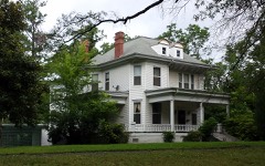 | Lo Beele House | 7.0 miles | 1982 |
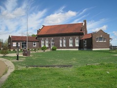 | Lick Skillet Railroad Work Station Historic District | 7.0 miles | 1992 |
| United States Post Office | 7.0 miles | 2022 | |
 | Rusher Hotel | 7.0 miles | 1986 |
| National Archives record | The nomination case file for reference 03000470 in Record Group 79. |
| Monroe County | All 43 listed properties in this county. |