Block
From the record
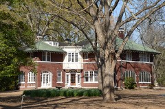
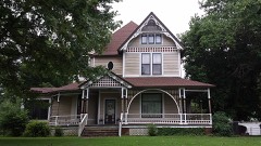
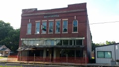
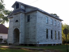
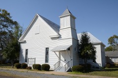
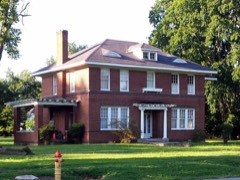
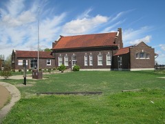
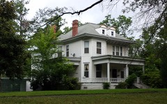
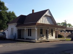
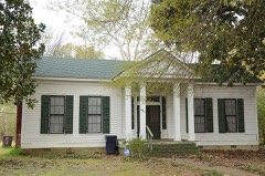
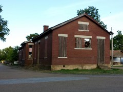
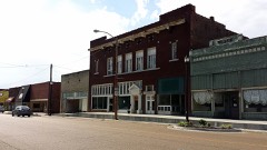
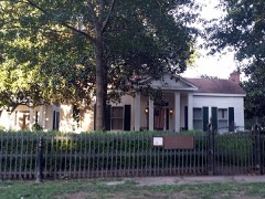
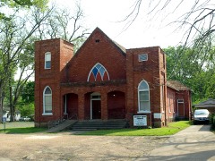
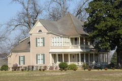
43 National Register listings published here.
Sources: the National Register database, National Park Service
52 topographic sheets cover 40 settlements here, and 43 properties are on the National Register of Historic Places.
43 National Register listings published here.
Sources: the National Register database, National Park Service
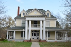
Every property in this county listed on the National Register of Historic Places, with the year it was listed and the federal nomination document.
Every wildfire the federal occurrence database records inside this county: 78 of them, burning about 2,587 acres. None started naturally and 18 were recorded as arson. Each settlement page carries the fires within five miles of it.
| Reported cause | Fires |
|---|---|
| Debris and open burning | 37 |
| Arson/incendiarism | 18 |
| Missing data/not specified/undetermined | 12 |
| Smoking | 6 |
| Equipment and vehicle use | 2 |
| Other causes | 1 |
| Misuse of fire by a minor | 1 |
| Recreation and ceremony | 1 |
The five largest, by the area the report gives. One of them was set deliberately.
| Date | Cause | Size | Reported by | Name on the report |
|---|---|---|---|---|
| 13 October 2015 | Debris and open burning | 319 acres | Arkansas Forestry Commission | not named |
| 12 November 2001 | Debris and open burning | 221 acres | Arkansas Forestry Commission | not named |
| 27 September 1999 | Debris and open burning | 173 acres | Arkansas Forestry Commission | not named |
| 11 October 2000 | Debris and open burning | 157 acres | Arkansas Forestry Commission | not named |
| 19 September 2005 | Arson/incendiarism | 155 acres | Arkansas Forestry Commission | not named |
| 22 August 2007 | Smoking | 141 acres | Arkansas Forestry Commission | HOLLY GROVE |
| 27 February 2014 | Debris and open burning | 135 acres | Arkansas Forestry Commission | MON1587631 |
| 9 July 2002 | Debris and open burning | 122 acres | Central Arkansas Refuges Complex | BANKS |
Every settlement page carries the fires within five miles of it - see the settlement index below.
The NOAA Storm Events Database holds 354 reports for this county, causing no deaths, 8 injuries and about $51,621,500 in recorded property damage. Each settlement page carries the reports that name it.
| Kind of event | Reports |
|---|---|
| Thunderstorm Wind | 130 |
| Hail | 90 |
| Flood | 86 |
| Tornado | 22 |
| Flash Flood | 20 |
| Heavy Rain | 3 |
| Lightning | 2 |
| Funnel Cloud | 1 |
The most serious of them, by death, then injury, then recorded damage. The accounts are quoted exactly as the forecast office filed them.
| When | Event | Place named | Harm | What the report says |
|---|---|---|---|---|
| February 1965 | Tornado (F3) | not stated | 5 hurt, $25,000 | no account filed |
| May 2013 | Tornado (EF1) | Brinkley Meml Arpt | 1 hurt, $100,000 | An EF1 tornado began around Greenlee Park on the east side of Brinkley and moved mostly to the north. It took the roof off a house, slightly injuring a person inside. A few other buildings had minor roof damage. Trees were uprooted or snapped off. The tornado continued into St. Francis County 2.5 miles west-southwest of Wheatley. |
| February 2011 | Thunderstorm Wind | Brinkley Meml Arpt | 1 hurt, $100,000 | Two tractor-trailers were blown over on Interstate 40 just northeast of Brinkley. One of the drivers was injured. |
| April 2011 | Lightning | Clarendon | 1 hurt, $1,000 | A person was injured when lightning struck a house. The person was holding onto an aluminum storm door at the time. |
| May 2011 | Flood | Zent | $35,000,000 | Parts of Arkansas Highways 1, 17, 86, 146, and 302 were closed due to flooding. Some parts of the Sheffield Nelson Dagmar Wildlife Management Area were closed due to flooding. Hundreds of people were evacuated south of Clarendon. In the southern part of the county, communities that were flooded included East Lake, Maddox Bay, Green Lake, and Indian Bay. Flooding also occurred at Deep Elm and Lawrenceville. Altogether, about 750 residences in Monroe County were flooded. Flooding in Monroe County continued into June. |
| July 1994 | Tornado (F1) | to 6.5 | $5,000,000 | An F1 tornado touched down about 2.5 miles south-southeast of Brinkley and traveled approximately 5 miles before lifting. Thirteen large electrical transmission towers were damaged or destroyed. Large power lines fell onto U.S. Highway 49. Smaller power lines were also blown down along the tornado's path, as were a few trees. Several grain storage bins were destroyed. No injuries were reported. |
| March 2008 | Flood | Clarendon Muni Arpt | $3,000,000 | Heavy rain caused the White River at Clarendon to go above major flood level and to the highest stage since May, 1973. The river was in minor flood at the beginning of the month and continued to rise due to the heavy rains. Approximately 10 county roads and part of Arkansas Highway 302 north of Clarendon were closed because of flooding. Residents of Maddox Bay and Indian Bay were evacuated due to flooding. Numerous homes, possibly as many as 40, flooded at Maddox Bay, Indian Bay, and at St. Charles. There were some minor agricultural losses, such as to winter wheat. The flooding continued into April. |
| April 1982 | Tornado (F2) | not stated | $2,500,000 | no account filed |
| June 2014 | Flash Flood | Zent | $1,300,000 | Rainfall measured 7.25 inches 6 miles southwest of Brinkley, while Brinkley collected 7.20 inches of rain. About 40 houses were flooded in Brinkley, primarily in the Snow Addition. Several houses had to be evacuated in the Zent area as well. The Brinkley airport flooded, as did some of the hangars. Parts of U.S. 49, U.S. 70, Arkansas 86, Arkansas 238, and Arkansas 302 flooded, along with numerous county roads. Farm fields were flooded, as well. The University of Arkansas Cooperative Extension Service reported that 15,000 acres of rice, soybeans, and corn were flooded in the county. |
| July 1994 | Thunderstorm Wind | Brinkley | $500,000 | Thunderstorm winds downed numerous trees, some of which fell on parked cars. A number of homes and businesses were damaged by fallen trees. Some power lines were also pulled down by falling trees. One mobile home was destroyed and several others were damaged. An airplane was flipped over at the municipal airport. |
| January 2012 | Tornado (EF1) | Ragtown | $300,000 | A large shed was flipped over the top of a quonset-shaped farm shop. Large holes were ripped into the sides of the shop. An irrigation pivot was overturned, tin was torn off tractor sheds and other types of sheds, and power poles and trees were blown down. The tornado exited Monroe County south-southeast of Palmer and entered Phillips County southwest of Postelle. |
| October 2012 | Tornado (EF1) | Clarendon | $300,000 | An EF1 tornado moved through downtown Clarendon and areas adjacent to downtown. A video rental store/bait shop was badly damaged. A highway sign was thrown through a front window, with the sign landing on the floor of the store. Altogether, two windows and the front door were blown out, and most of the rear of the building was destroyed. No one at the store was injured, as it had closed just 5 to 10 minutes before the tornado arrived. A gas station's canopy was damaged, and a motel had its canopy blown away. A large carport was blown on top of an 18-wheeler. The roof was blown off a barbershop, and metal from the roof knocked over the town's fire siren. Large trees, power poles, and power lines were blown down. The entire town was without power after the tornado passed through. A boat dock on the White River was destroyed. |
| April 2011 | Flood | Zent | $275,000 | Widespread areal flooding occurred. |
| December 2009 | Flood | Zent | $250,000 | Flash flooding, which developed early on the morning of the 24th, became widespread areal flooding later in the day on the 24th and continued into Christmas morning. |
| December 2009 | Flash Flood | Zent | $250,000 | Widespread heavy rain led to the development of flash flooding early on the 24th. Several streets in Brinkley were flooded. |
| April 2008 | Flood | Clarendon Muni Arpt | $250,000 | Flooding which began in March became worse in Monroe County as additional heavy rain fell in the White River watershed. The Clarendon gage crested at 33.78 feet, highest since April, 1973. Homes, cabins, and businesses were flooded in Clarendon and in communities along the river, such as Indian Bay, Lawrenceville, and Aberdeen. Arkansas Highway 302 north of Clarendon was closed by high water. Most of the damages were incurred in March, so the damage amounts for April were much less. High stages on the Mississippi River compounded the high water problems on the White River. The Clarendon gage remained above flood stage into May. |
| April 1985 | Tornado (F2) | not stated | $250,000 | no account filed |
| April 1978 | Tornado (F2) | not stated | $250,000 | no account filed |
| November 1973 | Tornado (F2) | not stated | $250,000 | no account filed |
| February 2011 | Thunderstorm Wind | Brinkley | $200,000 | A severe thunderstorm struck the Cloverdale section of Brinkley. Trees, power lines, and power poles were blown down. A few of the trees landed on houses and carports. A number of houses suffered roof or siding damage. Fences were blown down. Ten garage doors at a vacant car dealership were blown in. |
| August 2018 | Thunderstorm Wind | Brinkley | $100,000 | Several trees were blown down across Brinkley, one of which damaged a home. There was also damage to the roof of the elementary school. |
| November 2006 | Thunderstorm Wind | Brinkley | $100,000 | Straight-line winds from a severe thunderstorm produced damage in and around the Brinkley area. Numerous trees and power lines were blown down, with a few homes and vehicles damaged by fallen trees. Several dozen houses also sustained roof damage from the strong winds. Part of the roof of a grain elevator was torn off. It appears that a brief gustnado may have have been spawned around a farm, resulting in the destruction of a metal farm shop and four grain bins. |
| June 2012 | Thunderstorm Wind | Keevil | $80,000 | A shop building was destroyed and debris from the shop punctured a grain bin. Pieces of metal from the shop flew into a corn crop, shearing off plants. Two barns were damaged by flying debris. A fuel tank and spray rig were overturned. A tractor was damaged. Much of the metal roof was torn off a shed. Trees were blown down. |
| June 2012 | Thunderstorm Wind | Clarendon | $75,000 | Trees were blown down, damaging some buildings. |
| May 2009 | Flash Flood | Holly Grove | $75,000 | Houses were flooded along Arkansas Highway 146 roughly 5 miles southeast of Holly Grove. |
| October 2009 | Flash Flood | Zent | $75,000 | U.S. Highway 49 and Arkansas Highways 302 and 17 were closed due to flooding. Numerous county roads were damaged. |
| June 2021 | Flash Flood | Clarendon | $50,000 | Many roads were flooded across the area. Several businesses were flooded and numerous cars were stranded as well. |
| April 2020 | Thunderstorm Wind | Indian Bay | $50,000 | Damage occurred to a mobile home and roof damage occured to a home. A small shed was blown away. |
| June 2014 | Thunderstorm Wind | Holly Grove | $50,000 | Several trees were blown down onto houses. |
| April 2011 | Thunderstorm Wind | Brinkley | $50,000 | Trees and power lines were blown down. Large signs of several businesses were blown down. |
| June 2009 | Thunderstorm Wind | Brinkley | $50,000 | Trees and power lines were blown down. The street department sustained roof damage. |
| June 1994 | Thunderstorm Wind | Roe | $50,000 | Thunderstorm winds blew down a few trees and damaged some buildings. |
| July 1994 | Thunderstorm Wind | Brinkley | $50,000 | Thunderstorm winds damaged the roof of a house. |
| October 2014 | Thunderstorm Wind | Roe | $40,000 | Numerous trees and some power lines were blown down. A couple of houses were damaged by falling trees. |
| April 2013 | Thunderstorm Wind | Holly Grove | $40,000 | Trees, power lines, and power poles were blown down. Some of the trees fell on houses. |
| April 2011 | Thunderstorm Wind | Brinkley | $40,000 | Numerous power lines were blown down, leaving much of Brinkley without power. Several trees were blown down as well. |
| July 2014 | Flood | Zent | $25,000 | Due to excessive rain on the morning of June 29th, some roads and fields remained flooded into July. Flooding of homes in Brinkley, primarily in the Snow Addition, and at the Brinkley airport also continued. Arkansas 238 southeast of Brinkley was flooded until the middle of July. |
| June 2014 | Flood | Zent | $25,000 | Due to the excessive rain on the morning of the 29th, some roads and fields remained flooded into July. Flooding of homes in Brinkley, primarily in the Snow Addition, and at the Brinkley airport also continued. |
| May 2013 | Tornado (EF1) | Allendale | $25,000 | A brief EF1 tornado uprooted or snapped numerous trees in a cemetery, and an adjacent building suffered roof damage. |
| December 2011 | Flood | Clarendon | $25,000 | Additional heavy rainfall in December as well as routed water from upstream dams kept the White River at Clarendon above flood stage throughout December. |
| April 2011 | Thunderstorm Wind | Clarendon | $25,000 | Numerous trees and power lines were blown down. |
| April 2011 | Thunderstorm Wind | Clarendon | $25,000 | Numerous trees were blown down in Clarendon. |
| December 2009 | Flood | Ninety Point | $25,000 | Heavy rainfall in early December, combined with planned reservoir releases, caused the White River at Clarendon to rise above flood stage on the 8th and 9th. This river remained above flood stage at this location through the rest of December and into January, aided by additional very heavy rainfall on the 23rd and 24th. Thousands of acres of cropland and several rural roads became inundated due to the high water. |
| May 2008 | Tornado (EF1) | Deep Elm | $25,000 | Many trees were blown down, including a huge tree that fell on an old house being used as a deer camp. Part of the roof of a house was blown off. |
| February 1976 | Tornado (F1) | not stated | $25,000 | no account filed |
| February 1975 | Tornado (F1) | not stated | $25,000 | no account filed |
| June 2013 | Flood | Clarendon | $20,000 | Heavy rainfall from late May into early June caused the White River at Clarendon to rise above flood stage during the morning hours on the 5th, before falling below flood stage during the afternoon hours on the 14th. |
| January 2013 | Thunderstorm Wind | Brinkley | $15,000 | Trees and power lines were blown down. |
| April 2011 | Thunderstorm Wind | Clarendon | $15,000 | Trees and power lines were blown down. |
| February 2008 | Tornado (EF0) | Clarendon | $15,000 | Several dozen trees were blown down or snapped off, power lines were blown down along Arkansas Highway 39, and shingles were taken off a few roofs. |
| January 2014 | Flood | Jeffries | $10,000 | Heavy rainfall in December and early January kept the White River at Clarendon above flood stage through much of January. The river fell below flood stage during the morning hours of the 25th. |
| October 2014 | Thunderstorm Wind | Holly Grove | $10,000 | Some trees were blown down. |
| May 2014 | Flood | Duncan | $10,000 | Heavy rainfall from spring rains caused the White River at Clarendon to rise above flood stage during the morning hours of the 7th. This river remained above flood stage through much of May before falling below flood stage during the morning hours of the 29th. |
| June 2014 | Thunderstorm Wind | Brinkley | $10,000 | A tree fell, knocking down power lines. |
| May 2012 | Thunderstorm Wind | Holly Grove | $10,000 | Large limbs were blown down, causing power outages. |
| June 2012 | Thunderstorm Wind | Roe | $10,000 | Trees were blown down, one of which fell on a mobile home. |
| April 2012 | Flood | Clarendon | $10,000 | Heavy rainfall at the end of March pushed the White River at Clarendon above flood stage through the 21st of April. |
| November 2011 | Flood | Clarendon | $10,000 | Heavy rainfall caused the White River near Clarendon to rise above flood stage during the late evening hours on the 28th. This river reached over 26 feet during the month of November and minor flooding continued through the end of the month. |
| May 2011 | Flood | Clarendon | $10,000 | Very heavy rainfall in late April and early May caused the White River at Clarendon to rise well above flood stage, reaching major flood stage levels during the month of May. |
| August 2010 | Thunderstorm Wind | Dagmar | $10,000 | Many trees were blown down near Interstate 40. |
The Survey's mineral resources record lists 4 workings inside this county. 1 still produces and 3 are closed or unrecorded. Each settlement page carries the workings within five miles of it.
| Commodity | Workings |
|---|---|
| Sand and Gravel, Construction | 4 |
The least common of them first, because a county's hundredth gravel pit says nothing its first ten did not.
| Where | Site | Commodity | Status | Recorded |
|---|---|---|---|---|
| Ark St Hwy Dept Pit #2 | Sand and Gravel, Construction | Past Producer | ||
| Brewer Pit | Sand and Gravel, Construction | Past Producer | ||
| Mobley Cnstrctn Co Pit | Sand and Gravel, Construction | Past Producer | ||
| Unk | Sand and Gravel, Construction | Producer |
Named settlements recorded in the Geographic Names Information System, each with the topographic sheets covering it. Villages, hamlets and abandoned places alike. Each is shown with the nearest named watercourse or landform and the survey quadrangle it falls on.
Keevil township · 72021 · On Little Robe Bayou · De Valls Bluff SE quadrangle
15 sheets, 1941 to 1990
Montgomery-Smalley township · 72069 · On Prairie Cypress Creek · Indian Bay SE quadrangle
17 sheets, 1939 to 1986
No longer a settlement
Jackson township · 72069 · On Boat Gunwale Slash · Holly Grove quadrangle
14 sheets, 1940 to 1990
Montgomery-Smalley township · 72069 · On Indian Bayou · Turner quadrangle
16 sheets, 1939 to 1986
Keevil township · 72021 · Clarendon quadrangle
16 sheets, 1935 to 1990
No longer a settlement
Cypress Ridge township · 72021 · Keevil quadrangle
15 sheets, 1940 to 1990
No longer a settlement
The vanished settlements of Monroe County: the places named above that are no longer on the map.