BlockBefore

Gene Rush House

Built in 1964 (mid-century modern). Listed on the National Register of Historic Places in 2019.

From the record

“The Gene Rush House is a historic house at 9515 Barrett Road near Roland, Arkansas. Built around 1964 for Arkansas wildlife biologist Gene Rush, the house is a local example of Mid-century modern residential architecture.”

Wikipedia article Gene Rush House, CC BY-SA 4.0.

One of 383 National Register listings published here for Pulaski County · listed in 2019 · category: Building · built in 1964, mid-century modern.

Sources: the Wikipedia article · the National Register database, National Park Service
The listing

  • What is counted as historic. The nomination lists 2 buildingss, 2 objectss, 1 site as contributing to the listing.
  • Listed as. Rush, Gene, House - the National Register files a house under its owner's surname.
  • Address. 9515 Barrett Rd., Roland, 72135
  • When was it listed? January 2019
  • Category. building
  • Township. Big Rock township
  • When was it built? 1964
  • Architectural style. mid-century modern
  • National Register reference number. 100003335 - assigned by the National Park Service when the property was listed.

Fires near this property

73 since 1997

Regional context, not property-specific evidence. The federal wildfire occurrence database lists 73 fires within 5 miles of Gene Rush House between 1997 and 2019, burning about 841 acres in total. 4 started naturally. 9 were recorded as arson. Distance is straight-line from the map coordinates, so a fire counted here may appear on a neighbouring settlement's page as well.

Reported cause Fires
Missing data/not specified/undetermined24
Debris and open burning20
Recreation and ceremony10
Arson/incendiarism9
Equipment and vehicle use4
Natural4
Smoking2

The most recent of them, most recent first, with the day each was reported and the service that recorded it.

DateCause SizeReported by Name on the report
7 September 2011Debris and open burning1.0 acresArkansas Forestry Commissionnot named
29 September 2001Arson/incendiarism25 acresArkansas Forestry Commissionnot named
20 September 2001Missing data/not specified/undetermined5.0 acresArkansas Forestry Commissionnot named
16 September 2010Arson/incendiarism114 acresArkansas Forestry Commissionnot named
12 September 2001Arson/incendiarism5.0 acresArkansas Forestry Commissionnot named
10 September 1999Missing data/not specified/undetermined10 acresArkansas Forestry Commissionnot named
6 August 1997Missing data/not specified/undetermined1.0 acresArkansas Forestry Commissionnot named
30 August 2000Missing data/not specified/undetermined3.0 acresArkansas Forestry Commissionnot named

Every fire recorded in Pulaski County

Mines and quarries near this property

2 within 5 miles

Regional context, not property-specific evidence. The federal mineral resources record lists 2 workings within 5 miles of Gene Rush House: 2 unknowns. None of them still produces. What was taken out: Silica, Copper. Distance is straight-line from the map coordinates, so a quarry counted here may appear on a neighbouring settlement's page as well.

Where SiteCommodity StatusRecorded
Big Bear Mining Co.CopperUnknown
H. J. White ProspectSilicaUnknown

Every working recorded in Pulaski County

Storms near this property

24 since 1996

Regional context, not property-specific evidence. The National Weather Service names Roland, the town this property stands in, in 24 storm reports between 1996 and 2020: 9 thunderstorm wind, 6 hail, 4 flash flood, 3 tornado. The reports record 1 injury. Each account below is quoted exactly as the forecast office filed it, from the NOAA Storm Events Database, and each date opens the federal record of that event.

WhenEvent Place namedHarm What the report says
July 2000Thunderstorm WindRoland1 hurtno account filed
August 2014Flash FloodRoland$1,500,000Flash flooding occurred in parts of Maumelle, Morgan, and Marche. Arkansas 365 was flooded and at least one water rescue was necessary. Flooding in Maumelle entered some townhouses and apartments. A rain gauge in Maumelle measured 1.97 inches of rain between 1:45 and 2:45 PM CDT, and a total of 3.28 inches from 12:30 PM to 4:14 PM CDT.
May 2010Thunderstorm WindRoland$200,000Dozens of trees were blown down in the Roland area.
April 2007Flash FloodRoland$10,000Heavy rains flooded roads in the area around Roland and Monnie Springs.
April 2020Thunderstorm WindRoland-Lake Maumelle Fire Department reported multiple trees down on power lines and blocking roads in Roland.
February 2018Flash FloodRoland-High water was covering Vincent and Beale Streets in Roland.
August 2018Heavy RainRoland-Measured a 24 hour storm total of 10.63 inches beginning on the morning of August 7th.
August 2018Flash FloodRoland-Beaver Creek Rd. was flooded by Mill Bayou Creek and that water was approaching a few homes in the area.
August 2006Thunderstorm WindRoland-Several trees were blown down.
August 2006LightningRoland-Lightning struck a tree, causing it to fall on a house.
November 2005Tornado (F1)Roland-A weak tornado moved into western Pulaski County from eastern Perry County. The tornado badly damaged an old auto service garage and damaged the roofs of several houses. Trees were also downed. The tornado dissipated 14.5 miles west-southwest of Roland.
March 2004Thunderstorm WindRoland-Thunderstorm winds downed several trees.
July 2003Thunderstorm WindRoland-Thunderstorm winds downed several trees along Highway 300.
July 2002Tornado (F0)Roland-A waterspout touched down on Lake Maumelle and traveled westward for about 1.5 miles before lifting. No damage occurred. The waterspout was observed by nearby boaters who were already ashore.
May 2000Tornado (F0)Roland-A weak tornado briefly touched down in western Pulaski County about 5 miles southwest of Roland. The tornado mainly affected a marina on Lake Maumelle, with several boat docks damaged and a sailboat mast bent. One witness saw the tornado spin at least one sailboat around in the water.
July 1997Thunderstorm WindRoland-Thunderstorm winds knocked down a few trees and large tree limbs.
May 2010HailRoland-no account filed
October 2004Thunderstorm WindRoland-no account filed
May 2000HailRoland-no account filed
January 1999HailRoland-no account filed
June 1999Thunderstorm WindRoland-no account filed
May 1998HailRoland-no account filed
July 1997HailRoland-no account filed
May 1996HailRoland-no account filed

Every storm recorded in Pulaski County

Map coverage status

No historic map-sheet match is published for this property yet. That does not mean no map exists. This record needs a coordinate-quality review before it can be joined to a sheet boundary. Browse the county's mapped places while that work is pending.

Listed places nearby

6 within 8 miles

Other National Register properties close enough to walk or drive between, ordered by distance from this one. Both positions come from the same geocoding pass that matched these properties to their map sheets.

Photograph PropertyDistance Listed
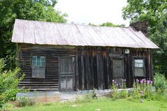
La Belle Creole0.7 miles2024
Maumelle River Bridge2.3 miles2020
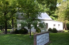
Walnut Grove Methodist Church4.9 miles1977
Doe Branch Post Office5.4 miles2001
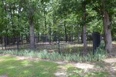
Pyeatte-Mason Cemetery5.9 miles1996
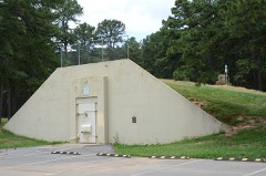
Maumelle Ordnance Works Bunker #46.3 miles2006

Sources for this property

National Archives recordThe nomination case file for reference 100003335 in Record Group 79.
Wikipedia articleCommunity-written account of this property, licensed CC BY-SA.
Pulaski CountyAll 383 listed properties in this county.

Provenance

  • Listing record. National Park Service National Register of Historic Places, listed-properties dataset, current to 2026-05-22.
  • Map join. Address geocoded through the United States Census geocoder, then tested against the published boundary of every sheet in the USGS Historical Topographic Map Collection.
  • How this page is made. Listing fields come from federal records; map-sheet coverage is a labelled coordinate-to-boundary calculation, not a source-field claim.
  • Wildfire. Short, Karen C. 2022. Spatial wildfire occurrence data for the United States, 1992-2020 [FPA_FOD_20221014]. 6th Edition. Fort Collins, CO: Forest Service Research Data Archive. https://doi.org/10.2737/RDS-2013-0009.6 Collected with United States Government funding and usable without additional permissions or fees.
  • Mines and quarries. USGS Mineral Resources Data System (MRDS) https://mrdata.usgs.gov/mrds/ A work of the United States government, no copyright under 17 U.S.C. 105.
  • Storms. NOAA National Centers for Environmental Information, Storm Events Database https://www.ncei.noaa.gov/stormevents/ A work of the United States government, no copyright under 17 U.S.C. 105. Narratives are quoted verbatim from the National Weather Service report and are not edited or summarised.