 Block
From the record
One of 19 National Register listings published here for Randolph County · listed in 2019 · category: Building.
Sources: the National Register database, National Park Service
Listed on the National Register of Historic Places in 2019.
One of 19 National Register listings published here for Randolph County · listed in 2019 · category: Building.
Sources: the National Register database, National Park Service
Regional context, not property-specific evidence. The federal wildfire occurrence database lists 48 fires within 5 miles of Pocahontas Federal Savings and Loan between 1997 and 2019, burning about 739 acres in total. None started naturally. 4 were recorded as arson. Distance is straight-line from the map coordinates, so a fire counted here may appear on a neighbouring settlement's page as well.
| Reported cause | Fires |
|---|---|
| Debris and open burning | 35 |
| Missing data/not specified/undetermined | 7 |
| Arson/incendiarism | 4 |
| Equipment and vehicle use | 1 |
| Misuse of fire by a minor | 1 |
The most recent of them, most recent first, with the day each was reported and the service that recorded it.
| Date | Cause | Size | Reported by | Name on the report |
|---|---|---|---|---|
| 28 September 1998 | Debris and open burning | 17 acres | Arkansas Forestry Commission | not named |
| 28 September 1998 | Missing data/not specified/undetermined | 2.0 acres | Arkansas Forestry Commission | not named |
| 2 September 2014 | Debris and open burning | 12 acres | Arkansas Forestry Commission | RAN28393895 |
| 17 September 2000 | Debris and open burning | 1.0 acres | Arkansas Forestry Commission | not named |
| 12 September 2005 | Debris and open burning | 8.0 acres | Arkansas Forestry Commission | not named |
| 31 August 2007 | Debris and open burning | 13 acres | Arkansas Forestry Commission | not named |
| 13 August 2005 | Missing data/not specified/undetermined | 2.0 acres | Arkansas Forestry Commission | not named |
| 12 August 2005 | Misuse of fire by a minor | 20 acres | Arkansas Forestry Commission | not named |
Regional context, not property-specific evidence. The federal mineral resources record lists 5 workings within 5 miles of Pocahontas Federal Savings and Loan: 3 unknowns, 1 past producer, 1 prospect. None of them still produces. What was taken out: Iron, Sand and Gravel, Construction, Stone. Distance is straight-line from the map coordinates, so a quarry counted here may appear on a neighbouring settlement's page as well.
| Where | Site | Commodity | Status | Recorded |
|---|---|---|---|---|
| Unk | Stone | Unknown | ||
| H M Bishop Farm | Iron | Prospect | ||
| Unk | Sand and Gravel, Construction | Unknown | ||
| Unk | Sand and Gravel, Construction | Unknown | ||
| Unknown Iron | Iron | Past Producer |
Regional context, not property-specific evidence. The National Weather Service names Pocahontas, the town this property stands in, in 134 storm reports between 1993 and 2025: 44 flood, 37 thunderstorm wind, 35 hail, 14 flash flood. The reports record 2 deaths and 1 injury. Each account below is quoted exactly as the forecast office filed it, from the NOAA Storm Events Database, and each date opens the federal record of that event.
| When | Event | Place named | Harm | What the report says |
|---|---|---|---|---|
| April 2008 | Flood | Pocahontas | 1 killed, $2,250,000 | Heavy rain produced flooding in March along the Black River and it's tributaries. The flooding provided intense pressure on the county's levees. Two breaches occurred, one of them on the Scaggs-Ferry Levee. Numerous roads were closed from the high water including Arkansas 90, U.S.Highway 62, Arkansas 166, Arkansas 93, Arkansas 328, Arkansas 304, and U.S. Highway 67 South from Pocahontas into Lawrence County. By the beginning of April, over forty buildings including some houses and a senior citizen complex received damage from the flooding. Of those, ten houses were destroyed, thirty-four houses had major damage, and twelve had minor damage. Randolph County was declared a state disaster area. One death occurred. A teenager drowned when the boat he was in capsized in a flooded area outside the main channel of the Black River near the Noland community. |
| May 2011 | Flood | Pocahontas | 1 killed, $525,000 | Heavy rain from numerous rounds of severe storms brought the Black River at Pocahontas to record levels during late April which continued through the end of May. The crest surpassed the Flood of 1915. Two levees broke sending water further away from its normal banks. Much of the area around Pocahontas was flooded as a result. U.S. Highway 67 was flooded between Pocahontas and Walnut Ridge. The Current River was also extremely high in Eastern Randolph County. Numerous homes and businesses were flooded. Roads and bridges were flooded and/or damaged. Evacuations occurred in Pocahontas and East Pocahontas. A woman drowned when she drove her vehicle into flood waters on Highway 67 between Pocahontas and the Lawrence County line during the early morning hours of May 3rd. |
| January 1999 | Thunderstorm Wind | Pocahontas | 1 hurt, $50,000 | Several houses had their roofs blown off. One truck was blown off the road injuring the driver. Several trees were knocked down as well. |
| May 2017 | Flash Flood | Pocahontas | $3,000,000 | The levee east of Pocahontas broke in several places during the morning hours of May 3rd. Water poured south along the Big Running Water Creek across thousands of acres of farmland. Many small communities were flooded. Several water rescues occurred at the intersection of Highway 67 and Highway 90 in Shannon. |
| March 2008 | Flood | Pocahontas | $2,250,000 | Heavy rain produced flooding along the Black River and it's tributaries. The flooding provided intense pressure on the county's levees. Two breaches occurred, one of them on the Scaggs-Ferry Levee. Numerous roads were closed from the high water including Arkansas 90, U.S.Highway 62, Arkansas 166, Arkansas 93, Arkansas 328, Arkansas 304, and U.S. Highway 67 South from Pocahontas into Lawrence County. Over forty buildings including some houses and a senior citizen complex received damage from the flooding. Of those, ten houses were destroyed, thirty-four houses had major damage, and twelve had minor damage. Randolph County was declared a state disaster area. |
| April 1999 | Tornado (F2) | Pocahontas | $2,000,000 | The tornado touched down on the east side of Paragould and moved northeast. The tornado hit a commercial area with several restaurants and other businesses damaged or destroyed. Several trees and power lines were blown down as well. |
| April 2006 | Tornado (F3) | Pocahontas | $1,000,000 | A tornado began 3 miles south of Pocahontas and tracked east into Greene County. In Shannon, three businesses and five homes were destroyed. Another two businesses and two homes had major damage. Eighteen other homes had minor damage. The tornado produced F1 type damage in Randolph County. |
| April 2011 | Flood | Pocahontas | $525,000 | Heavy rain from numerous rounds of severe storms brought the Black River at Pocahontas to record levels during late April which continued through the end of May. The crest surpassed the Flood of 1915. Two levees broke sending water further away from its normal banks. Much of the area around Pocahontas was flooded as a result. U.S. Highway 67 was flooded between Pocahontas and Walnut Ridge. The Current River was also extremely high in Eastern Randolph County. Numerous homes and businesses were flooded. Roads and bridges were flooded and/or damaged. Evacuations occurred in Pocahontas and East Pocahontas. |
| June 2017 | Thunderstorm Wind | Pocahontas | $100,000 | Partial structural damage to factory. Trees and power lines down. |
| October 2009 | Flash Flood | Pocahontas | $78,000 | Several roads were closed due to flooding. |
| February 2022 | Thunderstorm Wind | Pocahontas | $75,000 | A tree fell on a house north of Pocahontas. A roof was blown off a factory building in Pocahontas and numerous power lines were downed. |
| January 2007 | Flash Flood | Pocahontas | $50,000 | Heavy rain produced flash flooding as a result 13 roads across Randolph county were flooded. |
| June 1994 | Thunderstorm Wind | Pocahontas | $50,000 | Thunderstorm winds downed numerous trees and damaged several buildings. |
| September 1993 | Thunderstorm Wind | Pocahontas | $50,000 | Thunderstorm winds downed some trees and power lines. |
| February 2018 | Flash Flood | Pocahontas | $30,000 | Several roads across town are under water. |
| July 2005 | Thunderstorm Wind | Pocahontas | $25,000 | Radio station KPOC had part of the roof damaged. Several buildings along Highway 67 had significant structural damage. Several large trees and power lines were knocked down. Some of the trees fell on some houses. Some of the down trees caused some gas lines to rupture. |
| April 2017 | Flash Flood | Pocahontas | $20,000 | Several reports of roads underwater in the western portion of Pocahontas. |
| June 2009 | Flash Flood | Pocahontas | $20,000 | Heavy rain caused widespread flash flooding around Randolph County including in the cities of Pocahontas and Maynard. One low water crossing bridge was damaged and few rice levees broke due to the high water. |
| April 2006 | Hail | Pocahontas | $15,000 | no account filed |
| May 2020 | Thunderstorm Wind | Pocahontas | $10,000 | A large tree was blown down on a home and winds from an observation site near town measured between 45 and 50 mph around that time. |
| April 2010 | Thunderstorm Wind | Pocahontas | $10,000 | Straight line winds severely damaged two camper trailers when winds blew one into the other near Pocahontas. |
| October 2004 | Tornado (F0) | Pocahontas | $10,000 | The tornado touched down in Pocahontas and moves east. Several businesses were damaged. |
| October 2000 | Thunderstorm Wind | Pocahontas | $10,000 | Several power lines were knocked down. |
| July 1999 | Thunderstorm Wind | Pocahontas | $10,000 | Several large trees were knocked down. One tree fell on a car. |
| October 2007 | Thunderstorm Wind | Pocahontas | $5,000 | Numerous trees and power lines were knocked down on Highway 67 in Pocahontas. Trees were also blown down across Highway 67 and Townsend Lane. |
| November 2006 | Hail | Pocahontas | $5,000 | Nickel to quarter size hail fell 1 mile west-northwest of Pocahontas. |
| July 2005 | Thunderstorm Wind | Pocahontas | $5,000 | Two trees were blown down on top of a house. |
| July 2005 | Thunderstorm Wind | Pocahontas | $5,000 | Several trees were knocked down. |
| July 2005 | Thunderstorm Wind | Pocahontas | $5,000 | Some power lines were blown down. |
| May 2002 | Thunderstorm Wind | Pocahontas | $5,000 | A couple of power lines were knocked down. |
| August 2002 | Thunderstorm Wind | Pocahontas | $5,000 | Some power lines were knocked down. |
| June 2001 | Thunderstorm Wind | Pocahontas | $5,000 | A couple of trees were blown down. |
| May 1998 | Thunderstorm Wind | Pocahontas | $5,000 | Several trees and power lines were knocked down. |
| April 2008 | Hail | Pocahontas | $5,000 | no account filed |
| January 1996 | Thunderstorm Wind | Pocahontas | $5,000 | no account filed |
| March 1996 | Hail | Pocahontas | $5,000 | no account filed |
| July 1995 | Hail | Pocahontas | $5,000 | no account filed |
| August 2018 | Thunderstorm Wind | Pocahontas | $3,000 | Several trees down north of Pocahontas. North Thomasville Street and Olive Street is the main area of damage. |
| November 2006 | Thunderstorm Wind | Pocahontas | $2,500 | Trees and power lines were knocked down from straight line winds 1 mile west-northwest of Pocahontas. |
| November 2006 | Thunderstorm Wind | Pocahontas | $2,500 | Straight line winds knocked down trees and power lines across the city of Pocahontas. |
| September 2006 | Hail | Pocahontas | $2,500 | no account filed |
| June 2017 | Thunderstorm Wind | Pocahontas | $2,000 | Large tree down near the First Baptist Church on North Thomasville Road. |
| June 2007 | Thunderstorm Wind | Pocahontas | $2,000 | Straight line winds knocked trees down on Highway 62, 3 miles west of Pocahontas. |
| September 2006 | Thunderstorm Wind | Pocahontas | $2,000 | Straight line winds knocked down trees 5 miles west of Pocahontas. |
| February 2008 | Hail | Pocahontas | $2,000 | no account filed |
| October 2009 | Flash Flood | Pocahontas | $1,000 | A bridge off Millcreek Road had water covering it. Over three inches of rain fell in the area over several hours. |
| May 2004 | Thunderstorm Wind | Pocahontas | $1,000 | Several large tree limbs were blown down. |
| May 2002 | Flash Flood | Pocahontas | $1,000 | A few streets were flooded. |
| January 1999 | Flood | Pocahontas | $1,000 | Some street flooding occurred in Pocahontas due to heavy rains. |
| August 1998 | Thunderstorm Wind | Pocahontas | $1,000 | A few trees were knocked down. |
| July 1998 | Flood | Pocahontas | $1,000 | Several roads had water over them. |
| March 2008 | Hail | Pocahontas | $1,000 | no account filed |
| June 2008 | Hail | Pocahontas | $1,000 | no account filed |
| July 2003 | Hail | Pocahontas | $750 | no account filed |
| April 2003 | Hail | Pocahontas | $750 | no account filed |
| June 1994 | Thunderstorm Wind | Pocahontas | $500 | A large tree was blown down, blocking Highway 251. |
| April 2006 | Hail | Pocahontas | $100 | no account filed |
| May 1998 | Hail | Pocahontas | $100 | no account filed |
| September 2001 | Hail | Pocahontas | $50 | no account filed |
| October 2004 | Hail | Pocahontas | $10 | no account filed |
No historic map-sheet match is published for this property yet. That does not mean no map exists. This record needs a coordinate-quality review before it can be joined to a sheet boundary. Browse the county's mapped places while that work is pending.
Other National Register properties close enough to walk or drive between, ordered by distance from this one. Both positions come from the same geocoding pass that matched these properties to their map sheets.
| Photograph | Property | Distance | Listed |
|---|---|---|---|
 | Randolph County Courthouse | under 500 feet | 1996 |
 | Pocahontas Post Office | under 500 feet | 2002 |
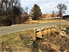 | Marr's Creek Bridge | 0.1 miles | 2008 |
 | Old Randolph County Courthouse | 0.1 miles | 1973 |
 | Pocahontas Commercial Historic District | 0.2 miles | 2009 |
| Bispham-Brown House | 0.3 miles | 2022 |
| National Archives record | The nomination case file for reference 100003338 in Record Group 79. |
| Randolph County | All 19 listed properties in this county. |