 Block
From the record
19 National Register listings published here.
Sources: the National Register database, National Park Service
40 topographic sheets cover 56 settlements here, and 19 properties are on the National Register of Historic Places.
19 National Register listings published here.
Sources: the National Register database, National Park Service
Every property in this county listed on the National Register of Historic Places, with the year it was listed and the federal nomination document.
| Photograph | Property | Type | Listed | Reference |
|---|---|---|---|---|
| Bispham-Brown House | building | 2022 | 100007329 | |
 | Black River Bridge | structure | 1990 | 90000522 |
 | Cedar Grove School #81 | building | 2004 | 03001452 |
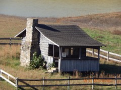 | Hillyard Cabin | building | 1994 | 94000851 |
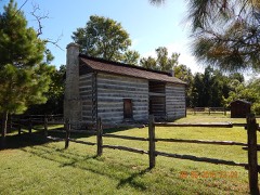 | Looney- French House | building | 2004 | 04001035 |
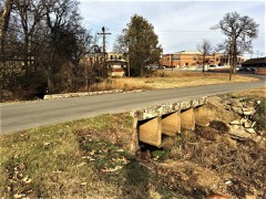 | Marr's Creek Bridge | structure | 2008 | 07001433 |
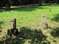 | Old Davidsonville State Historic Monument | site | 1974 | 74000499 |
 | Old Randolph County Courthouse | building | 1973 | 73000390 |
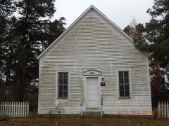 | Old Union School | building | 1993 | 93001203 |
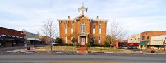 | Pocahontas Commercial Historic District | district | 2009 | 09000315 |
| Pocahontas Federal Savings and Loan | building | 2019 | 100003338 | |
 | Pocahontas Post Office | building | 2002 | 02000488 |
 | Randolph County Courthouse | building | 1996 | 96000910 |
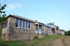 | Ravenden Springs School | building | 2004 | 03001379 |
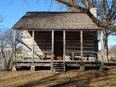 | Rice-Upshaw House | building | 2004 | 04001107 |
 | St.Mary's AME Church-Pocahontas Colored School | building | 2002 | 02000830 |
| US 67, Old, Biggers to Datto | structure | 2004 | 04001046 | |
| Yadkin Church | building | 2019 | 100004003 |
Every wildfire the federal occurrence database records inside this county: 425 of them, burning about 7,782 acres. None started naturally and 61 were recorded as arson. Each settlement page carries the fires within five miles of it.
| Reported cause | Fires |
|---|---|
| Debris and open burning | 238 |
| Missing data/not specified/undetermined | 97 |
| Arson/incendiarism | 61 |
| Equipment and vehicle use | 17 |
| Smoking | 6 |
| Misuse of fire by a minor | 6 |
The five largest, by the area the report gives. One of them was set deliberately.
| Date | Cause | Size | Reported by | Name on the report |
|---|---|---|---|---|
| 24 January 2009 | Missing data/not specified/undetermined | 234 acres | Arkansas Forestry Commission | NUBIN RIDGE |
| 8 December 2008 | Debris and open burning | 225 acres | Arkansas Forestry Commission | JAMES CREEK |
| 23 January 2009 | Debris and open burning | 206 acres | Arkansas Forestry Commission | J-BELLA |
| 26 March 2019 | Missing data/not specified/undetermined | 200 acres | Arkansas Forestry Commission | not named |
| 4 March 1999 | Arson/incendiarism | 174 acres | Arkansas Forestry Commission | not named |
| 17 March 2019 | Missing data/not specified/undetermined | 150 acres | Arkansas Forestry Commission | not named |
| 10 March 2004 | Debris and open burning | 138 acres | Arkansas Forestry Commission | not named |
| 6 March 2012 | Debris and open burning | 95 acres | Arkansas Forestry Commission | not named |
Every settlement page carries the fires within five miles of it - see the settlement index below.
The NOAA Storm Events Database holds 344 reports for this county, causing 2 deaths, 7 injuries and about $33,818,590 in recorded property damage. Each settlement page carries the reports that name it.
| Kind of event | Reports |
|---|---|
| Thunderstorm Wind | 120 |
| Hail | 103 |
| Flood | 65 |
| Flash Flood | 31 |
| Tornado | 22 |
| Lightning | 2 |
| Heavy Rain | 1 |
The most serious of them, by death, then injury, then recorded damage. The accounts are quoted exactly as the forecast office filed them.
| When | Event | Place named | Harm | What the report says |
|---|---|---|---|---|
| April 2008 | Flood | Pocahontas | 1 killed, $2,250,000 | Heavy rain produced flooding in March along the Black River and it's tributaries. The flooding provided intense pressure on the county's levees. Two breaches occurred, one of them on the Scaggs-Ferry Levee. Numerous roads were closed from the high water including Arkansas 90, U.S.Highway 62, Arkansas 166, Arkansas 93, Arkansas 328, Arkansas 304, and U.S. Highway 67 South from Pocahontas into Lawrence County. By the beginning of April, over forty buildings including some houses and a senior citizen complex received damage from the flooding. Of those, ten houses were destroyed, thirty-four houses had major damage, and twelve had minor damage. Randolph County was declared a state disaster area. One death occurred. A teenager drowned when the boat he was in capsized in a flooded area outside the main channel of the Black River near the Noland community. |
| May 2011 | Flood | Pocahontas | 1 killed, $525,000 | Heavy rain from numerous rounds of severe storms brought the Black River at Pocahontas to record levels during late April which continued through the end of May. The crest surpassed the Flood of 1915. Two levees broke sending water further away from its normal banks. Much of the area around Pocahontas was flooded as a result. U.S. Highway 67 was flooded between Pocahontas and Walnut Ridge. The Current River was also extremely high in Eastern Randolph County. Numerous homes and businesses were flooded. Roads and bridges were flooded and/or damaged. Evacuations occurred in Pocahontas and East Pocahontas. A woman drowned when she drove her vehicle into flood waters on Highway 67 between Pocahontas and the Lawrence County line during the early morning hours of May 3rd. |
| February 2008 | Tornado (EF1) | Dalton | 4 hurt, $200,000 | The initial tornado touchdown occurred about one mile west northwest of Dalton, Arkansas around 720 pm CST. The tornado moved northeast for 11 miles on a non-continuous path with the last touchdown near Warm Springs, Arkansas before crossing into Missouri. The maximum width was around 200 yards. The tornado was determined to be an EF-1 with maximum wind speeds near 110 mph. There were 4 minor injuries. The first touchdown occurred one mile west northwest of Dalton and destroyed one home. Minor damage occurred to another house and a detached garage with living quarters above it. The tornado touched down again near the Blackwell Community about 3 miles northeast of Dalton. A manufactured home was moved off its foundation with an outbuilding totally destroyed. Another touchdown occurred 4 miles northeast of Dalton moving a cabin off its block foundation. A fourth touchdown was noted 5 miles northeast of Dalton. Three homes had moderate roof damage. In addition, a large metal building had severe damage. Tree damage was noted near Warm Springs indicating another touchdown. The tornado then tracked into Ripley County, Missouri. |
| July 1994 | Tornado (F2) | to 3 SSE | 1 hurt, $500,000 | An F2 tornado touched down one mile south of Pocahontas and traveled south-southeastward for approximately two miles before lifting. The tornado heavily damaged two businesses and destroyed two mobile homes. Two other mobile homes were removed from their foundations. An tractor-semitrailer was blown off U.S. Highway 67. The driver's wife received minor injuries when the entire rig flipped over into a ditch. Another tractor-semitrailer was blown over at a local business. Some trees and power lines were also blown down along the highway. |
| January 1999 | Thunderstorm Wind | Pocahontas | 1 hurt, $50,000 | Several houses had their roofs blown off. One truck was blown off the road injuring the driver. Several trees were knocked down as well. |
| December 1982 | Tornado (F1) | not stated | 1 hurt, $25,000 | no account filed |
| May 2017 | Flood | Supply | $15,000,000 | Heavy rain brought the Black River at Pocahontas to a record crest that topped the April 2011 flood. The levee east of town broke in at least nine places, including one 300 yard stretch, sending water across much of Randolph County. East Pocahontas was flooded and suffered major damage. Highway 67 was flooded between Pocahontas and Walnut Ridge. Highway 67/62 between Pocahontas and Corning was flooded. Highways 166 and 304 were also closed. Highway 304 was closed for 37 days. The Current River also flooded farmland in eastern Randolph County. Numerous homes, farms, businesses and vehicles were flooded. Many roads and bridges were flooded and damaged. More than 500 people were evacuated Pocahontas. At least 50 homes were destroyed or damaged by flooding in Pocahontas. The Elnora Freewill Baptist Church was heavily damaged. The Randolph County Jail had to evacuate prisoners. |
| May 2017 | Flash Flood | Pocahontas | $3,000,000 | The levee east of Pocahontas broke in several places during the morning hours of May 3rd. Water poured south along the Big Running Water Creek across thousands of acres of farmland. Many small communities were flooded. Several water rescues occurred at the intersection of Highway 67 and Highway 90 in Shannon. |
| September 2006 | Flash Flood | North Portion | $2,500,000 | Heavy rains caused flash flooding in northern portions of Randolph County. The hardest hit area was near Maynard where flood water entered many homes near Highway 115. Porches were ripped off from some homes due to the flood water. In addition, 8 to 12 inches of flood water covered the intersection of Highway 90 and Highway 251. Officials estimated that 70 percent of roads and highways had been damaged by flooding, and about half of the damage had been severe. Two chicken houses in North Central Randolph County were flooded, killing about 40,000 chickens. In addition, a number of cattle drowned and crops were severely damaged. |
| March 2008 | Flood | Pocahontas | $2,250,000 | Heavy rain produced flooding along the Black River and it's tributaries. The flooding provided intense pressure on the county's levees. Two breaches occurred, one of them on the Scaggs-Ferry Levee. Numerous roads were closed from the high water including Arkansas 90, U.S.Highway 62, Arkansas 166, Arkansas 93, Arkansas 328, Arkansas 304, and U.S. Highway 67 South from Pocahontas into Lawrence County. Over forty buildings including some houses and a senior citizen complex received damage from the flooding. Of those, ten houses were destroyed, thirty-four houses had major damage, and twelve had minor damage. Randolph County was declared a state disaster area. |
| April 1999 | Tornado (F2) | Pocahontas | $2,000,000 | The tornado touched down on the east side of Paragould and moved northeast. The tornado hit a commercial area with several restaurants and other businesses damaged or destroyed. Several trees and power lines were blown down as well. |
| April 2014 | Flash Flood | Elevenpoint | $1,650,000 | Heavy rain produced flash flooding across parts of Randolph County. Highway 62 and others roads west of Pocahontas were flooded. Several streets were impassable in Maynard. Many county roads were also flooded north of Imboden. |
| April 2006 | Tornado (F3) | Pocahontas | $1,000,000 | A tornado began 3 miles south of Pocahontas and tracked east into Greene County. In Shannon, three businesses and five homes were destroyed. Another two businesses and two homes had major damage. Eighteen other homes had minor damage. The tornado produced F1 type damage in Randolph County. |
| April 2011 | Flood | Pocahontas | $525,000 | Heavy rain from numerous rounds of severe storms brought the Black River at Pocahontas to record levels during late April which continued through the end of May. The crest surpassed the Flood of 1915. Two levees broke sending water further away from its normal banks. Much of the area around Pocahontas was flooded as a result. U.S. Highway 67 was flooded between Pocahontas and Walnut Ridge. The Current River was also extremely high in Eastern Randolph County. Numerous homes and businesses were flooded. Roads and bridges were flooded and/or damaged. Evacuations occurred in Pocahontas and East Pocahontas. |
| March 2022 | Tornado (EF1) | Elevenpoint | $200,000 | This tornado started southeast of Dalton in Randolph County. Several small outbuildings were destroyed, there were softwood, shallow rooted trees uprooted, and there were chicken coops that were either completely or partially destroyed. The tornado track was determined by geotagged photos. |
| August 2020 | Tornado (EF2) | Biggers | $200,000 | A storm survey crew from the NWS Office in Little Rock found tornado consistent with an EF2 rating. A house sustained major roof damage on Highway 328 west of Maynard, with most of the walls still standing. An agricultural shop was destroyed 2 miles south of Biggers. ||The tornado started just southeast of US67/62 southwest of|Biggers, destroying a metal farm building and snapping trees|along Lutrell Cemetery Road. The tornado continued northwest|blowing in some garage doors on some large metal buildings, along|with snapping limbs off of multiple trees along Gas Plant and|Biggers-Reyno roads. The tornado continued northwest for several|miles, causing mainly damage to trees, from broken limbs, to|uprooting or snapping those tree trunks. The worst damage was|observed at a site built home off of State Hwy 328 and Jerrett|Loop Road southwest of Maynard, where large sections of the roof|were torn off allowing a couple walls to fall inward. At the same|residence, a large metal outbuilding or barn was destroyed. Many|mature trees were snapped or uprooted around this location. The|tornado finally lifted further northwest along State Hwy 251|south of Palestine Road. |
| March 2022 | Thunderstorm Wind | Elevenpoint | $100,000 | Several power poles were knocked down along with damage to poultry houses and two structures. |
| July 2019 | Lightning | Maynard | $100,000 | Lightning started two house fires in Maynard according to a trained storm spotter in the area. |
| May 2017 | Flood | Success | $100,000 | Major flooding occurred along the Eleven Point River. State Highway 90 closed with flooding between Dalton and Ravenden Springs. Campgrounds along the river were impacted. Many roads in Randolph County were flooded. Extensive agricultural acreage inundated. |
| June 2017 | Thunderstorm Wind | Pocahontas | $100,000 | Partial structural damage to factory. Trees and power lines down. |
| February 2022 | Thunderstorm Wind | Maynard | $80,000 | Two houses had their roofs blown off in Maynard. |
| January 2002 | Flash Flood | Biggers | $80,000 | One bridge was washed out. |
| October 2009 | Flash Flood | Pocahontas | $78,000 | Several roads were closed due to flooding. |
| February 2022 | Thunderstorm Wind | Pocahontas | $75,000 | A tree fell on a house north of Pocahontas. A roof was blown off a factory building in Pocahontas and numerous power lines were downed. |
| May 2021 | Thunderstorm Wind | Pocahontas Muni Arpt | $50,000 | Numerous trees and power lines were down across the county. A tree was blown onto a home near Pocahontas. |
| February 2018 | Thunderstorm Wind | Shannon | $50,000 | One grain bin toppled and nine utility poles broken. |
| January 2007 | Flash Flood | Pocahontas | $50,000 | Heavy rain produced flash flooding as a result 13 roads across Randolph county were flooded. |
| September 2001 | Flash Flood | Ravenden Spgs | $50,000 | One road and several bridge abutments were washed out. Several roads were flooded. |
| June 1994 | Thunderstorm Wind | Pocahontas | $50,000 | Thunderstorm winds downed numerous trees and damaged several buildings. |
| November 1993 | Thunderstorm Wind | Maynard | $50,000 | A barn and several sheds were damaged. |
| September 1993 | Thunderstorm Wind | Pocahontas | $50,000 | Thunderstorm winds downed some trees and power lines. |
| February 2022 | Thunderstorm Wind | Biggers | $40,000 | A roof was blown off a duplex in Biggers. |
| May 2019 | Tornado (EF0) | Ravenden Spgs | $40,000 | On the evening of May 29, 2019, a brief EF-0 tornado moved east northeast from Wyatt Road over Conrad Trail along an aprroximately six tenths of a mile track. A large metal outbuilding was partially destroyed with tin blown downwind and twisted around trees, fences, and another object. A mobile home was also damaged sustaining roof damage and with several large trees downed near the property. The damage was consistent with 80 mph peak winds and the maximum width was 75 yards. This occurred approximately 3 miles south of Ravenden Springs. This is the 22nd tornado across Arkansas for 2019. |
| May 1998 | Thunderstorm Wind | Noland | $40,000 | An unoccupied trailer was turned over in Noland. A trailer home was destroyed in Shannon. Several other mobile homes and several houses were damaged. Several trees were knocked down. |
| July 2004 | Thunderstorm Wind | Biggers | $35,000 | A school had its roof blown off. Numerous trees were knocked down. |
| August 2018 | Thunderstorm Wind | Pocahontas Muni Arpt | $30,000 | Aluminum roof blown off of AID building on Commerce Drive behind Wal-Mart. |
| February 2018 | Flash Flood | Pocahontas | $30,000 | Several roads across town are under water. |
| February 2018 | Thunderstorm Wind | Manson | $30,000 | Significant damage to metal building at Long Road and Highway 67. |
| December 2012 | Thunderstorm Wind | Noland | $25,000 | Damaging straight line winds snapped a few cedar trees at the ground. A small metal hay barn had roof damage and a partially built home received roof damage. |
| July 2005 | Thunderstorm Wind | Pocahontas | $25,000 | Radio station KPOC had part of the roof damaged. Several buildings along Highway 67 had significant structural damage. Several large trees and power lines were knocked down. Some of the trees fell on some houses. Some of the down trees caused some gas lines to rupture. |
| May 2000 | Thunderstorm Wind | Warm Spgs | $25,000 | A few homes were damaged. Several trees were uprooted and fell on homes and power lines. |
| November 1984 | Tornado (F1) | not stated | $25,000 | no account filed |
| April 1955 | Tornado (F2) | not stated | $25,000 | no account filed |
| May 2021 | Thunderstorm Wind | Manson | $20,000 | Straight-line wind damage was noted along Manson Road mainly west of US-67 south of Pocahontas near the community of Manson. Damage consisted of several uprooted and snapped trees, a destroyed outbuilding, and damaged power lines. |
| August 2019 | Thunderstorm Wind | Attica | $20,000 | Several trees were snapped or uprooted between Pocahontas and Attica. A metal barn was also destroyed and relayed via social media. |
| March 2017 | Thunderstorm Wind | Ravenden Spgs | $20,000 | Carport blown off and trees down. |
| April 2017 | Flash Flood | Pocahontas | $20,000 | Several reports of roads underwater in the western portion of Pocahontas. |
| June 2009 | Flash Flood | Pocahontas | $20,000 | Heavy rain caused widespread flash flooding around Randolph County including in the cities of Pocahontas and Maynard. One low water crossing bridge was damaged and few rice levees broke due to the high water. |
| July 2008 | Lightning | Noland | $20,000 | Lightning struck a home on Muddy Lane, outside of Imboden in Randolph County. A shop building was completely destroyed and a vehicle was damaged as a result of a fire from the lightning strike. |
| October 2001 | Thunderstorm Wind | Countywide | $15,000 | Several signs and numerous trees were knocked down. |
| April 2006 | Hail | Pocahontas | $15,000 | no account filed |
| April 2006 | Hail | Maynard | $15,000 | no account filed |
| May 2020 | Thunderstorm Wind | Pocahontas | $10,000 | A large tree was blown down on a home and winds from an observation site near town measured between 45 and 50 mph around that time. |
| June 2018 | Thunderstorm Wind | Lorine | $10,000 | Several trees were down on Highways 62 and 90 west of Pocahontas. Tree down on the Eleven Point River Bridge on Highway 62. Power lines were also knocked down. |
| April 2010 | Thunderstorm Wind | Pocahontas | $10,000 | Straight line winds severely damaged two camper trailers when winds blew one into the other near Pocahontas. |
| October 2004 | Tornado (F0) | Pocahontas | $10,000 | The tornado touched down in Pocahontas and moves east. Several businesses were damaged. |
| January 2000 | Thunderstorm Wind | Ravenden Spgs | $10,000 | A window was blown out of a home in Pocahontas. Trees were knocked down in Ravenden Springs and Pocahontas. |
| July 2000 | Thunderstorm Wind | Ravenden Spgs | $10,000 | Several trees and power lines were knocked down. |
| October 2000 | Thunderstorm Wind | Pocahontas | $10,000 | Several power lines were knocked down. |
| May 1999 | Thunderstorm Wind | Countywide | $10,000 | Several trees and power lines were blown down across the county. |
The Survey's mineral resources record lists 25 workings inside this county. None of them still produces: all are closed or unrecorded. Each settlement page carries the workings within five miles of it.
| Commodity | Workings |
|---|---|
| Sand and Gravel, Construction | 17 |
| Stone | 5 |
| Iron | 3 |
The least common of them first, because a county's hundredth gravel pit says nothing its first ten did not.
| Where | Site | Commodity | Status | Recorded |
|---|---|---|---|---|
| Adams Property | Iron | Prospect | ||
| H M Bishop Farm | Iron | Prospect | ||
| Pointer Mine | Iron | Prospect | ||
| Unk | Stone | Unknown | ||
| Unk | Stone | Unknown | ||
| Unk | Stone | Unknown | ||
| Unk | Stone | Unknown | ||
| Unk | Stone | Unknown | ||
| Unk | Sand and Gravel, Construction | Unknown | ||
| Unk | Sand and Gravel, Construction | Unknown | ||
| Unk | Sand and Gravel, Construction | Unknown | ||
| Unk | Sand and Gravel, Construction | Unknown | ||
| Unk | Sand and Gravel, Construction | Unknown | ||
| Unk | Sand and Gravel, Construction | Unknown | ||
| Unk | Sand and Gravel, Construction | Unknown | ||
| Unk | Sand and Gravel, Construction | Unknown | ||
| Unk | Sand and Gravel, Construction | Unknown | ||
| Unk | Sand and Gravel, Construction | Unknown | ||
| Unk | Sand and Gravel, Construction | Unknown | ||
| Unk | Sand and Gravel, Construction | Unknown | ||
| Unk | Sand and Gravel, Construction | Unknown | ||
| Unk | Sand and Gravel, Construction | Unknown | ||
| Unk | Sand and Gravel, Construction | Unknown | ||
| Unk | Sand and Gravel, Construction | Unknown | ||
| Unk | Sand and Gravel, Construction | Unknown |
Named settlements recorded in the Geographic Names Information System, each with the topographic sheets covering it. Villages, hamlets and abandoned places alike. Each is shown with the nearest named watercourse or landform and the survey quadrangle it falls on.
Baker township · 72478 · On Baker Den Hill · Dalton quadrangle
8 sheets, 1957 to 1983
No longer a settlement
Columbia township · 72455 · On Knotts Creek · Pocahontas quadrangle
12 sheets, 1935 to 1984
Foster township · 72455 · On Knotts Creek · Pocahontas quadrangle
12 sheets, 1935 to 1984
East Roanoke township · 72455 · On Eleven Point River · Noland quadrangle
12 sheets, 1934 to 1983
No longer a settlement
Running Lake township · 72455 · On Flat Lake Creek · Pocahontas quadrangle
12 sheets, 1935 to 1984
No longer a settlement
Demun township · 72455 · On Marr Creek · Pocahontas quadrangle
12 sheets, 1935 to 1984
Water Valley township · 72455 · On Eassis Creek · Ravenden Springs quadrangle
8 sheets, 1957 to 1983
Richardson township · 72444 · On Ingram Creek · Maynard quadrangle
11 sheets, 1935 to 1984
Running Lake township · 72455 · On Flat Lake Creek · Pocahontas quadrangle
12 sheets, 1935 to 1984
Eleven Point township · 72455 · Near Cooley Hill · Ravenden Springs SE quadrangle
8 sheets, 1957 to 1983
Bristow township · 72455 · On Straight Branch · Manson quadrangle
12 sheets, 1932 to 1984
Running Lake township · 72413 · Reyno quadrangle
12 sheets, 1935 to 1984
No longer a settlement
Janes Creek township · 72460 · On Ferguson Creek · Ravenden Springs quadrangle
8 sheets, 1957 to 1983
No longer a settlement
Little Black township · 72444 · Near Grindstone Hill · Supply quadrangle
12 sheets, 1935 to 1984
Ingram township · 72478 · On Wright Creek · Maynard quadrangle
11 sheets, 1935 to 1984
No longer a settlement
East Roanoke township · 72455 · On Julia Dean Creek · Noland quadrangle
12 sheets, 1934 to 1983
Dalton township · 72455 · On North Fork Dry Creek · Dalton quadrangle
8 sheets, 1957 to 1983
No longer a settlement
Little Black township · 72444 · Near Grindstone Hill · Supply quadrangle
12 sheets, 1935 to 1984
Running Lake township · 72455 · On Running Lake · Pocahontas quadrangle
12 sheets, 1935 to 1984
No longer a settlement
Janes Creek township · 72460 · On Hall Creek · Ravenden Springs quadrangle
8 sheets, 1957 to 1983
Running Lake township · 72455 · Pocahontas quadrangle
12 sheets, 1935 to 1984
No longer a settlement
Shiloh township · 72455 · On Tattle Creek · Ravenden Springs SE quadrangle
8 sheets, 1957 to 1983
Warm Springs township · 72478 · On Green Fork Creek · Warm Springs quadrangle
8 sheets, 1957 to 1983
Water Valley township · 72434 · On Jew Creek · Ravenden Springs quadrangle
8 sheets, 1957 to 1983
No longer a settlement
Janes Creek township · 72459 · On Brushy Branch · Ravenden Springs quadrangle
8 sheets, 1957 to 1983
No longer a settlement
The vanished settlements of Randolph County: the places named above that are no longer on the map.