 Block
From the record
One of 160 National Register listings published here for Washington County · listed in 2019 · category: Building.
Sources: the National Register database, National Park Service
Listed on the National Register of Historic Places in 2019.
One of 160 National Register listings published here for Washington County · listed in 2019 · category: Building.
Sources: the National Register database, National Park Service
Regional context, not property-specific evidence. The federal wildfire occurrence database lists 13 fires within 5 miles of Tweedy-Puntch House between 2001 and 2017, burning about 81 acres in total. 1 started naturally. 3 were recorded as arson. Distance is straight-line from the map coordinates, so a fire counted here may appear on a neighbouring settlement's page as well.
| Reported cause | Fires |
|---|---|
| Missing data/not specified/undetermined | 5 |
| Debris and open burning | 3 |
| Arson/incendiarism | 3 |
| Misuse of fire by a minor | 1 |
| Natural | 1 |
The most recent of them, most recent first, with the day each was reported and the service that recorded it.
| Date | Cause | Size | Reported by | Name on the report |
|---|---|---|---|---|
| 6 July 2012 | Arson/incendiarism | 3.0 acres | Arkansas Forestry Commission | not named |
| 5 July 2013 | Missing data/not specified/undetermined | 5.0 acres | Arkansas Forestry Commission | not named |
| 28 July 2011 | Misuse of fire by a minor | 4.0 acres | Arkansas Forestry Commission | not named |
| 25 July 2012 | Missing data/not specified/undetermined | 1.0 acres | Arkansas Forestry Commission | not named |
| 24 July 2005 | Debris and open burning | 3.0 acres | Arkansas Forestry Commission | not named |
| 19 July 2012 | Natural | 22 acres | Arkansas Forestry Commission | not named |
| 9 March 2001 | Debris and open burning | 4.0 acres | Arkansas Forestry Commission | not named |
| 5 February 2001 | Debris and open burning | 10 acres | Arkansas Forestry Commission | not named |
Regional context, not property-specific evidence. The federal mineral resources record lists 10 workings within 5 miles of Tweedy-Puntch House: 8 past producers, 1 producer, 1 unknown. 1 still produces. What was taken out: Sand and Gravel, Construction, Limestone, Dimension, Stone, Crushed/Broken, Stone. Distance is straight-line from the map coordinates, so a quarry counted here may appear on a neighbouring settlement's page as well.
| Where | Site | Commodity | Status | Recorded |
|---|---|---|---|---|
| Johnson Quarry & Plant | Stone, Crushed/Broken | Producer | ||
| Unk | Stone | Unknown | ||
| Mcclinton Bros Co | Limestone, Dimension | Past Producer | ||
| Unk | Limestone, Dimension | Past Producer | ||
| Unk | Sand and Gravel, Construction | Past Producer | ||
| Unk | Sand and Gravel, Construction | Past Producer | ||
| Unk | Sand and Gravel, Construction | Past Producer | ||
| Unk | Sand and Gravel, Construction | Past Producer | ||
| Unk | Sand and Gravel, Construction | Past Producer | ||
| Unk | Sand and Gravel, Construction | Past Producer |
Regional context, not property-specific evidence. The National Weather Service names Springdale, the town this property stands in, in 77 storm reports between 1993 and 2025: 36 thunderstorm wind, 35 hail, 6 flash flood. The reports record 1 death. Each account below is quoted exactly as the forecast office filed it, from the NOAA Storm Events Database, and each date opens the federal record of that event.
| When | Event | Place named | Harm | What the report says |
|---|---|---|---|---|
| April 2017 | Flash Flood | Springdale | 1 killed | Several roads were flooded and impassable. Two young children were playing near a flooded creek. One of the children fell into the water, was swept downstream, and was drowned. |
| November 1993 | Thunderstorm Wind | Springdale | $500,000 | Thunderstorm winds knocked down several large trees. Some of the trees fell onto vehicles. Several buildings also sustained roof damage. |
| April 2022 | Hail | Springdale | $150,000 | Tennis ball size hail damaged homes, businesses, and vehicles. |
| April 2022 | Hail | Springdale | $100,000 | Hen egg size hail damaged homes, businesses, and vehicles. |
| April 2022 | Hail | Springdale | $50,000 | Half dollar size hail damaged homes, businesses, and vehicles. |
| April 2011 | Hail | Springdale | $30,000 | no account filed |
| April 2011 | Hail | Springdale | $30,000 | no account filed |
| February 1997 | Thunderstorm Wind | Springdale | $30,000 | no account filed |
| March 2015 | Hail | Springdale | $25,000 | no account filed |
| July 2023 | Thunderstorm Wind | Springdale | $10,000 | Strong thunderstorm wind snapped large tree limbs, damaged fences, and blew down power poles. |
| March 2015 | Hail | Springdale | $10,000 | no account filed |
| August 2012 | Thunderstorm Wind | Springdale | $5,000 | Strong thunderstorm wind blew down numerous trees in and around Springdale. A large swingset and trampoline were also destroyed. |
| November 2005 | Thunderstorm Wind | Springdale | $5,000 | Strong thunderstorm wind blew down trees and power lines. |
| November 1998 | Thunderstorm Wind | Springdale | $5,000 | A large tree was blown onto the roof of a home on Rustic Drive near the small community of Little Flock. |
| May 1995 | Hail | Springdale | $5,000 | no account filed |
| June 1997 | Thunderstorm Wind | Springdale | $3,000 | no account filed |
| April 2025 | Thunderstorm Wind | Springdale | $2,000 | Strong thunderstorm wind snapped large tree limbs, and blew down power lines. |
| May 2017 | Thunderstorm Wind | Springdale | $1,000 | Strong thunderstorm wind blew shingles off the roof of a home. |
| November 1998 | Thunderstorm Wind | Springdale | $1,000 | A tree, reportedly 2 feet in diameter, fell onto a power line near US Hwy 71B and Cooper Drive, causing a power outage for 1,900 customers as far north as Lowell. |
| May 1999 | Thunderstorm Wind | Springdale | $500 | Several trees were blown down in Springdale. |
| April 2001 | Thunderstorm Wind | Springdale | $100 | Thunderstorm winds blew a tree down onto Highway 412. |
| September 1996 | Thunderstorm Wind | Springdale | $100 | no account filed |
| June 2023 | Thunderstorm Wind | Springdale | - | Strong thunderstorm wind blew down a tree. |
| June 2023 | Thunderstorm Wind | Springdale | - | Strong thunderstorm wind blew down several trees. |
| May 2022 | Thunderstorm Wind | Springdale | - | Strong thunderstorm wind snapped large tree limbs. |
| May 2022 | Flash Flood | Springdale | - | Portions of Highway 71B in Springdale were flooded and closed. |
| August 2022 | Thunderstorm Wind | Springdale | - | Strong thunderstorm wind blew down a couple of small trees near Highway 412 and Highway 71. |
| August 2021 | Thunderstorm Wind | Springdale | - | Strong thunderstorm wind snapped large tree limbs. |
| May 2020 | Thunderstorm Wind | Springdale | - | Strong thunderstorm wind snapped large tree limbs. |
| July 2020 | Thunderstorm Wind | Springdale | - | Strong thunderstorm wind blew down several trees. |
| May 2017 | Thunderstorm Wind | Springdale | - | Strong thunderstorm wind snapped a tree near Mill Street in Springdale. |
| December 2015 | Thunderstorm Wind | Springdale | - | Strong thunderstorm wind pushed a detached garage off its foundation, snapped several trees, and moved a stock trailer approximately 20 feet. |
| July 2015 | Thunderstorm Wind | Springdale | - | Strong thunderstorm wind blew down a tree in Springdale. |
| May 2013 | Thunderstorm Wind | Springdale | - | A storm spotter estimated thunderstorm wind gusts of 70 mph. |
| August 2013 | Flash Flood | Springdale | - | South Thompson Street was closed due to flooding. |
| July 2012 | Thunderstorm Wind | Springdale | - | Strong thunderstorm wind blew down large tree limbs. |
| May 2011 | Thunderstorm Wind | Springdale | - | Thunderstorm wind gusts to 70 mph were estimated by a storm chaser. |
| May 2011 | Thunderstorm Wind | Springdale | - | Strong thunderstorm wind blew down trees. |
| May 2010 | Thunderstorm Wind | Springdale | - | Strong thunderstorm wind blew down trees. |
| July 2010 | Flash Flood | Springdale | - | Several water rescues occurred due to flooding in town. |
| June 2009 | Flash Flood | Springdale | - | Heavy rain caused numerous streets and low lying areas to briefly flood. |
| March 2008 | Flash Flood | Springdale | - | Heavy rain caused numerous streets to be closed due to high water. Some water rescues were performed. |
| May 2005 | Thunderstorm Wind | Springdale | - | Thunderstorm winds blew down a large tree. |
| May 2005 | Thunderstorm Wind | Springdale | - | Thunderstorm winds estimated at 70 miles an hour blew down a large tree in Nob Hill. |
| May 1998 | Hail | Springdale | - | An isolated severe thunderstorm, producing dime-sized hail, formed near Springdale in advance of a larger complex of thunderstorms over eastern Oklahoma. |
| July 1995 | Thunderstorm Wind | Springdale | - | A severe thunderstorm produced strong winds which downed trees and power lines in Springdale. |
| May 2025 | Hail | Springdale | - | no account filed |
| May 2025 | Hail | Springdale | - | no account filed |
| February 2023 | Hail | Springdale | - | no account filed |
| February 2023 | Hail | Springdale | - | no account filed |
| April 2023 | Hail | Springdale | - | no account filed |
| July 2018 | Hail | Springdale | - | no account filed |
| March 2017 | Hail | Springdale | - | no account filed |
| March 2016 | Hail | Springdale | - | no account filed |
| March 2015 | Hail | Springdale | - | no account filed |
| June 2014 | Hail | Springdale | - | no account filed |
| April 2014 | Hail | Springdale | - | no account filed |
| May 2013 | Hail | Springdale | - | no account filed |
| March 2009 | Thunderstorm Wind | Springdale | - | no account filed |
| June 2008 | Hail | Springdale | - | no account filed |
No historic map-sheet match is published for this property yet. That does not mean no map exists. This record needs a coordinate-quality review before it can be joined to a sheet boundary. Browse the county's mapped places while that work is pending.
Other National Register properties close enough to walk or drive between, ordered by distance from this one. Both positions come from the same geocoding pass that matched these properties to their map sheets.
| Photograph | Property | Distance | Listed |
|---|---|---|---|
 | Old Springdale High School | 0.5 miles | 1994 |
| Shiloh Historic District | 0.8 miles | 1978 | |
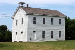 | Shiloh Church | 0.8 miles | 1975 |
 | Beely-Johnson American Legion Post 139 | 0.8 miles | 2007 |
 | Springdale Poultry Industry Historic District | 1.0 miles | 2011 |
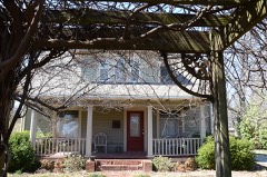 | House at 712 N. Mill Street | 1.0 miles | 1992 |
| National Archives record | The nomination case file for reference 100004435 in Record Group 79. |
| Washington County | All 160 listed properties in this county. |