Block
From the record
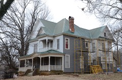
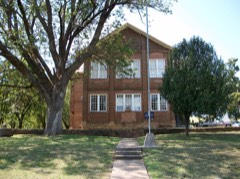
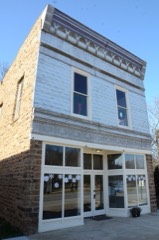
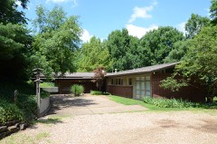
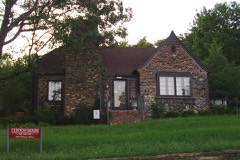
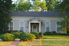
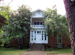
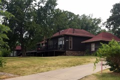
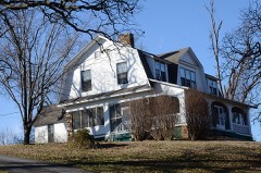
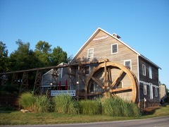
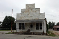
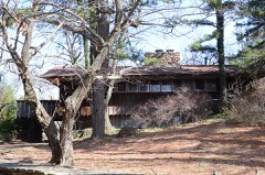
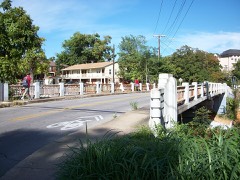
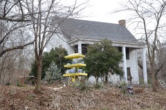
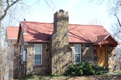
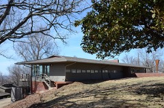
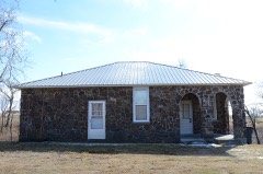
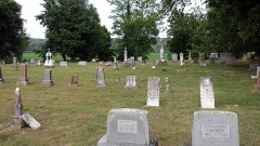
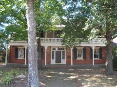
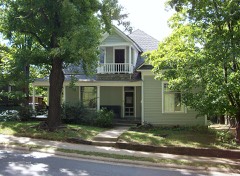
160 National Register listings published here.
Sources: the National Register database, National Park Service
138 topographic sheets cover 86 settlements here, and 160 properties are on the National Register of Historic Places.
160 National Register listings published here.
Sources: the National Register database, National Park Service
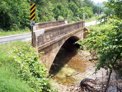
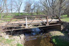
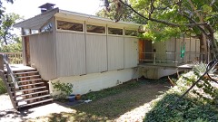
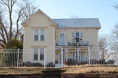
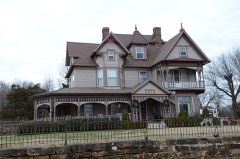
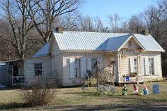
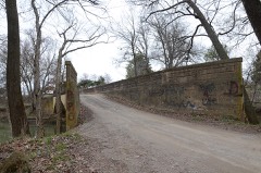
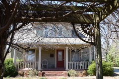
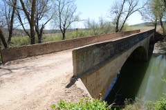
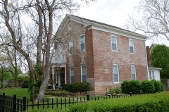
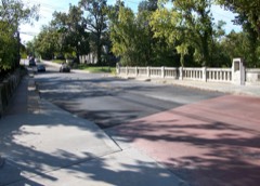
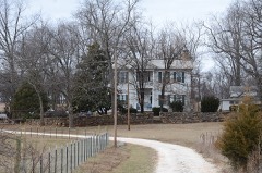
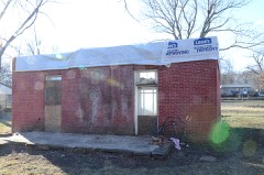
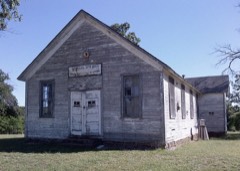
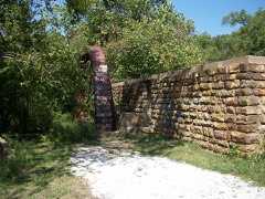
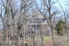
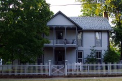
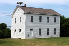
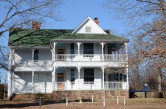
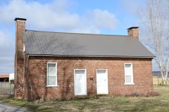
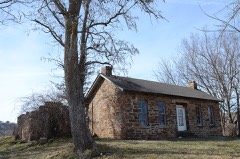
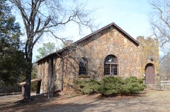
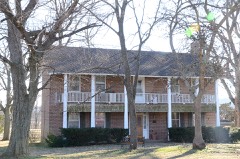
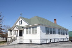
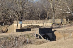
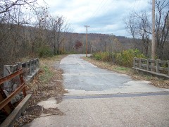
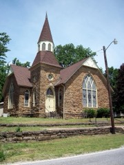
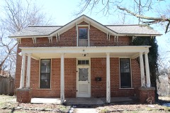
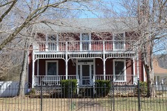
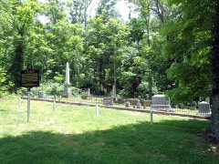
Every property in this county listed on the National Register of Historic Places, with the year it was listed and the federal nomination document.
Every wildfire the federal occurrence database records inside this county: 359 of them, burning about 7,703 acres. 6 started naturally and 62 were recorded as arson. Each settlement page carries the fires within five miles of it.
| Reported cause | Fires |
|---|---|
| Debris and open burning | 134 |
| Missing data/not specified/undetermined | 114 |
| Arson/incendiarism | 62 |
| Equipment and vehicle use | 26 |
| Smoking | 7 |
| Natural | 6 |
| Misuse of fire by a minor | 6 |
| Recreation and ceremony | 3 |
| Fireworks | 1 |
The five largest, by the area the report gives. Two of them were set deliberately.
| Date | Cause | Size | Reported by | Name on the report |
|---|---|---|---|---|
| 29 August 2017 | Missing data/not specified/undetermined | 3,800 acres | Arkansas Forestry Commission | not named |
| 27 March 2003 | Arson/incendiarism | 339 acres | Arkansas Forestry Commission | BUCKHORN CAMP FIRE |
| 25 November 2005 | Missing data/not specified/undetermined | 315 acres | Ozark-St. Francis National Forests | SUGARTREE |
| 5 April 2004 | Arson/incendiarism | 205 acres | Arkansas Forestry Commission | BRANNON |
| 18 March 2009 | Missing data/not specified/undetermined | 98 acres | Ozark-St. Francis National Forests | HOLT RIDGE |
| 20 November 2008 | Debris and open burning | 90 acres | Arkansas Forestry Commission | not named |
| 7 April 2000 | Debris and open burning | 90 acres | Arkansas Forestry Commission | not named |
| 13 April 2011 | Debris and open burning | 90 acres | Arkansas Forestry Commission | not named |
Every settlement page carries the fires within five miles of it - see the settlement index below.
The NOAA Storm Events Database holds 1,041 reports for this county, causing 13 deaths, 84 injuries and about $106,842,400 in recorded property damage. Each settlement page carries the reports that name it.
| Kind of event | Reports |
|---|---|
| Hail | 433 |
| Thunderstorm Wind | 406 |
| Flash Flood | 130 |
| Tornado | 53 |
| Flood | 11 |
| Lightning | 8 |
The most serious of them, by death, then injury, then recorded damage. The accounts are quoted exactly as the forecast office filed them.
| When | Event | Place named | Harm | What the report says |
|---|---|---|---|---|
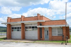
| December 2010 | Tornado (EF3) | Cincinnati | 4 killed, 7 hurt, $1,500,000 | This segment is the second of six segments of this long-track tornado. The tornado moved into Washington County snapping numerous trees as it approached the town of Cincinnati. In Cincinnati, the tornado destroyed several permanent homes, destroyed the volunteer fire station, destroyed a mobile home, damaged several other permanent homes, snapped or uprooted numerous trees, snapped numerous power poles, and destroyed barns and outbuildings. Two people were killed in the mobile home that was destroyed and a third person was killed either in or near a barn while he was tending to his cattle. At least seven injuries also occurred. The tornado was about 300 yards wide when it went through town. The maximum estimated wind speed in the tornado based on this damage was 140 mph.||The tornado continued to move rapidly northeastward and widened to about 500 yards northeast of Cincinnati. Several permanent homes were severely damaged, several mobile homes were destroyed, at least four chicken houses were destroyed, outbuildings were destroyed, numerous trees were snapped or uprooted, and power poles were snapped. A woman in one of the mobile homes that was destroyed was transported to a hospital with serious injuries. She later died from those injuries on January 4th.||The tornado continued into Benton County, Arkansas. |
| June 1970 | Tornado (F3) | not stated | 1 killed, 44 hurt, $2,500,000 | no account filed |
| September 2006 | Lightning | Prairie Grove | 1 killed, 1 hurt | Lightning struck a fishing boat killing one of the occupants and injuring the other. |
| May 2013 | Thunderstorm Wind | Springdale Muni Arpt | 1 killed, $2,000 | Strong thunderstorm wind damaged the sign of a business. The debris from the sign blew across Highway 412, struck a car in the driver side window, and killed the driver instantly. |
| May 2022 | Flash Flood | Fayetteville | 1 killed | Portions of Town Branch Creek and Cato Springs Branch Creek flooded nearby roads. A woman was swept away by flood water near where Beechwood Avenue crosses Town Branch Creek. |
| April 2017 | Flash Flood | Prairie Grove | 1 killed | Many roads were flooded from Savoy to Prairie Grove to Farmington. A man was swept off off Highway 16 by flood waters, and was drowned. |
| April 2017 | Flash Flood | Springdale | 1 killed | Several roads were flooded and impassable. Two young children were playing near a flooded creek. One of the children fell into the water, was swept downstream, and was drowned. |
| April 2011 | Flash Flood | Moffit | 1 killed | Heavy rainfall resulted in several roads in this area becoming flooded. A vehicle driven into rapidly flowing flood waters across Highway 265 between Hubbard Road and Onda Mountain Road stalled. The driver exited the vehicle and was washed downstream, drowning in the flood waters. An 11 year old boy survived this incident. |
| March 2008 | Flash Flood | Johnson | 1 killed | Heavy rain caused flooding which resulted in roads being closed in the central portion of Washington County. A 48 year old man tried to drive through a flooded low water crossing near West Fork and his vehicle became stranded. He was washed downstream and was found 7 miles away in the White River. |
| May 1986 | Thunderstorm Wind | not stated | 1 killed | no account filed |
| March 2022 | Tornado (EF3) | Johnson | 7 hurt, $20,000,000 | This tornado developed south of Joyce Boulevard and east of Steele Boulevard, southwest of the Northwest Arkansas Mall. The tornado damaged businesses, blew down trees, rolled a van, and then moved across the western portion of the mall. As it moved north-northeast from near the mall, the tornado blew down a cellular phone tower, and destroyed a building near Main Drive. As it continued north-northeast, it damaged numerous homes and businesses, and blew down numerous trees. Major portions of the roofs of several homes were blown off on Pagosa Street, and a vehicle was flipped over in a driveway. The tornado then destroyed the gymnasium at George Elementary School, which was a metal building structure. A home just north of the gym was severely damaged, and a couple nearby large, wooden electrical poles were snapped. A large, metal building structure was destroyed as the tornado neared Highway 412, with several other businesses nearby severely damaged. A hangar was destroyed and other buildings were damaged on the east side of the Springdale Airport. Minor damage to trees and to the roofs of homes continued until the tornado neared Emma Avenue, where it appeared to dissipate. Based on this damage, maximum estimated wind in the tornado was 135 to 145 mph. Debris from the tornado was carried into Benton County. This tornado injured seven people, and damaged or destroyed at least 135 homes, and damaged or destroyed at least 40 businesses. |
| January 1975 | Tornado (F1) | not stated | 5 hurt, $25,000 | no account filed |
| April 1979 | Tornado (F2) | not stated | 4 hurt, $250,000 | no account filed |
| February 1997 | Thunderstorm Wind | Fayetteville | 3 hurt, $150,000 | no account filed |
| May 1989 | Thunderstorm Wind | not stated | 3 hurt | no account filed |
| March 2016 | Tornado (EF2) | Odell | 2 hurt, $300,000 | This is the third segment of a three segment tornado. In Washington County, this tornado destroyed several mobile homes, rolled a sport utility vehicle several hundred feet, destroyed outbuildings, severely damaged two homes, and snapped or uprooted numerous trees. Two people were injured when a double-wide mobile home they were in was rolled. Based on this damage, maximum estimated wind in this segment of the tornado was 120 to 130 mph. |
| May 1960 | Tornado (F2) | not stated | 1 hurt, $250,000 | no account filed |
| April 1954 | Tornado (F3) | not stated | 1 hurt, $250,000 | no account filed |
| December 2010 | Tornado (EF2) | Harmon | 1 hurt, $100,000 | This segment is the sixth of six segments of this long-track tornado. The tornado overturned a box truck on Highway 412, injuring its driver, severely damaged a couple permanent homes, severely damaged a mobile home, snapped or uprooted numerous trees, and snapped numerous power poles. The maximum estimated wind speed in this segment of the tornado based on this damage was 125 mph. |
| November 1970 | Tornado (F2) | not stated | 1 hurt, $25,000 | no account filed |
| November 1955 | Tornado (F2) | not stated | 1 hurt, $2,500 | no account filed |
| June 1990 | Thunderstorm Wind | not stated | 1 hurt | no account filed |
| May 1989 | Hail | not stated | 1 hurt | no account filed |
| August 1988 | Thunderstorm Wind | not stated | 1 hurt | no account filed |
| July 2003 | Hail | Fayetteville | $50,000,000 | Hail up to the size of baseballs did damage did extensive damage across a large part of Fayetteville. Cars and roofs of buildings were especially devastated. |
| April 1996 | Hail | Fayetteville | $9,000,000 | no account filed |
| April 2004 | Flash Flood | Countywide | $7,000,000 | Several rounds of thunderstorms pelted Washington county during the April 20s. For the 72 hour period ending a 7 am cdt Fayetteville and Prairie Grove has 7.41 and 7.33 inches of rain respectively. This heavy rain caused rounds of flash flooding from the evening of April 22nd to the daytime hours of April 24th. Numerous county roads were flooded and damaged during that time span. Damage to the roads was estimated to be in excess of $6 million. Roads were not the only things damaged. A train track near Greenland was washed out. Several 40 foot metal shipping containers were washed into the Illinois river near Hogeye. As many as 40 to 50 homes sustained damage. Many of those homes were in the Goshen and Elkins areas. On April 25th, the governor of Arkansas declared the county a disaster area. |
| October 1984 | Tornado (F1) | not stated | $2,500,000 | no account filed |
| May 2025 | Tornado (EF2) | (Fyv)Fayetteville Ar | $1,000,000 | This tornado developed along SW Campbell Road, west of I-49, where trees were snapped and uprooted. It moved northeast across I-49, severely damaging a metal building structure, and then turned to the east across the southern portion of Drake Field. It then turned east-northeast, crossing Highway 16 and dissipated near Combs Bell Road. Numerous trees were snapped or uprooted along the path of this tornado, industrial buildings and homes and businesses were damaged, many power poles were snapped, and outbuildings were destroyed. The tornado produced a tornadic debris signature from the KSRX WSR-88D. Based on this damage, maximum estimated wind in the tornado was 115 to 125 mph. |
| April 2025 | Tornado (EF1) | Wheeler | $750,000 | This tornado developed just south of Jess Anderson Road and north of Highway 16. The tornado moved northeast, uprooting trees and snapping large tree limbs as it crossed Jess Anderson Road and Wheeler Road. The tornado damage numerous homes in a neighborhood along and just west of Hughmount Road, several of which sustained significant roof damage and broken windows. It continued to damage the roofs of homes and uproot trees as it crossed Weir Road, Rupple Road, and Howard Nickell Road. It dissipated north of Howard Nickell Road and west of Salem Road. Based on this damage, maximum estimated wind in the tornado was 100 to 110 mph. |
| January 2013 | Tornado (EF1) | Harris | $500,000 | A tornado damaged 40 to 50 homes, destroyed barns and outbuildings, destroyed chicken houses, and snapped or uprooted numerous trees. The most significant damage to permanent homes was structural damage to several roofs. Based on this damage, the maximum estimated wind in the tornado was 100 to 110 mph. |
| August 2009 | Hail | Fayetteville | $500,000 | Tea cup size hail damaged numerous homes and automobiles. |
| April 1994 | Thunderstorm Wind | Fayetteville | $500,000 | Thunderstorm winds blew down several trees and a small sign at the University of Arkansas. Some buildings also had a few windows blown out. |
| June 1994 | Thunderstorm Wind | Fayetteville | $500,000 | Thunderstorm winds knocked down some trees. Several of the trees fell onto homes and cars. |
| November 1993 | Thunderstorm Wind | Springdale | $500,000 | Thunderstorm winds knocked down several large trees. Some of the trees fell onto vehicles. Several buildings also sustained roof damage. |
| June 2000 | Flash Flood | Countywide | $450,000 | Heavy thunderstorm rains including 3.44 inches at Cincinnati and 3.38 inches at Prairie Grove caused widespread flooding across Washington county. The main damage was to roads and bridges. However, three homes were flooded in the south part of Fayetteville. |
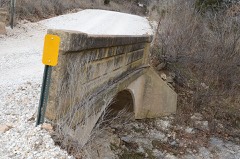
| June 1999 | Flash Flood | North Portion | $450,000 | In Springdale, US Hwy 71B was flooded. High water forced the closing of Gutensohn Road just north of Sunset Avenue and bridges at Silent Grove and Shady Grove Roads. In Fayetteville, creeks overflowed into several neighborhoods, including the low-lying Willow Springs subdivision in west Fayetteville, where several homes sustained several thousand dollars in flood damage. The area near 18th Street and Beechwood Avenue, which connects to AR Hwy 16, was also flooded. Garland Avenue, which becomes AR Hwy 112, was flooded in places. The corner of AR Hwy 16 and AR Hwy 265 also flooded.Damage to roads throughout Washington County was estimated at $400,000. Initial assessments showed damage to 50 miles of county roads with four bridges destroyed, impassable or needing significant repairs. Among the worst hit was a low-water bridge over the War Eagle River on Washington County Road 526, also known as Gar Hole Road, which collapsed after being undermined by raging flood waters. Other bridges damaged include a bridge on County Road 872 near the Harmon community, a low-water bridge on County Road 203 and a small bridge on County Road 2002 near the Black Oak community. |
| October 2024 | Tornado (EF1) | Prairie Grove | $300,000 | This tornado developed north of Highway 62 over the southwest side of Prairie Grove. It moved northeast across the southern portion of town and dissipated north of Illinois Chapel Road over open country. Numerous homes were damaged in the path of the tornado, some with significant roof damage. Trees were uprooted, outbuildings were damaged, numerous large tree limbs were snapped, and power poles were blown down by the tornado. Based on this damage, maximum estimated wind in the tornado was 95 to 105 mph. |
| May 2020 | Hail | Johnson | $250,000 | Grapefruit size hail damaged vehicles, homes, and businesses. |
| May 1979 | Tornado (F1) | not stated | $250,000 | no account filed |
| March 1976 | Tornado (F2) | not stated | $250,000 | no account filed |
| April 1954 | Tornado (F3) | not stated | $250,000 | no account filed |
| April 1954 | Tornado (F3) | not stated | $250,000 | no account filed |
| May 2020 | Hail | Johnson | $200,000 | Hailstones were measured to five inches in diameter by a resident on Buckingham Drive. Hail damaged vehicles and homes in this area. |
| May 2020 | Hail | Efay | $200,000 | Hail larger than baseball size damaged vehicles, homes, and businesses. |
| July 2013 | Flash Flood | Johnson | $200,000 | Locally heavy rainfall resulted in small creeks coming out of their banks and flooding a nursing home, from which 20 people were evacuated. A dozen homes were also flooded along with vehicles and portions of Hewitt Road, Ball Street, Wilkerson Road, and Main Drive. Constuction in this portion of Johnson may have been a factor in the flooding. |
| April 2022 | Hail | Springdale | $150,000 | Tennis ball size hail damaged homes, businesses, and vehicles. |
| July 2022 | Thunderstorm Wind | Farmington | $150,000 | Strong thunderstorm wind damaged several chicken houses. The strong wind also snapped large tree limbs, one of which fell onto a home and resulted in significant damage. |
| August 2012 | Lightning | Goshen | $150,000 | Lightning struck two homes causing fires. Minor damage occurred with one of the homes while major damage occurred with the second home. |
| April 2011 | Lightning | Harmon | $150,000 | Lightning struck a house and started a fire. The house was a total loss. |
| April 2008 | Tornado (EF2) | Black Oak | $125,000 | An NWS storm survey determined that a strong tornado caused major damage to a permanent home, damaged several other homes, caused extensive tree damage, and snapped power poles. |
| April 2026 | Hail | Elm Spgs | $100,000 | Baseball size hail damaged homes and vehicles. |
| April 2026 | Hail | Goshen | $100,000 | Tennis ball size hail damaged homes and vehicles. |
| May 2025 | Tornado (EF1) | Lincoln | $100,000 | This tornado developed along W South Street and moved across the south side of Lincoln. It moved east-northeast until it crossed County Road 438, then moved east. The tornado crossed Hogeye Road, turning northeast before dissipating east of Highway 265. The tornado damaged homes, several severely, uprooted or snapped numerous trees, snapped power poles, and destroyed outbuildings. It produced a tornadic debris signature from the KSRX WSR-88D. Based on this damage, maximum estimated wind in the tornado was 100 to 110 mph. |
| April 2022 | Hail | Springdale | $100,000 | Hen egg size hail damaged homes, businesses, and vehicles. |
| October 2021 | Tornado (EF1) | Sunset | $100,000 | This is the first segment of a two segment tornado. The tornado developed east of Winslow, just to the west of Winfrey Valley Road, where a barn was damaged, a few trees were uprooted, and large tree limbs were snapped. The tornado moved just north of east along Sunset Road where a mobile home was shifted off its foundation and windows were broken, a chicken house was destroyed, and trees were snapped or uprooted. The tornado then moved across heavily wooded terrain that was inaccessible by road to the Madison County line, beyond which it continued. Based on this damage, maximum estimated wind in this segment of the tornado was 95 to 105 mph. |
| May 2020 | Hail | Efay | $100,000 | Tennis ball size hail damaged vehicles, homes, and businesses. |
| June 2015 | Flash Flood | West Fork | $100,000 | Several secondary roads were washed out by flood water. |
| May 2013 | Tornado (EF1) | Cincinnati | $100,000 | This is the second and final segment of this tornado. In Washington County, this tornado damaged a home, damaged several barns, and snapped or uprooted numerous trees. Based on this damage, maximum estimated wind in this tornado segment was 100 to 110 mph. |
| June 2013 | Lightning | Prairie Grove | $100,000 | Lightning struck a house, causing a fire that severely damaged it. An elderly woman in the house was killed by the fire after she called 911. |
The Survey's mineral resources record lists 32 workings inside this county. 3 still produce and 29 are closed or unrecorded. Each settlement page carries the workings within five miles of it.
| Commodity | Workings |
|---|---|
| Sand and Gravel, Construction | 26 |
| Limestone, Dimension | 4 |
| Stone, Crushed/Broken | 2 |
The least common of them first, because a county's hundredth gravel pit says nothing its first ten did not.
| Where | Site | Commodity | Status | Recorded |
|---|---|---|---|---|
| Johnson Quarry & Plant | Stone, Crushed/Broken | Producer | ||
| West Fork Quarry & Plant | Stone, Crushed/Broken | Producer | ||
| Mcclinton Bros Co | Limestone, Dimension | Past Producer | ||
| Unk | Limestone, Dimension | Past Producer | ||
| Unk | Limestone, Dimension | Past Producer | ||
| Unk | Limestone, Dimension | Past Producer | ||
| Cove Creek Pit & Plant | Sand and Gravel, Construction | Producer | ||
| Dr.Ray Pit & Plant | Sand and Gravel, Construction | Past Producer | ||
| Unk | Sand and Gravel, Construction | Past Producer | ||
| Unk | Sand and Gravel, Construction | Past Producer | ||
| Unk | Sand and Gravel, Construction | Past Producer | ||
| Unk | Sand and Gravel, Construction | Past Producer | ||
| Unk | Sand and Gravel, Construction | Past Producer | ||
| Unk | Sand and Gravel, Construction | Past Producer | ||
| Unk | Sand and Gravel, Construction | Past Producer | ||
| Unk | Sand and Gravel, Construction | Past Producer | ||
| Unk | Sand and Gravel, Construction | Past Producer | ||
| Unk | Sand and Gravel, Construction | Past Producer | ||
| Unk | Sand and Gravel, Construction | Past Producer | ||
| Unk | Sand and Gravel, Construction | Past Producer | ||
| Unk | Sand and Gravel, Construction | Past Producer | ||
| Unk | Sand and Gravel, Construction | Past Producer | ||
| Unk | Sand and Gravel, Construction | Past Producer | ||
| Unk | Sand and Gravel, Construction | Past Producer | ||
| Unk | Sand and Gravel, Construction | Past Producer | ||
| Unk | Sand and Gravel, Construction | Past Producer | ||
| Unk | Sand and Gravel, Construction | Past Producer | ||
| Unk | Sand and Gravel, Construction | Past Producer | ||
| Unk | Sand and Gravel, Construction | Past Producer | ||
| Unk | Sand and Gravel, Construction | Past Producer | ||
| Unk | Sand and Gravel, Construction | Past Producer | ||
| Unk | Sand and Gravel, Construction | Past Producer |
Named settlements recorded in the Geographic Names Information System, each with the topographic sheets covering it. Villages, hamlets and abandoned places alike. Each is shown with the nearest named watercourse or landform and the survey quadrangle it falls on.
Farmington township · 72730 · Near Miller Mountain · Fayetteville quadrangle
19 sheets, 1899 to 1995
White River township · 72701 · On Greasy Creek · Sulphur City quadrangle
15 sheets, 1898 to 1978
Fayetteville township · 72703 · Fayetteville quadrangle
19 sheets, 1899 to 1995
No longer a settlement
Springdale township · 72764 · By Neills Bluff · Sonora quadrangle
19 sheets, 1899 to 1994
Lees Creek township · 72959 · Near Coal Bank Hollow · Winslow quadrangle
15 sheets, 1898 to 1978
Harmon township · 72704 · Robinson quadrangle
17 sheets, 1899 to 1979
No longer a settlement
Brush Creek township · 72764 · On Friendship Creek · Sonora quadrangle
19 sheets, 1899 to 1994
Crawford township · 72959 · On London Creek · Brentwood quadrangle
15 sheets, 1898 to 1978
White River township · 72701 · Near Lutman Hollow · Sulphur City quadrangle
15 sheets, 1898 to 1978
No longer a settlement
Illinois township · 72769 · Near Bates Mountain · Watts quadrangle
19 sheets, 1899 to 1979
Springdale township · 72762 · Springdale quadrangle
18 sheets, 1899 to 1994
No longer a settlement
Dutch Mills township · 72744 · On Little Branch · Lincoln quadrangle
15 sheets, 1898 to 1978
Farmington township · 72730 · On Farmington Branch · Fayetteville quadrangle
19 sheets, 1899 to 1995
Fayetteville township · 72701 · Near Root Hill · Fayetteville quadrangle
19 sheets, 1899 to 1995
Fayetteville township · 72701 · Near Mount Sequoyah · Fayetteville quadrangle
19 sheets, 1899 to 1995
Greenland township · 72701 · On Ward Slough · West Fork quadrangle
17 sheets, 1898 to 1994
Elkins township · 72701 · On Middle Fork White River · Elkins quadrangle
18 sheets, 1899 to 1994
White River township · 72701 · Near Lutman Hollow · Sulphur City quadrangle
15 sheets, 1898 to 1978
Valley township · 72753 · On Sweetwater Creek · Prairie Grove quadrangle
16 sheets, 1898 to 1978
Marrs Hill township · 72704 · On Goose Creek · Wheeler quadrangle
18 sheets, 1899 to 1979
No longer a settlement
Goshen township · 72703 · Near Vaughan Mountain · Spring Valley quadrangle
14 sheets, 1900 to 1985
Richland township · 72727 · Elkins quadrangle
18 sheets, 1899 to 1994
No longer a settlement
Fayetteville township · 72701 · On Cato Springs Branch · Fayetteville quadrangle
19 sheets, 1899 to 1995
Richland township · 72727 · Near Chicken Bristle Mountain · Goshen quadrangle
14 sheets, 1900 to 1985
Brush Creek township · 72764 · Near Granny Hollow · Spring Valley quadrangle
14 sheets, 1900 to 1985
West Fork township · 72959 · On Winn Creek · West Fork quadrangle
17 sheets, 1898 to 1994
Reed township · 72701 · On Dry Creek · Brentwood quadrangle
15 sheets, 1898 to 1978
No longer a settlement
Prairie Grove township · 72753 · On Budd Kidd Creek · Prairie Grove quadrangle
16 sheets, 1898 to 1978
Marrs Hill township · 72753 · Near Weaver Hill · Wheeler quadrangle
18 sheets, 1899 to 1979
No longer a settlement
Springdale township · 72764 · On Roberts Creek · Sonora quadrangle
19 sheets, 1899 to 1994
Fayetteville township · 72701 · On Town Branch · Elkins quadrangle
18 sheets, 1899 to 1994
No longer a settlement
Dutch Mills township · 72744 · Near Sugartree Mountain · Westville quadrangle
17 sheets, 1898 to 1978
No longer a settlement
Boston township · 72717 · On Skylight Mountain · Evansville quadrangle
15 sheets, 1898 to 1978
Brush Creek township · 72764 · Near Been Mountain · Spring Valley quadrangle
14 sheets, 1900 to 1985
Tontitown township · 72762 · On Little Wildcat Creek · Springdale quadrangle
18 sheets, 1899 to 1994
Cove Creek township · 72774 · Near Lick Hollow · Strickler quadrangle
16 sheets, 1898 to 1978
White River township · 72701 · On Trace Creek · Sulphur City quadrangle
15 sheets, 1898 to 1978
Prairie township · 72701 · On West Fork White River · Elkins quadrangle
18 sheets, 1899 to 1994
No longer a settlement
Wyman township · 72701 · Near Round Mountain · Elkins quadrangle
18 sheets, 1899 to 1994
No longer a settlement
Brush Creek township · 72764 · Near Hickory Flat Hollow · Spring Valley quadrangle
14 sheets, 1900 to 1985
Litteral township · 72704 · On Hamestring Creek · Wheeler quadrangle
18 sheets, 1899 to 1979
West Fork township · 72774 · Near West Mountain · West Fork quadrangle
17 sheets, 1898 to 1994
Wheeler township · 72704 · On Little Wildcat Creek · Wheeler quadrangle
18 sheets, 1899 to 1979
Crawford township · 72701 · Near Tom Ritter Hollow · Sulphur City quadrangle
15 sheets, 1898 to 1978
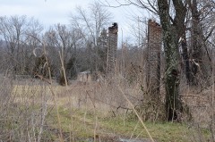
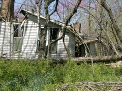
The vanished settlements of Washington County: the places named above that are no longer on the map.