 Block
From the record
One of 32 National Register listings published here for Lonoke County · listed in 2019 · category: Building.
Sources: the National Register database, National Park Service
Listed on the National Register of Historic Places in 2019.
One of 32 National Register listings published here for Lonoke County · listed in 2019 · category: Building.
Sources: the National Register database, National Park Service
Regional context, not property-specific evidence. The federal wildfire occurrence database lists 4 fires within 5 miles of J. M. Bransford House between 2002 and 2006, burning about 131 acres in total. None started naturally. 1 was recorded as arson. Distance is straight-line from the map coordinates, so a fire counted here may appear on a neighbouring settlement's page as well.
| Reported cause | Fires |
|---|---|
| Debris and open burning | 2 |
| Arson/incendiarism | 1 |
| Equipment and vehicle use | 1 |
The most recent of them, most recent first, with the day each was reported and the service that recorded it.
| Date | Cause | Size | Reported by | Name on the report |
|---|---|---|---|---|
| 9 September 2006 | Arson/incendiarism | 30 acres | Arkansas Forestry Commission | not named |
| 5 September 2002 | Equipment and vehicle use | 11 acres | Arkansas Forestry Commission | not named |
| 23 September 2004 | Debris and open burning | 13 acres | Arkansas Forestry Commission | not named |
| 23 September 2004 | Debris and open burning | 77 acres | Arkansas Forestry Commission | not named |
Regional context, not property-specific evidence. The federal mineral resources record lists 1 working within 5 miles of J. M. Bransford House: 1 past producer. None of them still produces. What was taken out: Flagstone. Distance is straight-line from the map coordinates, so a quarry counted here may appear on a neighbouring settlement's page as well.
| Where | Site | Commodity | Status | Recorded |
|---|---|---|---|---|
| Freshour G P Contrctr | Flagstone | Past Producer |
Regional context, not property-specific evidence. The National Weather Service names Lonoke, the town this property stands in, in 72 storm reports between 1993 and 2025: 38 thunderstorm wind, 20 hail, 6 flash flood, 3 tornado. The reports record 5 injuries. Each account below is quoted exactly as the forecast office filed it, from the NOAA Storm Events Database, and each date opens the federal record of that event.
| When | Event | Place named | Harm | What the report says |
|---|---|---|---|---|
| February 2001 | Tornado (F1) | Lonoke | 3 hurt | A weak tornado was spawned in central Lonoke County about 2.5 miles west-southwest of Lonoke. The tornado moved quickly northeast and destroyed a mobile home on the west side of Lonoke. Three people in the mobile home were injured, including a baby who suffered a broken arm. The tornado also downed trees and power lines. The tornado travelled about 9 miles before dissipating about 6.8 miles northeast of Lonoke. |
| October 2004 | Thunderstorm Wind | Lonoke | 2 hurt | Straight line thunderstorm winds overturned a mobile home, injuring two occupants. Only minor injuries were reported. |
| March 2008 | Lightning | Lonoke | $1,000,000 | A hand-built historical house known as Eagle Plantation burned down when struck by lightning. |
| April 2017 | Lightning | Lonoke | $600,000 | Three houses and a barn in different portions of the county were struck by lightning during the night. The barn and two of the houses were destroyed. |
| February 2011 | Tornado (EF1) | Lonoke | $400,000 | A tornado began on the south side of Lonoke and tracked through the southeastern part of the city, then ended near U.S. Highway 70 just east of the city. Many houses suffered roof damage, windows were blown out of a house, and the porch was blown off a church. Numerous trees were blown down. One of the trees crushed a wood-frame house that was vacant. Power lines were blown down. Much of the roof of the National Guard Armory was blown off. |
| April 2011 | Thunderstorm Wind | Lonoke | $200,000 | Numerous trees and power lines were blown down. Some of the trees landed on houses. Additionally, some houses had roof damage. |
| April 2011 | Thunderstorm Wind | Lonoke | $200,000 | Many trees were blown down in Lonoke, and a number of houses were damaged by falling trees. |
| June 2008 | Thunderstorm Wind | Lonoke | $200,000 | Trees were down on at least four houses. Trees were down on Arkansas Highway 31. There was a tree blocking Ferguson Street. |
| May 2010 | Thunderstorm Wind | Lonoke | $150,000 | Thunderstorm winds affected an area covering quite a few square miles. Roofs were partially blown off a number of barns and sheds. Dozens of trees had limbs blown off and other trees were toppled. A large tree fell through the roof of a house. Along Arkansas Highway 31, fallen limbs or trees littered virtually every yard. |
| July 2011 | Thunderstorm Wind | Lonoke | $50,000 | Several trees were blown down in Cabot. One tree fell on a house and another landed on a car. |
| August 1993 | Thunderstorm Wind | Lonoke | $50,000 | Numerous trees were blown down. |
| January 2012 | Thunderstorm Wind | Lonoke | $20,000 | Several trees and some power lines were blown down near Arkansas 31. |
| July 2009 | Flash Flood | Lonoke | $10,000 | In Lonoke, Privett Park Drive, Newbury Drive, and most roads south of Palm Street were flooded. |
| February 2018 | Thunderstorm Wind | Lonoke | $2,000 | Trees were snapped and part of a metal roof was blown off of a home. |
| June 2018 | Thunderstorm Wind | Lonoke | $2,000 | The roof of a storage shed was blown off by thunderstorm winds. |
| June 2014 | Thunderstorm Wind | Lonoke | $2,000 | A tree was blown down onto U.S. 70. |
| August 2010 | Flash Flood | Lonoke | $2,000 | Streets were flooded in Lonoke. |
| February 2001 | Flash Flood | Lonoke | $2,000 | Heavy rainfall over Lonoke County resulted in flash flooding along Highway 89 between Lonoke and Furlow. |
| December 2013 | Flood | Lonoke | $1,000 | Arkansas 89 was closed due to flooding. |
| July 1994 | Thunderstorm Wind | Lonoke | $500 | Thunderstorm winds blew down a large tree. |
| April 2025 | Thunderstorm Wind | Lonoke | - | Numerous trees and powerlines were blown down across the town of Lonoke. |
| May 2022 | Thunderstorm Wind | Lonoke | - | Trees were reported downed in Lonoke. |
| March 2021 | Hail | Lonoke | - | Quarter sized hail was observed in Lonoke. |
| February 2018 | Thunderstorm Wind | Lonoke | - | A well anchored display tent was blown over at an auto dealership. |
| June 2018 | Flash Flood | Lonoke | - | Lincoln and Academy streets were closed due to high water. |
| June 2018 | Thunderstorm Wind | Lonoke | - | A large tree was blown down onto State Hwy 31 south of Lonoke. |
| April 2017 | Flash Flood | Lonoke | - | Many roads throughout the county are underwater. The sheriff's office was discouraging travel in the county. |
| December 2012 | Flood | Lonoke | - | Street flooding occurred in Lonoke. |
| September 2007 | Flash Flood | Lonoke | - | Flooding was reported on Kerr Road. |
| June 2007 | Funnel Cloud | Lonoke | - | A funnel cloud was sighted and photographed by a number of people, approximately 10 miles south of Lonoke. |
| March 2006 | Thunderstorm Wind | Lonoke | - | Thunderstorm winds damaged several houses, downed numerous trees and also moved a large combine. |
| July 2005 | Thunderstorm Wind | Lonoke | - | Trees and power lines downed. |
| May 2001 | Thunderstorm Wind | Lonoke | - | Several buildings sustained roof damage from a severe thunderstorm 5 miles north of Lonoke. |
| March 1998 | Thunderstorm Wind | Lonoke | - | Thunderstorm winds damaged a camper and the roof of a building. |
| April 1998 | Thunderstorm Wind | Lonoke | - | Thunderstorm winds moved a large boat down the street several hundred feet. |
| March 1995 | Thunderstorm Wind | Lonoke | - | Thunderstorm winds downed some trees and damaged a few storage sheds. |
| November 1995 | Thunderstorm Wind | Lonoke | - | Thunderstorm winds knocked over a cotton trailer and downed some trees. |
| June 2014 | Hail | Lonoke | - | no account filed |
| April 2011 | Hail | Lonoke | - | no account filed |
| May 2011 | Hail | Lonoke | - | no account filed |
| June 2009 | Hail | Lonoke | - | no account filed |
| June 2009 | Hail | Lonoke | - | no account filed |
| June 2009 | Hail | Lonoke | - | no account filed |
| June 2008 | Thunderstorm Wind | Lonoke | - | no account filed |
| August 2003 | Thunderstorm Wind | Lonoke | - | no account filed |
| August 2003 | Thunderstorm Wind | Lonoke | - | no account filed |
| August 2003 | Thunderstorm Wind | Lonoke | - | no account filed |
| August 2003 | Thunderstorm Wind | Lonoke | - | no account filed |
| August 2003 | Thunderstorm Wind | Lonoke | - | no account filed |
| August 2003 | Thunderstorm Wind | Lonoke | - | no account filed |
| April 2003 | Hail | Lonoke | - | no account filed |
| February 2001 | Hail | Lonoke | - | no account filed |
| August 2001 | Thunderstorm Wind | Lonoke | - | no account filed |
| July 2001 | Hail | Lonoke | - | no account filed |
| March 2000 | Hail | Lonoke | - | no account filed |
| April 2000 | Hail | Lonoke | - | no account filed |
| July 2000 | Thunderstorm Wind | Lonoke | - | no account filed |
| May 1999 | Thunderstorm Wind | Lonoke | - | no account filed |
| March 1999 | Thunderstorm Wind | Lonoke | - | no account filed |
| May 1999 | Thunderstorm Wind | Lonoke | - | no account filed |
No historic map-sheet match is published for this property yet. That does not mean no map exists. This record needs a coordinate-quality review before it can be joined to a sheet boundary. Browse the county's mapped places while that work is pending.
Other National Register properties close enough to walk or drive between, ordered by distance from this one. Both positions come from the same geocoding pass that matched these properties to their map sheets.
| Photograph | Property | Distance | Listed |
|---|---|---|---|
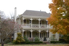 | Trimble House | under 500 feet | 1982 |
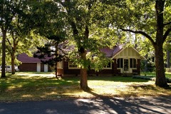 | Shull House | under 500 feet | 1982 |
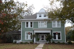 | Wheat House | under 500 feet | 1982 |
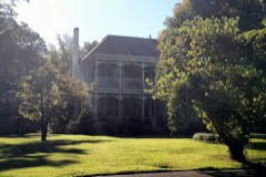 | Trimble-McCrary House | 0.1 miles | 2004 |
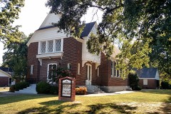 | First Presbyterian Church | 0.1 miles | 2004 |
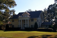 | Walls House | 0.2 miles | 1982 |
| National Archives record | The nomination case file for reference 100004440 in Record Group 79. |
| Lonoke County | All 32 listed properties in this county. |