Block
From the record
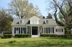
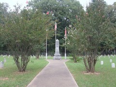
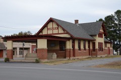
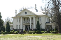
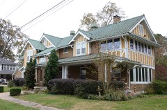
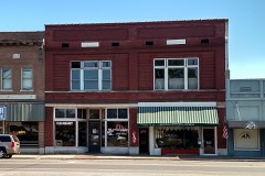
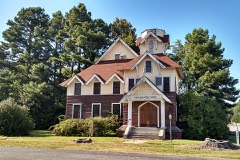
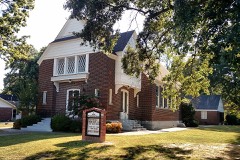
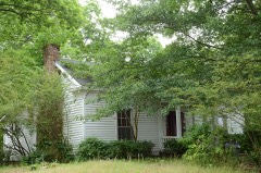
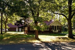
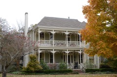
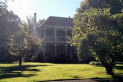
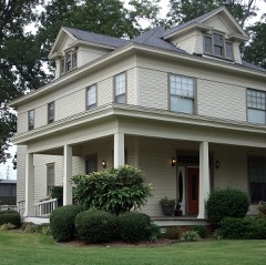
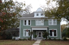
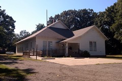
32 National Register listings published here.
Sources: the National Register database, National Park Service
107 topographic sheets cover 124 settlements here, and 32 properties are on the National Register of Historic Places.
32 National Register listings published here.
Sources: the National Register database, National Park Service
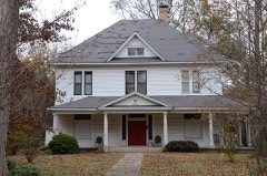
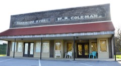
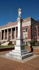
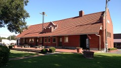
Every property in this county listed on the National Register of Historic Places, with the year it was listed and the federal nomination document.
Every wildfire the federal occurrence database records inside this county: 138 of them, burning about 3,903 acres. 5 started naturally and 51 were recorded as arson. Each settlement page carries the fires within five miles of it.
| Reported cause | Fires |
|---|---|
| Debris and open burning | 52 |
| Arson/incendiarism | 51 |
| Missing data/not specified/undetermined | 20 |
| Equipment and vehicle use | 7 |
| Natural | 5 |
| Misuse of fire by a minor | 2 |
| Smoking | 1 |
The five largest, by the area the report gives. Three of them were set deliberately.
| Date | Cause | Size | Reported by | Name on the report |
|---|---|---|---|---|
| 1 March 2012 | Debris and open burning | 367 acres | Arkansas Forestry Commission | not named |
| 23 March 2004 | Arson/incendiarism | 270 acres | Arkansas Forestry Commission | LUNENBURG |
| 22 November 2006 | Arson/incendiarism | 203 acres | Arkansas Forestry Commission | BEAR CREEL |
| 12 November 2016 | Arson/incendiarism | 192 acres | Arkansas Forestry Commission | not named |
| 15 August 2015 | Debris and open burning | 130 acres | Arkansas Forestry Commission | not named |
| 17 June 1998 | Debris and open burning | 127 acres | Arkansas Forestry Commission | not named |
| 9 March 2004 | Debris and open burning | 117 acres | Arkansas Forestry Commission | not named |
| 5 October 2000 | Debris and open burning | 83 acres | Arkansas Forestry Commission | not named |
Every settlement page carries the fires within five miles of it - see the settlement index below.
The NOAA Storm Events Database holds 853 reports for this county, causing 21 deaths, 131 injuries and about $142,732,730 in recorded property damage. Each settlement page carries the reports that name it.
| Kind of event | Reports |
|---|---|
| Thunderstorm Wind | 371 |
| Hail | 275 |
| Tornado | 88 |
| Flash Flood | 71 |
| Flood | 15 |
| Funnel Cloud | 14 |
| Heavy Rain | 10 |
| Lightning | 9 |
The most serious of them, by death, then injury, then recorded damage. The accounts are quoted exactly as the forecast office filed them.
| When | Event | Place named | Harm | What the report says |
|---|---|---|---|---|
| March 1952 | Tornado (F3) | not stated | 9 killed, 9 hurt, $250,000 | no account filed |
| March 1976 | Tornado (F3) | not stated | 5 killed, 64 hurt, $25,000,000 | no account filed |
| November 1988 | Tornado (F2) | not stated | 2 killed, 8 hurt, $25,000,000 | no account filed |
| March 1952 | Tornado (F4) | not stated | 2 killed, 6 hurt, $250,000 | no account filed |
| June 2023 | Thunderstorm Wind | Carlisle | 2 killed, 1 hurt | A large tree fell on a house causing 2 fatalities and 1 injury in Carlisle. |
| May 2011 | Flood | Austin | 1 killed, $2,000,000 | Widespread areal flooding continued from April into May. Parts of Arkansas Highways 13, 236, and 381 as well as U.S. Highway 70 were closed due to flooding. On the morning of the 1st, two sections of U.S. Highway 67/167 Southbound were closed due to flooding, and one section of the highway was closed Northbound. On the 2nd, Arkansas Highway 89 was closed due to high water, and fast-flowing water more than a foot deep was over Kerr Station Rd. On the 3rd, a 55 year-old man drowned when he drove around barricades into flood waters several feet deep on Arkansas Highway 236 northeast of Furlow. His body was not recovered until the 6th. |
| April 1978 | Tornado (F2) | not stated | 5 hurt, $250,000 | no account filed |
| September 2005 | Tornado (F2) | Bevis Corner | 5 hurt | A strong tornado was spawned in Lonoke County roughly 2 miles east-southeast of Bevis Corner. The tornado moved to the northwest around the remnants of Hurricane Rita. Estimated winds with the tornado were about 120 mph. The tornado demolished a couple of mobile homes, with an injury in one of these homes. Several other mobile homes sustained some damage, such as being moved off of their foundations or having their roofs caved in. In one of these homes, 4 additional injuries were noted. The tornado was on the ground for just over 7 miles before dissipating near Kerr. |
| March 1986 | Thunderstorm Wind | not stated | 4 hurt | no account filed |
| March 1997 | Tornado (F2) | Furlow | 3 hurt, $150,000 | no account filed |
| February 1951 | Tornado (F2) | not stated | 3 hurt, $25,000 | no account filed |
| February 2001 | Tornado (F1) | Lonoke | 3 hurt | A weak tornado was spawned in central Lonoke County about 2.5 miles west-southwest of Lonoke. The tornado moved quickly northeast and destroyed a mobile home on the west side of Lonoke. Three people in the mobile home were injured, including a baby who suffered a broken arm. The tornado also downed trees and power lines. The tornado travelled about 9 miles before dissipating about 6.8 miles northeast of Lonoke. |
| November 1988 | Thunderstorm Wind | not stated | 3 hurt | no account filed |
| May 2008 | Tornado (EF2) | Cobbs | 2 hurt, $3,000,000 | This tornado exited Pulaski County, east of Wrightsville, and entered Lonoke County, just northwest of Keo. Two houses and two farm shops near Keo had roof damage. In addition, two houses north of Keo were destroyed. Trees, power poles, and grain bins were blown down, and there was damage at a fish farm. Two farm shops in Pettus were damaged. Also, five large, steel, electrical transmission towers were partially to totally destroyed. |
| April 1982 | Tornado (F2) | not stated | 2 hurt, $2,500,000 | no account filed |
| December 2009 | Flood | Wattensaw | 2 hurt, $40,000 | An elderly woman was rescued after her car was swept off Oakdale Rd. by flood waters from Wattensaw Bayou. Her husband had to be rescued after he went looking for his wife and had his vehicle swept off Arkansas Highway 13 by the same bayou. |
| October 2004 | Thunderstorm Wind | Lonoke | 2 hurt | Straight line thunderstorm winds overturned a mobile home, injuring two occupants. Only minor injuries were reported. |
| February 2000 | Tornado (F2) | Furlow | 2 hurt | A strong tornado was spawned in western Lonoke County about 3.7 miles north of Furlow. Just as the tornado developed, it removed roof shingles from a few houses and badly damaged a farm shop. A mobile home was then demolished in the Fairview community. The worst structural damaged was found at the intersection of Arkansas Highways 31 and 236, or 4 miles south of Woodlawn. There, two small houses and some grain bins were destroyed, several vehicles and some telephone equipment were badly damaged and power poles were blown down. Farther east, more damage was found about 5 miles north of Carlisle near the intersection of Arkansas Highway 13 and East Shaefer Road. In this area, an old abandoned house and a mobile home were destroyed with a couple of houses damaged. Also, at least three dozen power poles were replaced. Two injuries were reported in Lonoke County. The tornado moved east into Prairie County, crossing the county line about 5 miles northeast of Carlisle. |
| April 1980 | Tornado (F2) | not stated | 1 hurt, $2,500,000 | no account filed |
| December 2009 | Flood | Mountain Spgs | 1 hurt, $2,000,000 | Flash flooding, which developed early on the morning of the 24th, became widespread areal flooding later in the morning on the 24th and continued for several days. Arkansas Highway 89 was closed near Furlow. Fire departments used boats to rescue five residents on Grayhawk Circle, where water was about 5 feet deep on Christmas Eve morning. Along Arkansas Highway 236 West, water was 4 to 5 feet deep on the road and even deeper in the houses. The South Bend Fire Department responded to 38 calls for rescues from vehicles trapped in high water, and assisted six families who needed to leave flooded homes. One motorist suffered hypothermia before he was rescued from his car. Problem areas included Graham Road, Kerr Station Road, South Kerr Road, Gentry Lane, Rifle Lane, and Shotgun Lane. Arkansas Highway 31 was flooded from Beebe to Lonoke. U.S. Highway 70 was closed by flooding between Carlisle and Lonoke. In Carlisle, part of City Hall flooded. In Lonoke, a number of homes and the city shop were flooded. County roads throughout the county were damaged. |
| June 2009 | Thunderstorm Wind | Ward | 1 hurt, $250,000 | A workshop building at a residence was blown down, roof damage occurred at several houses and shingles were removed from additional roofs, and a barn was badly damaged. Numerous trees and power lines were blown down. One woman was injured when a tree fell on her car in the Apple Hill area. |
| May 1967 | Tornado (F2) | not stated | 1 hurt, $250,000 | no account filed |
| June 2009 | Thunderstorm Wind | Austin | 1 hurt, $200,000 | Trees and power lines were blown down. Some of the trees fell on houses and vehicles. A man was injured when he was struck by a falling tree. |
| January 1999 | Tornado (F1) | Ward | 1 hurt | no account filed |
| April 1991 | Thunderstorm Wind | not stated | 1 hurt | no account filed |
| November 1988 | Tornado (F2) | not stated | $25,000,000 | no account filed |
| April 2011 | Tornado (EF2) | Pettus | $20,000,000 | A tornado destroyed 51 large steel power transmission towers. These towers carried 500 kilovolt transmission lines. For the most part, the towers fell into open farm fields, but one fell into a pond on a fish farm. The power cables that fell with the towers blocked a number of roads, including Arkansas Highway 31. Power poles, power lines, and trees were blown down as well. |
| June 2009 | Hail | Kerr | $5,000,000 | The devastating hailstorm moved eastward out of Pulaski County, and continued east across all of Lonoke County. The hail swath about 10 miles wide. The hail ranged in size from the size of nickels (0.88 inch) to the size of baseballs (2.75 inches). Communities affected included South Bend, Parnell, Furlow, Fairview, Brownsville, Lonoke, and Carlisle. ||The largest hail fell a few miles north and northeast of Lonoke, where much of the hail was golf ball size (1.75 inches) to baseball size (2.75 inches). The hailstones ruined roofs, damaged siding on houses, broke windows in houses, broke car windshields, killed birds perched in trees, and destroyed gardens and crops. The worst damage was found in the vicinity of these roads: Plafcan Rd., Fred Koch Rd., Watson Lane, E. Watson Rd., Ferguson Ln., Wesley Kittler Rd., Kittler Rd., E. Schafer Rd., Raymond Schafer Rd., Brownsville Loop, Arkansas Highway 13, Lawson Rd., Lilly Rd., Oakdale Rd., Northcutt Rd., D.K. Bennett Rd., Bud Young Rd., and Arkansas Highway 31.||The University of Arkansas Cooperative Extension Service indicated that between 22 and 27 farmers lost 60% to 100% of their crops. Altogether, about 26,000 acres of crops were lost, including 16,260 acres of soybeans, 8,130 acres of rice, and 1,600 acres of corn. Corn stalks that were 8 feet tall were cut in half and soybeans were beaten to the ground.||For the sake of completeness, all hail reports received by the National Weather Service are listed individually. |
| April 2010 | Tornado (EF2) | Kerr | $4,600,000 | This tornado exited Pulaski County south-southeast of Jacksonville and entered Lonoke County north of Kerr. In Lonoke County, the tornado affected the South Bend and Furlow communities, then continued to the northeast, passing south of Cabot and east of Ward. A Red Cross survey indicated: 20 houses and 14 mobile homes destroyed, 27 houses and 6 mobile homes with major damage, 50 houses and 22 mobile homes with minor damage, and 15 houses and 14 mobile homes affected. In addition, numerous trees and power lines were blown down. The tornado exited Lonoke County north-northeast of Jacksons Store and entered White County southeast of Beebe. |
| March 2023 | Tornado (EF2) | South Bend | $4,290,000 | This tornado continued from Pulaski County into Lonoke County|within Holland Bottoms State Wildlife Area west of Kerr Station Road. Many trees|were snapped or uprooted in this wildlife area. ||The tornado exited the wildlife area into the Parnell community, with more|roofs damaged and some garages destroyed along Oliver Lane. The|tornado crossed Arkansas Highway 89 near Russell Road, destroying a|mobile home. The tornado continued into some more rural areas of|southeast Cabot, with some damage to a few homes and several more|trees uprooted or snapped. The tornado finally lifted between|Arkansas Highway 321 and Campground Road west of Laser Lane. This tornado was rated an EF2 with maximum estimated winds of 132 mph within Lonoke County. This tornado tracked for a total distance of 34.2 miles across two counties. |
| April 1980 | Tornado (F2) | not stated | $2,500,000 | no account filed |
| December 2009 | Flash Flood | Ward | $2,000,000 | Widespread heavy rain resulted in the development of flash flooding early on the morning of the 24th. Water rescues were necessary in Cabot. |
| April 2008 | Tornado (EF2) | Cabot | $2,000,000 | A tornado began southwest of Cabot and was most intense as it traveled through industrial and business areas on the west side of the railroad tracks in Cabot. Business structures destroyed included a self-storage warehouse and two storage buildings. A truck repair building was badly damaged, and two large warehouses also suffered damage. Several vehicles on a used-car lot were damaged when a large canopy fell. A canopy was damaged at a gas station, and there was roof damage to several businesses. To the east of the railroad tracks, numerous houses sustained roof damage, both in the middle of Cabot and on northeast through the Shiloh subdivision. A few houses and vehicles were damaged by falling trees. |
| April 2011 | Tornado (EF1) | Coy | $1,750,000 | A tornado destroyed grain bins, overturned irrigation pivots, and tore much of the roof off of a large farm shop. A tractor-trailer truck on U.S. Highway 165 was overturned. Power poles were broken and trees were blown down. One tree fell into a house. |
| March 2008 | Lightning | Lonoke | $1,000,000 | A hand-built historical house known as Eagle Plantation burned down when struck by lightning. |
| May 2008 | Tornado (EF1) | Carlisle | $1,000,000 | The tornado damaged approximately 25 homes, along with the Carlisle Fire Station, the old railroad depot, a storage garage, an automotive repair garage, a beauty shop, and a minnow farm. Many trees, power lines, and power poles were knocked down. |
| April 2017 | Lightning | Lonoke | $600,000 | Three houses and a barn in different portions of the county were struck by lightning during the night. The barn and two of the houses were destroyed. |
| June 2009 | Thunderstorm Wind | Mountain Spgs | $500,000 | A barn was destroyed and several farm buildings and barns were severely damaged. Hundreds of trees were blown down, one of which sliced through a mobile home. Roofs of several residences were damaged. Power lines were blown down. Boats were blown around on a lake. |
| June 1994 | Thunderstorm Wind | Cabot | $500,000 | Thunderstorm winds downed trees, some of which fell on houses. |
| June 1994 | Tornado (F1) | Carlisle- | $500,000 | An F1 tornado touched down 1.5 miles northeast of Carlisle. The tornado moved into Carlisle before lifting. Trees and power lines were blown down. Approximately 20 houses were damaged, along with a few businesses. Most of the damage occurred in Carlisle. |
| July 2008 | Lightning | England | $450,000 | Lightning struck a house, setting it on fire. The one year-old home was destroyed, with only the foundation and parts of the brick walls remaining. |
| February 2011 | Tornado (EF1) | Lonoke | $400,000 | A tornado began on the south side of Lonoke and tracked through the southeastern part of the city, then ended near U.S. Highway 70 just east of the city. Many houses suffered roof damage, windows were blown out of a house, and the porch was blown off a church. Numerous trees were blown down. One of the trees crushed a wood-frame house that was vacant. Power lines were blown down. Much of the roof of the National Guard Armory was blown off. |
| April 2011 | Tornado (EF1) | England Flying Svc A | $350,000 | This tornado exited Pulaski County east-southeast of Wampoo and entered Lonoke County west of the England Flying Service Airport. In Lonoke County, a number of power poles were snapped off, a farm fertilizer truck was flipped on its side, a grain trailer was tipped over, and some barns and outbuildings were damaged. In the city of England, falling trees damaged the roofs of several houses. |
| April 2011 | Flood | Austin | $325,000 | Widespread areal flooding occurred. |
| March 2019 | Tornado (EF1) | Culler | $300,000 | Several metal farm buildings were either damaged or destroyed, along with many power poles snapped. This tornado then continued into Prairie County near the intersection of West Zion Road and County Road 817. |
| September 2008 | Tornado (EF1) | Cabot | $300,000 | This tornado was spawned by Tropical Storm Ike. The tornado peeled the metal structure off a self-storage warehouse building. Although the items stored in the warehouse were left pretty much in place, heavy rain poured onto them, badly damaging them. The roofs of several apartment buildings were damaged. In some cases, holes in the roof were large enough to allow rainwater to fall into the apartments. Metal buildings at an abandoned lumber yard had strips to metal torn off and thrown onto neighboring properties. A medical supply company's roof was damaged and bay doors were blown in. The facade of a strip mall was damaged, and business signs at the strip mall were blown out. Fences were blown down, as were power poles, power lines, and several large trees. |
| August 2009 | Thunderstorm Wind | South Bend | $250,000 | A metal canopy at a convenience store was lifted up by the wind and landed on the roof of the store. Roof damage occurred on several homes. A fence was blown down. Numerous trees were blown down, as were power lines. Arkansas Highway 294 was blocked by the fallen trees. One tree fell on a mobile home. During the clean-up process, a man was badly injured on Jarry Lane when a tree fell on him. The man had to be airlifted to a hospital. This was an indirect injury. |
| April 1985 | Tornado (F2) | not stated | $250,000 | no account filed |
| April 1979 | Tornado (F2) | not stated | $250,000 | no account filed |
| April 1973 | Tornado (F2) | not stated | $250,000 | no account filed |
| May 1967 | Tornado (F2) | not stated | $250,000 | no account filed |
| May 1967 | Tornado (F2) | not stated | $250,000 | no account filed |
| April 2021 | Lightning | England | $200,000 | Lightning struck a house setting it on fire. The home was a total loss. |
| April 2011 | Thunderstorm Wind | Lonoke | $200,000 | Numerous trees and power lines were blown down. Some of the trees landed on houses. Additionally, some houses had roof damage. |
| April 2011 | Thunderstorm Wind | Lonoke | $200,000 | Many trees were blown down in Lonoke, and a number of houses were damaged by falling trees. |
| May 2010 | Lightning | Cabot | $200,000 | Lightning struck a residence north-northwest of Cabot. The resulting fire destroyed the second floor of the house, and the first floor was heavily damaged by water. |
| May 2009 | Flash Flood | Sylvania | $200,000 | Approximately 20 homes had water in their garages in Cabot. A number of county roads were damaged. |
| June 2008 | Thunderstorm Wind | Lonoke | $200,000 | Trees were down on at least four houses. Trees were down on Arkansas Highway 31. There was a tree blocking Ferguson Street. |
| May 2010 | Thunderstorm Wind | Lonoke | $150,000 | Thunderstorm winds affected an area covering quite a few square miles. Roofs were partially blown off a number of barns and sheds. Dozens of trees had limbs blown off and other trees were toppled. A large tree fell through the roof of a house. Along Arkansas Highway 31, fallen limbs or trees littered virtually every yard. |
| August 2010 | Lightning | Parnell | $150,000 | Lightning struck a house on Poppy Lane. The resulting fire destroyed the two-story house. |
The Survey's mineral resources record lists 8 workings inside this county. 4 still produce and 4 are closed or unrecorded. Each settlement page carries the workings within five miles of it.
| Commodity | Workings |
|---|---|
| Flagstone | 4 |
| Clay | 2 |
| Aluminum | 1 |
| Stone, Crushed/Broken | 1 |
The least common of them first, because a county's hundredth gravel pit says nothing its first ten did not.
| Where | Site | Commodity | Status | Recorded |
|---|---|---|---|---|
| Bauxite Exploration | Aluminum | Occurrence | Bauxite | |
| Cabot Quarry & Mill No. 1 | Stone, Crushed/Broken | Producer | ||
| England Pit & Plant | Clay | Producer | ||
| Unk | Clay | Past Producer | ||
| Cabot Quarry & Mill No 2 | Flagstone | Producer | ||
| Cabot Quarry and Mill No 2 | Flagstone | Producer | ||
| Freshour G P Contrctr | Flagstone | Past Producer | ||
| Sheaffer Quarry | Flagstone | Past Producer |
Named settlements recorded in the Geographic Names Information System, each with the topographic sheets covering it. Villages, hamlets and abandoned places alike. Each is shown with the nearest named watercourse or landform and the survey quadrangle it falls on.
Magness township · 72007 · Near Haymes Hill · Mountain Springs quadrangle
11 sheets, 1956 to 1994
Magness township · 72023 · Near Lewisburg Ridge · Mountain Springs quadrangle
11 sheets, 1956 to 1994
Gray township · 72023 · Near Holland Bottoms · Cabot quadrangle
19 sheets, 1891 to 1994
No longer a settlement
Oak Grove township · 72023 · Near Smith Mountain · Oak Grove quadrangle
14 sheets, 1940 to 1990
Caroline township · 72176 · On Hudson Branch · Oak Grove quadrangle
14 sheets, 1940 to 1990
Ward township · 72007 · Near Apple Hill · Beebe quadrangle
10 sheets, 1953 to 1994
Magness township · 72023 · Near Haymes Hill · Mountain Springs quadrangle
11 sheets, 1956 to 1994
Prairie township · 72086 · Wattensaw quadrangle
14 sheets, 1940 to 1990
No longer a settlement
York township · 72023 · Near Ford Bottoms · Cabot quadrangle
19 sheets, 1891 to 1994
Eagle township · 72086 · Near Smith Mountain · Oak Grove quadrangle
14 sheets, 1940 to 1990
Oak Grove township · 72023 · Near Smith Mountain · Oak Grove quadrangle
14 sheets, 1940 to 1990
Carlisle township · 72024 · On Rickey Branch · Pocket Prairie quadrangle
14 sheets, 1940 to 1990
Magness township · 72007 · Near Haymes Hill · Mountain Springs quadrangle
11 sheets, 1956 to 1994
Lonoke township · 72086 · Jacksonville quadrangle
19 sheets, 1891 to 1987
No longer a settlement
Magness township · 72023 · Near Haymes Hill · Mountain Springs quadrangle
11 sheets, 1956 to 1994
Caroline township · 72007 · Near Rock Hill · Mountain Springs quadrangle
11 sheets, 1956 to 1994
Caroline township · 72007 · On Hudson Branch · Oak Grove quadrangle
14 sheets, 1940 to 1990
Caroline township · 72007 · On Hudson Branch · Oak Grove quadrangle
14 sheets, 1940 to 1990
York township · 72023 · On Dubb Creek · Cabot quadrangle
19 sheets, 1891 to 1994
Eagle township · 72086 · Near Smith Mountain · Oak Grove quadrangle
14 sheets, 1940 to 1990
Magness township · 72023 · Near Haymes Hill · Mountain Springs quadrangle
11 sheets, 1956 to 1994
Lonoke township · 72086 · Near Pocket Prairie · Pocket Prairie quadrangle
14 sheets, 1940 to 1990
Eagle township · 72023 · Near Smith Mountain · Oak Grove quadrangle
14 sheets, 1940 to 1990
Magness township · 72023 · Near Haymes Hill · Mountain Springs quadrangle
11 sheets, 1956 to 1994
York township · 72023 · Near Ford Bottoms · Cabot quadrangle
19 sheets, 1891 to 1994
Caroline township · 72176 · On Hudson Branch · Oak Grove quadrangle
14 sheets, 1940 to 1990
Indian Bayou township · 72046 · On Bakers Bayou · Humnoke quadrangle
15 sheets, 1937 to 1990
Totten township · 72024 · On Browns Branch · Wattensaw quadrangle
14 sheets, 1940 to 1990
Oak Grove township · 72023 · Near Smith Mountain · Oak Grove quadrangle
14 sheets, 1940 to 1990
Magness township · 72023 · Near Haymes Hill · Mountain Springs quadrangle
11 sheets, 1956 to 1994
Goodrum township · 72023 · Near Smith Mountain · Oak Grove quadrangle
14 sheets, 1940 to 1990
The vanished settlements of Lonoke County: the places named above that are no longer on the map.