 Block
From the record
One of 20 National Register listings published here for Saline County · listed in 2020 · category: Building.
Sources: the National Register database, National Park Service
Listed on the National Register of Historic Places in 2020.
One of 20 National Register listings published here for Saline County · listed in 2020 · category: Building.
Sources: the National Register database, National Park Service
Regional context, not property-specific evidence. The federal wildfire occurrence database lists 121 fires within 5 miles of Bennett House between 1997 and 2020, burning about 752 acres in total. 5 started naturally. 31 were recorded as arson. Distance is straight-line from the map coordinates, so a fire counted here may appear on a neighbouring settlement's page as well.
| Reported cause | Fires |
|---|---|
| Missing data/not specified/undetermined | 37 |
| Debris and open burning | 35 |
| Arson/incendiarism | 31 |
| Natural | 5 |
| Smoking | 5 |
| Equipment and vehicle use | 3 |
| Misuse of fire by a minor | 3 |
| Railroad operations and maintenance | 2 |
The most recent of them, most recent first, with the day each was reported and the service that recorded it.
| Date | Cause | Size | Reported by | Name on the report |
|---|---|---|---|---|
| 5 September 2005 | Missing data/not specified/undetermined | 8.0 acres | Arkansas Forestry Commission | not named |
| 29 September 2019 | Missing data/not specified/undetermined | 7.0 acres | Arkansas Forestry Commission | not named |
| 26 September 2015 | Missing data/not specified/undetermined | 2.0 acres | Arkansas Forestry Commission | not named |
| 25 September 2015 | Smoking | 1.0 acres | Arkansas Forestry Commission | not named |
| 25 September 2015 | Misuse of fire by a minor | 20 acres | Arkansas Forestry Commission | not named |
| 23 September 2005 | Arson/incendiarism | 1.0 acres | Arkansas Forestry Commission | not named |
| 22 September 2015 | Smoking | 5.0 acres | Arkansas Forestry Commission | not named |
| 20 September 2000 | Arson/incendiarism | 1.0 acres | Arkansas Forestry Commission | not named |
Regional context, not property-specific evidence. The federal mineral resources record lists 21 workings within 5 miles of Bennett House: 11 unknowns, 4 past producers, 3 producers, 2 prospects. 3 still produce. What was taken out: Aluminum, Clay, Sand and Gravel, Construction, Nickel. Distance is straight-line from the map coordinates, so a quarry counted here may appear on a neighbouring settlement's page as well.
| Where | Site | Commodity | Status | Recorded |
|---|---|---|---|---|
| Ben J.Field | Quartz | Unknown | ||
| C.E. Lowry, Trustee, Properties | Nickel, Cobalt | Prospect | Underground | |
| Gingles Deposit | Bentonite | Unknown | ||
| Hurricane Creek Deposit | Niobium (Columbium) | Occurrence | ||
| Republic Mining & Mgf. Co. | Iron | Unknown | ||
| Saline County | Aluminum, Iron, Silica, Titanium, Water, Free | Prospect | 1887 | |
| Belvedere S & G Co. Pit and Plant | Sand and Gravel, Construction | Producer | ||
| Hill Sand and Gravel, Inc. | Sand and Gravel, Construction | Producer | ||
| Hicks and Rodenbaugh Clay Banks | Clay | Unknown | ||
| Unknown | Clay | Unknown |
Regional context, not property-specific evidence. The National Weather Service names Benton, the town this property stands in, in 134 storm reports between 1993 and 2024: 62 thunderstorm wind, 48 hail, 11 flash flood, 4 tornado. The reports record 11 deaths and 51 injuries. Each account below is quoted exactly as the forecast office filed it, from the NOAA Storm Events Database, and each date opens the federal record of that event.
| When | Event | Place named | Harm | What the report says |
|---|---|---|---|---|
| March 1997 | Tornado (F4) | Benton | 10 killed, 40 hurt, $25,000,000 | The thunderstorm that produced the tornado across Clark and Hot Spring County earlier spawned another tornado in Saline County. The tornado touched down 5 miles southeast of Benton and traveled northeastward, damaging a number of homes and downing numerous trees and power lines. As the tornado approached Shannon Hills, the tornado expanded to 0.8 mile wide. Dozens of homes were either damaged or destroyed in the area around the Shannon Hills, Vimy Ridge and Sardis communities. 10 people were killed, with most victims inside their homes when the storm hit.The tornado exhibited characteristics of F2 to F3 strength prior to moving into the Shannon Hills area. After that, the tornado reached F4 intensity as it moved across the Shannon Hills area and eventually into Pulaski County. |
| August 1998 | Lightning | Benton | 1 killed | no account filed |
| February 2000 | Tornado (F1) | Benton | 9 hurt | A weak tornado was spawned in Saline County about 3.6 miles west-northwest of Benton. The tornado moved east into the Benton area, damaging homes and businesses. There were 66 homes with minor damage, 18 homes with major damage and 10 commercial buildings damaged. There were 9 injuries reported, with the injured treated and released from the hospital. The tornado also downed trees and power lines before dissipating 1.2 miles southwest of Bryant. |
| June 1998 | Thunderstorm Wind | Benton | 2 hurt | no account filed |
| April 1996 | Lightning | Benton | $300,000 | no account filed |
| April 2014 | Thunderstorm Wind | Benton | $75,000 | Thunderstorm winds blew down trees and power lines. |
| April 2020 | Thunderstorm Wind | Benton | $50,000 | A tree was blown down on a house due to the strong thunderstorm winds. |
| July 1994 | Thunderstorm Wind | Benton | $50,000 | Thunderstorm winds damaged several roofs. |
| July 1996 | Lightning | Benton | $50,000 | no account filed |
| June 2014 | Thunderstorm Wind | Benton | $40,000 | Numerous trees were blown down. One of the trees landed on a car. |
| April 2011 | Thunderstorm Wind | Benton | $40,000 | A large tree fell on a house in the Overview Subdivision. |
| August 2011 | Thunderstorm Wind | Benton | $25,000 | Trees and power lines were blown down. |
| August 2020 | Thunderstorm Wind | Benton | $10,000 | A power pole was blown over onto parked cars on Military Road in Benton. |
| July 2016 | Thunderstorm Wind | Benton | $10,000 | A billboard was damaged on I-30 in Benton. |
| September 2012 | Thunderstorm Wind | Benton | $10,000 | Trees were blown down. |
| April 2011 | Thunderstorm Wind | Benton | $10,000 | A tree fell on a mobile home. |
| May 2015 | Thunderstorm Wind | Benton | $5,000 | Trees were blown down and resulting in some power outages as the falling trees damaged power lines. |
| July 2012 | Thunderstorm Wind | Benton | $5,000 | Large tree limbs were thrown by the wind. Some siding was removed from a garage. |
| July 2012 | Thunderstorm Wind | Benton | $5,000 | A few trees were blown down. One of the trees landed on a house. |
| April 2011 | Thunderstorm Wind | Benton | $5,000 | Trees were blown down in Benton. |
| August 2011 | Thunderstorm Wind | Benton | $5,000 | A few large trees were blown down. Mailboxes were blown over. |
| July 1994 | Hail | Benton | $5,000 | Thunderstorm winds blew down several trees. |
| July 1994 | Thunderstorm Wind | Benton | $5,000 | Thunderstorm winds blew down several trees. |
| November 1994 | Thunderstorm Wind | Benton | $5,000 | Thunderstorm winds damaged a camping trailer. |
| April 1994 | Thunderstorm Wind | Benton | $5,000 | Thunderstorm winds downed some trees. |
| May 1994 | Thunderstorm Wind | Benton | $5,000 | Some trees and power lines were knocked down. |
| June 1994 | Thunderstorm Wind | Benton | $5,000 | Thunderstorm winds downed some power lines. |
| June 1994 | Thunderstorm Wind | Benton | $5,000 | Some trees were blown down. |
| August 1993 | Thunderstorm Wind | Benton | $5,000 | Thunderstorm winds downed some trees. |
| July 2010 | Thunderstorm Wind | Benton | $2,000 | A tree and large limbs were blown down, blocking a road. |
| September 2012 | Thunderstorm Wind | Benton | $1,000 | Some shingles were blown off a roof. |
| April 2011 | Thunderstorm Wind | Benton | $1,000 | Large tree limbs were blown down. |
| May 2024 | Thunderstorm Wind | Benton | - | Several trees were blown down blocking all lines of AR-Highway 5 and AR-Highway 35 in Benton. |
| April 2024 | Thunderstorm Wind | Benton | - | A large tree and numerous powerlines were downed across Highway 35 southbound in Benton. |
| July 2024 | Heavy Rain | Benton | - | A 24 hour rainfall total of 4.53 inches was measured at Benton. |
| May 2022 | Thunderstorm Wind | Benton | - | Trees were down at Benton. |
| September 2022 | Flash Flood | Benton | - | The sheriff's office reported multiple roads underwater across the southern half of Saline county. |
| May 2021 | Flash Flood | Benton | - | ADEM reported that at least 4 homes and 8 cars were impacted by flooding in Saline county. Approximately 15 people have been rescued. Multiple roads were flooded throughout the county as well. |
| August 2020 | Flash Flood | Benton | - | A video showed water flowing over roads in Benton on social media, relayed by broadcast media. |
| April 2019 | Flash Flood | Benton | - | Benton police department reported flooding at the intersection of Highway 35 and Edison Rd. |
| April 2019 | Flash Flood | Benton | - | Water was over Edison Avenue at AR-35 with traffic backing up. |
| April 2019 | Hail | Benton | - | Received a few pictures of ping pong ball sized hail in Benton via Facebook. |
| July 2016 | Flash Flood | Benton | - | There was street flooding along the service road east of the I-30 Sevier St. exit. |
| June 2015 | Thunderstorm Wind | Benton | - | One tree was snapped near ground level. |
| July 2014 | Heavy Rain | Benton | - | Rainfall measured 1.80 inches in one hour. |
| November 2012 | Hail | Benton | - | There were numerous reports of hail, ranging from .25 to .75 inch in diameter, in the Benton area. Hail covered the ground in some places. |
| August 2012 | Heavy Rain | Benton | - | Rainfall measured 4.08 inches in 24 hours. |
| November 2011 | Heavy Rain | Benton | - | Benton recorded the wettest November ever. Rainfall of 15.00 inches broke the record of 13.13 inches set in 1988. |
| March 2011 | Hail | Benton | - | Golf ball size hail was reported in downtown Benton. |
| March 2011 | Hail | Benton | - | Penny size hail and winds estimated at 55 mph were reported in the Christy Acres Addition. |
| April 2008 | Flash Flood | Benton | - | Interstate 30 at exit 119 in Benton was flooded. |
| February 2008 | Thunderstorm Wind | Benton | - | Sardis Road between Shannon Hills and southwest Little Rock was closed due to limbs and trees blocking the road. |
| October 2007 | Thunderstorm Wind | Benton | - | Trees and power lines were reported down along Arkansas Highway 298, Arkansas Highway 5 North, Congo Road and Salem Road. |
| May 2006 | Thunderstorm Wind | Benton | - | Several trees were blown down and landed on a house in Benton. |
| August 2006 | Thunderstorm Wind | Benton | - | Trees down. |
| August 2003 | Thunderstorm Wind | Benton | - | Thunderstorm winds downed a large tree. |
| May 2003 | Tornado (F2) | Benton | - | A strong tornado was spawned mostly within the city limits of Benton. The tornado moved northeast, and heavily damaged buildings at an auto dealership. Minor damage was noted elsewhere in and near town. The tornado dissipated 5.6 miles northeast of town. |
| May 2003 | Flash Flood | Benton | - | Heavy rainfall caused flash flooding to occur in Benton. Several streets were closed due to the high water conditions for a short period of time. |
| June 2003 | Thunderstorm Wind | Benton | - | Thunderstorm winds knocked down some trees and large limbs. |
| March 2002 | Thunderstorm Wind | Benton | - | Thunderstorm winds caused some roof damage to several buildings in Benton. |
No historic map-sheet match is published for this property yet. That does not mean no map exists. This record needs a coordinate-quality review before it can be joined to a sheet boundary. Browse the county's mapped places while that work is pending.
Other National Register properties close enough to walk or drive between, ordered by distance from this one. Both positions come from the same geocoding pass that matched these properties to their map sheets.
| Photograph | Property | Distance | Listed |
|---|---|---|---|
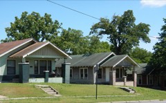 | Gan Row Historic District | 0.2 miles | 1999 |
 | Gann Building | 0.3 miles | 1975 |
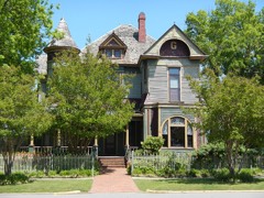 | Gann House | 0.3 miles | 1976 |
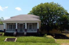 | Hyten, Charles "Bullet" Dean, House | 0.4 miles | 2012 |
 | Saline County Courthouse | 0.4 miles | 1976 |
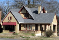 | J. W. and Ann Lowe Clary House | 0.4 miles | 1993 |
| National Archives record | The nomination case file for reference 100004906 in Record Group 79. |
| Saline County | All 20 listed properties in this county. |