 Block
From the record
20 National Register listings published here.
Sources: the National Register database, National Park Service
96 topographic sheets cover 59 settlements here, and 20 properties are on the National Register of Historic Places.
20 National Register listings published here.
Sources: the National Register database, National Park Service
Every property in this county listed on the National Register of Historic Places, with the year it was listed and the federal nomination document.
| Photograph | Property | Type | Listed | Reference |
|---|---|---|---|---|
| Bennett House | building | 2020 | 100004906 | |
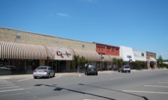 | Benton Commercial Historic District | district | 2008 | 08000706 |
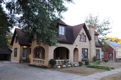 | Dr. T.E. Buffington House | building | 2014 | 14000250 |
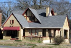 | J. W. and Ann Lowe Clary House | building | 1993 | 93000053 |
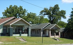 | Gan Row Historic District | district | 1999 | 99000106 |
 | Gann Building | building | 1975 | 75000415 |
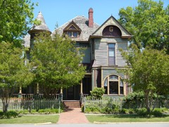 | Gann House | building | 1976 | 76000464 |
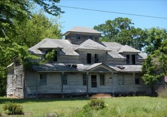 | Hester-Lenz House | building | 2004 | 04000002 |
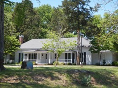 | Andrew Hunter House | building | 1976 | 76000466 |
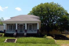 | Hyten, Charles "Bullet" Dean, House | building | 2012 | 12000804 |
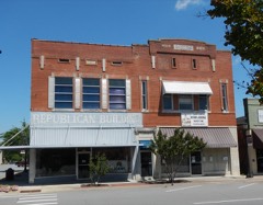 | Independent Order of Odd Fellows Building | building | 2004 | 04000509 |
| International Harvester Servicenter | building | 2020 | 100005591 | |
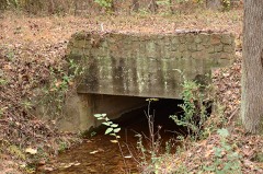 | Old Benton-Sardis Road Bridge | structure | 2007 | 06001274 |
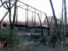 | Old River Bridge | structure | 1977 | 77000277 |
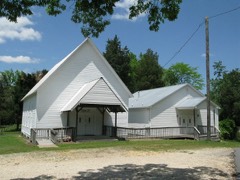 | Pleasant Hill Methodist Church | building | 1991 | 91000684 |
 | Royal Theatre | building | 2003 | 03000955 |
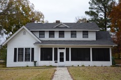 | Rucker House | building | 1988 | 88000744 |
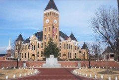 | Saline County Courthouse | building | 1976 | 76000465 |
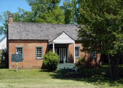 | Shoppach House | building | 1975 | 75000416 |
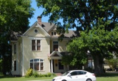 | Dr. James Wyatt Walton House | building | 1977 | 77000276 |
Every wildfire the federal occurrence database records inside this county: 1,343 of them, burning about 17,508 acres. 73 started naturally and 495 were recorded as arson. Each settlement page carries the fires within five miles of it.
| Reported cause | Fires |
|---|---|
| Arson/incendiarism | 495 |
| Debris and open burning | 340 |
| Missing data/not specified/undetermined | 298 |
| Natural | 73 |
| Equipment and vehicle use | 60 |
| Smoking | 25 |
| Recreation and ceremony | 23 |
| Misuse of fire by a minor | 17 |
| Railroad operations and maintenance | 8 |
| Power generation/transmission/distribution | 4 |
The five largest, by the area the report gives. Four of them were set deliberately.
| Date | Cause | Size | Reported by | Name on the report |
|---|---|---|---|---|
| 7 April 2006 | Natural | 5,091 acres | Ouachita National Forest | FLATSIDE |
| 12 July 2011 | Arson/incendiarism | 540 acres | Arkansas Forestry Commission | HOWARD MT. |
| 10 October 2010 | Arson/incendiarism | 486 acres | Arkansas Forestry Commission | TRASKWOOD |
| 10 December 2006 | Recreation and ceremony | 327 acres | Ouachita National Forest | WINONA |
| 12 December 2005 | Arson/incendiarism | 275 acres | Ouachita National Forest | ALUM #1 |
| 25 January 2015 | Debris and open burning | 150 acres | Arkansas Forestry Commission | not named |
| 16 January 2009 | Arson/incendiarism | 140 acres | Arkansas Forestry Commission | EAST END |
| 6 March 2020 | Missing data/not specified/undetermined | 140 acres | Arkansas Forestry Commission | not named |
Every settlement page carries the fires within five miles of it - see the settlement index below.
The NOAA Storm Events Database holds 848 reports for this county, causing 15 deaths, 127 injuries and about $137,379,030 in recorded property damage. Each settlement page carries the reports that name it.
| Kind of event | Reports |
|---|---|
| Thunderstorm Wind | 336 |
| Hail | 291 |
| Flash Flood | 80 |
| Tornado | 56 |
| Flood | 53 |
| Heavy Rain | 17 |
| Lightning | 9 |
| Funnel Cloud | 6 |
The most serious of them, by death, then injury, then recorded damage. The accounts are quoted exactly as the forecast office filed them.
| When | Event | Place named | Harm | What the report says |
|---|---|---|---|---|
| March 1997 | Tornado (F4) | Benton | 10 killed, 40 hurt, $25,000,000 | The thunderstorm that produced the tornado across Clark and Hot Spring County earlier spawned another tornado in Saline County. The tornado touched down 5 miles southeast of Benton and traveled northeastward, damaging a number of homes and downing numerous trees and power lines. As the tornado approached Shannon Hills, the tornado expanded to 0.8 mile wide. Dozens of homes were either damaged or destroyed in the area around the Shannon Hills, Vimy Ridge and Sardis communities. 10 people were killed, with most victims inside their homes when the storm hit.The tornado exhibited characteristics of F2 to F3 strength prior to moving into the Shannon Hills area. After that, the tornado reached F4 intensity as it moved across the Shannon Hills area and eventually into Pulaski County. |
| December 1982 | Tornado (F3) | not stated | 1 killed, 28 hurt, $25,000,000 | no account filed |
| March 1959 | Tornado (F2) | not stated | 1 killed, 7 hurt, $250,000 | no account filed |
| May 2010 | Flash Flood | New Summit | 1 killed, $30,000 | Flash flooding occurred on several roads in Bryant. According to a police report, several men went to the Midland Soccer Fields in Bryant to look at the flood waters. One of the men, 45 years old, wanted to see how deep the water was, so he waded into it. The current of the water swept him into a culvert. A 911 call was received form the park just before 11:45 PM CDT. Despite the efforts of several people, he drowned, During the rescue attempt, a firefighter was also pulled through the culvert by the force of the water, but he was not injured. |
| August 1998 | Lightning | Benton | 1 killed | no account filed |
| August 1988 | Thunderstorm Wind | not stated | 1 killed | no account filed |
| October 2004 | Tornado (F2) | Sardis | 11 hurt | An F2 tornado touched down 4 miles southwest of Sardis and tracked to the east-northeast before moving into Pulaski County. Numerous trees and power lines were downed along the path of the tornado. A number of mobile homes sustained minor or major damage. Eleven people sustained minor injuries, many of which were inside their mobile homes when the tornado struck. |
| February 2000 | Tornado (F1) | Benton | 9 hurt | A weak tornado was spawned in Saline County about 3.6 miles west-northwest of Benton. The tornado moved east into the Benton area, damaging homes and businesses. There were 66 homes with minor damage, 18 homes with major damage and 10 commercial buildings damaged. There were 9 injuries reported, with the injured treated and released from the hospital. The tornado also downed trees and power lines before dissipating 1.2 miles southwest of Bryant. |
| April 2010 | Tornado (EF2) | Sardis | 8 hurt, $3,000,000 | This tornado exited Grant County northwest of Ico and re-entered Saline County south of Sardis. The tornado traveled through the East End community, causing EF2 damage. A Red Cross survey of the damage indicated: 4 houses and 11 mobile homes destroyed, 11 houses and 3 mobile homes with major damage, 26 houses and 4 mobile homes with minor damage, and 16 houses and 13 mobile homes affected. A fire station in East End was destroyed and part of the roof was torn off a church. Two businesses also suffered damage. In addition, numerous trees and power lines were blown down. Eight people were injured. The tornado exited Saline County northeast of East End and entered Pulaski County south-southeast of Landmark. |
| July 2009 | Flash Flood | Paron | 7 hurt, $150,000 | Excessive rainfall caused flooding in the area around Lake Norrell. On Lake Norrell Road, the approach to the Caney Creek Bridge was washed out. The road was closed for five hours, until county road crews could remove the asphalt that had been torn out and replace it temporarily with gravel. Other roads suffering damage were Rushing, Sanders Ford, and Cold Springs. On Rushing Road, an SUV was trapped in flood waters. Two adults and three children were in the vehicle as water rose up the doors. The people exited through the windows but were swept through a culvert under the road. Two people nearby attempted to help but were also pulled through the culvert. One adult was taken to the hospital. The other six people suffered minor injuries, such as scrapes, cuts, and bruises. |
| October 1995 | Tornado (F2) | Sardis | 6 hurt | An F2 tornado touched down in the Sardis community and traveled approximately one-half mile before lifting. Several mobile homes were flipped over by the tornado. Altogether, six people residing in the mobile homes received minor injuries. Numerous trees and power lines were also blown down. Several outbuildings were also damaged or destroyed. |
| November 1973 | Tornado (F1) | not stated | 4 hurt, $25,000 | no account filed |
| May 2015 | Thunderstorm Wind | Salem | 2 hurt | Numerous trees and power lines were blown down in the Salem Community north of Benton. One tree fell through an outhouse in the 6700 block of Congo Road. Two people were injured due to these falling trees. Several people were without power as a result of the high winds. |
| June 1998 | Thunderstorm Wind | Benton | 2 hurt | no account filed |
| April 2008 | Tornado (EF2) | Bauxite Jct | 1 hurt, $5,000,000 | A tornado began on the northeast side of Benton and ended on the northwest side of Bryant. The tornado caused major damage to four houses and minor damage to 20 houses. It also traveled through the Hurricane Lake Mobile Home Park, destroying 22 mobile homes, and causing major damage to 11 mobile homes, and minor damage to 10 mobile homes. Major damage occurred at a car dealership on Interstate 30, where more than 150 vehicles were damaged, many of which had windshields or rear windows blown out. Diagonally across the interstate from the car dealership, a lumber yard suffered substantial damage. |
| April 2008 | Tornado (EF1) | Slocomb | 1 hurt, $5,000,000 | A tornado began west of Haskell and continued on to just west of Benton. The tornado destroyed nine houses and three mobile homes, caused major damage to approximately 16 houses and one mobile home, and minor damage to approximately 40 houses and one mobile home. One house that was under construction had all its framing completed and was ready for shingles to be put on. The tornado blew all the framing lumber down a hillside, but the concrete safe room that had been constructed remained intact. Many power lines and some power poles were blown down. Thousands of trees were blown down. |
| May 2008 | Tornado (EF2) | Lakeside | 1 hurt, $1,000,000 | This tornado exited Grant County, northeast of Ico, and moved into Saline County, south-southeast of East End. A total of 16 homes were impacted. Four were destroyed, nine had major damage and three had minor damage. The tornado exited Saline County, southeast of East End, and moved into Pulaski County, southwest of Woodson. |
| November 1988 | Tornado (F2) | not stated | $25,000,000 | no account filed |
| April 2008 | Tornado (EF2) | New Summit | $10,000,000 | A tornado began northwest of Bryant and ended northwest of Alexander. The tornado caused major damage in the Hurricane Meadows subdivision, and then continued on to the northeast. Altogether, six houses were destroyed, and approximately 30 others suffered varying degrees of damage. |
| March 1997 | Tornado (F2) | Vimy Ridge | $10,000,000 | no account filed |
| May 2011 | Flood | East End | $3,000,000 | no account filed |
| December 1982 | Tornado (F2) | not stated | $2,500,000 | no account filed |
| April 1979 | Tornado (F2) | not stated | $2,500,000 | no account filed |
| April 2011 | Tornado (EF1) | Hot Springs Village | $2,000,000 | This tornado exited Garland County northwest of the incorporated portion of Fountain Lake and entered Saline County in Hot Springs Village. Thousands of trees were blown down in Hot Springs Village, with more than 100 houses suffering damage from the falling trees. A cell phone tower was also blown down. Power outages were widespread. Boats and docks were destroyed on Lake Balboa. |
| December 2009 | Flood | Owensville | $2,000,000 | Flash flooding, which developed early on the evening of the 23rd, became widespread areal flooding on the 24th and continued through Christmas. At least 12 homes in Shannon Hills had major flood damage. Numerous roads were closed in Benton. The driveway in front of the fire station washed out in Bauxite. Streets flooded in the Forest Cove and Sunset Meadows subdivisions in Bryant. The Saline River at Benton rapidly rose above flood stage just after midnight on the 24th, reaching major flood stage the evening of the 24th. The Saline River remained above flood stage through much of Christmas Day before falling below flood stage the evening of the 25th. |
| December 2009 | Flash Flood | Owensville | $2,000,000 | Widespread heavy rain on the evening of the 23rd led to the development of flash flooding. Numerous county roads were blocked due to flooding. One subdivision in Haskell was flooded. |
| March 2008 | Flood | Benton Saline Co Arp | $1,500,000 | Heavy rain caused the Saline River near Benton to go above flood stage. County roads along the river were flooded. Agricultural losses were primarily flooded pastures and the possible loss of a few head of cattle. |
| September 2012 | Lightning | New Summit | $1,200,000 | Lightning set fire to a church building in Bryant. The building housing the youth center and the administrative offices of the church was destroyed. |
| April 2011 | Flood | East End | $1,000,000 | Widespread areal flooding occurred. |
| September 2008 | Flood | Kentucky | $1,000,000 | Heavy rainfall from Tropical Depression Gustav caused the third highest crest of record for the Saline River at Benton. Arkansas Highway 5 was flooded as well as several streets in Benton. A manufactured home subdivision flooded with as many as 20 structures affected. Five homes were flooded on River Street and other side streets. A horse farm also flooded with a barn and practice race track damaged. |
| March 2010 | Tornado (EF1) | Grape | $875,000 | Emergency management reports indicated two homes were destroyed, two homes suffered major damage, and 18 homes had minor damage. A fire station was damaged, and numerous barns and outbuildings were destroyed. Trees and power lines were blown down. |
| May 2009 | Flash Flood | Reform | $850,000 | Elliott Trail and Vance Road were closed due to flooding. Flooding occurred on Arkansas Highway 5 near Bryant. Numerous county roads and bridges suffered damage. About 20 homes were damaged. A few houses were damaged by flooding in Bryant and Shannon Hills. |
| April 2011 | Tornado (EF1) | Detonti | $600,000 | A house on U.S. Highway 167 had its roof and chimney damaged. Ironically, this same house had been damaged by a tornado 30 years ago. A mobile home had its roof and porch blown off. Numerous trees and power lines were blown down. Several houses suffered damage from falling trees. The roof of a country club was blown off, allowing water to pour inside and ruin a new wood floor that had just been installed. The tornado exited Saline County northeast of Lakeside and continued into Pulaski County west-northwest of Woodson. |
| May 2016 | Tornado (EF1) | Tatumville | $500,000 | NWS Storm Survey revealed an EF1 Tornado with a track length of 2.7 miles...and max width of 200 yards. Numerous trees were uprooted or snapped...with a few trees on homes. Several homes had roof damage. A manufactured home had windows broken. |
| November 1993 | Tornado (F2) | Haskell | $500,000 | A short-lived F2 tornado touched down in the community of Haskell. Several homes received roof and structural damage. A few mobile homes were also damaged and one was completely destroyed. A number of trees were knocked down and a few storage buildings were also damaged. |
| March 2017 | Tornado (EF2) | Glen Rose | $400,000 | After crossing into Saline County, the tornado strengthened and caused EF2 damage. Some buildings were damaged. An outbuilding suffered severe damage... with a roof of a new home being ripped off. A roof was nearly completely blown off a newly constructed house. |
| November 2011 | Flash Flood | Electric | $400,000 | Hurricane Creek flooded, putting flood waters into Bishop Park in Bryant and a flooring store on Interstate 30. A number of roads were flooded in the county. |
| March 2017 | Tornado (EF1) | Nance | $300,000 | This tornado touched down near the end of Steele Road south of US highway 70 southeast of Lonsdale, knocking down or snapping many trees. Several outbuildings or barns were either severely damaged or destroyed as the tornado moved north-northeast. The tornado then crossed US highway 70 east of Lonsdale. A carport was lofted into trees north/east of US hwy 70, along with additional outbuildings being damaged or destroyed. The tornado continued north destroying another barn before lifting shortly afterwards. |
| October 2009 | Flash Flood | Vimy Ridge | $300,000 | Substantial flooding occurred in Shannon Hills. A number of homes were flooded. |
| April 1996 | Lightning | Benton | $300,000 | no account filed |
| December 1982 | Tornado (F1) | not stated | $250,000 | no account filed |
| December 1982 | Tornado (F3) | not stated | $250,000 | no account filed |
| May 1955 | Tornado (F3) | not stated | $250,000 | no account filed |
| April 2011 | Tornado (EF1) | Hot Springs Village | $200,000 | This tornado exited Garland County northwest of the incorporated part of Fountain Lake and moved into Saline County in Hot Springs Village. In the Village, many trees were blown down and a number of these fell on houses. After leaving the Village, the tornado blew the porch off a house and damaged the roof, and blew down hundreds of trees. |
| September 2014 | Thunderstorm Wind | New Summit | $150,000 | A small, covered dock on Hurricane Lake was destroyed. Boats at the dock were overturned or sunk. |
| March 2008 | Flash Flood | Bryant | $150,000 | Porter Road and Narrows Road between U.S. Highway 70 and Arkansas Highway 5 sustained damage due to flooding. Boone Road, Mount Carmel Road, Westfield Road, Independence Circle, Sedgefield Drive, NW 4th Street, Kensington Drive, Forest Drive, Springhill Drive, Foxridge Drive, Hilltop Road, South Shobe Road and a home on Waterford were all flooded. |
| October 2009 | Flash Flood | Owensville | $135,000 | Numerous county roads were damaged by flooding. |
| May 2019 | Lightning | New Summit | $100,000 | A lightning strike caused a house fire in the Remington Place Neigborhood. Time is estimated. |
| April 2011 | Tornado (EF1) | Electric | $100,000 | This tornado exited Garland County north-northeast of Beaudry and entered Saline County west-northwest of Electric. Hundreds of trees were blown down on land belonging to a private timber company. Most of the tree damage was noted just north of Weyerhaeuser 24000 Rd. |
| April 2010 | Tornado (EF1) | Sardis | $100,000 | This was the second of five tornadoes spawned by the same supercell thunderstorm. A couple of roofs and some outbuildings were damaged. Trees were blown down. The tornado exited Saline County south of Sardis and entered Grant County northwest of Ico. |
| May 2010 | Thunderstorm Wind | Vimy Ridge | $100,000 | Many trees were down in the Shannon Hills area, blocking roads and laying on houses. Power lines were also down. |
| May 2008 | Thunderstorm Wind | Bland | $100,000 | More than 100 trees were blown down in the area around Lake Norrell, with some of the trees down on houses. There was roof damage to houses on Lake Norrell Road, West Lake Road, and Eagles Nest Road. Some sheds and boat docks were also damaged. |
| September 1996 | Tornado (F2) | Traskwood | $100,000 | no account filed |
| April 2014 | Thunderstorm Wind | Benton | $75,000 | Thunderstorm winds blew down trees and power lines. |
| September 2012 | Thunderstorm Wind | Bryant | $75,000 | A large tree fell into a house, causing major damage. |
| July 2012 | Thunderstorm Wind | Avilla | $75,000 | Two barns were blown down, some outbuildings were damaged, and trees were blown down onto roads. |
| August 2010 | Thunderstorm Wind | Salem | $75,000 | Multiple trees and some power lines were blown down. |
| September 2008 | Tornado (EF1) | Traskwood | $70,000 | This tornado moved out of Hot Spring County, east-northeast of Glen Rose, and entered Saline County, northwest of Traskwood. Many trees were blown down, one of which fell on a house. The tornado moved through the Crossroads community, which had been hit by a tornado on April 3, 2008. |
| July 2007 | Lightning | Vimy Ridge | $60,000 | Lightning struck an 80 year-old house on East Polk Road. The house was destroyed. |
| April 2020 | Thunderstorm Wind | Benton | $50,000 | A tree was blown down on a house due to the strong thunderstorm winds. |
The Survey's mineral resources record lists 95 workings inside this county. 14 still produce and 81 are closed or unrecorded. Each settlement page carries the workings within five miles of it.
| Commodity | Workings |
|---|---|
| Aluminum | 46 |
| Silica | 9 |
| Clay | 7 |
| Bentonite | 4 |
| Quartz | 4 |
| Nickel | 3 |
| Talc-Soapstone | 3 |
| Stone, Crushed/Broken | 3 |
| Sand and Gravel, Construction | 3 |
| Nickel, Talc-Soapstone | 2 |
| Niobium (Columbium) | 1 |
| Ruthenium | 1 |
| Kaolin, Aluminum | 1 |
| Iron | 1 |
The least common of them first, because a county's hundredth gravel pit says nothing its first ten did not.
| Where | Site | Commodity | Status | Recorded |
|---|---|---|---|---|
| A.S. Brown Manganese Peoperty | Manganese | Unknown | ||
| Alcoa Arkansas Operations | Aluminum, Gallium, Iron, Silica, Titanium, Water, Free | Producer | 1886, 1952 | |
| Arkansas Bauxite Region | Kaolin, Aluminum | Producer | 1887, 1896 | |
| Bryant Mill | Talc-Soapstone, Slate, Dimension | Producer | ||
| C.E. Lowry, Trustee, Properties | Nickel, Cobalt | Prospect | Underground | |
| Hurricane Creek Deposit | Niobium (Columbium) | Occurrence | ||
| Marler Mine | Aluminum, Silica | Unknown | ||
| Milwhite Barite | Barium-Barite | Producer | ||
| Quapaw Bauxite Mine | Aluminum, Iron, Silica, Titanium, Water, Free | Past Producer | 1920, 1932 | |
| Quapaw Pit & Benton Plant | Aluminum, Stone, Crushed/Broken | Past Producer | ||
| Republic Mining & Mgf. Co. | Iron | Unknown | ||
| Saline County | Aluminum, Iron, Silica, Titanium, Water, Free | Prospect | 1887 | |
| Unknown | Fullers Earth | Unknown | ||
| Unnamed Ruthenium Occurrence | Ruthenium | Occurrence | 1987 | |
| Wallis Soapstone Pit | Talc-Soapstone, Nickel | Prospect | ||
| Duke-Warner Pit | Nickel, Talc-Soapstone | Prospect | ||
| Inman Soapstone Prospect | Nickel, Talc-Soapstone | Prospect | ||
| Arkansas Talc Co. Mine | Talc-Soapstone | Unknown | ||
| Belvedere S & G Co. Pit and Plant | Sand and Gravel, Construction | Producer | ||
| Congo Pit | Talc-Soapstone | Producer | ||
| Dierks Pit | Sand and Gravel, Construction | Past Producer | Bedded | |
| Hill Sand and Gravel, Inc. | Sand and Gravel, Construction | Producer | ||
| Unknown | Stone, Crushed/Broken | Unknown | ||
| Unknown | Nickel, Talc-Soapstone | Prospect | ||
| Unknown | Stone, Crushed/Broken | Unknown | ||
| Unknown | Stone, Crushed/Broken | Unknown | ||
| Unnamed | Nickel | Occurrence | Pyrite, Pyrrhotite, Soapstone | |
| Ben J.Field | Quartz | Unknown | ||
| Crystal Mountain Mine | Quartz | Producer | 1987 | |
| Gingles Deposit | Bentonite | Unknown | ||
| H.L.Barber Prospect | Quartz | Unknown | ||
| Kuhn Mine | Quartz | Producer | 1987, 1989 | |
| Long-Bell Deposit | Bentonite | Unknown | ||
| Palmer Deposit | Bentonite | Producer | ||
| Wilkerson Deposit | Bentonite | Unknown | ||
| Henderson and Davis Clay Banks | Clay | Unknown | ||
| Hicks and Rodenbaugh Clay Banks | Clay | Unknown | ||
| Unknown | Clay | Unknown | ||
| Unknown | Clay | Unknown | ||
| Unknown | Clay | Unknown | ||
| Unknown | Clay | Unknown | ||
| Woolsey Clay Bank | Clay | Unknown | ||
| Fairchild #1 Claim | Silica | Unknown | ||
| Harold Prospect | Silica | Unknown | ||
| Hester Prospect | Silica | Unknown | ||
| Hogan Green Area | Silica | Unknown | ||
| J.T.Willis | Silica | Unknown | ||
| Lake Sylvia Prospect | Silica | Unknown | ||
| Monro Johnson | Silica | Unknown | ||
| Ouachita National Forest | Silica | Unknown | ||
| Pritchard Prospect | Silica | Unknown | ||
| (Facility) Bauxite, Ar Alumina Refinery | Aluminum | Plant | 1952 | |
| Alcoa Bauxite Mine | Aluminum | Producer | 1887, 1898 | |
| Alumina Pilot Plant | Aluminum | Past Producer | ||
| Archer Deposit | Aluminum | Unknown | ||
| Arkansas Operations Alumina Plant | Aluminum | Past Producer | ||
| Arkansas Operations Mine | Aluminum | Producer | ||
| Arkansas Talc Co.-Mill | Aluminum | Unknown | ||
| Bailey Deposit | Aluminum | Unknown | ||
| Benton Plant | Aluminum | Past Producer | ||
| Bray-Thomas | Aluminum | Unknown | ||
| East Carghill Deposit | Aluminum | Unknown | ||
| Fletcher Deposit | Aluminum | Unknown | ||
| Granity Survey Bauxite Area | Aluminum | Unknown | ||
| Hardy Deposit | Aluminum | Unknown | ||
| Harris Deposit | Aluminum | Unknown | ||
| Harrison Deposit | Aluminum | Unknown | ||
| Hudspeth-Fletcher | Aluminum | Unknown | ||
| Hurricane Creek | Aluminum | Unknown | ||
| Hurricane Creek Mill | Aluminum | Past Producer | ||
| Hurricane Creek Plant | Aluminum | Past Producer | ||
| International Paper Co. | Aluminum | Unknown | ||
| Lasater-Mcmurry | Aluminum | Unknown | ||
| Little Deposit | Aluminum | Unknown | ||
| Magnetic Survey of Bauxite Region | Aluminum | Unknown | ||
| Mayer Deposit | Aluminum | Unknown | ||
| Mcneil Deposite | Aluminum | Unknown | ||
| Mildred Mcmurry | Aluminum | Unknown | ||
| Mine No. 5 | Aluminum | Unknown | ||
| Mine No.2 | Aluminum | Unknown | ||
| Mine No.3 | Aluminum | Unknown | ||
| Mine No.4 | Aluminum | Unknown | ||
| Mine No.6 | Aluminum | Unknown | ||
| Pine Haven Clay Deposit Alcoa | Aluminum | Unknown | ||
| Pit No. 1-Plant | Aluminum | Unknown | ||
| Pit No.1 | Aluminum | Unknown | ||
| Reynolds Surface Mine | Aluminum | Producer | 1887, 1898 | |
| Reynolds Surface Mine | Aluminum | Past Producer | 1943 | |
| Rock Island Deposit | Aluminum | Unknown | ||
| South Harris Deposit | Aluminum | Unknown | ||
| Sutton Deposit | Aluminum | Unknown | ||
| Thomas-Williams Deposit | Aluminum | Past Producer | ||
| Tindall Deposit | Aluminum | Unknown | ||
| Walden Deposit | Aluminum | Unknown | ||
| West Carghill Deposit | Aluminum | Unknown |
Named settlements recorded in the Geographic Names Information System, each with the topographic sheets covering it. Villages, hamlets and abandoned places alike. Each is shown with the nearest named watercourse or landform and the survey quadrangle it falls on.
Otter township · 72103 · On Dry Creek · Spring Lake quadrangle
22 sheets, 1891 to 1994
No longer a settlement
Liberty township · 72087 · On Middle Fork Saline River · Haskell quadrangle
19 sheets, 1890 to 1985
No longer a settlement
Marble township · 72087 · Near Goosepond Mountain · Goosepond Mountain quadrangle
14 sheets, 1890 to 1985
Hurricane township · 72002 · On Brier Lick Branch · Bryant quadrangle
23 sheets, 1891 to 1994
Hurricane township · 72002 · On Brier Lick Branch · Bryant quadrangle
23 sheets, 1891 to 1994
No longer a settlement
Holland township · 72122 · Near Horseshoe Mountain · Fourche SW quadrangle
14 sheets, 1890 to 1985
No longer a settlement
Traskwood township · 72167 · Traskwood quadrangle
10 sheets, 1955 to 1985
No longer a settlement
Jefferson township · 72122 · On Little Alum Fork · Lonsdale NE quadrangle
15 sheets, 1890 to 1985
No longer a settlement
Bauxite township · 72011 · On Cold Spring Branch · Bryant quadrangle
23 sheets, 1891 to 1994
No longer a settlement
Jefferson township · Goosepond Mountain quadrangle
14 sheets, 1890 to 1985
No longer a settlement
Fairplay township · 72019 · Haskell quadrangle
19 sheets, 1890 to 1985
No longer a settlement
Bauxite township · 72011 · On Cold Spring Branch · Bryant quadrangle
23 sheets, 1891 to 1994
Hurricane township · 72011 · On Blue Branch · Bryant quadrangle
23 sheets, 1891 to 1994
No longer a settlement
Fairplay township · 72019 · On South Fork Saline River · Haskell quadrangle
19 sheets, 1890 to 1985
No longer a settlement
Bauxite township · 72011 · On Cold Spring Branch · Bryant quadrangle
23 sheets, 1891 to 1994
Haskell township · 72015 · Traskwood quadrangle
10 sheets, 1955 to 1985
No longer a settlement
Bauxite township · 72011 · On Cold Spring Branch · Bryant quadrangle
23 sheets, 1891 to 1994
Bauxite township · 72019 · On Little Hurricane Creek · Benton quadrangle
23 sheets, 1890 to 1994
Fairplay township · 72019 · On Caney Creek · Haskell quadrangle
19 sheets, 1890 to 1985
No longer a settlement
Owen township · 72019 · On Little Hurricane Creek · Congo quadrangle
20 sheets, 1890 to 1994
Beaver township · 72002 · Near Big Ridge · Congo quadrangle
20 sheets, 1890 to 1994
No longer a settlement
Bauxite township · 72011 · Benton quadrangle
23 sheets, 1890 to 1994
No longer a settlement
Bryant township · 72002 · Near Alexander Mountain · Bryant quadrangle
23 sheets, 1891 to 1994
The vanished settlements of Saline County: the places named above that are no longer on the map.