 Block
From the record
One of 18 National Register listings published here for Greene County · listed in 2022 · category: Building.
Sources: the National Register database, National Park Service
Listed on the National Register of Historic Places in 2022.
One of 18 National Register listings published here for Greene County · listed in 2022 · category: Building.
Sources: the National Register database, National Park Service
Regional context, not property-specific evidence. The federal wildfire occurrence database lists 2 fires within 5 miles of Standard Oil Company Oil Station Garage Building in 2015, burning about 54 acres in total. None started naturally. None was recorded as arson. Distance is straight-line from the map coordinates, so a fire counted here may appear on a neighbouring settlement's page as well.
| Reported cause | Fires |
|---|---|
| Misuse of fire by a minor | 1 |
| Debris and open burning | 1 |
The most recent of them, most recent first, with the day each was reported and the service that recorded it.
| Date | Cause | Size | Reported by | Name on the report |
|---|---|---|---|---|
| 13 February 2015 | Misuse of fire by a minor | 50 acres | Arkansas Forestry Commission | not named |
| 19 January 2015 | Debris and open burning | 4.0 acres | Arkansas Forestry Commission | not named |
Regional context, not property-specific evidence. The federal mineral resources record lists 10 workings within 5 miles of Standard Oil Company Oil Station Garage Building: 7 past producers, 2 producers, 1 unknown. 2 still produce. What was taken out: Sand and Gravel, Construction. Distance is straight-line from the map coordinates, so a quarry counted here may appear on a neighbouring settlement's page as well.
| Where | Site | Commodity | Status | Recorded |
|---|---|---|---|---|
| Cline Pit | Sand and Gravel, Construction | Past Producer | ||
| Edd Ridge | Sand and Gravel, Construction | Past Producer | ||
| Express Pit & Plant | Sand and Gravel, Construction | Producer | ||
| Greene County | Sand and Gravel, Construction | Past Producer | ||
| Jf Bowlin | Sand and Gravel, Construction | Past Producer | ||
| Kelley Pit | Sand and Gravel, Construction | Producer | ||
| L Treadway | Sand and Gravel, Construction | Past Producer | ||
| Unk | Sand and Gravel, Construction | Unknown | ||
| Wells Gravel Pit | Sand and Gravel, Construction | Past Producer | ||
| Whitley Pit | Sand and Gravel, Construction | Past Producer |
Regional context, not property-specific evidence. The National Weather Service names Paragould, the town this property stands in, in 67 storm reports between 1993 and 2026: 30 thunderstorm wind, 18 hail, 14 flash flood, 2 tornado. No death or injury is recorded in these reports. Each account below is quoted exactly as the forecast office filed it, from the NOAA Storm Events Database, and each date opens the federal record of that event.
| When | Event | Place named | Harm | What the report says |
|---|---|---|---|---|
| July 2009 | Lightning | Paragould | $1,000,000 | A lightning strike started a fire at the Martin Sprocket & Gear Incorporated Plant. The fire destroyed all the warehouses and ten percent of the plant received heavy smoke damage from the fire. |
| November 2000 | Thunderstorm Wind | Paragould | $250,000 | Several houses were damaged. A wooden monument built to honor World War I veterans was blown down. Several trees and power lines were knocked down. |
| December 2009 | Flash Flood | Paragould | $206,000 | Heavy rain produced flash flooding near Paragould. County Roads 920 and 853 were closed as a result. Two men and a small child had to be rescued from their vehicle after it became stalled in waist high water. |
| January 2007 | Flash Flood | Paragould | $53,000 | Heavy rain produced flash flooding across Greene County as a result several roads were washed away. In addition, many side streets in Paragould were flooded. Water rose high enough to flood a few street level apartments. |
| March 2026 | Thunderstorm Wind | Paragould | $30,000 | Nine power poles were snapped on Highway 135 South, just south of 412 East. |
| June 2017 | Flash Flood | Paragould | $30,000 | Several roads on the southeast side of Paragould were closed due to rising water. |
| May 2003 | Thunderstorm Wind | Paragould | $20,000 | A mobile home was overturned. |
| May 2003 | Thunderstorm Wind | Paragould | $20,000 | A tractor shed was destroyed and a grain elevator was damaged. Pieces of awning at the Oak Grove Middle School were blown off. One house was damaged when a trampoline was blown into in. Several large tree limbs were blown down. |
| April 2002 | Thunderstorm Wind | Paragould | $20,000 | One mobile home had its top blown off. Some trees and power lines were knocked down. |
| July 1995 | Tornado (F0) | Paragould | $20,000 | Some houses had their windows blown out of them. A mobile home had its roof blown off, carried across a road and wrapped around a tree. A barn was destroyed. Numerous trees and power lines were blown down. |
| May 2004 | Thunderstorm Wind | Paragould | $15,000 | An automobile auction building was unroofed. Several trees were blown down. |
| August 2004 | Thunderstorm Wind | Paragould | $15,000 | Some trees and power lines were knocked down. A couple of power poles were broken. |
| March 2026 | Thunderstorm Wind | Paragould | $12,000 | Power poles (3-4) were knocked down on AR 135 Hwy S near the Twin Oaks Motel. |
| May 2023 | Thunderstorm Wind | Paragould | $10,000 | Power poles were snapped on South 2nd Avenue. |
| May 2022 | Thunderstorm Wind | Paragould | $10,000 | Carport destroyed and vehicle damaged in Paragould. |
| March 2021 | Flash Flood | Paragould | $10,000 | Flooding in Paragould caused cars to stall. |
| June 2017 | Flash Flood | Paragould | $10,000 | Roads flooded near Allen Engineering in Paragould. |
| July 2005 | Thunderstorm Wind | Paragould | $10,000 | At least one home had some roof damage. Several trees were knocked down. |
| July 2004 | Thunderstorm Wind | Paragould | $10,000 | Some trees and power lines were blown down. |
| August 2004 | Thunderstorm Wind | Paragould | $10,000 | Several trees and power lines were knocked down. |
| May 1998 | Thunderstorm Wind | Paragould | $10,000 | A cellular phone tower as well as a few trees and power lines were blown down just west of Paragould. |
| April 2006 | Hail | Paragould | $10,000 | no account filed |
| May 2000 | Flash Flood | Paragould | $5,000 | A few houses had water in them. Several roads were closed. |
| July 2000 | Thunderstorm Wind | Paragould | $5,000 | Some trees were knocked down. |
| April 1999 | Thunderstorm Wind | Paragould | $5,000 | Several trees were blown down. |
| September 1999 | Lightning | Paragould | $5,000 | A fire in the press room of a local newspaper was caused by lightning. |
| January 1996 | Thunderstorm Wind | Paragould | $5,000 | no account filed |
| November 2020 | Thunderstorm Wind | Paragould | $3,000 | Straight-line winds knocked a flag pole down and tore a roof of a pavilion. |
| March 2008 | Thunderstorm Wind | Paragould | $3,000 | Straight line winds blew three trees down in Paragould. |
| July 2023 | Thunderstorm Wind | Paragould | $2,000 | A large tree was knocked down near Paragould. |
| August 2020 | Thunderstorm Wind | Paragould | $2,000 | Reports via social media of a large tree down on West Thompson St. in Paragould. |
| August 2006 | Thunderstorm Wind | Paragould | $2,000 | A few trees and power poles were knocked down. |
| December 1996 | Thunderstorm Wind | Paragould | $2,000 | no account filed |
| April 1996 | Thunderstorm Wind | Paragould | $2,000 | no account filed |
| April 2007 | Hail | Paragould | $1,500 | Nickel to half dollar size hail fell around the Paragould area. |
| March 2017 | Hail | Paragould | $1,000 | Quarter to golf-ball size hail fell and broke a car windshield southwest Paragould. |
| October 2009 | Flash Flood | Paragould | $1,000 | Several roads in the area were flooded. |
| October 2004 | Tornado (F0) | Paragould | $1,000 | A tornado briefly touched down twice in Paragould producing minimal damage. |
| April 1998 | Thunderstorm Wind | Paragould | $1,000 | A few trees and several tree limbs were blown down. |
| December 2002 | Flood | Paragould | $500 | Some minor street flooding occurred in Paragould. |
| June 1994 | Thunderstorm Wind | Paragould | $500 | Three large trees along with numerous smaller trees were knocked down. |
| June 1994 | Thunderstorm Wind | Paragould | $500 | Several trees and power lines were blown down. |
| August 1993 | Thunderstorm Wind | Paragould | $500 | Thunderstorm winds knocked down a few power lines. |
| March 2004 | Hail | Paragould | $100 | no account filed |
| May 2003 | Hail | Paragould | $100 | no account filed |
| February 2005 | Hail | Paragould | $60 | no account filed |
| April 2003 | Hail | Paragould | $50 | no account filed |
| October 2001 | Hail | Paragould | $50 | no account filed |
| July 2006 | Flash Flood | Paragould | $10 | Torrential rains caused 2 feet of water to cover portions of County Road 920. |
| July 2005 | Hail | Paragould | $10 | no account filed |
| April 2003 | Hail | Paragould | $10 | no account filed |
| June 2022 | Flash Flood | Paragould | - | Flash flooding reported on US-412 and on Buttercup Lane in Paragould. |
| May 2018 | Hail | Paragould | - | Nickel to quarter size. |
| April 2017 | Flash Flood | Paragould | - | Lake street flooded and closed due to heavy rainfall. |
| June 2014 | Flash Flood | Paragould | - | Heavy rain caused flash flooding in Paragould. As a result Jones Road was impassable due to deep water. |
| June 2014 | Hail | Paragould | - | Quarter to half Dollar size hail fell in Paragould. |
| July 2012 | Thunderstorm Wind | Paragould | - | Straight line winds knocked a tree onto a house, damaging the house, in Central Paragould. |
| October 2010 | Hail | Paragould | - | Nickel size hail fell in Paragould. |
| April 2010 | Hail | Paragould | - | Quarter size hail covered the ground in Paragould. |
| June 2010 | Flash Flood | Paragould | - | Heavy rain produced flash flooding in Paragould. Lake Street, Highway 412 and North Second Street were all flooded. |
No historic map-sheet match is published for this property yet. That does not mean no map exists. This record needs a coordinate-quality review before it can be joined to a sheet boundary. Browse the county's mapped places while that work is pending.
Other National Register properties close enough to walk or drive between, ordered by distance from this one. Both positions come from the same geocoding pass that matched these properties to their map sheets.
| Photograph | Property | Distance | Listed |
|---|---|---|---|
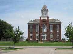 | Greene County Courthouse | 0.2 miles | 1976 |
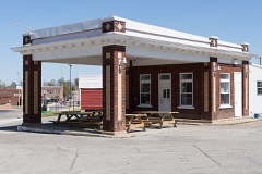 | Gulf Oil Company Service Station | 0.2 miles | 1994 |
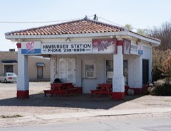 | Texaco Station No. 1 | 0.2 miles | 2001 |
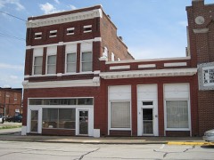 | Paragould Downtown Commercial Historic District | 0.3 miles | 2003 |
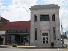 | National Bank of Commerce Building | 0.3 miles | 1993 |
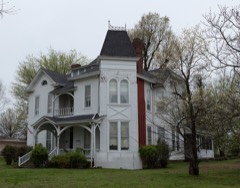 | Jackson-Herget House | 0.3 miles | 1992 |
| National Archives record | The nomination case file for reference 100008154 in Record Group 79. |
| Greene County | All 18 listed properties in this county. |