 Block
From the record
18 National Register listings published here.
Sources: the National Register database, National Park Service
70 topographic sheets cover 55 settlements here, and 18 properties are on the National Register of Historic Places.
18 National Register listings published here.
Sources: the National Register database, National Park Service
Every property in this county listed on the National Register of Historic Places, with the year it was listed and the federal nomination document.
| Photograph | Property | Type | Listed | Reference |
|---|---|---|---|---|
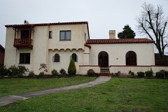 | Beisel-Mitchell House | building | 1996 | 96001031 |
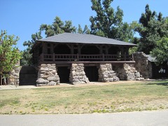 | Crowley's Ridge State Park-Bathhouse | building | 1992 | 92000537 |
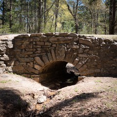 | Crowley's Ridge State Park-Bridge | structure | 1992 | 92000540 |
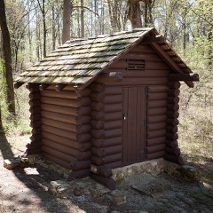 | Crowley's Ridge State Park-Comfort Station | building | 1992 | 92000538 |
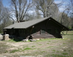 | Crowley's Ridge State Park-Dining Hall | building | 1992 | 92000536 |
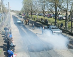 | George Ray's Dragstrip | site | 2006 | 06000075 |
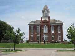 | Greene County Courthouse | building | 1976 | 76000412 |
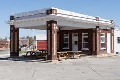 | Gulf Oil Company Service Station | building | 1994 | 94000850 |
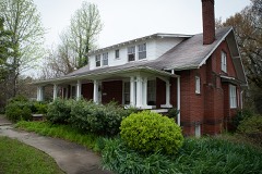 | Highfill-McClure House | building | 2002 | 02000260 |
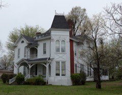 | Jackson-Herget House | building | 1992 | 92000907 |
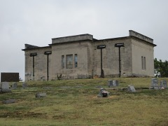 | Linwood Mausoleum | building | 2007 | 06001314 |
 | National Bank of Commerce Building | building | 1993 | 93000423 |
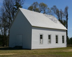 | Old Bethel Methodist Church | building | 1978 | 78000590 |
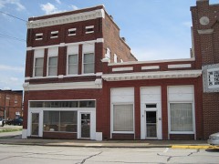 | Paragould Downtown Commercial Historic District | district | 2003 | 03000646 |
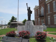 | Paragould War Memorial | object | 1997 | 97000554 |
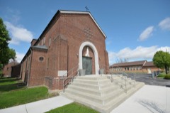 | St. Mary's Catholic Church | building | 2015 | 14001198 |
| Standard Oil Company Oil Station Garage Building | building | 2022 | 100008154 | |
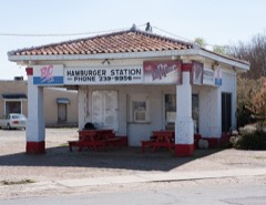 | Texaco Station No. 1 | building | 2001 | 01000718 |
Every wildfire the federal occurrence database records inside this county: 60 of them, burning about 1,064 acres. None started naturally and 10 were recorded as arson. Each settlement page carries the fires within five miles of it.
| Reported cause | Fires |
|---|---|
| Debris and open burning | 34 |
| Missing data/not specified/undetermined | 10 |
| Arson/incendiarism | 10 |
| Misuse of fire by a minor | 3 |
| Equipment and vehicle use | 1 |
| Recreation and ceremony | 1 |
| Smoking | 1 |
The five largest, by the area the report gives. Three of them were set deliberately.
| Date | Cause | Size | Reported by | Name on the report |
|---|---|---|---|---|
| 18 November 2001 | Arson/incendiarism | 200 acres | Arkansas Forestry Commission | not named |
| 24 September 1999 | Debris and open burning | 100 acres | Arkansas Forestry Commission | JERUSALEM COMPLEX |
| 29 October 1999 | Debris and open burning | 80 acres | Arkansas Forestry Commission | not named |
| 13 February 2015 | Misuse of fire by a minor | 50 acres | Arkansas Forestry Commission | not named |
| 14 April 2003 | Missing data/not specified/undetermined | 50 acres | Arkansas Forestry Commission | not named |
| 8 April 2006 | Arson/incendiarism | 40 acres | Arkansas Forestry Commission | not named |
| 6 October 2004 | Debris and open burning | 40 acres | Arkansas Forestry Commission | not named |
| 9 April 2000 | Arson/incendiarism | 35 acres | Arkansas Forestry Commission | not named |
Every settlement page carries the fires within five miles of it - see the settlement index below.
The NOAA Storm Events Database holds 347 reports for this county, causing 3 deaths, 66 injuries and about $39,397,770 in recorded property damage. Each settlement page carries the reports that name it.
| Kind of event | Reports |
|---|---|
| Thunderstorm Wind | 145 |
| Hail | 113 |
| Flash Flood | 40 |
| Tornado | 39 |
| Flood | 5 |
| Lightning | 3 |
| Funnel Cloud | 2 |
The most serious of them, by death, then injury, then recorded damage. The accounts are quoted exactly as the forecast office filed them.
| When | Event | Place named | Harm | What the report says |
|---|---|---|---|---|
| April 1968 | Tornado (F3) | not stated | 1 killed, 6 hurt, $2,500,000 | no account filed |
| March 1997 | Tornado (F3) | Fontaine | 1 killed, 5 hurt, $500,000 | no account filed |
| May 2011 | Flood | Stonewall | 1 killed, $100,000 | Heavy rain during the end of April into the beginning of May caused the Cache River to rise above flood stage. Numerous roads were closed and/or damaged. Some homes sustained minor damage. One man drowned while attempting to check on his flooded home. He became disorientated and could not tell where the road and the flood waters were. He drove his vehicle into a flooded ditch as a result. |
| April 2006 | Tornado (F3) | Delaplaine | 47 hurt, $25,000,000 | A tornado continued to track east from Randolph County into Greene County and eventually continued into Dunklin County, Missouri. The hardest hit area was in the town of Marmaduke. Forty-seven injuries occurred in Marmaduke with two people being airlifted to a local hospital. One hundred and thirty houses were destroyed in Marmaduke with twenty-five mobile homes also being destroyed. A pharmacy was also destroyed in Marmaduke. Outside of Marmaduke, in the rest of the county, nineteen homes and 11 mobile homes were destroyed. In addition, seven houses and two mobile homes had major damage in the county. In all, approximately five hundred homes were affected. |
| March 2025 | Tornado (EF2) | Brookings | 4 hurt, $2,000,000 | A tornado crossed from northern Craighead County into Greene County and continued northeast where additional tree damage was noted. Some of the gaps in damage indicators over areas that were difficult to access were filled in using Sentinel satellite data. As the tornado approached Paragould, the tornado intensified just before Pruetts Chapel Road causing damage in the Club View Estates and The Enclave communities. Multiple homes have significant roof damage. A few homes in the Club View Estates neighborhood were impacted by a tornado for the second time in 10 months. A home on South 34th Street had several first-story walls collapsed into the home, with the entire second floor collapsed on itself. An additional home on Enclave Circle had large sections of the brick exterior collapsed inward on the home with about half of the second floor and roof missing. The tornado continued to the northeast, causing damage to a two-story home on Valley South Drive with large sections of the second floor collapsed inward or missing. The tornado moved northeast onto Park Ridge Drive, with additional roof damage and trees uprooted. The tornado continued along Chateau Blvd causing minor damage to an assisted living building and uprooting more trees. After crossing Highway 49, Clove Circle was impacted with a home losing its roof and causing some minor brick damage to the home. The tornado intensified again near West Mueller Street, causing significant damage to a home. The tornado continued northeast along West Park Street causing a few homes to lose portions of their roofs and uprooting multiple trees. As the tornado crossed Highway 412, multiple metal building systems were damaged. Damage included a partially collapsed outbuilding, roof damage to multiple buildings, and debris being tracked to the northeast. No additional damage was noted beyond this area. Tornado damage is consistent with an EF-2 tornado with 125 mph winds in Paragould. |
| April 1967 | Tornado (F2) | not stated | 2 hurt, $2,500,000 | no account filed |
| January 1964 | Tornado (F2) | not stated | 2 hurt, $250,000 | no account filed |
| May 2024 | Tornado (EF2) | Finch | $1,000,000 | The tornado began along County Road 735 in Paragould, AR, resulting in a few trees uprooted and snapped. Damage was also noted to a carport which had fallen on a vehicle with only minor roof damage to the home. The tornado continued to move east, crossing Highway 412 and producing additional tree damage. Wind speeds within the tornado intensified as it approached Spring Grove Road where the first signs of significant structural damage were noted to a home. A couple of homes suffered minor roof damage along Pruetts Chapel Road with further intensification noted on Rockingchair Road and Sandy Lane where significant roof damage occurred to a residence and a couple of outbuildings were completely destroyed. Damage became more sporadic as the tornado moved east along Pruetts Chapel Road, but additional significant damage to homes and trees was noted on South 34th Street and Sandwedge Drive, along Enclave Circle, and on Carroll Road. The maximum intensity of the tornado was likely in this area. One home lost its entire roof and widespread tree damage with a clear path was noted nearby. The tornado quickly weakened as it moved to the east with the last damage noted just to the west of Highway 49 north of Mockingbird Lane. Peak winds were estimated at 120 mph. |
| July 2009 | Lightning | Paragould | $1,000,000 | A lightning strike started a fire at the Martin Sprocket & Gear Incorporated Plant. The fire destroyed all the warehouses and ten percent of the plant received heavy smoke damage from the fire. |
| August 2018 | Tornado (EF1) | Finch | $500,000 | This tornado developed near County Road 714 and damaged two barns early in its path. The tornado uprooted or snapped trees along County Roads 714, 740, and 707. The tornado overturned a mobile home off of County Road 740 and destroyed a storage shed along County Road 707. The tornado caused minor roof damage near the intersection of County Roads 707 and 718 and along County Road 745. The tornado dissipated just east of County Road 745. |
| March 2020 | Tornado (EF1) | Bard | $300,000 | This tornado developed south of U.S. Highway 412 and west of County Road 934. The tornado overturned a center pivot irrigation system. As it crossed Highway 412, it damaged an industrial building and a grain bin. West of Highway 119, the tornado damaged trees, storage buildings, and a mobile home. The last damage was observed to trees along Highway 119. Peak winds were estimated at 90 mph. |
| March 2017 | Tornado (EF0) | Marmaduke | $250,000 | The first damage occurred to a gas station just west of Highway 49. As the tornado moved through the south and east sections of Marmaduke, approximately 20 homes suffered roof damage. Several trees were snapped. Near the end of the track, the tornado damaged the roof and several roll-up doors of an industrial plant. Peak winds estimated at 80 mph. |
| November 2000 | Thunderstorm Wind | Paragould | $250,000 | Several houses were damaged. A wooden monument built to honor World War I veterans was blown down. Several trees and power lines were knocked down. |
| March 1984 | Tornado (F1) | not stated | $250,000 | no account filed |
| November 1965 | Tornado (F3) | not stated | $250,000 | no account filed |
| December 2009 | Flash Flood | Paragould | $206,000 | Heavy rain produced flash flooding near Paragould. County Roads 920 and 853 were closed as a result. Two men and a small child had to be rescued from their vehicle after it became stalled in waist high water. |
| April 2017 | Lightning | Gainesville | $150,000 | Lightning is suspected to have caused a house fire near Oak Grove Heights north of Paragould. The house was destroyed by the fire. |
| March 2026 | Tornado (EF0) | Light | $125,000 | A tornado began just south of Highway 412, damaging a grain bin and snapping a few trees along County Road 300. The tornado then caused damage to a camper along County Road 208. This tornado continued east-northeast and damaged an outbuilding on County Road 205 and caused tree damage at the intersection of County Road 205 and 214. This tornado resulted in EF-0 damage with 85 mph winds. The tornado lifted east of County Road 214. |
| June 2011 | Tornado (EF1) | Bard | $120,000 | A tornado touched down just north of U.S. Highway 412, about 4 miles east of Paragould. The tornado overturned a semi-truck on Highway 412. Two homes, one business and one barn on the south side of the highway sustained roof damage. Windows were also blown out. The tornado continued on a south-southeast path and caused severe damage to a single wide mobile home along County Road 932. The entire roof was blown off and more than half of the walls were knocked down. A second single wide mobile home along County Road 905 sustained partial roof damage. A business size metal storage building along County Road 905 sustained significant roof damage and a steel carport was destroyed. Sheet metal from the storage building was found in cornfields up to a mile away on the track. Several trees were uprooted and branches were knocked down all along the track. The tornado lifted in a corn field, a quarter mile east of County Road 932. |
| March 2026 | Tornado (EF0) | Beech Grove | $100,000 | This tornado started along Highway 34 W and damaged the roof of a metal outbuilding and the roof of a residence. Some damage to tree branches in this area was also noted. The tornado moved eastward towards Greene Road 125, where additional tree damage occurred along with minor damage to a barn. This tornado was rated EF-0 with 80 mph winds. The tornado lifted in a wooded area near Greene Road 125. |
| May 2024 | Tornado (EF1) | Schug | $100,000 | This tornado developed in far southern Greene County, AR, just east of the intersection of County Road 931 and Craighead County Road 989 on the Greene-Craighead County line. The first sign of damage was some farm equipment blown into an open field. Two homes were damaged just north of County Road 931, one significantly. The first home along County Road 931 suffered minor exterior damage and a tree was snapped in its front yard. More significant damage occurred to the house just to the east near the intersection of 931 and Craighead County Road 991, where much of the roof was removed and a nearby outbuilding was completely destroyed. In addition, exterior walls from an add-on room partially collapsed. Several power lines were also down along County Road 931 as the tornado crossed into extreme northern Craighead County. Mostly tree damage was noted in Craighead County just south of Route 931 with the tornado lifting in an open field to the west of Highway 135. Peak winds were estimated at 105 mph. |
| February 2011 | Flash Flood | Delaplaine | $100,000 | Heavy rain produced flash flooding in Northwest Greene County. County Road 138 was closed due to flooding along with all the low water crossings across Northwest Greene County. The Evening Star community on County Roads 223 and 229 was completely flooded. The Stanford community had some flooding on County Road 203 while County Road 215 was flooded near Beech Groove. |
| May 2011 | Flood | Marmaduke | $100,000 | Heavy rain during late April into early May caused the St. Francis River to rise to near record levels. The river remained above flood stage through the end of May. Several roads were closed and/or damaged. A few homes sustained minor damage. Several hundred acres of cropland was flooded. |
| February 2018 | Thunderstorm Wind | Walcott | $75,000 | Roofs were blown off two barns near Highway 168 and County Road 310. |
| March 2008 | Flood | Delaplaine | $75,000 | Heavy rain produced flooding along the Black River and it's tributaries. County Roads 933, 960, 911, 520, and 435 were closed as a result of the flooding. Many residents were forced to evacuate due to the rising flood waters. Two houses and several roads received major damage. County road 520 was washed away. Greene County was declared a state disaster area. |
| January 1999 | Tornado (F1) | Evening Star | $75,000 | A tornado touched down near Evening Star and continued northeast toward Beech Grove. At least twelve homes were damaged or destroyed. A church was also badly damaged. |
| May 2021 | Thunderstorm Wind | Bethel | $60,000 | Straight-line winds knocked several trees in the southern part of Paragould and caused minor damage to a few homes and mobile homes. One mobile home was heavily damaged. |
| January 2007 | Flash Flood | Paragould | $53,000 | Heavy rain produced flash flooding across Greene County as a result several roads were washed away. In addition, many side streets in Paragould were flooded. Water rose high enough to flood a few street level apartments. |
| August 2018 | Tornado (EF0) | Marmaduke | $50,000 | This tornado developed along Highway 34 east of Marmaduke. The tornado damaged a few trees and overturned and dragged a semi-trailer designed for carrying grain. |
| May 1998 | Tornado (F1) | Light | $50,000 | A tornado crossed in from Lawrence county and moved northeast toward the town of Light. Several houses were damaged or destroyed. A few trees and power lines were knocked down. |
| April 2018 | Hail | Finch | $50,000 | no account filed |
| March 1996 | Thunderstorm Wind | Walcott | $50,000 | no account filed |
| May 2024 | Thunderstorm Wind | Delaplaine | $45,000 | Three silos were destroyed and thrown into a nearby field along Highway 280 near the Greene-Clay county line between Delaphaine and Brookings. |
| September 2012 | Thunderstorm Wind | Bethel | $40,000 | Straight line winds blew a roof off a shop building along Highway 69 in Paragould. In addition, a tractor-trailer was blown over on Tower Drive. |
| January 2002 | Thunderstorm Wind | Evening Star | $40,000 | A barn was blown down near Lafe. A 100 foot antenna was twisted. Several trees were knocked down. |
| March 2026 | Thunderstorm Wind | Paragould | $30,000 | Nine power poles were snapped on Highway 135 South, just south of 412 East. |
| May 2019 | Tornado (EF0) | Hooker | $30,000 | Tornado reported near Knob, Arkansas with damage to a home on Greene Road 402. |
| June 2018 | Thunderstorm Wind | Center Hill | $30,000 | Power lines and trees down around Paragould. |
| August 2018 | Thunderstorm Wind | Finch | $30,000 | Large tree down on house on County Road 707. |
| June 2017 | Flash Flood | Paragould | $30,000 | Several roads on the southeast side of Paragould were closed due to rising water. |
| July 2010 | Flash Flood | Schug | $30,000 | Heavy rain produced widespread flash flooding in Paragould. U.S. Highway 49 had a least a foot of water over the road while South 4th Street had nearly two feet of water covering it. Highway 412 was underwater in several places and at least ten other roads in the town of Paragould were flooded. Water was as high as the wheel wells of vehicles in a few locations. A few homes had water seeping into them. |
| March 2026 | Tornado (EF1) | Lafe | $25,000 | The tornado touched down in a wooded area west of County Road 138 southwest of Lafe. Tree damage was noted as the tornado crossed County Road 138 with additional tree damage near County Road 151. The tornado continued northeast, causing minor roof damage to a residence near the intersection of Greene Roads 151 and 142. A small barn was also destroyed off Greene Road 142 near Highway 135. The tornado crossed Highway 135 and damaged a barn just south of Highway 34 E. This damage was consistent with a 90 mph EF1 tornado. The tornado lifted in a wooded area north of Highway 34 E. |
| May 2021 | Tornado (EF0) | Gainesville | $25,000 | The tornado damaged trees and moved a double-wide mobile home off of its piers along Highway 34. The tornado crossed Highway 34 and damaged a shed and a large metal storage building. As the tornado approached and crossed Highway 135, it uprooted numerous trees and snapped the trunks of a couple of trees. The last observed damage was east of Highway 135 along County Road 510. Peak winds were estimated at 80 mph. |
| March 2006 | Thunderstorm Wind | Beech Grove | $25,000 | Several buildings were damaged. Many trees were knocked down. |
| January 1999 | Tornado (F1) | Bethel | $25,000 | The tornado started just south of Bethel and continued east toward the town of Schug. A roof was blown off of a substance abuse center and several mobile homes were damaged in Schug. |
| March 1999 | Thunderstorm Wind | Schug | $25,000 | A trailer was destroyed. |
| January 1999 | Thunderstorm Wind | Light | $25,000 | One business lost its roof. Several trees were blown down. |
| April 1984 | Tornado (F1) | not stated | $25,000 | no account filed |
| March 1976 | Tornado (F2) | not stated | $25,000 | no account filed |
| September 1974 | Tornado (F1) | not stated | $25,000 | no account filed |
| April 1957 | Tornado (F3) | not stated | $25,000 | no account filed |
| March 2008 | Thunderstorm Wind | Paragould Muni Arpt | $20,000 | Straight line winds turned over a Cessna airplane at the Paragould Airport. Power poles were also knocked down in the area. |
| May 2003 | Thunderstorm Wind | Paragould | $20,000 | A mobile home was overturned. |
| May 2003 | Thunderstorm Wind | Paragould | $20,000 | A tractor shed was destroyed and a grain elevator was damaged. Pieces of awning at the Oak Grove Middle School were blown off. One house was damaged when a trampoline was blown into in. Several large tree limbs were blown down. |
| April 2002 | Thunderstorm Wind | Paragould | $20,000 | One mobile home had its top blown off. Some trees and power lines were knocked down. |
| January 2000 | Thunderstorm Wind | Marmaduke | $20,000 | Several barns and grain bins were damaged. Several large trees were knocked down. |
| July 1995 | Tornado (F0) | Paragould | $20,000 | Some houses had their windows blown out of them. A mobile home had its roof blown off, carried across a road and wrapped around a tree. A barn was destroyed. Numerous trees and power lines were blown down. |
| March 2025 | Thunderstorm Wind | Clarks Chapel | $15,000 | Straight-line winds associated with the rear flank downdraft of the Paragould tornado caused minor roof damage to a home on CR 737 and damaged an outbuilding on CR 716. |
| January 2023 | Flash Flood | Paragould Muni Arpt | $15,000 | Residential flooding occurred on Formon Drive and Stacy Drive in north Paragould. Water reached at least 6 inches deep in some homes and some residents were evacuated. |
| May 2022 | Thunderstorm Wind | Lafe | $15,000 | A roof was torn off of a building two miles northwest of Lafe. |
The Survey's mineral resources record lists 49 workings inside this county. 8 still produce and 41 are closed or unrecorded. Each settlement page carries the workings within five miles of it.
| Commodity | Workings |
|---|---|
| Sand and Gravel, Construction | 36 |
| Stone | 11 |
| Clay | 2 |
The least common of them first, because a county's hundredth gravel pit says nothing its first ten did not.
| Where | Site | Commodity | Status | Recorded |
|---|---|---|---|---|
| Bradburn Property | Clay | Occurrence | ||
| Sheppard Linke | Clay | Unknown | ||
| Unk | Stone | Unknown | ||
| Unk | Stone | Unknown | ||
| Unk | Stone | Unknown | ||
| Unk | Stone | Unknown | ||
| Unk | Stone | Unknown | ||
| Unk | Stone | Unknown | ||
| Unk | Stone | Unknown | ||
| Unk | Stone | Unknown | ||
| Unk | Stone | Unknown | ||
| Unk | Stone | Unknown | ||
| Unk | Stone | Unknown | ||
| Cline Pit | Sand and Gravel, Construction | Past Producer | ||
| Cooper Pit | Sand and Gravel, Construction | Producer | ||
| Delta Asphalt of Ark,Inc Pit,No 1 | Sand and Gravel, Construction | Producer | ||
| Dwyer Pit No 1 | Sand and Gravel, Construction | Producer | ||
| Edd Ridge | Sand and Gravel, Construction | Past Producer | ||
| Express Pit & Plant | Sand and Gravel, Construction | Producer | ||
| Greene County | Sand and Gravel, Construction | Past Producer | ||
| Jf Bowlin | Sand and Gravel, Construction | Past Producer | ||
| Kelley Pit | Sand and Gravel, Construction | Producer | ||
| L Treadway | Sand and Gravel, Construction | Past Producer | ||
| Paragould Pit | Sand and Gravel, Construction | Producer | ||
| Tedler Pit | Sand and Gravel, Construction | Producer | ||
| Tri-County Pit & Plant | Sand and Gravel, Construction | Producer | ||
| Unk | Sand and Gravel, Construction | Unknown | ||
| Unk | Sand and Gravel, Construction | Unknown | ||
| Unk | Sand and Gravel, Construction | Unknown | ||
| Unk | Sand and Gravel, Construction | Unknown | ||
| Unk | Sand and Gravel, Construction | Unknown | ||
| Unk | Sand and Gravel, Construction | Unknown | ||
| Unk | Sand and Gravel, Construction | Unknown | ||
| Unk | Sand and Gravel, Construction | Unknown | ||
| Unk | Sand and Gravel, Construction | Unknown | ||
| Unk | Sand and Gravel, Construction | Unknown | ||
| Unk | Sand and Gravel, Construction | Unknown | ||
| Unk | Sand and Gravel, Construction | Unknown | ||
| Unk | Sand and Gravel, Construction | Unknown | ||
| Unk | Sand and Gravel, Construction | Unknown | ||
| Unk | Sand and Gravel, Construction | Unknown | ||
| Unk | Sand and Gravel, Construction | Unknown | ||
| Unk | Sand and Gravel, Construction | Unknown | ||
| Unk | Sand and Gravel, Construction | Unknown | ||
| Unk | Sand and Gravel, Construction | Unknown | ||
| Unk | Sand and Gravel, Construction | Unknown | ||
| Unk | Sand and Gravel, Construction | Unknown | ||
| Wells Gravel Pit | Sand and Gravel, Construction | Past Producer | ||
| Whitley Pit | Sand and Gravel, Construction | Past Producer |
Named settlements recorded in the Geographic Names Information System, each with the topographic sheets covering it. Villages, hamlets and abandoned places alike. Each is shown with the nearest named watercourse or landform and the survey quadrangle it falls on.
Bagwell Lake township · 72450 · On Hurricane Creek · Paragould East quadrangle
15 sheets, 1940 to 1984
Bagwell Lake township · 72450 · Near Boland Island · Cardwell quadrangle
14 sheets, 1940 to 1984
Bagwell Lake township · 72450 · Near Boland Island · Cardwell quadrangle
14 sheets, 1940 to 1984
Dalton township · 72412 · On Sugar Creek · Walcott quadrangle
14 sheets, 1940 to 1984
No longer a settlement
Bagwell Lake township · 72450 · On Johnson Creek · Paragould East quadrangle
15 sheets, 1940 to 1984
Dalton township · 72425 · Near Jones Ridge · Delaplaine quadrangle
14 sheets, 1940 to 1984
Bula township · 72450 · On Village Creek · Paragould West quadrangle
15 sheets, 1940 to 1984
Bagwell Lake township · 72443 · On Locust Creek · Paragould East quadrangle
15 sheets, 1940 to 1984
Campground township · 72450 · On Pigeon Roost Creek · Lafe quadrangle
14 sheets, 1940 to 1984
No longer a settlement
Bagwell Lake township · 72450 · On Hurricane Creek · Paragould East quadrangle
15 sheets, 1940 to 1984
Bagwell Lake township · 72443 · On Jordan Creek · Marmaduke quadrangle
15 sheets, 1940 to 1984
Bagwell Lake township · 72461 · Near White Oak Ridge · Senath quadrangle
12 sheets, 1934 to 1984
Dalton township · 72425 · Peach Orchard quadrangle
14 sheets, 1935 to 1984
No longer a settlement
Bagwell Lake township · 72461 · Near Brushy Ridge · Mounds quadrangle
14 sheets, 1940 to 1984
Bagwell Lake township · 72450 · On Johnson Creek · Paragould East quadrangle
15 sheets, 1940 to 1984
Bula township · 72450 · On Eightmile Creek · Paragould East quadrangle
15 sheets, 1940 to 1984
Bagwell Lake township · 72436 · Marmaduke quadrangle
15 sheets, 1940 to 1984
No longer a settlement
Bula township · 72450 · On Village Creek · Paragould West quadrangle
15 sheets, 1940 to 1984
Bagwell Lake township · 72450 · On Johnson Creek · Paragould East quadrangle
15 sheets, 1940 to 1984
Bagwell Lake township · 72461 · On White Oak Ridge · Senath quadrangle
12 sheets, 1934 to 1984
The vanished settlements of Greene County: the places named above that are no longer on the map.