 Block
From the record
One of 64 National Register listings published here for Faulkner County · listed in 2024 · category: Building.
Sources: the National Register database, National Park Service
Listed on the National Register of Historic Places in 2024.
One of 64 National Register listings published here for Faulkner County · listed in 2024 · category: Building.
Sources: the National Register database, National Park Service
Regional context, not property-specific evidence. The federal wildfire occurrence database lists 73 fires within 5 miles of Centerville United Methodist Church between 1998 and 2020, burning about 800 acres in total. 2 started naturally. 14 were recorded as arson. Distance is straight-line from the map coordinates, so a fire counted here may appear on a neighbouring settlement's page as well.
| Reported cause | Fires |
|---|---|
| Debris and open burning | 30 |
| Arson/incendiarism | 14 |
| Missing data/not specified/undetermined | 13 |
| Equipment and vehicle use | 11 |
| Recreation and ceremony | 2 |
| Natural | 2 |
| Misuse of fire by a minor | 1 |
The most recent of them, most recent first, with the day each was reported and the service that recorded it.
| Date | Cause | Size | Reported by | Name on the report |
|---|---|---|---|---|
| 5 September 1998 | Arson/incendiarism | 4.0 acres | Arkansas Forestry Commission | not named |
| 23 September 2007 | Arson/incendiarism | 33 acres | Arkansas Forestry Commission | not named |
| 21 September 2006 | Debris and open burning | 2.0 acres | Arkansas Forestry Commission | not named |
| 21 September 2000 | Arson/incendiarism | 10 acres | Arkansas Forestry Commission | not named |
| 6 August 2011 | Equipment and vehicle use | 1.0 acres | Arkansas Forestry Commission | not named |
| 5 August 2011 | Natural | 22 acres | Arkansas Forestry Commission | not named |
| 31 August 1998 | Equipment and vehicle use | 1.0 acres | Arkansas Forestry Commission | not named |
| 30 August 1998 | Debris and open burning | 10 acres | Arkansas Forestry Commission | not named |
Regional context, not property-specific evidence. The federal mineral resources record lists 2 workings within 5 miles of Centerville United Methodist Church: 2 past producers. None of them still produces. What was taken out: Clay. Distance is straight-line from the map coordinates, so a quarry counted here may appear on a neighbouring settlement's page as well.
| Where | Site | Commodity | Status | Recorded |
|---|---|---|---|---|
| Unk | Clay | Past Producer | ||
| Unk Shale Pits 3 | Clay | Past Producer |
Regional context, not property-specific evidence. The National Weather Service names Greenbrier, the town this property stands in, in 85 storm reports between 1994 and 2025: 45 thunderstorm wind, 28 hail, 7 flash flood, 2 lightning. No death or injury is recorded in these reports. Each account below is quoted exactly as the forecast office filed it, from the NOAA Storm Events Database, and each date opens the federal record of that event.
| When | Event | Place named | Harm | What the report says |
|---|---|---|---|---|
| September 2020 | Thunderstorm Wind | Greenbrier | $50,000 | Multiple trees were down and roofs were off of mobile homes from East Republican Rd. to Hwy. 25 between Greenbrier and Guy. |
| September 2020 | Thunderstorm Wind | Greenbrier | $50,000 | Multiple trees were down and roofs were off of mobile homes from East Republican Rd. to Hwy. 25 between Greenbrier and Guy. |
| June 1994 | Thunderstorm Wind | Greenbrier | $50,000 | Thunderstorm winds damaged part of a church. |
| November 1996 | Lightning | Greenbrier | $30,000 | no account filed |
| April 2009 | Thunderstorm Wind | Greenbrier | $25,000 | Trees were down across the area. |
| April 2011 | Thunderstorm Wind | Greenbrier | $20,000 | Trees were blown down across the city. |
| March 2017 | Thunderstorm Wind | Greenbrier | $10,000 | The wind tore a metal roof off a barn...removed structure from porch and threw it into the trees...tore part of siding off of house...and picked up and blew trampoline and basketball goal into the tree line. Winds were estimated over 80 mph. |
| April 2016 | Thunderstorm Wind | Greenbrier | $10,000 | The second story and roof of a bed and breakfast was badly damaged by strong winds. No injuries were reported. |
| August 2009 | Lightning | Greenbrier | $10,000 | A natural gas line was damaged by a lightning strike. |
| December 2012 | Thunderstorm Wind | Greenbrier | $5,000 | Several trees were blown down. |
| June 2010 | Thunderstorm Wind | Greenbrier | $5,000 | Several houses had shingles blown off and a couple of trees were blown down. |
| September 2008 | Flash Flood | Greenbrier | $5,000 | Streets were flooded in Greenbrier. |
| June 1994 | Thunderstorm Wind | Greenbrier | $5,000 | Thunderstorm winds downed some trees. |
| April 2011 | Flash Flood | Greenbrier | $2,000 | Water was over several roads in Greenbrier. |
| August 2010 | Flash Flood | Greenbrier | $1,000 | Street flooding occurred in Greenbrier. |
| May 2025 | Hail | Greenbrier | - | Quarter sized hail was estimated to have fallen near Soda Valley. |
| April 2025 | Thunderstorm Wind | Greenbrier | - | Multiple trees were blown down in Greenbrier. |
| January 2024 | Hail | Greenbrier | - | Penny sized hail fell near Greenbrier, AR. |
| May 2024 | Thunderstorm Wind | Greenbrier | - | A tree was blown over onto a house in the town of Greenbrier. |
| June 2024 | Hail | Greenbrier | - | Quarter-sized hail fell in the town of Greenbrier. |
| June 2024 | Hail | Greenbrier | - | Half-dollar sized hail fell near the town of Greenbrier. |
| August 2024 | Thunderstorm Wind | Greenbrier | - | Numerous tree limbs blown down near the town of Greenbrier. |
| July 2024 | Heavy Rain | Greenbrier | - | A 24 hour rainfall total of 5.00 inches was measured at Conway. |
| July 2024 | Flash Flood | Greenbrier | - | An apartment complex off of Mountain Drive was flooding on Mountain Drive in the town of Greenbrier. |
| July 2023 | Flash Flood | Greenbrier | - | Numerous roads were underwater in and around Greenbrier. |
| June 2023 | Thunderstorm Wind | Greenbrier | - | Power poles were blown down near Greenbrier. |
| August 2022 | Hail | Greenbrier | - | Quarter sized hail was reported in Greenbrier. Delayed report. |
| February 2021 | Thunderstorm Wind | Greenbrier | - | Several trees were blown down. |
| May 2020 | Flash Flood | Greenbrier | - | Flash flooding impacted several county roads near Greenbrier, requiring the local fire department to deploy barricades. The most highly traveled road impacted was Linder Rd. before Highway 65. |
| April 2020 | Thunderstorm Wind | Greenbrier | - | Portions of Highway 65 were blocked by downed power lines. |
| May 2018 | Thunderstorm Wind | Greenbrier | - | A sign was blown onto a car, and a large tree limb fell on a fence. |
| March 2017 | Thunderstorm Wind | Greenbrier | - | The wind tore a metal roof off a barn...removed structure from porch and threw it into the trees...tore part of siding off of house...and picked up and blew trampoline and basketball goal into the tree line. Winds were estimated over 70 mph. |
| April 2016 | Thunderstorm Wind | Greenbrier | - | Trees were reported down in Greenbrier. |
| August 2011 | Thunderstorm Wind | Greenbrier | - | Winds were estimated up to 70 mph. |
| July 2006 | Thunderstorm Wind | Greenbrier | - | Mobile homes were blown over just north of Greenbrier, with some trees downed as well. |
| August 2006 | Thunderstorm Wind | Greenbrier | - | Thunderstorm winds downed a number of trees and power lines. Several homes that were under construction were also damaged. |
| November 2005 | Tornado (F0) | Greenbrier | - | A weak tornado was spawned in northwestern Faulkner County roughly 3.7 miles northeast of Greenbrier. The tornado tracked to the northeast, and caused some minor roof damage to a house and a barn. A couple of small outbuldings were destroyed. The tornado dissipated 2.5 miles east-southeast of Guy. |
| March 2004 | Thunderstorm Wind | Greenbrier | - | Thunderstorm winds downed a large tree. |
| May 2003 | Thunderstorm Wind | Greenbrier | - | Thunderstorm winds knocked some large trees limbs along Highway 65. |
| May 2003 | Tornado (F1) | Greenbrier | - | A weak tornado touched down in northern Faulkner County just southwest of Greenbrier. The tornado tracked northeastward for about 7 miles before lifting. The storm moved to the south of the Greenbrier area. Numerous trees and power poles were blown down, with some homes sustaining minor roof damage. |
| May 2003 | Thunderstorm Wind | Greenbrier | - | Thunderstorm winds downed several trees. |
| May 2001 | Thunderstorm Wind | Greenbrier | - | Thunderstorm winds blew down several large trees. |
| May 1997 | Thunderstorm Wind | Greenbrier | - | Thunderstorm winds damaged the roofs of a few buildings. |
| July 1995 | Thunderstorm Wind | Greenbrier | - | Thunderstorm winds damaged several homes which resulted in gas leaks. Numerous trees and power lines were also blown down. |
| July 1995 | Thunderstorm Wind | Greenbrier | - | Thunderstorm winds downed some trees. |
| August 1995 | Thunderstorm Wind | Greenbrier | - | Thunderstorm winds knocked down some trees and large limbs. |
| July 1995 | Thunderstorm Wind | Greenbrier | - | Some trees were knocked down. |
| October 1995 | Thunderstorm Wind | Greenbrier | - | Thunderstorm winds blew the awning off a camper. |
| October 2022 | Hail | Greenbrier | - | no account filed |
| April 2022 | Hail | Greenbrier | - | no account filed |
| May 2018 | Hail | Greenbrier | - | no account filed |
| July 2016 | Hail | Greenbrier | - | no account filed |
| April 2015 | Hail | Greenbrier | - | no account filed |
| December 2012 | Hail | Greenbrier | - | no account filed |
| April 2012 | Hail | Greenbrier | - | no account filed |
| April 2011 | Hail | Greenbrier | - | no account filed |
| September 2011 | Hail | Greenbrier | - | no account filed |
| April 2011 | Hail | Greenbrier | - | no account filed |
| April 2011 | Hail | Greenbrier | - | no account filed |
| April 2006 | Hail | Greenbrier | - | no account filed |
No historic map-sheet match is published for this property yet. That does not mean no map exists. This record needs a coordinate-quality review before it can be joined to a sheet boundary. Browse the county's mapped places while that work is pending.
Other National Register properties close enough to walk or drive between, ordered by distance from this one. Both positions come from the same geocoding pass that matched these properties to their map sheets.
| Photograph | Property | Distance | Listed |
|---|---|---|---|
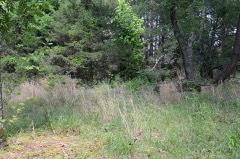 | Hardy Cemetery | 1.0 miles | 2009 |
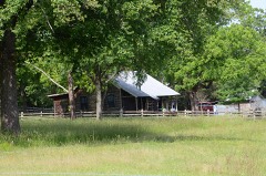 | Blessing Farmstead | 1.7 miles | 1990 |
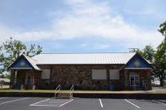 | Guy High School Gymnasium | 5.1 miles | 1992 |
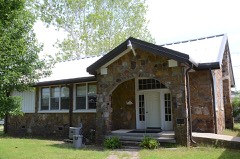 | Guy Home Economics Building | 5.1 miles | 1992 |
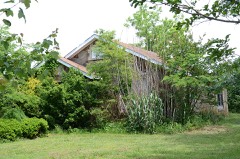 | E.E. Hooten House | 5.7 miles | 2005 |
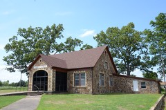 | Church of Christ | 5.8 miles | 2005 |
| National Archives record | The nomination case file for reference 100010313 in Record Group 79. |
| Faulkner County | All 64 listed properties in this county. |