 Block
From the record
One of 64 National Register listings published here for Faulkner County · listed in 2024 · category: Object.
Sources: the National Register database, National Park Service
Listed on the National Register of Historic Places in 2024.
One of 64 National Register listings published here for Faulkner County · listed in 2024 · category: Object.
Sources: the National Register database, National Park Service
Regional context, not property-specific evidence. The federal wildfire occurrence database lists 80 fires within 5 miles of Conway Mayes Marker between 1998 and 2020, burning about 571 acres in total. None started naturally. 9 were recorded as arson. Distance is straight-line from the map coordinates, so a fire counted here may appear on a neighbouring settlement's page as well.
| Reported cause | Fires |
|---|---|
| Debris and open burning | 42 |
| Missing data/not specified/undetermined | 17 |
| Arson/incendiarism | 9 |
| Equipment and vehicle use | 6 |
| Smoking | 5 |
| Railroad operations and maintenance | 1 |
The most recent of them, most recent first, with the day each was reported and the service that recorded it.
| Date | Cause | Size | Reported by | Name on the report |
|---|---|---|---|---|
| 9 September 1998 | Equipment and vehicle use | 1.0 acres | Arkansas Forestry Commission | not named |
| 8 September 2015 | Debris and open burning | 3.0 acres | Arkansas Forestry Commission | not named |
| 7 September 2000 | Smoking | 3.0 acres | Arkansas Forestry Commission | not named |
| 7 September 2000 | Arson/incendiarism | 3.0 acres | Arkansas Forestry Commission | not named |
| 5 September 2006 | Debris and open burning | 1.0 acres | Arkansas Forestry Commission | not named |
| 3 September 2005 | Debris and open burning | 2.0 acres | Arkansas Forestry Commission | not named |
| 18 September 2000 | Debris and open burning | 5.0 acres | Arkansas Forestry Commission | not named |
| 9 August 2000 | Debris and open burning | 5.0 acres | Arkansas Forestry Commission | not named |
Regional context, not property-specific evidence. The federal mineral resources record lists 3 workings within 5 miles of Conway Mayes Marker: 3 past producers. None of them still produces. What was taken out: Clay, Sand and Gravel, Construction, Stone. Distance is straight-line from the map coordinates, so a quarry counted here may appear on a neighbouring settlement's page as well.
Regional context, not property-specific evidence. The National Weather Service names Conway, the town this property stands in, in 186 storm reports between 1993 and 2025: 75 thunderstorm wind, 67 hail, 31 flash flood, 6 heavy rain. The reports record 1 death and 5 injuries. Each account below is quoted exactly as the forecast office filed it, from the NOAA Storm Events Database, and each date opens the federal record of that event.
| When | Event | Place named | Harm | What the report says |
|---|---|---|---|---|
| April 2004 | Lightning | Conway | 1 killed | no account filed |
| January 1996 | Thunderstorm Wind | Conway | 3 hurt | no account filed |
| July 1999 | Thunderstorm Wind | Conway | 2 hurt | no account filed |
| August 2010 | Flash Flood | Conway | $150,000 | Several streets flooded in downtown Conway. Cars stalled in the high water, and water entered a few businesses. |
| May 2022 | Thunderstorm Wind | Conway | $100,000 | Trees fell on homes and across roads, windows were damaged and there were power outages. |
| March 2019 | Thunderstorm Wind | Conway | $100,000 | Three cars were crushed by a tree in Conway. |
| April 2018 | Thunderstorm Wind | Conway | $50,000 | Storm damage occurred at the University of Central Arkansas Campus Carmichael Hall. |
| August 2011 | Thunderstorm Wind | Conway | $50,000 | A number of trees were blown down in the Conway area. Two of the trees fell on houses. A tree fell on Highway 25 in the Beaver Fork area, pulling down power lines and cable lines. A tree fell into a brick wall at the entrance to the Quail Creek subdivision. |
| June 1994 | Thunderstorm Wind | Conway | $50,000 | Some trees were blown down and several buildings were damaged. |
| February 2018 | Thunderstorm Wind | Conway | $40,000 | Trees were blown down in the city of Conway, including one that fell on a car and one that fell on a house. |
| May 2009 | Thunderstorm Wind | Conway | $40,000 | Several large trees were down. One tree fell on a house. |
| February 2018 | Thunderstorm Wind | Conway | $25,000 | Trees were blown down in the city of Conway... with one that fell on a car. |
| July 2014 | Thunderstorm Wind | Conway | $25,000 | A number of large trees were blown down. |
| June 2014 | Thunderstorm Wind | Conway | $25,000 | Numerous trees were blown down in Conway and around Faulkner County. |
| August 2012 | Thunderstorm Wind | Conway | $25,000 | Trees were blown down. |
| September 2012 | Thunderstorm Wind | Conway | $25,000 | Multiple trees were blown down. |
| June 2009 | Lightning | Conway | $15,000 | A day spa in Conway was damaged by a fire started by a lightning strike. |
| September 2009 | Thunderstorm Wind | Conway | $15,000 | A few trees were down in and around the city. |
| January 2007 | Flash Flood | Conway | $12,000 | Several roads across the county were impassible due to high water levels. |
| April 2023 | Thunderstorm Wind | Conway | $10,000 | A large tree was blown down on a building. This was a delayed report. |
| August 2011 | Thunderstorm Wind | Conway | $10,000 | Trees and power lines were blown down in downtown Conway. |
| October 2019 | Thunderstorm Wind | Conway | $5,000 | A carport was blown over on East German Lane in the town of Conway. |
| June 2015 | Flash Flood | Conway | $5,000 | Several roads in downtown Conway were severely flooded, with some businesses having water entering their buildings. |
| August 2012 | Thunderstorm Wind | Conway | $5,000 | A privacy fence and a few trees were blown down. |
| June 2012 | Thunderstorm Wind | Conway | $5,000 | Large tree limbs were blown down. One of the limbs went through the roof of a house. |
| July 2007 | Thunderstorm Wind | Conway | $2,000 | A fence was blown down and a trampoline was blown 100 yards. |
| April 1996 | Lightning | Conway | $2,000 | no account filed |
| July 2016 | Thunderstorm Wind | Conway | $1,000 | A strong outflow boundary downed trees on the UCA Campus. Power was knocked out on Campus as well. |
| August 2010 | Flash Flood | Conway | $1,000 | Siebenmorgen Rd. had 4 to 6 inches of water flowing across it. |
| February 2025 | Flash Flood | Conway | - | Multiple roads were impassable with road closures taking place. |
| May 2025 | Thunderstorm Wind | Conway | - | Multiple trees were blown down near Conway. |
| April 2025 | Thunderstorm Wind | Conway | - | A tree was blown over at Centennial Valley Golf Course in Conway. |
| June 2025 | Flash Flood | Conway | - | High water covered several roads in downtown Conway. |
| June 2025 | Hail | Conway | - | Quarter sized hail fell in the city of Conway, report via mPING. |
| August 2024 | Thunderstorm Wind | Conway | - | A tree branch was snapped in half in the city of Conway. |
| August 2024 | Thunderstorm Wind | Conway | - | Several tree limbs were blown down in the city of Conway. |
| August 2024 | Thunderstorm Wind | Conway | - | Numerous tree limbs blown down in the city of Conway. |
| July 2024 | Flash Flood | Conway | - | Multiple roads flooded in southern Conway as a result of high water via Stone Dan Creek overflowing out of its banks. |
| July 2024 | Flash Flood | Conway | - | In the city of Conway, water was over the roadway at the intersection of Sugar Creek Drive and Donaghey Avenue. |
| July 2024 | Flash Flood | Conway | - | In the community of Conway street flooding took place in downtown with a car becoming stranded in the water over the roadway. |
| July 2024 | Heavy Rain | Conway | - | A 24 hour rainfall total of 5.00 was measured at Greenbrier. |
| January 2023 | Flash Flood | Conway | - | A report was received from mPING of street flooding and/or vehicles stranded. |
| January 2023 | Flash Flood | Conway | - | A report was received from mPING of street flooding and/or vehicles stranded. |
| January 2023 | Flood | Conway | - | A report was received from mPING of a river or creek overflowing or cropland, yard, basement flooding. |
| January 2023 | Flash Flood | Conway | - | Street flooding was reported in the city of Conway on Oak St. and near Hendrix College. |
| June 2023 | Thunderstorm Wind | Conway | - | A mPING report of 3 inch tree limbs broken along with power poles broken. |
| June 2023 | Thunderstorm Wind | Conway | - | Numerous trees were blown down throughout the city of Conway. |
| May 2022 | Thunderstorm Wind | Conway | - | A social media picture showed a large tree limb down, approximately a foot in diameter. |
| April 2022 | Hail | Conway | - | This was an mPING report. |
| April 2022 | Hail | Conway | - | Quarter size hail fell off Nutter Chapel Road in Conway. |
| April 2022 | Hail | Conway | - | Hail was reported south of Dave Ward Drive and west of Donaghey. |
| July 2022 | Thunderstorm Wind | Conway | - | A tree was blown down on Rooster Rd. The time was based on radar data. |
| May 2020 | Flash Flood | Conway | - | Flooding was reported on Harkrider and Siebenmorgan Roads in Conway. |
| May 2020 | Flash Flood | Conway | - | Sixth street in downtown Conway flooded. |
| August 2019 | Flash Flood | Conway | - | Flooding was reported in Conway with water over Dave Ward Drive. |
| May 2019 | Thunderstorm Wind | Conway | - | Trees were reported down in Conway, AR. |
| February 2019 | Flash Flood | Conway | - | Several inches of water over the street. |
| February 2019 | Flash Flood | Conway | - | A creek overflowed, as well as yard and basement flooding. |
| February 2018 | Flash Flood | Conway | - | Multiple roads in and around Conway are barricaded due to flash flooding. |
| October 2018 | Flash Flood | Conway | - | South Germain (German) Rd. at Stone Dam Creek was closed due to flooding. |
No historic map-sheet match is published for this property yet. That does not mean no map exists. This record needs a coordinate-quality review before it can be joined to a sheet boundary. Browse the county's mapped places while that work is pending.
Other National Register properties close enough to walk or drive between, ordered by distance from this one. Both positions come from the same geocoding pass that matched these properties to their map sheets.
| Photograph | Property | Distance | Listed |
|---|---|---|---|
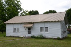 | Liberty School Cafeteria | 1.4 miles | 1992 |
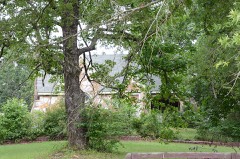 | Tyler-Southerland House | 4.3 miles | 2005 |
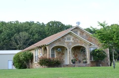 | Sellers House | 4.8 miles | 2005 |
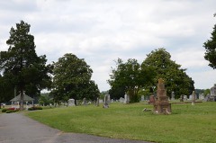 | Oak Grove Cemetery Historic Section | 5.5 miles | 2009 |
 | Century Flyer | 5.8 miles | 2010 |
 | Michael M. Hiegel House | 5.8 miles | 1998 |
| National Archives record | The nomination case file for reference 100010832 in Record Group 79. |
| Faulkner County | All 64 listed properties in this county. |