 Block
From the record
One of 29 National Register listings published here for Hempstead County · listed in 2024 · category: Site.
Sources: the National Register database, National Park Service
Listed on the National Register of Historic Places in 2024.
One of 29 National Register listings published here for Hempstead County · listed in 2024 · category: Site.
Sources: the National Register database, National Park Service
Regional context, not property-specific evidence. The federal wildfire occurrence database lists 39 fires within 5 miles of Saint Paul Methodist Church Cemetery. Historic Section between 1998 and 2018, burning about 362 acres in total. 5 started naturally. 17 were recorded as arson. Distance is straight-line from the map coordinates, so a fire counted here may appear on a neighbouring settlement's page as well.
| Reported cause | Fires |
|---|---|
| Arson/incendiarism | 17 |
| Debris and open burning | 10 |
| Natural | 5 |
| Missing data/not specified/undetermined | 4 |
| Equipment and vehicle use | 3 |
The most recent of them, most recent first, with the day each was reported and the service that recorded it.
| Date | Cause | Size | Reported by | Name on the report |
|---|---|---|---|---|
| 9 September 1999 | Natural | 3.0 acres | Arkansas Forestry Commission | not named |
| 6 September 1999 | Natural | 1.0 acres | Arkansas Forestry Commission | not named |
| 28 September 2016 | Debris and open burning | 2.0 acres | Arkansas Forestry Commission | not named |
| 28 September 2006 | Debris and open burning | 6.0 acres | Arkansas Forestry Commission | not named |
| 25 September 2012 | Equipment and vehicle use | 2.0 acres | Arkansas Forestry Commission | not named |
| 18 September 2011 | Natural | 15 acres | Arkansas Forestry Commission | not named |
| 18 September 2007 | Equipment and vehicle use | 1.0 acres | Arkansas Forestry Commission | not named |
| 30 August 1999 | Arson/incendiarism | 40 acres | Arkansas Forestry Commission | not named |
Regional context, not property-specific evidence. The federal mineral resources record lists 2 workings within 5 miles of Saint Paul Methodist Church Cemetery. Historic Section: 1 past producer, 1 producer. 1 still produces. What was taken out: Clay, Limestone, Dimension. Distance is straight-line from the map coordinates, so a quarry counted here may appear on a neighbouring settlement's page as well.
| Where | Site | Commodity | Status | Recorded |
|---|---|---|---|---|
| Sample Site | Clay | Past Producer | ||
| Saratoga Chalk Mine & Mill | Limestone, Dimension | Producer |
Regional context, not property-specific evidence. The National Weather Service names Ozan, the town this property stands in, in 16 storm reports between 1993 and 2026: 7 hail, 4 flash flood, 3 thunderstorm wind, 1 tornado. No death or injury is recorded in these reports. Each account below is quoted exactly as the forecast office filed it, from the NOAA Storm Events Database, and each date opens the federal record of that event.
| When | Event | Place named | Harm | What the report says |
|---|---|---|---|---|
| October 2009 | Flash Flood | Ozan | $250,000 | Numerous county roads were underwater and closed, including County Roads 2, 3, 5, 8, 9, 54, 333, 57, 198, 118 west, 50, 56, 189, 205, 254, 246, 243 and at Allen's Ferry Landing. Many of these roads were washed out. |
| November 1997 | Tornado (F1) | Ozan | $70,000 | OES chased a funnel cloud from just southeast of Alpine, southeastward across extreme eastern Howard County into Hempstead County. The funnel lowered throughout the chase until it touched down and was classified as a tornado 5.5 miles south of Nashville, AR. Damage initially consisted of broken and felled trees. The tornado then moved over cleared pastureland and intensified on CR318 between Hwy 4 and CR 44; totally destroying several chicken coups...leaving the chickens untouched...felling a tree onto a car, and slightly damaging a house. The tornado then began to weaken and rapidly dissipated. Skywarn spotters living in the area, the Hempstead County Judge and OES were eyewitnesses to the event. |
| January 2012 | Thunderstorm Wind | Ozan | $20,000 | Report of two damaged chicken houses on CR 1310 between Ozan and Nashville, Arkansas. |
| July 2010 | Lightning | Ozan | $20,000 | A strong thunderstorm developed over a pasture and lightning struck a tree with a herd of cattle standing underneath the tree. Approximately a dozen cows were killed. |
| April 2026 | Hail | Ozan | - | Golf ball size hail reported in the town of Ozan. |
| March 2023 | Hail | Ozan | - | Hail up to ping pong ball size reported near Ozan via social media. |
| May 2023 | Flash Flood | Ozan | - | Highway 278 was flooded just southeast of the Ozan community. |
| June 2021 | Flash Flood | Ozan | - | Hempstead Road 1315 was flooded and closed due to a washed out culvert. |
| June 2021 | Flash Flood | Ozan | - | County Road 333 was flooded and closed due to rushing water from the Middle Fork Ozan Creek. A car attempted to cross the flooded roadway and stalled in the high water. |
| August 2005 | Thunderstorm Wind | Ozan | - | Trees downed in the community of Yancy. |
| March 1993 | Hail | Ozan | - | Hail up to baseball-size covered the ground. |
| April 2014 | Hail | Ozan | - | no account filed |
| April 2012 | Hail | Ozan | - | no account filed |
| April 2007 | Hail | Ozan | - | no account filed |
| May 2001 | Hail | Ozan | - | no account filed |
| November 1996 | Thunderstorm Wind | Ozan | - | no account filed |
No historic map-sheet match is published for this property yet. That does not mean no map exists. This record needs a coordinate-quality review before it can be joined to a sheet boundary. Browse the county's mapped places while that work is pending.
Other National Register properties close enough to walk or drive between, ordered by distance from this one. Both positions come from the same geocoding pass that matched these properties to their map sheets.
| Photograph | Property | Distance | Listed |
|---|---|---|---|
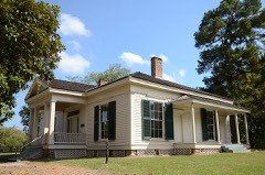 | Grandison D. Royston House | 5.5 miles | 1971 |
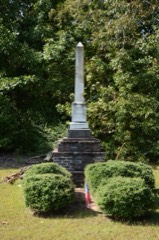 | Washington Confederate Monument | 6.1 miles | 1996 |
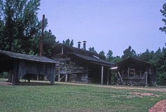 | Goodlett Gin | 6.3 miles | 1975 |
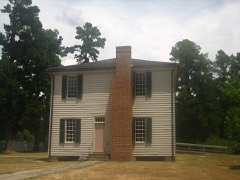 | Confederate State Capitol | 6.3 miles | 1972 |
| National Archives record | The nomination case file for reference 100010871 in Record Group 79. |
| Hempstead County | All 29 listed properties in this county. |