 Block
From the record
One of 160 National Register listings published here for Washington County · listed in 2012 · category: Object.
Sources: the National Register database, National Park Service
Listed on the National Register of Historic Places in 2012.
One of 160 National Register listings published here for Washington County · listed in 2012 · category: Object.
Sources: the National Register database, National Park Service
Regional context, not property-specific evidence. The federal wildfire occurrence database lists 14 fires within 5 miles of Strengthen the Arm of Liberty Monument between 2002 and 2017, burning about 40 acres in total. 2 started naturally. None was recorded as arson. Distance is straight-line from the map coordinates, so a fire counted here may appear on a neighbouring settlement's page as well.
| Reported cause | Fires |
|---|---|
| Missing data/not specified/undetermined | 6 |
| Debris and open burning | 6 |
| Natural | 2 |
The most recent of them, most recent first, with the day each was reported and the service that recorded it.
| Date | Cause | Size | Reported by | Name on the report |
|---|---|---|---|---|
| 28 August 2012 | Natural | 3.0 acres | Arkansas Forestry Commission | not named |
| 2 August 2012 | Natural | 4.0 acres | Arkansas Forestry Commission | not named |
| 12 August 2005 | Debris and open burning | 3.0 acres | Arkansas Forestry Commission | not named |
| 1 August 2005 | Debris and open burning | 3.0 acres | Arkansas Forestry Commission | not named |
| 4 July 2013 | Missing data/not specified/undetermined | 1.0 acres | Arkansas Forestry Commission | not named |
| 27 July 2012 | Missing data/not specified/undetermined | 1.0 acres | Arkansas Forestry Commission | not named |
| 24 July 2005 | Debris and open burning | 3.0 acres | Arkansas Forestry Commission | not named |
| 11 July 2011 | Missing data/not specified/undetermined | 5.0 acres | Arkansas Forestry Commission | not named |
Regional context, not property-specific evidence. The federal mineral resources record lists 14 workings within 5 miles of Strengthen the Arm of Liberty Monument: 12 past producers, 2 producers. 2 still produce. What was taken out: Sand and Gravel, Construction, Limestone, Dimension, Stone, Crushed/Broken. Distance is straight-line from the map coordinates, so a quarry counted here may appear on a neighbouring settlement's page as well.
| Where | Site | Commodity | Status | Recorded |
|---|---|---|---|---|
| Johnson Quarry & Plant | Stone, Crushed/Broken | Producer | ||
| Mcclinton Bros Co | Limestone, Dimension | Past Producer | ||
| Unk | Limestone, Dimension | Past Producer | ||
| Unk | Limestone, Dimension | Past Producer | ||
| Cove Creek Pit & Plant | Sand and Gravel, Construction | Producer | ||
| Unk | Sand and Gravel, Construction | Past Producer | ||
| Unk | Sand and Gravel, Construction | Past Producer | ||
| Unk | Sand and Gravel, Construction | Past Producer | ||
| Unk | Sand and Gravel, Construction | Past Producer | ||
| Unk | Sand and Gravel, Construction | Past Producer |
Regional context, not property-specific evidence. The National Weather Service names Fayetteville, the town this property stands in, in 164 storm reports between 1993 and 2026: 70 hail, 67 thunderstorm wind, 22 flash flood, 3 flood. The reports record 1 death and 3 injuries. Each account below is quoted exactly as the forecast office filed it, from the NOAA Storm Events Database, and each date opens the federal record of that event.
| When | Event | Place named | Harm | What the report says |
|---|---|---|---|---|
| May 2022 | Flash Flood | Fayetteville | 1 killed | Portions of Town Branch Creek and Cato Springs Branch Creek flooded nearby roads. A woman was swept away by flood water near where Beechwood Avenue crosses Town Branch Creek. |
| February 1997 | Thunderstorm Wind | Fayetteville | 3 hurt, $150,000 | no account filed |
| July 2003 | Hail | Fayetteville | $50,000,000 | Hail up to the size of baseballs did damage did extensive damage across a large part of Fayetteville. Cars and roofs of buildings were especially devastated. |
| April 1996 | Hail | Fayetteville | $9,000,000 | no account filed |
| August 2009 | Hail | Fayetteville | $500,000 | Tea cup size hail damaged numerous homes and automobiles. |
| April 1994 | Thunderstorm Wind | Fayetteville | $500,000 | Thunderstorm winds blew down several trees and a small sign at the University of Arkansas. Some buildings also had a few windows blown out. |
| June 1994 | Thunderstorm Wind | Fayetteville | $500,000 | Thunderstorm winds knocked down some trees. Several of the trees fell onto homes and cars. |
| April 2011 | Flash Flood | Fayetteville | $100,000 | Several roads on the southeast side of Fayetteville were flooded. Flood water entered homes in the Stonebridge Meadows subdivision on River Meadows Drive south of Goff Farm road. Another area where water was entering homes was near the intersection of Goff Farm Road and Cherry Hills Drive. |
| April 2011 | Hail | Fayetteville | $100,000 | no account filed |
| May 2022 | Flash Flood | Fayetteville | $50,000 | Fayetteville FD performed multiple swift water rescues for people stranded in their vehicles in flood water near W Wedington Drive and I-49. Apartments and several homes in the area were evacuated due to the rising flood water. |
| June 2002 | Thunderstorm Wind | Fayetteville | $50,000 | Thunderstorm winds estimated at 70 miles an hour downed trees and power lines. The wind also damaged the roof of an apartment building. Twelve residents of the apartment building were displaced as water poured through the damaged roof and through their ceilings. |
| April 2000 | Thunderstorm Wind | Fayetteville | $50,000 | Thunderstorm winds blew a semi truck over. |
| June 1999 | Lightning | Fayetteville | $50,000 | Lightning caused fires at two separate homes in Fayetteville between 9:00 and 9:40 AM CDT. |
| April 1994 | Thunderstorm Wind | Fayetteville | $50,000 | Several homes and businesses sustained roof damage. |
| June 1994 | Thunderstorm Wind | Fayetteville | $50,000 | Thunderstorm winds blew down some trees and power lines. |
| May 1995 | Thunderstorm Wind | Fayetteville | $50,000 | no account filed |
| June 1997 | Thunderstorm Wind | Fayetteville | $35,000 | no account filed |
| July 2018 | Thunderstorm Wind | Fayetteville | $25,000 | Strong thunderstorm wind damaged the siding of a home in the western part of the city. Three structures at the Arkansas Agricultural Research Center were destroyed by strong thunderstorm wind. |
| April 2011 | Hail | Fayetteville | $25,000 | no account filed |
| April 2011 | Hail | Fayetteville | $25,000 | no account filed |
| April 2011 | Hail | Fayetteville | $25,000 | no account filed |
| June 2019 | Flash Flood | Fayetteville | $20,000 | Cars were partially submerged in flooding along Martin Luther King Jr. Boulevard in Fayetteville. |
| May 1999 | Thunderstorm Wind | Fayetteville | $20,000 | High winds blew the roof off of a clothing store in the 2300 block of College Avenue in Fayetteville. The ASOS at the Fayetteville Regional Airport (Drake Field) measured a peak wind gust of 47 knots (54 mph). |
| March 2015 | Thunderstorm Wind | Fayetteville | $15,000 | Strong thunderstorm wind blew down a tree onto a car. |
| July 2016 | Thunderstorm Wind | Fayetteville | $10,000 | Strong thunderstorm wind blew down a large tree and power lines. |
| February 2001 | Thunderstorm Wind | Fayetteville | $10,000 | Thunderstorm winds blew down a tree which damaged three cars. |
| May 1999 | Thunderstorm Wind | Fayetteville | $10,000 | Siding was blown off several houses in Fayetteville. Tree limbs were also blown down. |
| June 2017 | Hail | Fayetteville | $10,000 | no account filed |
| August 2017 | Hail | Fayetteville | $10,000 | no account filed |
| April 2011 | Hail | Fayetteville | $10,000 | no account filed |
| February 1997 | Thunderstorm Wind | Fayetteville | $6,000 | no account filed |
| July 2012 | Thunderstorm Wind | Fayetteville | $5,000 | Strong thunderstorm wind blew down large tree limbs and power lines on West Deane Street. |
| September 2012 | Thunderstorm Wind | Fayetteville | $5,000 | Power lines were blown down by strong thunderstorm wind in south Fayetteville. |
| May 2011 | Thunderstorm Wind | Fayetteville | $5,000 | Strong thunderstorm wind blew down power lines and large tree limbs. |
| August 2006 | Thunderstorm Wind | Fayetteville | $5,000 | Thunderstorm winds estimated at 70 miles an hour blew down numerous trees. Several of the trees blocked roads. Power lines were also blown down leaving 6000 customers without electricity. |
| August 2002 | Thunderstorm Wind | Fayetteville | $5,000 | Thunderstorm winds estimated at 60 miles an hour blew down two main line power poles along Garland Avenue. This caused power to be cut off to 1400 customers. |
| November 2001 | Thunderstorm Wind | Fayetteville | $5,000 | Thunderstorm winds estimated at 70 miles an hour blew down trees and power lines. |
| May 1998 | Flood | Fayetteville | $5,000 | AQ Chicken reported severe flooding and had to be closed until they could reclaim all of the dead chickens that floated away. There was an unofficial report of 1.5 inches in Wedington Woods falling in less than one hour. Debris was washed from ditches into streets in the city of Fayetteville. |
| August 2017 | Hail | Fayetteville | $5,000 | no account filed |
| June 1997 | Thunderstorm Wind | Fayetteville | $5,000 | no account filed |
| April 1995 | Hail | Fayetteville | $5,000 | no account filed |
| August 2017 | Thunderstorm Wind | Fayetteville | $2,000 | Strong thunderstorm wind snapped large tree limbs and blew down power poles. |
| August 2017 | Thunderstorm Wind | Fayetteville | $1,000 | Strong thunderstorm wind blew down power lines near Morningside Drive and 15th Street on the southeast side of Fayetteville. |
| November 1998 | Thunderstorm Wind | Fayetteville | $1,000 | Numerous trees were blown down from 2-5 miles south of Fayetteville. |
| January 1996 | Thunderstorm Wind | Fayetteville | $1,000 | no account filed |
| May 1999 | Thunderstorm Wind | Fayetteville | $500 | Numerous large tree branches were blown down in Fayetteville. |
| May 1998 | Lightning | Fayetteville | $500 | Lightning hit a tranformer in downtown Fayetteville, knocking out power to some downtown buildings |
| March 1998 | Thunderstorm Wind | Fayetteville | $200 | Tree downed on a road on the west side of Fayetteville. |
| May 2000 | Thunderstorm Wind | Fayetteville | $100 | Thunderstorm winds blew down several large tree limbs. |
| May 2000 | Thunderstorm Wind | Fayetteville | $100 | Thunderstorm winds blew down several large tree limbs. |
| July 2000 | Thunderstorm Wind | Fayetteville | $100 | Thunderstorm winds blew down several large tree limbs. |
| May 1998 | Thunderstorm Wind | Fayetteville | $100 | OES Director reported a tree down along SH 112 in north Fayetteville. |
| June 1996 | Thunderstorm Wind | Fayetteville | $100 | no account filed |
| April 2026 | Thunderstorm Wind | Fayetteville | - | Strong thunderstorm wind snapped large tree limbs. |
| May 2025 | Flash Flood | Fayetteville | - | Several streets were reported flooded in Fayetteville. |
| May 2025 | Flash Flood | Fayetteville | - | Portions of N Shiloh Drive were flooded. |
| June 2025 | Flood | Fayetteville | - | Numerous water rescues were conducted across Washington County as a result of flooding. |
| March 2024 | Thunderstorm Wind | Fayetteville | - | Strong thunderstorm wind blew down a large tree. |
| August 2024 | Thunderstorm Wind | Fayetteville | - | Strong thunderstorm wind blew down trees. |
| August 2024 | Thunderstorm Wind | Fayetteville | - | Strong thunderstorm wind blew down several trees. |
No historic map-sheet match is published for this property yet. That does not mean no map exists. This record needs a coordinate-quality review before it can be joined to a sheet boundary. Browse the county's mapped places while that work is pending.
Other National Register properties close enough to walk or drive between, ordered by distance from this one. Both positions come from the same geocoding pass that matched these properties to their map sheets.
| Photograph | Property | Distance | Listed |
|---|---|---|---|
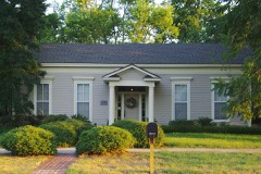 | Troy Gordon House | 1.3 miles | 1978 |
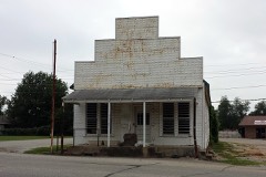 | Johnson Switch Building | 1.5 miles | 1999 |
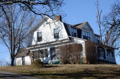 | Hemingway House and Barn | 1.6 miles | 1982 |
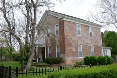 | Jackson House | 2.0 miles | 1982 |
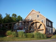 | Johnson House and Mill | 2.0 miles | 1976 |
 | Fayetteville Veterans Administration Hospital | 2.1 miles | 2012 |
| National Archives record | The nomination case file for reference 12000279 in Record Group 79. |
| Washington County | All 160 listed properties in this county. |