BlockBefore
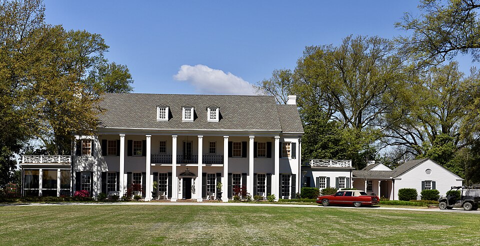
Photograph of Wilson Residential Historic District
Photograph by Jim Roberts, CC BY-SA 4.0. Via Wikimedia Commons.

Wilson Residential Historic District

Listed on the National Register of Historic Places in 2016.

From the record

“The Wilson Residential Historic District encompasses a cluster of four upscale residences just northeast of downtown Wilson, Arkansas, a city in Mississippi County, Arkansas. Founded in 1886 as a company town by Robert Edward Lee Wilson, the city's growth was regulated and planned by the company until it was formally incorporated in 1950.”

Wikipedia article Wilson Residential Historic District, CC BY-SA 4.0.

One of 40 National Register listings published here for Mississippi County · listed in 2016 · category: District.

Sources: the Wikipedia article · the National Register database, National Park Service

The listing

  • Address. 4737, 4785, 4877 & 5101 US 61, Wilson, 72395
  • When was it listed? September 2016
  • Category. district
  • Township. Golden Lake township
  • National Register reference number. 16000652 - assigned by the National Park Service when the property was listed.

Storms near this property

17 since 1994

Regional context, not property-specific evidence. The National Weather Service names Wilson, the town this property stands in, in 17 storm reports between 1994 and 2025: 11 thunderstorm wind, 5 hail, 1 tornado. No death or injury is recorded in these reports. Each account below is quoted exactly as the forecast office filed it, from the NOAA Storm Events Database, and each date opens the federal record of that event.

WhenEvent Place namedHarm What the report says
May 2008Thunderstorm WindWilson$10,000Straight line winds blew trees down in Wilson. A broadcast booth of a football stadium was blown down and an equipment barn was destroyed as well.
August 2002Thunderstorm WindWilson$10,000Several power lines and a large tree were blown down.
May 2025Thunderstorm WindWilson$5,000Multiple large trees down in Wilson.
June 2023Thunderstorm WindWilson$5,000Several trees were knocked down in the Wilson area.
June 2023Thunderstorm WindWilson$5,000Trees were knocked down across the railroad tracks in Wilson.
May 2000Thunderstorm WindWilson$5,000A few trees were knocked down.
June 1994Thunderstorm WindWilson$5,000Thunderstorm winds downed some trees and telephone poles.
May 2025Thunderstorm WindWilson$3,000Trees down across Hwy 61.
January 2020Thunderstorm WindWilson$2,000The siding was stripped from part of a house in Wilson.
November 2007HailWilson$2,000Penny size hail was covering the ground.
July 1997Thunderstorm WindWilson$1,000Several trees and power lines were knocked down.
October 1996Thunderstorm WindWilson$1,000no account filed
June 1995HailWilson$100no account filed
January 1999Tornado (F0)Wilson$50A tornado briefly touched down near Wilson producing little damage.
June 1994HailWilson-Thunderstorm winds downed some trees and telephone poles.
June 2023HailWilson-no account filed
April 2015HailWilson-no account filed

Every storm recorded in Mississippi County

Map coverage status

No historic map-sheet match is published for this property yet. That does not mean no map exists. This record needs a coordinate-quality review before it can be joined to a sheet boundary. Browse the county's mapped places while that work is pending.

Listed places nearby

6 within 8 miles

Other National Register properties close enough to walk or drive between, ordered by distance from this one. Both positions come from the same geocoding pass that matched these properties to their map sheets.

Photograph PropertyDistance Listed
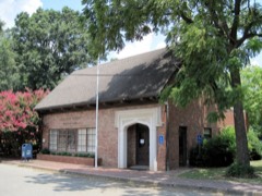
Wilson Community House0.7 miles2015
Wilson Commercial Historic District0.9 miles2016
Wilson Motor Company1.2 miles2019
Wilson High School Gymnasium1.4 miles2015
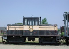
Delta Valley & Southern Railway Locomotive #503.2 miles2007
Keiser School7.2 miles1992

Sources for this property

National Archives recordThe nomination case file for reference 16000652 in Record Group 79.
Wikipedia articleCommunity-written account of this property, licensed CC BY-SA.
Mississippi CountyAll 40 listed properties in this county.

Provenance

  • Listing record. National Park Service National Register of Historic Places, listed-properties dataset, current to 2026-05-22.
  • Map join. Address geocoded through the United States Census geocoder, then tested against the published boundary of every sheet in the USGS Historical Topographic Map Collection.
  • How this page is made. Listing fields come from federal records; map-sheet coverage is a labelled coordinate-to-boundary calculation, not a source-field claim.
  • Storms. NOAA National Centers for Environmental Information, Storm Events Database https://www.ncei.noaa.gov/stormevents/ A work of the United States government, no copyright under 17 U.S.C. 105. Narratives are quoted verbatim from the National Weather Service report and are not edited or summarised.