Block
From the record
40 National Register listings published here.
Sources: the National Register database, National Park Service
85 topographic sheets cover 124 settlements here, and 40 properties are on the National Register of Historic Places.
40 National Register listings published here.
Sources: the National Register database, National Park Service
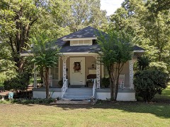
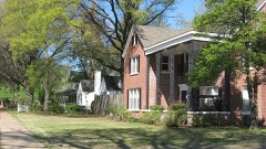
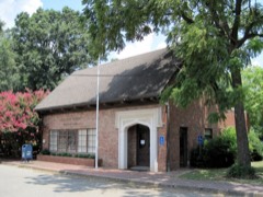
Every property in this county listed on the National Register of Historic Places, with the year it was listed and the federal nomination document.
Every wildfire the federal occurrence database records inside this county: 6 of them, burning about 84 acres. None started naturally and none was recorded as arson. Each settlement page carries the fires within five miles of it.
| Reported cause | Fires |
|---|---|
| Debris and open burning | 4 |
| Smoking | 1 |
| Missing data/not specified/undetermined | 1 |
The five largest, by the area the report gives. None of them was recorded as arson.
| Date | Cause | Size | Reported by | Name on the report |
|---|---|---|---|---|
| 9 September 1999 | Debris and open burning | 40 acres | Arkansas Forestry Commission | not named |
| 6 August 1999 | Debris and open burning | 35 acres | Arkansas Forestry Commission | not named |
| 5 September 1999 | Debris and open burning | 4.0 acres | Arkansas Forestry Commission | not named |
| 19 September 1999 | Missing data/not specified/undetermined | 3.0 acres | Arkansas Forestry Commission | not named |
| 13 September 1999 | Debris and open burning | 2.0 acres | Arkansas Forestry Commission | not named |
| 23 June 2007 | Smoking | under an acre | Central Arkansas Refuges Complex | LEVEE FIRE |
Every settlement page carries the fires within five miles of it - see the settlement index below.
The NOAA Storm Events Database holds 510 reports for this county, causing 9 deaths, 153 injuries and about $35,177,450 in recorded property damage. Each settlement page carries the reports that name it.
| Kind of event | Reports |
|---|---|
| Thunderstorm Wind | 258 |
| Hail | 145 |
| Tornado | 59 |
| Flash Flood | 26 |
| Flood | 10 |
| Lightning | 9 |
| Heavy Rain | 2 |
| Funnel Cloud | 1 |
The most serious of them, by death, then injury, then recorded damage. The accounts are quoted exactly as the forecast office filed them.
| When | Event | Place named | Harm | What the report says |
|---|---|---|---|---|
| April 1998 | Tornado (F4) | Manila | 2 killed, 12 hurt, $350,000 | The tornado began just west of Manila and tracked northeast. The tornado demolished or heavily damaged several homes including some mobile homes. Two children were killed in one of these mobile homes. The tornado continued northeast flattening a discount department store and an gas station/food mart. Three small factory and machine shop buildings as well as a furniture store were destroyed. Several other buildings were seriously damaged. The tornado reached the main residential section of Manila destroying several homes. Numerous trees and power lines were also blown down. |
| March 1952 | Tornado (F3) | not stated | 1 killed, 57 hurt, $250,000 | no account filed |
| March 1952 | Tornado (F3) | not stated | 1 killed, 57 hurt, $250,000 | no account filed |
| February 1954 | Tornado (F3) | not stated | 1 killed, 4 hurt, $25,000 | no account filed |
| December 2021 | Tornado (EF3) | Leachville | 1 killed, $1,250,000 | After crossing from Craighead County into Mississippi County the tornado struck the northern portions of Leachville, in northwestern Mississippi County. Several homes suffered partial or complete roof loss in northwestern Leachville. A restaurant, store, and cotton gin suffered considerable damage along Highway 77, and numerous power poles were snapped. A fatality occurred in the store. Anchors to the store's metal frame were pulled out of the concrete foundation. The tornado's path was estimated at nearly a mile wide in this area. The tornado approached the Little River area south of Hornersville, near the Arkansas/Missouri state line. A stand of trees was debarked east of Arkansas County Road 243. Several homes and mobile homes were heavily damaged or destroyed along State Line Road. Additional debarking of trees was noted. The tornado then crossed into Dunklin County, Missouri. Peak winds in Mississippi County were estimated at 145 mph. |
| July 2014 | Lightning | Carrolls Corner | 1 killed | Lightning struck and killed a teenager as he was running to take cover from a storm. He was found underneath a tree in a church's parking lot. |
| March 2011 | Flood | Luxora | 1 killed | An elderly man drove his truck into flood waters when he lost control of the vehicle in the current causing the cab to fill with water. The passenger of the vehicle died as a result. |
| June 1999 | Lightning | Blytheville | 1 killed | A man was killed by a lightning strike while working on the roof of a building. |
| February 1952 | Tornado (F2) | not stated | 5 hurt | no account filed |
| September 1959 | Tornado (F3) | not stated | 4 hurt, $250,000 | no account filed |
| April 1965 | Tornado (F2) | not stated | 4 hurt, $2,500 | no account filed |
| May 1968 | Tornado (F4) | not stated | 3 hurt, $25,000 | no account filed |
| February 2018 | Tornado (EF2) | Keiser | 1 hurt, $1,000,000 | The tornado started just southwest of the town of Keiser. Several buildings in town lost parts of their roofs and had windows blown out. A couple of buildings had partial or entire roof loss. Blown transformers and downed trees were observed across the community. The tornado continued through fields and then crossed Interstate 55, causing considerable damage to a hotel. Additional damage was noted to a metal building facility near Keiser Road and Denso Road. The tornado continued northeast over open fields, lifting before reaching South County Road 535. Peak winds were estimated at 125 mph. |
| May 2008 | Tornado (EF2) | Three Way | 1 hurt, $500,000 | A tornado touched down just south of Etowah, near the Garden Point Community, and tracked northeast to near Carrolls Corner. The track was nearly continuous for roughly 4 miles. Most of the damage occurred on a half mile stretch of Highway 77 between Highway 140 and Highway 297. Two homes sustained major damage. The roof was blown off of one home and the back side of another home was torn off. Four other homes sustained moderate damage and another home sustained minor damage. One person was injured. A car dealership was also completely destroyed along with ten used vehicles on the car lot. Several out buildings were also destroyed. Numerous trees, power poles, and power lines were knocked down along the path. There was also one mobile home destroyed on County Road 121. A recreational vehicle and an irrigation system were also overturned. |
| October 2014 | Thunderstorm Wind | Osceola Harwell Arpt | 1 hurt, $150,000 | Straight line winds produced minor damage to homes in a residential neighborhood and to several businesses mainly from shingle damage or from falling trees. The most significant damage was to a convenience store which had the roof shifted off which then caused a load bearing wall to collapse. One minor injury occurred as a result. |
| May 2000 | Tornado (F1) | Carmi | 1 hurt, $20,000 | The tornado began near Carmi and moved northeast toward Leachville. A few mobile homes were damaged. Several trees and power lines were knocked down. |
| June 1954 | Tornado (F1) | not stated | 1 hurt, $2,500 | no account filed |
| June 2006 | Lightning | Victoria | 1 hurt, $10 | A man was injured when he was struck by lightning near Victoria. He was taken to the hospital and the extent of his injuries was unknown. |
| July 2010 | Lightning | Joiner | 1 hurt | A man was struck by lightning while standing out on a balcony in Joiner. The lightning first struck a nearby tree and then jumped to the balcony striking and injuring the man. |
| April 1984 | Tornado (F3) | not stated | $25,000,000 | no account filed |
| May 2011 | Flood | St Thomas | $750,000 | The Mississippi River rose to near record levels at Osceola during the beginning and middle part of May. About 50 homes were damaged by backwater flooding from the Mississippi River into tributaries and along the Mississippi River itself. Several thousand acres of agriculture fields were flooded. Several roads were flooded and/or damaged. The river remained above flood stage through the end of the month. |
| May 2010 | Flash Flood | Whitton | $750,000 | Very heavy rain produced widespread flooding in portions of Mississippi County especially the Osceola area where at least 35 homes were affected by flood waters. At any one point homes had anywhere from two inches to up to a foot of water inside. The most concentrated area of flooded homes occurred near the Osceola Country Club. In Wilson, flooding forced the closure of Hampson Archaeological Museum State Park, which had 4 feet on its grounds and seepage occurred inside the museum building. In Lepanto, several homes were flooded. In total, 70 homes were affected by flood waters in Mississippi County where eight inches of rain fell in less than a 24 hour period. |
| May 2003 | Tornado (F2) | Carmi | $400,000 | The tornado moved into Mississippi County from Craighead County and continued to move northeast. Three homes were destroyed and several others were damaged. A car was damaged when a tree fell on it. Six farm pivots were damaged. |
| April 2017 | Tornado (EF1) | Wilson Jct | $300,000 | Tornado began approximately 1.5 west southwest of Dell and moved northeast along Highway 18, eventually lifting 4 miles northeast of Dell. The tornado was on the ground for roughly 6 minutes. A mobile home was destroyed and several buildings at a cotton gin were damaged. Multiple tree damage as well as damage to roofs was also observed. Peak winds were estimated at 105 mph. |
| April 1989 | Tornado (F1) | not stated | $250,000 | no account filed |
| May 1965 | Tornado (F2) | not stated | $250,000 | no account filed |
| May 1955 | Tornado (F2) | not stated | $250,000 | no account filed |
| December 2021 | Thunderstorm Wind | Cottonwood Corner | $150,000 | Powerful straight-line winds destroyed a mobile home on Cottonwood Corner Road west of Osceola. Several power lines were knocked down in Osceola. Trucks were overturned west of Osceola and a truck was blown off I-55. Power lines were knocked down in Luxora. |
| April 2022 | Tornado (EF0) | Garson | $110,000 | This tornado began just south of West County Road 70 in the Garson area causing damage to hardwood trees. As the tornado moved northeast across agricultural land, several center pivot irrigation systems were rolled. The tornado crossed into Dunklin County near County Road 645, damaging a mobile home unit and additional center pivot irrigation systems along Missouri Route K and County Road 626. An outbuilding was damaged along County Road 655 with the tornado lifting as it moved into Hornersville. Thanks to NSSL for assistance with this damage survey. |
| January 2020 | Thunderstorm Wind | Joiner | $100,000 | Several homes and mobile homes sustained significant damage. Numerous trees were knocked down across the Joiner. |
| April 2017 | Flash Flood | Marie | $100,000 | Trucks under water in the city of Marie. |
| January 2008 | Tornado (EF1) | Brymar | $100,000 | A tornado formed just southwest of Driver and lifted just northeast of Grider. The tornado was 75 yards wide and 3.5 miles in length. Numerous homes sustained roof damage and many trees were knocked down along the path of the tornado. People were initially trapped in a residence but were rescued. A metal farm equipment building at U.S. Highway 61 and South County Road 503 was shifted off its foundation. A vehicle was also destroyed. |
| March 2021 | Tornado (EF1) | Marie | $75,000 | This tornado broke several power poles along Highway 14 south of Marie. A mobile home was heavily damaged along County Road 447. Further to the northeast, a storage building was destroyed along County Road 471. The last observed damage was tree limbs along County Road 860. Peak winds were estimated at 95 mph. |
| April 2001 | Thunderstorm Wind | Osceola | $75,000 | A hotel had its metal roof torn off and had its doors blown off. Several cars were damaged near the hotel. One business had its plate glass window demolished. Another business had two buildings damaged. Several power lines and power poles were blown down. |
| January 1999 | Thunderstorm Wind | Lennie | $75,000 | Two trailer home were destroyed and another five homes were damaged. Several trees and power lines were also blown down. |
| January 1996 | Thunderstorm Wind | Burdette | $70,000 | no account filed |
| May 2025 | Thunderstorm Wind | Rotan | $60,000 | At least six power poles were snapped along Hwy 61 between Osceola and Hwy 198. |
| October 2013 | Thunderstorm Wind | Milligan Ridge | $60,000 | Straight line winds produced some minor damage to a farm shop building and a few grain bins in Milligan Ridge. Power lines were knocked down as well. |
| June 2025 | Flash Flood | Osceola | $50,000 | Some roads were flooded in Osceola. A home was inundated with two feet of water. |
| April 2022 | Tornado (EF0) | West Ridge | $50,000 | The tornado began near Highway 140 and West County Road 738 in the West Ridge community. A metal building and a home sustained minor damage and much of the roof was removed from the old school building on Highway 297 just east of Highway 140. The tornado continued northeast, depositing debris in the field downstream of the school, eventually crossing the intersection of Highways 140 and 136 on the east side of Three Way. Minor roof and tree damage was observed here with the tornado quickly lifting. Peak winds were estimated at 80 mph. Thanks to NSSL for assistance with this damage survey. |
| May 2017 | Thunderstorm Wind | Whitton | $50,000 | Large tree fell on a house in Whitton. |
| April 2003 | Lightning | Burdette | $50,000 | A house was destroyed by a fire started by lightning. |
| June 1998 | Thunderstorm Wind | Gosnell | $50,000 | One home near Gosnell was destroyed by a blown down tree. Some highway equipment was also damaged. Trees and interstate highway signs were also knocked down. A tree also fell on a house 10 miles northeast of Blytheville producing major damage to the house. |
| June 1995 | Hail | Gosnell | $50,000 | Hail was reported to be the size of a pigeon egg. |
| August 1993 | Thunderstorm Wind | Blytheville | $50,000 | Thunderstorm winds downed numerous trees and power lines. Some roads were blocked for a time by fallen trees. |
| March 2017 | Thunderstorm Wind | Hickman | $40,000 | Roof blown off a four-plex apartment. |
| May 2000 | Thunderstorm Wind | Blytheville | $40,000 | Several cotton wagons are blown over. A few power poles were snapped. A privacy fence was also blown down. A carport had a wall blown out. Numerous trees were knocked down. One tree fell on a garage. |
| March 2021 | Tornado (EF0) | Bardstown | $35,000 | A tornado uprooted trees and blew down a sign as it approached Interstate 55. As it crossed I-55, the tornado blew over a semi-tractor-trailer. The tornado broke tree limbs just east of I-55. Peak winds were estimated at 75 mph. |
| May 2000 | Thunderstorm Wind | Leachville | $35,000 | A shed and a farm shop were destroyed in Leachville. A home was damaged in Manila. Several trees and power lines were knocked down. |
| May 2025 | Thunderstorm Wind | Blytheville Aprt | $30,000 | A swath of straight-line winds affected the area near Blytheville Municipal Airport, north of the community of Armorel. A center-pivot irrigation system was overturned between the airport and N County Road 791, while the Blytheville ASOS measured a 60 mph wind gust. Further east, trees and stockade fences were downed in the Birchwood Estates subdivisions, with at least one home suffering minor roof damage. A second center-pivot irrigation system was overturned near the intersection of County Road 919 and E County Road 122. Maximum wind gusts were estimated at 80 mph. |
| March 2017 | Thunderstorm Wind | Armorel | $30,000 | Widespread damage to fences and outbuildings. |
| April 2017 | Thunderstorm Wind | Dearman | $30,000 | The side of a farm shop building was blown down. |
| February 2025 | Flash Flood | Gosnell | $25,000 | Several roads were flooded in the Gosnell area. Water reached at least one home. |
| April 2025 | Thunderstorm Wind | Burdette | $25,000 | A swath of straight line winds uprooted and snapped trees, knocked down power poles, and overturned an irrigation pivot in northeast Mississippi County. |
| March 2023 | Tornado (EF3) | St Thomas | $25,000 | The tornado that tracked through Wynne, Arkansas eventually moved from through the oxbows of the Mississippi River crossing between Tennessee and Arkansas a couple of times. Significant tree damage along the Mississippi River occurred. As the tornado passed over Corna Lake in Tipton County (the west side of the Mississippi River) and extreme southern Mississippi County, EF- 3 damage was observed. The tornado then crossed the Mississippi River into Tipton County, Tennessee. Peak winds were estimated at 145 mph in Mississippi County. |
| April 2023 | Thunderstorm Wind | Birdsong | $25,000 | A semi-truck was overturned on I-55. |
| June 2023 | Thunderstorm Wind | Joiner | $25,000 | A large tree fell on a mobile home on the west side of Joiner. |
| July 2014 | Lightning | Osceola Muni Arpt | $25,000 | Lightning struck a building at the Osceola Municipal Airport. As a result, a fire occurred which caused major damage to the building. |
| March 2008 | Thunderstorm Wind | Yarbro | $25,000 | Straight line winds knocked down several telephone poles and damaged a few transformers in Yarbro. |
| May 2003 | Tornado (F1) | Keiser | $25,000 | The tornado touched down southwest of Keiser and tracked northeast. Several homes were damaged and some trees were blown down. |
The Survey's mineral resources record lists 1 working inside this county. It is closed or unrecorded. Each settlement page carries the workings within five miles of it.
| Commodity | Workings |
|---|---|
| Sand and Gravel, Construction | 1 |
The least common of them first, because a county's hundredth gravel pit says nothing its first ten did not.
| Where | Site | Commodity | Status | Recorded |
|---|---|---|---|---|
| Unk | Sand and Gravel, Construction | Past Producer |
Named settlements recorded in the Geographic Names Information System, each with the topographic sheets covering it. Villages, hamlets and abandoned places alike. Each is shown with the nearest named watercourse or landform and the survey quadrangle it falls on.
Big Lake township · 72442 · On Sand Slough · Manila South quadrangle
11 sheets, 1941 to 1986
Chickasawba township · 72315 · Near Chickasawba Mound · Blytheville quadrangle
10 sheets, 1939 to 1986
Big Lake township · 72442 · Manila North quadrangle
11 sheets, 1941 to 1986
No longer a settlement
Chickasawba township · 72315 · On Chickasawba Mound · Blytheville quadrangle
10 sheets, 1939 to 1986
Golden Lake township · 72350 · Near Dean Island · Pecan Point quadrangle
14 sheets, 1931 to 1986
Chickasawba township · 72315 · On Dogwood Ridge · Blytheville quadrangle
10 sheets, 1939 to 1986
Little River township · 72428 · Near Jacksons Island · Etowah quadrangle
9 sheets, 1939 to 1986
McGavock township · 72338 · On Frenchmans Bayou · Frenchmans Bayou quadrangle
14 sheets, 1931 to 1986
Little River township · 72442 · Near Milligan Ridge · Manila South quadrangle
11 sheets, 1941 to 1986
Little River township · 72442 · On Milligan Ridge · Caraway quadrangle
10 sheets, 1941 to 1986
Carson township · 72395 · Near Towhead of Island Number 34 · Nodena quadrangle
10 sheets, 1956 to 1986
Chickasawba township · 72315 · Blytheville quadrangle
10 sheets, 1939 to 1986
No longer a settlement
Chickasawba township · 72315 · On Crooked Lake Bayou · Armorel quadrangle
12 sheets, 1939 to 1986
Bowen township · 72315 · Blytheville quadrangle
10 sheets, 1939 to 1986
No longer a settlement
Monroe township · 72370 · Near Bullerton Towhead · Osceola quadrangle
10 sheets, 1956 to 1986
Whitton township · 72386 · Frenchmans Bayou quadrangle
14 sheets, 1931 to 1986
No longer a settlement
Neal township · 72438 · Leachville quadrangle
10 sheets, 1941 to 1986
No longer a settlement
Little River township · 72370 · On Redmond Old River · Etowah quadrangle
9 sheets, 1939 to 1986
Canadian township · 72358 · Near Island Number 25 · Open Lake quadrangle
17 sheets, 1939 to 1986
Carson township · 72395 · Nodena quadrangle
10 sheets, 1956 to 1986
No longer a settlement
Fletcher township · 72358 · On Mill Bayou · Luxora quadrangle
9 sheets, 1939 to 1986
No longer a settlement
The vanished settlements of Mississippi County: the places named above that are no longer on the map.