BlockBefore
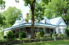
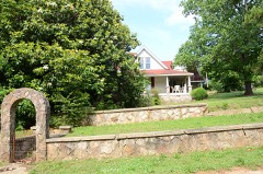
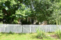
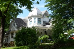
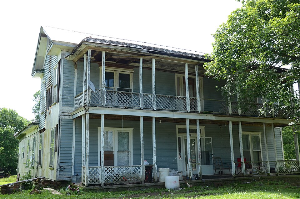
Photograph of Stokes House
Photograph by Valis55, CC BY-SA 3.0. Via Wikimedia Commons.

Stokes House

Listed on the National Register of Historic Places in 1982.

From the record

“The Stokes House is a historic house on the east side of Cammack Street in Evening Shade, Arkansas. It is a two-story wood-frame structure with a side gable roof, and a pair of single-story additions extending to the rear.”

Wikipedia article Stokes House (Evening Shade, Arkansas), CC BY-SA 4.0.

One of 28 National Register listings published here for Sharp County · listed in 1982 · category: Building.

Sources: the Wikipedia article · the National Register database, National Park Service · the Wikipedia article
The listing

  • What is counted as historic. The nomination lists 1 building as contributing to the listing.
  • Address. Cammack St., Evening Shade, 72532
  • When was it listed? June 1982
  • Category. building
  • Also known as. Evening Shade MRA
  • Township. Piney Fork township
  • National Register reference number. 82002141 - assigned by the National Park Service when the property was listed.

Fires near this property

100 since 1997

Regional context, not property-specific evidence. The federal wildfire occurrence database lists 100 fires within 5 miles of Stokes House between 1997 and 2019, burning about 1,324 acres in total. 3 started naturally. 29 were recorded as arson. Distance is straight-line from the map coordinates, so a fire counted here may appear on a neighbouring settlement's page as well.

Reported cause Fires
Debris and open burning39
Arson/incendiarism29
Missing data/not specified/undetermined22
Equipment and vehicle use6
Natural3
Misuse of fire by a minor1

The most recent of them, most recent first, with the day each was reported and the service that recorded it.

DateCause SizeReported by Name on the report
6 September 1998Equipment and vehicle use4.0 acresArkansas Forestry Commissionnot named
5 September 2013Missing data/not specified/undetermined1.0 acresArkansas Forestry Commissionnot named
5 September 1998Arson/incendiarism2.0 acresArkansas Forestry Commissionnot named
25 September 1999Debris and open burning1.0 acresArkansas Forestry Commissionnot named
15 September 2000Equipment and vehicle use8.0 acresArkansas Forestry Commissionnot named
8 August 2011Natural10 acresArkansas Forestry Commissionnot named
5 August 2005Debris and open burning14 acresArkansas Forestry Commissionnot named
31 August 2007Debris and open burning8.0 acresArkansas Forestry Commissionnot named

Every fire recorded in Sharp County

Mines and quarries near this property

4 within 5 miles

Regional context, not property-specific evidence. The federal mineral resources record lists 4 workings within 5 miles of Stokes House: 4 unknowns. None of them still produces. What was taken out: Stone, Iron Oxide Pigments. Distance is straight-line from the map coordinates, so a quarry counted here may appear on a neighbouring settlement's page as well.

Where SiteCommodity StatusRecorded
Tommie Marlin DepositIron Oxide PigmentsUnknown
Reichartz LandStoneUnknown
UnkStoneUnknown
UnkStoneUnknown

Every working recorded in Sharp County

Storms near this property

29 since 1993

Regional context, not property-specific evidence. The National Weather Service names Evening Shade, the town this property stands in, in 29 storm reports between 1993 and 2025: 11 thunderstorm wind, 9 hail, 5 flash flood, 2 tornado. No death or injury is recorded in these reports. Each account below is quoted exactly as the forecast office filed it, from the NOAA Storm Events Database, and each date opens the federal record of that event.

WhenEvent Place namedHarm What the report says
March 2022Tornado (EF0)Evening Shade$80,000This tornado started in central Izard county, just southeast of Melbourne, and tracked northeast 9.86 miles in Izard county and 1.48 miles in Sharp county. The tornado continued into into western Sharp county and dissipated northwest of Evening Shade. There was mostly tree damage. Several homes in and around Sage had roof damage, with a few barns and sheds heavily damaged. The worst damage was 0.5 mile east of Sage, with numerous trees snapped and a horse barn destroyed. Farther northeast, a mobile home was rolled, and a person was injured. A modular home was ripped apart about 4.0 miles west-northwest of Evening Shade. The occupants went to a nearby metal storage container for shelter, and it was rolled. There were four injuries reported here, including one serious injury.
October 2017Thunderstorm WindEvening Shade$20,000Photos showed extensive mostly roof damage to a home, with trees on the property downed or snapped.
July 2010Flash FloodEvening Shade$10,000Creeks overflowed, washing out gravel on county roads. Arkansas Highway 58 was closed as water was up to car bumpers.
April 2013Thunderstorm WindEvening Shade$5,000Trees were blown down in the Evening Shade area.
July 2010Flash FloodEvening Shade$5,000Farm fields were flooded.
May 2025Flash FloodEvening Shade-Low water bridge that connects Silver Springs Rd to Powells Chapel Rd was flooded and portions of Silver Springs Rd was washed out.
February 2023Flash FloodEvening Shade-Numerous roads across Sharp County were reported underwater and impassable.
March 2023Heavy RainEvening Shade-The COOP observer reported 2.43 inches of rain.
March 2022Thunderstorm WindEvening Shade-Trained storm spotter reported a 62 mph wind gust and trees and power lines down at the junction of Hwy. 167 and Bear Valley Rd. about 5 miles north of Evening Shade.
March 2020Thunderstorm WindEvening Shade-Numerous downed trees in Sharp County caused widespread power outages.
May 2020Thunderstorm WindEvening Shade-A large tree was blown over near the Evening Shade steam engine.
June 2019Thunderstorm WindEvening Shade-Power lines were blown down in Evening Shade and was relayed by the Lawrence County EM.
March 2017Thunderstorm WindEvening Shade-Several trees were down around evening shade.
November 2011Heavy RainEvening Shade-The Evening Shade reporting station recorded the wettest November ever. Rainfall of 11.78 inches broke the record of 10.50 inches set in 1996.
September 2006Tornado (F1)Evening Shade-A weak tornado moved from eastern Izard County into western Sharp County. The tornado tracked from 5.8 miles north-northwest of Evening Shade to 5 miles south-southeast of Ash Flat. The tornado damaged several homes, with mostly roof damage noted. A mobile home and recreational vehicle were overturned, and another mobile home was partially destroyed. The tornado also snapped or uprooted dozens of trees before dissipating.
July 2003Thunderstorm WindEvening Shade-A large tree was blown down onto U.S. Highway 167.
July 1995Thunderstorm WindEvening Shade-Some trees and power lines were blown down.
October 1993HailEvening Shade-Hail up to golf ball-size fell for five minutes.
May 2021HailEvening Shade-no account filed
April 2016HailEvening Shade-no account filed
April 2007HailEvening Shade-no account filed
August 2003HailEvening Shade-no account filed
May 2000Thunderstorm WindEvening Shade-no account filed
April 1998HailEvening Shade-no account filed
July 1998HailEvening Shade-no account filed
July 1998Flash FloodEvening Shade-no account filed
March 1997HailEvening Shade-no account filed
July 1996HailEvening Shade-no account filed

Every storm recorded in Sharp County

Map coverage status

No historic map-sheet match is published for this property yet. That does not mean no map exists. This record needs a coordinate-quality review before it can be joined to a sheet boundary. Browse the county's mapped places while that work is pending.

Listed places nearby

6 within 8 miles

Other National Register properties close enough to walk or drive between, ordered by distance from this one. Both positions come from the same geocoding pass that matched these properties to their map sheets.

Photograph PropertyDistance Listed
Coger Houseunder 500 feet1982
John W. Shaver Houseunder 500 feet1982
W. A. Edwards Houseunder 500 feet1982
Sam Davidson House0.2 miles1982
Charles W. Shaver House0.2 miles1982
John McCaleb House0.4 miles1982

Sources for this property

National Archives recordThe nomination case file for reference 82002141 in Record Group 79.
Wikipedia articleCommunity-written account of this property, licensed CC BY-SA.
Sharp CountyAll 28 listed properties in this county.

Provenance

  • Listing record. National Park Service National Register of Historic Places, listed-properties dataset, current to 2026-05-22.
  • Map join. Address geocoded through the United States Census geocoder, then tested against the published boundary of every sheet in the USGS Historical Topographic Map Collection.
  • How this page is made. Listing fields come from federal records; map-sheet coverage is a labelled coordinate-to-boundary calculation, not a source-field claim.
  • Wildfire. Short, Karen C. 2022. Spatial wildfire occurrence data for the United States, 1992-2020 [FPA_FOD_20221014]. 6th Edition. Fort Collins, CO: Forest Service Research Data Archive. https://doi.org/10.2737/RDS-2013-0009.6 Collected with United States Government funding and usable without additional permissions or fees.
  • Mines and quarries. USGS Mineral Resources Data System (MRDS) https://mrdata.usgs.gov/mrds/ A work of the United States government, no copyright under 17 U.S.C. 105.
  • Storms. NOAA National Centers for Environmental Information, Storm Events Database https://www.ncei.noaa.gov/stormevents/ A work of the United States government, no copyright under 17 U.S.C. 105. Narratives are quoted verbatim from the National Weather Service report and are not edited or summarised.