 Block
From the record
28 National Register listings published here.
Sources: the National Register database, National Park Service
56 topographic sheets cover 35 settlements here, and 28 properties are on the National Register of Historic Places.
28 National Register listings published here.
Sources: the National Register database, National Park Service
Every property in this county listed on the National Register of Historic Places, with the year it was listed and the federal nomination document.
| Photograph | Property | Type | Listed | Reference |
|---|---|---|---|---|
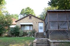 | Sherman and Merlene Bates House | building | 2002 | 02001077 |
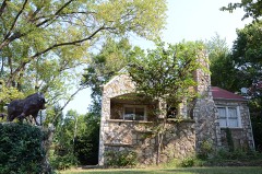 | Sherman Bates House | building | 1998 | 98001515 |
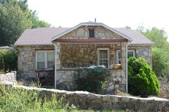 | Fred Carter House | building | 1998 | 98001510 |
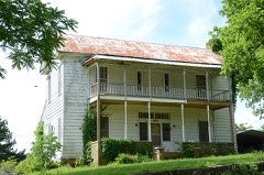 | Coger House | building | 1982 | 82002134 |
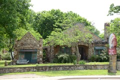 | Crystal River Tourist Camp | district | 1991 | 91000620 |
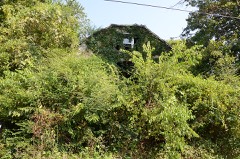 | Ernest Daugherty House | building | 1998 | 98001513 |
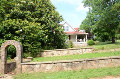 | Sam Davidson House | building | 1982 | 82002135 |
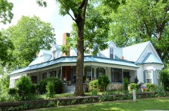 | W. A. Edwards House | building | 1982 | 82002136 |
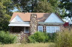 | Graham, Fred House | building | 1999 | 99000157 |
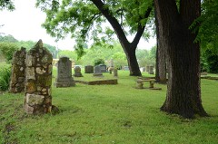 | Hardy Cemetery Historic Section | site | 2006 | 06000089 |
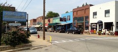 | Hardy Downtown Historic District | district | 1995 | 95001121 |
| Floyd Jackson House | building | 1998 | 98001516 | |
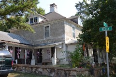 | David L. King House | building | 2002 | 02001076 |
| Little Springs Missionary Baptist Church | building | 2016 | 16000321 | |
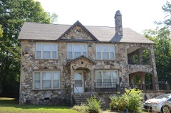 | Esther Locke House | building | 1998 | 98001509 |
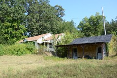 | Web Long House and Motel | building | 1998 | 98001512 |
 | John McCaleb House | building | 1982 | 82002137 |
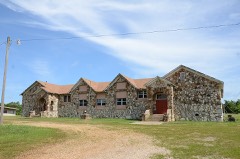 | Poughkeepsie School Building | building | 1992 | 92001198 |
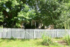 | Charles W. Shaver House | building | 1982 | 82002139 |
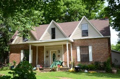 | John W. Shaver House | building | 1982 | 82002140 |
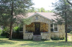 | William Shaver House | building | 1998 | 98001511 |
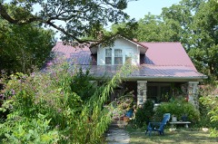 | Silas Sherrill House | building | 1998 | 98001514 |
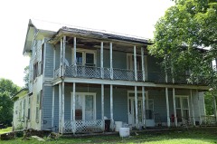 | Stokes House | building | 1982 | 82002141 |
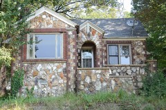 | Carrie Tucker House | building | 1999 | 99000156 |
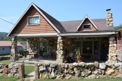 | Thomas Walker House | building | 2005 | 04001490 |
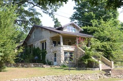 | Lee Weaver House | building | 1998 | 98001508 |
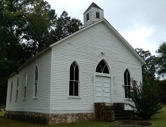 | Williford Methodist Church | building | 1992 | 92001629 |
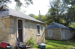 | Woodland Courts | district | 1992 | 92001634 |
Every wildfire the federal occurrence database records inside this county: 754 of them, burning about 14,081 acres. 15 started naturally and 260 were recorded as arson. Each settlement page carries the fires within five miles of it.
| Reported cause | Fires |
|---|---|
| Debris and open burning | 273 |
| Arson/incendiarism | 260 |
| Missing data/not specified/undetermined | 165 |
| Equipment and vehicle use | 30 |
| Natural | 15 |
| Recreation and ceremony | 5 |
| Misuse of fire by a minor | 3 |
| Smoking | 2 |
| Railroad operations and maintenance | 1 |
The five largest, by the area the report gives. 6 of them were set deliberately.
| Date | Cause | Size | Reported by | Name on the report |
|---|---|---|---|---|
| 15 April 2004 | Arson/incendiarism | 322 acres | Arkansas Forestry Commission | WARRIOR CREEK |
| 31 March 2010 | Arson/incendiarism | 304 acres | Arkansas Forestry Commission | TUCKER FIRE |
| 1 April 2003 | Arson/incendiarism | 282 acres | Arkansas Forestry Commission | D8 124 |
| 24 February 2004 | Arson/incendiarism | 251 acres | Arkansas Forestry Commission | not named |
| 15 August 2012 | Natural | 232 acres | Arkansas Forestry Commission | GRANGE FIRE |
| 19 March 2001 | Arson/incendiarism | 220 acres | Arkansas Forestry Commission | not named |
| 31 October 2010 | Arson/incendiarism | 174 acres | Arkansas Forestry Commission | SITKA |
| 29 February 2012 | Debris and open burning | 155 acres | Arkansas Forestry Commission | BOSS GOBLER FARM |
Every settlement page carries the fires within five miles of it - see the settlement index below.
The NOAA Storm Events Database holds 370 reports for this county, causing 3 deaths, 32 injuries and about $88,608,000 in recorded property damage. Each settlement page carries the reports that name it.
| Kind of event | Reports |
|---|---|
| Thunderstorm Wind | 137 |
| Hail | 110 |
| Flash Flood | 62 |
| Flood | 26 |
| Tornado | 22 |
| Heavy Rain | 7 |
| Lightning | 5 |
| Funnel Cloud | 1 |
The most serious of them, by death, then injury, then recorded damage. The accounts are quoted exactly as the forecast office filed them.
| When | Event | Place named | Harm | What the report says |
|---|---|---|---|---|
| April 2011 | Thunderstorm Wind | Grange | 1 killed, $125,000 | A house was destroyed and the 48 year-old woman inside was thrown out and killed. Trees and power lines in the area were blown down. |
| September 2006 | Flash Flood | Hardy | 1 killed | Water rescues continued at the Riverbend campground and the Spring River Beach Club. Some people were in trees to avoid the water. One man was swept away by the water and drowned. |
| September 2006 | Flash Flood | Williford | 1 killed | Martins Creek was out of its banks, and was flowing over U.S. Highway 63. Water was also over Martin Creek Road, and a vehicle was swept away. A young man in the vehicle drowned. |
| February 2008 | Tornado (EF3) | Horseshoe Bend | 15 hurt, $30,000,000 | The tornado moved out of Izard County, south of Horseshoe Bend, and into Sharp County, northwest of Evening Shade. According to a survey by the Red Cross, 30 houses were destroyed, 7 suffered major damage, 17 had minor damage, and 11 others were affected. In addition, 10 mobile homes were destroyed, 1 had major damage, 2 had minor damage, and 1 was affected. Two apartments had minor damage and two others were affected. At least 40 businesses along U.S. Highway 62/412 in Highland were damaged or destroyed. Also, a church was destroyed and vehicles were overturned along the highway. The fire department in Highland lost most of its building and equipment. The Highland High School had minor damage. The tornado finally ended its long path northeast of Highland. |
| December 1982 | Tornado (F3) | not stated | 3 hurt, $25,000,000 | no account filed |
| November 1994 | Tornado (F1) | Poughkeepsie to 4 SE | 3 hurt, $500,000 | An F1 tornado touched down 1 mile north of Poughkeepsie and travelled 6 miles on the ground before lifting 4 miles southeast of Sitka. Damage along the path of the tornado consisted of a large number of trees being knocked down. Two mobile homes were destroyed. Three people were in one of the mobile homes at the time the storm hit and received minor injuries. Several barns were either damaged or destroyed. |
| November 2005 | Tornado (F2) | Sitka | 3 hurt | A strong tornado touched down briefly in Sharp County about a mile southwest of Sitka. Estimated winds with the tornado were about 115 mph. The worst damage noted was at the intersection of Lone Oak Road and Summerfield Creek Road. One mobile home was demolished, with contents strewn well across a field. Another mobile home was damaged. A storage shed was thrown across a street into the trees and a travel trailer was overturned. A vacant house was destroyed by falling trees. Five vehicles were damaged with windows being blown out. Numerous trees were uprooted or snapped off along the path of the tornado. Three people sustained injuries. The tornado was on the ground for almost five miles before dissipating. |
| September 2003 | Flash Flood | Hardy Ozark Acres Ar | 3 hurt | no account filed |
| February 1956 | Tornado (F2) | not stated | 2 hurt, $25,000 | no account filed |
| March 1998 | Lightning | Ash Flat | 1 hurt | Lightning struck a house in Ash Flat. The bolt of lightning travelled into the house and exited from one of the walls. A man was in the room at the time and was struck by the lightning bolt as it exited the wall. He suffered some minor burns to the back of his head. He was later treated and released from a local hospital. |
| April 1999 | Tornado (F2) | Cave City | 1 hurt | no account filed |
| December 1983 | Thunderstorm Wind | not stated | 1 hurt | no account filed |
| March 2008 | Flood | Hardy | $15,000,000 | Heavy rain caused the Spring River at Hardy to go above major flood level. The mayor of Hardy was notified by the Little Rock Office of the National Weather Service the day before this event that very heavy rain was possible. The local officials took steps to notify the property owners along the river. As a result, only a few homes along the river had to be evacuated during the event and there were no fatalities. A significant amount of personal property was also moved out of the floodplain. The river rose quickly and the surge of water swept away homes, propane tanks, canoes, parked vehicles, and even pieces of the road. Approximately 112 homes were affected by the flood with at least 6 destroyed and more than 20 with major damage. Approximately 55 to 60 homes were seriously damaged. Two homes were swept down the river. Damage to public property was estimated at $2 Million. The Hardy City Hall, police station and city park sustained heavy damage with 4 feet of water in City Hall. U.S. Highway 63 flooded, as did the Burlington Northern Santa Fe railroad. A portion of the railroad was washed out. This was the highest the river had been since at least December of 1982. There had been a significant amount of development in the floodplain since the 1982 flood. |
| May 2011 | Flood | Wirth | $4,500,000 | Four hundred feet of railroad tracks had to be replaced near Williford due to flooding from the Spring River. |
| April 2011 | Flood | Hardy | $2,000,000 | City Hall had to be evacuated, along with some houses in Hardy. |
| March 2008 | Flash Flood | Wirth | $2,000,000 | Portions of Hardy were flooded, and U.S. Highway 63 had 2 to 3 feet of water over it. Homes along the Spring River were evacuated. Numerous roads in the county were barricaded. Barnes Road, Hewlett Road, Piney Creek Road, and Bear Creek Road were blocked due to bridges being underwater. U.S. Highway 62 was closed at its intersection with Arkansas Highway 175 five miles south of Hardy. A gas station in Cherokee Village had fuel tanks floating out of the ground. There were 50 evacuations. A car was swept off the road in Williford; the driver was rescued. |
| April 2014 | Flash Flood | Cherokee Vlg | $1,500,000 | Flash flooding caused severe damage to roads and bridges. |
| March 1996 | Tornado (F3) | Sidney | $1,500,000 | no account filed |
| April 2011 | Flood | Wirth | $1,000,000 | Widespread areal flooding occurred. |
| December 2015 | Thunderstorm Wind | Cherokee Vlg Arpt | $500,000 | Several homes were severely damaged or even destroyed in the Highland area. Two mobile homes were a total loss. A shop was severely damaged, along with a few homes with their roofs torn off. Several trees and power lines were also blown down. |
| April 2008 | Flood | Cherokee Vlg | $500,000 | Excessive rainfall in Missouri and north Arkansas caused another sharp rise on the Spring River with portions of Hardy and Williford flooding for the second time in less than a month. The river rose to 20.8 feet, within two feet of the March crest. Over bank flooding begins at 10 feet. Local officials reported two houses or cabins floated past the highway bridge in town. While flooding on the South Fork of the Spring River was not has severe as the March event, the flood wave from the Warm Fork of the Spring River, which comes from north of town, was significantly higher. |
| June 1994 | Thunderstorm Wind | Hardy | $500,000 | Thunderstorm winds, estimated up to 90 mph, blew down numerous large trees. Several of these trees fell onto mobile homes. |
| September 1993 | Thunderstorm Wind | Cave City | $500,000 | Thunderstorm winds blew the roof off two buildings and knocked down some trees and power lines. |
| May 2011 | Flood | Hardy | $500,000 | no account filed |
| November 2003 | Flash Flood | Hardy | $300,000 | Flash flooding occurred at the River Bend Park in Hardy. About 100 camping trailers and recreation vehicles were underwater. Twelve people had to be rescued from the camping trailers located at the park. No injuries were reported. |
| October 2009 | Flood | Hardy | $250,000 | Flooding on the Spring River at Hardy washed out Loberg Park, destroying the fence around the park, damaging playground equipment and partially washing out trails in the park. Two residents near the park had to be rescued by boat. The fence around the ballpark at Buford Beach was destroyed. A church was flooded. The library in Williford flooded. A fire engine was stranded in high water. |
| December 1982 | Tornado (F4) | not stated | $250,000 | no account filed |
| August 2011 | Thunderstorm Wind | Poughkeepsie | $225,000 | Roofs were peeled off houses and sheds. A chicken house suffered major damage. Several sheds were lifted off their foundations and thrown into fences. Power poles were snapped in half and trees were uprooted. |
| April 2011 | Thunderstorm Wind | Shelbyville | $200,000 | A business that manufactures portable buildings had a number of the buildings damaged or destroyed. Power lines were blown down. |
| October 2009 | Flash Flood | Wirth | $125,000 | Approaches to many low water bridges were destroyed. Bridges on Big Creek and Martin Creek were severely damaged. A bridge on Shaw Cemetery Road was also damaged. Numerous rescues were necessary. |
| November 2015 | Flash Flood | Hardy | $100,000 | Several roads were flooded or washed out across the county. |
| August 2012 | Thunderstorm Wind | King Mills | $100,000 | Many trees were blown down, with some of the trees landing on houses and vehicles. Power lines and power poles were blown down. |
| June 2011 | Thunderstorm Wind | Ash Flat | $100,000 | Large oak trees were uprooted. Several fireworks stands were destroyed. Several buildings had damage to roofs and siding. |
| December 2009 | Flood | Wirth | $100,000 | Heavy rain led to flooding in many parts of Sharp County. Bridges in Cherokee Village were flooded, as were Hulett Rd. at Center, Charleston and Blackstone Streets in Cave City, the Orr Ave. Bridge at Ash Flat, Carpenter Rd. at Evening Shade, and Barnes Rd. Other locations closed due to flooding in Cherokee Village were the Town Center bridges, East Lakeshore near Pontiac, North Golf Course bridge, Beach Club Hill, West Waketa and Allegheny at the bridge and Griffin Bridge. Woodland Hills Rd. was flooded in Hardy. |
| April 2008 | Flash Flood | Nelsonville | $100,000 | Several roads were washed out in the southern portion of Sharp County. Flooding was reported along Arkansas Highway 58 east and south of Williford. The library in Williford flooded. U.S. Highway 63 in Hardy was flooded. |
| March 2022 | Tornado (EF0) | Evening Shade | $80,000 | This tornado started in central Izard county, just southeast of Melbourne, and tracked northeast 9.86 miles in Izard county and 1.48 miles in Sharp county. The tornado continued into into western Sharp county and dissipated northwest of Evening Shade. There was mostly tree damage. Several homes in and around Sage had roof damage, with a few barns and sheds heavily damaged. The worst damage was 0.5 mile east of Sage, with numerous trees snapped and a horse barn destroyed. Farther northeast, a mobile home was rolled, and a person was injured. A modular home was ripped apart about 4.0 miles west-northwest of Evening Shade. The occupants went to a nearby metal storage container for shelter, and it was rolled. There were four injuries reported here, including one serious injury. |
| December 2018 | Thunderstorm Wind | Ash Flat | $75,000 | There were reports of roofs blown off buildings, and trailers were thrown across the parking lot and in ditches. |
| September 2010 | Thunderstorm Wind | Ash Flat | $75,000 | Trees were blown down and many barns and roofs had metal and shingles blown off. Many homes in the Ash Flat area lost power for hours. |
| July 2009 | Thunderstorm Wind | Hardy Ozark Acres Ar | $75,000 | A hay barn was blown down, the roof was torn off a building, and trees were blown down. |
| August 2007 | Thunderstorm Wind | Cave City | $75,000 | Trees and power lines were blown down, with one of the trees falling on a pickup truck. Shingles were blown off roofs. Signs at businesses were destroyed. |
| May 2022 | Thunderstorm Wind | Ash Flat | $70,000 | Delayed report...significant damage occurred around Ash Flat, including several large trees blown down, damage to power poles, and one home with a metal roof torn off. South of town, a few houses were damaged by fallen trees, and a few barns or outbuildings sustained wind damage as well. This report was relayed via NWSChat from Ash Flat Fire Department. The time is based on radar data. |
| December 2019 | Thunderstorm Wind | Sitka | $50,000 | A large barn was destroyed and trees were uprooted. |
| February 2018 | Thunderstorm Wind | Aetna | $50,000 | Chicken house roofs were damaged and removed. Outbuildings were damaged. The damage was consistent with straight-line winds in excess of 70 mph. |
| April 2013 | Thunderstorm Wind | Sidney | $50,000 | A shed and a hay barn were destroyed, a travel trailer was turned upside down, tin was blown off three chicken houses, and a number of large trees were blown down. |
| April 2008 | Flash Flood | Aetna | $50,000 | Roads in Sharp county were washed out. |
| August 1993 | Thunderstorm Wind | Cherokee Village | $50,000 | Thunderstorm winds downed trees and power lines. |
| May 2011 | Thunderstorm Wind | Ash Flat | $30,000 | Trees and power lines were blown down. |
| July 2012 | Thunderstorm Wind | Hardy | $25,000 | Trees and power lines were down across Hardy. Many people were without power. |
| May 2011 | Thunderstorm Wind | Highland | $25,000 | Many trees were blown down. |
| August 2011 | Thunderstorm Wind | Ash Flat | $25,000 | Trees were blown down across Ash Flat. Some of the falling trees took down power lines. |
| March 2020 | Tornado (EF1) | Center | $20,000 | For the majority of the tornado's path, large trees and power poles and power lines were the most common damage indicators. The majority of the structural damage caused by the tornado was observed at the Mashburn farm where there was substantial damage to outbuildings, including one outbuilding that slid off of its foundation. There was minor damage to a residence on the farm as well, and extensive tree damage throughout the property. |
| October 2017 | Thunderstorm Wind | Evening Shade | $20,000 | Photos showed extensive mostly roof damage to a home, with trees on the property downed or snapped. |
| May 2011 | Thunderstorm Wind | Cherokee Vlg | $20,000 | A roof was blown off a health food store. |
| April 2009 | Thunderstorm Wind | Ash Flat | $20,000 | Two houses were damaged in the area. |
| October 2009 | Flash Flood | Cherokee Vlg | $20,000 | Flash flooding occurred in Cherokee Village. |
| May 2011 | Thunderstorm Wind | Ash Flat | $15,000 | Part of a tin roof was torn off a building. Road signs and one highway sign were bent or damaged. Power outages occurred. |
| June 2011 | Thunderstorm Wind | Hardy | $15,000 | Trees and power lines were blown down. |
| May 2011 | Thunderstorm Wind | Cave City | $15,000 | A house was damaged and power lines were blown down. |
| April 2021 | Flash Flood | Hardy | $10,000 | A campground manager reported the Spring River was out of its banks through Hardy, high water in River Bend Park, Loberg Park, and Hardy City RV Park Campground. One RV was washed away by the water. No injuries. |
| July 2021 | Thunderstorm Wind | Ash Flat | $10,000 | Damaging winds destroyed a metal carport and caused sporadic damage, including tree damage, in the city of Ash Flat. The time was estimated from radar. |
The Survey's mineral resources record lists 61 workings inside this county. 2 still produce and 59 are closed or unrecorded. Each settlement page carries the workings within five miles of it.
| Commodity | Workings |
|---|---|
| Iron | 20 |
| Sand and Gravel, Construction | 15 |
| Zinc | 12 |
| Stone | 7 |
| Lead | 6 |
| Manganese | 4 |
| Lead, Zinc | 1 |
| Dolomite | 1 |
| Silver, Zinc | 1 |
| Iron Oxide Pigments | 1 |
The least common of them first, because a county's hundredth gravel pit says nothing its first ten did not.
| Where | Site | Commodity | Status | Recorded |
|---|---|---|---|---|
| Bruce Farm | Lead, Silver, Zinc | Occurrence | ||
| Calamine | Lead, Zinc | Past Producer | ||
| Fugate Hollow | Zinc, Dolomite | Prospect | ||
| Tommie Marlin Deposit | Iron Oxide Pigments | Unknown | ||
| Carolyn Newman | Manganese | Occurrence | ||
| K D Aldridge Prospect | Manganese | Past Producer | 1917 | |
| Matlock Mine | Manganese | Past Producer | 1918 | |
| Story Mine | Manganese | Past Producer | 1918 | |
| Fitzhugh | Lead, Zinc | Past Producer | ||
| Golconda | Zinc, Lead | Past Producer | ||
| Unk | Zinc, Lead | Past Producer | ||
| Unk | Zinc, Lead | Past Producer | ||
| Unk | Zinc, Lead | Past Producer | ||
| Ash Flat Quarry | Stone | Producer | ||
| Ferris Quarry | Stone | Prospect | ||
| Reichartz Land | Stone | Unknown | ||
| Unk | Stone | Unknown | ||
| Unk | Stone | Unknown | ||
| Unk | Stone | Unknown | ||
| Unk | Stone | Unknown | ||
| Daylight | Zinc | Past Producer | ||
| George Smith Tract | Zinc | Past Producer | ||
| Graceland | Zinc | Past Producer | ||
| Rock Springs | Zinc | Past Producer | ||
| Widow Franklin | Zinc | Past Producer | ||
| Willett Property | Zinc | Past Producer | ||
| Unk | Sand and Gravel, Construction | Unknown | ||
| Unk | Sand and Gravel, Construction | Unknown | ||
| Unk | Sand and Gravel, Construction | Unknown | ||
| Unk | Sand and Gravel, Construction | Past Producer | ||
| Unk | Sand and Gravel, Construction | Unknown | ||
| Unk | Sand and Gravel, Construction | Unknown | ||
| Unk | Sand and Gravel, Construction | Past Producer | ||
| Unk | Sand and Gravel, Construction | Past Producer | ||
| Unk | Sand and Gravel, Construction | Unknown | ||
| Unk | Sand and Gravel, Construction | Unknown | ||
| Unk | Sand and Gravel, Construction | Unknown | ||
| Unk | Sand and Gravel, Construction | Unknown | ||
| Unk | Sand and Gravel, Construction | Unknown | ||
| Unk | Sand and Gravel, Construction | Unknown | ||
| Unk | Sand and Gravel, Construction | Unknown | ||
| Andrew Mood Property | Iron | Occurrence | ||
| Bevens Bloomery | Iron | Past Producer | ||
| Iron Ore Mountain | Iron | Past Producer | ||
| Iron Ore Ridge | Iron | Past Producer | ||
| L.A.Reavis Property | Iron | Occurrence | ||
| Lawrence Stone Property | Iron | Occurrence | ||
| Unk | Iron | Unknown | ||
| Unk | Iron | Producer | ||
| Unk | Iron | Unknown | ||
| Unk | Iron | Unknown | ||
| Unk | Iron | Unknown | ||
| Unk | Iron | Unknown | ||
| Unk | Iron | Unknown | ||
| Unk | Iron | Unknown | ||
| Unk | Iron | Unknown | ||
| Unk | Iron | Unknown | ||
| Unk | Iron | Unknown | ||
| Unk | Iron | Unknown | ||
| Unk | Iron | Unknown | ||
| Unk | Iron | Occurrence |
Named settlements recorded in the Geographic Names Information System, each with the topographic sheets covering it. Villages, hamlets and abandoned places alike. Each is shown with the nearest named watercourse or landform and the survey quadrangle it falls on.
Washington township · 72521 · On Dry Branch · Evening Shade quadrangle
8 sheets, 1957 to 1983
No longer a settlement
North Union township · 72482 · On Section Branch · Williford quadrangle
8 sheets, 1957 to 1983
Richwoods township · 72513 · On Richwoods Branch · Ash Flat quadrangle
9 sheets, 1957 to 1983
South Big Rock township · 72569 · Evening Shade quadrangle
8 sheets, 1957 to 1983
No longer a settlement
South Lebanon township · 72466 · On Freeman Branch · Poughkeepsie quadrangle
8 sheets, 1957 to 1983
No longer a settlement
Big Creek township · 72466 · On Bandy Branch · Poughkeepsie quadrangle
8 sheets, 1957 to 1983
Hardy township · 72542 · Near Boone Hollow · Hardy quadrangle
8 sheets, 1957 to 1983
No longer a settlement
Cherokee township · 72529 · On Little Otter Creek · Stuart quadrangle
10 sheets, 1957 to 1983
Cherokee township · 72529 · On Right Prong Otter Creek · Stuart quadrangle
10 sheets, 1957 to 1983
No longer a settlement
Piney Fork township · 72532 · On Town Branch · Evening Shade quadrangle
8 sheets, 1957 to 1983
Jackson township · 72482 · Near Sawmill Hollow · Hardy quadrangle
8 sheets, 1957 to 1983
No longer a settlement
Davidson township · 72542 · On Big Spring Branch · Ash Flat quadrangle
9 sheets, 1957 to 1983
No longer a settlement
East Sullivan township · 72521 · On Wooldridge Creek · Cave City quadrangle
19 sheets, 1890 to 1989
North Big Rock township · 72569 · On Runnels Branch · Poughkeepsie quadrangle
8 sheets, 1957 to 1983
Strawberry township · 72466 · Poughkeepsie quadrangle
8 sheets, 1957 to 1983
No longer a settlement
Lower North township · 72554 · Near Yates Ridge · Hardy NE quadrangle
8 sheets, 1957 to 1983
No longer a settlement
The vanished settlements of Sharp County: the places named above that are no longer on the map.