
BlockBefore
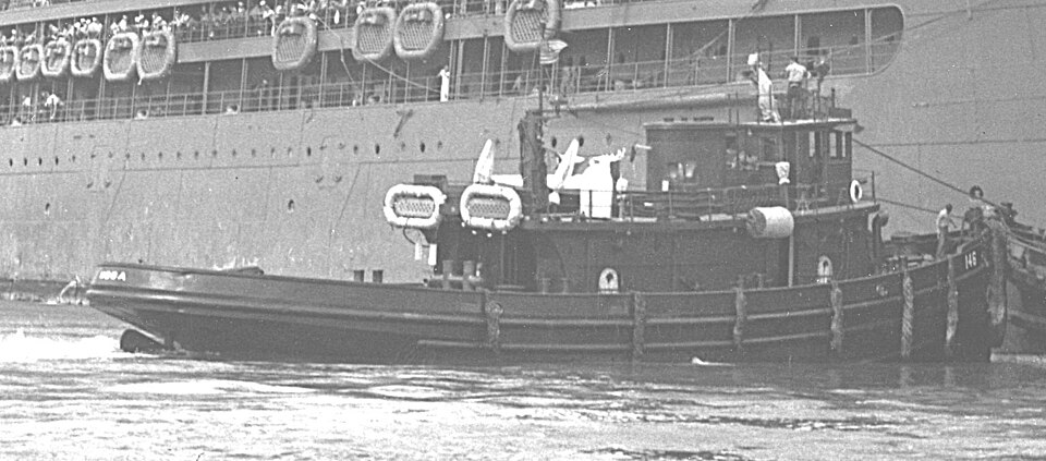
Photograph of USS Hoga
Photograph by Unknown, Public domain. Via Wikimedia Commons.

CITY OF OAKLAND (USS HOGA)

A National Historic Landmark. Listed on the National Register of Historic Places in 1989.

From the record

“Hoga (YT-146/YTB-146/YTM-146) is a United States Navy Woban-class district harbor tug named after the Sioux Indian word for "fish." After World War II, the tug was known as Port of Oakland and then City of Oakland when she was a fireboat in Oakland, California.”

Wikipedia article Hoga (YT-146), CC BY-SA 4.0.

One of 383 National Register listings published here for Pulaski County · listed in 1989 · category: Structure · a National Historic Landmark.

Sources: the Wikipedia article · the National Register database, National Park Service

The listing

  • National Historic Landmark. The highest federal designation, held by about 2,600 places in the country against roughly 100,000 Register listings.
  • What is counted as historic. The nomination lists 1 structure as contributing to the listing.
  • Still standing. The Park Service records this property as extant.
  • Address. 120 River Park Drive, North Little Rock (formerly Oakland)
  • When was it listed? June 1989
  • Category. structure
  • National Register reference number. 89001429 - assigned by the National Park Service when the property was listed.

Map coverage status

No historic map-sheet match is published for this property yet. That does not mean no map exists. This record needs a coordinate-quality review before it can be joined to a sheet boundary. Browse the county's mapped places while that work is pending.

Sources for this property

National Archives recordThe nomination case file for reference 89001429 in Record Group 79.
Wikipedia articleCommunity-written account of this property, licensed CC BY-SA.
Pulaski CountyAll 383 listed properties in this county.

Provenance

  • Listing record. National Park Service National Register of Historic Places, listed-properties dataset, current to 2026-05-22.
  • Map join. Address geocoded through the United States Census geocoder, then tested against the published boundary of every sheet in the USGS Historical Topographic Map Collection.
  • How this page is made. Listing fields come from federal records; map-sheet coverage is a labelled coordinate-to-boundary calculation, not a source-field claim.