 Block
From the record
One of 203 National Register listings published here for White County · listed in 1991 · category: Building.
Sources: the National Register database, National Park Service · the Wikipedia article
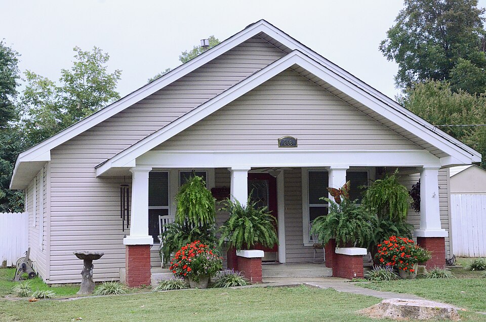
Listed on the National Register of Historic Places in 1991.
One of 203 National Register listings published here for White County · listed in 1991 · category: Building.
Sources: the National Register database, National Park Service · the Wikipedia article
Regional context, not property-specific evidence. The federal wildfire occurrence database lists 48 fires within 5 miles of Berry House between 1997 and 2020, burning about 1,162 acres in total. None started naturally. 11 were recorded as arson. Distance is straight-line from the map coordinates, so a fire counted here may appear on a neighbouring settlement's page as well.
| Reported cause | Fires |
|---|---|
| Debris and open burning | 19 |
| Missing data/not specified/undetermined | 13 |
| Arson/incendiarism | 11 |
| Equipment and vehicle use | 4 |
| Smoking | 1 |
The most recent of them, most recent first, with the day each was reported and the service that recorded it.
| Date | Cause | Size | Reported by | Name on the report |
|---|---|---|---|---|
| 30 September 2014 | Debris and open burning | 15 acres | Arkansas Forestry Commission | WHI17938919 |
| 23 September 2010 | Equipment and vehicle use | 2.0 acres | Arkansas Forestry Commission | not named |
| 19 September 2019 | Missing data/not specified/undetermined | 10 acres | Arkansas Forestry Commission | not named |
| 19 September 1997 | Debris and open burning | 2.0 acres | Arkansas Forestry Commission | not named |
| 10 September 1998 | Smoking | 1.0 acres | Arkansas Forestry Commission | not named |
| 28 August 2000 | Arson/incendiarism | 20 acres | Arkansas Forestry Commission | not named |
| 27 August 2012 | Missing data/not specified/undetermined | 1.0 acres | Arkansas Forestry Commission | not named |
| 25 August 2010 | Arson/incendiarism | 1.0 acres | Arkansas Forestry Commission | not named |
Regional context, not property-specific evidence. The National Weather Service names Beebe, the town this property stands in, in 60 storm reports between 1993 and 2024: 27 thunderstorm wind, 20 hail, 6 tornado, 6 flash flood. The reports record 2 deaths and 29 injuries. Each account below is quoted exactly as the forecast office filed it, from the NOAA Storm Events Database, and each date opens the federal record of that event.
| When | Event | Place named | Harm | What the report says |
|---|---|---|---|---|
| January 1999 | Tornado (F3) | Beebe | 2 killed, 29 hurt | no account filed |
| December 2009 | Flood | Beebe | $400,000 | Flooding caused water to enter 22 homes in the Windwood Addition. Evacuations were necessary. Nearby, a railroad trestle was washed out on the mainline between Little Rock and St. Louis. |
| April 2010 | Tornado (EF1) | Beebe | $375,000 | This tornado exited Lonoke County north-northeast of Jacksons Store and entered White County southeast of Beebe. A Red Cross survey indicated the following damage in White County: two houses and one mobile home were destroyed, two houses had major damage, one house and two mobile homes had minor damage, and two other houses were affected. Numerous trees were blown down. |
| July 2014 | Thunderstorm Wind | Beebe | $100,000 | Several metal buildings were damaged. |
| September 2012 | Thunderstorm Wind | Beebe | $50,000 | Trees and power lines were blown down, and there was also some structural damage. |
| June 2008 | Thunderstorm Wind | Beebe | $50,000 | Trees and power lines were down. One tree fell through a mobile home. |
| September 1993 | Thunderstorm Wind | Beebe | $50,000 | Thunderstorm winds knocked down several large trees. |
| June 2009 | Thunderstorm Wind | Beebe | $20,000 | Trees and large limbs were down. |
| April 2014 | Thunderstorm Wind | Beebe | $10,000 | Trees were blown down in the Beebe area. |
| June 1994 | Thunderstorm Wind | Beebe | $5,000 | Thunderstorm winds downed some trees along Highway 64 near Beebe. |
| June 1994 | Thunderstorm Wind | Beebe | $5,000 | Thunderstorm winds downed some trees. 1 W Beebe,09,1000CST,,,0,0,4,0,Thunderstorm Winds Several large trees were knocked down. Some roofs were damaged by fallen trees. |
| June 1994 | Thunderstorm Wind | Beebe | $5,000 | Some trees were blown down. |
| August 2011 | Thunderstorm Wind | Beebe | $3,000 | A couple of power poles were snapped. |
| May 2017 | Thunderstorm Wind | Beebe | $1,000 | The public reported a carport was damaged from wind after severe thunderstorms produced strong winds in Beebe. |
| April 2024 | Thunderstorm Wind | Beebe | - | Several trees blown down on houses, powerlines blown over, and billboards damaged in the town of Beebe. |
| August 2024 | Thunderstorm Wind | Beebe | - | Multiple oak trees were snapped near the trunk in the town of Beebe. |
| August 2024 | Hail | Beebe | - | Nickel sized hail fell in the community of Beebe. |
| April 2020 | Thunderstorm Wind | Beebe | - | A tree was blown down blocking one lane of Highway 367. |
| June 2017 | Flash Flood | Beebe | - | Water was cover Campground Road just east of Beebe. |
| May 2016 | Thunderstorm Wind | Beebe | - | A few small trees were down with numerous branches down as well. |
| July 2015 | Thunderstorm Wind | Beebe | - | Trees and powerlines were blown down in Beebe. |
| November 2015 | Flash Flood | Beebe | - | U.S. Hwy 67 was closed in both directions near exit 28 due to flooding. |
| January 2007 | Flash Flood | Beebe | - | Water covered Highway 13 east of Beebe. |
| September 2006 | Thunderstorm Wind | Beebe | - | Thunderstorm winds downed trees, and tore metal roofs off of a barn and a home. |
| November 2005 | Thunderstorm Wind | Beebe | - | Power lines knocked down. |
| July 2004 | Thunderstorm Wind | Beebe | - | Thunderstorm winds blew down some trees and tore shingles off several buildings and homes. |
| December 2001 | Tornado (F0) | Beebe | - | The storm that produced a weak tornado in northwest Lonoke County spawned another weak tornado in White County. The tornado (F0) touched down about 3 miles north of Beebe and tracked northeast. The tornado had difficulty reaching the ground and skipped at times. Damage mostly consisted of tree tops, power lines and power poles...with some power outages occurring. The tornado moved 6 miles before dissipating around 2 miles north of Garner. |
| February 2001 | Tornado (F2) | Beebe | - | A strong tornado moved from northern Lonoke County into southern White County about 2.5 miles south-southwest of Beebe. The tornado was only on the ground about half a mile before dissipating 2 miles south-southwest of Beebe. The tornado caused mostly tree damage. |
| February 2001 | Tornado (F1) | Beebe | - | A weak tornado was spawned in southern White County about 2 miles south of Beebe. The tornado moved quickly northeast, and badly damaged several mobile homes. Roofs were also damaged at a couple of homes, with trees downed. The tornado travelled about 7 miles before dissipating about 1.5 miles east of McRae. |
| April 1995 | Thunderstorm Wind | Beebe | - | Several trees were knocked down. |
| July 1995 | Thunderstorm Wind | Beebe | - | Thunderstorm winds blew down some trees. |
| May 2010 | Hail | Beebe | - | no account filed |
| April 2009 | Hail | Beebe | - | no account filed |
| April 2008 | Hail | Beebe | - | no account filed |
| March 2008 | Hail | Beebe | - | no account filed |
| May 2007 | Hail | Beebe | - | no account filed |
| April 2006 | Hail | Beebe | - | no account filed |
| April 2006 | Hail | Beebe | - | no account filed |
| April 2004 | Flash Flood | Beebe | - | no account filed |
| July 2004 | Hail | Beebe | - | no account filed |
| March 2003 | Hail | Beebe | - | no account filed |
| May 2003 | Hail | Beebe | - | no account filed |
| May 2003 | Hail | Beebe | - | no account filed |
| May 2003 | Flash Flood | Beebe | - | no account filed |
| March 2001 | Flash Flood | Beebe | - | no account filed |
| June 2001 | Hail | Beebe | - | no account filed |
| November 2000 | Hail | Beebe | - | no account filed |
| June 1999 | Thunderstorm Wind | Beebe | - | no account filed |
| February 1999 | Tornado (F1) | Beebe | - | no account filed |
| April 1999 | Hail | Beebe | - | no account filed |
| April 1999 | Thunderstorm Wind | Beebe | - | no account filed |
| July 1998 | Thunderstorm Wind | Beebe | - | no account filed |
| November 1998 | Thunderstorm Wind | Beebe | - | no account filed |
| February 1998 | Hail | Beebe | - | no account filed |
| May 1997 | Hail | Beebe | - | no account filed |
| March 1996 | Thunderstorm Wind | Beebe | - | no account filed |
| March 1996 | Thunderstorm Wind | Beebe | - | no account filed |
| May 1995 | Hail | Beebe | - | no account filed |
| July 1995 | Hail | Beebe | - | no account filed |
| June 1994 | Hail | Beebe | - | no account filed |
No historic map-sheet match is published for this property yet. That does not mean no map exists. This record needs a coordinate-quality review before it can be joined to a sheet boundary. Browse the county's mapped places while that work is pending.
Other National Register properties close enough to walk or drive between, ordered by distance from this one. Both positions come from the same geocoding pass that matched these properties to their map sheets.
| Photograph | Property | Distance | Listed |
|---|---|---|---|
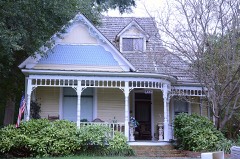 | Lizzie Garrard House | 0.2 miles | 1991 |
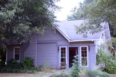 | Shue House | 0.3 miles | 1991 |
 | Laws-Jarvis House | 0.3 miles | 1992 |
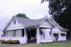 | Sellers House | 0.3 miles | 1991 |
 | Col. Ralph Andrews House | 0.3 miles | 1991 |
 | Powell Clothing Store | 0.4 miles | 1991 |
| National Archives record | The nomination case file for reference 91001262 in Record Group 79. |
| Wikipedia article | Community-written account of this property, licensed CC BY-SA. |
| White County | All 203 listed properties in this county. |