 Block
From the record
One of 28 National Register listings published here for Ashley County · listed in 1993 · category: Building.
Sources: the National Register database, National Park Service
Listed on the National Register of Historic Places in 1993.
One of 28 National Register listings published here for Ashley County · listed in 1993 · category: Building.
Sources: the National Register database, National Park Service
Regional context, not property-specific evidence. The federal wildfire occurrence database lists 162 fires within 5 miles of Crossett Experimental Forest Building No. 6 between 1997 and 2019, burning about 2,098 acres in total. 3 started naturally. 50 were recorded as arson. Distance is straight-line from the map coordinates, so a fire counted here may appear on a neighbouring settlement's page as well.
| Reported cause | Fires |
|---|---|
| Missing data/not specified/undetermined | 59 |
| Arson/incendiarism | 50 |
| Debris and open burning | 25 |
| Equipment and vehicle use | 10 |
| Misuse of fire by a minor | 5 |
| Smoking | 3 |
| Railroad operations and maintenance | 3 |
| Recreation and ceremony | 3 |
| Natural | 3 |
| Power generation/transmission/distribution | 1 |
The most recent of them, most recent first, with the day each was reported and the service that recorded it.
| Date | Cause | Size | Reported by | Name on the report |
|---|---|---|---|---|
| 8 September 2011 | Missing data/not specified/undetermined | under an acre | Arkansas Forestry Commission | not named |
| 7 September 2016 | Arson/incendiarism | 1.0 acres | Arkansas Forestry Commission | not named |
| 4 September 2019 | Missing data/not specified/undetermined | 1.0 acres | Arkansas Forestry Commission | not named |
| 3 September 2019 | Power generation/transmission/distribution | under an acre | Louisiana Office of Forestry | not named |
| 3 September 2019 | Missing data/not specified/undetermined | 12 acres | Arkansas Forestry Commission | not named |
| 3 September 2019 | Missing data/not specified/undetermined | 1.0 acres | Arkansas Forestry Commission | not named |
| 29 September 2004 | Misuse of fire by a minor | 1.0 acres | Arkansas Forestry Commission | not named |
| 29 September 2000 | Equipment and vehicle use | 80 acres | Louisiana Office of Forestry | not named |
Regional context, not property-specific evidence. The National Weather Service names Crossett, the town this property stands in, in 117 storm reports between 1993 and 2026: 64 thunderstorm wind, 33 hail, 10 flash flood, 5 tornado. The reports record 1 injury. Each account below is quoted exactly as the forecast office filed it, from the NOAA Storm Events Database, and each date opens the federal record of that event.
| When | Event | Place named | Harm | What the report says |
|---|---|---|---|---|
| April 2012 | Thunderstorm Wind | Crossett | 1 hurt, $75,000 | Numerous trees were blown down around Crossett. One tree was blown down onto a mobile home injuring one occupant inside. A few power lines were also blown down around town. |
| March 2006 | Thunderstorm Wind | Crossett | $700,000 | A potent squall line of thunderstorms moved across Ashley county and caused widespread damage, especially across southern and eastern sections of the county. As the squall line moved through, a small segment of the line pushed out ahead of the line. This "bow segment" caused extensive damage along a swath from just south of Crossett to near Portland. The most significant damaged occurred just south and southeast of Crossett. Along the damage swath, numerous trees and power lines were blown down. Several structures sustained damage along with a few outbuildings blown away. |
| January 2020 | Tornado (EF1) | North Crossett | $400,000 | This tornado started just off Highway 133 and continued just east of north where it dissipated just before reaching Highway 8, southeast of Hamburg. At the start, just a few trees were uprooted, some of which took a power line down along Highway 133. The tornado increased in intensity and width as it crossed Binnis Loop Rd. More trees were uprooted or snapped and a couple of homes sustained some roof damage. One large shed was destroyed with fragments of the roof thrown across the road. The tornado traveled along Highway 52 for quite a while. Along this part of the path, numerous trees were uprooted and snapped. Some power lines and poles were down as well. Quite a bit of uprooted trees were noted on the south side of the country club. The tornado moved over the airport where one large hangar had roof damage and the back wall had panels blown out. As the tornado neared Highway 425, the center was to the north side of Highway 52 and continued to snap and uproot trees. As it crossed Highway 425, numerous trees were snapped and uprooted. Moving east-northeast, the tornado began to weaken and dissipated just after crossing Ashley 312 Road. Maximum peak winds were estimated at 100 mph. |
| August 2018 | Thunderstorm Wind | Crossett | $300,000 | Widespread trees, large limbs, and power lines were down throughout the city, with the heaviest damage between Main and Cedar streets. There was minor roof damage to a few homes and other buildings, both due to wind and blown down trees. Scattered blown down trees, due to lessening winds, continued to a few miles east of Crossett along Highway 82 and a little south of the highway. |
| July 2011 | Thunderstorm Wind | Crossett | $300,000 | Multiple trees and power lines were blown down in the city of Crossett. A few of the trees and power lines were blown down near the Crossett Police Department. TV cable lines were blown down. A power line fell on a vehicle in town. A transformer and light pole were blown down on 10th Avenue. |
| September 2011 | Thunderstorm Wind | South Crossett | $200,000 | A large shed and a chicken house were heavily damaged along Highway 133 south of Crossett. |
| October 2009 | Flash Flood | West Crossett | $200,000 | More heavy rainfall on the 13th caused significant flooding across a large portion of Ashley County. Numerous roads were under water and closed. Crops across the region were damaged as well from all of the rain and saturated conditions. |
| December 2013 | Thunderstorm Wind | Crossett | $175,000 | A swath of wind damage occurred across the county as a squall line passed. Trees were blown down all across the county. A few of the trees were snapped due to the strong winds. Several power lines were also blown down, and a large tree was blown onto a house along Highway 165 in the Boydell community. A tree was also blown onto a house in downtown Crossett. |
| April 2018 | Thunderstorm Wind | North Crossett | $85,000 | Widespread trees and powerlines were blown down around the county. A large tree was blown down on a car in Crossett. |
| January 2005 | Thunderstorm Wind | Crossett | $60,000 | Numerous trees were blown down, a few homes had shingles blown off their roof and a portion of the Sears building was damaged. |
| March 2013 | Hail | Crossett | $50,000 | A swath of golf ball size hail fell from Crossett to just south of Berlin near the Arkansas and Louisiana state line. |
| September 2009 | Thunderstorm Wind | Crossett | $50,000 | Several trees and a few power lines were blown down as a weakening line of showers and embedded storms pushed south across the county. |
| April 1993 | Thunderstorm Wind | West Crossett | $50,000 | Thunderstorm winds blew down numerous trees. It was estimated that between 50 and 100 trees were taken down by the strong winds. Most of the trees were located on property owned by a forest company. |
| March 1996 | Hail | Crossett | $50,000 | no account filed |
| November 2006 | Thunderstorm Wind | Crossett | $40,000 | Many trees and some power lines were blown down across the southern part of the county. |
| April 2003 | Tornado (F1) | West Crossett | $30,000 | This tornado moved into Ashley county from Bradley county. The tornado was just W of Lake Georgia Pacific and only snapped and downed numerous trees. |
| April 2003 | Thunderstorm Wind | Crossett | $30,000 | Several trees down in Crossett, with numerous trees down across the county. |
| March 2016 | Flash Flood | Crossett | $25,000 | Several roads in the city limits were flooded. Water approached many homes. |
| March 2016 | Flood | Crossett | $25,000 | Numerous roadways across the county had flooding issues. |
| March 2016 | Flash Flood | West Crossett | $25,000 | Section of Marias Saline Road washed away. |
| April 2007 | Thunderstorm Wind | Crossett | $25,000 | Scattered trees and power lines were blown down across the county. |
| May 2007 | Thunderstorm Wind | North Crossett | $25,000 | A few trees were blown down with one tree down on a house. |
| December 2002 | Tornado (F0) | North Crossett | $25,000 | A tornado briefly touched down 5 miles north of North Crossett, toppling several trees along State Road 133. In addition, a shed was destroyed and the roof was removed from a barn. Producing no injuries, the tornado traveled about one mile before lifting. |
| April 2022 | Thunderstorm Wind | Crossett | $20,000 | A tree was blown down onto a home along 8th Avenue. |
| April 2013 | Tornado (EF1) | Crossett | $20,000 | The tornado started along County Road 229 about six miles south of Crossett. It moved east-northeast to northeast, crossing Highway 133 near the intersection with County Road 5. Several large trees were downed across Highway 133 at this point. The tornado continued northeast, and reached its maximum intensity near the intersection of County Road 5E and County Road 4. Here a number of hardwood and softwood trees were snapped and uprooted. The tornado turned more north-northeast and appeared to dissipate as it was crossing Arkansas Trace Road about four miles southeast of Crossett. Maximum wind speeds were estimated at 90 mph. |
| May 2007 | Thunderstorm Wind | Crossett | $20,000 | A few trees and power lines were blown down. |
| May 2003 | Thunderstorm Wind | Crossett | $20,000 | Numerous trees were blown down. |
| May 1999 | Thunderstorm Wind | Crossett | $20,000 | A couple of trees fell on a house. |
| June 2019 | Thunderstorm Wind | North Crossett | $15,000 | A tree was blown down on utility equipment along Willis Street. |
| April 2019 | Flash Flood | Crossett | $15,000 | Flooding occurred in houses and roads in several locations. |
| April 2017 | Hail | Crossett | $15,000 | A swath of hail up to golfball size fell across portions of the county. |
| April 2017 | Thunderstorm Wind | Crossett | $15,000 | Multiple trees were blown down in Crossett and North Crossett. |
| July 2011 | Thunderstorm Wind | Crossett | $15,000 | Several trees and power lines were blown down throughout the city. |
| May 2006 | Thunderstorm Wind | Crossett | $15,000 | A few power poles were blown down. |
| June 2008 | Thunderstorm Wind | Crossett | $12,000 | Several trees and power lines were blown down along Beach Street. |
| June 2024 | Thunderstorm Wind | Crossett | $10,000 | Multiple trees and power poles downed around the city of Crossett. |
| April 2020 | Thunderstorm Wind | North Crossett | $10,000 | Trees and power poles were blown down. |
| March 2018 | Flood | North Crossett | $10,000 | A few roads were underwater in Ashley County. |
| June 2018 | Flash Flood | Crossett | $10,000 | Several rounds of heavy rain resulted in widespread street flooding around Crossett and water covered a few surrounding county roads. |
| August 2018 | Flash Flood | South Crossett | $10,000 | Water was over some roads in Crossett, including Cedar Street. A car drove into a ditch due to water over a road. |
| July 2016 | Thunderstorm Wind | Crossett | $10,000 | Trees were blown down. |
| April 2013 | Thunderstorm Wind | South Crossett | $10,000 | A tree was blown down onto a house along Sycamore Circle. Another tree was blown down on Cedar Street. Additional trees were blown down along Highway 82 near Crossett, and a tree was blown down on Highway 133 North. |
| November 2000 | Thunderstorm Wind | Crossett | $10,000 | Several trees were blown down. Shingles were blown off of a few houses and some awnings were damaged. |
| April 2018 | Thunderstorm Wind | South Crossett | $8,000 | Trees were blown down along County Road 3. |
| August 1999 | Thunderstorm Wind | Crossett | $8,000 | Trees and power lines were blown down. |
| May 2024 | Thunderstorm Wind | North Crossett | $7,000 | Trees were blown down across multiple roads including Holly Street and Olive Street. |
| July 2010 | Thunderstorm Wind | Crossett | $7,000 | A few trees were blown down on a few power lines around Crossett. |
| May 2024 | Thunderstorm Wind | South Crossett | $6,000 | Trees were blown down across Cypress Street. |
| June 2014 | Thunderstorm Wind | Crossett | $6,000 | Scattered trees and powerlines were knocked down across the central and western portions of the county. |
| April 2024 | Flood | North Crossett | $5,000 | Several streets were flooded. |
| May 2015 | Thunderstorm Wind | West Crossett | $5,000 | A couple of trees were blown down. |
| November 2015 | Thunderstorm Wind | South Crossett | $5,000 | A utility pole was broken. |
| December 2012 | Thunderstorm Wind | Crossett | $5,000 | A tree limb knocked down part of a shed. A tree was blown down on Dunmore Loop and another blown down on Highway 425 South. |
| June 2003 | Flash Flood | Crossett | $5,000 | Heavy rains caused several streets to flood. |
| April 2015 | Thunderstorm Wind | West Crossett | $4,000 | Several trees were blown down and resulted in power outages near West Crossett. |
| August 2007 | Thunderstorm Wind | Crossett | $4,000 | Several trees were blown down in Crossett with a few blocking a portion of Main Street. |
| March 2025 | Hail | West Crossett | $3,000 | Quarter to half dollar sized hail fell in and around Crossett. |
| June 2020 | Thunderstorm Wind | Crossett | $3,000 | Power lines were blown down in Crossett. |
| June 2019 | Thunderstorm Wind | West Crossett | $3,000 | A tree was blown down on Maris Saline Rd. |
| April 2019 | Flash Flood | South Crossett | $3,000 | King Circle was not passable. |
No historic map-sheet match is published for this property yet. That does not mean no map exists. This record needs a coordinate-quality review before it can be joined to a sheet boundary. Browse the county's mapped places while that work is pending.
Other National Register properties close enough to walk or drive between, ordered by distance from this one. Both positions come from the same geocoding pass that matched these properties to their map sheets.
| Photograph | Property | Distance | Listed |
|---|---|---|---|
| Crossett Experimental Forest Building No. 8 | under 500 feet | 1993 | |
| Crossett Experimental Forest Building No. 2 | 0.1 miles | 1993 | |
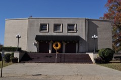 | Crossett Municipal Auditorium | 6.2 miles | 2007 |
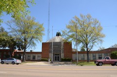 | Crossett Municipal Building | 6.7 miles | 2007 |
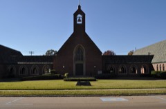 | Crossett Methodist Church | 6.9 miles | 2010 |
| Edward C. Crossett Youth Center | 7.1 miles | 2024 |
| National Archives record | The nomination case file for reference 93001085 in Record Group 79. |
| Ashley County | All 28 listed properties in this county. |