| June 2014 | Tornado (EF1) | Batesville | 2 hurt, $250,000 | An EF1 tornado began on the north side of Batesville adjacent to U.S. 167, then moved to the northeast. At a motel, part of the roof was taken off the lobby entrance and a couple of windows were blown out. A company selling flooring materials had a wall caved in and part of the roof taken off. At a childcare center, windows were blown out, part of the roof was taken off, and cars were tossed around in the parking lot, causing minor injuries to two people. A small business had a window blown out of its building and cars in the parking lot also lost some windows. In addition, trees, power lines, and cable lines were blown down. |
| July 2012 | Lightning | Batesville | $250,000 | Lightning struck a business in Batesville. The air conditioning, phone circuits, and circuit breakers were destroyed. A fire started in the front of the building, badly damaging it. The company sold cylinders of industrial gases, but the fire did not reach any of the cylinders. |
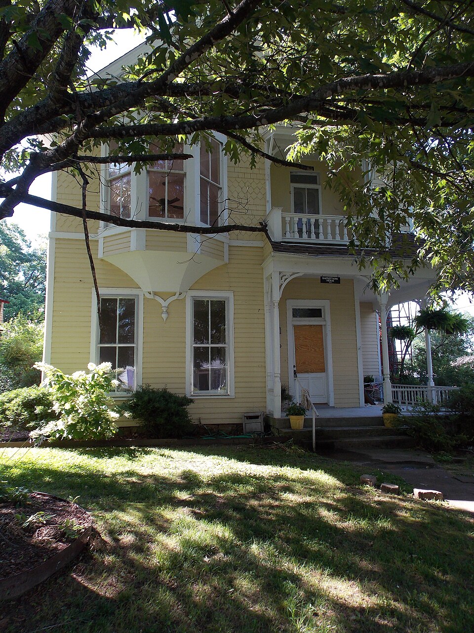
| March 2012 | Lightning | Batesville | $175,000 | Lightning struck a large oak tree, traveled through the ground, blew up the gas meter, and set the historic Mayflower House on fire. The house had been divided up into apartments. |
| April 2010 | Flash Flood | Batesville | $100,000 | Four feet of water covered the 800 block of S. St. Louis (U.S. Highway 167). Three feet of water covered Arkansas Highway 69 near the hospital. Cars stalled in the high water. |
| July 2014 | Thunderstorm Wind | Batesville | $60,000 | A tree fell on a house. |
| September 2012 | Thunderstorm Wind | Batesville | $50,000 | Falling trees snapped power poles and brought down power lines in the eastern half of Batesville. Some of the fallen trees blocked roads. |
| April 2011 | Thunderstorm Wind | Batesville | $50,000 | A roof was blown off a business in Batesville. |
| July 2010 | Lightning | Batesville | $50,000 | Lightning struck the Independence County 911 center in Batesville, causing several computer systems to go down. |
| June 1994 | Thunderstorm Wind | Batesville | $50,000 | Thunderstorm winds blew the roofs off several barns. |
| November 1993 | Thunderstorm Wind | Batesville | $50,000 | Thunderstorm winds blew down several trees. Some of the trees fell onto vehicles. A building in Batesville also sustained some roof damage. |
| June 2012 | Thunderstorm Wind | Batesville | $40,000 | Numerous trees and power lines were blown down. Some of the trees fell on houses. |
| March 2012 | Lightning | Batesville | $30,000 | Lightning set fire to a shop/garage structure. |
| July 2013 | Thunderstorm Wind | Batesville | $25,000 | Power lines were knocked down and power poles were snapped, causing power to be lost to a significant part of Batesville. |
| April 2011 | Flood | Batesville | $15,000 | no account filed |
| May 2011 | Flood | Batesville | $10,000 | no account filed |
| March 2012 | Flood | Batesville | $5,000 | Heavy rain at Batesville and upstream along the White River caused the White River at Batesville to crest just below moderate flood stage. |
| July 2007 | Flash Flood | Batesville | $5,000 | A local emergency manager reported numerous roads closed across the county and Batesville Airport was closed. Two culverts were washed out on Miller Creek Road. Grading and gravel replacement was necessary on some other roads. |
| May 2011 | Flood | Batesville | $5,000 | no account filed |
| August 2009 | Thunderstorm Wind | Batesville | $4,000 | A few tree limbs fell and broke power lines. |
| January 2007 | Flash Flood | Batesville | $3,000 | Flash flooding occurred in Batesville. Flooding and debris were noted at the intersection of Highways 14 and 25. |
| January 2013 | Flood | Batesville | $2,000 | Heavy rain fell from January 9th through January 13th and caused minor flooding along the White River at Batesville. The co-operative observer at Batesville reported a total of 5.39 inches through the period. On the 12th, 4.70 inches of rain fell. The river crested at 15.47 feet. |
| February 2011 | Flash Flood | Batesville | $2,000 | Streets were flooded in Batesville and streams were on the rise. |
| June 2011 | Thunderstorm Wind | Batesville | $1,000 | Tree limbs greater than 6 inches in diameter were knocked down. |
| August 2010 | Thunderstorm Wind | Batesville | $1,000 | A tree was blown down. |
| March 2026 | Thunderstorm Wind | Batesville | - | Multiple trees were blown down around the town of Batesville. |
| April 2025 | Flood | Batesville | - | Major river flooding was observed at Batesville along the White River. |
| January 2025 | Flood | Batesville | - | River flooding took place on the White River at Batesville. The river would remain in minor flood stage during the duration of time this site was in flood stage and a crest would take place on 1/30/2025 at 2015 LST of 17.02 feet. |
| April 2025 | Heavy Rain | Batesville | - | A public observer measured 9.88 inches of total rainfall from this event in the town of Batesville. |
| September 2025 | Thunderstorm Wind | Batesville | - | Numerous power poles were snapped on the southern side of the town of Batesville. |
| November 2024 | Flood | Batesville | - | The White River at Batesville entered minor flood stage in early November and reached a crest of 16.88 feet on November 6 at 10 PM CST. |
| July 2024 | Flood | Batesville | - | Heavy rain led to minor river flooding on the White River at Batesville. The White River at Batesville crested exactly at 0000 LST on July 18th at a stage of 15.45 feet. |
| July 2024 | Heavy Rain | Batesville | - | A 24 hour rainfall total of 4.47 inches was measured at Newport. |
| March 2023 | Heavy Rain | Batesville | - | Numerous sites across the county reported between 4.00 and 4.25 inches of rain. |
| February 2023 | Heavy Rain | Batesville | - | Rainfall was measured at 4.17 inches at Batesville as of 536 PM CST. |
| August 2023 | Flash Flood | Batesville | - | Several roads in the town of Batesville were underwater. Batesville Lock and Dam observed 5.85 inches of rain over the previous 24 hour period. |
| August 2023 | Thunderstorm Wind | Batesville | - | Multiple trees were downed in the vicinity of Wolford Addition. |
| February 2022 | Thunderstorm Wind | Batesville | - | Multiple trees were down in Batesville. |
| July 2022 | Thunderstorm Wind | Batesville | - | A tree was snapped a couple of feet above ground level. |
| April 2021 | Flood | Batesville | - | Heavy rain brought flooding to the White River at Batesville at the end of April. |
| July 2021 | Heavy Rain | Batesville | - | An AWOS reported 2.26 inches of rain fell in 49 minutes. Of that, 1.13 inches fell in 20 minutes and 2.06 inches fell in 44 minutes. |
| July 2018 | Thunderstorm Wind | Batesville | - | Power lines were blown down, and roof damage occurred in town. |
| June 2017 | Flash Flood | Batesville | - | Numerous road closures in and around Batesville due to flash flooding, including portions of State Highway 14. |
| June 2017 | Flash Flood | Batesville | - | Video on social media showed flash flooding in Batesville. |
| April 2017 | Heavy Rain | Batesville | - | The 24 hour rainfall at Batesville Lock and Dam was 4.29 inches. This is a corrected report. |
| April 2017 | Flood | Batesville | - | Flooding was noted on the White River at Batesville after heavy rain fell. The flooding began early on 4/30/17. |
| May 2017 | Flood | Batesville | - | Heavy rain from April caused flooding that continued into May on the White River at Batesville. |
| May 2017 | Flood | Batesville | - | Heavy rain again caused flooding in early May on the White River at Batesville. |
| March 2016 | Flash Flood | Batesville | - | Cars became stalled due to high water over the roads in Batesville. |
| June 2016 | Hail | Batesville | - | Quarter sized hail reported by law enforcement. |
| May 2015 | Flood | Batesville | - | The White River at Batesville rose above flood stage during the early afternoon hours of the 11th, falling back below flood stage during the morning hours of the 13th. |
| December 2015 | Flood | Batesville | - | The White River at Batesville rose above flood stage during the evening hours on the 27th, falling back below flood stage during the late afternoon hours on the 30th. |
| April 2014 | Flood | Batesville | - | Heavy rainfall on the 27th caused the White River at Batesville to rise above flood stage during the early morning hours on the 28th, then fell back below flood stage during the late afternoon hours that same day. |
| July 2013 | Hail | Batesville | - | Hail ranging from nickel to golf ball size fell. |
| November 2011 | Heavy Rain | Batesville | - | The Batesville Lock and Dam reporting station recorded the wettest November ever. Rainfall of 13.49 inches broke the record of 13.08 inches set in 1996. |
| July 2010 | Heavy Rain | Batesville | - | Rainfall measured 2.30 inches in 20 minutes. |
| October 2009 | Flood | Batesville | - | Heavy rainfall at the end of October pushed the White River at Batesville above flood stage. |
| August 2008 | Flash Flood | Batesville | - | Arkansas Highway 25 had water over the roadway, but the road remained passable. |
| April 2008 | Flash Flood | Batesville | - | Several streets along Pioneer Drive in Batesville were flooded. |
| June 2007 | Flash Flood | Batesville | - | Roads were flooded in and around Batesville. |
| September 2007 | Flash Flood | Batesville | - | Flash flooding occurred in Batesville and a number of other places in the county. Several of the roads had to be barricaded until the water receded. |
 Block