Block
From the record
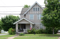
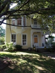
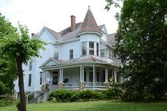
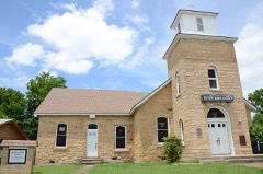
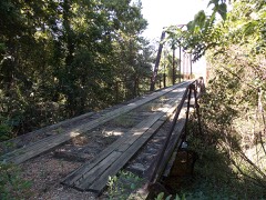
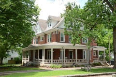
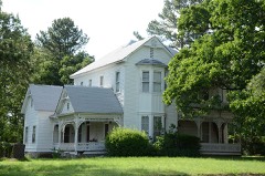
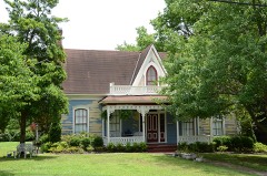
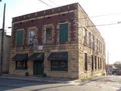
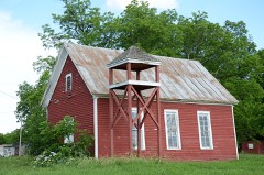
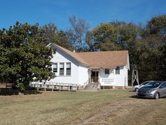
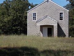
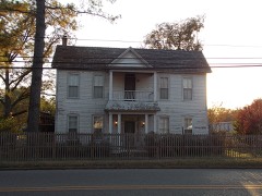
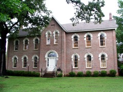
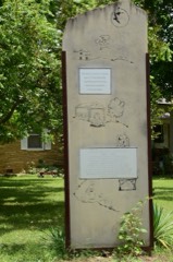
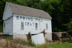
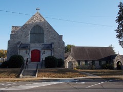
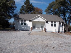
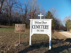
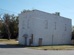
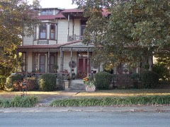
43 National Register listings published here.
Sources: the National Register database, National Park Service
95 topographic sheets cover 81 settlements here, and 43 properties are on the National Register of Historic Places.
43 National Register listings published here.
Sources: the National Register database, National Park Service
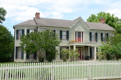
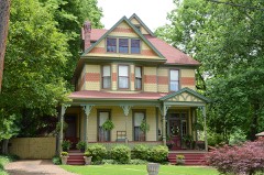
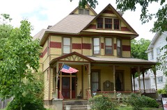
Every property in this county listed on the National Register of Historic Places, with the year it was listed and the federal nomination document.
Every wildfire the federal occurrence database records inside this county: 731 of them, burning about 15,157 acres. 14 started naturally and 278 were recorded as arson. Each settlement page carries the fires within five miles of it.
| Reported cause | Fires |
|---|---|
| Arson/incendiarism | 278 |
| Debris and open burning | 201 |
| Missing data/not specified/undetermined | 190 |
| Equipment and vehicle use | 28 |
| Natural | 14 |
| Smoking | 10 |
| Recreation and ceremony | 5 |
| Misuse of fire by a minor | 3 |
| Railroad operations and maintenance | 2 |
The five largest, by the area the report gives. Four of them were set deliberately.
| Date | Cause | Size | Reported by | Name on the report |
|---|---|---|---|---|
| 15 November 1999 | Arson/incendiarism | 212 acres | Arkansas Forestry Commission | not named |
| 22 July 2012 | Debris and open burning | 199 acres | Arkansas Forestry Commission | TURKEY PIN HOLLOW |
| 17 February 2011 | Arson/incendiarism | 188 acres | Arkansas Forestry Commission | not named |
| 17 August 2000 | Missing data/not specified/undetermined | 121 acres | Arkansas Forestry Commission | not named |
| 28 July 2012 | Natural | 119 acres | Arkansas Forestry Commission | BOLDER FIRE |
| 5 December 2005 | Arson/incendiarism | 95 acres | Arkansas Forestry Commission | not named |
| 24 March 2011 | Arson/incendiarism | 95 acres | Arkansas Forestry Commission | not named |
| 13 March 2014 | Debris and open burning | 95 acres | Arkansas Forestry Commission | IND15928700 |
Every settlement page carries the fires within five miles of it - see the settlement index below.
The NOAA Storm Events Database holds 559 reports for this county, causing 9 deaths, 56 injuries and about $93,246,500 in recorded property damage. Each settlement page carries the reports that name it.
| Kind of event | Reports |
|---|---|
| Thunderstorm Wind | 223 |
| Hail | 174 |
| Flash Flood | 60 |
| Tornado | 42 |
| Flood | 32 |
| Heavy Rain | 15 |
| Lightning | 10 |
| Funnel Cloud | 3 |
The most serious of them, by death, then injury, then recorded damage. The accounts are quoted exactly as the forecast office filed them.
| When | Event | Place named | Harm | What the report says |
|---|---|---|---|---|
| May 1968 | Tornado (F4) | not stated | 7 killed, 24 hurt, $2,500,000 | no account filed |
| November 1955 | Tornado (F3) | not stated | 1 killed, 3 hurt, $250,000 | no account filed |
| October 2009 | Flash Flood | New Hope | 1 killed, $15,000 | A pickup truck was swept off Webber Chapel Road into an unnamed creek. The driver was killed after being swept downstream. A passenger in the vehicle saved himself by clinging to a tree. |
| April 1973 | Tornado (F3) | not stated | 18 hurt, $2,500,000 | no account filed |
| March 1984 | Tornado (F4) | not stated | 3 hurt, $25,000,000 | no account filed |
| January 1999 | Tornado (F2) | Oil Trough | 3 hurt | no account filed |
| June 2014 | Tornado (EF1) | Batesville | 2 hurt, $250,000 | An EF1 tornado began on the north side of Batesville adjacent to U.S. 167, then moved to the northeast. At a motel, part of the roof was taken off the lobby entrance and a couple of windows were blown out. A company selling flooring materials had a wall caved in and part of the roof taken off. At a childcare center, windows were blown out, part of the roof was taken off, and cars were tossed around in the parking lot, causing minor injuries to two people. A small business had a window blown out of its building and cars in the parking lot also lost some windows. In addition, trees, power lines, and cable lines were blown down. |
| September 2012 | Thunderstorm Wind | Ramsey Hill | 1 hurt, $50,000 | Numerous trees and power lines were blown down. One person suffered minor injuries when a window in the press box blew in during a high school football game at Southside. |
| January 1999 | Tornado (F2) | Pleasant Plains | 1 hurt | no account filed |
| April 1984 | Hail | not stated | 1 hurt | no account filed |
| March 1984 | Tornado (F4) | not stated | $25,000,000 | no account filed |
| March 2008 | Flood | Ramsey Hill | $20,000,000 | Heavy rain caused the White River at Batesville to go well above major flood level. The flood crest was the highest since December, 1982 and the second highest since the two upstream major flood reduction reservoirs were completed in the middle of the twentieth century. Water rose to within 2 feet of going over the U.S. Highway 167 road bed and more than 20 levee openings had to be stop logged closed. Portions of Batesville along Polk Bayou flooded and some of the business district near the river also flooded. Most of the town of Oil Tough was flooded and approximately 50 to 100 people had to be evacuated. Arkansas Highway 14 was closed near Oil Trough by high water. Riverside Park in Batesville was flooded and the new hydropower facility built in the old lock chamber on the river was isolated by the high water. The Southside Water Utility was also surrounded by the river and the swift currents cut through a small levee and almost destroyed the water intake. Most of the winter wheat throughout the county flooded and was lost. At least 10 homes were destroyed, 13 received major damage, and perhaps 50 more were damaged to a lesser degree. |
| March 1997 | Tornado (F2) | Oil Trough | $3,000,000 | no account filed |
| September 2012 | Thunderstorm Wind | Batesville Regl Arpt | $2,000,000 | Three hangars were destroyed and a couple of others were damaged by flying debris. Part of one hangar ended up in U.S. 167 adjacent to the airport, closing the highway until the debris could be removed. Additional debris ended up against a business and a truck across U.S. 167 from the airport. Four airplanes were damaged or destroyed. Power poles were blown down. |
| April 2014 | Flash Flood | Cushman | $1,500,000 | Flash flooding struck several parts of Independence County, making numerous water rescues necessary. At least two feet of water covered Arkansas 233 at Moorefield, a mudslide occurred on Arkansas 25 near Brock Mountain, a car was under water at a convenience store in Pfeiffer, and a bridge was under water between Batesville and Moorefield on Arkansas 25 when a creek overflowed. County roads and bridges had considerable damage. A number of houses were damaged by floodwaters. |
| May 2011 | Flood | Cushman | $1,500,000 | Parts of Arkansas Highways 14, 37, and 69 were closed due to flooding. Flooding in Independence County continued into June. |
| April 2008 | Flood | O Neil | $1,500,000 | Heavy rain produced significant rises on the upper White River and tributaries. The combination of high river flows and the excessive upstream reservoir releases caused a second major flood event at the Batesville gage. Homes and businesses were flooded for a second time in less than month in Batesville and Oil Trough. Additional damages were noted by the Southside Water Association due to excessive scour near the intake. The Batesville wastewater treatment plant also had some minor riverbank failure problems. |
| March 2010 | Tornado (EF1) | Hutson | $1,200,000 | In the Maple Springs area, three new chicken houses were destroyed and six others were damaged. More than 80,000 chickens were killed or turned loose. A large grain truck was overturned onto a farm tractor. A mobile elevator was destroyed, as were two sheds. Two travel trailers were overturned. |
| April 2011 | Flood | Cushman | $600,000 | Widespread areal flooding occurred. Portions of Arkansas Highways 14, 37, and 69 were closed from the 26th through the end of the month. |
| September 1993 | Tornado (F2) | Oil Trough- | $500,000 | An F2 tornado touched down 2 miles south of Oil Trough and traveled approximately 5 miles to the northeast before lifting. The path that the tornado traveled was mostly in farm fields. However, the tornado did strike several houses and an airplane hangar. One home sustained major damage, while two other homes received some minor structural damage. A number of trees were also snapped off or uprooted along the path. A local pilot managed to capture a portion of the storm on videotape. The homes that were damaged were unoccupied at the time the tornado struck. |
| April 1996 | Thunderstorm Wind | Pleasant Plains | $500,000 | no account filed |
| May 2013 | Flash Flood | Cushman | $275,000 | There was considerable damage to county roads and bridges. For the 24-hour period ending at 7 AM on the 31st, Batesville Lock and Dam measured 4.26 inches of rain. At the Batesville airport, rainfall on the 31st measured 6.25 inches. |
| July 2012 | Lightning | Batesville | $250,000 | Lightning struck a business in Batesville. The air conditioning, phone circuits, and circuit breakers were destroyed. A fire started in the front of the building, badly damaging it. The company sold cylinders of industrial gases, but the fire did not reach any of the cylinders. |
| September 2012 | Thunderstorm Wind | Desha | $250,000 | Numerous large trees were blown down. Two trees fell into houses and three fell on vehicles. A shop building was destroyed, with flying debris from the shop ending up against the house next door. Power lines, and cable and telephone lines were blown down. Two firefighters were injured during the clean-up process; these are counted as indirect injuries. |
| March 1991 | Tornado (F2) | not stated | $250,000 | no account filed |
| March 1988 | Tornado (F2) | not stated | $250,000 | no account filed |
| December 1982 | Tornado (F1) | not stated | $250,000 | no account filed |
| May 1961 | Tornado (F2) | not stated | $250,000 | no account filed |
| November 1955 | Tornado (F3) | not stated | $250,000 | no account filed |
| November 1955 | Tornado (F3) | not stated | $250,000 | no account filed |
| April 2011 | Flash Flood | Cushman | $200,000 | Many streets and county roads were flooded. Approximately 20 people were evacuated from low-lying areas. |
| March 2012 | Lightning | Batesville | $175,000 | Lightning struck a large oak tree, traveled through the ground, blew up the gas meter, and set the historic Mayflower House on fire. The house had been divided up into apartments. |
| July 2010 | Lightning | Cushman | $175,000 | Lightning struck a house on Lightning Ridge Road. The resulting fire burned the house to the ground, leaving only one garage door standing. Between 6:30 and 8:00 PM CDT, about 1500 lightning strikes were recorded in Independence County. |
| February 2008 | Thunderstorm Wind | Floral | $150,000 | A chicken house was destroyed in Floral. |
| August 2007 | Thunderstorm Wind | Cave City | $125,000 | A shop was blown off a house, with some of the debris traveling as much as 500 yards. A storage building at a residence was blown 200 yards, ending up in a pond. Barns and outbuildings were damaged. Trampolines were blown across yards. Trees and power lines were blown down. One of the trees was quite large and hit the corner of a house as it fell. |
| March 2012 | Lightning | Limedale | $100,000 | Lightning set fire to a house near Bethesda. |
| May 2011 | Flash Flood | Cushman | $100,000 | Numerous roads were flooded. Four people had to be rescued from a vehicle that was washed off a roadway. The Batesville Motor Speedway grounds were cleared with the help of tow trucks. |
| April 2010 | Flash Flood | Batesville | $100,000 | Four feet of water covered the 800 block of S. St. Louis (U.S. Highway 167). Three feet of water covered Arkansas Highway 69 near the hospital. Cars stalled in the high water. |
| February 2009 | Thunderstorm Wind | Hutson | $100,000 | Thunderstorm winds damaged a house and heavily damaged a hay barn in the Maple Springs Community. Power lines, power poles and trees were also knocked down. |
| February 2009 | Thunderstorm Wind | Oil Trough | $100,000 | Damage was reported to businesses in the Oil Trough and Pleasant Plains areas. Power lines were also reported down in this area. |
| April 2009 | Thunderstorm Wind | Cushman Jct | $100,000 | A tree was down at the corner of 8th and Main Street. A large oak tree was uprooted at a cemetery damaging several headstones. Another tree was down on U.S. Highway 167 near Main Street. Another one had to be cut from across Arkansas Highway 106 on Ruddell Hill. A large cedar tree was uprooted at Boswell St. A large plate glass window was blown out of an antique store on Main St. A large oak tree fell across two vehicles and a porch on Franklin St. |
| July 2009 | Flash Flood | James | $100,000 | The emergency manager estimated that flash flooding occurred at 25 to 30 places in Independence County. Mount Harmon Rd. was washed out and a pick-up truck drove off into a 5-foot hole. Other washouts occurred on Sanders Rd., Lonoke Lane, Gap Rd., Big Creek Rd., Young Rd., Crutcher Rd., Kramer Rd., and the road into Camp Crossed Arrows. |
| April 2010 | Thunderstorm Wind | Newark | $75,000 | A mobile home was destroyed when a large oak tree fell on it. An equipment shed was destroyed, causing damage to the farm equipment stored inside it. |
| April 2009 | Flash Flood | Moorefield | $75,000 | Street flooding was reported in Batesville. Water was up to the door handles on cars. |
| March 2010 | Thunderstorm Wind | Charlotte | $65,000 | A mobile home was rolled, destroying it. Three other homes had roof and outbuilding damage. Trees and power lines were blown down. |
| July 2014 | Thunderstorm Wind | Batesville | $60,000 | A tree fell on a house. |
| June 2014 | Flash Flood | Bethesda | $55,000 | Oil Trough measured 5.34 inches of rain and a gauge 1 mile west of Salado collected 4.40 inches. A bridge was damaged on Arkansas 230. Numerous county roads and farm fields were flooded. |
| July 2012 | Thunderstorm Wind | Floral | $50,000 | Three chicken houses had roof damage, and trees and power lines were blown down. |
| September 2012 | Thunderstorm Wind | Batesville | $50,000 | Falling trees snapped power poles and brought down power lines in the eastern half of Batesville. Some of the fallen trees blocked roads. |
| April 2011 | Thunderstorm Wind | Batesville | $50,000 | A roof was blown off a business in Batesville. |
| March 2010 | Thunderstorm Wind | Elmo | $50,000 | Two truck trailers were overturned, with one of the trailers crushing a boat and boat trailer. A camper shell was blown into a power pole, and barns and outbuildings were damaged. |
| July 2010 | Lightning | Batesville | $50,000 | Lightning struck the Independence County 911 center in Batesville, causing several computer systems to go down. |
| June 1994 | Thunderstorm Wind | Batesville | $50,000 | Thunderstorm winds blew the roofs off several barns. |
| November 1993 | Thunderstorm Wind | Batesville | $50,000 | Thunderstorm winds blew down several trees. Some of the trees fell onto vehicles. A building in Batesville also sustained some roof damage. |
| June 2012 | Thunderstorm Wind | Batesville | $40,000 | Numerous trees and power lines were blown down. Some of the trees fell on houses. |
| May 2010 | Thunderstorm Wind | Sulphur Rock | $35,000 | One house had support columns on the front porch moved out of place, a grill and chairs blown off the porch, and shingles blown off the roof. On the same property, part of the barn roof was blown off. Another house had part of its roof peeled up and a metal carport blown into the back yard. |
| July 2014 | Thunderstorm Wind | Pleasant Plains | $30,000 | A tree fell onto a brand-new school bus. |
| March 2012 | Lightning | Batesville | $30,000 | Lightning set fire to a shop/garage structure. |
| September 2012 | Thunderstorm Wind | Ramsey Hill | $30,000 | Trees, large limbs, and power lines were blown down along Arkansas 14 from Batesville to Salado. The highway was blocked for awhile due to trees and power lines in the road. |
| April 2011 | Thunderstorm Wind | Oil Trough | $30,000 | A privately-owned anemometer measured wind gusts of 95 mph. A large outbuilding, 60 ft by 70 ft, was blown off its foundation and across the road. |
The Survey's mineral resources record lists 256 workings inside this county. 23 still produce and 233 are closed or unrecorded. Each settlement page carries the workings within five miles of it.
| Commodity | Workings |
|---|---|
| Manganese | 188 |
| Sand and Gravel, Construction | 28 |
| Stone | 10 |
| Limestone, General | 10 |
| Phosphorus-Phosphates | 8 |
| Stone, Crushed/Broken | 8 |
| Clay | 3 |
| Marble, Dimension | 2 |
| Iron | 2 |
| Calcium | 2 |
| Limestone, Dimension | 2 |
| Platinum, Limestone, Dimension | 1 |
| Flagstone | 1 |
The least common of them first, because a county's hundredth gravel pit says nothing its first ten did not.
| Where | Site | Commodity | Status | Recorded |
|---|---|---|---|---|
| Batesville | Platinum, Limestone, Dimension | Occurrence | Unknown | |
| Mcbride Mines | Marble, Dimension, Flagstone | Producer | ||
| Blue Ridge Mine | Manganese, Iron | Past Producer | ||
| Rangaire Lime Plant | Calcium | Producer | ||
| Rangaire Love Hollow Mine | Calcium | Producer | ||
| Stone Products Corp | Marble, Dimension | Unknown | ||
| Texas Lime Co Plant | Limestone, Dimension | Producer | ||
| Texas Line Co Pit | Limestone, Dimension | Producer | ||
| Unk | Iron | Unknown | ||
| Unk | Clay | Unknown | ||
| Unk | Clay | Unknown | ||
| Unk | Clay | Unknown | ||
| Arkansas Lime Co | Stone, Crushed/Broken | Producer | ||
| Batesville Quarry | Stone, Crushed/Broken | Producer | ||
| Blowing Cave Creek Mn Limestone | Manganese, Phosphorus-Phosphates | Prospect | ||
| Clubhouse Manganiferrous Carbonate | Manganese, Phosphorus-Phosphates | Prospect | ||
| Crusher #2 | Stone, Crushed/Broken | Producer | ||
| Hickory Valley | Phosphorus-Phosphates | Unknown | ||
| Lafferty Creek Manganese Limestone | Manganese, Phosphorus-Phosphates | Prospect | ||
| Lower Cave Crk Manganese Limestone | Manganese, Phosphorus-Phosphates | Prospect | 1915 | |
| Mcbride Plant | Stone, Crushed/Broken | Producer | ||
| Mcbride Quarry | Stone, Crushed/Broken | Producer | ||
| Midwest | Stone, Crushed/Broken | Past Producer | ||
| Mulligan Hollow Manganese Limestone | Manganese, Phosphorus-Phosphates | Prospect | ||
| Rocky Point Quarry | Stone, Crushed/Broken | Unknown | ||
| Rutherford Hollow Mn Limestone | Manganese, Phosphorus-Phosphates | Prospect | ||
| Sheid Quarry | Stone, Crushed/Broken | Unknown | Limestone | |
| Upper Cave Crk Manganese Carbonate | Manganese, Phosphorus-Phosphates | Prospect | ||
| Batesville Mill | Limestone, General | Producer | ||
| Batesville White Lime Quarry | Limestone, General | Unknown | ||
| Limedale Lime Plant | Limestone, General | Producer | ||
| Limedale Quarry & Mill | Limestone, General | Producer | ||
| Midwest Lime Co | Limestone, General | Producer | ||
| Stoney Point Pit | Limestone, General | Producer | ||
| Stoney Point Plant | Limestone, General | Producer | ||
| Unk | Stone | Unknown | ||
| Unk | Limestone, General | Unknown | ||
| Unk | Limestone, General | Unknown | ||
| Unk | Stone | Unknown | ||
| Unk | Stone | Unknown | ||
| Unk | Stone | Unknown | ||
| Unk | Stone | Unknown | ||
| Unk | Stone | Unknown | ||
| Unk | Limestone, General | Unknown | ||
| Unk | Stone | Unknown | ||
| Unk | Stone | Unknown | ||
| Unk | Stone | Unknown | ||
| Unk | Stone | Unknown | ||
| Collier Pit & Plant | Sand and Gravel, Construction | Producer | ||
| Collier Plant | Sand and Gravel, Construction | Producer | ||
| Galloway Dredge & Plant | Sand and Gravel, Construction | Producer | ||
| Galloway Dredge & Plant | Sand and Gravel, Construction | Producer | ||
| Galloway Sand & Gravel Plant | Sand and Gravel, Construction | Unknown | ||
| River Sand & Gravel Dredge | Sand and Gravel, Construction | Producer | ||
| Unk | Sand and Gravel, Construction | Unknown | ||
| Unk | Sand and Gravel, Construction | Unknown | ||
| Unk | Sand and Gravel, Construction | Unknown | ||
| Unk | Sand and Gravel, Construction | Unknown | ||
| Unk | Sand and Gravel, Construction | Unknown | ||
| Unk | Sand and Gravel, Construction | Unknown | ||
| Unk | Sand and Gravel, Construction | Unknown | ||
| Unk | Sand and Gravel, Construction | Unknown | ||
| Unk | Sand and Gravel, Construction | Unknown | ||
| Unk | Sand and Gravel, Construction | Unknown | ||
| Unk | Sand and Gravel, Construction | Unknown | ||
| Unk | Sand and Gravel, Construction | Unknown | ||
| Unk | Sand and Gravel, Construction | Unknown | ||
| Unk | Sand and Gravel, Construction | Unknown | ||
| Unk | Sand and Gravel, Construction | Unknown | ||
| Unk | Sand and Gravel, Construction | Unknown | ||
| Unk | Sand and Gravel, Construction | Unknown | ||
| Unk | Sand and Gravel, Construction | Unknown | ||
| Unk | Sand and Gravel, Construction | Unknown | ||
| Unk | Sand and Gravel, Construction | Unknown | ||
| Unk | Sand and Gravel, Construction | Unknown | ||
| White River Sand & Gravel Co. | Sand and Gravel, Construction | Producer | ||
| A G Gray Mine | Manganese | Past Producer | 1918 | |
| A R Chinn | Manganese | Past Producer | 1917 | |
| Adler Prospect No 1 | Manganese | Past Producer | 1934 | |
| Adler Prospect No 2 | Manganese | Past Producer | 1937 | |
| Adler-Sothard Mine | Manganese | Past Producer | 1918 | |
| Allen Mine | Manganese | Past Producer | 1918 | |
| Arkala Property | Manganese | Unknown | ||
| Aydelott Mine | Manganese | Unknown | ||
| Bales Mine | Manganese | Past Producer | 1909 | |
| Ball Mine | Manganese | Past Producer | 1918 | |
| Barnett Mine | Manganese | Past Producer | 1917 | |
| Batesville | Manganese | Unknown | ||
| Baxter Prospects | Manganese | Past Producer | 1918 | |
| Bell Hill Prospect | Manganese | Prospect | ||
| Blair Prospect | Manganese | Prospect | ||
| Bob Wilson Prospect | Manganese | Past Producer | 1916 | |
| Brooks Hill | Manganese | Past Producer | 1918 | |
| Burge Mine | Manganese | Past Producer | 1918 | |
| Button Mine | Manganese | Past Producer | ||
| Button Prospect | Manganese | Past Producer | ||
| C.C.Johnson Prospect | Manganese | Past Producer | ||
| C.W.Maxfield Prospect | Manganese | Past Producer | ||
| Calaway Prospect | Manganese | Past Producer | 1916 | |
| Cason Mine | Manganese | Past Producer | 1928 | |
| Champlain Prospect | Manganese | Prospect | ||
| Champlain Prospect | Manganese | Past Producer | 1918 | |
| Chapel Hill Mine | Manganese | Past Producer | ||
| Climer Prospect | Manganese | Occurrence | ||
| Club House Extension Mine | Manganese | Past Producer | 1939 | |
| Club House Mine | Manganese | Past Producer | 1928 | |
| Cole Orchard Prospect | Manganese | Past Producer | ||
| Collins | Manganese | Past Producer | 1918 | |
| Cripple Hill Prospect | Manganese | Past Producer | ||
| Criswell Prospect | Manganese | Prospect | ||
| Crosser Prospect | Manganese | Past Producer | 1936 | |
| Cutter Mine | Manganese | Past Producer | 1918 | |
| Dead Tree Hill Prospect | Manganese | Past Producer | ||
| Deener Prospect | Manganese | Past Producer | 1918 | |
| Denison Mine | Manganese | Past Producer | 1918 | |
| Dunegan Mine | Manganese | Past Producer | 1918 | |
| E.W.Roach Prospect | Manganese | Past Producer | ||
| Edmonson Hill | Manganese | Prospect | ||
| Edwards Mine | Manganese | Past Producer | 1918 | |
| Eliza Patterson Prospect | Manganese | Past Producer | ||
| Ella Clark Prospect | Manganese | Past Producer | 1931 | |
| Ellen Clark Prospect | Manganese | Past Producer | 1918 | |
| F M Barnes | Manganese | Past Producer | 1937 | |
| Felts Prospect | Manganese | Past Producer | ||
| Fortune Prospect | Manganese | Past Producer | 1917 | |
| Frazier Prospect | Manganese | Past Producer | ||
| Friday Prospect | Manganese | Past Producer | ||
| G A Wilson | Manganese | Past Producer | 1918 | |
| G.D.Reves Tract | Manganese | Occurrence | ||
| G.G.W.Patterson | Manganese | Occurrence | ||
| Galloway Mine | Manganese | Past Producer | 1918 | |
| George Mine | Manganese | Past Producer | 1918 | |
| Greenfield | Manganese | Unknown | ||
| Grubb Cut Mine | Manganese | Past Producer | 1917 | |
| Haigwood Prospect | Manganese | Past Producer | ||
| Hankins Hollow Mine | Manganese | Past Producer | 1918 | |
| Hawkins Mine | Manganese | Past Producer | 1916 | |
| Helms Prospect | Manganese | Prospect | ||
| Henley Mine | Manganese | Past Producer | 1918 | |
| Hightower Prospect | Manganese | Past Producer | 1916 | |
| Hunt Hollow Mine | Manganese | Past Producer | 1917 | |
| J A Reeves | Manganese | Past Producer | 1918 | |
| J B Thompson Prospect | Manganese | Past Producer | 1917 | |
| J P Barnes Prospect | Manganese | Past Producer | 1917 | |
| J R Dobson Prospect | Manganese | Past Producer | ||
| J.W.Greenfield Prospect | Manganese | Unknown | ||
| Jackson Prospect | Manganese | Occurrence | ||
| Jake Cole Prospect | Manganese | Past Producer | 1917 | |
| Jeff Weaver Prospect | Manganese | Past Producer | ||
| John Patterson Mine | Manganese | Past Producer | 1918 | |
| John Woods Shaft | Manganese | Unknown | ||
| Kelley Prospect | Manganese | Occurrence | ||
| Kimbrough Mine | Manganese | Past Producer | 1917 | |
| Kimmer Mine | Manganese | Past Producer | 1918 | |
| Lassiter | Manganese | Past Producer | 1918 | |
| Lizzie Brannon | Manganese | Past Producer | ||
| Lost Forty | Manganese | Unknown | ||
| M Gee Mine | Manganese | Past Producer | 1918 | |
| Manganese Cave Mine | Manganese | Past Producer | ||
| Marshall Mine | Manganese | Past Producer | ||
| Martha Thompson | Manganese | Past Producer | 1917 | |
| Martin No 2 Mine | Manganese | Past Producer | ||
| Martin Number One Mine | Manganese | Past Producer | 1934 | |
| Matheny Mine | Manganese | Past Producer | 1918 | |
| Maxfield Prospect | Manganese | Occurrence | ||
| Mcbride Mine | Manganese | Past Producer | 1939 | |
| Mcgee Mine | Manganese | Past Producer | ||
| Meeker Mine | Manganese | Past Producer | 1934 | |
| Miller Prospect | Manganese | Occurrence | ||
| Miller Rinehart Mine | Manganese | Past Producer | 1928 | |
| Milligan Prospect | Manganese | Unknown | ||
| Milligan-Perrin Prospect | Manganese | Past Producer | 1918 | |
| Montgomery Hill Mine | Manganese | Past Producer | ||
| Montgomery Mine | Manganese | Past Producer | 1918 | |
| Montgomery Prospect | Manganese | Prospect | ||
| Moser Prospect | Manganese | Past Producer | 1917 | |
| Mount Etna Mine | Manganese | Past Producer | 1917 | |
| Moyer Mine | Manganese | Past Producer | 1918 | |
| Napoleon Hill Site | Manganese | Producer | ||
| Neill Prospect | Manganese | Past Producer | 1917 | |
| O Flinn Prospect | Manganese | Past Producer | ||
| Oliver Iron Mining Co's Prospect | Manganese | Unknown | ||
| Ozark Mine | Manganese | Past Producer | 1939 | |
| Page Mine | Manganese | Past Producer | 1918 | |
| Page Mine | Manganese | Past Producer | ||
| Parker Mine | Manganese | Past Producer | 1930 | |
| Pect | Manganese | Occurrence | ||
| Perrin Mine | Manganese | Past Producer | 1918 | |
| Polk Southard | Manganese | Past Producer | 1918 | |
| Pool Prospect | Manganese | Past Producer | 1918 | |
| Pritchett Prospect | Manganese | Occurrence | ||
| R T Patterson Mine | Manganese | Past Producer | 1917 | |
| R.W.Reeves Prospect | Manganese | Prospect | ||
| Reed Mine | Manganese | Past Producer | ||
| Roach Mine | Manganese | Past Producer | 1918 | |
| Roberts Mine | Manganese | Past Producer | 1918 | |
| Rogers Mine | Manganese | Past Producer | 1918 | |
| Roseborough Mine | Manganese | Past Producer | 1918 | |
| Rowe Field Mine | Manganese | Past Producer | ||
| Rutherford Mine | Manganese | Past Producer | 1918 | |
| S W Weaver Mine | Manganese | Past Producer | 1918 | |
| Salt Peter Hill Mine | Manganese | Past Producer | 1916 | |
| Salt Peter Hollow | Manganese | Unknown | ||
| Sand Field Prospect | Manganese | Past Producer | 1917 | |
| Sanders Prospect | Manganese | Past Producer | 1916 | |
| Schlieper Mine | Manganese | Past Producer | 1918 | |
| Searcy Cave Hill Prospect | Manganese | Past Producer | 1939 | |
| Searcy Mine | Manganese | Past Producer | ||
| Searcy Prospect | Manganese | Prospect | 1939 | |
| Section Eight Prospect | Manganese | Past Producer | ||
| Section Thirty Four Prospect | Manganese | Past Producer | 1918 | |
| Shaw Mine | Manganese | Past Producer | 1916 | |
| Shell Mine | Manganese | Past Producer | 1918 | |
| Shell Reither Prospect | Manganese | Past Producer | 1934 | |
| Silberstien Prospect | Manganese | Past Producer | ||
| Simmons Prospect | Manganese | Past Producer | 1918 | |
| Simpson | Manganese | Past Producer | 1914 | |
| Sis Clark Corner Prospect | Manganese | Prospect | ||
| Sis Clark Mine | Manganese | Past Producer | 1918 | |
| Smith Mine | Manganese | Past Producer | 1930 | |
| Smith Prospect | Manganese | Past Producer | 1918 | |
| South Hill Prospect | Manganese | Past Producer | 1918 | |
| Southern Mine | Manganese | Past Producer | 1918 | |
| Stark Spring Mine | Manganese | Past Producer | 1934 | |
| Sterrett Mine | Manganese | Past Producer | 1917 | |
| T.M.Tate Mine | Manganese | Past Producer | ||
| Thompson Site | Manganese | Unknown | ||
| Tosh Hill Prospect | Manganese | Prospect | ||
| Turner Mine | Manganese | Past Producer | 1917 | |
| U S Canadian Manganese Co's Prospct | Manganese | Prospect | ||
| U.N.Dobson Prospect | Manganese | Unknown | ||
| Unk | Manganese | Unknown | ||
| Unk | Manganese | Unknown | ||
| Unk | Manganese | Unknown | ||
| Unk | Manganese | Unknown | ||
| Unk | Manganese | Unknown | ||
| Unk | Manganese | Unknown | ||
| Unk | Manganese | Unknown | ||
| W A Chinn Mine | Manganese | Past Producer | 1916 | |
| W C Collie Mine | Manganese | Past Producer | 1918 | |
| W L Greenfield | Manganese | Past Producer | 1916 | |
| W L Johnson Prospect | Manganese | Past Producer | 1918 | |
| W T Gray | Manganese | Past Producer | 1917 | |
| W W Allen Mine | Manganese | Past Producer | 1918 | |
| W.L.Greenfield | Manganese | Past Producer | ||
| W.W.Allen | Manganese | Prospect | ||
| Waco Prospect | Manganese | Unknown | ||
| Walbert Mine | Manganese | Unknown | ||
| Walter Chinn | Manganese | Occurrence | ||
| Walter Chinn Prospect | Manganese | Past Producer | 1918 | |
| Weaver-Dowdy | Manganese | Prospect | ||
| Wildcat | Manganese | Past Producer | 1917 | |
| Wolford Mine | Manganese | Past Producer | 1917 | |
| Woodpecker Hollow Mine | Manganese | Past Producer | 1929 | |
| Woodyard Prospect | Manganese | Occurrence | ||
| Wren Mine | Manganese | Past Producer |
Named settlements recorded in the Geographic Names Information System, each with the topographic sheets covering it. Villages, hamlets and abandoned places alike. Each is shown with the nearest named watercourse or landform and the survey quadrangle it falls on.
Big Bottom-Wycough-Logan township · 72501 · On Mud Creek · Newark quadrangle
14 sheets, 1935 to 1986
No longer a settlement
Jefferson township · 72501 · Sandtown quadrangle
18 sheets, 1890 to 1989
No longer a settlement
Moorefield township · 72501 · On Blue Creek · Sulphur Rock quadrangle
20 sheets, 1890 to 1989
Cushman-Union township · 72501 · Near Grooms Hollow · Batesville quadrangle
20 sheets, 1890 to 1989
Ashley township · 72501 · On Cave Creek · Batesville quadrangle
20 sheets, 1890 to 1989
No longer a settlement
Ruddell township · 72501 · On Stillhouse Branch · Sulphur Rock quadrangle
20 sheets, 1890 to 1989
Dota township · 72522 · On Dry Fork Dota Creek · Charlotte quadrangle
11 sheets, 1932 to 1986
McHue township · 72501 · On Taylor Branch · Jamestown quadrangle
18 sheets, 1890 to 1986
Ruddell township · 72501 · On Pfeiffer Creek · Sulphur Rock quadrangle
20 sheets, 1890 to 1989
Cushman-Union township · 72501 · Near Dave Green Hollow · Bethesda quadrangle
18 sheets, 1890 to 1989
Cushman-Union township · 72501 · Near Brooks Hill · Bethesda quadrangle
18 sheets, 1890 to 1989
Ruddell township · 72501 · Near Ruddell Hill · Batesville quadrangle
20 sheets, 1890 to 1989
Ruddell township · 72501 · Near Grooms Hollow · Batesville quadrangle
20 sheets, 1890 to 1989
No longer a settlement
McHue township · 72501 · Near Ramsey Hill · Jamestown quadrangle
18 sheets, 1890 to 1986
Oil Trough township · 72564 · On Dog Lick Branch · Huff quadrangle
15 sheets, 1890 to 1986
No longer a settlement
Greenbrier township · 72527 · On Alderbrook Branch · Jamestown quadrangle
18 sheets, 1890 to 1986
Oil Trough township · 72564 · Near Pleasant Island · Newark quadrangle
14 sheets, 1935 to 1986
Washington township · 72501 · On Goodwin Slough · Concord quadrangle
17 sheets, 1890 to 1986
Ruddell township · 72501 · On Stillhouse Branch · Sulphur Rock quadrangle
20 sheets, 1890 to 1989
Cushman-Union township · 72501 · Near Clark Hill · Mount Pleasant quadrangle
19 sheets, 1890 to 1989
No longer a settlement
Oil Trough township · 72112 · On Bear Wallow Slough · Olyphant quadrangle
12 sheets, 1935 to 1986
Moorefield township · 72501 · On Watson Creek · Sulphur Rock quadrangle
20 sheets, 1890 to 1989
Washington township · 72501 · On Harmon Creek · Bethesda quadrangle
18 sheets, 1890 to 1989
Relief township · 72534 · On Hutchinson Mountain · Jamestown quadrangle
18 sheets, 1890 to 1986
Greenbrier township · 72501 · Near Tivis Flynn Hollow · Jamestown quadrangle
18 sheets, 1890 to 1986
Cushman-Union township · 72501 · Near Grooms Hollow · Batesville quadrangle
20 sheets, 1890 to 1989
Washington township · 72501 · On Rocky Branch · Bethesda quadrangle
18 sheets, 1890 to 1989
No longer a settlement
Black River-Marshell township · 72524 · On Caney Slough · Swifton West quadrangle
10 sheets, 1935 to 1986
Black River-Marshell township · 72524 · On Little Creek · Strawberry quadrangle
11 sheets, 1932 to 1986
No longer a settlement
Greenbrier township · 72550 · On Rocky Creek · Jamestown quadrangle
18 sheets, 1890 to 1986
Ruddell township · 72501 · Near Bone Cave Hollow · Batesville quadrangle
20 sheets, 1890 to 1989
Moorefield township · 72501 · On Moorefield Creek · Sulphur Rock quadrangle
20 sheets, 1890 to 1989
Big Bottom-Wycough-Logan township · 72562 · On Twomile Creek · Newark quadrangle
14 sheets, 1935 to 1986
Big Bottom-Wycough-Logan township · 72562 · On Fivemile Creek · Newark quadrangle
14 sheets, 1935 to 1986
Big Bottom-Wycough-Logan township · 72562 · On Thompson Creek · Newark quadrangle
14 sheets, 1935 to 1986
Washington township · 72501 · On Blue Spring Branch · Bethesda quadrangle
18 sheets, 1890 to 1989
Oil Trough township · 72564 · On Big Bottom Slough · Newark quadrangle
14 sheets, 1935 to 1986
Big Bottom-Wycough-Logan township · 72562 · By Little Paroquet Bluff · Jacksonport quadrangle
13 sheets, 1935 to 1986
Ruddell township · 72501 · On Stillhouse Branch · Batesville quadrangle
20 sheets, 1890 to 1989
Ashley township · 72501 · Near Brewer Hill · Sulphur Rock quadrangle
20 sheets, 1890 to 1989
Cushman-Union township · 72501 · Near Dave Green Hollow · Bethesda quadrangle
18 sheets, 1890 to 1989
No longer a settlement
Dota township · 72562 · On Baker Branch · Charlotte quadrangle
11 sheets, 1932 to 1986
Fairview township · 72568 · On Shoat Branch · Pleasant Plains quadrangle
15 sheets, 1890 to 1986
Moorefield township · 72501 · Near Eagle Mountain · Sulphur Rock quadrangle
20 sheets, 1890 to 1989
Ruddell township · 72501 · On Pfeiffer Creek · Sulphur Rock quadrangle
20 sheets, 1890 to 1989
Ruddell township · 72501 · On Ruddell Hill · Batesville quadrangle
20 sheets, 1890 to 1989
White River township · 72501 · On Fallen Ash Creek · Salado quadrangle
17 sheets, 1890 to 1986
Ruddell township · 72501 · Near Grooms Hollow · Batesville quadrangle
20 sheets, 1890 to 1989
White River township · 72579 · On Gibbs Creek · Sulphur Rock quadrangle
20 sheets, 1890 to 1989
Ruddell township · 72501 · On Miller Creek · Batesville quadrangle
20 sheets, 1890 to 1989
Washington township · 72501 · Near Bracy Mountain · Bethesda quadrangle
18 sheets, 1890 to 1989
Big Bottom-Wycough-Logan township · 72562 · Newark quadrangle
14 sheets, 1935 to 1986
No longer a settlement
Ruddell township · 72501 · On Pfeiffer Creek · Sulphur Rock quadrangle
20 sheets, 1890 to 1989
Fairview township · 72534 · On Mitchell Branch · Pleasant Plains quadrangle
15 sheets, 1890 to 1986
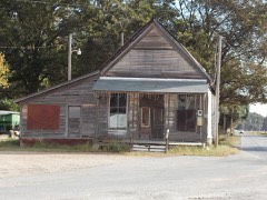
The vanished settlements of Independence County: the places named above that are no longer on the map.